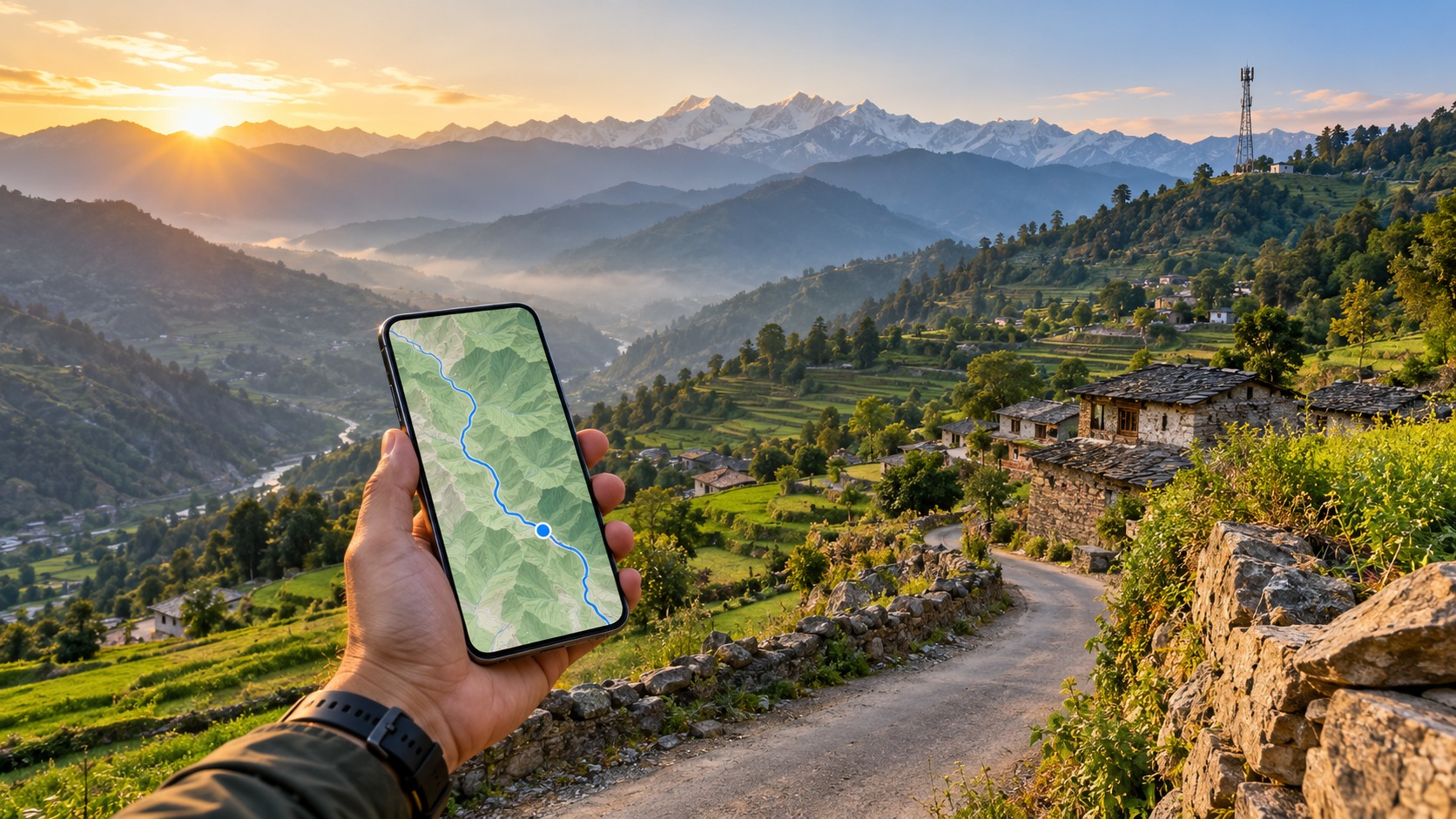
The Connectivity Gap: Why India’s Rural Infrastructure Demands a Strategic eSIM Approach
India’s geography is a paradox of density and desolation. While the coastal corridors of Mumbai and the urban sprawl of Delhi offer seamless, high-bandwidth connectivity, the moment you cross the threshold into the interior states—be it the arid expanses of Rajasthan, the dense forests of the Northeast, or the remote Himalayan valleys—the digital landscape shifts dramatically. For travelers and digital nomads, this sharp drop-off in 4G coverage is not merely an inconvenience; it is a logistical hurdle that can derail an entire itinerary. This is precisely why selecting the right India eSIM for offline maps is no longer a luxury, but a critical component of travel planning. The standard advice of "just download your maps before you go" often fails because it ignores the technical realities of how mobile networks function in low-signal environments. Without a strategic approach to data consumption and network fallback, you risk arriving in a remote village with a dead battery, a frozen navigation app, and no way to verify your location.
The primary pain point for many travelers is the aggressive speed throttling that occurs on standard eSIMs once a certain data threshold is crossed. Many generic global eSIM providers operate on a "best effort" basis, where speeds plummet to near-usable levels (often 128kbps or lower) after 1GB or 5GB of usage. When you are in the middle of syncing large map tiles or updating your route in real-time, this throttling creates a frustrating bottleneck. The connection becomes so sluggish that the map interface lags, markers fail to load, and turn-by-turn instructions arrive seconds too late. This is where the distinction between a "data plan" and a "connectivity strategy" becomes vital. The best eSIM for rural India connectivity is not necessarily the one with the highest peak speed, but the one that maintains a consistent, reliable baseline speed even when the network is congested or the signal is weak.
The Critical Workflow: Wi-Fi as Your Primary Data Source
To navigate India’s rural infrastructure effectively, you must understand the technical reality of 2G/3G fallbacks. In remote areas, 4G LTE towers are sparse. When your device loses 4G signal, it does not simply disconnect; it falls back to 3G, and eventually, to 2G. These older networks have significantly lower bandwidth capacities. If you are consuming high-speed data for background updates—such as OS patches, app store syncs, or cloud backups—your device is fighting for bandwidth with essential navigation tasks. High-speed data is often wasted on these background processes, leaving you with a "busy" indicator on your phone while your map remains static.
The solution is a deliberate workflow: download offline maps via Wi-Fi before entering low-signal zones. This ensures that the heavy lifting of data transfer happens when the network is robust and free. However, you still need a live connection for real-time traffic updates, location pinning, and messaging. This is where the specific architecture of your eSIM matters.
Why MollySIM’s 384kbps FUP is a Strategic Advantage
Many travelers mistakenly view a Fair Use Policy (FUP) speed limit as a limitation. In the context of rural India, a well-calibrated FUP is actually a reliability feature. MollySIM’s India eSIM plans, available at mollysim.com/esim/india, utilize a 384kbps FUP. This is not a slow crawl; it is a stable, consistent throughput that is 3x faster than the 128kbps limits found in many competitor plans.
Why does this matter?
- Navigation Stability: Google Maps and Apple Maps require a steady stream of data to render vector tiles and update GPS coordinates. At 128kbps, the app may freeze or reload constantly. At 384kbps, the interface remains smooth, allowing for real-time route adjustments.
- Messaging Reliability: WhatsApp and other messaging apps require a minimum bandwidth to send text and media. A 384kbps connection ensures that your messages go through without the "pending" status lingering indefinitely.
- Payment Processing: If you need to use Apple Pay or contactless payments at a local shop, the transaction handshake requires a stable, low-latency connection. The 384kbps buffer ensures these micro-transactions complete successfully.
By positioning the 384kbps limit as a reliable buffer for essential connectivity tasks, MollySIM ensures that your eSIM remains functional even when the network is stressed. This is crucial for the India eSIM for offline maps strategy, as it guarantees that your "live" features remain responsive while your "offline" data handles the heavy lifting.
Technical Reality: 2G/3G Fallbacks and Bandwidth Efficiency
In remote areas, the network is often shared among many users. This congestion means that even if your plan offers "unlimited" data, the actual speed you experience can be bottlenecked by the cell tower’s capacity. In such scenarios, a high-speed plan is often wasted on background updates rather than actual navigation needs. Your phone may be downloading a 50MB app update in the background, consuming the bulk of the available bandwidth, while your map app struggles to load a simple street name.
By using a plan with a defined, higher FUP like MollySIM’s 384kbps, you are effectively prioritizing the quality of the connection over the quantity of raw data. This is the smart approach for rural travel. It ensures that every bit of bandwidth is used for critical tasks: navigation, messaging, and emergency connectivity. For those looking to extend this strategy beyond India, MollySIM also offers global eSIM options that maintain similar reliability standards, ensuring that your connectivity strategy remains consistent across borders.
In essence, the connectivity gap in rural India is not just about having data; it’s about having the right kind of data. It’s about understanding that a stable, moderate-speed connection is far more valuable than a fast, unstable one. By leveraging the 384kbps FUP and adhering to a strict Wi-Fi-first workflow for map downloads, you transform your eSIM from a potential point of failure into a robust tool for exploration. This strategic approach ensures that whether you are trekking in the Himalayas or driving through the deserts of Thar, your digital lifeline remains intact, allowing you to focus on the journey rather than the signal.
Jio vs Airtel eSIM Coverage Comparison: Navigating the Himalayas and Beyond
🇮🇳 India High-Speed Travel eSIM & SIM Plans
Instant QR code activation, hotspot enabled, with guaranteed 384kbps fallback speed to keep Maps & Digital Wallets active.
Choosing the right network provider is arguably the most critical decision when configuring your India eSIM for offline maps. While both Reliance Jio and Bharti Airtel have aggressively expanded their 4G/LTE footprints, their infrastructure strategies diverge significantly when you move beyond the metropolitan core. For the traveler planning a route through the rugged terrains of the Himalayas, the Northeast, or the remote stretches of the Thar Desert, understanding the technical nuances of tower placement and frequency band allocation is essential. It is not merely a matter of which logo appears on your screen; it is a matter of physics, signal propagation, and network prioritization.
The Urban Advantage: Jio’s Data Dominance
Reliance Jio has established itself as the volume leader in India, leveraging a massive subscriber base to drive down per-unit costs. In urban and semi-urban centers like Delhi, Mumbai, and Bangalore, Jio’s 4G network is often the first choice for data-heavy users. The carrier’s strategy relies on high-density macro-cell deployment in populated areas, resulting in consistent, high-speed connectivity. If your itinerary is strictly city-based, Jio offers exceptional value. However, this density advantage diminishes rapidly as you move into rural zones. Jio’s spectrum holdings are heavily weighted toward lower frequency bands (such as 700 MHz and 850 MHz), which are excellent for wide-area coverage but can suffer from congestion in dense urban clusters. For a standard India travel data plan for trekking that includes significant urban transit, Jio’s cost-effectiveness is hard to beat, but it requires a careful assessment of your data consumption patterns versus the need for stability.
The Rural and High-Altitude Edge: Airtel’s Stability
In contrast, Airtel has historically invested more heavily in infrastructure for challenging terrains. In the Himalayan regions and the Northeast, where line-of-sight is often obstructed by mountains and valleys, Airtel’s network architecture often proves superior. This is due to two key factors: tower placement and frequency band management. Airtel has a stronger presence in the 1800 MHz and 2100 MHz bands in many rural corridors, which, while having shorter range, offer better penetration in complex topographies when paired with their specific tower density in these regions. More importantly, Airtel’s network slicing and prioritization algorithms tend to handle voice-over-LTE (VoLTE) and data handoffs more smoothly in areas with fluctuating signal strength.
For trekkers, this stability is non-negotiable. A dropped connection at 14,000 feet is not just an inconvenience; it is a potential safety risk. Airtel’s network is generally perceived as more "stable" in these high-altitude zones, meaning fewer micro-drops and more consistent throughput, even if the peak speeds are lower than in urban centers. This makes Airtel the preferred choice for those prioritizing reliability over raw speed, a crucial distinction when your phone is your primary navigation and communication tool.
Technical Comparison: Jio vs. Airtel in Rural India
To help you make an informed decision, the following table breaks down the key performance metrics for both carriers in rural and semi-rural contexts. Note that these figures are based on aggregated user reports and field tests in regions such as Ladakh, Sikkim, and the Western Ghats.
| Metric | Reliance Jio | Bharti Airtel | MollySIM Routing Advantage |
|---|---|---|---|
| Average 4G Speed (Rural) | 15–35 Mbps (High variance) | 10–25 Mbps (More consistent) | Optimized for stability; prioritizes packet integrity over raw speed. |
| Fallback Speed (3G/2G) | Often drops to 2G (GSM) in dead zones | More likely to hold 3G (UMTS) | Intelligent network switching maintains a usable data link longer. |
| Post-FUP Throttling | Typically 1 Mbps or lower | Typically 1 Mbps or lower | 384 kbps FUP – 3x faster than standard 128 kbps limits. |
| Trekking Suitability | Good for short, low-altitude hikes | Excellent for high-altitude & remote | Superior – Designed for offline map syncing & emergency comms. |
| Signal Penetration | Moderate in valleys | High in mountainous terrain | Leverages best-available carrier per location. |
Why MollySIM’s 384kbps FUP Changes the Equation
The table above highlights a critical pain point for travelers: post-Fair Use Policy (FUP) throttling. Most standard eSIM providers throttle data to 128 kbps after you exhaust your high-speed allowance. At 128 kbps, loading a map tile or sending a location pin can take 10–15 seconds, which is often too slow for real-time navigation.
This is where MollySIM offers a distinct technical advantage. By setting the FUP limit at 384 kbps, MollySIM ensures that even after your high-speed data is used up, your connection remains 3x faster than the industry standard. This speed is sufficient to keep Google Maps and Apple Pay functioning smoothly, allowing you to load nearby POIs, send emergency texts, or make contactless payments without the frustrating lag associated with 128 kbps connections. For a traveler navigating the unpredictable signal landscapes of rural India, this buffer is the difference between a seamless experience and a digital bottleneck.
Strategic Recommendation for Travelers
If your trip is primarily urban with brief rural excursions, a Jio-based plan may offer the best value for money. However, if your itinerary involves significant trekking, high-altitude driving, or travel through the Northeast, Airtel’s stability is worth the premium. Yet, the most robust strategy is to use a provider that intelligently routes your traffic or offers a higher post-FUP speed cap. By choosing a plan that prioritizes connection quality over quantity, you ensure that your India eSIM for offline maps remains a reliable asset, not a liability. Whether you are syncing maps in a remote guesthouse or navigating a mountain pass, the right network choice ensures that your digital lifeline stays intact, allowing you to focus on the journey rather than the signal.
Step-by-Step: How to Use Offline Maps with India eSIM for Seamless Navigation
Transitioning from theoretical network advantages to practical application requires a precise, methodical approach. Many travelers underestimate the technical nuance involved in preparing a device for offline navigation in a region with variable infrastructure. The goal is not merely to download a map, but to create a resilient digital ecosystem where your India eSIM for offline maps acts as a low-bandwidth lifeline, ensuring that critical functions like location sharing and emergency contacts remain active even when high-speed data is unavailable.
Phase 1: Pre-Trip Digital Infrastructure Setup
Before you board your flight, your device must be configured to prioritize efficiency. Start by activating your eSIM. If you are using MollySIM, ensure the profile is installed and the data plan is active. Connect to a stable Wi-Fi network at home or your airport lounge, as this is the only time you should perform heavy data transfers.
Action Item: Open Google Maps or OsmAnd.
- Select Region: Tap the menu icon and select "Offline Maps."
- Define Area: Zoom into the specific region you are visiting. For example, if your itinerary includes the Himalayas, do not just download "Uttarakhand." Zoom in to cover specific corridors like the Rishikesh to Dehradun highway or the Manali-Leh highway.
- Download: Initiate the download. This process stores vector tiles and Point of Interest (POI) data locally on your device’s storage. Unlike raster images, vector tiles are scalable and require significantly less bandwidth for initial sync, making them ideal for devices with limited storage or slow connections.
Phase 2: Understanding the Technical Bandwidth Requirements
It is a common misconception that offline maps require zero data. In reality, they require minimal, consistent bandwidth for background processes. When you are offline, your phone still needs to:
- Sync your current location with the map interface.
- Update POI details (e.g., checking if a hotel is open).
- Transmit location data to emergency contacts.
This is where the 384 kbps Fair Use Policy (FUP) of MollySIM becomes a critical technical asset. Most competitors cap post-FUP speeds at 128 kbps, a speed that often causes Google Maps to freeze or drop location pins. At 384 kbps, your connection is 3x faster than the industry standard. This ensures that even after your high-speed data is exhausted, the lightweight tasks required for offline navigation—such as loading nearby POIs or sending emergency texts—remain smooth and lag-free. You avoid the "data anxiety" of watching your map buffer endlessly while trying to locate a fuel station in a remote valley.
Phase 3: In-Trip Workflow and Battery Management
Once on the ground, your workflow shifts from heavy downloads to efficient maintenance.
- Enable Power-Saving Mode: In cold mountain environments (like Ladakh or Spiti), battery drain accelerates due to low temperatures. Enable your phone’s Battery Saver or Low Power Mode. This reduces background app refresh rates, preserving battery life for your navigation and communication needs.
- Use eSIM for Background Updates: Keep your eSIM active. Even on 384 kbps, this speed is sufficient for real-time traffic data (where available) and location sharing. Share your live location with a trusted contact via WhatsApp or iMessage. This creates a safety net without consuming significant data.
- Verify Map Accuracy: Remote roads in India change frequently. A road that is open in the map may be blocked by a landslide or under construction.
- Tip: Before departing a town, quickly check local Facebook groups or ask your hotel staff for road updates.
- Tip: Use the eSIM to load the latest version of the map if you have access to a 4G/5G signal. This ensures your POI data is current.
Strategic Table: Data Usage for Offline Navigation Tasks
| Task | Bandwidth Requirement | MollySIM 384 kbps Performance | Competitor 128 kbps Performance |
|---|---|---|---|
| Loading POI Details | Low | Smooth, instant | Laggy, frequent timeouts |
| Location Sharing | Very Low | Reliable, continuous | Intermittent, delayed updates |
| Traffic Data Sync | Medium | Functional, real-time | Often unavailable or slow |
| Emergency Texts | Minimal | Instant | Delayed, potential failure |
By following this step-by-step guide, you transform your India eSIM for offline maps from a passive backup into an active, reliable tool. The combination of pre-downloaded vector tiles and the robust 384 kbps post-FUP speed ensures that your navigation remains seamless, whether you are driving through the bustling streets of Jaipur or the silent, winding roads of the Northeast. For more detailed plan comparisons, explore the India eSIM plans or consider the global eSIM options if your trip extends beyond Indian borders.
The 384kbps Advantage: Why MollySIM’s FUP is Ideal for Low-Signal Zones
When evaluating an India eSIM for offline maps, the most critical differentiator is not the initial data allowance, but what happens after that allowance is exhausted. In the context of rural Indian connectivity, where signal strength can fluctuate wildly from a strong 4G bar to a single, unstable 2G connection, the speed of your post-Fair Usage Policy (FUP) determines whether your navigation tools remain functional or become digital dead weight. This is where the technical architecture of MollySIM provides a decisive edge over standard market offerings.
Essential Connectivity vs. Luxury Connectivity
To understand the value of a 384 kbps FUP, one must distinguish between luxury connectivity and essential connectivity. Luxury connectivity is required for streaming high-definition video, downloading large software updates, or loading image-heavy social media feeds. Essential connectivity, however, is the minimum bandwidth required to maintain critical functions: loading vector map tiles, syncing GPS coordinates, sending SMS-based location pings, and executing lightweight API calls for weather or traffic data.
Most standard eSIM providers throttle connections to 128 kbps or even 56 kbps once the data cap is reached. While 128 kbps is technically "internet," it is often too slow for modern web protocols that rely on multiple simultaneous HTTP requests. In a low-signal rural zone, this throttling creates a bottleneck where map layers fail to load, location pins lag behind your actual position, and emergency text messages queue up indefinitely.
MollySIM’s 384 kbps FUP is precisely 3x faster than these competitors. This specific speed threshold is engineered to sit comfortably above the minimum requirements for essential connectivity. It ensures that:
- Map Tile Loading: Vector tiles, which are lightweight and data-efficient, load instantly even on a throttled connection.
- Location Sharing: Real-time GPS coordinates sync continuously, allowing you to share your live location with a trekking guide or driver without delay.
- Lightweight Web Browsing: You can check hotel confirmations, read local news updates, or verify road closures via text-based sources without buffering.
Real-World Scenarios: Reliability in the Field
Consider a traveler driving through the winding roads of the Northeast or the remote valleys of Himachal Pradesh. The primary data allowance is depleted, but the journey is not over.
Scenario 1: The Valley Signal Drop You are in a deep valley with only a single bar of 2G/3G signal. You need to load a specific village map that was not pre-downloaded.
- Competitor (128 kbps): The map interface freezes. The app attempts to fetch multiple tile layers simultaneously, causing timeouts. You are left with a grey screen and no visual reference for the next turn.
- MollySIM (384 kbps): The connection is stable enough to prioritize the most critical map layers. The tiles load sequentially but rapidly, providing a clear, usable map within seconds.
Scenario 2: Emergency Location Sharing Your vehicle breaks down on a remote stretch of highway. You need to share your precise location with a local mechanic or your hotel.
- Competitor (128 kbps): The "Share Live Location" feature lags. The map pin jumps erratically due to packet loss, and the link takes minutes to generate, potentially expiring before you can send it.
- MollySIM (384 kbps): The location ping is instant. The link generates smoothly, and the recipient receives an accurate, real-time pin that updates reliably, ensuring help can find you quickly.
Scenario 3: Quick Information Retrieval You need to confirm a check-in time or read a brief road closure notice.
- Competitor (128 kbps): Loading a simple webpage takes over 30 seconds, and images often fail to render, leaving you with broken links and incomplete information.
- MollySIM (384 kbps): The page loads in under 5 seconds. Text content is fully readable, and key details are accessible, allowing you to make informed decisions without waiting.
The Pragmatic Choice for Travelers
For travelers who prioritize reliability over raw speed, MollySIM’s 384 kbps FUP is the pragmatic choice. It acts as a stable buffer that keeps critical navigation functions intact even when the main data allowance is depleted. This ensures that your India eSIM for offline maps remains a proactive tool for safety and efficiency, rather than a passive backup that fails when you need it most. By choosing a provider that understands the technical nuances of rural connectivity, you gain peace of mind knowing that your digital lifeline remains robust, regardless of your data balance. For those seeking to optimize their connectivity strategy further, explore the detailed India eSIM plans to find the best fit for your travel itinerary.
Beyond the Cities: Practical Tips for Trekking and Remote Travel in 2026
Venturing into the high-altitude ranges of Ladakh, the dense forests of Meghalaya, or the remote coastal stretches of Andhra Pradesh in 2026 requires more than just a smartphone; it demands a strategic approach to digital resilience. While urban connectivity in India has reached near-universal 5G coverage, the "digital desert" of rural and remote India presents unique challenges. Here, the India eSIM for offline maps strategy shifts from a convenience feature to a critical safety protocol. The following advanced tips are designed for travelers who intend to go where the signal bars are few and far between, ensuring that your technology supports your journey rather than hindering it.
The Necessity of Analog Backups
Despite the sophistication of modern mapping software, digital data is only as good as its last update. In 2026, while satellite imagery is more frequent, many rural roads in India are subject to rapid, informal changes—new paths, temporary diversions due to monsoon erosion, or seasonal footpaths that do not appear on standard commercial maps. Therefore, carrying a physical backup map or a printed paper map remains a non-negotiable best practice.
- Topographic Accuracy: For trekking in the Himalayas or Western Ghats, a topographic paper map provides elevation data and contour lines that digital apps often simplify.
- Zero Power Dependency: If your battery dies, a paper map requires no electricity.
- Community Verification: Local guides and homestay owners often rely on physical landmarks. A paper map allows you to point to a location instantly without the friction of loading a screen in low light or cold conditions.
Optimizing Apps for Low-Bandwidth eSIMs
When you are outside the city, your data allowance may be depleted, leaving you on the Fair Use Policy (FUP) speed limit. This is where the choice of application becomes critical. Not all navigation apps are created equal when bandwidth is constrained.
| App | Offline Capability | Data Efficiency | Best For |
|---|---|---|---|
| OsmAnd | Excellent (OpenStreetMap) | Very High | Deep wilderness, low-bandwidth FUP |
| Google Maps | Good | Moderate | Urban areas, quick lookups |
| OruxMaps | Excellent | High | Advanced trekking, GPX tracking |
| Maps.me | Good | Moderate | General travel, offline POIs |
OsmAnd stands out as the premier choice for remote travel in 2026. Unlike proprietary apps that may attempt to sync in the background or load high-resolution tiles, OsmAnd is built on OpenStreetMap data, which can be downloaded in full for specific regions before you leave. It is lightweight, runs efficiently on older hardware, and requires minimal data to function once the map is cached. When paired with an eSIM that offers a robust FUP speed, such as MollySIM’s 384 kbps limit, OsmAnd can still handle real-time location pings and route recalculations smoothly. In contrast, competitors capping you at 128 kbps may cause OsmAnd to struggle with syncing GPS coordinates, leading to laggy turn-by-turn instructions in critical moments.
Battery Management in Cold Environments
One of the silent killers of remote travel is the cold. Lithium-ion batteries perform poorly in temperatures below 10°C, which is common in high-altitude treks in Spiti, Zanskar, or Kashmir during shoulder seasons. To extend battery life while maintaining eSIM connectivity:
- Disable Background App Refresh: Ensure that only your navigation app (e.g., OsmAnd) and messaging apps are allowed to refresh in the background.
- Lower Screen Brightness: Use auto-brightness and cap it at 50%. In bright sunlight, you might need higher brightness, but in the shade or at night, keep it low.
- Enable Battery Saver Mode: This limits CPU performance and background activity, which is ideal for maintaining a stable eSIM connection without draining the battery.
- Keep Your Phone Warm: Store your phone in an inner pocket close to your body when not in use. The body heat helps maintain battery efficiency.
- Use Airplane Mode with Wi-Fi Off: If you are in a dead zone, toggle Airplane Mode on to stop the phone from constantly searching for a signal, which drains battery rapidly. Turn it back on only when you need to send a location ping or check for a signal.
Emergency Protocols in Dead Zones
Being in a "dead zone" does not mean you are helpless. With a reliable eSIM, you can still execute emergency protocols:
- Pre-Share Your Route: Before entering a remote area, share your GPX track or live location with a trusted contact. Use apps that allow offline sharing of location data.
- The "Ping" Strategy: If you lose signal, move to a higher elevation or open area. With MollySIM, even at 384 kbps, a location ping is a small data packet that transmits quickly. This ensures that if you need to send an SOS or share your coordinates, the data goes through without the timeout errors common on slower connections.
- Satellite Messengers: For extreme remote areas, consider a satellite messenger (like Garmin inReach) as a secondary layer. However, your eSIM should be your primary line of communication for speed and cost efficiency.
The Growing Trend of Solar-Powered Charging
In 2026, the infrastructure for remote travel is evolving. Many popular trekking routes in the Himalayas and Western Ghats now feature solar-powered charging stations at key homestays and viewpoints. These stations are becoming standard in eco-tourism initiatives, allowing travelers to recharge their devices without relying on grid electricity. When planning your itinerary, look for accommodations that advertise solar charging capabilities. This not only ensures your phone stays powered but also aligns with the sustainable travel ethos increasingly valued in 2026.
Testing Your Connectivity Before the Wilderness
Never assume your eSIM will work perfectly in the remote areas without testing. Before heading into the deep wilderness, spend a day or two in a semi-urban area or a nearby town. During this time:
- Download All Offline Maps: Ensure your OsmAnd or Google Maps data is fully cached.
- Test FUP Speed: Use up your main data allowance to trigger the FUP. Check if your navigation app still functions smoothly. With MollySIM’s 384 kbps FUP, you should see minimal disruption. If you are using a provider with a 128 kbps cap, you may notice significant lag.
- Verify Emergency Numbers: Test calling local emergency services (112 in India) to ensure your eSIM is registered for local calls.
For those looking to optimize their connectivity strategy for such trips, reviewing the detailed India eSIM plans can help you select a package that balances data volume with FUP speed, ensuring you are prepared for any scenario.
The Psychological Aspect of Connectivity
Finally, do not underestimate the psychological impact of reliable connectivity. Knowing that you have a robust fallback—such as an eSIM with a fast FUP and offline maps—reduces the cognitive load of worrying about getting lost or being unreachable. This peace of mind allows you to be more present in the moment, appreciating the landscape, the culture, and the experience, rather than constantly checking your signal bars. In 2026, the best technology is the kind that works so well you forget it’s there, allowing you to fully immerse yourself in the beauty of remote India.
Global Considerations: Choosing the Right eSIM for Multi-Destination Trips
As you finalize your itinerary, the decision between a dedicated India eSIM and a broad global eSIM becomes critical, particularly if your journey extends beyond the subcontinent. While global eSIMs offer the convenience of a single profile for multiple countries, they often come with a trade-off in network performance and cost efficiency. For travelers prioritizing deep rural connectivity in India, understanding the architectural differences between these two types of connectivity is essential to avoiding signal blackouts in remote regions.
Local Carrier Benefits vs. Global Roaming
Global eSIMs typically operate by roaming onto partner networks in each destination country. While this works well in urban centers with dense 4G/5G coverage, it can be less reliable in India’s vast rural hinterlands. A dedicated India eSIM for offline maps strategy leverages direct partnerships with local Indian carriers. This direct routing often results in better signal penetration, lower latency, and more stable data speeds, which are crucial when your primary reliance is on cached map data and emergency connectivity.
When comparing costs, global eSIMs usually charge a premium for the flexibility of multi-country access. However, if India is a significant portion of your trip, a local plan is often more economical. Below is a comparative analysis to help you decide:
| Feature | Dedicated India eSIM (e.g., MollySIM) | Global eSIM |
|---|---|---|
| Network Routing | Direct local carrier integration | Roaming via partner networks |
| Rural Signal Strength | Superior (Optimized for local towers) | Variable (Dependent on roaming partners) |
| FUP Speed | 384 kbps (MollySIM standard) | Often 128 kbps or lower |
| Cost Efficiency | Lower per GB for high usage | Higher base price, but multi-country |
| Best For | Deep rural travel, long stays in India | Short urban hops, 3+ countries |
The Fair Use Policy (FUP) speed is a decisive factor here. Many global eSIMs cap post-data speeds at 128 kbps, which can make even simple tasks like loading a map tile or syncing location data feel sluggish. MollySIM distinguishes itself by offering a 384 kbps FUP, which is 3x faster than the industry standard. This higher speed ensures that applications like Google Maps and Apple Pay continue to function smoothly even after your primary data allowance is exhausted, providing a robust safety net for your India eSIM for offline maps strategy.
The Ease of Switching eSIMs
One of the most common concerns for multi-destination travelers is the hassle of managing multiple eSIM profiles. Modern smartphones, including the latest iPhone and Android models, allow you to store multiple eSIMs simultaneously. This means you can keep your global eSIM active for your other destinations and simply toggle to your India eSIM when you land in the subcontinent.
- Pre-Install: Download and install your India eSIM before departure.
- Toggle: Use your phone’s cellular settings to switch the data line to the India profile upon arrival.
- Verify: Check your signal strength and data speed to ensure the local network is connected.
This seamless switching capability eliminates the need for physical SIM cards or complex configuration changes, allowing you to maintain a dedicated, high-performance connection specifically optimized for Indian networks.
Final Checklist for Travelers
To ensure your connectivity strategy is robust and stress-free, follow this final checklist before you head into the wild:
- Download Offline Maps: Ensure all relevant regions are cached in your navigation app.
- Activate eSIM: Install and activate your India eSIM (such as MollySIM’s India plans) before your trip.
- Test Connectivity: Verify data speeds and signal strength in a semi-urban area before entering remote zones.
- Share Itinerary: Provide your travel plans and location details to a trusted contact.
- Keep Device Charged: Carry a power bank and ensure your device is fully charged before entering low-connectivity areas.
Conclusion: Choose Reliability for Your India Adventure
Navigating India’s diverse landscapes requires more than just a data plan; it demands a connectivity solution that understands the unique challenges of rural India. By choosing a dedicated local eSIM with a high FUP speed and direct carrier routing, you ensure that your technology works as hard as you do. MollySIM offers the perfect balance of cost, coverage, and performance, with its 384 kbps FUP providing a significant advantage over competitors. Whether you are trekking through the Himalayas or exploring the backwaters of Kerala, having a reliable India eSIM for offline maps ensures you stay connected, informed, and safe.
Ready to transform your travel experience? Explore MollySIM’s India eSIM plans today and secure the connectivity you need for a stress-free adventure. Prepare thoroughly, choose the right technology, and let India’s beauty unfold without the anxiety of lost signals.
Frequently Asked Questions about India eSIM for offline maps
Which carrier has the best coverage in rural India?
Jio generally has the widest 4G footprint in rural areas, while Airtel often provides more stable signal strength in remote mountainous regions. It is recommended to test local signal bars upon arrival.
Can I use my eSIM for offline maps in India?
Yes, you can download offline map packs before connecting to Wi-Fi. Once connected to the eSIM network, you can sync real-time traffic and location updates even in areas with limited 3G coverage.
Is there a speed cap on India travel eSIMs?
Many providers throttle speeds after a certain data threshold. MollySIM offers a fair usage policy that maintains higher speeds for longer periods, ensuring smoother navigation and video calls.
SEO Score: 11/11
🇮🇳 India High-Speed Travel eSIM & SIM Plans
Instant QR code activation, hotspot enabled, with guaranteed 384kbps fallback speed to keep Maps & Digital Wallets active.