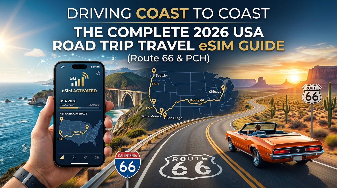
Driving Coast to Coast: The Complete 2026 USA Road Trip Travel eSIM Guide (Route 66 & PCH)
The Great American Road Trip Connectivity Challenge: Rural Dead Zones vs. 5G Corridors
Crossing the continental United States by car covers nearly 3,000 miles of dramatically shifting terrain, climate zones, and telecommunication infrastructure. Within a single driving day on historic Route 66 or along the Pacific Coast Highway (PCH), your smartphone transitions from hyper-dense, multi-gigabit mmWave 5G urban hubs to complete radio silence across rugged mountain passes, desolate salt flats, and protected tribal lands.
For road trippers and remote workers, this patchwork of coverage presents a severe operational risk if you rely on traditional connectivity solutions.
`` +-----------------------------------------------------------------------------------+ | USA CROSS-COUNTRY COVERAGE PROFILE | +------------------------------------+----------------------------------------------+ | Dense Urban Corridors (I-95, I-5) | Ultra-wideband 5G (300–1,000+ Mbps) | | Interstates & Major Arterials | Mid-Band 5G / Standard LTE (25–150 Mbps) | | National Parks & Mountain Passes | Low-Band LTE / Extended Range (1–10 Mbps) | | Rural Deserts / County Dead Zones | 2G Legacy / "No Service" (0 Mbps) | +------------------------------------+----------------------------------------------+ ``
The Pitfall of Single-Carrier Physical SIMs
International travelers often purchase a single-carrier prepaid SIM card (such as a retail T-Mobile or AT&T starter pack) upon landing in New York or Los Angeles. While these networks perform exceptionally well in metropolitan areas, the US telecom landscape is geographically fragmented:
- T-Mobile leads in high-speed urban and suburban 5G mid-band deployments, but can drop off quickly in remote mountain valleys and deep canyon roads along Highway 1.
- AT&T and Verizon maintain legacy low-band infrastructure that covers expansive rural swathes of the American heartland, yet they still suffer localized blind spots across vast national parks like Grand Canyon, Zion, or Death Valley.
Relying on a single domestic carrier leaves zero redundancy when driving through rural county dead zones. If your sole provider loses its signal tower 40 miles outside Amarillo, Texas or through the Big Sur coastline, your navigation freezes, digital maps fail to update real-time detour routing, and roadside emergency dispatch becomes inaccessible.
Real-Time Telemetry, Safety, and the Throttle Trap
A cross-country drive demands consistent, resilient data for continuous background tasks:
- Dynamic Turn-by-Turn GPS: Offline maps cannot alert you to sudden flash flooding in Arizona, wildfire road closures in California, or multi-car pileups on Interstate 40.
- Emergency Dispatch & Roadside Assistance: Contacting AAA or local highway patrols in low-signal corridors requires immediate, stable connectivity.
- Nomad Productivity on the Move: Digital nomads running mobile hotspots from rest stops or remote Bureau of Land Management (BLM) camp areas require reliable bandwidth to push commits, join calls, and process transactions.
``` CRITICAL DATA DEMANDS ON THE ROAD
[ Live Vector Maps ] [ Emergency Dispatch ] [ Digital Wallets ] │ │ │ └───────────────┬──────────┴───────────┬──────────────┘ ▼ ▼ Requires Sustained Bandwidth & Resilient Roaming ```
Many budget travel eSIMs exacerbate rural travel challenges through punitive Fair Use Policies (FUP). When your high-speed quota runs out in the middle of a desert stretch, standard travel eSIM providers aggressively throttle your connection to an unusable 128kbps—a speed so slow that map tiles fail to render, search queries time out, and mobile payment platforms crash.
To prevent this point of failure, modern cross-country travelers utilize multi-network eSIM profiles. Providers like MollySIM mitigate this risk by integrating a generous 384kbps Fair Use Policy throttle—three times faster than the 128kbps industry standard. Even after heavy high-speed data usage from daily streaming and hotspotting, a 384kbps baseline ensures that critical vector map rendering on Google Maps, Apple Pay contactless authorizations at rural gas pumps, and VoIP messaging continue to operate smoothly without stranding you in the digital dark.
Carrier Footprint Face-Off: T-Mobile, AT&T, and Verizon Across Remote Highways
🇺🇸 United States High-Speed Travel eSIM & SIM Plans
Instant QR code activation, hotspot enabled, with guaranteed 384kbps fallback speed to keep Maps & Digital Wallets active.
Selecting the right network infrastructure determines whether your GPS maintains real-time telemetry or freezes during critical mountain-pass interchanges. While marketing maps display near-ubiquitous national coverage, real-world cross-country testing reveals dramatic disparities in how the "Big Three" US carriers perform once you leave interstate corridors.
``` RURAL CARRIER TOPOLOGY COMPARISON
T-Mobile (n41) AT&T (Band 14/12) Verizon (Band 13) ┌───────────────┐ ┌───────────────┐ ┌───────────────┐ │ Ultra-Fast │ │ Deep Forest & │ │ Broad Heartland│ │ Urban/Suburban│ │ Highway Reach │ │ & Desert Fill │ └───────┬───────┘ └───────┬───────┘ └───────┬───────┘ │ │ │ └───────────────────┬───────┴───────────────────────────┘ ▼ MollySIM Dynamic Multi-Carrier Switching Backbone ```
1. T-Mobile: Peak Urban Speeds vs. Topographical Blindspots
T-Mobile leads the United States in mid-band 5G deployment, utilizing its 2.5 GHz (Band n41) "5G Ultra Capacity" (5G UC) layer. In metropolitan hubs like Chicago, St. Louis, and Los Angeles, downlink speeds frequently exceed 400–600 Mbps. However, mid-band signals attenuate rapidly over distance and fail to penetrate rugged terrain. Along California's Highway 1 through Big Sur and across the Mojave Desert stretches of Route 66, T-Mobile's signal often drops completely when line-of-sight to regional towers is obscured by coastal cliffs or desert mesas.
2. AT&T: The Rural Fiber and Public Safety Backbone
AT&T provides the most consistent rural coverage profile along remote US highway miles. Bolstered by its federal FirstNet contract (public safety communications on Band 14 700 MHz spectrum), AT&T has built hardened macro-towers throughout national parks, tribal lands, and deep-valley corridors. While AT&T's peak download speeds in major cities are often lower than T-Mobile's, its low-band sub-1GHz spectrum maintains voice-over-LTE (VoLTE) and live navigation data where other operators drop to "No Service."
3. Verizon: The Legacy Heartland Workhorse
Verizon’s legacy as America’s premier long-haul network rests on its dense low-band deployment (Band 13 700 MHz). Throughout the agricultural heartland of Oklahoma, the Texas Panhandle, and eastern New Mexico, Verizon delivers exceptional cellular reach. The primary drawback during peak road-trip seasons is network congestion: high tourist traffic in destinations like the Grand Canyon can saturate Verizon's LTE and low-band 5G bands, drastically slowing data throughput even when displaying full signal bars.
Comparative Evaluation: Single-Carrier vs. Multi-Network Road Readiness
The table below benchmarks the individual carrier footprints against single-carrier physical SIM cards and dynamic multi-network travel profiles.
| Network / Solution Profile | Rural Highway Reach (Interstate & Scenic) | Peak Urban Speeds (Suburban / Metro) | Multi-Carrier Dynamic Roaming | Throttled FUP Baseline Speed | Provisioning & Activation |
|---|---|---|---|---|---|
| T-Mobile USA | Moderate (High drop rate in coastal canyons & deserts) | Industry Best (400–800 Mbps on 5G UC) | ❌ Locked to T-Mobile towers only | 128 kbps (Standard Prepaid) | Physical swap or carrier app registration |
| AT&T USA | Exceptional (Extensive sub-1GHz Band 14/12 reach) | Moderate–High (100–300 Mbps on 5G+) | ❌ Locked to AT&T towers only | 128 kbps (Standard Prepaid) | In-store ID verification or app |
| Verizon Wireless | Very High (Broad heartland coverage) | High (150–400 Mbps on 5G Ultra Wideband) | ❌ Locked to Verizon towers only | 128 kbps (Standard Prepaid) | Carrier portal / eSIM download |
| Generic Local Physical Tourist SIM | Single-network dependent (Varies by host brand) | Variable based on MVNO priority tier | ❌ Single network lock-in | 64–128 kbps (Severe stalling) | Physical kiosk line, airport collection |
| MollySIM Multi-Carrier eSIM | Maximum Combined (Auto-switches to strongest local tower) | Ultra-Fast 5G / High-Speed 4G LTE roaming | ✅ Dynamic Multi-Network Switching | 384 kbps (3x industry speed for maps & payments) | Instant QR delivery (1-minute setup) |
The Power of Dynamic Carrier Switching
No single US network guarantees uninterrupted data across a 2,500-mile cross-country drive. When you hit dead zones where T-Mobile's mid-band cuts out in the Ozarks or Verizon gets congested outside Flagstaff, a single-carrier subscription leaves you disconnected.
Utilizing a multi-network eSIM architecture eliminates these single points of failure. By partnering with Tier-1 US operators, services like MollySIM allow your phone to dynamically negotiate the strongest available cell tower—jumping between major backbones on the fly. Paired with MollySIM's 384kbps safety net, cross-country drivers bypass the traditional 128kbps throttling trap, preserving navigation stability, weather radar updates, and contactless payment verification anywhere from coast to coast.
Route-by-Route Signal Breakdown: Route 66, Pacific Coast Highway, and Blue Ridge Parkway
Navigating across America means encountering wildly contrasting geological landscapes. Each topography presents unique electromagnetic challenges that disrupt cellular radio frequencies (RF). Understanding these terrain-induced blind spots allows you to plan your digital route strategy effectively.
`` [Route 66] [Pacific Coast Hwy] [Blue Ridge Parkway] Vast Desert Plains Sheer Ocean Cliffs Mountain Hollows & Canopy ┌─────────────────────┐ ┌───────────────────────┐ ┌─────────────────────────┐ │ Tower Distance: │ │ Line-of-Sight Block: │ │ Canopy Attenuation: │ │ 15–25 Miles Apart │ │ Granite Bluffs │ │ Dense Deciduous Foliage │ └──────────┬──────────┘ └───────────┬───────────┘ └────────────┬────────────┘ ▼ ▼ ▼ Low-Band RF Dropouts Single-Sided Cells Rapid Tower Handoffs ``
1. Route 66: The Mojave Expanse & New Mexico High Plains
- High-Risk Zones: Amboy Crater to Needles (California), Tucumcari to Santa Rosa (New Mexico), Seligman to Kingman bypass (Arizona).
The 2,448-mile stretch from Chicago to Santa Monica transitions from densely deployed mid-band 5G urban grids into low-band desert corridors. Once you detour off modern Interstate 40 onto historic, two-lane alignments:
- Tower Density Depletion: Cell tower spacing widens from urban 0.5-mile intervals to 15–25 miles apart. In regions like the Mojave Desert (between Barstow and Needles), standard mid-band frequencies (1.7 GHz–2.5 GHz) fade completely, leaving your device reliant on long-range 600–700 MHz spectrum (Band 12, 13, and 71).
- Network Boundary Shifts: AT&T dominates northern New Mexico’s open plains, while Verizon maintains the strongest footprint around Arizona’s elevated plateaus. Single-network SIMs experience abrupt "No Service" drops spanning 30 to 45 continuous miles.
2. Pacific Coast Highway (CA-1): The Big Sur Oceanic Bluff Dilemma
- High-Risk Zones: Carmel Highlands to San Simeon, Ragged Point, and pockets around Mendocino County.
California’s Highway 1 is notoriously difficult for cellular engineering. The dramatic collision of the Santa Lucia Mountains with the Pacific Ocean creates severe structural dead zones:
- Topographical Shadowing: Tower infrastructure cannot be built on the ocean side, halving the potential coverage area. Cell towers situated inland atop coastal ridges shoot RF signals over the highway, leaving vehicles traveling below sheer 1,000-foot granite cliffs in deep RF shadows.
- Marine Layer Attenuation: Heavy coastal fog and atmospheric moisture cause signal scattering, particularly on higher-frequency 5G networks.
- Zero Roaming Handshakes: Between Big Sur Village and Lucia, single-carrier subscribers regularly face 30+ miles of absolute zero-reception corridors. A multi-carrier eSIM like MollySIM mitigates this by latching onto whichever regional macro-cell (whether AT&T along northern bluffs or T-Mobile closer to municipal outposts) penetrates the closest ravine.
3. Blue Ridge Parkway: Appalachian Hollows & Canopy Attenuation
- High-Risk Zones: Linville Gorge (North Carolina), Peaks of Otter (Virginia), and remote trailheads around Mount Mitchell.
Spanning 469 miles across Virginia and North Carolina along the Appalachian Mountains, the Parkway introduces two distinct signal blockers:
- Dense Canopy Absorption: Mid-band and high-band cellular waves struggle to penetrate the thick, mature deciduous tree canopy characteristic of the Blue Ridge chain. Signal strength degrades substantially from spring through late autumn.
- The "Hollow" Effect: As the road winds along ridge lines and plunges into deep valleys (hollows), phones undergo aggressive, rapid tower handoffs. This constant switching drains battery life and leads to packet drops.
Route Connectivity & Frequency Comparison
| Scenic Corridor | Primary Blind Spots | Dominant Backhaul | Terrain Obstacle | Recommended Connectivity Redundancy |
|---|---|---|---|---|
| Historic Route 66 | Mojave Desert (CA), Eastern NM Plains | Verizon / AT&T | Tower distance & flat horizons | Multi-carrier failover with low-band spectrum capability |
| Pacific Coast Hwy (CA-1) | Big Sur Coastal Shelf, Lucia to Gorda | AT&T / Regional Fiber | Sheer granite cliffs & marine dispersion | Pre-downloaded offline base map + dynamic network switching |
| Blue Ridge Parkway | Deep Hollows, Mileposts 310–360 | UScellular / AT&T | Tree canopy attenuation & ridge shadowing | Carrier-flexible eSIM with high Fair Use baseline speeds |
How Dynamic Switching Keeps Your Trip Alive
When cell towers thin out in regions like these, hitting a standard carrier data cap drops your speeds to an unusable 128 kbps—instantly breaking dynamic route recalculations and fuel stop lookups.
Because MollySIM automatically roams across Tier-1 US backbones and enforces a 384 kbps safety-net floor, your phone continues rendering vector tiles on Google Maps, processing mobile fuel payments via Apple Pay, and transmitting live telemetry without freezing in remote gaps.
Why Dynamic Multi-Network Switching Is Essential for Coast-to-Coast Driving
A transcontinental road trip across the United States exposes mobile devices to wildly fragmented cellular territory. In urban hubs like Chicago, St. Louis, and Los Angeles, mid-band 5G networks provide ultra-dense bandwidth. However, once you cross the 100th Meridian into the Texas Panhandle, the high desert of New Mexico, or the coastal mountain passes along Route 1, coverage splinters across completely different carrier footprints.
Buying a standard local prepaid SIM ties your modem to a single carrier’s infrastructure. If you buy a T-Mobile SIM, you risk signal blackouts in the deep granite cuts of Big Sur where AT&T holds the dominant regional tower contracts. Conversely, an AT&T-locked device may drop packets entirely across stretches of rural Arizona where T-Mobile’s 600 MHz (Band 71) extended-range 5G penetrates furthest.
`` +-------------------------------------------------------------------+ | Coast-to-Coast Cellular Architecture | +-------------------------------------------------------------------+ │ ┌─────────────────────┴─────────────────────┐ ▼ ▼ [Single-Carrier SIM] [MollySIM Dynamic Engine] • Locked to 1 Network • Aggregates Tier-1 Backbones • Tower Blind Spot = Complete Dropped Call (AT&T + T-Mobile + Verizon) • Requires Manual Roaming Toggles • Autonomous RSRP/RSRQ Failover • Throttled to 128 kbps post-cap • Seamless Carrier Handoff • 384 kbps High-Floor Safety Net ``
The Architecture Behind Multi-Network Roaming
Instead of locking the hardware modem to a single domestic Mobile Network Code (MNC), MollySIM deploys an enterprise-grade roaming core that interfaces directly with multiple Tier-1 US backbones simultaneously (including AT&T and T-Mobile).
The operating system does not treat these networks as foreign competitors; rather, the underlying SIM profile establishes authenticated peering agreements with each carrier. This creates a virtualized aggregation layer that grants your phone access to whichever host tower provides the cleanest radio signal at any given coordinate.
Autonomous Tower Handoff: Zero Driver Interaction
Attempting to troubleshoot connectivity while driving at highway speeds is hazardous. Manual network selection requires navigating deep into your phone’s cellular settings, running a 60-second carrier scan, and guessing which operator has an active transceiver nearby.
`` High-Speed Driving (75 MPH) │ ├─► Signal Degradation Detected (RSRP drops below -115 dBm) │ ├─► Dynamic Modem Handshake (No APN reconfiguration required) │ └─► Auto-Switch to Dominant Carrier (e.g., T-Mobile 5G ──► AT&T LTE) ``
The dynamic switching engine manages signal transitions autonomously through standard cellular metrics:
- Signal Metric Analysis: The device radio constantly monitors Reference Signal Received Power (RSRP) and Reference Signal Received Quality (RSRQ).
- Threshold-Triggered Failover: When the active carrier’s RSRP deteriorates below usable voice/data thresholds (typically around -115 dBm to -120 dBm), the profile initiates an automated handshake with the next available partner network.
- Transparent Protocol Migration: The modem negotiates the switch in the background—transitioning, for example, from a fading T-Mobile 5G Ultra Capacity band to a resilient AT&T sub-1 GHz LTE channel.
- Persistent Data Sessions: Because Access Point Name (APN) configurations are handled dynamically at the provisioning layer, your data connection does not require manual APN updates, network toggles, or device reboots.
Comparing Roadside Data Architectures
| Connectivity Feature | Single-Carrier Local SIM | Standard Budget Travel eSIM | MollySIM Multi-Network Engine |
|---|---|---|---|
| US Network Access | Single carrier only (e.g., T-Mobile) | Single partner network | Multi-Carrier Tier-1 Aggregation (AT&T / T-Mobile) |
| Failover Mechanism | None (Dead zones remain dead) | Manual carrier toggle in Settings | Autonomous real-time tower switching |
| Driver Intervention | Pull over to swap SIM cards | Navigate device menus while parked | 100% automated background switching |
| APN Maintenance | Manual update required per carrier | Static profile, occasional glitches | Fully managed zero-configuration APN |
| FUP Throttling Floor | 128 kbps (Map rendering fails) | 64–128 kbps (Total packet drop) | 384 kbps (Vector maps & Apple Pay operational) |
By eliminating single-carrier reliance, dynamic switching ensures uninterrupted navigation through remote corridors, keeping dynamic GPS routing, weather radar overlays, and emergency communication active without requiring the driver to touch their screen.
Navigation Redundancy: Offline GPS Caching and MollySIM’s 384kbps Safety Net
Even with multi-network dynamic switching, cross-country travel exposes motorists to total RF shadow zones. Topographical barriers—such as the granite sheer walls of the Mojave National Preserve, the subterranean cuts of the Bighorn Basin, or the marine-layer-induced signal attenuation along the Big Sur coastline on Highway 1—can temporarily sever all terrestrial cellular handshakes.
Building a fault-tolerant digital cockpit requires a two-pronged strategy: aggressive local vector map caching prior to departure, backed by a resilient baseline data connection that prevents complete system drops when your high-speed quota runs out.
`` +-------------------------------------------------------------------+ | FAIL-SAFE COCKPIT TOPOLOGY | | | | [Layer 1: Offline Cache] ---> Local Storage (No RF Required) | | (Google/Apple/Gaia Vector Data) | | | | [Layer 2: Active Dynamic] --> MollySIM Tier-1 Dual-Carrier Auto | | (High-Speed Dynamic Rerouting) | | | | [Layer 3: FUP Safety Net] -> 384kbps Sustained Unmetered Floor | | (Live API / VoIP / Apple Pay) | +-------------------------------------------------------------------+ ``
Step-by-Step Pre-Trip Map Caching Protocol
Map data should be stored directly to your device's flash storage while connected to high-bandwidth Wi-Fi before entering rural corridors. Modern vector maps require significantly less local storage than legacy raster tiles, making it practical to store thousands of highway miles across key apps:
- Google Maps (iOS & Android):
- Tap your Profile Picture > Offline Maps > Select Your Own Map.
- Pan and zoom the bounding rectangle across major transit segments (e.g., I-40 through New Mexico or US-395 along the Eastern Sierra).
- Download individual zones (typically 250MB to 1.5GB per sector).
- Technical Note: Offline Google Maps preserves address lookups and route calculation via cached vector networks, but disables live traffic heatmaps and dynamic incident reporting.
- Apple Maps (iOS 17+):
- Tap your Avatar > Offline Maps > Download New Map.
- Search for specific regions (e.g., "Grand Canyon National Park" or "Olympic Peninsula").
- Select your boundary size and toggle Automatic Updates and Optimize Storage to maintain local cache integrity without exhausting iPhone flash memory.
- Gaia GPS or OnX Offroad (Topographical & Public Lands):
- Essential for dispersed camping (BLM land) and backcountry passes off Route 66.
- Select Map Layers > USFS 2016 / USGS Topo > Save for Offline.
- Select zoom levels up to 1:24k scale to maintain contour resolution when cell service drops to zero.
The Reality of the FUP Floor: 384kbps vs. 128kbps
On extended 3,000-mile road trips, heavy usage—such as background dashcam cloud syncs, passenger streaming, and continuous route telemetry—can deplete high-speed data allocations earlier than anticipated. On conventional travel eSIMs, exceeding your high-speed threshold triggers a severe Fair Use Policy (FUP) throttle, dropping throughput to 64kbps or 128kbps.
At 64–128kbps, standard network sockets time out. The Transport Layer Security (TLS) handshake fails due to latency, rendering apps like Google Maps and Apple Pay inoperable:
`` 64-128 kbps (Budget eSIMs) : [TLS Handshake Timeout] ----X (Connection Dropped) 384 kbps (MollySIM Floor) : [TLS Handshake] ---> [Continuous API Stream] (Operational) ``
To prevent total digital stranding, MollySIM implements an unmetered 384kbps safety floor—triple the industry standard.
``` CRITICAL APP PERFORMANCE AT THROTTLED SPEEDS
Application / Protocol Bandwidth Needed 128kbps Throttle MollySIM 384kbps Floor ---------------------------------------------------------------------------------------------------- Google Maps Dynamic Vector Reroute ~30-50 kbps FAILS (Socket Timeout) FULLY FUNCTIONAL Apple Pay / Google Wallet Auth ~10-20 kbps FAILS (Session Drop) FULLY FUNCTIONAL WhatsApp / iMessage (Text & Voice) ~16-32 kbps INTERMITTENT REAL-TIME OPERATIONAL Basic VoIP Audio (Opus Codec) ~24-40 kbps SEVERE JITTER STABLE & USABLE Stripe / Square POS Terminal Sync ~15-30 kbps FAILS FULLY FUNCTIONAL ```
At 384kbps, your navigation app can still pull lightweight dynamic vector differentials, stream real-time road hazard alerts, authorize mobile payments at remote fuel stations, and transmit two-way emergency text and voice messages over VoIP protocols. This guaranteed baseline turns a potential mid-desert communication blackout into a fully manageable transit leg.
Step-by-Step Installation and Optimization Guide for Your USA Road Trip eSIM
Setting up your connectivity profile before you pull out of the airport car rental bay ensures you never navigate blind. A minor misconfiguration in dual-SIM settings can lead to unexpected roaming charges from your domestic carrier or leave you without 2-factor authentication (2FA) codes when booking roadside motels.
Follow this battle-tested configuration sequence to install, lock down, and optimize MollySIM for uninterrupted cross-country travel.
Phase 1: Pre-Departure Installation (At Home via Wi-Fi)
Install your eSIM 12 to 24 hours before your flight or road trip begins while connected to a stable home Wi-Fi network.
- Locate Your Activation QR Code: Open your confirmation email from MollySIM on a secondary screen (laptop, tablet, or printout).
- Scan and Profile Provisioning:
- iOS: Navigate to Settings > Cellular (or Mobile Data) > Add eSIM > Use QR Code. Scan the code and tap Continue to download the carrier profile.
- Android (Pixel/Samsung): Go to Settings > Network & Internet (or Connections) > SIMs > Add SIM > Download a SIM instead. Scan the QR code and confirm the download.
- Label the Profile: Set custom labels immediately to avoid UI confusion. Label your home carrier as "Primary / Home" and your new travel line as "MollySIM USA".
- Initial State: Keep the MollySIM line turned OFF until you land in the United States or cross the border.
Phase 2: Dual-SIM Architecture & 2FA Configuration
Once you arrive on US soil, configure your device routing to preserve bank verification texts while forcing all internet traffic through your high-speed travel plan.
`` RECOMMENDED DUAL-SIM CONFIGURATION Setting Target Home / Primary SIM MollySIM Travel eSIM ----------------------------------------------------------------------------------------- SIM State ON ON Default Voice Line SELECTED (For incoming calls) UNCHECKED SMS / MMS (Banking 2FA) ACTIVE N/A Cellular Data DISABLED SELECTED (Primary Data Line) Data Roaming OFF (Avoid home surcharges) ON (Required for operation) Allow Cellular Data Switching OFF OFF ``
Critical Risk Mitigation: Ensure "Allow Cellular Data Switching" (iOS) or "Switch data automatically" (Android) is toggled OFF. If left on, your phone will silently failover to your home SIM when driving through low-signal stretches of Route 66, triggering punitive international roaming fees from your domestic carrier.
Phase 3: In-Transit Data Preservation & OS Tuning
Cross-country road trips demand efficient bandwidth management. Background operating system tasks can quietly chew through high-speed allowances without your knowledge.
- Enable Low Data Mode (iOS) / Data Saver (Android): Go to your MollySIM cellular settings and toggle Low Data Mode to ON. This pauses background iCloud/Google Photos syncs, halts automated App Store updates, and reduces background API polling.
- Disable Wi-Fi Assist: Turn off Wi-Fi Assist (iOS) to prevent your phone from burning through travel data when hotel or diner Wi-Fi connections weaken as you walk toward your car.
- Pre-Cache Offline Maps: Even with MollySIM’s unmetered 384kbps safety floor keeping routing APIs operational during edge-case dead zones, downloading regional offline maps in Google Maps or Apple Maps for desert corridors (Mojave, Texas Panhandle, Navajo Nation) saves bandwidth for live telematics and streaming.
Phase 4: Remote Rest Stop Network Troubleshooting
If your device displays "No Service" or drops to an unresponsive 3G/E node after climbing a mountain pass or traversing an unpopulated county, the device’s baseband modem may be locked to a legacy cell tower.
`` [Signal Dropped / Tower Hang] │ ▼ [Toggle Airplane Mode (15s)] ──(Resolved?)──► [Return to Transit] │ (No) ▼ [Settings > Cellular > Network Selection] │ ▼ [Disable "Automatic" Search] │ ▼ [Manually Select: AT&T ⇄ T-Mobile ⇄ Verizon] ──► [Lock Strongest LTE/5G Carrier] ``
- Cycle Airplane Mode: Toggle Airplane Mode ON for 15 seconds, then turn it OFF. This forces the modem to perform a fresh PLMN (Public Land Mobile Network) sweep.
- Manual Carrier Selection:
- Navigate to Settings > Cellular > MollySIM Line > Network Selection.
- Toggle Automatic to OFF.
- Wait 30–60 seconds for the surrounding radio towers to populate.
- Manually select the dominant regional tier-1 provider (switch between AT&T, T-Mobile, or Verizon depending on which carrier covers that specific valley).
- APN Verification: Ensure the Access Point Name (APN) matches the instructions provided in your MollySIM setup dashboard. In 99% of cases, this provisions automatically upon network handoff.
🇺🇸 United States High-Speed Travel eSIM & SIM Plans
Instant QR code activation, hotspot enabled, with guaranteed 384kbps fallback speed to keep Maps & Digital Wallets active.