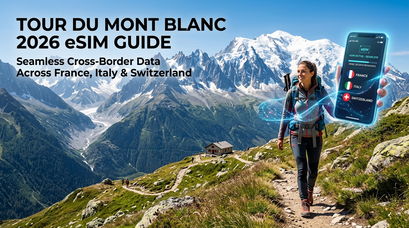
The Alpine Tri-Border Challenge: Mobile Connectivity on the Tour du Mont Blanc
Spanning roughly 170 kilometers and demanding over 10,000 meters of cumulative elevation gain, the Tour du Mont Blanc (TMB) is not merely a grueling physical endurance test—it is one of the most complex geopolitical telecom environments in Western Europe. As hikers circumnavigate the Mont Blanc Massif, their smartphones must navigate three separate sovereign telecommunications jurisdictions (France, Italy, and Switzerland) while contending with severe physical obstructions inherent to glaciated alpine terrain.
Regional Telecom Landscapes: France, Italy, and Switzerland
Each nation along the circuit manages its cellular infrastructure through distinct top-tier Mobile Network Operators (MNOs), resulting in noticeable performance variations as you cross borders:
- France (Haute-Savoie): The western flanks (Chamonix, Les Houches, Les Contamines-Montjoie) rely predominantly on Orange, SFR, and Bouygues Telecom. Coverage is dense along the valley floors, with Orange maintaining the strongest macro-towers positioned high on the mid-mountain ski lift stations (e.g., Plan de l'Aiguille, Flégère).
- Italy (Aosta Valley): Pushing through the southern arc into the Val Vény and Val Ferret toward Courmayeur, the landscape transitions to TIM, Vodafone Italia, and WindTre. TIM provides exceptional macro-cell coverage anchored along the Aosta Valley artery, but coverage drops off sharply as soon as you plunge behind the sharp lateral moraines beneath the Miage Glacier.
- Switzerland (Valais): The eastern segment spanning La Fouly, Champex-Lac, and Trient is dominated by Swisscom and Sunrise. Swisscom boasts the most reliable alpine infrastructure in the world, maintaining dedicated low-emission cellular micro-sites even near remote mountain refuges (cabanes).
High-Altitude Passes: The Critical Transition Points
The most problematic segments for mobile connectivity occur at the high-altitude cols that demarcate the borders. At these elevations, your device gets caught in a "ping-pong" effect—simultaneously scanning conflicting, weak signals from competing base stations miles down in adjacent valleys.
| Mountain Pass | Elevation | Border Transition | Dominant Signal Profile | Connectivity Reality |
|---|---|---|---|---|
| Col de la Seigne | 2,516 m | France ➔ Italy | Weak SFR (FR) / Intermittent TIM (IT) | Extreme shadow behind the Aiguille des Glaciers; connection drops 200m below the pass on the Italian side. |
| Grand Col Ferret | 2,537 m | Italy ➔ Switzerland | TIM (IT) handover to Swisscom (CH) | Strong, unobstructed line-of-sight to Valais towers; rapid, automated network switching required. |
| Col de Balme | 2,191 m | Switzerland ➔ France | Swisscom / Sunrise (CH) ➔ Orange (FR) | Broad plateau creates signal overlap; manual network locking is often needed to stop battery drain. |
RF Propagation Physics: 700/800MHz LTE vs. High-Band 5G
The primary barrier to consistent mobile data along the TMB is not distance—it is radio frequency (RF) physics. The Mont Blanc Massif consists of dense, jagged protogine granite, steep glacial troughs, and hanging valleys that completely block direct line-of-sight (LOS) to macro towers located in Chamonix, Courmayeur, or Martigny.
- High-Frequency 5G (3.5 GHz / Band n78): While modern European cities enjoy blazing multi-gigabit speeds on mid-to-high band 5G, these millimetric and sub-6GHz waves suffer massive attenuation when confronted by solid rock, dense larch forests, and sudden atmospheric moisture changes (mountain fog and storms). They simply cannot wrap around knife-edge arêtes.
- Low-Frequency LTE (Band 20 / 800 MHz & Band 28 / 700 MHz): For the backcountry hiker, low-band spectrum is essential. These sub-1GHz frequencies have long wavelengths capable of knife-edge diffraction—literally bending over mountain ridges into deep valleys.
Because coverage in these high-altitude zones relies almost entirely on weak, diffracted low-band LTE carriers, standard single-network tourist SIMs quickly fail.
Using an alpine-ready cross-border solution like MollySIM resolves this by dynamically latching onto whichever Tier-1 regional carrier (Orange, TIM, or Swisscom) has the strongest local low-band transponder.
Furthermore, if heavy offline topographic downloads or weather radar checks exhaust your high-speed quota mid-trek, MollySIM enforces a 384kbps Fair Use Policy (FUP) throttle—which is 3x faster than the 128kbps industry standard. At 384kbps, critical vector mapping platforms like Google Maps, emergency GPS positioning, and contactless Apple Pay / Google Wallet transactions continue to function smoothly without timing out on mountain refuge payment terminals.
The Swiss Roaming Trap: Why Standard EU SIMs Fail on the TMB
🇪🇺 Europe 33 Countries High-Speed Travel eSIM & SIM Plans
Instant QR code activation, hotspot enabled, with guaranteed 384kbps fallback speed to keep Maps & Digital Wallets active.
For most travelers visiting Europe, the European Union’s "Roam Like at Home" (RLAH) regulations provide a false sense of security. Under EU Directive 2026/612, mobile subscribers can use their domestic domestic call, text, and data allowances across all 27 EU member states without incurring supplementary fees.
However, the Tour du Mont Blanc creates a uniquely hazardous connectivity scenario: Switzerland is not a member of the European Union or the European Economic Area (EEA).
Because Swiss network infrastructure operates outside the jurisdiction of EU pricing caps, mobile operators are legally permitted to levy uncapped, international roaming surcharges the moment your handset authenticates on a Swiss cell tower.
       [France (EU / RLAH)]  <--->  [Switzerland (NON-EU / Overage Risk)]
                 \                      /
                  \   Col de Balme     /
                   \  Grand Col Ferret/
                    \                /
             [Italy (EU / RLAH)] <---'
The Financial Reality of Swiss Data Overages
When using a standard EU SIM card or a localized prepaid tourist SIM bought in Paris, Chamonix, or Rome, crossing into Swiss territory triggers immediate tier-3 international roaming billing. Standard out-of-bundle rates from mainstream European and international domestic carriers routinely reach:
- €5.00 to €15.00 per Megabyte of uncompressed data.
- €12.00 to €20.00 daily pass fees that activate automatically upon packet transfer, often capped at meager 100MB daily limits.
- Automatic carrier cutoff thresholds (frequently set at €50 or €60), instantly terminating your internet access in the backcountry when background app refreshes silently exhaust the limit.
A modern smartphone running background tasks—such as synchronizing high-resolution photos to iCloud, downloading offline map tiles, or pulling real-time weather radar data—can consume 200MB in under ten minutes, resulting in hundreds of euros in unexpected roaming surcharges before you even reach your evening mountain refuge.
"Border Bleed": The High-Ridge Connectivity Hazard
You do not have to physically step foot in Switzerland to suffer Swiss roaming charges. Radio frequency (RF) signals do not respect geopolitical borders; high-altitude line-of-sight propagation means powerful transponders situated on Swiss peaks beam signals deep into French and Italian valleys.
While traversing boundary ridges—most notably the Col de Balme (France–Switzerland border) and the Grand Col Ferret (Italy–Switzerland border)—your smartphone continuously scans for the strongest signal. A Swiss cell tower located kilometers away across an open valley often presents a cleaner, higher-gain signal than an obstructed French or Italian mast situated down in the valley floor.
Without an integrated multi-country profile, your device will passively latch onto the Swiss mast via "border bleed," initiating background data syncs at punitive roaming rates while you are still hiking on French or Italian soil.
| Roaming Setup | France Coverage | Italy Coverage | Switzerland Coverage | Accidental Border Bleed Risk |
|---|---|---|---|---|
| Standard EU Carrier SIM | Included (RLAH) | Included (RLAH) | Excluded (€5–€15/MB Surcharge) | Critical (Triggers Instant Billing) |
| Local Prepaid French SIM | Tier-1 Native | Roaming Surcharges | Blocked / Pay-Per-MB | High (Data Drops or Charges Surcharges) |
| MollySIM Multi-Country eSIM | Included (Orange/SFR) | Included (TIM/Vodafone) | Included (Swisscom/Sunrise) | Zero (Seamless Autonomous Switching) |
Unified Alpine Routing: The MollySIM Advantage
Navigating the Tour du Mont Blanc demands a connectivity solution that treats the Western Alps as a unified geographic region rather than three separate regulatory zones.
MollySIM eliminates cross-border roaming penalties by provisioning a single, multi-IMSI Europe eSIM profile that natively bundles France, Italy, and Switzerland under a single flat-rate data pool. Instead of manually swapping physical SIM cards at border checkpoints or toggling data roaming on and off to prevent phantom Swiss charges, your device hops seamlessly between Tier-1 networks—such as Orange (France), TIM (Italy), and Swisscom (Switzerland)—based strictly on signal strength and low-band LTE availability.
Even if unpredictable weather detours or continuous high-resolution GPS tracking consume your primary data allocation, MollySIM’s generous 384kbps Fair Use Policy (FUP) baseline ensures your lifeline remains active. Operating at 3x the speed of standard 128kbps throttles, 384kbps provides sufficient throughput to load vector topography on Google Maps, send emergency text coordinates, and authorize mountain hut expenses via Apple Pay or Google Wallet without ever risking a Swiss roaming bill.
Tri-Border Network Landscape & Connectivity Solutions Compared
Navigating the Tour du Mont Blanc requires traversing three distinct national telecommunications zones within a span of 170 kilometers. Because the route crosses between the European Union (France and Italy) and non-EU territory (Switzerland), data provisioning is fragmented. Selecting the correct technical infrastructure requires understanding the topographical dominance of local carriers and the practical trade-offs of different connectivity hardware.
       [ France: Orange / SFR ]  <--- Chamonix Valley & Les Houches
                  |
     [ Italy: TIM / Vodafone ]   <--- Courmayeur & Val Ferret
                  |
    [ Switzerland: Swisscom ]    <--- Grand Col Ferret & Champex-Lac
Carrier Infrastructure Along the Massif
- France (Orange & SFR): Orange France maintains the most robust high-altitude macro-cell deployment across the Haute-Savoie region. Its dense sub-1GHz spectrum (Band 20/800MHz and Band 28/700MHz) penetrates deep into the Chamonix Valley, Les Houches, and the remote approaches toward Refuge des Fressieux and Croix du Bonhomme. SFR provides secondary coverage along main arterial roads but drops significantly in steep cols.
- Italy (TIM & Vodafone Italia): In the Aosta Valley, TIM provides the highest reliability along the descent from Col de la Seigne into Val Veny, as well as the high-traffic hubs around Courmayeur. Vodafone Italia matches this density in urbanized trail junctions but suffers from packet latency along the isolated stretches of the Italian Val Ferret.
- Switzerland (Swisscom & Sunrise): Swisscom operates the undisputed gold standard for alpine coverage. Leveraging remote microwave repeaters and high-gain mountain-pass transceivers, Swisscom maintains high-speed LTE through the isolated ascent to Grand Col Ferret, the La Fouly basin, and Champex-Lac. Sunrise provides reliable backup in valley floors but experiences blind spots in steep glacial valleys.
Comparative Matrix: TMB Connectivity Options
| Connectivity Solution | Tri-Border Auto-Switching | Swiss Data Included? | Multi-Network Redundancy | Trail Weight & Durability | Throttled Fallback (FUP) | Best Used For |
|---|---|---|---|---|---|---|
| Direct French SIM (Orange/SFR Holiday) | Semi-Automatic (EU Roam) | No (High roaming surcharge) | Single profile only (Orange or SFR) | Physical SIM tray handling on trail | Cutoff or 32–64 kbps | Chamonix-only localized stays |
| Direct Italian SIM (TIM/Vodafone) | Semi-Automatic (EU Roam) | No (High roaming surcharge) | Single profile only | Physical SIM tray handling on trail | Cutoff or 64 kbps | Courmayeur hub treks |
| Direct Swiss SIM (Swisscom) | Manual (Requires EU roaming add-on) | Yes (Native) | Single network (Swisscom only) | Physical SIM / local registration | Cutoff or 128 kbps | Swiss-segment-only hikers |
| Pocket Wi-Fi Rental | Automatic (Varies by provider) | Optional add-on | Dual-carrier virtual SIM | Heavy (+180g–250g); cold-sensitive battery | 128 kbps | Multi-device family groups |
| Standard Travel eSIMs | Automatic (EU only) | Excluded or Extra Tier | Single partner per country | 0g (Embedded) | 128 kbps (Unusable for maps) | Budget hikers staying inside EU |
| MollySIM Europe Multi-Country eSIM | Full Autonomous Hopping | Yes (Native Swisscom & Sunrise) | Multi-Carrier per country (Orange, TIM, Swisscom) | 0g (Zero pack weight, 100% digital) | 384 kbps (Smooth maps & banking) | Full 10–12 Day TMB Circuit |
Technical Evaluation of Hardware Form Factors
1. Physical SIM Swapping
Carrying multiple plastic nano-SIMs for France, Italy, and Switzerland introduces significant operational friction. Replacing SIM cards using a SIM ejector tool at a windy col like Grand Col Ferret or in damp weather risks losing trays or damaging waterproof device seals. Furthermore, standard prepaid EU SIMs bought in France or Italy instantly cut data or apply exorbitant pay-as-you-go rates (up to €12/MB) the moment your phone pings a Swisscom tower in La Fouly.
2. Pocket Wi-Fi Units
Dedicated pocket hotspot devices add 180 to 250 grams of dead weight to an ultralight pack. Alpine sub-zero morning temperatures degrade external lithium-ion battery packs rapidly, often exhausting power before you reach your evening refuge. In addition, carrying a secondary device requires daily recharging in mountain refuges where electrical outlets are frequently scarce or restricted.
3. Modern Multi-IMSI eSIM Profiles
Digital eSIM profiles provisioned with multi-IMSI technology eliminate mechanical failure points entirely. Profiles like MollySIM aggregate Orange, TIM, and Swisscom onto an automated routing layer. If an Orange tower is occluded by the Aiguille de Bionnassay, your phone drops to SFR without manual intervention.
Critically, when you exceed your high-speed quota mid-hike, MollySIM's 384kbps baseline speed provides 300% more throughput than standard 128kbps industry caps. This ensures topographic vector map tiles, live Garmin syncs, and emergency communication continue functioning reliably throughout the entire massif.
Alpine Safety & Mountain Refuge Logistics: The MollySIM 384kbps Safety Floor
The Mont Blanc massif generates its own volatile microclimates. A bluebird morning starting out from Courmayeur can deteriorate into zero-visibility squalls with gale-force winds by the time you reach the crest of the Grand Col Ferret. In remote alpine terrain, maintaining an unbroken data link is not an entertainment luxury—it is a functional safety tool and an essential operational lifeline for stage management.
Real-Time Refuge Logistics and Trail Protocols
High-altitude refuges along the TMB circuit operate under strict check-in windows. Iconic locations such as Refugio Bonatti (Val Ferret, Italy) and Refuge de la Croix du Bonhomme (France) enforce rigid dinner seatings (typically 18:30 to 19:00) and strict no-show cancellation thresholds.
If unexpected physical fatigue, route diversions around high passes, or sudden thunderstorms delay your ascent:
- Failure to notify the refuge manager: Wardens often assume an overdue hiker is injured on the trail and may initiate emergency protocols or reallocate reserved bunks to emergency walk-ins.
- Refuge contact protocols: Many remote refuges lack standard landlines and rely entirely on WhatsApp messaging or cellular data-linked check-in systems to manage arrival queues.
The Breakdown of Standard 128kbps Throttling
When prepaid travel eSIMs exhaust their high-speed data buckets, the vast majority throttle users down to 64kbps or 128kbps. Under alpine operating conditions, a 128kbps bandwidth cap causes severe network failure:
- TLS/SSL Handshake Timeouts: Modern HTTPS-encrypted apps (Météo-France, AllTrails, Apple Maps) require rapid cryptographic handshakes. At 128kbps, these requests frequently time out, rendering apps completely unresponsive.
- Packet Drop on Weak Edge Signals: High-altitude cell towers often operate with elevated signal-to-noise ratios. A 128kbps connection cannot handle the packet loss, completely dropping the connection.
How MollySIM's 384kbps Fair Use Speed Maintains Vital Systems
To prevent dangerous communication blackouts, MollySIM enforces an unlimited 384kbps safety floor once high-speed allocations are consumed. By delivering three times the data throughput of standard travel eSIMs, this baseline bandwidth maintains persistent access to critical safety and logistical services:
| Protocol / Application | Data Payload Profile | 128kbps (Competitor Standard) | MollySIM 384kbps Safety Floor |
|---|---|---|---|
| Emergency WhatsApp / Signal | Text + Voice Notes (32–64 KB) | Frequent delivery failures | Instant delivery & voice note sync |
| Live GPS / Find My Location | Lat/Long telemetry packets | Drops during handshakes | Stable, continuous tracking |
| Vector Map Tiles (Komoot/Gaia) | Compressed PBF vector data | Freezes; blank screen | Smooth tile caching & rendering |
| High-Res Weather Radar | 15-min precipitation loops | Times out repeatedly | Loads live rain/storm radar scans |
| Emergency Alpine Rescue Sync | PGHM / Rega SOS telemetry | High failure rate | Rock-solid transmission |
If an extraction becomes necessary, communicating your precise coordinates and battery status to the Peloton de Gendarmerie de Haute-Montagne (PGHM) in Chamonix or Rega (Swiss Air-Rescue) requires zero latency on low-payload channels. The 384kbps baseline ensures that no matter where you are across the 170-kilometer loop, your device remains operational for two-way communication, essential trail navigation, and contactless refuge payments without sudden disconnections.
Trail Optimization: Offline Topo Caching, GPS Tracking, and Battery Longevity
Navigating the 170-kilometer Tour du Mont Blanc loop with a digital-first setup requires deliberate hardware and software management. The convergence of sub-zero alpine passes, remote valleys devoid of cell towers, and resource-heavy navigation applications creates extreme demands on modern smartphones. Optimizing your device before leaving Chamonix, Courmayeur, or Champex-Lac ensures uninterrupted navigation while preventing rapid battery exhaustion.
1. Offline Topo & 3D Vector Map Caching Protocols
Never rely on real-time map rendering while traversing remote cols like the Col du Bonhomme or the Grand Col Ferret. High-resolution satellite imagery and raster topographic layers consume massive bandwidth and cause critical map rendering failures in cellular dead zones.
Execute this offline preparation protocol over stable Wi-Fi prior to departure:
- Gaia GPS / Outdooractive (IGN France & Swisstopo Layers): Download vector topo layers at a minimum zoom scale of 1:25,000. Create an offline polygon covering a 10 km buffer around the entire TMB corridor to account for high-route variations (e.g., Col des Fours or Fenêtre d'Arpette). Vector maps require roughly 450 MB of storage, compared to over 4 GB for uncompressed raster tiles.
- FATMAP / Strava 3D Terrains: Cache custom routes along with high-resolution 3D terrain elevation models. Pre-render 3D routes along high-avalanche/rockfall zones to allow offline slope gradient analysis during inclement weather.
- AllTrails / Komoot: Save the TMB master track offline, including elevation waypoints and turn-by-turn routing data.
Pro-Tip: Even if you exhaust your primary high-speed data allocation or encounter an uncached trail detour, MollySIM's (https://mollysim.com) 384kbps safety floor maintains enough bandwidth to render live OpenStreetMap and Mapbox vector tiles in real time—a task where standard 128kbps connections time out.2. Cellular RF Power Draw and Thermal Depletion
Alpine environments drain smartphone batteries through two simultaneous mechanisms: RF Power Amplification and Electrochemical Deceleration.
                   ┌─────────────────────────────────────────────────┐
                   │          Fringe Signal / Deep Valley            │
                   │           (RSRP < -115 dBm or No Service)       │
                   └───────────────────────┬─────────────────────────┘
                                           │
                        ┌──────────────────┴──────────────────┐
                        ▼                                     ▼
        ┌───────────────────────────────┐     ┌───────────────────────────────┐
        │   Cellular Baseband Modem     │     │     Lithium-Ion Chemistry     │
        │   Ramps RF Output to Max      │     │     Cold Weather (< 0°C / 32°F)│
        │   (Power Class 3: ~23 dBm)    │     │     Internal Impedance Spikes │
        └───────────────┬───────────────┘     └───────────────┬───────────────┘
                        │                                     │
                        └──────────────────┬──────────────────┘
                                           ▼
                       ┌───────────────────────────────────────┐
                       │   Catastrophic Voltage Sag & Rapid    │
                       │   Depletion (Up to 40% Loss in 2 Hrs) │
└───────────────────────────────────────┘- Antenna Power Hunting: When descending into deep glacial troughs (such as the Vallée des Glaciers or Val Veny), your phone’s baseband modem detects a dropping Reference Signal Received Power (RSRP). To maintain a link, the internal radio frequency (RF) power amplifier ramps up to maximum transmission power (Power Class 3: ~23 dBm / 200 mW). This continuous "network hunting" consumes up to 5x more power than operating in a strong coverage area.
- Lithium-Ion Voltage Sag: At temperatures near or below freezing (common at elevations above 2,000 meters), internal battery resistance spikes. The resulting voltage drop causes the battery management system (BMS) to misread the state of charge, leading to sudden, premature device shutdowns even when the meter shows 20–30% capacity.
3. Field Configuration for Maximum Battery and Data Longevity
Apply these precise system settings to achieve 14–18 hours of continuous operation while logging active GPS tracks:
| Device Setting | Recommended Configuration | Operational Rationale |
|---|---|---|
| System Power State | Low Power Mode (Always ON) | Caps CPU clock speeds, cuts background push syncs, and limits display refresh rate to 60Hz. |
| Network Selection | Manual Selection at Border Cols | Prevents rapid carrier-hopping between Orange FR, Iliad IT, and Swisscom when traversing ridgelines. |
| Cellular Mode | LTE / 4G (Disable 5G Auto) | 5G Standalone/Non-Standalone scanning strains the transceiver with zero benefit on remote trail segments. |
| Location Services | While Using App (Disable Precise for non-nav apps) | Restricts GPS baseband activation exclusively to your primary navigation engine (e.g., Gaia GPS). |
| Background Refresh | Strictly OFF (Global Toggle) | Eliminates hidden uploads/downloads from cloud storage, photo syncs, and social applications. |
| Thermal Placement | Internal Chest Pocket | Uses radiant body heat to keep the battery above 15°C (59°F), preventing cold-induced voltage collapse. |
By pairing rigorous offline map caching with power-efficient baseband settings, you preserve your device's battery for vital trail communications, emergency PGHM/Rega alerts, and seamless contactless transactions at mountain refuges.
Step-by-Step TMB Setup: Activating and Testing Your Cross-Border eSIM
Installing and configuring your digital profile before stepping onto the tarmac at Geneva Airport (GVA) or tying your boots in Les Houches prevents activation failures in low-connectivity mountain zones. Follow this chronological deployment protocol to guarantee continuous coverage across France, Italy, and Switzerland.
Phase 1: Pre-Departure Installation (At Home via Wi-Fi)
Install your MollySIM Europe regional profile 24 to 48 hours before departure over a secure, high-speed home network. The eSIM validity clock only begins once the profile registers with a supported European cell tower, so pre-loading it carries zero penalty.
iOS Installation (iPhone XS and Newer)
- Navigate to Settings > Cellular (or Mobile Data) > Add eSIM.
- Select Use QR Code and scan the activation QR code delivered in your MollySIM confirmation email (or enter the SM-DP+ Address and Activation Code manually).
- Tap Continue through the prompt screens until the profile downloads completely.
- Set the label for this line to "TMB Data" or "MollySIM" to cleanly distinguish it from your primary line.
Android Installation (Google Pixel, Samsung Galaxy S20+)
- Navigate to Settings > Network & Internet (or Connections) > SIMs (or SIM Manager).
- Tap Add eSIM (or + Add Mobile Plan) > Scan QR Code.
- Scan your activation code and confirm the download.
- Rename the newly added profile to "TMB Data".
Phase 2: Dual-SIM Architecture & 2FA Protection
A major risk on long-distance treks is missing critical banking alerts or two-factor authentication (2FA) SMS messages required by European train networks (SNCF/SBB) or mountain hut booking platforms. To keep your domestic number reachable while routing 100% of data traffic through local European backbones without roaming penalties, apply this dual-SIM matrix:
| Functional Layer | Primary SIM (Domestic Carrier) | Travel eSIM (MollySIM Europe) |
|---|---|---|
| Line Status | ON | ON |
| Default Voice Line | Primary (Receive SMS only) | Off / Data Only |
| Cellular Data | OFF | PRIMARY DATA SOURCE (ON) |
| Data Roaming | STRICTLY OFF (Prevents home carrier fees) | MUST BE ON (Enables FR/IT/CH handshakes) |
| Cellular Data Switching | DISABLED (Prevents fallback to home data) | N/A |
| APN Configuration | Default (Automatic) | Set to globaldata (or leave on Automatic) |
Note on Data Continuity: Even if you exhaust your high-speed quota mid-stage between Courmayeur and Champex-Lac, MollySIM maintains an uncapped 384kbps Fair Use Policy (FUP) baseline speed. Unlike the standard 128kbps throttle used by legacy roaming providers—which completely breaks modern navigation engines—384kbps delivers 3x the bandwidth, keeping interactive vector maps (Google Maps, Komoot), WhatsApp text pings, and contactless Apple Pay / Google Wallet transactions responsive.
Phase 3: Geneva Arrival & Alpine Border Handshakes
When your flight lands at Geneva Airport (which physically straddles the French-Swiss border) or when you cross high-altitude ridgelines along the trail, run this quick diagnostic check:
[Arrival Verification Checklist]
1. Turn Airplane Mode ON for 10 seconds, then turn it OFF.
2. Verify MollySIM is designated as the active "Cellular Data" line.
3. Confirm "Data Roaming" is toggled ON under the MollySIM profile menu.
4. Verify LTE or 4G indicator displays next to the signal strength bars.
Manual Network Selection at Border Passes
When crossing the Col de Balme (France ⇄ Switzerland), Grand Col Ferret (Italy ⇄ Switzerland), or Col de la Seigne (France ⇄ Italy), transceivers from multiple nations broadcast overlapping signals across the valley. If your device gets stuck in a "No Service" loop while trying to connect to a weak distant mast, manually force the local carrier:
- iOS: Settings > Cellular > Select "TMB Data" > Network Selection > Toggle OFF "Automatic" > Select target carrier.
- Android: Settings > Connections > Mobile Networks > Network Operators > Select target carrier.
| Country Segment | Recommended Primary Carrier | Fallback Secondary Carrier | Key Border Transit Points |
|---|---|---|---|
| France | Orange FR | SFR | Chamonix, Les Houches, Les Contamines |
| Italy | TIM | Vodafone IT | Val Veny, Courmayeur, Val Ferret |
| Switzerland | Swisscom | Sunrise | La Fouly, Champex-Lac, Trient, Col de Balme |
Once through the mountain pass and descending into the target valley, switch the Network Selection toggle back to Automatic so your device can pick up local base stations uninterrupted.
🇪🇺 Europe 33 Countries High-Speed Travel eSIM & SIM Plans
Instant QR code activation, hotspot enabled, with guaranteed 384kbps fallback speed to keep Maps & Digital Wallets active.