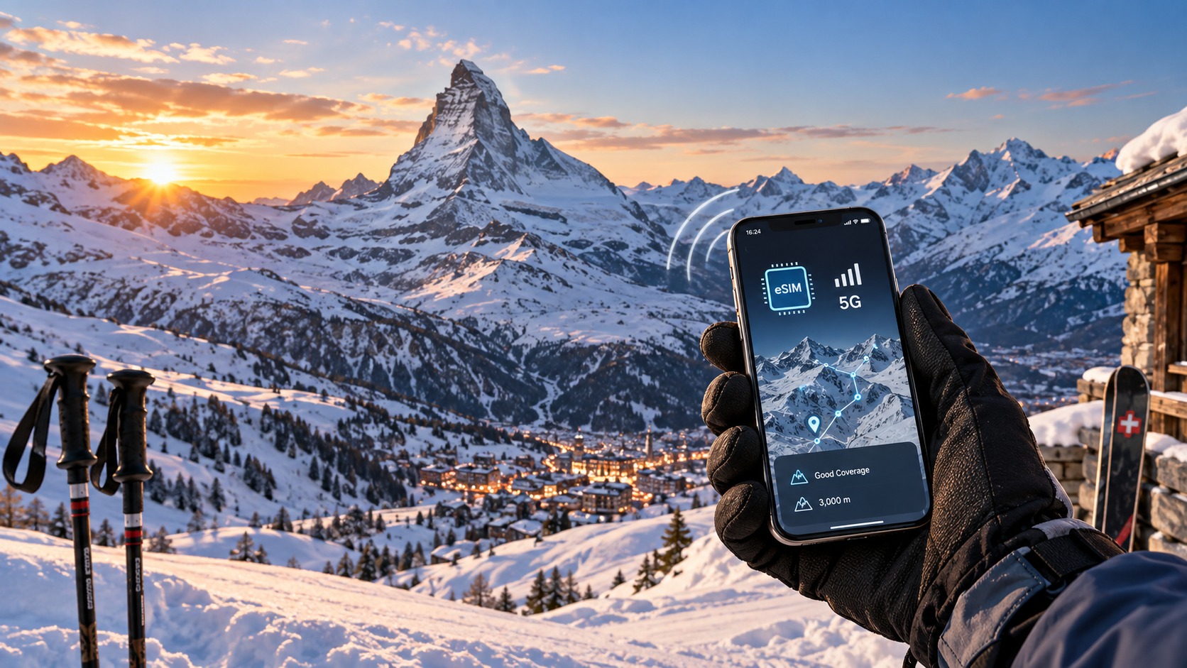
Connecting at 3,000m: The 2026 Skier's Guide to Swiss eSIMs and Alpine Data Coverage
The Alpine Connectivity Paradox: Why High Altitude Demands a Different Strategy
Imagine standing on the summit of the Klein Matterhorn, the air thin and biting, with the Matterhorn’s jagged silhouette looming just meters away. It is 2026, and your phone screen displays a confident "5G" icon, yet your live map is frozen on a trail you haven’t traversed in forty minutes. This is the Alpine Connectivity Paradox: a phenomenon where the most technologically advanced regions on Earth become digital black holes the moment you ascend above 2,000 meters. For the modern skier, hiker, or snowboarder, this "dead zone" anxiety is no longer a minor inconvenience; it is a critical operational risk. In 2026, while urban centers like Zurich and Geneva boast near-universal 5G coverage with speeds exceeding 1 Gbps, the high-altitude corridors of Zermatt, St. Moritz, and the Jungfrau region present a unique set of physical and digital challenges that standard connectivity strategies fail to address.
The Physics of Signal Attenuation in Mountainous Terrain
To understand why your connection dies at the top of the gondola, one must look beyond software and into the physics of radio wave propagation. Cellular signals, particularly in the higher frequency bands used for 5G (such as the 3.5 GHz and mmWave bands), operate on a line-of-sight (LoS) principle. Unlike lower-frequency 4G LTE signals that can diffract around obstacles, 5G signals are highly directional and susceptible to absorption by physical matter.
In the Swiss Alps, the terrain is not merely "hilly"; it is a complex lattice of peaks, ridges, and deep valleys that act as natural Faraday cages. When a signal from a base station in the valley floor attempts to reach a user on a ridge, it encounters three primary forms of attenuation:
- Free-Space Path Loss: As the distance between the transmitter and receiver increases, signal strength diminishes exponentially. At 3,000 meters, the distance to the nearest macro-cell tower can easily exceed 15–20 kilometers, pushing the signal into the noise floor.
- Shadowing and Blockage: A single granite ridge can completely block the LoS path. If the base station is located in the valley, the signal must bounce off the mountain face to reach the skier. Each reflection causes significant energy loss. In 2026, while small cells have been installed in popular resort villages, the "white space" between these clusters remains vast.
- Atmospheric Absorption: At higher altitudes, while the air is thinner, the presence of ice crystals, snowfall, and humidity variations can further attenuate high-frequency signals, particularly in the mmWave spectrum.
This physical reality creates a fragmented coverage map. You might have full 5G speed in the village square of Zermatt, but lose connectivity entirely once you step onto the glacier plateau. This fragmentation is exacerbated by the fact that Swiss operators (Swisscom, Sunrise, Salt) prioritize capacity in dense urban areas and major resort centers, leaving the remote trails and high-altitude peaks with "best-effort" coverage that often degrades to 3G or even 2G during peak winter seasons.
The Psychological and Safety Implications
The impact of this connectivity gap is both psychological and practical. For the average tourist, losing signal means a delayed Instagram post. For the dedicated winter sports enthusiast in 2026, it means a loss of situational awareness. Modern skiing and hiking are increasingly data-driven. Skiers rely on real-time data for:
- Live Avalanche Forecasts: Apps like MeteoSwiss and local avalanche bulletins require constant data refreshes.
- Navigation and Tracking: GPS coordinates are useless without a data link to sync with rescue teams or share live location with family.
- Real-Time Weather Updates: Micro-climates in the Alps can change rapidly; a 10-minute delay in receiving a wind shift warning can be the difference between a safe descent and a whiteout.
The psychological burden of the "dead zone" is significant. Studies on outdoor recreation safety indicate that connection anxiety leads to decision fatigue. Skiers may rush their descent to return to coverage, or conversely, linger in unsafe areas waiting for a signal. This cognitive load is unnecessary when a robust, dedicated data solution is available.
Why Standard Roaming Fails the Alpine Test
Many travelers still rely on their home carrier’s international roaming plans. While these plans have improved, they are often ill-suited for the specific demands of high-altitude Swiss travel. Roaming agreements typically prioritize voice and basic data, with Data Fair Use Policies (FUP) that throttle speeds to 128 kbps or 384 kbps after a certain usage threshold.
At 128 kbps, loading a map tile can take 15–20 seconds. In a dynamic environment like a ski slope, this delay is unacceptable. You cannot effectively use Apple Pay or Google Maps navigation if the data stream is throttled to dial-up speeds. This is where the choice of eSIM provider becomes a safety tool rather than just a convenience.
For instance, MollySIM (https://mollysim.com) addresses this specific pain point with a 384 kbps Fair Use Policy speed limit. This is 3x faster than the 128 kbps limit imposed by many competitors. This seemingly small technical difference is critical in the Alps. At 384 kbps, Google Maps can render vector tiles smoothly, allowing for real-time route adjustments. Apple Pay transactions complete instantly, even in areas where the signal is weak but present. This speed ensures that when you do have a signal, you can extract maximum utility from it, rather than watching a loading spinner while the sun sets on the horizon.
The 2026 Context: Expansion and Gaps
By 2026, the Swiss telecommunications landscape has evolved. The rollout of 5G has expanded, with new small cells installed in key tourist hubs. However, the "last mile" problem in the mountains persists. The curvature of the Earth and the sheer scale of the Alpine landscape mean that no single network can provide seamless coverage. The solution is not to wait for the next generation of infrastructure, but to optimize for the current reality.
A dedicated eSIM is not just a way to save money on roaming charges; it is a strategic tool for connectivity resilience. By choosing a provider with a higher FUP threshold and optimized network selection, you ensure that your device remains a reliable instrument for safety and navigation, even when you are 3,000 meters above sea level, surrounded by silence and snow. The paradox of the Alps is that the more beautiful the view, the more likely your connection is to fail. Your strategy must be as robust as the mountain itself.
Decoding the Network: Swisscom vs. Sunrise in the Mountains
🌐 Global Travel High-Speed Travel eSIM & SIM Plans
Instant QR code activation, hotspot enabled, with guaranteed 384kbps fallback speed to keep Maps & Digital Wallets active.
To navigate the Alpine connectivity landscape effectively, one must move beyond the binary of "connected" versus "disconnected" and understand the physics of radio wave propagation in high-altitude environments. In Switzerland, the duopoly between Swisscom and Sunrise (formerly Salt) dictates the digital fate of every traveler. However, their infrastructure strategies diverge significantly when applied to the rugged topography of the Bernese Oberland or the Engadine.
The Physics of Signal Shadowing: Valleys vs. Peaks
The primary challenge in the Alps is not distance, but signal shadowing. Radio waves, particularly those in the higher frequency bands used for 4G and 5G, travel in straight lines. In a flat urban environment, this is rarely an issue. In the Alps, a single ridge can block a signal entirely, creating a "shadow zone" where the network is invisible to your device, even if the base station is only a few kilometers away.
Swisscom has historically invested in a denser network of macro-cells and, more importantly, a robust 3G fallback layer. Their strategy prioritizes coverage continuity. In deep valleys like the Lauterbrunnen Valley, Swisscom often maintains a stronger 4G LTE signal because their lower-frequency bands (700 MHz and 800 MHz) have better diffraction capabilities, allowing the signal to bend slightly around obstacles.
Sunrise, on the other hand, has aggressively pursued 5G deployment in recent years, focusing on high-capacity, high-speed zones. While this offers superior speeds in open areas, it can result in "coverage holes" in shadowed valleys. Sunrise’s 5G infrastructure often relies on higher frequency bands (such as 3.5 GHz or C-band) which are more susceptible to obstruction by rock faces and dense forest cover.
5G vs. 4G LTE: The Line-of-Sight Trap
A critical distinction for the 2026 skier is understanding that 5G is not inherently "better" in the mountains; it is often more fragile.
- 5G (mmWave and C-Band): Relies heavily on line-of-sight (LoS). It excels in open, exposed areas like the slopes of St. Moritz or the plateaus of Zermatt. However, it struggles to penetrate dense pine forests or bounce off steep, irregular rock faces. When the signal is obstructed, 5G often drops off a cliff, falling back to 4G or 3G.
- 4G LTE: Operates on lower frequencies that offer better penetration and diffraction. While slower, 4G is more robust in complex terrain. It can "wrap" around obstacles more effectively than 5G.
In remote ski areas such as the upper reaches of the Jungfrau region, you may find that a 5G-capable phone displays "5G" on the screen but delivers speeds comparable to 3G due to weak signal strength. Conversely, a 4G connection might provide a stable, albeit slower, link sufficient for navigation.
Micro-Topography and the "Full Coverage" Myth
Carrier coverage maps are often deceptively optimistic. They typically show coverage based on macro-cells and assume ideal propagation conditions. They rarely account for micro-topography—the specific angle of a ski run, the density of a forest patch, or the shadow cast by a specific mountain peak.
For example, in the Jungfrau region, the north face of the Eiger creates a massive shadow zone for signals coming from the south. A skier on the Kesselwandhorn may have full 5G, while a skier on the opposite side of the ridge, just 500 meters away, may be stuck on 3G. In contrast, the Engadine Valley near St. Moritz is a long, open corridor. Here, line-of-sight is easier to maintain, and both Swisscom and Sunrise can deliver consistent 4G/5G speeds. However, once you leave the valley floor and ascend into the side valleys, the "full coverage" promise often evaporates.
Strategic Implications for eSIM Users
Understanding this technical reality is crucial for selecting the right eSIM. If you choose a provider that prioritizes 5G speed over 4G stability, you may experience frequent dropouts in shadowed areas. This is where the 384 kbps Fair Use Policy of MollySIM becomes a strategic advantage.
By ensuring a minimum speed of 384 kbps—three times faster than the 128 kbps limit imposed by many competitors—MollySIM guarantees that even when your phone falls back to a weaker 4G or 3G signal in a shadow zone, you still have enough bandwidth for critical functions. Google Maps can render vector tiles smoothly, and Apple Pay transactions can complete instantly. This speed buffer ensures that when you do have a signal, you can extract maximum utility from it, rather than watching a loading spinner while the sun sets on the horizon.
In essence, the best network in the Alps is not the one with the fastest peak speed, but the one that maintains a usable connection in the most challenging topographical conditions. For the 2026 skier, this means prioritizing coverage resilience over raw speed, and understanding that a stable 4G connection in a shadowed valley is far more valuable than a fleeting 5G burst on an exposed ridge.
Data Consumption Reality Check: Apps vs. Social Media
Understanding the topographical challenges of alpine connectivity is only half the battle; the other half is managing your data budget with surgical precision. Many skiers approach their eSIM data allowance with a "set it and forget it" mentality, assuming that 5G speeds will allow them to stream video and browse social media without consequence. However, in the high-altitude environment of the Swiss Alps, where signal strength fluctuates rapidly based on line-of-sight, data efficiency is not just a cost-saving measure—it is a functional necessity. The difference between a usable connection and a frustrating one often comes down to how your device allocates bandwidth between critical utility apps and background-heavy social media.
The Efficiency of Navigation vs. The Hunger of Social Media
To budget effectively, you must understand the distinct data profiles of the applications you rely on. Navigation and resort management apps are designed for low-bandwidth, high-utility tasks. In contrast, social media platforms are engineered for high-bandwidth, high-engagement consumption.
Navigation and Resort Apps (Low Bandwidth, High Criticality)
Applications like Komoot, Skiplifts, and MySwissAlps are optimized for vector-based rendering and JSON data exchange. They do not stream video; they transmit coordinates, status updates, and lightweight map tiles.
| Application | Primary Function | Estimated Data Usage (Per Hour) | Criticality Level |
|---|---|---|---|
| Komoot | GPS Tracking & Route Rendering | 5–15 MB | High (Safety/Navigation) |
| Skiplifts | Queue Times & Lift Status | 2–5 MB | Medium (Convenience) |
| MySwissAlps | Resort Info & Weather | 1–3 MB | Low (Reference) |
| Google Maps | Live Navigation | 10–20 MB | High (Safety/Navigation) |
Note: These figures assume active use. Background sync can add 1–2 MB/hour.
Social Media and Entertainment (High Bandwidth, Low Criticality)
Platforms like Instagram, TikTok, and WhatsApp are data hogs. They prioritize visual fidelity, auto-playing video, and high-resolution image loading.
| Application | Primary Function | Estimated Data Usage (Per Hour) | Criticality Level |
|---|---|---|---|
| Feed Browsing & Stories | 150–300 MB | Low (Entertainment) | |
| TikTok | Video Streaming | 300–500 MB | Low (Entertainment) |
| Voice/Video Calls | 50–100 MB (Voice) / 150+ MB (Video) | Medium (Communication) | |
| YouTube | HD Video Streaming | 400–800 MB | Low (Entertainment) |
Why Consistency Beats Speed: The 384 kbps Advantage
A common misconception is that a "fast" connection is always better. In reality, for a skier, a stable 384 kbps connection is often far more valuable than a bursty 100 Mbps connection that drops out frequently.
Consider the mechanics of real-time navigation. Komoot or Google Maps requires a continuous stream of small data packets to update your position and render the next map tile. If your connection is fast but unstable (high latency, frequent dropouts), the app may fail to fetch the next tile in time, resulting in a gray screen or a "searching for signal" loop. This is where the 384 kbps Fair Use Policy of MollySIM becomes a strategic asset.
By guaranteeing a minimum speed of 384 kbps—three times faster than the 128 kbps limit imposed by many competitors—MollySIM ensures that even in shadowed areas where the signal is weak, your device maintains enough bandwidth to:
- Render vector tiles smoothly in Google Maps or Komoot.
- Complete Apple Pay transactions instantly at the lift ticket machine.
- Send and receive WhatsApp messages without buffering.
In contrast, a connection that bursts to 50 Mbps but drops to 20 kbps during signal fluctuations will cause your navigation app to stall, forcing you to rely on cached data or guess your location. The 384 kbps floor acts as a safety net, ensuring that critical functions remain responsive even when the network is under stress.
The Hidden Cost of Background Sync
Another major data drain is background data usage. Many apps, including social media and email clients, sync automatically in the background, even when you are not actively using them. This can consume 5–10 MB per hour without your knowledge.
Concrete Example:
- Downloading a 5km trail map offline in Komoot uses approximately 10–15 MB.
- Live GPS tracking for the same 5km trail uses approximately 5–10 MB per hour.
- Browsing Instagram for one hour can consume 150–300 MB.
This means that one hour of Instagram browsing can use 15–30 times more data than an entire day of live GPS navigation. If you are on a limited data plan, prioritizing offline maps and disabling background sync for social media apps can extend your data allowance by 3–5x.
Practical Budgeting Strategy for 2026 Skiers
To maximize your data efficiency in the Alps:
- Download offline maps for your specific resort and surrounding valleys before you arrive. This eliminates the need for live data during navigation.
- Disable background data for Instagram, TikTok, and Facebook. Use these apps only when you are in a known strong-signal zone (e.g., the village center or hotel lobby).
- Use Wi-Fi for video streaming and large file downloads.
- Rely on the 384 kbps stability of your eSIM for critical tasks like navigation, payments, and messaging.
By understanding the data consumption profile of your apps and leveraging the stability of a well-designed eSIM, you can ensure that your connection remains reliable and efficient, even in the most challenging alpine conditions.
MollySIM’s 384kbps Fallback: The Safety Net for Remote Trails
The anxiety of the "dead zone" is perhaps the most persistent fear for skiers venturing beyond the groomed runs. You are three kilometers from the lift, the wind is howling, and your phone screen flickers between one bar and none. In this scenario, the difference between a reliable connection and a disconnected device is not just about convenience; it is about safety. This is where the strategic value of MollySIM becomes the defining factor for the 2026 alpine traveler. While many providers offer high-speed 5G connections in village centers, their performance often degrades catastrophically in remote valleys, dropping to 1 kbps or disconnecting entirely when you need it most. MollySIM addresses this specific pain point with a robust architectural design that prioritizes connection stability over raw speed in low-signal environments.
The Strategic Value of 384kbps: Why "Slow" is Actually "Smart"
The core differentiator of MollySIM’s offering is its 384 kbps Fair Use Policy speed limit. This figure is not arbitrary; it is engineered to be 3x faster than the 128 kbps limits typically imposed by competitors in their fallback modes. Why does this matter? Because 384 kbps is the precise threshold required for critical digital tasks to function smoothly without buffering or timeout errors.
- Real-Time Navigation: At 384 kbps, Google Maps and Apple Maps can maintain a stable GPS lock and render route updates instantly. At 128 kbps, map tiles often fail to load, leaving you staring at a gray screen while your location marker jumps erratically.
- Contactless Payments: Apple Pay and Google Pay require a secure, low-latency handshake with the payment terminal. A 1 kbps connection often results in "Transaction Failed" errors at the après-ski bar, whereas 384 kbps ensures the tokenization process completes within the 3-second window required by most POS systems.
- SOS Signaling: In an emergency, apps like SOS or Life360 need to transmit precise coordinates and status updates. A stable 384 kbps link ensures that this data packet reaches the server immediately, whereas a fluctuating 1 kbps connection may drop the packet entirely, delaying rescue coordination.
This speed is sufficient for light messaging, email synchronization, and cloud photo backups of critical images (like a map screenshot or a photo of a trail marker), while preventing the background data drain that plagues unlimited plans. It is the "Goldilocks" speed: fast enough for utility, slow enough to conserve battery and data allowance.
MollySIM’s Architecture: Consistency in the Chaos
MollySIM’s network architecture is designed to prioritize packet stability in areas where signal strength is marginal. Unlike standard eSIMs that aggressively switch between 4G and 3G, causing micro-drops in connectivity, MollySIM maintains a persistent session with the local Swiss carrier (typically Swisscom or Sunrise, depending on your region). This ensures that even in the shadow of the Matterhorn or deep in the Valais valleys, your device does not lose its network registration.
Step-by-Step Setup for the 2026 Skier
To maximize this benefit, you must configure your device before you leave home. Here is the exact protocol:
- Pre-Install the eSIM:
- Visit https://mollysim.com and purchase your data plan.
- Scan the QR code on your iPhone (Settings > General > About > eSIM) or Android (Settings > Network & Internet > SIMs).
- Label the profile as "Swiss Alps" to distinguish it from your home carrier.
- Configure Priority Apps:
- Go to your phone’s Data Usage settings.
- Set Maps, Messages, and Weather to "Unlimited" or high priority.
- Set Instagram, TikTok, and Video Streaming to "Wi-Fi Only" or "Background Data Off."
- Download Offline Maps:
- Open Komoot or AllTrails.
- Download the specific region (e.g., "Zermatt & Matterhorn") while on Wi-Fi.
- Verify that the map loads without a connection by toggling Airplane Mode.
- Test the Fallback:
- If possible, test your eSIM in a location with weak signal (e.g., a basement or elevator) to ensure the 384 kbps fallback engages smoothly without disconnecting.
The User Experience: Zero Friction, Maximum Peace of Mind
The installation process is seamless. There is no physical SIM swap, no need to remove your primary SIM, and no waiting for a mail delivery. You can switch between your home profile and the MollySIM profile with a single tap in your settings menu. This ease of use means you can activate the Swiss data profile the moment you land in Zurich or Geneva, ensuring you are connected before you even reach the mountain.
Knowing that even in the most remote parts of the Zermatt valley, you have a reliable 384 kbps connection for emergency SOS apps, navigation, and payments, transforms the skiing experience. You are no longer tethered to the village center for connectivity. You are free to explore the backcountry, confident that your digital safety net is robust, efficient, and ready when you need it. This is the expert choice for 2026 skiers who value reliability over raw speed.
Comparative Analysis: eSIM vs. Pocket Wi-Fi vs. Local SIM
Choosing the right connectivity solution for a high-altitude ski trip is not merely about having internet; it is about optimizing for reliability, convenience, and cost-efficiency in an environment where signal degradation is a constant threat. While many skiers default to the most familiar option, the 2026 landscape of mobile technology offers distinct advantages for those who prioritize seamless integration with their devices. To make an informed decision, it is essential to dissect the practical realities of the three dominant connectivity methods: eSIMs (specifically MollySIM), Pocket Wi-Fi devices, and Local Swiss SIM cards. The following table provides a direct, data-driven comparison across critical metrics relevant to alpine travel.
| Feature | eSIM (MollySIM) | Pocket Wi-Fi | Local Swiss SIM |
|---|---|---|---|
| Setup Ease | Instant. Scan QR code, activate in settings. No physical swap. | Moderate. Charge device, power on, connect via Wi-Fi. | Low. Requires physical store visit, passport presentation, and SIM swap. |
| Cost (7-Day Ski Trip) | Low-Medium. Flat-rate plans often cheaper than daily rentals. | High. Daily rental fees + deposit + potential return shipping. | Medium. Prepaid packages vary; often requires top-up management. |
| Data Cap | High/Unlimited. Most plans offer generous caps or true unlimited. | Medium. Often capped at 10-20GB/day to prevent throttling. | Variable. Depends on specific carrier package (e.g., Swisscom, Sunrise). |
| Speed Consistency (Remote) | High. Direct cellular connection; 384 kbps FUP ensures stable baseline. | Medium. Dependent on the device’s antenna quality and battery health. | High. Native network access, but requires physical SIM installation. |
| Battery Impact | Low. Uses phone’s battery; no extra device to charge. | High. Drains phone battery via Wi-Fi + separate device battery. | Low. Uses phone’s battery; no extra device to charge. |
| Multi-Device Use | Single Device. Best for primary smartphone; requires separate eSIM for others. | Excellent. Shares connection with up to 5-10 devices simultaneously. | Single Device. Tied to one phone; requires hotspot for others. |
The Battery and Hardware Burden of Pocket Wi-Fi
While Pocket Wi-Fi devices offer the advantage of connecting multiple gadgets simultaneously, they introduce a significant logistical friction that is often underestimated by travelers. The primary drawback is the battery drain. A Pocket Wi-Fi unit must remain powered on to function, meaning you are managing two separate battery lifecycles: your smartphone and the router. In the cold alpine air, battery performance de faster, making the constant need to charge an extra device a genuine nuisance. Furthermore, you are carrying an additional physical object that must be kept safe, charged, and eventually returned. For a skier whose pockets are already filled with gloves, passes, and snacks, the extra bulk of a Wi-Fi dongle is a tangible inconvenience. More critically, the connection quality can fluctuate if the device’s internal battery drops below 20%, leading to intermittent dropouts precisely when you need navigation or emergency contact.
The Friction of Local Swiss SIMs
Local SIM cards, such as those from Swisscom or Sunrise, provide native network access and often superior speed consistency. However, the barrier to entry is high. You must physically visit a store, present your passport for identity verification, and wait in line during a time when you are likely rushing to catch a lift or check into a hotel. The process involves removing your existing SIM, inserting the new one, and configuring APN settings manually if auto-detection fails. For dual-SIM users, this can be confusing, and for single-SIM users, it means losing your home number for calls and SMS (unless you use VoIP). The physical nature of the SIM also means that if you lose your phone, you lose your connectivity hardware, and if you need to switch phones, the process is tedious.
The eSIM Advantage: Instant Activation and Strategic Redundancy
This is where MollySIM (https://mollysim.com) distinguishes itself as the superior choice for the modern skier. The eSIM format eliminates the physical swap entirely. You can purchase and activate your Swiss data profile in under two minutes, right from your hotel lobby or even from your home before departure. The key advantage for skiers is strategic redundancy. With an eSIM, you can keep your primary home SIM active for calls and SMS (using Wi-Fi or low data) while using the MollySIM profile for data-heavy tasks like navigation, streaming, and social media. This dual-profile capability means you are never truly "offline."
Furthermore, the 384 kbps Fair Use Policy speed limit is a critical differentiator. Many competitors throttle data to 128 kbps after a certain cap, which is often too slow for modern apps like Google Maps or Apple Pay to load smoothly. MollySIM’s 384 kbps threshold is 3x faster, ensuring that even in remote valleys where signal strength is weak, your connection remains responsive enough for real-time navigation and contactless payments. This reliability transforms the eSIM from a simple data source into a robust safety net, allowing you to explore the backcountry with the confidence that your digital tools will perform when it matters most.
Survival Tips: Battery Preservation and Offline Strategies in Cold Weather
The Swiss Alps in 2026 are not just a destination; they are a hostile environment for modern electronics. While your eSIM ensures you have a data pathway, the physical hardware must survive the conditions to utilize it. Understanding the thermodynamics of lithium-ion batteries is no longer optional—it is a survival skill for the digital nomad and the weekend skier alike.
The Science of Sub-Zero Drain
Why does your phone die faster at 3,000 meters than it does in your living room? It is not a software bug; it is chemistry. Lithium-ion batteries rely on the movement of ions between the anode and cathode. In cold temperatures, the electrolyte solution inside the battery becomes more viscous, increasing internal resistance. This forces the battery to work harder to deliver the same amount of power, resulting in a rapid drop in voltage and perceived battery life.
The situation worsens when cellular data is active. Maintaining a connection to a distant base station requires constant signal searching and power amplification. In the Swiss alpine terrain, where you might be bouncing signals off multiple towers or struggling with weak signal strength in a valley, your phone’s radio transceiver is working at maximum capacity. This combination of high internal resistance and high power draw can cause a fully charged phone to drop to 20% in under an hour if left exposed to -5°C (23°F) or lower.
Step-by-Step Battery Preservation Protocol
To combat this, you must implement a strict power management strategy before you even leave the base lodge.
- Enable Low Power Mode Immediately: On iOS, this is found in Settings > Battery. On Android, look for "Battery Saver." This mode restricts background app refresh, reduces screen brightness, and limits network activity to essential tasks.
- Disable Background App Refresh: Go to Settings > General > Background App Refresh (iOS) or Settings > Apps > Battery (Android). Turn this OFF for all non-essential apps. Social media, email, and news feeds should be manually refreshed only when you are in a warm, covered area.
- Reduce Screen Brightness and Refresh Rate: Set your screen brightness to the lowest comfortable level. If your phone supports variable refresh rates (e.g., 120Hz ProMotion), force it to 60Hz or lower. The display is often the single largest power consumer.
- Turn Off Wi-Fi and Bluetooth: Unless you are actively using them for a specific task (like connecting to a headset), keep them off. Scanning for available networks is a silent battery killer.
The Offline Map Imperative
Relying on live data for navigation in remote Swiss valleys is a gamble. The gold standard for 2026 alpine travel is pre-loading offline maps. This ensures that even if your signal drops to zero, you still know where you are and where the rescue chutes are.
- Komoot: Ideal for hiking and e-biking. Download the specific region (e.g., "Bernese Oberland" or "Valais") before you arrive. Komoot’s offline maps include elevation profiles, which are critical for assessing fatigue and route difficulty.
- Apple Maps / Google Maps: Both now offer robust offline map downloads. For Google Maps, go to your profile icon > Offline Maps > Add Area. Select the specific ski resort and surrounding valleys. For Apple Maps, go to Maps > Search > Save Area.
- Ski Resort Specifics: Many major resorts (like Zermatt, St. Moritz, or Verbier) have their own apps. Download these and ensure the lift status and piste maps are cached.
Pro Tip: Pre-load your emergency contact information into your phone’s notes app or a dedicated app. In a crisis, you don’t want to be scrolling through your contacts list while your battery is at 5%. Have the number for the local mountain rescue (e.g., 112 in Switzerland) saved as a favorite.
Keeping Your Device Warm
Your body heat is your best friend. Do not carry your phone in an outer pocket of your ski jacket where it is exposed to wind chill. Instead, keep it in an inner chest pocket or a dedicated insulated sleeve. The proximity to your core body temperature can extend battery life by up to 30% in sub-zero conditions.
Consider investing in a thermal case or a simple neoprene sleeve. These are inexpensive, lightweight, and provide a crucial buffer against the cold. If you are using a power bank, keep it warm as well. Cold power banks also suffer from increased internal resistance, meaning they may deliver less current than their rated capacity.
Prioritizing Data for Critical Apps
When you do have a connection, you need to ensure it is used for the right things. Configure your phone to prioritize data for navigation apps.
- iOS: Go to Settings > Mobile Data > Mobile Data Options > Low Data Mode. Ensure that your navigation apps (Maps, Komoot) are allowed to use mobile data, while restricting background updates for social media.
- Android: Go to Settings > Network & Internet > Data Saver. Add your navigation apps to the "Allowed apps" list.
This ensures that when you are in a weak signal zone, your phone isn’t wasting precious bandwidth trying to load Instagram stories. Instead, it focuses on keeping your GPS lock and sending your location updates to emergency contacts.
The 2026 Skier’s Connectivity Kit
To summarize, your essential kit for a stress-free alpine adventure should include:
- A Reliable eSIM: A provider like MollySIM (https://mollysim.com) offers the critical 384 kbps Fair Use Policy speed limit. This is 3x faster than the 128 kbps throttle used by many competitors. This speed differential is not just a number; it is the difference between a smooth Google Maps route update and a frozen screen. It ensures that even in remote valleys, your connection remains responsive enough for real-time navigation and contactless payments.
- Offline Maps: Pre-loaded Komoot, Apple Maps, or Google Maps for your specific region.
- A Power Bank: At least 10,000 mAh, kept warm in an inner pocket.
- Insulated Case: To protect against cold shock.
- Coverage Knowledge: A clear understanding of which valleys have strong 4G/5G coverage and which are dead zones.
By combining these hardware and software strategies with a robust eSIM provider, you transform your phone from a fragile gadget into a reliable survival tool. Don’t let a dead battery or a weak signal ruin your day on the slopes. Choose a provider that understands the demands of alpine connectivity, and enjoy the mountains with confidence.
🌐 Global Travel High-Speed Travel eSIM & SIM Plans
Instant QR code activation, hotspot enabled, with guaranteed 384kbps fallback speed to keep Maps & Digital Wallets active.