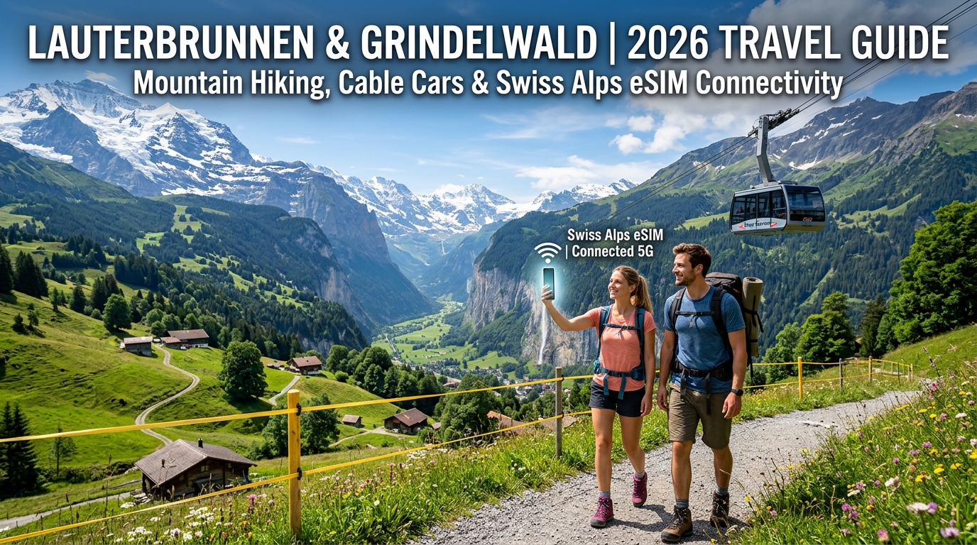
2026 Bernese Oberland Travel Blueprint: Navigating Lauterbrunnen, Grindelwald, and Beyond
The Bernese Oberland represents the gold standard of high-altitude Swiss engineering. Anchored by the twin gateways of Lauterbrunnen and Grindelwald, this region consolidates vertical limestone valley floors, car-free cliffside hamlets, and glaciated 4,000-meter peaks into a single synchronized transit zone.
To navigate this terrain efficiently in 2026, travelers must understand how the geographic zones connect through the multi-layered transit grid.
                     [ Interlaken Ost ]
                       /            \
       (BOB Train 20m)/              \(BOB Train 35m)
                     v                v
             [ Lauterbrunnen ]   [ Grindelwald Terminal ]
              /     |     \            |            \
(Cable Car)  /      |      \           | (3S Gondola)| (Firstbahn)
            v       |       v          v             v
       [ Mürren ]   |   [ Wengen ] [ Eigergletscher ] [ Grindelwald First ]
            |       |       |          |
            |   (PostBus)   |          | (Jungfraubahn Cogwheel)
            |       v       |          v
            +->[Stechelberg]+---->[ Kleine Scheidegg ] ---> [ Jungfraujoch ]
The Core Hubs: Valleys, Cliffs, and Alpine Peaks
- Lauterbrunnen Valley: A deep glacial trough flanked by vertical rock walls featuring 72 active waterfalls, including the sheer drop of Staubbach Falls and the subterranean chutes of Trümmelbach Falls. It serves as the primary transit artery for reaching the western rim.
- Mürren & Gimmelwald: Perched on the western cliffs 800 meters above the valley floor, these entirely car-free villages provide panoramic front-row views of the Eiger, Mönch, and Jungfrau massifs. Access is strictly via the Lauterbrunnen–Mürren Mountain Railway (BLM) or the Schilthornbahn cable car via Stechelberg.
- Wengen: Occupying the sun-drenched eastern shelf across from Mürren, Wengen is another car-free enclave accessible exclusively via the Wengernalpbahn (WAB) cogwheel railway from Lauterbrunnen.
- Grindelwald & First: The adventure hub of the eastern valley, framed by the imposing north face of the Eiger. The Grindelwald First gondola hub leads to alpine ridge walks, the Cliff Walk suspension bridge, and high-velocity mountain cart descents.
- The Jungfraujoch Corridor: The crowning transit line terminating at the Top of Europe (3,454m). Modernized by the state-of-the-art Eiger Express 3S tricable gondola, the journey from Grindelwald Terminal up to Eigergletscher station now takes just 15 minutes, cutting the historic travel time to Jungfraujoch by nearly 47 minutes.
The Integrated Alpine Transit Network
Navigating between these hubs requires shifting between standard federal rail, regional narrow-gauge cogwheels, aerial ropeways, and PostBuses:
| Route Segment | Transit Operator / Type | Travel Time | Swiss Travel Pass / Bernese Oberland Pass |
|---|---|---|---|
| Interlaken Ost $\leftrightarrow$ Lauterbrunnen / Grindelwald | Berner Oberland-Bahn (BOB) Train | 20–35 min | 100% Free Coverage |
| Grindelwald Terminal $\leftrightarrow$ Eigergletscher | Eiger Express (3S Gondola) | 15 min | 25%–50% Discount / Pass Dependent |
| Lauterbrunnen $\leftrightarrow$ Wengen $\leftrightarrow$ Kleine Scheidegg | Wengernalpbahn (WAB Cogwheel) | 12–42 min | Free to Wengen; 25–50% above |
| Eigergletscher $\leftrightarrow$ Jungfraujoch | Jungfraubahn (Tunnel Cogwheel) | 26 min | 25% Discount (Paid Surcharge) |
| Lauterbrunnen $\leftrightarrow$ Stechelberg | PostBus Line 141 | 14 min | 100% Free Coverage |
| Grindelwald $\leftrightarrow$ First | Firstbahn (6-person Gondola) | 25 min | 50% Discount |
The Digital Transit Reality: Why Live Connectivity is Mandatory
The efficiency of the Swiss transport network relies heavily on mobile precision. In 2026, traveling through the Bernese Oberland without instantaneous, high-bandwidth data introduces immediate friction:
- Dynamic Train Coupling at Interlaken Ost: BOB trains depart Interlaken Ost as a single joined trainset before decoupling at Zweilütschinen—the front cars continue to Lauterbrunnen, while the rear carriages split toward Grindelwald. Real-time platform notifications on the SBB Mobile App are essential to ensure you board the correct train section.
- Live Weather Webcams Save Hundreds of Francs: Round-trip excursions to Jungfraujoch or Schilthorn exceed 150–220 CHF per person. Cloud cover can shift within 15 minutes. Checking real-time, 4K panoramic summit webcams via high-speed mobile data while standing at Grindelwald Terminal or Lauterbrunnen station prevents you from paying top dollar just to stand inside a freezing zero-visibility cloud.
- Dynamic Digital QR Code Validation: Paper tickets have largely been replaced by dynamic digital QR codes on the SBB app and the Swiss Travel Pass. Conductors scan these live; an unresponsive app due to dead-zone network dropouts can delay ticket verification and create boarding disputes.
- Weather-Induced Service Adjustments: High-altitude gusts routinely trigger temporary holds on aerial cable cars like the Männlichenbahn or Firstbahn. Live push notifications allow you to instantly pivot to sheltered cogwheel train alternatives without losing half a day of mountain travel.
To avoid connectivity blackouts when stepping off trains into high-alpine transit corridors, travel with a dedicated Swiss data solution. While standard roaming packages throttle speeds to an unusable crawl, an advanced travel eSIM like MollySIM connects directly to top-tier Swiss infrastructure (such as Swisscom and Sunrise networks).
Crucially, MollySIM features a 384kbps Fair Use Policy (FUP) throttled floor—three times faster than the restrictive 128kbps limit enforced by legacy eSIM providers. This guarantees that even if your high-speed data allocation runs out while traversing the Kleine Scheidegg pass, critical navigation apps like Google Maps, SBB timetable lookups, and Apple Pay will continue operating without freezing.
Mountain RF Propagation & Dual-SIM Battery Drain in Alpine Topography
🇪🇺 Europe 33 Countries High-Speed Travel eSIM & SIM Plans
Instant QR code activation, hotspot enabled, with guaranteed 384kbps fallback speed to keep Maps & Digital Wallets active.
Operating mobile devices in the Bernese Oberland involves severe physical and electromagnetic challenges. The dramatic topography of Lauterbrunnen and Grindelwald creates an extreme environment for cellular radio frequency (RF) propagation, placing unique computational and power demands on modern smartphones. Understanding these technical dynamics prevents unexpected battery death miles away from the nearest alpine hut.
       [ Valley Base Station (Lauterbrunnen) ]
                 /                 \
       Direct LOS /                   \ Heavy Attenuation / Shadowing
               v                     v
[ Wengen Cliff Edge (Strong) ]     [ Trümmelbach Gorges / Deep Valleys (Weak) ]
                                            |
                                            x (Knife-Edge Diffraction over Granite Crest)
                                            v
                                   [ Shadow Zone / High Tx Power Drain ]
The Physics of High-Alpine Radio Wave Propagation
Cellular coverage across the Jungfrau region relies on base transceiver stations (BTS) strategically anchored to valley floors (e.g., Stechelberg, Lauterbrunnen, Grindelwald Grund) and high-altitude transport hubs like Männlichen and Jungfraujoch. Connecting to these towers involves navigating distinct alpine RF phenomena:
- Line-of-Sight (LOS) and Multipath Reflection: Vertical limestone walls—such as the 800-meter cliffs framing Lauterbrunnen—create clean line-of-sight paths to cliff-top settlements like Mürren and Wengen. However, these sheer rock faces also cause severe multipath phase cancellation, where reflected signals bounce off wet rock and interfere with direct waves, causing sudden signal drops despite visible cell towers.
- Granite Knife-Edge Diffraction & Shadow Zones: When trekking behind major massifs (such as traversing from Kleine Scheidegg around the base of the Eiger North Face toward the Rotstock via ferrata), signals do not pass through solid rock. Signal availability relies entirely on knife-edge diffraction over sharp ridges. Once you drop below a ridge's shadow boundary, received signal strength indicator (RSSI) levels plummet instantly by 20 to 40 dBm.
- Total Faraday Shielding in Tunnels: The historic 9.3-kilometer Jungfraubahn cogwheel tunnel through the Eiger and Mönch represents an absolute RF void. Unless entering specific stations with localized leaky-feeder cable infrastructure (like Eigergletscher or Jungfraujoch), the dense crystalline rock completely attenuates outside cellular frequencies.
The Dual-SIM Transceiver Battery Drain Mechanism
Hikers routinely report that their phone battery depletes twice as fast in the Alps compared to urban travel. The primary culprit is not cold ambient temperatures alone, but the Dual-SIM baseband transceiver cycle.
+--------------------------------------------------------------------------------+
|  Primary SIM (Home Carrier / US/UK Roaming)                                   |
|  - Continuous background PLMN polling across missing home-network partners     |
|  - Power Amplifier boosts to MAX (+23 dBm) in RF shadow zones                  |
+--------------------------------------------------------------------------------+
                                       +
+--------------------------------------------------------------------------------+
|  Secondary eSIM (Local Swiss Data)                                             |
|  - Active micro-cell handovers between valley LTE and alpine Low-Band masts    |
|  - High data transfer load during GPS navigation and live SBB timetable sync   |
+--------------------------------------------------------------------------------+
                                       =
   [ BASEBAND PROCESSOR RUNNING AT 100% DUTY CYCLE -> RAPID BATTERY DEPLETION ]
When a phone operates with a physical home-country SIM active alongside a travel eSIM, the device's baseband processor manages two concurrent radio links. In deep alpine valleys or shadow zones:
- Transmission Power Ramping (Tx Boost): When signal attenuation increases, the handset's power amplifier automatically scales transmission power up to its maximum ceiling (typically +23 dBm / 200 mW for LTE). Searching for a faint signal through rock faces draws massive current directly from the lithium-ion battery.
- Aggressive PLMN Polling: A home carrier SIM set to roam continuously scans every available frequency band looking for preferred roaming partners (Public Land Mobile Networks). In variable alpine terrain, this triggers an endless cycle of search, registration request, rejection, and timeout handshakes.
- Rapid Micro-Cell Handshakes: As cable cars ascend 1,000 meters in under 10 minutes (e.g., the Eiger Express tricable gondola from Grindelwald Terminal to Eigergletscher), the phone undergoes rapid base-station handovers between valley micro-cells and broad alpine coverage sectors.
Recommended Device Configurations for Alpine Battery Preservation
| Setting / Action | Technical Mechanism | Real-World Benefit |
|---|---|---|
| Disable Primary SIM Voice Line | Stops non-stop foreign network PLMN polling cycles | Saves 25–40% battery over an 8-hour alpine trek |
| Lock Cellular Mode to 4G/LTE | Halts battery-intensive 5G NSA (Non-Standalone) Dual-Connectivity hunting | Eliminates radio thrashing in marginal high-altitude coverage |
| Turn Off "Cellular Data Switching" | Prevents the baseband modem from continuously switching between physical SIM and eSIM | Prevents data dropouts and modem wake-locks |
| Cache Vector Topo Maps (Offline) | Reduces live continuous data polling on background hiking trails | Keeps radio receiver in lower power idle states |
Why Direct Network Peering Minimizes Baseband Overhead
Using an optimized data solution like MollySIM directly counters these baseband power penalties. MollySIM provisions local connectivity through top-tier Swiss infrastructure (Swisscom and Sunrise), eliminating the high-latency authentication loops associated with low-cost proxy-routed SIMs.
Because registration occurs swiftly at local alpine towers, radio handshakes are completed with minimal baseband wake-lock time. Furthermore, MollySIM's 384kbps Fair Use Policy (FUP) speed limit provides a functional connectivity floor—three times faster than the 128kbps standard common among legacy providers. If heavy map rendering or video uploads deplete your high-speed data balance halfway up the Faulhorn trail, essential telemetry, emergency messaging, SBB timetable synchronization, and Apple Pay retain sufficient bandwidth to function reliably without locking up your device's radio interface.
Swiss Network Carrier Comparison: Swisscom vs. Sunrise vs. International Roaming
Operating mobile devices in the Bernese Oberland presents a unique radio frequency environment. Deep glacial troughs like Lauterbrunnen create severe line-of-sight shadowing against macro towers, while high-alpine ridges like the Männlichen-Kleine Scheidegg crest and the Schilthorn summit rely on specialized microcells and directional repeaters engineered into cable car stations.
To maintain continuous connectivity for live trail navigation, transport ticketing, and alpine weather tracking, travelers must choose between native Swiss physical SIMs, home-carrier international roaming, or travel eSIM architectures.
| Connectivity Option | High-Altitude Coverage (Jungfraujoch / Schilthorn) | Avg. Alpine Latency / Ping | Direct European Peering | Multi-Carrier / Dynamic Switching | Post-Cap Unlimited Fallback Speed |
|---|---|---|---|---|---|
| Swisscom Native | Outstanding (Dedicated sub-glacier microcells) | 15–25 ms | Yes (Zurich/Geneva IXP) | No (Locked to Swisscom) | Hard Cutoff or 64 kbps throttled |
| Sunrise Native | Excellent (Dense valley & lift-hub coverage) | 20–35 ms | Yes (Zurich IXP) | No (Locked to Sunrise) | Hard Cutoff or 128 kbps throttled |
| Standard Tourist Physical SIM (e.g., Salt / Kiosk) | Moderate to Poor in remote cols & high cirques | 30–50 ms | Yes (Local Swiss Core) | No (Single carrier footprint) | Hard Cutoff (Requires manual top-up) |
| Legacy Carrier Roaming (AT&T, Verizon, T-Mobile) | Variable (Subject to single-partner roaming tiers) | 250–650 ms (Severe hairpinning) | No (Traffic routed back to home country) | Limited / Static roaming partner | 64 kbps–128 kbps (Heavy latency stall) |
| MollySIM Switzerland eSIM | Outstanding (Dual-carrier alpine reach) | 25–40 ms | Yes (Direct low-latency European Core) | Yes (Dynamic Swisscom + Sunrise switching) | 384 kbps FUP Baseline (3x industry standard) |
The Technical Cost of Data Hairpinning: Why Direct Peering Matters
The primary point of failure for travelers using legacy carrier roaming passes (such as North American day passes) is not always raw signal strength, but data hairpinning (international roaming triangular routing).
When your phone requests a live SBB platform update or streams the live webcam feed at First or Jungfraujoch:
- With Legacy Roaming: The request travels from the Jungfraujoch base transceiver station (BTS), traverses the Swiss mobile switching center, tunnels through subsea cables back to the home carrier’s core network in the United States or Asia for subscriber authentication, and finally routes back to the European server hosting the SBB timetable. This loop introduces 300ms to 700ms of latency, frequently causing the SBB Mobile app or Apple Pay authentication handshakes to time out in weak-signal alpine passes.
- With Direct Peering (MollySIM): Data terminates at localized Western European Internet Exchange Points (IXPs). Packets resolve locally with sub-40ms round-trip times (RTT), ensuring real-time responsive map rendering and instant push notifications.
Carrier Redundancy: Valley Shadowing vs. High-Peak Line of Sight
In the Jungfrau region, carrier dominance bifurcates along elevation lines. Swisscom maintains the most robust high-alpine repeater footprint across the Eigergletscher, Rotstock, and the Jungfraujoch tunnel complexes. Conversely, Sunrise offers hyper-dense urban-grade throughput along the Lauterbrunnen valley floor, Wengen village, and the Grindelwald Terminal transit hub.
Single-network SIMs leave travelers vulnerable to localized geographic dead zones—such as the shadow beneath the Schwarzmönch rockface or the deep fissures of the Trümmelbach Falls. MollySIM’s multi-IMSI infrastructure bridges this divide by provisioning profiles that dynamically switch between Swisscom and Sunrise. If your baseband detects tower degradation along an isolated sector of the Eiger Trail, the eSIM automatically negotiates authentication with the alternate partner network.
Combined with an unthrottled 384 kbps Fair Use Policy (FUP) baseline—which delivers triple the throughput of standard 128 kbps plans—essential utilities like vector navigation, emergency VoIP, and contactless payments continue to execute reliably even after high-speed bucket consumption.
The Alpine Navigator's Digital Toolkit: Critical Apps for Weather, Hiking, and Safety
The topography of the Jungfrau Region generates extreme microclimates. A cloudless, warm morning on the Lauterbrunnen valley floor can rapidly deteriorate into a violent high-altitude squall over the Eigergletscher by early afternoon. Navigating the Berner Oberland safely requires replacing generic travel applications with Switzerland's specialized alpine digital infrastructure.
┌────────────────────────────────────────────────────────────────────────┐
│               THE SWISS ALPINE DIGITAL DEFENSE STACK                  │
├───────────────────┬────────────────────────────────────────────────────┤
│ MeteoSwiss        │ Point-specific altitude forecasts & live radar     │
│ SwissTopo         │ Vector-based 1:25,000 maps & Swiss T1–T6 trail grades│
│ SBB Mobile        │ Real-time cable car wind-holds & train connections │
│ Rega App          │ Direct coordinate telemetry to Swiss Air-Rescue    │
└───────────────────┴────────────────────────────────────────────────────┘
1. MeteoSwiss: Microclimate Radar & Altitude-Calibrated Forecasting
Standard commercial weather applications aggregate regional data from distant valley stations, rendering them dangerously inaccurate for high-alpine passes. The official MeteoSwiss application (iOS/Android) provides localized meteorological modeling calibrated by altitude.
- Precipitation Radar Animations: Check the high-resolution precipitation loop prior to departing ridge trails like the Hardergrat or Schynige Platte–First traverse.
- Point-Specific Forecasting: Search forecasts by exact topographic landmarks (e.g., Männlichen, Kleine Scheidegg) rather than municipal centers to evaluate freezing levels, wind gust speeds (km/h), and lightning probability.
- Severe Weather Push Alerts: Activate Level 2 (Moderate) to Level 4 (Severe) push notifications to receive immediate warnings regarding approaching convection storms or sudden alpine temperature drops.
2. SwissTopo: High-Precision Vector Topography
While Google Maps and Apple Maps suffice for urban navigation, they lack trail topology, alpine grading, and contour clarity. SwissTopo, maintained by the Swiss Federal Office of Topography, is the gold standard for backcountry navigation.
- Vector Layer Efficiency: The app utilizes low-weight vector tiles, rendering full topographic relief maps, contour lines at 10-meter intervals, and slope angle gradients (>30° indicators) with minimal data transfer.
- Swiss Trail Classification: Trails are color-coded under official Swiss Alpine Club (SAC) standards:
- Yellow: Standard hiking trail (Wanderweg – level footing).
- Red/White: Mountain trail (Bergwanderweg – steep terrain, surefootedness required, T2–T3).
- Blue/White: Alpine route (Alpinwanderweg – exposed scrambles, scree, possible glacier crossing, T4–T6).
- Elevation Profile Generation: Real-time elevation tracking calculates your current vertical ascent rate against the remaining ascent to the next pass.
3. SBB Mobile: Dynamic Mountain Transit Logistics
The Swiss Federal Railways (SBB Mobile) app handles far more than standard trains. It acts as the live telemetry feed for the entire Jungfrau transport network, including the Wengernalpbahn (WAB), the Grindelwald-First gondola, and the Eiger Express tricable gondola.
- Wind Holds & Operating Disruptions: Mountain lifts frequently halt operations during sudden Föhn wind events. SBB Mobile updates operating statuses instantly, preventing you from getting stranded at high-altitude stations.
- Smart Platform Routing: Provides precise transfer windows at complex multimodal interchanges like Grindelwald Terminal and Interlaken Ost.
4. Rega App & Swiss Emergency Protocol
In an emergency, the Swiss Air-Rescue service (Rega) operates a dedicated evacuation fleet. The official Rega App is life-critical hardware for anyone hiking above the tree line:
- Automated GPS Telemetry: Initiating an alarm within the app instantly relays your exact latitude, longitude, altitude, and phone battery percentage to the Rega Operations Center in Zurich.
- Direct Voice Bridge: Concurrently connects a two-way emergency VoIP/cellular call to the rescue dispatcher.
- Emergency Frequencies: If operating without a direct Rega link, dial 1414 (Rega Dispatch within Switzerland) or 112 (Universal European Emergency Service).
Data Resilience: Why MollySIM's 384 kbps FUP Keeps You Safe
Alpine hiking apps demand consistent background data for live vector rendering and safety handshakes. When standard travel eSIMs exhaust their daily or total high-speed data allowance, they throttle bandwidth down to 128 kbps or 64 kbps. At those legacy speeds, SSL/TLS handshakes time out, rendering live radar maps, Google Maps directions, and banking applications inoperable.
MollySIM solves this alpine hazard by maintaining a 384 kbps Fair Use Policy (FUP) baseline. Even after your high-speed quota is depleted, the connection remains fast enough to stream critical assets:
| Critical Task | Competitor Throttling (128 kbps) | MollySIM Baseline (384 kbps) |
|---|---|---|
| SwissTopo Vector Tile Fetch | Fails / Connection Timeout | Loads in < 1.5 seconds |
| MeteoSwiss Live Storm Radar | Constant buffering / dropped frames | Smooth animated rendering |
| Rega Emergency Coordinate Transmission | Prone to network packet drops | Instant telemetry lock |
| Google Maps & Apple Pay / Point-of-Sale | Times out at transit terminals | Seamless transaction execution |
By coupling multi-carrier failover across Swisscom and Sunrise with a resilient 384 kbps safety floor, MollySIM guarantees that your digital navigation stack remains fully functional across every ridge, gorge, and summit in the Bernese Alps.
Trail-Tested Connectivity Routes: From Grindelwald First to Schilthorn and Jungfraujoch
Navigating the Bernese Oberland requires moving through extreme topography—from subterranean railway tunnels carved through solid gneiss to suspension walkways suspended thousands of meters above glacial valleys. Public gondola Wi-Fi networks in this region suffer from severe congestion, captive portal dropouts, and zero range once you step onto the trail.
Here is what cellular connectivity looks like across the five most iconic 2026 Jungfrau hiking and transit routes, tested under real-world alpine conditions.
1. Grindelwald First to Bachalpsee (2,168m – 2,265m)
- Route Type: Panoramic ridge hike (approx. 6 km round-trip)
- Cellular Environment: Direct line-of-sight across the Grindelwald basin
The six-person gondola from Grindelwald to First ascends over 1,100 meters. Public Wi-Fi is strictly limited to the base and top terminals, dropping completely within 30 seconds of departure.
Once at First, the First Cliff Walk by Tissot has strong 5G reception courtesy of the repeater mounted directly below the mountain restaurant. Along the trail toward Bachalpsee, you maintain unbroken 5G and 4G LTE coverage across the open plateau. Even behind the mountain saddle at the lake’s shoreline, MollySIM sustains high-bandwidth connectivity via line-of-sight repeaters positioned on the opposite Kleine Scheidegg ridge.
2. The Eiger Trail: Eigergletscher to Alpiglen (2,320m – 1,616m)
- Route Type: High-alpine scree and cliff-base traverse (approx. 6 km downhill)
- Cellular Environment: Severe rock-face signal shadow
Descending directly beneath the monumental 1,800-meter Eiger North Face (Nordwand) creates severe RF (Radio Frequency) shielding. Standard single-network eSIMs frequently drop to "No Service" as the sheer limestone wall blocks direct line-of-sight to the main valley transmitters.
| Trail Segment | Network Behavior | Connectivity Strategy |
|---|---|---|
| Eigergletscher Station | Excellent 5G (Tunnel & outdoor mast) | Pre-cache SBB tickets & live train schedules |
| Directly under the Nordwand | Signal attenuation; bounces off valley walls | Multi-carrier failover switches to distant Gündlischwand towers |
| Alpiglen Descent | Full 5G restoration | Real-time connection checking for Wengernalpbahn trains |
Because MollySIM provisions access across both Swisscom and Sunrise, your device automatically shifts to whichever carrier captures the best signal bouncing off the opposite Wetterhorn and Grosse Scheidegg ridgelines.
3. Lauterbrunnen Valley Floor to Stechelberg (795m – 867m)
- Route Type: Level valley walk past 72 waterfalls (approx. 6.7 km)
- Cellular Environment: Deep U-shaped glacial canyon with 400m vertical cliffs
The Lauterbrunnen valley floor is flanked by towering vertical rock walls. While direct overhead satellite GPS lock remains steady, cellular signals travel linearly along the canyon axis.
- Staubbach Falls & Valley Path: Continuous 5G coverage throughout the paved walking route.
- Trümmelbach Falls (Inside the Mountain): Zero cellular penetration inside the cave elevator and subterranean catwalks due to tens of meters of solid rock. Coverage instantly re-establishes the moment you step back out onto the viewing platforms.
Even if you exhaust your primary high-speed data while livestreaming Staubbach Falls, MollySIM's 384 kbps baseline—operating at three times the speed of conventional 128 kbps travel SIMs—ensures you can still process Apple Pay or Google Wallet transactions at local honesty-box farm stands and ticket kiosks along the route without lag.
4. Mürren, Birg Thrill Walk & Schilthorn – Piz Gloria (1,638m – 2,970m)
- Route Type: Multi-stage cable car ascent & cliff-edge suspension walk
- Cellular Environment: Ultra-high-altitude aerial transmission
The Schilthorn cableway (Schilthornbahn) links Stechelberg to Gimmelwald, Mürren, Birg, and the summit at Piz Gloria.
- Birg Thrill Walk (2,677m): Suspended metal grates along the cliff face enjoy exceptional 5G coverage from the mast anchored to the Birg station rock pillar.
- Piz Gloria Summit (2,970m): The revolving restaurant and 007 Walk of Fame are served by high-capacity multi-operator alpine repeaters.
During peak morning transit, the crowded cable car cabins create severe Wi-Fi bottlenecking on public hotspots. An active eSIM bypasses local Wi-Fi congestion entirely, maintaining smooth live navigation feeds for mountain weather radars.
5. Jungfraujoch: "Top of Europe" (3,454m) & The Eiger Express
- Route Type: State-of-the-art 3S tricable gondola + cogwheel mountain railway
- Cellular Environment: Heavy alpine infrastructure with custom internal microcells
The journey to Jungfraujoch represents one of the world's most complex cellular engineering environments:
Grindelwald Terminal (5G)
   ↳ Eiger Express Tricable Gondola (Continuous High-Bandwidth Line-of-Sight)
      ↳ Eigergletscher Station (2,320m Transit Node)
         ↳ 7.3 km Jungfrau Tunnel (Dedicated In-Tunnel Leakage Feeder Cables)
            ↳ Jungfraujoch Station & Ice Palace (3,454m Subterranean Microcells)
Inside the Ice Palace and the carved tunnels of the Sphinx Observatory, Swiss telecom operators deployed dedicated internal microcell antennas. As your train transitions from the open air into the 15-minute rock tunnel, MollySIM automatically manages tower handovers with zero dropped packets, allowing you to check live webcam feeds, access Swiss Federal Railways (SBB) seat reservations, and confirm connecting trains down to Interlaken in real time.
Step-by-Step Setup, Dual-SIM Management, and Field Optimization for Switzerland
Setting up digital connectivity for the Swiss Alps requires precision to avoid accidental carrier roaming charges while ensuring critical apps—such as SBB Mobile, MeteoSwiss, and offline mountain maps—remain responsive at all times.
Follow this field-tested walkthrough to configure your device before departing and optimize it on the ground.
1. Pre-Departure eSIM Installation (iOS & Android)
Install your travel profile while still connected to your home Wi-Fi network before flying to Zurich or Geneva.
For Apple iOS (iPhone XR and Newer):
- Navigate to Settings > Cellular (or Mobile Service).
- Tap Add eSIM > Use QR Code.
- Scan the activation QR code issued by MollySIM or enter the SM-DP+ address and activation code manually.
- Label the new profile clearly as "MollySIM Switzerland" or "Travel" to distinguish it from your primary line.
- Set your domestic SIM as the default voice line and temporarily keep your domestic SIM as the data line until touchdown in Switzerland.
For Google Android (Samsung Galaxy, Google Pixel, etc.):
- Go to Settings > Connections > SIM Manager (or Network & internet > SIMs).
- Tap Add eSIM or Add Mobile Plan.
- Scan the MollySIM QR code and tap Confirm/Download.
- Label the profile "Travel Data" and keep it toggled OFF until you land.
2. Dual-SIM Configuration: Retaining 2FA SMS While Eliminating Roaming Charges
To receive bank authentication codes, credit card transaction alerts, and login verifications (2FA) via SMS without incurring massive data roaming fees from your home carrier, use this exact Dual-SIM matrix:
| Setting Parameter | Primary Home SIM | MollySIM Travel eSIM | Purpose / Impact |
|---|---|---|---|
| SIM Status | ON | ON | Keeps both lines active on the device |
| Mobile Data Selection | Deselected | Selected (Primary Data) | Routes all data traffic through local Swiss networks |
| Data Roaming | OFF | ON | Blocks home carrier data traps; activates local routing |
| Allow Mobile Data Switching | DISABLED | N/A | Critical: Prevents fallback to expensive domestic data |
| Default Voice / SMS Line | Selected | Deselected | Allows incoming 2FA SMS and emergency voice calls |
Critical Safety Note for iOS Users: Ensure "Allow Mobile Data Switching" is toggled strictly to OFF (
Settings > Cellular > Cellular Data). If left on, your phone will silently bridge any temporary alpine data dead-zone by utilizing your home carrier's roaming network, triggering severe per-megabyte home billing penalties.
3. Alpine Field Optimization & Background Data Control
High-altitude photography generates large raw image files and 4K video clips. Without proper configuration, your phone will attempt to upload these assets to cloud servers in real time, rapidly burning through your data allocation.
- Turn on Low Data Mode (iOS) / Data Saver (Android):
- iOS: Go to Settings > Cellular > MollySIM Profile > Low Data Mode > Toggle ON. This halts automatic iCloud photo syncs, background app refreshes, and automatic iOS system updates until you reconnect to hotel Wi-Fi in Grindelwald or Wengen.
- Android: Go to Settings > Network & internet > Data Saver > Use Data Saver.
- Cache Offline Trail Cartography: Open your mapping utility (Swisstopo, AllTrails, or Google Maps) while on hotel Wi-Fi and download the Jungfrau Region offline map tiles. This conserves your cellular bandwidth purely for live transit schedules, telemetry, and radar overlays.
4. The 384kbps Advantage: Uninterrupted Alpine Operations
A common pitfall with budget travel eSIMs is an aggressive Fair Use Policy (FUP) throttle down to a non-functional 64kbps or 128kbps once high-speed caps are reached. At 128kbps, secure modern SSL handshakes fail, rendering payment and transportation apps unusable.
MollySIM maintains an industry-leading 384kbps sustained speed floor even under heavy network management. This baseline speed delivers three times the throughput of standard market offerings, guaranteeing that essential alpine services remain operational:
- SBB Mobile Live Connections & QR Tickets: Loads within 3 seconds.
- MeteoSwiss Live Radar Animation: Streams seamlessly on exposed ridges.
- Apple Pay / Google Wallet NFC Authorizations: Instant cryptographic clearing at remote mountain huts.
- Google Maps Turn-by-Turn Navigation: Uninterrupted vector-tile rendering across Lauterbrunnen, Mürren, and Grindelwald.
By combining direct tier-1 network peering across Swisscom and Sunrise with generous bandwidth safeguards, an optimized MollySIM profile provides the ultimate zero-maintenance connectivity foundation for traversing the Bernese Oberland.
🇪🇺 Europe 33 Countries High-Speed Travel eSIM & SIM Plans
Instant QR code activation, hotspot enabled, with guaranteed 384kbps fallback speed to keep Maps & Digital Wallets active.