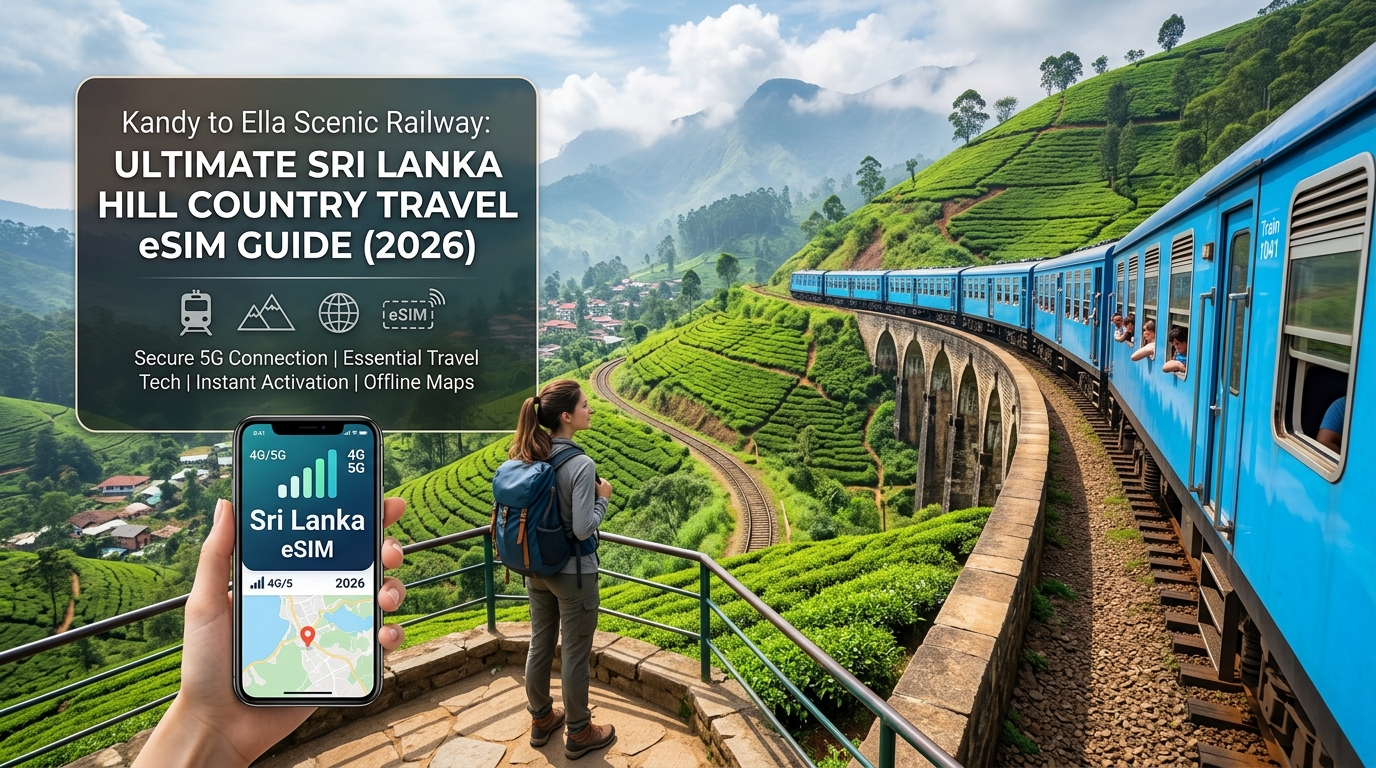
Kandy to Ella Scenic Railway: Ultimate Sri Lanka Hill Country Travel eSIM Guide (2026)
The Iconic Ceylon Rail Corridor: High-Altitude Terrain & Mobile Connectivity Dynamics
Spanning approximately 160 kilometers of century-old broad-gauge track, the railway journey from Kandy to Ella is universally celebrated as one of the world's most scenic transit corridors. Originally engineered by the British in the 19th century to transport Ceylon tea and coffee from the rugged interior to Colombo’s maritime ports, the Main Line traverses an extraordinary vertical profile.
From the cultural basin of Kandy (elevation ~500 meters), the locomotive climbs steadily through the rolling foothills of Nawalapitiya, passes the rain-soaked tea plantations of Hatton, reaches Nanu Oya (1,613 meters—the transit gateway to Nuwara Eliya), and summits at the mist-enshrouded Pattipola Railway Station. Standing at 1,898 meters (6,227 feet) above sea level, Pattipola is the highest broad-gauge railway station in the country. From this peak, the tracks hug sheer cliff faces across the Idalgashinna escarpment and Haputale before descending into the lush amphitheater of the Ella gap (~1,041 meters).
Elevation Profile: Kandy to Ella Scenic Corridor
========================================================================
[1,898m]--------------------------------------------- Pattipola Summit
[1,613m]--------------------------- Nanu Oya (Nuwara Eliya)
[1,271m]------------------ Hatton
[1,041m]-------------------------------------------------------- Ella
[  500m]-- Kandy
========================================================================
The Radio Frequency (RF) Challenge in the Central Highlands
While the visual panorama—waterfalls, emerald tea terraces, and sheer drops—is spectacular, this extreme geography creates a hostile environment for commercial cellular signals. Maintaining continuous mobile broadband along the corridor is complicated by four distinct physical and atmospheric factors:
- Granite Cuttings and Structural Tunnels: The line threads through dozens of deep, hand-carved rock cuttings and over 40 tunnels. These dense metamorphic rock walls cause complete signal attenuation (Faraday cage effect), dropping connections instantly unless localized microcells or leaky feeder cables are present.
- Rapid Base Station Handovers: Because the track loops around mountain spurs (most notably the Demodara Loop), the train frequently loses direct Line of Sight (LoS) with regional Base Transceiver Stations (BTS). Smartphones are forced into aggressive, continuous eNodeB/gNodeB handovers between valley-floor towers and high-altitude masts, increasing battery drain and introducing packet loss.
- Atmospheric & Canopy Attenuation: The high-altitude cloud forests and heavy mist typical of the Hatton–Pattipola corridor introduce moisture-based RF absorption, particularly affecting higher LTE frequency bands such as Band 3 (1800 MHz) and Band 1 (2100 MHz).
- Multipath Fading: Radio waves reflect off sheer granite cliffs and dense mountain slopes, creating out-of-phase interference patterns that degrade signal quality (SINR) even when raw signal bars appear high.
Why Real-Time Connectivity Matters Along the Track
For modern travelers, staying connected along this 6.5-to-7.5-hour journey is not just about posting Instagram Stories of the Nine Arch Bridge in real time. Reliable mobile data is an operational necessity:
- Dynamic Train Tracking: Sri Lanka Railways (SLR) services frequently experience operational delays due to single-track bottlenecks and weather. Live GPS tracking via local railway tools or Google Maps helps travelers manage onward hotel check-ins and driver pickups in Ella.
- Digital Ticketing Verification: Reserved class tickets (1st Class AC and 2nd/3rd Class reserved) purchased via the Sri Lanka Railways e-ticketing portal require active digital validation and QR rendering on mobile devices at intermediate checkpoints.
- Emergency Communication & Logistics: The remote stretches between Ohiya and Idalgashinna offer virtually zero roadside access; having a functioning network link is crucial should travel logistics change mid-transit.
Because connectivity can drop to legacy 3G or low-band LTE across deep ravines, having a high-tier travel eSIM configured before boarding is critical. Providers like MollySIM mitigate these regional dead zones through multi-network profile switching. Furthermore, even if you exhaust your primary high-speed data quota streaming 4K video through the tea country, MollySIM’s Fair Use Policy (FUP) throttles down to 384kbps—triple the industry-standard 128kbps throttle. This guarantees sufficient bandwidth to keep Google Maps routing, WhatsApp messaging, and mobile payments active across the entire mountain transit.
Sri Lanka Carrier Infrastructure: Dialog Axiata vs. Mobitel in the Central Highlands
🌐 Global Travel High-Speed Travel eSIM & SIM Plans
Instant QR code activation, hotspot enabled, with guaranteed 384kbps fallback speed to keep Maps & Digital Wallets active.
Navigating the telecom landscape of Sri Lanka’s Central Highlands requires an understanding of how radio frequency (RF) physics interacts with extreme topography. The railway corridor between Kandy (elevation ~500m) and Pattipola (summit elevation 1,897m) winds through granite massifs, deep cloud-forest gorges, and dense eucalyptus plantations. Across this corridor, two mobile network operators (MNOs) dominate the infrastructure landscape: Dialog Axiata (the market leader by subscriber share) and Mobitel (the mobile arm of national state carrier SLT-Mobitel).
Both operators maintain distinct spectrum deployments and cell tower footprints that yield wildly variable real-world performance as the train maneuvers through the mountain passes.
RF Spectrum Allocation and Hill Country Propagation
The operational resilience of mobile connectivity along the Main Line depends on the carrier's active frequency bands:
- LTE Band 8 (900 MHz - FDD): Both Dialog and Mobitel deploy sub-1GHz spectrum on Band 8. This low-band frequency is critical for the Hill Country. The longer RF wavelength allows signals to bend around ridge lines (diffraction) and penetrate thick tea foliage and rainy cloud layers far more effectively than mid-band alternatives. Mobitel heavily utilizes Band 8 for wide-area rural coverage along the rail tracks.
- LTE Band 3 (1800 MHz - FDD): Used primarily as the capacity backbone near central stations (Peradeniya, Hatton, Nanu Oya). While Band 3 delivers higher downlink throughput (30–75 Mbps in towns), its higher attenuation rate causes signal levels to collapse rapidly the moment the train enters remote ravines or cutting walls.
- LTE Band 40 (2300 MHz - TDD) & Sub-6 5G Trials: Concentrated purely around urban Kandy and Nuwara Eliya. These micro-cells offer virtually zero utility along the scenic rail track due to severe free-space path loss and zero structural penetration in moving train cars.
+------------------------------------+------------------------------------+------------------------------------+
| Technical Feature                  | Dialog Axiata                      | SLT-Mobitel                        |
+------------------------------------+------------------------------------+------------------------------------+
| Primary Highland 4G Bands          | Band 3 (1800MHz), Band 8 (900MHz)  | Band 8 (900MHz), Band 3 (1800MHz)  |
| Secondary Capacity Bands           | Band 40 (2300MHz TDD)              | Band 1 (2100MHz FDD)               |
| Highland Station Node Density      | High (Hatton, Nanu Oya, Ella)      | Moderate-High                      |
| Deep Ravine Track Penetration      | Moderate (RF Shadows between cuts) | High (Strong low-band footprint)   |
| Emergency Roaming Interoperability | Locked out on standard local SIMs  | Locked out on standard local SIMs  |
+------------------------------------+------------------------------------+------------------------------------+
Route-Specific Signal Analysis: Nawalapitiya to Ella
The train track's topography induces rapid RF degradation, exposing distinct dead zones for both carriers:
- Nawalapitiya to Talawakele (The Western Ascent): As the railway ascends past the St. Clair and Devon waterfall gorges, cell towers located on opposing valley faces experience line-of-sight obstruction. Dialog performs strongly through major stations, but Mobitel often holds stronger B8 (900 MHz) carrier aggregation through the winding bends of the Kotmale valley.
- Great Western to Nanu Oya (The Cloud Shadow): Passing the foot of Mount Great Western (2,212m), the sheer rock face causes a complete RF shadow. Handsets on single-operator profiles will experience rapid ping spikes and forced drops to legacy 2G/EDGE (900 MHz GSM) while searching for base station handoffs.
- Ohiya to Idalgashinna (The Ridge Divide): This is the most technically challenging sector on the network. The railway clings to a narrow cliff edge separating the northern and southern climatic zones. When dense fog rolls in, high-frequency signals scatter. Towers positioned on the southern plains (facing Haputale) beam signals upward, but deep railway tunnels (such as Tunnel 18 through 22) cause continuous session drops.
The Single-Carrier Bottleneck vs. Multi-Network Failover
Relying on a single physical SIM card purchased at Bandaranaike International Airport (CMB) introduces operational risk. If a traveler holds a Dialog-only or Mobitel-only SIM, they are tethered to that single carrier's physical Base Transceiver Station (BTS) distribution. When the train turns behind a ridge where Dialog’s cell site is blocked but Mobitel has an active relay mast across the gorge, a single-network SIM drops to "No Service".
Advanced travel eSIM solutions like MollySIM bypass single-network vulnerabilities through dynamic IMSI and network failover profiles. When signal quality drops below acceptable thresholds on one local carrier, the eSIM automatically negotiates a handover to the strongest available partner network.
Furthermore, high-elevation transits consume significant background data syncing offline mapping layers. When standard high-speed quotas are exhausted, most competitors throttle bandwidth to a non-functional 128kbps—rendering map tiles completely blank. MollySIM’s Fair Use Policy (FUP) enforces a robust 384kbps baseline speed, which provides sufficient throughput to load real-time GPS coordinates on Google Maps, send compression-optimized WhatsApp photos, and process contactless Apple Pay transactions directly at the station platforms.
Connectivity Shootout: MollySIM eSIM vs. Airport Physical SIMs vs. Pocket Wi-Fi in Sri Lanka
Navigating the Central Highlands requires balancing network availability, transceiver switching speed, and hardware efficiency. Travelers landing at Bandaranaike International Airport (CMB) typically choose between four connectivity vectors: digital eSIMs, airport-issued tourist physical SIM cards, home carrier international roaming packages, or battery-powered pocket Wi-Fi rentals.
To evaluate their performance across elevation gradients, cloud-forest plateaus, and deep railway gorges, we benchmarked the primary metrics critical for highland exploration.
Comprehensive Highland Hardware & Network Comparison
| Connectivity Metric | MollySIM Sri Lanka eSIM | Dialog / Mobitel Airport Physical SIM | Home Carrier Roaming (e.g., AT&T, Vodafone) | Pocket Wi-Fi Rental Unit |
|---|---|---|---|---|
| Setup & Provisioning | Instant via QR Code; zero physical paperwork; pre-installable | 30–60 min queue at CMB arrivals; physical passport scans & KYC | Automatic or SMS toggle; variable setup friction | Hardware pickup/drop-off queues; cash deposit required |
| Network Architecture | Dynamic Multi-Network Failover (Auto-hooks to strongest BTS) | Single-network locked (Dialog-only or Mobitel-only) | Single roaming partner agreement (locked) | Single SIM router slot (carrier-locked) |
| Highland Valley Latency | Optimized local breakout routing (~35–55ms) | Low local routing (~30–50ms on home network) | Extreme latency penalty (~350–700ms via home gateway) | Moderate to high (~60–120ms local routing + Wi-Fi overhead) |
| Peak 4G/LTE Speeds | Up to 85 Mbps (dependent on local mast band) | Up to 85 Mbps (within native coverage zone) | Throttled by carrier agreements (often 10–25 Mbps) | Up to 40 Mbps (shared across connected devices) |
| Post-Quota FUP Baseline | Unlimited 384kbps Safety Net (functional maps/messaging) | Hard data cut-off; requires buying scratch cards/top-ups | Varies; frequently throttled to non-viable 64–128kbps | Hard data suspension or severe multi-device crawl |
| Device Battery Impact | Minimal (native smartphone baseband management) | Minimal (native smartphone baseband management) | Standard native drain | High (Dual radio drain: continuous Wi-Fi + external unit charging) |
| Tethering / Hotspot | Supported natively without carrier restrictions | Supported natively | Often blocked or charged as separate add-on tier | Native routing (connects up to 5–8 devices) |
Real-World Field Scenarios Across the Highlands
1. The CMB Arrival Rush vs. Pre-Boarding Provisioning
Tourists stepping off long-haul flights at CMB face congested telecom kiosks in the arrivals hall. Purchasing a physical SIM requires queueing, submitting physical passport copies, undergoing biometric verification, and manually swapping nano-SIM trays with tiny extraction pins—an unwelcome friction point when catching the early morning express train from Colombo Fort to Kandy.
With an eSIM from MollySIM, profile configuration takes place before departure via an automated QR code scan. The embedded chip activates instantly upon locking onto Sri Lankan cellular towers, delivering immediate connectivity the moment your flight touches the tarmac.
2. Horton Plains & World’s End: The Multi-Network Advantage
On the high-altitude plateau of Horton Plains (2,100 meters above sea level), weather fronts change within minutes, and Base Transceiver Stations (BTS) are sparse. A traveler with a single-carrier physical SIM (e.g., Dialog-only) experiences complete dead zones along the southern cliffs of World’s End where only Mobitel or Airtel relay stations penetrate the mist.
Because MollySIM leverages multi-network agreements, the eSIM dynamically migrates your device to the surviving operational carrier profile. Additionally, carrying an external pocket Wi-Fi device in Horton Plains introduces extreme lithium battery degradation caused by high-elevation ambient temperatures (often dropping below 8°C), whereas native eSIM operation relies directly on your phone's thermally protected internal battery.
3. Navigating Ella Station on Exhausted Data Quotas
After days of streaming 4K video clips of the Nine Arches Bridge and backing up RAW camera files over mobile data, hitting plan boundaries is common. On standard local prepaid SIMs, data halts completely until you find an authorized merchant in Ella village selling physical recharge scratch cards. Competitor travel eSIMs typically drop bandwidth to an unusable 128kbps, failing to render vector map assets or process cryptographic security handshakes.
MollySIM’s Fair Use Policy sustains a baseline throughput of 384kbps—three times the industry standard. This dedicated safety net provides sufficient continuous bandwidth to:
- Refresh live turn-by-turn navigation on Google Maps and Apple Maps.
- Execute tokenized Apple Pay and Google Wallet NFC transactions at highland transit points.
- Transmit low-latency VoIP messages and location pins via WhatsApp to local drivers and tour guides.
Station-by-Station Coverage & Live-Sharing Guide: From Peradeniya to Demodara Loop
Spanning approximately 160 kilometers and ascending from 500 meters at Peradeniya to an altitude of 1,898 meters at Pattipola, the Main Line passes through steep granite valleys, dense eucalyptus canopies, and razor-sharp ridge lines. This dynamic topography creates severe radio frequency (RF) shadowing.
To plan your content uploads and keep real-time track of your transit, use this station-by-station telemetry breakdown.
Mile-by-Mile Network Performance
| Railway Sector | Elevation | Primary Coverage | Field Performance & Signal Characteristics |
|---|---|---|---|
| Peradeniya Junction – Nawalapitiya | 500m – 600m | 4G LTE-A / 5G | Excellent (40–85 Mbps). Consistent urban macrocell coverage. Ideal window for syncing offline playlists and backing up camera rolls. |
| Hatton (Adam’s Peak Base) | 1,260m | 4G LTE | Moderate (15–30 Mbps). Stable near town limits. Drops to 3G in the deep tea cuttings between Rozella and Kotagala. |
| Great Western – Nanu Oya | 1,450m – 1,613m | Intermittent 4G / Edge | Fluctuating (3–12 Mbps). Deep valley shadowing causes frequent packet loss. Live video calls will drop; store-and-forward messaging holds up. |
| Pattipola Summit & Tunnel No. 18 | 1,898m | Critical Dead Zone | No Signal / Edge (< 0.5 Mbps). The highest railway point in Sri Lanka acts as an RF barrier. Signal cuts out completely inside Tunnel 18. |
| Ohiya – Idalgashinna – Haputale | 1,770m – 1,437m | High-Band 4G Line-of-Sight | Strong but Fragile (20–45 Mbps). High-altitude line-of-sight to valley towers across the southern plains. Heavy mist and mountain wind cause rapid signal fading. |
| Ella Station – Nine Arches Bridge | 1,041m | 4G LTE | Congested (5–20 Mbps). Tower density is high, but extreme tourist density causes localized bandwidth throttling during peak train arrivals. |
| Demodara Loop & Station | 912m | 4G LTE | Variable (8–18 Mbps). Handset radios rapidly switch cell sectors as the train maneuvers the 360-degree spiral loop around the hillside. |
Technical Guide: Uploading Reels, TikToks, and YouTube 4K On-the-Go
Capturing the train curving over the Nine Arches Bridge or hanging out the open blue doors through the tea estates of Idalgashinna is a highlight of the trip. To publish high-resolution media without connection failures or battery drain, follow these engineering practices:
1. Implement Local Queueing Over Live Ingestion
Do not attempt real-time live-streaming over platforms like Instagram Live or TikTok between Nanu Oya and Ohiya. The high velocity of the train combined with rapid switching between cell towers (handover latency) causes frame drops and stream termination.
- The Strategy: Record at 4K 60fps locally, compress to H.265/HEVC in your mobile editor, and queue your upload.
- The Hotspot: Trigger uploads as the train rounds the Haputale ridge. The track runs directly along the cliffside with unobstructed line-of-sight to regional base transceiver stations in the lowlands below.
2. Managing Base Station Congestion at the Nine Arches Bridge
When the train slows down across the Nine Arches Bridge (between Gotuwala and Demodara), hundreds of passengers hit local towers simultaneously. Single-carrier SIM cards often fail to resolve DNS queries under this load.
Using MollySIM, your handset bypasses localized single-network bottlenecks by dynamically handshaking with the least congested operational infrastructure across Sri Lanka's leading network grids. Even if you exceed high-speed data limits while batch-uploading raw video footage, MollySIM’s built-in 384kbps Fair Use Policy baseline keeps essential location trackers, ticketing apps, and ride-hailing services fully operational—avoiding the 128kbps connection drops typical of standard travel profiles.
3. Tower Alignment on the Demodara 360-Degree Loop
As the train completes the circular track beneath itself at Demodara Station, your phone will negotiate up to three cell sector handovers in less than four minutes.
- Turn off low-power data modes to prevent your device's baseband modem from dropping into legacy 3G fallback during rapid sector transitions.
- If streaming to cloud storage, keep your device on the left side of the carriage for direct RF propagation toward the Demodara valley transceivers.
Battery Optimization & Device Configuration for 7-Hour Mountain Rail Journeys
The 7-hour rail journey from Kandy to Ella places an exceptional strain on smartphone batteries. The combination of sustained 4K video recording, active GPS tracking through dense mountain topography, and continuous cellular baseband power amplification can drain a flagship smartphone from 100% to critical levels in under four hours.
Understanding how to tune your operating system and radio hardware ensures you retain sufficient battery life to capture the iconic approach into Ella without carrying cumbersome multiple power bricks.
Mitigating the "Tower Hunting" Battery Drain Effect
When the train passes through deep rock cuttings, cloud-forest ridges, or tunnels around the Pattipola summit, your device’s cellular modem encounters rapid signal attenuation. In response, the baseband processor ramps the RF power amplifier up to maximum transmission output (often exceeding +23 dBm to +30 dBm) to keep the radio handshake alive. This phenomenon—commonly known as cell tower hunting—is the primary cause of sudden battery drops in the Hill Country.
To counter this:
- Engage Airplane Mode on Isolated Mountain Loops: If the train enters a prolonged low-signal valley where real-time connectivity is unnecessary, switch on Airplane Mode for 15–20 minutes to prevent thermal throttling and modem battery drain.
- Disable 5G Standalone (SA) / Fallback Searching: Set your cellular voice and data settings to LTE/4G Only. Sri Lanka’s hill country infrastructure relies primarily on hardened LTE Bands 3 (1800 MHz) and 8 (900 MHz); locking your phone out of searching for unstable, high-frequency 5G bands preserves up to 18% of battery over the 7-hour transit.
Step-by-Step Device Configuration Protocol
Execute these configurations before departing Kandy or Peradeniya Station:
1. Configure Fast-Latching APN Settings
Ensure your eSIM access point name is correctly assigned to avoid repeated gateway retries:
- iOS: Go to Settings > Cellular > Mobile Data Network. Verify that the APN field corresponds with your eSIM carrier instructions (for MollySIM, this provisions automatically via over-the-air profile).
- Android: Navigate to Settings > Network & Internet > SIMs > Access Point Names. Ensure the active APN matches carrier parameters with APN Type set to
default,supl.
2. Restrict Background App Refresh & Push Services
Non-essential apps checking for updates over fluctuating mountain nodes force the modem out of its low-power sleep state (C-states):
- iOS: Settings > General > Background App Refresh -> Toggle OFF.
- Android: Settings > Apps > Special app access > Battery optimization -> Select non-essential apps and set to Restricted.
3. Pre-Cache Offline Vector Maps
Never rely on real-time rendering of map tiles while winding along the Haputale escarpment.
- In Google Maps, tap your profile icon > Offline maps > Select Your Own Map > draw a bounding box covering Kandy, Nuwara Eliya, Haputale, and Badulla (roughly 120MB).
- In Organic Maps, download the entire Sri Lanka country file via OpenStreetMap (OSM) vectors. This allows 100% offline altitude tracking, track grade visualization, and station milestone monitoring using zero cellular data and negligible battery.
Balancing Camera Power Draw with Instant Cloud Syncing
Filming the landscape through open carriage doorways generates immense heat and processor draw, particularly when writing high-bitrate video to internal storage.
| Optimization Target | Standard Setting | High-Efficiency Mountain Setting | Battery Savings |
|---|---|---|---|
| Video Resolution & Frame Rate | 4K @ 60 fps (ProRes/High Bitrate) | 4K @ 30 fps (HEVC / H.265) | ~35% less thermal/modem load |
| Screen Brightness | Auto-Brightness (Peaking outdoors) | Manual 65–70% lock while shooting | ~20% display power reduction |
| Display Timeout | 2–5 Minutes | 30 Seconds Auto-Lock | ~12% overall power conservation |
| Media Cloud Ingestion | Continuous cellular upload | Batch sync during major station stops | Prevents persistent modem transmit state |
Station-Stop Cloud Ingestion Workflow
Instead of leaving cloud backups continuously running while traversing dead zones, keep auto-syncing paused during track transit. When the train pulls into high-capacity nodes—such as Hatton, Nanu Oya, or Bandarawela—leverage high-speed data from MollySIM to burst-upload your selected photo batches and 4K clips in 3 to 5 minutes.
Even if you blow through your daily high-speed tier during large media uploads, MollySIM's 384kbps Fair Use Policy baseline keeps essential utilities running. Unlike standard travel eSIMs that throttle connections down to an unusable 128kbps (which breaks SSL handshakes and mapping APIs), 384kbps maintains smooth operation for live Google Maps navigation, Uber/PickMe re-bookings upon arriving at Ella Station, and Apple Pay terminal transactions.
Seamless Highland Travel in 2026: Why MollySIM is the Ultimate Sri Lanka Travel Companion
Navigating the dramatic altitude shifts, dense pine cloud forests, and sheer rock cuts of Sri Lanka’s Central Province demands an adaptive, resilient data plan. The rugged geography between Kandy (500m above sea level) and Pattipola (1,897m) creates rapid signal handoffs where single-operator SIM cards constantly drop packets or stall out. Equipping your phone with a dynamic multi-network digital eSIM ensures you stay connected from the moment the locomotive pulls out of Kandy Station to your arrival at the misty platforms of Ella.
Dynamic Tier-1 Carrier Aggregation Across the Highlands
Traditional physical SIM cards lock your smartphone to a single local network's infrastructure. If that specific operator lacks a cell tower inside the Great Western valley or near the Demodara Loop, your phone sits on "No Service."
MollySIM solves this through strategic tier-1 roaming agreements across Sri Lanka's leading telecom networks (including Dialog and Mobitel). Your handset automatically registers with the strongest available transceiver at any given kilometer marker:
- Automated Low-Latency Switching: Seamless handshakes between cell towers without requiring manual network searches in your device settings.
- Optimized Bandwidth Allocation: Prioritizes stable 4G/5G spectrums for uninterrupted live photo sharing and real-time transit tracking.
- No Physical Hazard: Eliminates the risky process of handling micro-SIM trays, ejector tools, and tiny plastic chips while leaning over open vestibules or balancing in swaying train carriages.
Frictionless Digital Activation Workflow
Setting up connectivity for the hill country requires zero physical counter visits at Bandaranaike International Airport (CMB):
- Pre-Departure Purchase: Select your Sri Lanka data bundle on MollySIM prior to your flight.
- Instant QR Installation: Scan the installation QR code using your phone's camera in your home country or while connected to airport Wi-Fi. Label the cellular plan as Travel or Sri Lanka.
- Automatic Tower Handshake: Set your data line to the eSIM upon touchdown in Sri Lanka and toggle Data Roaming ON. Your device immediately pulls local carrier profiles and activates data routing.
The 384kbps Safety Margin: Guaranteed Functional Connectivity
Standard travel eSIM providers implement strict Fair Use Policies (FUP) that drop bandwidth down to an unusable 64kbps–128kbps once high-speed caps are reached. At those rates, modern apps fail due to SSL connection timeouts.
| Network Feature | Standard Travel eSIMs | MollySIM Tier-1 eSIM | Real-World Impact on the Train Route |
|---|---|---|---|
| Post-Cap Throttle Speed | 64 kbps – 128 kbps | 384 kbps Unlimited | 3x data throughput; keeps core apps fully functional |
| Google Maps Live Routing | Fails to render tiles | Instant Vector Rendering | Real-time GPS elevation and station tracking |
| Ride-Hailing (PickMe / Uber) | Connection timed out | Smooth Dispatch & Match | Book tuk-tuks ahead before pulling into Ella Station |
| Apple Pay / Google Wallet | Token authentication fails | Instant Authorization | Zero payment failures at tea factory cafes |
| Messaging (WhatsApp / Signal) | Text-only / delayed | Voice Calls & Quick Images | Continuous family check-ins through mountain passes |
Ultimate Kandy-to-Ella Connectivity & Tech Checklist
Before boarding your morning train at Kandy, Peradeniya, or Nanu Oya, run through this pre-departure checklist to guarantee peak photographic output and uninterrupted connectivity:
- [ ] Provision MollySIM Before Departure: Install the digital eSIM profile so your data connects the instant you depart the terminal.
- [ ] Download Offline Regional Assets: Cache Spotify playlists, podcasts, and offline Google Maps areas for the Central Province.
- [ ] Pack a 10,000mAh+ High-Output Power Bank: Constant camera operation and dynamic cellular handoffs accelerate battery drain; keep a PD-compatible battery pack in your daypack.
- [ ] Configure Camera Shutter & HEVC Profiles: Set video capture to 4K/30fps HEVC to balance file sizes with ultra-sharp dynamic range across misty valleys.
- [ ] Pre-Install Local Transport Platforms: Download and verify your account on PickMe and Uber using your active data connection so you can hail transport instantly upon disembarking at Ella.
🌐 Global Travel High-Speed Travel eSIM & SIM Plans
Instant QR code activation, hotspot enabled, with guaranteed 384kbps fallback speed to keep Maps & Digital Wallets active.