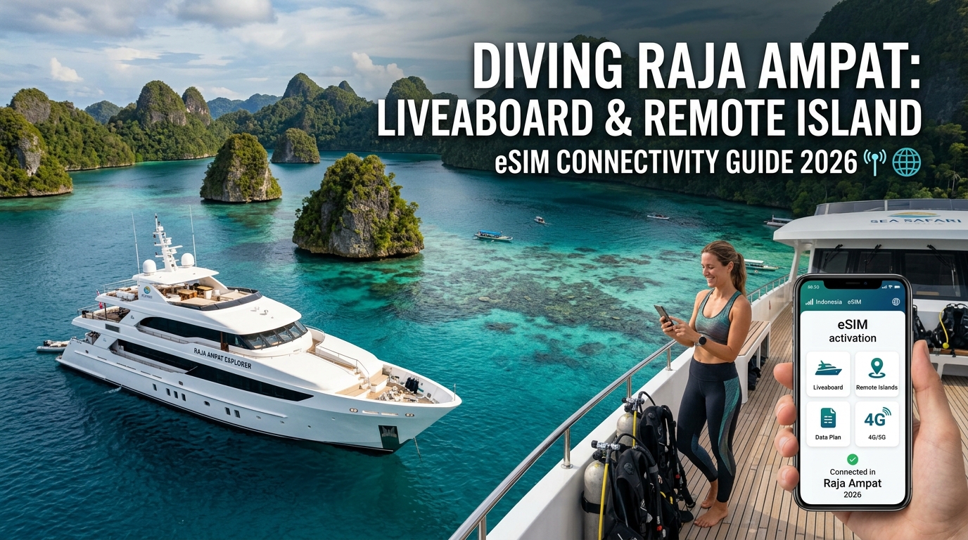
Diving Raja Ampat: Liveaboard & Remote Island eSIM Connectivity Guide 2026
Navigating Remote Papua: The Cellular Geography of Raja Ampat and Dampier Strait
Raja Ampat spans roughly 70,000 square kilometers of territory at the heart of the Coral Triangle, comprising over 1,500 islands, cays, and shoals. For divers stepping off the dock at Sorong (the industrial transit hub of Southwest Papua), cellular infrastructure shifts dramatically from standard urban 4G/5G grids to an ultra-sparse, solar-powered coastal microwave backhaul network. Understanding how this terrain interacts with radio frequency (RF) signals is the key to maintaining critical connectivity between dive sites.
The Mechanics of Karst Topography and BTS Placement
Mobile connectivity in the archipelago relies primarily on state-backed infrastructure built by Telkomsel, operating via Base Transceiver Stations (BTS) perched on elevated limestone karst pillars and village community towers. These installations face severe physical constraints:
- Microwave Line-of-Sight (LoS) Links: Rather than fiber-optic subsea cables, most outer-island towers (such as those on Mansuar, Arborek, and Friwen) receive backhaul signals bounced from relay stations near Waisai and Sorong.
- The "Island Shadow" Effect: Limestone karsts act as impenetrable RF shields. When a liveaboard anchors in the lee of a sheer cliff—a standard practice for calm night mooring—RF signals from the nearest BTS are completely blocked. Even if you are only three kilometers from a tower, sitting behind an 80-meter vertical rock wall drops your signal instantly from four bars to No Service.
- Tidal and Saltwater Signal Attenuation: RF propagation across open ocean suffers from multipath interference and high surface reflectivity, causing unpredictable signal flutter during long crossings across the Dampier Strait.
Regional Connectivity Breakdown: Dive Hubs vs. Dead Zones
| Geographic Sector | Anchor Dive Sites | BTS Proximity & Signal Health | Connectivity Realities |
|---|---|---|---|
| Sorong & Salawati Shelf | Port departure, Batanta North | High density; direct terrestrial 4G/5G | Solid broadband; prime zone for downloading offline satellite maps. |
| Central Dampier Strait | Cape Kri, Blue Magic, Manta Sandy, Sardine Reef | BTS on Mansuar, Arborek, and Friwen | Stable 4G on sundecks with direct LoS; drops significantly inside lower-deck cabins. |
| Fam Islands (Pianemo) | Melissa’s Garden, Batu Rufus, Pianemo Peak | Single micro-BTS at Pianemo lookout | Usable 4G near the tourist jetty; drops completely in outer coves and lagoons. |
| Northern Raja (Wayag/Kawe) | Equator Islands, Wayag 1 & 2, Pelagic Rock | No active commercial BTS | Complete cellular blackout. Requires satellite systems or offline caches. |
| Southern Raja (Misool) | Magic Mountain, Boo Windows, Fiabacet | Isolated low-capacity BTS near Yellu Village | Highly localized 3G/4G coverage; dead zones dominate 85% of southern marine reserves. |
Digital Detox vs. Operational Safety: Why Modern Divers Need Data
While liveaboard itineraries promise a retreat from routine screen time, connectivity remains essential for real-time dive safety and logistics:
- Hyper-Local Weather Monitoring: Weather patterns in West Papua shift violently with little warning. Liveaboard dive directors and self-guided groups rely on data connections to pull updated ECMWF and GFS satellite radar models on apps like Windy to avoid squalls (Angin Barat) while navigating exposed straits.
- Emergency Medical Communication: In the event of decompression sickness (DCS) or severe marine life envenomation, direct data access facilitates instant telemetry sharing and case coordination with DAN (Divers Alert Network) or emergency air-evacuation services in Sorong.
- Bandwidth Resilience in Weak-Signal Zones: Because connections frequently drop to minimal speeds around fringe karst towers, standard international roaming packages that drop to 128kbps become virtually useless, failing to load vector maps or essential travel authorizations. Modern data setups like MollySIM mitigate this by maintaining an emergency Fair Use Policy (FUP) floor of 384kbps—three times faster than typical roaming alternatives. This ensures that even when your high-speed bucket is exhausted or the local BTS throttles bandwidth, lightweight vector data (Google Maps, Apple Pay authentication, and WhatsApp texts) continues to transmit reliably from the deck.
Connectivity Comparison: Marine Satellite vs. Eco-Resort Wi-Fi vs. Travel eSIM
🌐 Global Travel High-Speed Travel eSIM & SIM Plans
Instant QR code activation, hotspot enabled, with guaranteed 384kbps fallback speed to keep Maps & Digital Wallets active.
Navigating the remote waters of the Coral Triangle requires balancing bandwidth demands against harsh geographic constraints. Divers exploring the Dampier Strait, Batanta, or the far reaches of Misool encounter three primary data pipelines: maritime satellite systems installed on mid-to-high-tier liveaboards, decentralized microwave/VSAT setups at eco-resorts, and direct cellular connections via regional travel eSIMs.
Understanding the technical bottlenecks of each pipeline prevents costly communication failures when syncing dive computers, checking synoptic weather charts, or confirming remote logistics.
Infrastructure Breakdown
1. Maritime Satellite (Starlink Maritime & Geostationary VSAT)
While LEO (Low Earth Orbit) networks like Starlink Maritime have revolutionized offshore connectivity, liveaboard implementation introduces severe multi-tenant contention. A single onboard terminal is routinely split across 16 to 22 guests and 10+ crew members streaming media simultaneously during post-dive downtime.
Furthermore, many operators pass this overhead to passengers via aggressive surcharges ($150–$300 per voyage) or enforce hard daily data caps (e.g., 500MB/day). During intense equatorial squalls (Angin Barat), heavy cloud density and torrential rain cause noticeable signal attenuation (rain fade), elevating latency and dropping packets.
2. Eco-Resort Shared Microwave & Fixed Wireless
Remote dive lodges in Central and Southern Raja Ampat typically bridge internet to their islands via point-to-point microwave relays tethered to mainland infrastructure in Sorong or Waisai, with older resorts still relying on legacy C-band/Ku-band VSAT dishes.
Bandwidth is severely constrained (often 10–20 Mbps aggregate for the entire property). Wi-Fi coverage is generally locked to the central dining pavilion or dive center, leaving overwater bungalows and private jetties completely offline. During peak evening hours—when guests upload high-resolution underwater RAWs and 4K footage—pings spike past 600ms, rendering real-time communication tools unusable.
3. Direct Cellular Connections via Travel eSIM
The Indonesian government and Telkomsel have erected high-gain Base Transceiver Stations (BTS) across strategic karst summits, including Mansuar, Gam, Arborek, and Misool's main channels.
When your vessel is cruising or moored within line-of-sight (typically up to 15–25 nautical miles with clear marine topography), a direct eSIM connection bypasses shared boat routers. By mounting your phone on the open dive deck or flybridge, you tap unthrottled point-to-point 4G LTE frequencies directly into the local core network, yielding minimal latency, zero local network contention, and dramatically lower data costs.
Technical Specification Matrix
| Metric / Parameter | Onboard Maritime Satellite (Starlink/VSAT) | Eco-Resort Microwave / Shared Wi-Fi | Standalone Travel eSIM (Direct Cellular) |
|---|---|---|---|
| Typical Latency | 65ms – 220ms (VSAT: 600ms+) | 120ms – 450ms | 35ms – 75ms |
| Average Speeds (Down / Up) | 5 – 25 Mbps down / 2 – 5 Mbps up (per user, contended) | 1 – 8 Mbps down / 0.5 – 2 Mbps up (highly shared) | 15 – 65 Mbps down / 8 – 25 Mbps up (direct BTS link) |
| Weather Vulnerability | Moderate to High (Heavy rain fade / cloud attenuation) | High (Prone to microwave antenna misalignment) | Low (Sub-6GHz radio waves penetrate precipitation well) |
| Average Cost per GB | $8.00 – $25.00+ (or flat $25/day liveaboard fee) | Free to $10.00/GB (often strictly rationed) | $1.20 – $3.50 / GB |
| Hardware Dependency | Vessel router, captive portal login, ship generator power | Resort access points; range limited to central clubhouse | Zero external hardware; runs natively on user device |
| Practical Dive Usability | Adequate at open sea, but throttled during evening peak hours | Poor for remote work; unreliable outside common areas | Optimal for flybridge dive logging, radar pulls, and personal hotspots |
The Top-Deck Line-of-Sight Advantage
Liveaboards spend up to 70% of their itineraries navigating internal island channels, anchoring in protected coves, or traversing passages between dive sites—rarely operating in true open ocean beyond coastal reach. Under these conditions, direct cellular connectivity provides substantially better performance than congested onboard satellite Wi-Fi.
Because 4G radio frequencies operate below 3GHz, they suffer far less atmospheric absorption during sudden tropical downpours than the higher-frequency Ku/Ka satellite bands used by space-based systems.
To maintain maximum reliability on remote itineraries, choosing an eSIM provider with intelligent Fair Use Policies is critical. While legacy roaming profiles drop speeds to an unusable 128kbps once high-speed allocations are tapped, MollySIM implements a robust 384kbps FUP floor. This bandwidth baseline is three times higher than the industry standard, ensuring that critical dive logging, GPS vector rendering in navigation apps, secure Apple Pay/Google Wallet authentication, and emergency messaging remain fully operational even when cruising past fringe signal boundaries.
Why Tier-1 Indonesian Network Aggregation & MollySIM 384kbps Backup Are Critical
Navigating the remote marine corridors of Southwest Papua requires an infrastructure setup that can handle dynamic geographical shifts. The cellular landscape across the Raja Ampat archipelago is not homogenous; carrier performance fluctuates wildly between the northern passages of the Dampier Strait and the isolated karst labyrinths of South Misool.
Dynamic Multi-IMSI Routing: Bypassing the Sorong SIM Bottleneck
In West Papua, Telkomsel operates the most extensive maritime footprint under Indonesia's universal service infrastructure mandate, deploying sub-1GHz Band 8 (900MHz) long-range transceivers across remote peaks like Mount Wagom. While secondary operators such as Indosat Ooredoo Hutchison (IOH) and XL Axiata offer competitive urban bandwidth within Sorong harbor, their signal drops off rapidly once a liveaboard clears the Batanta Strait.
Traditional travel setups require divers to queue at Domine Eduard Osok Airport (SOQ) in Sorong to purchase physical prepaid SIMs, register their international IMEI numbers with Indonesian customs (Direktorat Jenderal Bea dan Cukai), and navigate complex national tax thresholds.
MollySIM bypasses this friction by integrating Tier-1 local carrier profiles directly over-the-air. Its core routing engine automatically latches onto the strongest broadcast transponder—seamlessly switching from urban high-capacity LTE bands in Sorong to Telkomsel’s deep-penetration 900MHz rural cells in Central and South Raja Ampat without manual network renegotiation or hardware swaps.
The Operational Reality of 384kbps: Engineered for Remote Diver Safety
Most international roaming eSIMs implement a restrictive Fair Use Policy (FUP) that throttles speeds down to an unusable 128kbps—or cuts data entirely—once the primary high-speed package is consumed. In maritime environments with fluctuating latency, a 128kbps ceiling results in severe packet loss and broken TCP connections.
MollySIM establishes a 384kbps baseline floor on its unlimited data configurations, delivering 48 kilobytes per second of sustained throughput. This bandwidth is engineered to preserve essential data channels even when high-speed allowances are exhausted:
                                  DATA THROUGHPUT BENCHMARK
                                (384kbps vs. Industry 128kbps)

   Marine GRIB Weather File (150 KB)
   384kbps:  ████ 3.1s
   128kbps:  ████████████ 9.4s (High Timeout Risk)

   Shearwater / Garmin Dive Log Sync (45 KB XML/FIT)
   384kbps:  █ 0.9s
   128kbps:  ███ 2.8s

   WhatsApp Audio SOS Transmission (1 MB Voice Note)
   384kbps:  █████████████████████ 21.3s
128kbps: ████████████████████████████████████████████████████████ 64.0s- Marine Telemetry & GRIB Models: Downloading compressed 50–150KB GRIB meteorological files via apps like PredictWind or Windy completes in under 3.5 seconds, ensuring liveaboard skippers and divers can assess squall fronts before nocturnal crossings.
- Biometric Dive Log Synchronization: Cloud profiles from dive computers (Garmin Dive via Descent Mk2/Mk3 series, Subsurface Mobile, and Shearwater Cloud) exchange binary telemetry (.FIT and XML packets) reliably without timing out.
- Encrypted Financial Transactions: Digital tokenization protocols for Apple Pay, Google Wallet, and banking 2FA mechanisms authenticate without dropping out, ensuring you can settle onboard bar tabs and marine park fees at isolated harbor terminals.
- High-Priority Emergency Messaging: WhatsApp text payloads, real-time GPS coordinate broadcasts, and compressed audio SOS clips transmit with immediate zero-queue priority across low-signal edges.
Pre-Departure Checklist: Offline Navigation, Tide Caching, and Emergency Marine Protocols
Sorong Harbour is the operational threshold for any Raja Ampat expedition. Once your liveaboard drops its mooring lines and navigates past Batanta toward the Dampier Strait or south toward Misool, macro-cellular coverage becomes fragmented.
Before losing terrestrial high-speed data, complete this step-by-step pre-departure caching and configuration workflow while still docked within Sorong’s LTE-A coverage zones.
Phase 1: Essential Data Caching & Offline Map Assets
Liveaboard cruising itineraries change dynamically based on localized swell, squalls, and visibility. Do not rely on active streaming for hydrographic or topographical data.
+-------------------------------------------------------------------------+
|                  PRE-DEPARTURE OFFLINE CACHE WORKFLOW                   |
+-------------------------------------------------------------------------+
| [1] NAVIONICS       -> Download West Papua Tile (Depth contours/reefs)  |
| [2] WINDY / GRIB    -> Cache ECMWF & GFS 10-Day Forecast Models         |
| [3] TIDE TABLES     -> Save Dampier Strait & South Misool Solunar Data  |
| [4] VECTOR MAPS     -> Offline Google Maps & Organic Maps (Sorong/Waisai)|
| [5] e-SIM FAILSAFE  -> Confirm MollySIM APN Profile & FUP Continuity     |
+-------------------------------------------------------------------------+- Navionics Boating (Marine Bathymetry): Open Navionics, select Download Maps, and draw a bounding box encompassing the entirety of the Bird's Head Peninsula (Lat
0°30'S to 2°15'S, Long130°00'E to 131°30'E). Ensure depth contours down to 1-meter intervals and sonar charts are saved to local device flash storage. - GRIB Meteorological Models (Windy / PredictWind): Pre-download regional GRIB2 weather packages focusing on surface wind vector shifts, swell period (crucial for southern crossings to Misool), and cloud-burst convective CAPE indices across the Halmahera Sea interface.
- Localized Tide Tables (Nautide / Imray Tides): Critical current dive sites—including Cape Kri, Blue Magic, and The Passage—experience violent tidal rips exceeding 4 to 6 knots during moon transitions. Cache localized tide stations for Pulau Mansuar, Waisai, and Misool Pelagics to precisely time slack-water entries.
- Terrestrial & Vector Maps (Google Maps / Organic Maps): Download the offline vector base map of Sorong City, the Batanta corridor, and the central Dampier footprint. If your daily high-speed quota depletes while browsing island anchorages, MollySIM’s 384kbps unlimited Fair Use Policy (FUP) baseline ensures vector map routing, text search, and cloud POI updates continue rendering seamlessly without the connection timeouts common to competitors' 128kbps limits.
Phase 2: Offline Emergency Contacts & Hyperbaric Protocol Directory
In remote marine environments, latency in treating Decompression Illness (DCI) or managing offshore mechanical failure directly impacts diver survivability. Store the following directory directly in your device’s local contacts and offline digital notes prior to departure:
| Entity / Facility | Contact Details | Operating Frequency / Channel | Operational Role & Notes |
|---|---|---|---|
| BASARNAS Sorong (Search & Rescue) | Hotline: 115<br>Office: +62 951 321115<br>WhatsApp: +62 811 487 0115 | VHF Marine Ch 16 / Ch 08<br>(156.800 MHz) | Primary maritime search, vessel distress, and medical rescue dispatch across West Papua waters. |
| DAN Asia-Pacific (Divers Alert Network) | Emergency: +61 8 8212 9242<br>Indonesia Direct: +62 21 5085 8719 | N/A (VoIP / Cellular Call / Satellite Link) | 24/7 dive emergency medical advice, chamber clearance coordination, and medevac guarantee authorizations. |
| RSUD Sele Be Solu (Hyperbaric Chamber Unit) | Direct Desk: +62 951 325994<br>Emergency ER: +62 812 4800 9999 | Local Cellular Interface / Landline | Multiplace hyperbaric recompression facility located in Sorong. Primary chamber destination for Raja Ampat DCI evacuations. |
| Raja Ampat Marine Park Patrol | BLUD UPTD: +62 811 485 5544 | VHF Marine Ch 16 / Ch 68 | Marine protected area enforcement, reef grounding response, and local island liaison. |
Phase 3: Hardware & eSIM Failover Staging
- Lock APN & Roaming Parameters: Verify your MollySIM data roaming toggle is switched ON with APN set to
globaldata(or assigned profile defaults). MollySIM connects dynamically to Tier-1 infrastructure (Telkomsel/Indosat), ensuring maximum signal penetration around isolated limestone karst towers. - Setup WhatsApp SOS Shortcuts: Draft an offline template in your notes containing your Name, Passport Number, Dive Insurance Policy ID, Vessel Name, Vessel Call Sign, and Emergency Contact. If emergency bandwidth is limited, you can blast this pre-formatted block over low-bandwidth cellular edges instantly.
- Download 2FA Authenticator Backup Codes: Prevent lockouts when settling port fees, eco-permits (Tarif Layanan Pemeliharaan Lingkungan), or liveaboard bar tabs. Offline-cached authenticator tokens (such as Google Authenticator or hardware YubiKeys) avoid reliance on delayed international SMS gateways.
Granular Island Coverage Audit: From Northern Wayag to Southern Misool
Navigating Raja Ampat’s 40,000-square-kilometer maritime territory involves transiting through radical variations in radio frequency propagation. Cellular infrastructure across the archipelago relies primarily on isolated solar- and diesel-backed Base Transceiver Stations (BTS) mounted on high karst peaks or coastal community towers.
Understanding which dive sites offer line-of-sight (LoS) connectivity—and where total radio silence begins—is critical for managing both liveaboard workflows and safety communications.
Coverage Audit Matrix by Diving Sector
| Diving Zone / Geographic Hub | Primary Tower Infrastructure | Expected Signal Band | Marine Radius & Real-World Speeds | Signal Quality / Operational Status |
|---|---|---|---|---|
| Sorong Harbour & Doom Island | Multi-carrier macro-cells; dense urban fiber backhaul | 5G NR / LTE-A (Band 1, 3, 8) | Up to 15 NM out of port; 75–180 Mbps down | Uninterrupted: Ideal for heavy cloud backups, raw media uploads, and firmware updates before departure. |
| Dampier Strait (Kri, Mansuar, Yenbuba) | High-elevation BTS on South Waigeo & Yenbuba relay | 4G LTE (Band 3 - 1800MHz) | 8–12 NM clear water radius; 15–45 Mbps down | Strong/Stable: Solid coverage at major anchorages (Cape Kri, Yenbuba Jetty, Manta Sandy perimeter). |
| Central-West (Arborek, Pianemo, Fam) | Arborek Village mast & Fam Island micro-repeater | 4G LTE (Band 8 - 900MHz) | 4–6 NM around villages; 5–20 Mbps down | Moderate: Reliable LoS near villages; sharp shadow zones directly behind high limestone lagoons. |
| Northern Arc (Wayag, Kawe, Aljui Bay) | Isolated solar BTS on Kawe & pearl farm repeaters | 4G / 3G Legacy (Band 8) | Intermittent pockets; 0.5–8 Mbps down | Highly Variable: Aljui Bay has localized pockets near Atlas Pearl Farm. Central Wayag lagoons are 85% dead zones. |
| Southern Realm (Misool, Daram, Yellit) | Coastal towers at Usaha Jaya, Harfat, & resort arrays | 4G LTE (Band 8 - 900MHz) | Pockets near human settlements; 1–12 Mbps down | Fringe/Remote: Fiabacet and Daram chains have zero direct LoS. Intermittent signal near Yellit and South Misool passages. |
Key Dive Zones Breakdown
===================================================================================
DAMPIER STRAIT          ██████████████████████████████ 4G LTE (Stable 15-45 Mbps)
PIANEMO / FAM           ████████████████░░░░░░░░░░░░░░ 4G LTE (LoS Dependent)
NORTHERN WAYAG          ████████░░░░░░░░░░░░░░░░░░░░░░ 4G/Edge (Micro-pockets)
SOUTHERN MISOOL         ██████░░░░░░░░░░░░░░░░░░░░░░░░ Low-Band 4G (Pockets Only)
===================================================================================
1. Dampier Strait & Central Sanctuary (Kri, Mansuar, Gam)
The macro-towers situated on the southern ridge of Waigeo Island (near Waisai) and direct relay poles in Yenbuba produce reliable cellular coverage throughout the central Dampier channel. Vessels anchored off Cape Kri, Mansuar Island, and Sawinggrai enjoy reliable 4G LTE connections capable of streaming high-definition video and executing real-time voice calls. However, dipping behind Gam Island’s inner passages creates localized acoustic and RF shadow zones.
2. Fam Islands & Pianemo
Coverage across the iconic Pianemo lagoon depends on line-of-sight to the Fam village communication mast. While the standard viewing platform and outer anchorages receive consistent 4G Band 8 (900MHz) coverage, deep cuts between karst peaks will cause rapid connection drops.
3. Northern Raja Ampat (Wayag, Kawe, & Aljui Bay)
North of the equator, infrastructure thins drastically. Crossing the equator toward Kawe allows intermittent signal handoffs from scattered maritime towers. Once inside the enclosed lagoon labyrinths of Wayag 1 and 2, limestone cliffs block ground-level RF propagation entirely. Expect zero cellular reception at anchor inside the lagoon bays.
4. Southern Misool (Daram, Fiabacet, & Pelee)
Southern Misool represents one of the most remote marine sectors in Southeast Asia. While local BTS towers near resort concessions (e.g., Yellit) and local settlements like Usaha Jaya push low-frequency Band 8 signals across the water, coverage drops off sharply in outer dive regions like Daram and Magic Mountain.
When roaming through these peripheral zones with MollySIM, your device automatically leverages dynamic carrier aggregation, binding to whichever local infrastructure provides the lowest packet loss. Even if you cross into fringe sectors or exceed high-speed thresholds during extended transits, MollySIM’s sustained 384kbps Fair Use Policy (FUP) base speed remains a critical tactical advantage. Unlike competitor profiles that throttle down to a non-functional 128kbps, a steady 384kbps connection maintains enough throughput to load cached Google Maps data, process Apple Pay authentications, and transmit emergency GPS coordinates via messaging apps.
Tactical Vessel Placement: Maximizing Signal Acquisition on Liveaboards
Traditional Indonesian Phinisi vessels and modern steel-hulled liveaboards act as natural RF attenuators. The combination of dense ironwood (kayu besi), heavy marine plywood, and metallic bulkheads can degrade incoming cellular signals by 15 dBm to 30 dBm, effectively severing your connection while you remain below deck.
To optimize signal acquisition when operating in fringe coverage corridors:
- Position Devices on the Flybridge or Sun Deck: Elevating your device 4 to 6 meters above the water line eliminates surface water signal scatter and minimizes the visual angle obscured by surrounding karst topography.
- Overcome Thermal & Salt Encrustation: If staging an eSIM device on the sun deck as a mobile hotspot for your dive group, house the hardware under shade. High equatorial ambient temperatures ($32^\circ\text{C}+$) combined with 85% humidity will trigger thermal CPU throttling on unventilated smartphones, degrading baseband radio efficiency.
- Manual Network Re-Scanning: When your vessel drops anchor in a new bay, toggle Airplane Mode on for 10 seconds to force the internal baseband modem to dump stale tower tables and renegotiate the strongest available local cell tower sector.
Step-by-Step Setup: Activating Your Indonesia eSIM for Zero-Downtime Expeditions
Navigating cellular connectivity in remote archipelagos requires precision provisioning before departure. Missing a single configuration step can leave you stranded without data in the Dampier Strait, where resolving technical issues via customer support is virtually impossible.
Bypassing the Indonesian IMEI Registration Bottleneck
Under Indonesian Ministry of Communication and Information Technology (Kominfo) and Directorate General of Customs and Excise (Bea Cukai) regulations, all foreign mobile devices operating on domestic physical SIM cards must undergo mandatory IMEI registration. If you purchase a local physical SIM upon arrival at Jakarta (CGK), Denpasar (DPS), or Sorong (SOQ), you face:
- Mandatory queueing at Customs (Bea Cukai) declaration terminals.
- An import tax assessment (up to 40% on device values exceeding $500 USD).
- A 24- to 48-hour network propagation delay before domestic towers whitelist your hardware.
Utilizing a dedicated international travel eSIM such as MollySIM completely bypasses this bureaucratic hurdle. Travel eSIM profiles operate via pre-negotiated bilateral roaming agreements (primarily routed locally through Telkomsel or Indosat Ooredoo Hutchison). Because your device registers as an inbound roaming terminal rather than a permanent domestic import, no IMEI registration or import duty is required, allowing immediate connectivity the moment your aircraft lands on the tarmac at Domine Eduard Osok Airport (SOQ).
Phase 1: Pre-Departure Provisioning (At Home or in Transit)
Always install the digital profile while connected to a stable Wi-Fi network before reaching Papua:
- Scan or Enter Profile Details: Scan the QR code delivered upon checkout or manually input the
SM-DP+ AddressandActivation Codeinto your operating system's cellular management menu. - Assign a Dedicated Label: Name the secondary line something distinct (e.g., MollySIM Indo or Raja Data) to avoid confusion with your primary voice line.
- Keep the Line Inactive Until Takeoff: Leave the new eSIM toggled OFF until you board your final flight to Sorong to prevent prematurely initiating the validity period.
Phase 2: OS-Level Configuration Upon Landing in Sorong
Once on the ground in West Papua, configure your device settings to lock into regional high-gain bands.
| Setting Parameter | Apple iOS Configuration | Android (Samsung/Pixel) Configuration |
|---|---|---|
| Cellular Data Line | Select MollySIM Indo | Select MollySIM Indo as Mobile Data |
| Data Roaming | Enabled (ON) | Enabled (ON) |
| Allow Data Switching | Disabled (OFF to prevent primary carrier fees) | N/A (Set primary SIM calls only) |
| Network Selection | Manual -> Select Telkomsel | Manual -> Select Telkomsel |
| Access Point Name (APN) | globaldata (or auto-assigned by profile) | globaldata (Leave user/pass blank) |
Note on Dual-SIM Battery Optimization: Running two physical/eSIM radios simultaneously increases baseband modem power draw by 15–20%. Because cell towers are sparse in Raja Ampat, your primary domestic SIM will aggressively ping non-existent home networks, causing rapid thermal battery drain. Toggle off your primary home SIM entirely during remote cruising legs, relying solely on your active data eSIM.
Phase 3: Optimizing Low Data Mode for Offshore Bandwidth Preservation
When you return from a dive with 64GB of 4K underwater footage on your smartphone or action camera, automated cloud backups can instantly exhaust your cellular quota. Implementing strict operating system boundaries ensures that your bandwidth remains reserved for maritime navigation, weather updates, and emergency communications.
On iOS:
- Navigate to
Settings > Cellular > [Your eSIM Line] > Data Modeand select Low Data Mode. - This pauses automatic background updates, photo library cloud uploads, background app refresh, and reduces video streaming bitrate.
- Go to
Settings > Photosand disable Cellular Data under the sync preferences.
On Android:
- Navigate to
Settings > Connections > Data Usage > Data Saverand switch to Turn on now. - Tap
Allowed to use data while Data saver is onand restrict access exclusively to vital apps: WhatsApp, Windy, and Navionics Boating.
The Strategic Value of MollySIM's 384kbps FUP Buffer
Even with rigorous data controls, liveaboard itineraries can encounter unforeseen consumption spikes. Most standard travel eSIM providers implement severe Fair Use Policies (FUP) that throttle speeds down to 64kbps or 128kbps once the high-speed allowance is reached—effectively rendering modern TLS-encrypted web apps and mapping platforms entirely non-functional.
MollySIM enforces an industry-leading 384kbps baseline FUP, which is triple the speed of conventional 128kbps limits. At 384kbps:
- Vector-based navigation charts (Navionics, Google Maps) load reliably without asset timeouts.
- Encrypted biometric payment tokens (Apple Pay, Google Wallet) process at port departure terminals.
- High-compression VoIP calls and critical text/voice messaging on WhatsApp operate smoothly across remote anchorages.
🌐 Global Travel High-Speed Travel eSIM & SIM Plans
Instant QR code activation, hotspot enabled, with guaranteed 384kbps fallback speed to keep Maps & Digital Wallets active.