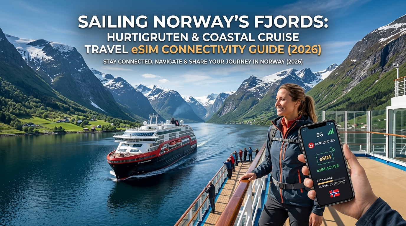
Sailing Norway's Fjords: Hurtigruten & Coastal Cruise Travel eSIM Connectivity Guide (2026)
The Coastal Cruise Connectivity Dilemma: Hurtigruten, Havila, and the Maritime Roaming Trap
The 2,500-nautical-mile voyage along the Norwegian Coastal Express—navigating from the historic wharves of Bergen north to the Arctic frontier of Kirkenes—is often heralded as the world’s most beautiful sea voyage. Spanning 34 ports of call through jagged fjords, remote archipelagos, and open ocean stretches, ships operated by Hurtigruten and Havila Voyages serve as both passenger cruise vessels and lifeline cargo carriers.
However, navigating modern digital connectivity along this route presents a unique technical conundrum for international travelers: relying on onboard satellite Wi-Fi often leads to severe bandwidth throttling, while failing to manage mobile network settings can trigger catastrophic maritime roaming fees.
The Reality of Onboard Cruise Wi-Fi: High Latency and Contention
While both Hurtigruten and Havila have modernized their fleets with hybrid satellite systems (including Starlink implementations on select vessels), shipboard Wi-Fi remains a shared, high-contention resource.
- Severe Peak-Hour Congestion: Bandwidth grinds to a halt during scenic cruising moments—such as transiting the UNESCO-protected Geirangerfjord or the narrow mouth of Trollfjorden—when hundreds of passengers simultaneously upload photos, stream 4K video, or attempt video calls.
- Fjord Obstruction & Latency Spikes: Steep fjord walls towering over 1,000 meters routinely block satellite line-of-sight, causing connection dropouts, high packet loss, and latency spikes exceeding 600ms.
- Premium Pricing Tiers: Access fees for shipboard Wi-Fi packages on coastal lines can cost upwards of €15 to €25 per day per device, often limited to single-device logins that cannot be shared via personal hotspot.
The "Maritime Satellite Roaming Trap": Beware MCP & Telenor Maritime
The most dangerous pitfall for cruise passengers is the Maritime Roaming Trap. When Hurtigruten or Havila vessels transition away from the immediate shoreline to cross exposed stretches of open sea—such as the notoriously rough waters of Stadhavet, Hustadvika, or Lopphavet—your smartphone automatically loses terrestrial cell tower signals.
Without manual intervention, modern smartphones automatically connect to the ship’s internal maritime cell tower (frequently broadcasting as Telenor Maritime, MCP, or NOR-01).
Because maritime satellite networks operate outside international roaming regulations and regional caps:
- Unregulated Pay-As-You-Go Rates: Data transfer via maritime micro-cells is billed at exorbitant rates, typically ranging from $10.00 to $22.00+ per megabyte.
- Silent Background Consumption: Background app refreshes, cloud photo backups, or system updates can consume 100 MB within minutes, resulting in instant $1,000+ surprise phone bills before arriving at the next port.
- No Automatic Caps: Many home carriers do not enforce domestic spending caps on international maritime satellite roaming.
Network Architecture: Onboard Wi-Fi vs. Maritime Satellite vs. Terrestrial eSIM
| Feature | Onboard Ship Wi-Fi | Maritime Cell (Telenor Maritime) | Terrestrial Travel eSIM |
|---|---|---|---|
| Typical Cost | €15–€25 / day | $10–$22+ / MB (Pay-as-you-go) | Fixed rate per GB (e.g., ~$2–$4/GB) |
| Connection Type | Shared LEO/GEO Satellite | Private Ship Satellite Micro-cell | Direct Coastal 4G / 5G Towers |
| Latency | 80ms – 600ms+ (Variable) | 700ms – 1,200ms | 20ms – 45ms (Low latency) |
| Bill Shock Risk | Zero (Prepaid) | Extreme (Postpaid billing trap) | Zero (Prepaid, auto-cutoff) |
| Hotspot Sharing | Blocked / Restricted per device | N/A | Fully supported |
The Smart Alternative: Independent Terrestrial Connectivity
Norway features one of the most advanced coastal telecommunications infrastructures on earth. Telia and Telenor have built high-gain, sea-facing 4G and 5G base stations along mountain peaks and isolated islets. Consequently, nearly 85% to 90% of the Norwegian Coastal Highway maintains direct line-of-sight terrestrial cellular reception, even several nautical miles offshore.
Securing an independent travel eSIM prior to departure allows travelers to bypass both sluggish onboard ship Wi-Fi and predatory maritime networks. Premium travel data providers like MollySIM offer dedicated multi-gigabyte Norway and regional Europe profiles that lock directly onto terrestrial networks.
Furthermore, unlike budget eSIM providers that cut off your connection entirely or throttle your speed to an unusable 128kbps once high-speed data expires, MollySIM enforces a 384kbps Fair Use Policy (FUP). At 384kbps—three times faster than standard competitor throttles—critical travel applications such as Google Maps, Apple Pay, banking authorization prompts, and messaging apps continue to function smoothly without leaving you stranded at an Arctic port.
Norwegian Coastal Telecom Infrastructure: 4G and 5G Coverage in Deep Fjords
🌐 Global Travel High-Speed Travel eSIM & SIM Plans
Instant QR code activation, hotspot enabled, with guaranteed 384kbps fallback speed to keep Maps & Digital Wallets active.
To understand how you can stream 4K video while drifting past sheer 1,000-meter vertical cliffs in the Norwegian Sea, you have to look at Norway's aggressive telecommunications strategy. Unlike many nations where remote rural areas become digital dead zones, Norway treats coastal connectivity as critical maritime safety and economic infrastructure.
Three primary mobile network operators (MNOs) power the country: Telenor, Telia Norway, and Ice.
The Big Three: Coastal Carrier Breakdown
- Telenor: As the former state telecommunications enterprise, Telenor commands the most extensive rural and maritime footprint in Scandinavia. It holds the largest share of low-band spectrum (Band 20 / 800 MHz and Band 28 / 700 MHz), which allows cellular signals to travel massive distances over open water and penetrate deep glacial valleys.
- Telia Norway: Telenor’s primary challenger features an exceptionally dense 5G footprint in Western Norway and major fjord hubs. In coastal cities like Ålesund, Molde, and Bodø, Telia frequently delivers raw downstream throughput exceeding 400 Mbps.
- Ice: Norway’s third carrier operates on a nationwide 4G/5G buildout, leaning on national roaming agreements with Telia outside its dedicated urban cells.
Engineering Connectivity Across Glacial Valleys and Open Seas
Delivering gigabit-capable wireless data across steep-walled fjords like Geirangerfjord, Nærøyfjord, and the razor-narrow Trollfjord requires unconventional cell-tower placement.
Norwegian telecom engineers place high-gain, down-tilted sector antennas on elevated mountain peaks (800 to 1,200 meters above sea level) rather than along shoreline sea level. Water acts as an exceptional radio wave reflector. The combination of line-of-sight propagation over seawater and elevated transmitters creates long-range RF coverage funneled directly into the fjord basins.
Even across wide ocean crossings—such as the notoriously rough Hustadvika stretch or traversing Vestfjorden toward the sheer granite walls of the Lofoten archipelago—coastal vessels consistently remain within line-of-sight of multiple island-based cellular masts.
| Fjord / Coastal Route Segment | Dominant Frequency Bands | Expected Coverage Stability | Typical Real-World Speeds |
|---|---|---|---|
| Geirangerfjord & Sunnylvsfjorden | 700 MHz (B28) / 800 MHz (B20) / 3.5 GHz (n78) | 92% continuous line-of-sight | 95 – 260 Mbps |
| Nærøyfjord & Aurlandsfjord | 800 MHz (B20) / 1800 MHz (B3) | 85% continuous line-of-sight | 60 – 180 Mbps |
| Lofoten Archipelago (Svolvær/Reine) | 700 MHz (B28) / 3.5 GHz (n78 5G) | 98% uninterrupted coastal coverage | 140 – 380 Mbps |
| Trollfjord Passage (Vesterålen) | 800 MHz (B20) | 75% coverage (intermittent near sheer cliffs) | 40 – 110 Mbps |
| Barents Sea / Nordkapp (71°N) | 700 MHz (B28) / 800 MHz (B20) | 88% along coastal shipping lanes | 50 – 150 Mbps |
Real-World Throughput: Cellular vs. Shipboard Satellite
Cruise ship Wi-Fi systems—even those upgraded to low-Earth-orbit (LEO) constellations like Starlink Maritime—funnel hundreds of passenger devices through shared shipboard access points, resulting in buffer-heavy connections, jitter, and strict packet-shaping policies.
In contrast, an independent terrestrial cellular link bypasses the ship's local network congestion entirely:
- Terrestrial 4G/5G Speeds: 100 to 300+ Mbps real-world download throughput; 30 to 60 Mbps upload.
- Terrestrial Latency: Stable 20ms to 45ms ping rates, enabling jitter-free VoIP, cloud syncing, and high-bitrate video streaming.
- Route Reliability: Over 90% of the classic 12-day Bergen–Kirkenes–Bergen route receives direct terrestrial signals.
Arctic Latitudes: Tromsø to the Barents Sea Coastline
North of the Arctic Circle, past the 70th parallel North through Tromsø, Hammerfest, and around the North Cape (Nordkapp) toward Kirkenes, Telenor maintains strategic military-grade base stations along the Finnmark coast. These towers provide reliable mobile broadband well into the Barents Sea shipping corridors.
To capitalize on this infrastructure without manual carrier swapping, using an adaptive travel profile from MollySIM allows your handset to connect to premier local Norwegian cell towers automatically. If your cruise itinerary includes heavy data consumption—such as uploading RAW camera files or video conferencing with colleagues back home—you are protected from sudden blackouts.
Even if you exhaust your high-speed allowance mid-voyage, MollySIM’s 384kbps Fair Use Policy (FUP) sustains essential data flow at triple the speed of legacy 128kbps limits. This ensures that route tracking in Google Maps, messaging on WhatsApp, biometric banking verifications, and Apple Pay checkouts continue to work reliably throughout Arctic port stops.
Comparative Breakdown: Coastal Ferry Wi-Fi vs. Maritime Satellite vs. Local SIM vs. Travel eSIM
Selecting the correct connectivity architecture for a Norwegian coastal voyage requires balancing throughput, latency, risk exposure, and hardware compatibility. Hurtigruten and Havila vessels navigate within sight of terrestrial cell towers for roughly 90% of their coastal transit, yet thousands of passengers default to oversubscribed onboard Wi-Fi or fall victim to exorbitant maritime cell traps.
The matrix below evaluates the technical and economic realities of the four primary connectivity channels along the Norwegian littoral corridor:
| Connectivity Parameter | Shipboard Satellite Wi-Fi (Starlink / VSAT) | Maritime Cellular Roaming (Telenor Maritime / MCP) | Local Norwegian Physical SIM (Telenor / Telia / MyCall) | MollySIM Scandinavian Multi-Network eSIM |
|---|---|---|---|---|
| Average Download / Upload Speeds | 5–25 Mbps down / 2–5 Mbps up (heavily congested during peak hours) | 1–8 Mbps down / 0.5–2 Mbps up | 100–300 Mbps down / 30–60 Mbps up (dependent on single-carrier coverage) | 100–300+ Mbps down / 30–60 Mbps up (adaptive multi-carrier switching) |
| Network Latency (Ping) | 60–120ms (Starlink) to 600ms+ (Legacy Geostationary) | 150–400ms | 20–45ms | 20–40ms |
| Typical Cost Basis | Free (Havila) or €10–€25/day (Hurtigruten non-suite tiers) | $5.00–$15.00+ per MB (Uncapped billing) | €30–€45 for 10–20 GB (+ physical SIM fee) | Fraction of shipboard costs; competitive per-GB tier pricing |
| Maritime Trap Vulnerability | None (Wi-Fi based) | Extreme: Auto-connects offshore with no regulatory rate caps | Low (locks strictly to land network) | Zero: APN profiles isolate device from satellite maritime base stations |
| Fjord Shadow Penetration | Spotty when sheer rock walls obstruct satellite line-of-sight | Dependent on line-of-sight to ship superstructure | Single-network locked; drops in rival carrier valleys | High: Dynamically roams across Telenor and Telia coastal nodes |
| Setup & Provisioning Friction | Portal login per device; frequent MAC-address session drops | Passive auto-connect (often leading to bill shock) | High: In-person passport/ID check required (Norwegian KYC law) | Zero: Instant digital installation via QR code prior to departure |
| Home SIM / 2FA Availability | Yes (Keeps primary SIM active in handset) | Yes (Exposes primary line to global maritime fees) | No (Requires physical SIM swap unless using dual-tray phone) | Yes: Retains home line for essential banking 2FA / SMS |
| Post-Quota FUP Safety Net | Hard cutoff or degraded to unusable <64kbps | None; continuous overage billing per kilobyte | Hard shutoff; requires manual online top-up portal | Uncapped 384kbps baseline (3x industry standard 128kbps) |
Technical Evaluation: Why Terrestrial Multi-Network eSIM Delivers Optimal ROI
Navigating the Norwegian Inside Passage (Indre Led) presents unique radio-frequency (RF) challenges that expose the flaws of single-network models and shipboard satellite services:
1. The Contention Ratio Bottleneck of Shipboard Wi-Fi
While newer coastal cruise vessels feature Starlink terminals, the bottleneck rarely lies in the satellite-to-ship downlink. Instead, the problem is local contention. When 400 to 600 passengers gather in the observation lounge during scenic passages like the Trollfjord or Hjørundfjord, shipboard Wi-Fi access points experience severe packet loss and radio frequency saturation. Bandwidth throttles to a crawl, rendering basic tasks like cloud backups or VoIP calling impossible.
2. The Multi-Carrier Fjord Advantage
Norway’s telecommunications topography is divided between Telenor and Telia. In narrow waterways such as the Geirangerfjord or Nærøyfjord, topography dictates coverage: one fjord wall may host a Telenor microcell, while the opposite mountain ridge relies on Telia. A standard local physical SIM locks you into a single carrier. If that carrier hits a blind spot behind a coastal massif, your data drops entirely.
An adaptive travel profile from MollySIM circumvents this by operating with multi-network core routing. Your handset continuously handshakes with the strongest available terrestrial mast, delivering consistent 100+ Mbps throughput where single-carrier SIM cards disconnect.
3. Protection from Unregulated Maritime Roaming
The single most expensive technical mistake on a Norwegian coastal voyage is allowing your handset to connect to MCP (Maritime Communications Partner) or Telenor Maritime base stations. When a ship drifts more than 2 nautical miles off the mainland—such as during the open-sea crossings of Hustadvika or the Folda—the vessel's internal cell site activates.
Unprotected phones with standard roaming enabled automatically lock onto this satellite-backhauled signal. Data rates on maritime networks often exceed $10.00 per megabyte, resulting in hundreds of dollars in background app refresh charges within minutes. Installing an eSIM before boarding mitigates this risk: its APN routing rules refuse connection to non-terrestrial MCC/MNC network codes, keeping your device anchored strictly to terrestrial Norwegian towers.
4. The 384kbps FUP Safety Net
Most travel eSIM providers enforce a harsh 128kbps (or lower) throttling limit once high-speed data caps are met. In practical field tests, 128kbps fails modern SSL/TLS handshake timeouts, effectively breaking interactive map rendering and secure point-of-sale systems.
MollySIM’s 384kbps Fair Use Policy (FUP) ensures that even if you consume your high-speed quota mid-voyage, critical applications remain functional. At 384kbps, the connection maintains sufficient bandwidth for:
- Continuous vector tile rendering on Google Maps and Apple Maps.
- Real-time GPS location telemetry and ferry timetable lookups.
- Instant messaging and voice-note processing over WhatsApp and Signal.
- Biometric push authentications for banking apps and Apple Pay/Google Wallet port checkouts.
Step-by-Step Configuration: Bypassing Maritime Traps via Manual Network Selection
To guarantee your smartphone never pairs with an exorbitant maritime satellite network (such as MCP, Telenor Maritime, or Telecom Italia Sparkle) during open-sea fjord transits, you must proactively decouple automated network switching.
By executing a manual network lock while still tied to the dock in ports like Bergen, Ålesund, or Tromsø, you force your modem firmware to ignore unauthorized non-terrestrial MCC/MNC broadcasts.
Dual-SIM Architecture Setup: Zero Roaming Risk with Active 2FA
Cruisers frequently require incoming SMS verification codes for banking authorizations, credit card verifications, or onboard purchases. You do not need to turn your primary domestic SIM completely offline to avoid roaming fees; you simply need to segregate voice/SMS channels from mobile data pathways.
| Setting Parameter | Primary Domestic SIM (Home Carrier) | Travel eSIM (MollySIM) | Technical Purpose |
|---|---|---|---|
| Line Status | ON | ON | Allows inbound 2FA SMS delivery. |
| Mobile Data | OFF | PRIMARY / ACTIVE | Routes all internet traffic through the prepaid bundle. |
| Data Roaming | DISABLED / OFF | ENABLED / ON | Prevents home carrier from charging accidental data fees. |
| Cellular Data Switching | DISABLED / OFF | N/A | Stops phone from switching data back to home SIM in dead zones. |
Step-by-Step Manual Carrier Locking
Execute these steps prior to the vessel departing the harbor terminal:
For iOS (Apple iPhone)
- Open Settings > Cellular (or Mobile Data).
- Under the SIMs section, select your MollySIM data profile.
- Tap Network Selection.
- Toggle the Automatic switch to OFF.
- Wait 15–30 seconds while the device scans local frequencies. A list of available carriers will populate.
- Explicitly select Telenor N or Telia N.
- Return to the main Cellular screen and ensure Allow Cellular Data Switching is toggled OFF.
For Android (Samsung One UI, Google Pixel, & Stock Android)
- Open Settings > Connections (or Network & Internet) > SIM manager.
- Set your Preferred SIM for Mobile data to MollySIM.
- Tap Mobile networks > Network operators (on Google Pixel: Settings > Network & internet > SIMs > MollySIM > scroll to Automatically select network).
- Disable Select automatically.
- Choose Telenor or Telia from the generated list of broadcast IDs.
- Verify under your Primary SIM settings that Data roaming remains toggled OFF.
Arctic Battery Optimization: Mitigating "Tower Hunting" Drain
When navigating past towering vertical cliff walls—such as the narrow passages of the Trollfjord or the Geirangerfjord—coastal base station signals undergo significant knife-edge diffraction and physical attenuation.
In sub-zero Arctic temperatures, standard smartphone modems dramatically ramp up RF transmission power (up to 23 dBm / 200 mW) attempting to handshake with distant mainland towers, which rapidly degrades lithium-ion battery performance.
To preserve battery life without losing critical connectivity:
- Lock Cellular Radios to LTE/4G: Norwegian 5G standalone (SA) networks along remote maritime corridors can cause persistent 5G/LTE band-hunting loops. Navigate to Voice & Data (iOS) or Preferred network type (Android) and switch from 5G Auto / 5G On to 4G / LTE. This stabilizes the radio transceiver on low-frequency 800MHz (Band 20) carriers that penetrate deep into fjord corridors.
- Rely on Sustained FUP Capabilities: Constantly toggling Airplane Mode on and off forces modern OS architectures to run aggressive background cache validations every time a connection is re-established. Leaving your connection live on MollySIM ensures uninterrupted background telemetry; even if your high-speed quota is exhausted, the baseline 384kbps Fair Use Policy speed—triple the industry-standard 128kbps throttle—maintains functional GPS caching on Apple Maps and Google Maps without triggering high-power connection renegotiations.
- Keep Devices Insulated: Keep your phone in an inside jacket pocket close to body heat when observing scenic passages from open cruise decks to prevent low-temperature voltage drops from shutting down the baseband processor.
MollySIM Scandinavian Multi-Network 5G and the 384kbps Aurora Safety Net
Navigating Norway’s 1,190 fjords presents a distinct telecommunications challenge: sheer vertical granite walls act as physical radio-frequency (RF) shields, creating severe signal shadowing. While local physical SIMs tether your device to a single domestic carrier's infrastructure, the MollySIM Norway and Scandinavian eSIM deploys dynamic multi-network roaming across Norway's primary telecommunications backbones: Telenor Norge and Telia Norge.
Dynamic Dual-Carrier Architecture: Telenor & Telia Auto-Switching
Instead of locking to a single Public Land Mobile Network (PLMN), MollySIM’s underlying core network actively evaluates Real-Time Signal Quality Indicators (RSRP and RSRQ).
- Telenor Norge: Delivers unmatched low-band coverage (Band 20 / 800MHz and Band 28 / 700MHz) across open sea lanes, isolated lighthouses, and remote northern ports like Honningsvåg and Kirkenes.
- Telia Norge: Provides dense micro-cell arrays and localized high-capacity 5G Standalone (SA) and Non-Standalone (NSA) pipelines within narrow coastal corridors, island archipelagos like Lofoten, and transit hubs (Bergen, Trondheim, Tromsø).
If your vessel sails into a topographic dead-zone where a Telenor coastal mast is obscured by a mountain ridge, your device automatically shifts to Telia’s available cell site without requiring manual network searches in your device settings.
Unthrottled 5G NR Pipelines for Coastal Content Workflows
Cruising through UNESCO-protected waters like Geirangerfjord or Nærøyfjord often coincides with heavy digital throughput demands—from offloading 4K ProRes drone footage to cloud storage to conducting video calls from the ship’s panoramic observation lounge.
MollySIM provides unthrottled access to Norway's mid-band 5G spectrum (3.5 GHz / Band n78) and low-band coverage (700 MHz / Band n28). This architecture delivers downlinks exceeding 450 Mbps and uplinks between 40 to 85 Mbps in coastal towns, ensuring that creative workflows and mission-critical remote work remain completely uninhibited by local Wi-Fi congestion.
The 384kbps Aurora Safety Net: Real-World Utility Breakdown
The critical differentiator for Arctic travelers is what happens when your primary high-speed data tier is depleted. Standard travel eSIM providers enforce aggressive Fair Use Policy (FUP) throttles down to 128kbps or 64kbps—bandwidth levels where modern HTTPS handshakes time out, rendering mapping and push notifications useless.
MollySIM implements an industry-leading 384kbps unlimited fallback speed (3x the industry standard). This specific bandwidth threshold ensures your essential telemetry, navigation, and Arctic safety applications continue running smoothly without paying for emergency top-ups.
| Service / App | Standard 128kbps Throttle | MollySIM 384kbps Fallback | Operational Impact on Coastal Cruise |
|---|---|---|---|
| Real-Time Aurora Trackers (SpaceWeatherLive, NorwayLights) | ❌ Connection Timeouts / Stalled Solar Wind Feeds | ✅ Instant Kp-Index & Magnetometer Data | Real-time push alerts trigger in time to catch sudden auroral substorms on deck. |
| Marine AIS Tracking (MarineTraffic, VesselFinder) | ❌ Map Tile Rendering Fails | ✅ Live Vector Rendering & Ship Speeds | Track vessel coordinates, maritime waypoints, and passing ship telemetry. |
| Vector GPS Navigation (Apple Maps, Google Maps) | ❌ Blank Offline Grid Errors | ✅ Functional Route & Satellite Vector Loading | Safe navigation during shore excursions in ports like Ålesund and Tromsø. |
| VoIP Voice & Messaging (WhatsApp, Signal, iMessage) | ⚠️ Audio Distortion / Dropped Packets | ✅ Crystal-Clear VoIP Audio & Instant Texts | Coordinate meetups with travel companions across large cruise vessels. |
| Mobile Payment Auth (Apple Pay, Google Wallet) | ❌ Token Handshake Latency Timeouts | ✅ Instant Gateway Verification | Uninterrupted transactions at remote northern terminals and ferry docks. |
By maintaining this 384kbps operational floor, your device preserves access to live solar wind telemetry, navigational vector data, and communication channels along the entire Arctic route from Bergen to the Russian border.
Fjord-by-Fjord Connectivity Map & Arctic Voyage Best Practices (Bergen to Kirkenes)
Navigating Norway’s 2,400-kilometer coastal highway via Hurtigruten or Havila introduces unique RF (radio frequency) propagation challenges. While coastal base transceiver stations (BTS) managed by Telenor and Telia line the shipping lanes, steep vertical bathymetry, narrow sea chasms, and reinforced marine hulls directly impact your mobile throughput.
Coastal Corridor Telemetry: Leg-by-Leg Coverage Expectations
+-------------------------------------------------------------------------------------------------------------------------+
| ROUTE LEG                   | EXPECTED SPEEDS     | NETWORK ANCHORS   | NOTABLE CELLULAR CHARACTERISTICS                |
+-------------------------------------------------------------------------------------------------------------------------+
| 1. Southern Fjords          | 5G / High-band 4G   | Telenor / Telia   | Excellent in open sounds; intermittent optical  |
|    (Bergen to Ålesund)      | (100–450 Mbps)      |                   | shadowing inside deep Geiranger/Hjørund cuts.   |
+-------------------------------------------------------------------------------------------------------------------------+
| 2. Helgeland Archipelago    | 4G LTE / Mid-band   | Telenor Norway    | Stable coverage past Torghatten & Seven         |
|    (Brønnøysund to Bodø)    | (35–120 Mbps)       |                   | Sisters; brief drops crossing Arctic Circle.    |
+-------------------------------------------------------------------------------------------------------------------------+
| 3. Lofoten & Vesterålen     | 5G Ultra-Dense      | Telia / Ice.net   | Full coverage across Vestfjorden; micro-outage  |
|    (Stamsund to Harstad)    | (150–500 Mbps)      |                   | when entering the sheer granite Trollfjord.     |
+-------------------------------------------------------------------------------------------------------------------------+
| 4. Tromsø Whale Route       | 4G LTE / 5G Hybrid  | Telenor Norway    | Robust coastal cells; maritime fringe coverage  |
|    (Finnsnes to Skjervøy)   | (50–200 Mbps)       |                   | offshore during winter whale migration paths.   |
+-------------------------------------------------------------------------------------------------------------------------+
| 5. Finnmark & Far North     | 4G LTE (Long-range) | Telenor Norway    | Barents Sea exposure; towers placed on headlands|
|    (Hammerfest to Kirkenes) | (15–60 Mbps)        |                   | create edge-of-cell handoff latencies.         |
+-------------------------------------------------------------------------------------------------------------------------+
Deep Dive: Navigational Sectors and Cellular Geodesics
1. Southern Fjords (Bergen – Måløy – Torvik – Ålesund – Geiranger/Hjørundfjord)
Leaving Bergen, vessels hug the coastline with line-of-sight exposure to mainland 5G towers. However, as the ship turns inland toward the UNESCO-listed Geirangerfjord or seasonal Hjørundfjord, vertical granite walls towering 1,000+ meters above sea level create severe optical shadowing.
- RF Behavior: High-band 5G drops back to sub-1GHz LTE (Band 20 / 800MHz). Expect signal bounce off sheer stone faces, which can cause micro-fading.
- Connectivity Tip: As you navigate the tight bends near the Seven Sisters Waterfall, rely on cached navigation; cellular arrays mounted at fjord entrances struggle to penetrate inner basin coves.
2. Arctic Circle Crossing & Helgeland Coast (Brønnøysund – Sandnessjøen – Nesna – Ørnes)
Passing the iconic hole in Torghatten mountain and the Seven Sisters (De syv søstre) mountain range, your ship navigates tens of thousands of low-lying skerries. Coverage here relies heavily on coastal navigation towers shared between maritime light systems and mobile base stations.
- RF Behavior: Crossing the Arctic Circle (66°33′N) at Vikingen involves open-water channels where the ship shifts between mainland arrays and island repeaters on Træna and Rødøy.
- Fallback Utility: When transitions cause momentary standard-packet drops, an eSIM from MollySIM running on its 384kbps continuous fallback limit avoids data stalls, keeping real-time GPS telemetry and marine traffic tracking responsive while standard 128kbps throttling models fail.
       Granite Fjord Wall (1,000m+)
            /|
           / |  <-- Shadow Zone (Signal Deflected)
          /  |
         /   |      [ Cruise Vessel ]
        /    | ~~~~~~~~ [####] ~~~~~~~~~
       /     |             |
Cell Tower   |       RF Line-of-Sight Blocked
 [((o))]     |
3. Lofoten Wall, Raftsundet & The Trollfjord Gap
Navigating across the choppy open waters of Vestfjorden toward Stamsund offers continuous line-of-sight to the towering "Lofoten Wall" (Lofotveggen). Telecom operators have heavily densified this tourist corridor with 5G macrocells.
- The Trollfjord Exception: The entry into Trollfjord is a classic dead zone. The channel is merely 100 meters wide with vertical cliffs blocking all lateral RF vectors. Expect zero coverage for approximately 25 minutes while the captain executes the vessel turn inside the basin.
4. The Tromsø Whale Corridor & North Cape (Honningsvåg to Barents Sea)
North of Tromsø—through the Kvænangen fjord system and around the exposed Nordkinn Peninsula—vessels face the open Arctic Ocean. Base stations are situated high on coastal capes (such as the 307-meter cliff of Nordkapp).
- RF Behavior: Long-range 800MHz (B20) signals extend up to 20 nautical miles out to sea, but signal strength drops rapidly in heavy swells due to sea-surface multipath interference.
- Russian Border Proximity (Kirkenes): Approaching Kirkenes and the Bøkfjorden basin, your device may detect non-EEA cell towers across the Russian border (Megafon/MTS). Ensure your device’s network selection remains locked to Norwegian partners (Telenor/Telia) to avoid unexpected non-EU roaming rates.
Critical Shipboard Best Practices for Arctic Cruising
Defeating the Steel Hull "Faraday Cage"
Modern coastal cruise liners (including Hurtigruten’s MS Roald Amundsen or Havila’s Capella) are floating fortresses of marine-grade steel, reinforced insulation, and solar-reflective metallized glass.
+----------------------------------------------------------------------------------------------------+
| VESSEL LOCATION                  | SIGNAL STRENGTH (RSRP) | PRACTICAL THROUGHPUT & USABILITY       |
+----------------------------------------------------------------------------------------------------+
| Top Observation Deck (Open Air)  | -72 dBm (Excellent)    | Full 5G Multi-Carrier Aggregation      |
| Forward Panorama Lounge (Glass)  | -92 dBm (Good)         | 4G/5G stable; slight attenuation       |
| Balcony Cabin (Aft / Port / Stbd)| -98 dBm (Fair to Good) | Excellent direct line toward shoreline |
| Interior Lower Deck Cabins       | -118 dBm to No Service | Severe steel hull attenuation (Faraday)|
+----------------------------------------------------------------------------------------------------+- Action: If you are staying in an interior cabin below the waterline, your device will rapidly cycle frequencies and drain battery power searching for signal. Use airplane mode while inside lower decks, or step out to public observation lounges and deck spaces when updating voyage logs or downloading route data.
Pre-Caching Offline Bathymetric and Topographic Charts
Cellular data along the coastal highway is dependable, but unpredictable Arctic squalls and fjord deflections can momentarily disrupt high-frequency bands.
- Download Norgeskart Outdoors (official Norwegian mapping authority data) and Navionics Boating offline vector tiles prior to departing Bergen or Tromsø.
- With MollySIM's persistent connectivity, even if you breach your primary high-speed data tier while streaming 4K video of the landscape, the 384kbps baseline floor (3x faster than the 128kbps industry standard) allows dynamic navigation overlays, marine traffic (AIS) pings, and payment authorizations via Apple Pay/Google Wallet to execute reliably without manual data top-ups.
Polar Night vs. Midnight Sun Power & Radio Management
- Polar Night (Mørketid / Aurora Hunting): Operating smartphones on freezing open decks (-15°C to -25°C wind chill in Finnmark) causes lithium-ion chemical reactions to stall, leading to sudden battery voltage drops. Keep an external power bank warm inside an inner pocket and mount your device on a non-conductive carbon-fiber tripod to prevent rapid thermal battery loss while monitoring real-time auroral magnetometers (SpaceWeatherLive / NorwayLights).
- Midnight Sun (Summer Glare & Overheating): Continuous 24-hour sunlight paired with processing high-resolution mirrorless camera transfers can cause smartphones to thermally throttle screen brightness and cellular modems. Keep devices shielded from direct solar radiation during long midsummer fjord transits.
🌐 Global Travel High-Speed Travel eSIM & SIM Plans
Instant QR code activation, hotspot enabled, with guaranteed 384kbps fallback speed to keep Maps & Digital Wallets active.