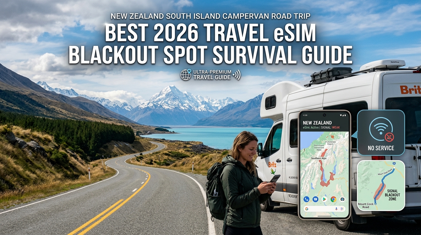
New Zealand South Island Campervan Road Trip: Best 2026 Travel eSIM & Blackout Spot Survival Guide
The South Island Connectivity Challenge: Southern Alps Topography & Freedom Camping Realities
Traversing New Zealand’s South Island (Te Waipounamu) in a campervan offers some of the most breathtaking wilderness landscapes on the planet, but it also presents one of the most formidable telecommunications environments in the developed world. The main geological culprit is the Southern Alps, a 500-kilometer continuous spine of razor-sharp peaks reaching up to 3,724 meters (Aoraki / Mount Cook).
This massive mountain barrier—combined with the dense temperate rainforest corridors of the West Coast and the sheer vertical granite walls of Fiordland—drastically restricts cellular infrastructure. Cell towers require line-of-sight transmission or physical fiber-optic backhaul. In regions like Haast Pass (SH6), Arthur’s Pass (SH73), and the Milford Road (SH94), rugged terrain and extreme weather make laying fiber and maintaining repeater masts logistically difficult and commercially unviable. As a result, road-trippers regularly encounter extensive cellular dead zones stretching for 50 to 120 kilometers at a time.
       [ West Coast / Tasman Sea ]
                  |
    ~~~~ Rainforest Corridors (SH6) ~~~~
                  |
      ▲▲▲▲ SOUTHERN ALPS (Spine) ▲▲▲▲   <-- Blocks Cellular RF Signals
                  |
    ..... High Country / MacKenzie Basin .....
                  |
       [ East Coast / Pacific Ocean ]
Why Real-Time Connectivity Is Critical for Campervans in 2026
Modern freedom camping in New Zealand is no longer an off-grid, low-tech endeavor. Strict regulatory enforcement, volatile alpine weather systems, and infrastructure bottlenecks mean sustained data connectivity is a vital safety layer rather than a mere luxury.
Campervan travelers must constantly monitor three essential data streams:
- Alpine Road Conditions & Pass Closures (Waka Kotahi NZTA):
New Zealand’s alpine passes can close within minutes due to rockfalls, heavy snow, or river washouts. High-sided motorhomes face severe rollover risks during gale-force wind events in the Canterbury Plains and Lindis Pass. The Waka Kotahi NZTA Journey Planner is essential for tracking real-time highway statuses, detour routes, and mandatory snow chain requirements.
- Dynamic Weather Tracking (MetService):
The West Coast receives up to 10 meters of rainfall annually. Atmospheric rivers frequently dump torrential rain, triggering flash floods that submerge low-lying coastal campsites. Access to MetService live weather radar animations, marine swell alerts, and alpine elevation snow levels is non-negotiable for safe vehicle placement.
- Dynamic DOC & Local Council Regulations:
Under the Self-Contained Motor Vehicles Legislation Act, non-certified or green-warrant certified campervans face strict local council bylaws. Freedom camping in areas like the Queenstown-Lakes District, Mackenzie Basin, and Fiordland is heavily geofenced. Using apps like CamperMate or the official Department of Conservation (DOC) portal to verify designated overnight sites, track active fire bans, and pay camp fees prevents instant NZ$400 council fines.
| Essential Service | Primary Mobile App / Portal | Critical Data Requirement | Risk of Zero Connectivity |
|---|---|---|---|
| Highway Safety | Waka Kotahi NZTA | Real-time road alerts, detour mapping, alpine chain advisories | Getting trapped on closed alpine passes (e.g., Arthur's Pass, SH94) |
| Severe Weather | MetService NZ | Dynamic Doppler radar maps, wind shear forecasts | Parking in flash-flood zones or driving high-profile vans in gale winds |
| DOC Compliance | DOC Portal / CamperMate | Real-time freedom camping boundaries, space availability | NZ$400 infringement notices from council enforcement officers |
The Safety Net: Avoiding Total Data Blackouts
When navigating remote segments of Otago, Canterbury, and the West Coast, high-speed data allowances can deplete quickly due to heavy GPS routing, background photo backups, and multi-app syncing. On standard international roaming profiles or lower-tier travel eSIMs, running out of primary data triggers a brutal throttle down to 128kbps—or cuts the connection entirely. A 128kbps connection regularly fails to load interactive MetService radar loops, Waka Kotahi detour maps, or banking verification screens.
Using a specialized travel provider like MollySIM mitigates this failure point. Even after your primary high-speed data allocation is fully consumed, MollySIM's Fair Use Policy maintains a 384kbps throttled baseline—three times faster than standard competitor eSIMs. This ensures that even in edge-of-grid coverage zones, life-critical background services, real-time Google Maps telemetry, WhatsApp text check-ins, and contactless Apple Pay transactions continue to function without interruption.
Spark vs. One NZ vs. 2degrees: South Island Network Infrastructure & Performance Matrix
🌐 Global Travel High-Speed Travel eSIM & SIM Plans
Instant QR code activation, hotspot enabled, with guaranteed 384kbps fallback speed to keep Maps & Digital Wallets active.
Navigating the South Island’s rugged geography requires an understanding of how New Zealand's physical mobile networks operate. The Southern Alps, deep glacial fjords, and vast coastal plains create extreme physical barriers for RF (Radio Frequency) propagation. The performance of any travel eSIM, physical SIM, or Wi-Fi device comes down entirely to which physical base stations (cell towers) and frequency bands your device can access.
       +-------------------------------------------------------------------------+
       |             SOUTH ISLAND RF PROPAGATION & SPECTRUM DYNAMICS             |
       +-------------------------------------------------------------------------+
       |  BAND 28 (700 MHz)        | Low Frequency  | Long Range | High Foliage Penetration |
       |  BAND 3 (1800 MHz)        | Mid Frequency  | Balanced Capacity / Highway Corridors |
       |  BAND n78 (3.5 GHz - 5G)  | High Band      | Ultra-Fast | Urban Density Only       |
       +-------------------------------------------------------------------------+
Spectrum Allocation & The Primacy of Band 28 (700 MHz)
New Zealand's three Tier-1 mobile network operators (MNOs)—Spark, One NZ (formerly Vodafone NZ), and 2degrees—deploy services across distinct LTE and 5G frequency allocations:
- Band 28 (700 MHz APT): The absolute lifeline of South Island campervan connectivity. Because lower radio frequencies travel further and penetrate dense beech forests, rolling tussock hills, and rain shadow valleys far better than higher frequencies, Band 28 is the primary spectrum deployed across rural state highways (SH6, SH8, SH73, SH94).
- Band 3 (1800 MHz) & Band 7 (2600 MHz): Deployed along high-traffic transit corridors and regional hubs (e.g., Queenstown, Wanaka, Nelson, Blenheim) to provide high-throughput data capacity.
- Band n78 (3.5 GHz 5G): Confined to dense population centers like Christchurch, Dunedin, Queenstown, and Invercargill. 5G drops off rapidly once you venture 10 kilometers outside urban perimeters.
Ensure that your handset supports LTE Band 28. A device lacking Band 28 hardware filters will lose signal the moment you drive past the outskirts of Rolleston or Mosgiel, regardless of your chosen carrier.
Tier-1 Carrier Footprint Analysis
1. Spark New Zealand
Spark operates the most extensive legacy rural macro-tower footprint across the South Island. Inheriting the historical infrastructure of the national telecommunications utility, Spark maintains robust transmission links along difficult alpine passes and isolated stretches of the West Coast. If you are parked deep in Arthur’s Pass or inside the Aoraki/Mount Cook basin, Spark’s Band 28 transmitters offer the highest probability of an active line of sight.
2. One NZ (Formerly Vodafone NZ)
One NZ holds a competitive infrastructure share across the South Island, with targeted strengths along primary coastal shipping routes, central Otago vineyards, and high-volume tourist loops. While their rural footprint rivals Spark in Canterbury and Otago, certain deep fjord cuts and remote West Coast valleys exhibit localized dead spots where Spark towers remain the sole broadcaster.
3. 2degrees
2degrees provides fast, modern 5G networks in urban hubs and competitive 4G service along major state highway arteries. However, their rural cell site density in deep wilderness areas (such as Fiordland, the Catlins, and the remote reaches of Kahurangi National Park) trails Spark and One NZ. In deep rural valleys, a single-carrier 2degrees profile is the most prone to drop connection completely.
South Island Connectivity Matrix: Direct Comparison
The following matrix benchmarks physical local SIMs, traditional hardware rentals, and dynamic eSIM roaming architectures across real-world South Island overland routes.
| Evaluation Metric | Spark Physical / eSIM | One NZ Physical / eSIM | 2degrees Physical / eSIM | Traditional Pocket Wi-Fi | MollySIM New Zealand Travel eSIM |
|---|---|---|---|---|---|
| Rural South Island Coverage | Superior (Extensive legacy rural macro-towers) | Very Strong (High density along primary transit routes) | Moderate (Urban-focused; thinner in alpine valleys) | Dependent on embedded single-carrier SIM | Optimized (Dynamic multi-network auto-switching) |
| Band 28 (700 MHz) Support | Full Native Support | Full Native Support | Full Native Support | Device dependent (often lacking Band 28) | Full Native Support (Handset pass-through) |
| Dead-Zone Failover Capability | None (Single-network lock) | None (Single-network lock) | None (Single-network lock) | None (Locked to one carrier provider) | Active (Switches between available local towers) |
| Multi-Network Carrier Switching | No | No | No | No | Yes (Connects to best available Tier-1 signal) |
| Airport Pickup & Setup Friction | High (Queues at CHC/ZQN kiosks, passport scanning) | High (Airport retail counter wait times) | High (Store check-in and manual SIM swapping) | High (Deposit required, return logistics, charging hassle) | Zero (Digital QR install via app before departure) |
| Post-Cap Safety Net (FUP) | Hard stop or expensive add-on data packs | Hard stop or 128kbps throttle (unusable for maps) | Hard stop or 128kbps throttle | Variable; severe throttling once daily cap reached | 384kbps Constant Throttle (Maintains Maps, Banking, Apple Pay) |
| Cost Efficiency (14–30 Day Trip) | NZ$49–$79 (Limited flexibility) | NZ$49–$85 (Prepaid tourist tiers) | NZ$40–$70 (Lower cap allowances) | NZ$150–$300+ (High daily rental fees + deposits) | High (Dynamic sizing: 1GB to 50GB starting under US$5) |
Why Single-Carrier Locks Fail Campervan Itineraries
The primary structural risk of buying a single local SIM card (e.g., buying exclusively from a Spark or One NZ retail store at Christchurch Airport) is the single-carrier coverage lock.
In the complex topography of the South Island, local telecommunications coverage shifts dynamically:
- In Mount Cook Village, a specific Spark cell site on the valley floor might provide 4 bars of Band 28 LTE, while One NZ drops down to 3G or searching status.
- Driving south through the Haast Pass towards Wanaka, the situation can invert: One NZ may catch an active micro-repeater signal along SH6 where Spark temporarily blackouts.
+-----------------------------------------------------------------------------------+
|               SINGLE-CARRIER LOCK vs. DYNAMIC MULTI-CARRIER FAILOVER              |
+-----------------------------------------------------------------------------------+
|  SINGLE SIM:   [Device] --------> Spark Cell Site --------> [Dead Zone if Shadowed]|
|                                                                                   |
|  MOLLYSIM:     [Device] --------> Spark Cell Site (Primary)                       |
|                   |                                                               |
|                   +-------------> One NZ / 2degrees (Auto-Failover if Shadowed)   |
+-----------------------------------------------------------------------------------+
Relying on a single domestic carrier creates unavoidable communication dead zones throughout your trip. By utilizing an agile multi-network roaming platform like MollySIM, your campervan’s connectivity does not stay trapped on an isolated, out-of-range tower. The eSIM negotiates with multiple Tier-1 local host networks, automatically handing over your active session to the strongest local carrier in that specific valley.
Coupled with a 384kbps Fair Use Policy baseline—which is three times faster than standard 128kbps competitor throttles—you prevent total navigation lockouts, maintain access to emergency radar data, and keep offline map updates processing reliably even if your high-speed tier runs dry.
Surviving South Island Cellular Blackout Zones: SH94 Milford Road, Haast Pass, and Glacier Country
The Southern Alps create colossal topographic barriers that completely block radio frequency propagation. Even the most robust multi-network cellular configurations hit absolute physical limits when traversing deep glacial valleys, remote rainforest gorges, and alpine passes.
When navigating these corridors in a campervan, you must know exactly where the signals cut out, how long you will remain completely offline, and how to execute a proactive data-caching workflow before leaving staging towns.
Anatomy of the South Island’s 4 Major Cellular Dead Zones
+---------------------------------------------------------------------------------------------------+
| CORRIDOR / HIGHWAY        | BLACKOUT DISTANCE     | LAST STABLE SIGNAL HUB | RECOVERY POINT       |
+---------------------------+-----------------------+------------------------+----------------------+
| SH94: Milford Road        | ~120 km (No 3G/4G/5G) | Te Anau Downs          | Milford Sound Wharf  |
| SH6: Haast Pass Corridor  | ~80 km mountain void  | Makarora Country Cafe  | Haast Township       |
| SH73: Arthur's Pass       | ~65 km alpine gorge   | Springfield / Sheffield| Kumara Junction      |
| West Coast Glacier Valleys| Intermittent pockets  | Franz Josef Township   | Fox Glacier Hub      |
+---------------------------------------------------------------------------------------------------+
1. State Highway 94: Te Anau to Milford Sound (Fiordland)
The 119-kilometer stretch from Te Anau Downs to Milford Sound is the longest continuous highway dead zone in New Zealand. As you enter the Eglinton Valley, towering granite massifs sever tower line-of-sight entirely.
- The Hazard: Sudden road closures due to rockfalls, avalanche control around the Homer Tunnel, or severe surface flooding. If you have not cached your DOC campsite permits, navigation routes, and road alerts before departing Te Anau, you will drive blind for up to 2.5 hours.
2. State Highway 6: Haast Pass (Wanaka to the West Coast)
Connecting the dry terrain of Central Otago to the temperate rainforests of the West Coast, the Haast Pass cuts through a deep, narrow canyon flanked by Mount Aspiring National Park.
- The Hazard: Mobile coverage terminates abruptly past Makarora and does not re-engage until you clear the Haast River mouth. Landslips and single-lane bridge bottlenecks require real-time updates that are unavailable on the pass itself.
3. State Highway 73: Arthur’s Pass (Canterbury to West Coast)
Crossing the main divide via the Otira Viaduct exposes campervans to high winds, sub-zero conditions, and sudden snow closures. Cellular coverage drops outside Springfield, re-emerges briefly as a low-capacity signal at Arthur’s Pass Village, and vanishes again down the steep Otira Gorge.
4. Glacier Country: Fox Glacier & Franz Josef Access Roads
While both glacier village centers maintain functional cell sites, moving even two kilometers into the access valleys (such as the glacier walk trailheads or Gillespies Beach) immediately triggers dead-zone conditions due to lateral moraine shadowing.
The Gateway Staging Protocol: Preloading Offline Assets
To ensure uninterrupted travel through these communication voids, use your high-speed data allocation in gateway staging hubs (Queenstown, Te Anau, Wanaka, and Hokitika) before entering the dead zones.
                  [ GATEWAY TOWN: Full 5G/4G Data via MollySIM ]
                                         |
     +-----------------------------------+-----------------------------------+
     |                                   |                                   |
     v                                   v                                   v
[CAMPERMATE]                      [GOOGLE MAPS]                       [TOPO50 NZ]
Download Offline Database:        Download Offline Areas:             Pre-cache Offline Map Tiles:
- Freedom Camping Rules           - Full Fiordland Sector             - High-res Topo Vectors
- Public Dump Stations            - West Coast SH6 Corridor           - Track Elevation Profiles
- Emergency Satellite Spots       - Arthur's Pass SH73                - Backcountry DOC Huts
Step-by-Step Staging Workflow
- Download Google Maps Offline Sectors:
- Open Google Maps in your staging hub (e.g., Wanaka or Te Anau).
- Tap your profile icon > Offline maps > Select your own map.
- Drag the bounding box over the entire Fiordland or West Coast region (each sector typically uses 250MB–500MB of storage).
- Benefit: Turn-by-turn vehicle routing, speed limits, and point-of-interest searching continue to function via GPS without active cellular data.
- Sync the CamperMate Offline Database:
- Open CamperMate while connected to high-speed data.
- Navigate to Settings > Offline Map Downloads > Select South Island.
- Benefit: Unlocks offline access to localized council freedom-camping bylaws, potable water points, public dump stations, and road hazard user-reports.
- Cache High-Resolution Topographic Maps (Topo50 NZ):
- If you plan to hike off the highway corridors (e.g., Routeburn, Roys Peak, or Key Summit), open your LINZ Topo50 app and download the regional map sectors.
- Benefit: Vector-level terrain detail, river crossings, and contour lines remain readable with standalone phone GPS hardware.
- Pull Live Waka Kotahi (NZTA) & MetService Hazard Bulletins:
- Prior to leaving your staging hub, load the live traffic dashboards for alpine passes. Note any active weather warnings for torrential rainfall or ice.
Low-Bandwidth Edge Performance: Why Baseline Throttle Speeds Matter
When exiting a mountain blackout corridor, your device doesn't instantly jump to full 5G. Instead, it catches heavily attenuated, fringe cell signals at the boundary edges (such as hilltops or open river valleys).
Standard travel eSIMs throttle users to an unworkable 128kbps once high-speed caps are reached, causing navigation re-routing to fail and critical travel apps to time out entirely.
By contrast, using a high-performance profile like MollySIM ensures your connection maintains a 384kbps Fair Use Policy baseline—three times faster than legacy alternatives. This speed delta keeps lightweight vector map rendering, instant messaging for emergency check-ins, and basic contactless authentications (like Apple Pay or online parking passes) fully functional, even on marginal edge-of-grid signals.
The Campervan Dual-SIM Blueprint: Securing Bank 2FA and Avoiding Roaming Bill Shock
Navigating the South Island in a campervan requires juggling two distinct connectivity demands: maintaining unthrottled, low-latency mobile data for remote navigation, and keeping your domestic phone line reachable for critical Two-Factor Authentication (2FA) security codes from banks and booking platforms.
Relying on a single domestic carrier plan risks catastrophic daily roaming charges (often $10–$15/day). Conversely, swapping out your physical SIM card entirely cuts off real-time fraud alerts and transaction approvals when paying for self-contained campsite permits or remote fuel pumps.
The optimal configuration runs a Dual-SIM active standby architecture: your domestic carrier remains active exclusively for zero-cost incoming SMS, while a high-throughput travel profile like MollySIM handles 100% of cellular data routing.
Step-by-Step OS Configuration Protocol
To prevent your home carrier from silently billing background data packets, configure your device settings prior to landing at Christchurch (CHC) or Queenstown (ZQN) Airport.
+---------------------------------------------------------------------------------------+
|                                DUAL-SIM TRAFFIC ROUTING                               |
+---------------------------------------------------------------------------------------+
|  [ Domestic Physical SIM / Primary eSIM ]  --->  Voice & Incoming SMS (Bank 2FA Only) |
|  [ Data Roaming: OFF ]                                                                |
+---------------------------------------------------------------------------------------+
|  [ MollySIM Travel Data Profile ]          --->  100% Mobile Data, VoIP, GPS Streams |
|  [ Data Roaming: ON ]                                                                 |
+---------------------------------------------------------------------------------------+
On iOS (iPhone 12 through iPhone 16 Pro):
- Navigate to Settings > Cellular (or Mobile Data).
- Under SIMs, label your physical/home line as "Primary" and your travel profile as "MollySIM".
- Tap Cellular Data and select MollySIM.
- Crucial Roaming Trap Prevention: Toggle "Allow Cellular Data Switching" to OFF. Leaving this enabled allows iOS to route background data via your primary line if local signal dips, triggering instant carrier day-passes.
- Tap your Primary Line, ensure Turn On This Line is enabled, but switch Data Roaming to OFF.
On Android (Google Pixel, Samsung Galaxy S-Series, OnePlus):
- Navigate to Settings > Network & Internet (or Connections) > SIM Manager.
- Set Preferred SIM for Mobile Data exclusively to MollySIM.
- Set Preferred SIM for Calls and SMS to your Primary SIM.
- Toggle Auto Data Switching (or "Switch data connection fallback") to OFF.
- Select your Primary SIM profile, enter its sub-menu, and ensure Roaming is switched OFF. Under the MollySIM profile, ensure Roaming is switched ON.
Advanced Routing: "Wi-Fi Calling over Cellular Data" (Backup Calling)
If your domestic provider supports Wi-Fi Calling, modern iOS and flagship Android devices can execute Backup Calling. When your primary carrier loses its direct roaming signal in remote valleys (like the Haast Pass), the phone can tunnel your domestic voice and 2FA SMS traffic over MollySIM’s active data pipeline as if you were connected to a local Wi-Fi network.
- iOS Setup: Enable Settings > Phone > Wi-Fi Calling > "Wi-Fi Calling on This iPhone". When in low-reception zones, your status bar will display
[Home Carrier] using Cellular Data, allowing zero-cost 2FA retrieval. - FUP Advantage: Because MollySIM operates with a robust 384kbps baseline throttle (compared to standard travel eSIMs that drop to an unusable 128kbps), lightweight SIP handshakes, Apple Pay tokenization, and 2FA authentication loops resolve instantly without network timeout errors.
Campervan 12V Auxiliary Battery & Power Management
Running continuous Dual-SIM standby alongside split-screen GPS navigation (e.g., Google Maps + CamperMate) places high demands on both your phone's processor and modem. In rural fringe zones, modems scale up transmission power to maximum milliwatt output to latch onto distant cell towers, accelerating thermal drain.
| Power Source Type | Efficiency & Risk Level | Best Practice for Remote Touring |
|---|---|---|
| Direct 12V USB-C PD Socket (Connected to Leisure Battery) | Optimal (90–95% Efficiency) | Draws negligible power from auxiliary AGM/Lithium house batteries; maintains fast-charging without cycling the campervan's main starter battery. |
| Dashboard USB-A Port (Standard Cab Fitting) | Insufficient (5V/1A Output) | Delivers ~5W. Dual-SIM GPS usage consumes 8–12W under active navigation, resulting in a net battery drain while driving. |
| Pure Sine Wave Inverter (12V to 230V) | Inefficient (15–20% Inversion Loss) | Uses unnecessary idle wattage to step DC power up to AC and back to DC. Reserve the inverter strictly for induction cooktops or laptop bricks. |
- Pro-Tip for Off-Grid Overnights: If freedom camping in low-coverage DOC sites (such as Moke Lake or Purakaunui Bay), switch your phone to Airplane Mode with Wi-Fi/Bluetooth enabled before sleeping. This stops the dual baseband modems from draining 15–25% of your battery overnight while hunting for non-existent cell towers.
The Backcountry Safety Net: Why MollySIM's 384kbps Unlimited Throttle is an Essential Lifeline
Running out of high-speed data in metropolitan Auckland or Christchurch is a minor inconvenience; exhausting your high-speed allowance halfway through the Haast Pass or along the Milford Road is a legitimate safety hazard.
Most generic travel eSIM providers manage data caps via hard cutoffs (severing your connection entirely) or severe throttling down to 64kbps or 128kbps. In practice, a 128kbps cap causes severe packet loss and TLS/SSL handshake timeouts on modern encrypted web protocols, rendering your phone effectively disconnected.
To solve this vulnerability for remote overlanders, MollySIM enforces a minimum 384kbps Fair Use Policy (FUP) throttle once high-speed allocations are exhausted. Operating at roughly 48 KB/sec, this 384kbps continuous baseline delivers triple the throughput of standard travel eSIMs, maintaining essential data sockets without leaving you stranded.
Throttled Speeds in the Backcountry: Performance Benchmark
| Remote Task | Standard eSIM (64–128 kbps) | MollySIM Unlimited Throttle (384 kbps) | Real-World Backcountry Impact |
|---|---|---|---|
| WhatsApp / iMessage Text & Location | ❌ Frequent timeout failures | ✅ Instant delivery (<2 sec) | Crucial for transmitting emergency updates and GPS pins to family or emergency contacts. |
| MetService Severe Weather Radar | ❌ Fails to render graphical assets | ✅ Loads within 8–12 sec | Essential for tracking alpine front shifts, river rises, and alpine pass snow warnings. |
| Google Maps / Apple Maps Vector Tiles | ❌ Map stays blank / "Offline" error | ✅ Functional vector rendering | Reroutes around unexpected road closures, slips, or fallen trees. |
| DOC Hut / Holiday Park Verification | ❌ Session timeout during payment/login | ✅ Loads booking portals | Allows booking last-minute non-powered campervan berths or backcountry DOC huts. |
| Apple Pay / Google Wallet Tokenization | ❌ Token verification failure | ✅ Seamless NFC authorization | Ensures fuel payment terminals at self-service rural stations (e.g., NPD, Allied) clear smoothly. |
Critical Wilderness Use Cases Enabled by 384kbps
1. Real-Time Emergency Telemetry & Location Sharing
When cell coverage flickers between mountain peaks, your phone only has a narrow transmission window to handshake with a distant cell tower. At 64kbps or 128kbps, background apps competing for bandwidth cause critical telemetry packets to drop. At 384kbps, an emergency text payload containing raw coordinates (-44.6713, 167.9256) via WhatsApp, Signal, or iMessage clears within a single second, ensuring search and rescue or local operators receive your precise pin.
2. MetService Alpine & River Surge Monitoring
Weather along the Southern Alps can deteriorate from blue skies to gale-force westerly squalls in under two hours. The official MetService NZ mobile platform relies on dynamic JSON calls to serve radar updates and active Red/Orange heavy rain warnings. MollySIM’s sustained 384kbps pipe provides sufficient throughput to load these text warnings, wind-shift telemetry, and lightweight static radar loops without hanging.
3. DOC Campsite Registration & Remote Self-Service Fuel
Arriving late at a Department of Conservation (DOC) campsite or an unmanned 24-hour rural fuel station (such as RD Petroleum or Allied Petrol in Southland) requires active data verification. A sub-128kbps connection regularly fails the two-factor authentication (2FA) and banking token exchange required by campervan booking engines and payment gateways. MollySIM’s 384kbps floor guarantees that lightweight transaction scripts execute reliably, ensuring you can secure a legal campsite and refuel your diesel tank without interruption.
Pre-Departure Checklist: Activating Your 2026 New Zealand Travel eSIM for Instant Landfall Connectivity
Stepping off the aircraft onto the tarmac at Christchurch International Airport (CHC) or Queenstown Airport (ZQN) immediately thrusts you into logistics mode. Between clearing biosecurity for your outdoor gear and coordinating campervan depot shuttle pickups, you cannot afford to waste time troubleshooting cellular handshakes.
Executing this phased pre-departure checklist ensures your mobile data comes online the precise second the cabin crew disengages airplane mode.
Step 1: Pre-Flight Staging & Profile Installation (Home Wi-Fi)
Do not wait until you are connected to congested public airport Wi-Fi to configure your digital SIM. Install the profile at home at least 12 to 24 hours prior to your long-haul flight.
- Scan the Activation QR Code: Navigate to Settings > Cellular / Mobile Service > Add eSIM (iOS) or Settings > Network & Internet > SIMs > Add SIM (Android). Scan the QR code provided in your MollySIM confirmation email.
- Label Your Profile: Rename the new profile to a distinct tag (e.g.,
MollySIM New Zealand) to prevent cross-line confusion with your domestic SIM. - Configure Voice & Data Roles:
- Default Voice Line: Keep set to your domestic carrier (if keeping your home number active for incoming multi-factor SMS codes).
- Mobile Data Line: Leave on your domestic carrier until you board your final flight segment to New Zealand.
| Configuration Field | Recommended Pre-Flight Setting | Recommended On-Arrival Setting (CHC/ZQN) |
|---|---|---|
| Cellular Data Line | Primary (Home Carrier) | MollySIM eSIM |
| Data Roaming (eSIM) | OFF | ON |
| Data Roaming (Primary SIM) | OFF (Prevents home carrier roaming fees) | OFF |
| Network Selection | Automatic | Automatic (Manual if entering fringe alpine valleys) |
Step 2: Touchdown Activation at CHC or ZQN
Once the aircraft touches down on the South Island runway:
- Enable the eSIM Profile: Toggle the
MollySIM New ZealandeSIM line to ON. - Switch Cellular Data: Designate the eSIM as your primary source for Cellular Data / Mobile Data.
- Turn Data Roaming ON: Within the eSIM sub-menu, switch Data Roaming to ON. Because international travel eSIMs route data via tier-1 clearinghouses, roaming must be active for the profile to authenticate.
- Verify APN (Access Point Name): MollySIM provisions APN settings automatically over-the-air. If data fails to populate within two minutes:
- iOS: Go to Cellular Data Network and verify the APN field matches the instructions in your activation voucher (typically left blank or auto-filled).
- Android: Navigate to Access Point Names, select the active profile, and ensure the APN is selected.
Step 3: Manual Network Selection for Alpine Fringe Corridors
By default, your device searches for towers automatically. However, when driving through deep valleys like the Haast Pass (SH6) or Arthur's Pass (SH73), devices often get stuck in an endless loop attempting to maintain a dying 5G signal from one provider instead of switching to a stronger LTE signal from another.
- How to Override: Go to Settings > Mobile Data > Network Selection, toggle off Automatic, and wait for the carrier list to populate.
- The Strategy: Toggle between One NZ and Spark. If your current carrier drops out completely near a mountain pass, manually force the alternative network to catch regional micro-cells deployed near DOC huts or highway roadhouses.
Even if you run through your high-speed bucket in remote areas, MollySIM maintains a 384kbps speed floor—triple the standard 128kbps throttle used by legacy providers. This prevents offline timeouts, keeping Google Maps routing active and ensuring Apple Pay or Google Wallet micro-authorizations clear instantly at unstaffed diesel pumps.
Step 4: Understanding New Zealand's 111 Emergency Roaming Protocols
South Island campervan travel involves long stretches of unpopulated terrain. It is vital to understand how emergency connectivity functions:
- Universal 111 Emergency Roaming: Under New Zealand telecommunications regulations, emergency calls to 111 are carrier-agnostic. If your screen displays "No Service" or "Emergency Calls Only", your phone will automatically piggyback on any available signal (Spark, One NZ, or 2degrees) to push voice calls and raw location tokens to emergency dispatch.
- Data vs. Voice Safety: While 111 handles emergency voice calls across any operational mast, it does not provide general emergency data (e.g., live web weather alerts). Ensure your primary map sectors, topo maps (via Topo50 NZ), and DOC hut booking confirmations are fully cached offline before departing metropolitan cellular boundaries.
🌐 Global Travel High-Speed Travel eSIM & SIM Plans
Instant QR code activation, hotspot enabled, with guaranteed 384kbps fallback speed to keep Maps & Digital Wallets active.