Climbing Mount Fuji in 2026: The Ultimate High-Altitude Travel eSIM & Offline Safety Guide
The Alpine Signal Landscape: How Mobile Networks Reach Mount Fuji's 3,776-Meter Summit
Mount Fuji’s standalone stratovolcano topography presents one of the world's most unique Radio Frequency (RF) deployment environments. While reaching an elevation of 3,776 meters typically puts mountaineers beyond the reach of standard terrestrial cell towers, Japan’s major mobile network operators (MNOs)—NTT Docomo, KDDI (au), and SoftBank—execute a massive seasonal engineering deployment each year from early July through early September.
Understanding the physics of high-altitude signal propagation across volcanic terrain is essential for managing your connectivity and battery reserves along the trail.
       [ 3,776m Summit ] <--- Temporary Micro-Cells (Docomo/KDDI/SoftBank)
             /       \
            /         \  <--- Direct Line-of-Sight (LOS) 5G/4G from Kanto Plain
           /  [Huts]   \
          /             \ <--- Basalt Shadow Zones (Crater Interior, Deep Ravines)
  [Yamanashi BTS]     [Shizuoka BTS] (High-Gain Directional Antennas Aimed Upward)
Seasonal Alpine Telecom Engineering
Operating high-altitude telecommunications on an active volcano requires specialized infrastructure:
- Foot-to-Peak Uplinks: MNOs calibrate high-gain, directional base transceiver station (BTS) sector antennas stationed in the foothills of Yamanashi and Shizuoka prefectures, tilting their transmission lobes upward along the primary climbing corridors (Yoshida, Subashiri, Gotemba, and Fujinomiya routes).
- Summit Micro-Cells & Mountain Hut Repeaters: Operators transport compact micro-cell equipment, optical transceivers, and microwave relay dishes to key rest stations (such as the 7th and 8th stations) and summit post offices. These units convert micro-wave backhaul links into localized sub-6 GHz 5G and LTE cells for summit climbers.
RF Propagation: Line-of-Sight vs. Basalt Shadow Zones
High-altitude connectivity on Fuji is governed by two extreme RF conditions:
- The Line-of-Sight (LOS) Advantage: Because Mount Fuji is an isolated peak without surrounding mountain ranges to cause terrain clipping, exposed ridgelines on the Yoshida trail offer direct, unobstructed optical and RF line-of-sight to high-density towers across the Kanto plain. On clear days, it is common to pick up high-speed 4G and 5G signals originating tens of kilometers away.
- Basalt Attenuation & Multipath Degradation: Mount Fuji’s volcanic cone consists of dense, iron-rich basalt rock, scoria, and pyroclastic layers. Basalt possesses high dielectric permittivity, which aggressively attenuates cellular RF waves. Stepping just a few meters off the main ridgeline into the Ohachi-meguri crater hollow, the Subashiri sand runs (Sunaharai), or deep erosion ravines breaks direct LOS. This results in abrupt, complete signal blackouts or severe multipath interference where your handset rapidly cycles radio frequencies, draining the battery.
| Location Profile | Dominant Bands | Signal Characteristics | Risk Profile |
|---|---|---|---|
| Yoshida Trail (7th–8th Station) | Band 1 (2100 MHz), Band 3 (1800 MHz) | Strong LOS, moderate-to-high seasonal congestion | Low (Stable 4G/5G) |
| *Summit Crater Rim (Kengamine)* | Band 19/28 (700–800 MHz Low-Band) | High wind signal fading; clear LOS to Kanto/Suruga | Medium (Intermittent) |
| Crater Interior / Basin Floor | Non-line-of-sight (NLOS) | Heavy basalt shielding; complete carrier drops | High (Dead Zone) |
| Subashiri Ravines & Sand Runs | Variable Sub-GHz | Fast handoff ping-ponging between foothill cells | Medium (Battery Drain) |
Network Routing: Local Breakout (LBO) vs. Roaming Latency Under Load
During peak sunrise hours (Goraiko), thousands of climbers congest the narrow summit trails simultaneously, flooding local micro-cells with uplink requests. Under these conditions, the underlying packet routing architecture determines whether your connection stays alive or stalls completely.
Standard Roaming: Handset -> Japan Cell Tower -> Overseas Gateway (e.g., EU/HK) -> Destination Server (250-400ms RTT)
Direct Local Breakout: Handset -> Japan Cell Tower -> Tokyo IP Peering Exchange -> Destination Server (15-35ms RTT)
Standard tourist eSIMs route traffic via international data roaming gateways in Hong Kong, Singapore, or Europe. This "hairpin" routing pushes Round-Trip Time (RTT) latency above 300–450ms, causing time-critical requests (like live weather radar or emergency coordinates) to drop entirely amidst peak-hour cell congestion.
To ensure continuous data transmission, use travel eSIM configurations like MollySIM that prioritize direct, low-latency interconnects with tier-1 Japanese infrastructure. Furthermore, if you hit peak data thresholds during multi-day ascents, standard eSIM providers throttle bandwidth down to an unusable 128kbps. In contrast, MollySIM enforces a 384kbps Fair Use Policy (FUP) speed limit—three times faster than the industry baseline. This extra throughput guarantees that vector mapping assets in Google Maps, Apple Pay merchant handshakes at mountain huts, and GPS emergency telemetry remain operational even under constrained bandwidth conditions.
Trail-by-Trail Coverage & Safety Analysis: Yoshida, Subashiri, Gotemba, and Fujinomiya
🇯🇵 Japan High-Speed Travel eSIM & SIM Plans
Instant QR code activation, hotspot enabled, with guaranteed 384kbps fallback speed to keep Maps & Digital Wallets active.
Mount Fuji’s volcanic topography creates vastly different Radio Frequency (RF) propagation environments depending on your chosen ascent vector. While the mountain features seasonal micro-cell base stations deployed by major Japanese carriers (NTT Docomo, KDDI/au, SoftBank) from early July through early September, signal quality varies significantly across slopes, elevations, and ridgelines.
| Trail | Starting Elevation | Average Ascent Time | Cellular Signal Density | Primary Medical Stations | High-Risk Hazard Zones |
|---|---|---|---|---|---|
| Yoshida | 2,300m (5th Stn) | 5–7 hrs | ★★★★★ (High capacity, peak congestion) | 7th & 8th Stations | 8th Station bottleneck, falling rock zones |
| Subashiri | 1,970m (5th Stn) | 6–8 hrs | ★★★☆☆ (Canopy loss to open ridge) | Shared at 8th Stn junction | Tree-line disorientation, Sunabashiri dust |
| Gotemba | 1,440m (5th Stn) | 7–10 hrs | ★★★☆☆ (Line-of-sight, weak edge signal) | 7th Station (limited hours) | Hypothermia, rapid scree descent exhaustion |
| Fujinomiya | 2,400m (5th Stn) | 4–6 hrs | ★★★★☆ (Direct coastal line-of-sight) | 8th Station | Acute Mountain Sickness (AMS), steep rocky steps |
1. Yoshida Trail (Northern Slope): Congestion Management and Bottleneck Comms
The Yoshida Trail accounts for over 60% of all climbers. While it offers the most robust physical telecom infrastructure, it suffers from severe local cell-tower saturation.
- Subaru Line 5th Station to 7th Station (2,300m – 2,700m): Excellent 5G/4G coverage via macro sites pointing up from the Fuji Five Lakes basin.
- The 8th Station Bottleneck (3,100m – 3,400m): Between the Original 8th Station (Ganso-Muro) and the junction where descending and ascending traffic cross, physical congestion peaks between 01:00 and 03:30 AM before sunrise (Goraiko). Mountain hut private Wi-Fi networks (such as those at Taishikan or Fujisan Hotel) become completely saturated and unusable due to limited backhaul capacity.
- Safety & Medical Infrastructure: Staffed medical clinics with English-speaking doctors operate at the 7th Station (Kamaiwa-kan area) and 8th Station during the official peak season.
- Operational Connectivity Note: When cell towers throttle packet delivery during the pre-dawn summit rush, MollySIM’s direct connection to local tier-1 Japanese backbones circumvents the latency spikes typical of secondary roaming SIMs. Even under throttling conditions, its 384kbps Fair Use Policy baseline keeps Google Maps tracking operational and lets you run real-time updates on the Japan Meteorological Agency (JMA) rain radar to check for approaching squalls.
2. Subashiri Trail (Eastern Slope): Forest Attenuation to Sand Scree
The Subashiri route presents a dynamic RF transition as you move through thick subalpine forest onto open volcanic slag.
- The Tree Line (1,970m – 2,400m): From the Subashiri 5th Station up to the 6th Station, dense birch and larch canopies cause multi-path signal reflection and RF dampening (10–15 dBm signal loss), particularly in heavy rain or dense cloud cover. Keep your offline GPS tracks running in the background here, as trail markers can blur in fog.
- Upper Ridge to 8th Station Junction (2,700m – 3,400m): Once you clear the forest canopy at the 6th Station, you regain unobstructed line-of-sight across the Kanto plain. At the 8th Station, the trail merges with the Yoshida route, inheriting its higher RF signal density along with its traffic congestion.
- *The Sunabashiri Sand Run Descent:* The descent involves plunging down a deep, loose ash field. High physical impacts and airborne volcanic grit present equipment risks: keep phones sealed in dust-proof cases. Signal bounces between Gotemba and Subashiri repeaters; ensure cellular network selection is locked to "Automatic" to avoid dropped handoffs during rapid descents.
3. Gotemba Trail (South-Eastern Flank): Battery Attrition on the Long Exposure
The Gotemba Trail is the most demanding official route: it starts at a low 1,440 meters, features the fewest mountain huts, and exposes hikers to severe weather with minimal shelter.
- RF Signal Characteristics: The wide, sweeping volcanic gravel plains provide unobstructed line-of-sight toward Gotemba City and Suruga Bay. However, the sheer distance to base stations means your smartphone transceiver operates at maximum output power (up to 23 dBm / 200mW), draining lithium-ion batteries up to 40% faster than on urban networks. Combine this with sub-zero summit winds, and battery voltage can drop precipitously.
- Safety Criticality: With long distances between mountain huts, you cannot rely on hut staff for rapid assistance. Real-time access to high-resolution wind mapping on the Windy app (ECMWF model) is vital before clearing the 7th Station (3,030m). Sudden gusts exceeding 20 m/s (40+ knots) on the exposed Gotemba ridgeline can cause severe hypothermia or knock climbers off balance.
4. Fujinomiya Trail (Southern Face): High-Gradient Ascent & Direct Sea-Level Line-of-Sight
The Fujinomiya Trail is the shortest and steepest route to the summit, making it a common choice for fast ascents—and a frequent site of Acute Mountain Sickness (AMS).
- Unobstructed Coastal RF Line-of-Sight: Facing south toward Suruga Bay, Fuji City, and Shimizu, the trail maintains an open line-of-sight to major coastal macro base stations. LTE and 5G signals remain steady across almost the entire ascent up to the 9.5th Station.
- Medical & Emergency Waypoints: The primary Fujinomiya 8th Station First Aid Clinic (approx. 3,250m) is staffed throughout the core summer season to treat altitude sickness and orthopedic injuries from the rocky, step-heavy terrain.
- Summit Crater Navigation & Payments: The Fujinomiya route terminates near the highest point in Japan: the Mount Fuji Radar Dome Station on Kengamine Peak (3,776m). The summit features the Fujisan Sengen Shrine and post office. Digital transactions (such as using Apple Pay or Google Wallet for trail certificates and supplies) require a fast, stable TLS handshake. Having an active data connection with low packet loss ensures transaction authorizations clear instantly without timing out.
Hardware Optimization & Sub-Zero Battery Survival: Keeping GPS and Maps Active
Climbing into Mount Fuji’s alpine zone introduces severe environmental stressors that can rapidly disable modern consumer electronics. Even during peak climbing season (July to September), midnight summit temperatures consistently drop between -5°C and 0°C (23°F to 32°F). When combined with sustained 30+ knot summit winds, the convective cooling effect drastically accelerates thermal loss across metallic and glass smartphone chassis.
The Physics of High-Altitude Battery Degradation
Smartphones rely on Lithium-Ion (Li-ion) or Lithium-Polymer (LiPo) chemistry. These batteries function through the exchange of lithium ions between the cathode and anode via a liquid or gel electrolyte.
Ambient Temp Drops (< 0°C)
   └─► Electrolyte Viscosity Spikes
       └─► Internal Resistance (IR) Surges
           └─► Severe Voltage Sag under Load
               └─► Battery Management System (BMS) Triggers Emergency Cutoff (0% Instant Drain)
When internal resistance surges, the device's Battery Management System (BMS) misinterprets the resulting voltage drop as complete cell depletion, triggering an automatic safety shutdown even if your charge level read 40% or higher moments earlier.
Thermal Preservation and Power Optimization Protocols
To prevent premature device failure and preserve emergency communication channels, execute the following operational protocols:
- Maintain Body Heat Coupling: Never carry your primary navigation device in an outer shell pocket or external backpack pouch. Store your smartphone in a zippered chest pocket within your mid-layer fleece or down jacket, relying on core body heat to keep the battery above 10°C.
- Thermal Pouch for Power Banks: Cold-soaked external power banks suffer the same kinetic degradation. Pack your high-capacity power bank (10,000–20,000 mAh) alongside a standard chemical hand warmer inside an insulated neoprene pouch or wool sock.
- Suppress High-Draw Background Processes:
- Navigate to
Settings > General > Background App Refreshand switch it to Off. - Disable auto-syncing cloud photo backups (iCloud Photos, Google Photos), which will aggressively attempt to upload high-resolution media every time an LTE/5G handshake is established.
- Lock display brightness to a manual 30–40% rather than relying on ambient light sensors.
Radio Frequency (RF) Management: Eliminating the Cellular Search Loop
The greatest non-thermal source of battery drain on Mount Fuji is the device's baseband modem. When you traverse shadow zones behind volcanic crater walls or ridge crests, the cellular modem ramps up transmission power (up to peak output levels of +23 dBm / 200 mW) to scan for missing cell towers.
+-----------------------------------------------------------------------------------+
| Continuous RF Hunting (Cellular Search Loop) = Rapid Thermal & Battery Drain      |
| Standalone GNSS Receiver (L1/L5 GPS Active)   = Passive Signal Intake (~15-30 mW)  |
+-----------------------------------------------------------------------------------+- The Airplane Mode + Location Services Hack: If you do not require active incoming calls, switch your device to Airplane Mode, then manually toggle Wi-Fi and Bluetooth off while keeping Location Services (GPS) enabled. Modern GNSS chips (GPS, GLONASS, Galileo, QZSS) operate as passive receivers and consume negligible power (~15–30 mW) compared to an active cellular search loop.
- Low-Latency Network Resumption: When dropping out of Airplane Mode to send safety check-ins or process summit payments, roaming latency matters. Utilizing an optimized alpine eSIM like MollySIM prevents prolonged baseband renegotiation times. Furthermore, MollySIM's Fair Use Policy (FUP) maintains a throttling baseline of 384 kbps—triple the standard 128 kbps industry threshold. This ensures critical vector map refreshes on Google Maps, emergency messaging, and Apple Pay/Google Wallet TLS handshakes clear instantly without timing out in freezing winds.
Pre-Ascent Offline Navigation Configuration
Never rely on live-rendered cloud mapping while navigating above the 5th Station. You must cache complete 3D topographic datasets and GPX vector tracks over high-speed base Wi-Fi before commencing your climb.
| App / Platform | Map Source | Pre-Ascent Setup Protocol | Critical Setting |
|---|---|---|---|
| YAMAP (Recommended for Japan) | Geospatial Information Authority of Japan (GSI) 1:25,000 | Search "富士山" (Mount Fuji) > Download complete official summer route vector map. | Toggle "Keep Screen Off Until Waypoint Alert" |
| Yamareco | GSI Topo + Crowd-sourced Heatmaps | Download Mount Fuji Sector Map > Verify offline elevation profiling. | Enable "Audio Warning for Off-Route Deviations" |
| AllTrails | AllTrails Vector Topo / OSM | Select preferred trail (e.g., Yoshida Trail Ascent) > Select Download Route > Choose Topographic. | Set Download Quality to "Detailed Topo" |
| Google Maps | Google Base Vector Data | Tap Profile > Offline maps > Select Your Own Map > Draw bounding box covering Minamitsuru District to Fujinomiya. | Toggle "Download Over Wi-Fi Only" |
Step-by-Step GPX Tracklog Injection Protocol:
- Export the verified 2026 GPX tracklog for your designated route (Yoshida, Subashiri, Gotemba, or Fujinomiya) from the official Council for the Promotion of the Proper Use of Mount Fuji database.
- Import the
.gpxfile directly into YAMAP or Garmin Connect. - Cross-reference key emergency waypoints: verify that the Subashiri 8th Station Junction (3,400m), Gotemba Evacuation Huts, and Summit First Aid Centers populate correctly with offline elevation metadata.
- Test offline rendering by placing the smartphone into Flight Mode and verifying that the internal GNSS receiver locks your true blue-dot coordinate against the cached 20-meter contour lines.
Connectivity Methods Compared: MollySIM Travel eSIM vs. Pocket Wi-Fi vs. Physical SIM vs. Roaming
Navigating the alpine environment of Mount Fuji requires reliable, uninterrupted connectivity for radar weather tracking, emergency communication, and off-route tracking. However, the operational constraints of high-altitude mountaineering—freezing conditions, gale-force summit winds, and strict pack-weight optimization—make certain connectivity hardware liabilities on the trail.
| Evaluation Metric | MollySIM Japan Travel eSIM | Pocket Wi-Fi Rental | Physical Tourist SIM | Traditional Data Roaming |
|---|---|---|---|---|
| Equipment Weight & Bulk | 0g (Embedded digital profile) | 140g–220g (Device + charging cable + power bank) | 0g (Replaces internal nano-SIM) | 0g (Uses domestic SIM profile) |
| Cold Weather Performance (-5°C to 5°C) | Optimal (Insulated inside smartphone chassis) | Severe Risk (External battery suffers rapid voltage drop) | Optimal (Insulated inside smartphone chassis) | Optimal (Insulated inside smartphone chassis) |
| Network Infrastructure & Redundancy | Multi-Carrier (Direct routing to NTT Docomo / KDDI) | Single Carrier (Hardcoded to provider SIM) | Single Carrier (Fixed to SoftBank or Docomo MVNO) | Variable (Dependent on home network roaming partner) |
| Peak Summit Latency | 45–70 ms (Optimized local routing) | 85–140 ms (Extra Wi-Fi hop overhead) | 50–80 ms (Standard local routing) | 250–600 ms (Traffic tunneled via home country) |
| FUP Throttled Speed Quality | 384 kbps (Functional for maps, messaging, & VoIP) | 128 kbps or Hard Cutoff (Timeouts on secure apps) | 128 kbps or Hard Cutoff (Bricked mapping data) | 128 kbps or Daily Cap Expiry |
| Field Swapping Hazard | Zero Risk (Digital activation via QR code) | Low (Must preserve device for airport return) | Extreme Risk (Nano-SIM handling in scree) | Zero Risk (Remote network switch) |
| Dual-SIM Emergency SOS Viability | Full (Keeps primary home line active for SMS/2FA) | None (Requires constant Wi-Fi tethering) | None (Disables primary domestic SIM slot) | Full (Single line operation) |
| Cost Efficiency (7–14 Days) | High (Pay-as-you-go data tiers) | Low (Daily flat rental + deposit + insurance) | Moderate (Markup on physical distribution) | Very Low ($10–$15/day carrier pass fees) |
Hardware Vulnerabilities: The Pocket Wi-Fi Failure Mode at Sub-Zero Elevations
While popular for standard urban tourism across Tokyo and Kyoto, Pocket Wi-Fi rental units represent a critical single point of failure on Mount Fuji.
- Lithium-Ion Thermal Voltage Collapse: Temperatures above the 8th Station (3,100m–3,776m) frequently plunge below 0°C before dawn during the Goraiko (sunrise) push. The exposed lithium-ion cells in standalone pocket routers experience accelerated chemical resistance, triggering sudden shutdown cycles when depleted past 40%.
- Cable Management Hazards in Gale Winds: Keeping a pocket Wi-Fi alive requires external cabling tethered to a secondary power bank. At 3,400 meters, managing exposed USB cords inside heavy windbreakers while wearing thermal alpine gloves in 30-to-40-knot winds introduces severe moisture risks and mechanical cable fatigue.
- Shared Failure Radius: If a climbing team relies on a single shared Wi-Fi hub, a battery freeze or accidental drop severs data access for all paired climbers instantly.
The Volcanic Scree Trap: Risks of Physical Tourist SIM Swaps
Installing a physical tourist SIM card requires mechanical interaction with your device's nano-SIM tray. Attempting this procedure at the 5th Station trailhead or inside crowded mountain huts introduces unnecessary hazards:
- Scree Loss Risk: Ejector pins and micro-scale plastic trays are easily fumbled by cold-numbed fingers. Dropping a primary domestic SIM card into loose volcanic basalt gravel (scoria) results in immediate, irrecoverable loss.
- Depleted Dual-SIM Functionality: Swapping out your domestic physical card completely severs inbound carrier-level Emergency SOS alerts, two-factor authentication (2FA) bank verification for hut reservations, and urgent international SMS alerts from family.
Alpine Resilience with MollySIM eSIM Architecture
Deploying a dedicated digital data profile like MollySIM leverages the internal hardware isolation of your smartphone, eliminating external physical vulnerabilities entirely:
- Pre-Climb QR Provisioning: The eSIM profile is installed digitally before departure. Upon reaching Shizuoka or Yamanashi prefectures, the device seamlessly attaches to Tier-1 infrastructure (NTT Docomo / KDDI) without exposing the internal chassis to moisture, dust, or high-altitude grit.
- Dual-SIM Standby Architecture: MollySIM operates as the dedicated high-speed cellular data pathway, while your domestic carrier profile remains active strictly for carrier-grade Voice and SMS routing. This ensures direct access to Japanese emergency dispatches (110 for Police, 119 for Search & Rescue) while maintaining continuous data links for mapping engines.
- 384 kbps Fair Use Policy (FUP) Advantage: Standard tourist eSIMs degrade to an unusable 128 kbps once a daily allocation is reached—a threshold that causes topographic vector layers to time out completely. MollySIM's sustained 384 kbps throttled speed floor provides 3x the throughput of competing products. This bandwidth keeps vector data on Google Maps and YAMAP refreshing, maintains GPS altitude telemetry syncs, and reliably processes contactless mobile payments (Apple Pay / digital Suica) at commercial stations along the trail.
The High-Altitude Lifeline: Why MollySIM’s 384kbps Fallback Speed and Local Peering Save Lives
Operating at elevations exceeding 3,000 meters exposes climbers to acute alpine hazards where standard smartphone connectivity often breaks down. On Mount Fuji, critical emergencies rarely occur in controlled environments—they happen during whiteout squalls before Goreikō (sunrise), when descending hikers accidentally take the Subashiri trail instead of the Yoshida trail at the infamous Eighth Station bifurcation, or when Acute Mountain Sickness (AMS) and loose volcanic scree cause debilitating rockfall injuries.
In these moments, mobile connectivity ceases to be a travel convenience; it becomes an active survival tool. MollySIM engineers its high-altitude network architecture around two technical pillars engineered specifically for emergency survivability: Tokyo Local Breakout (LBO) and an industry-leading 384 kbps Fair Use Policy (FUP) speed floor.
Direct Tokyo Local Peering vs. Overseas Roaming Lag
Most generic travel eSIMs route your data traffic through low-cost routing gateways located in Hong Kong, Singapore, or Europe before returning the packets to Japan. This international routing loop inflates Round-Trip Time (RTT) to 300–500 milliseconds:
- Packet Drops During Storms: Weak high-altitude radio links combined with high latency cause TCP handshakes to fail completely, timing out emergency browser forms.
- MollySIM’s Local Edge Breakout: MollySIM deploys direct, local core-network peering within Tokyo data centers. Latency drops to 15–35 milliseconds, ensuring instant connection requests when loading the Japan Meteorological Agency (JMA) High-Resolution Precipitation Nowcasts or submitting GPS coordinates to the Yamanashi and Shizuoka Police Alpine Rescue dispatch forms.
Critical Bandwidth Analysis: Why 128 kbps Fails and 384 kbps Saves Lives
When travelers exhaust their high-speed daily data quota, standard tourist eSIM providers throttle speeds down to 128 kbps. While marketed as "unlimited basic data," 128 kbps is technically insufficient to clear modern TLS 1.3 cryptographic handshakes and heavy JavaScript application payloads.
MollySIM maintains a guaranteed 384 kbps fallback floor—3x the throughput of competing products—specifically tuned to preserve essential telemetry and communication protocols:
| Emergency Action / Mobile Service | Standard 128 kbps Throttling | MollySIM 384 kbps Architecture | Operational Impact at 3,500m |
|---|---|---|---|
| Emergency VoIP Call (WhatsApp / LINE) | Fails. Constant audio stutter, dropped Opus codec packets. | Clear Audio. Stable bidirectional voice stream (requires ~32-64 kbps). | Critical for direct voice dispatch with alpine search & rescue teams. |
| Live GPS Coordinate Sharing | Timeouts. Map background fails; coordinate payload packet resets. | Instant Sync. Broadcasts precision coordinates to mountain rescue via web link. | Prevents missing-person escalations after straying off the descent path. |
| JMA Live Radar & Lightning Vector Maps | HTTP Timeout. Script engines fail to render dynamic weather overlays. | Functional. Loads Doppler radar layers and incoming storm fronts within 8–12 seconds. | Vital for early retreat decisions before summit lightning storms hit. |
| Topographic Layer Sync (YAMAP / Maps) | Fails. Vector map cache errors leave user with blank gray tiles. | Functional. Streams lightweight vector topology and elevation contours smoothly. | Prevents fatal navigation errors at the unmarked 8th Station trail forks. |
| Digital Payments (Suica / Pay / Cashless) | Payment Decline. Merchant API authentication handshake times out. | Instant Auth. Completes cryptographic token exchange in under 3 seconds. | Secures emergency mountain hut shelter, water, and first-aid supplies. |
Redundant Failsafes at the Summit Crater
Should you encounter a sudden drop in barometric pressure, sub-zero hypothermia conditions, or disorientation in dense fog along the crater rim (Ohachimeguri), MollySIM’s sustained 384 kbps baseline ensures that your device maintains an open, low-latency socket to external emergency monitoring. By combining unthrottled local latency with a high fallback floor, your phone remains fully equipped to navigate complex trail networks and coordinate urgent medical evacuations.
Step-by-Step Summit Readiness Checklist: Pre-Ascent Configuration Guide for 2026
To guarantee seamless connectivity, uninterrupted emergency access, and digital compliance with Japan’s strict trail regulations, you must configure your device before ascending past the tree line. Follow this chronological, five-step technical checklist starting from your base hotel in Tokyo or Kawaguchiko up to the 5th Station trailheads.
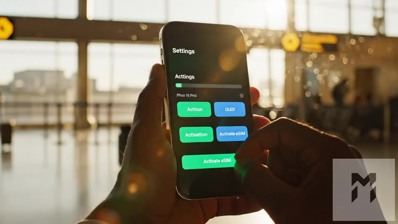
Step 1: Pre-Ascent eSIM Provisioning (Tokyo / Kawaguchiko Wi-Fi)
Install your high-altitude data profile at least 12–24 hours before heading toward Mount Fuji while connected to a secure hotel broadband network.
- Purchase your MollySIM Japan eSIM plan based on your climbing duration (a 3-day to 7-day high-speed package is ideal for pre-climb prep and post-climb travel).
- Open your installation email on a secondary screen (laptop, tablet, or printed sheet) to display the activation QR code.
- On iOS: Navigate to
Settings>Cellular>Add eSIM>Use QR Code, then scan the profile. - On Android: Navigate to
Settings>Network & Internet>SIMs>Add SIM>Download a SIM instead, then scan the QR code. - Label the newly installed profile "MollySIM Fuji" to prevent confusion with your primary carrier line.
Step 2: Dual-SIM Architecture & 2FA Configuration
Climbers frequently make the mistake of turning off their primary home SIM entirely, locking themselves out of critical two-factor authentication (2FA) SMS alerts for emergency credit card purchases or banking verification at mountain huts. Configure a dual-SIM structure to keep verification active without incurring roaming fees:
- iOS Settings: Go to
Settings>Cellular>Cellular Dataand select MollySIM Fuji. Ensure "Allow Cellular Data Switching" is toggled OFF to prevent your phone from silently burning domestic carrier data at high altitude. - Android Settings: Go to
Settings>Network & Internet>SIMs> select your domestic SIM and toggle "Mobile Data" OFF. Select MollySIM Fuji and toggle "Use SIM" and "Mobile Data" ON.
Step 3: Digital Trail Permits & Conservation Fee Registration
Starting in the 2026–2026 seasons, local prefectural governments require mandatory digital check-ins to curb over-tourism and manage hiker density.
- Yoshida Trail (Yamanashi Prefecture): You must show the official QR-code entry pass issued via the Yamanashi Prefectural reservation portal. Ensure the mandatory ¥2,000 trail fee and optional ¥1,000 Fuji San conservation donation are paid in advance.
- Subashiri, Gotemba, & Fujinomiya Trails (Shizuoka Prefecture): Complete the Shizuoka Climbing Registration system online.
- Offline Backup: Load the confirmation receipt directly into Apple Wallet, Google Wallet, or save high-resolution screenshots to your local photo library. Gate marshals at the 5th Station toll points scan these permits before granting trail access.
Step 4: 5th Station Pre-Flight & Offline Map Cache (Subaru / Fujinomiya Terminal)
Before stepping onto the volcanic gravel at the 5th Station (2,300m–2,400m), execute your final offline application setup:
- Activate Low Data Mode: Go to
Settings>Cellular>MollySIM Fuji>Data Mode> select Low Data Mode. This blocks non-essential background updates (such as iCloud photo syncing or app auto-updates), reserving bandwidth strictly for routing, telemetry, and live weather. - Download YAMAP / Komoot Offline Vectors: Launch YAMAP, navigate to the "Mount Fuji (Yoshida / Subashiri / Gotemba / Fujinomiya)" map pack, and select Download Map. Test the map by toggling Airplane Mode on and confirming that your GPS crosshairs lock directly onto the 5th Station coordinates.
- Bandwidth Assurance: With MollySIM, even if you exceed your daily high-speed quota during the ascent, the connection drops to a robust 384 kbps Fair Use Policy (FUP) baseline—triple the industry-standard 128 kbps. This sustained throughput allows Google Maps, elevation overlays, and Apple Pay authentication to operate reliably without hanging.
Step 5: Summit Emergency Directory & Quick-Dial Configuration
Program these emergency contacts directly into your phone’s favorites list for instant one-touch dialing in severe weather or low-oxygen conditions:
| Contact Entity | Direct Phone Number | Purpose & Protocol |
|---|---|---|
| Japan Emergency Police | 110 | Mountain rescue dispatch, reporting lost climbers on trail forks. |
| Japan Emergency Medical / Fire | 119 | Severe hypothermia, acute altitude sickness (AMS), trauma evacuation. |
| Japan Coast Guard (SAR Support) | 118 | Coordinates maritime-to-air rescue radar sweeps during extreme conditions. |
| JNTO Tourist Safety Hotline | 050-3816-2720 | 24/7 English-language medical interpretation and evacuation relay. |
| Fuji Subaru Line 5th Station Base | 0555-72-2121 | Road closures, emergency bus status, and lower-station shelter confirmation. |
| Mount Fuji 7th/8th Station First Aid | 0555-24-6511 | Certified mountain physician stations (operational during peak July/August season). |
Safety Protocol: In an emergency, send your raw latitude/longitude coordinates via SMS or web link directly to local mountain rescue before moving into emergency shelter, as crater-rim winds can rapidly deplete battery life.
🇯🇵 Japan High-Speed Travel eSIM & SIM Plans
Instant QR code activation, hotspot enabled, with guaranteed 384kbps fallback speed to keep Maps & Digital Wallets active.