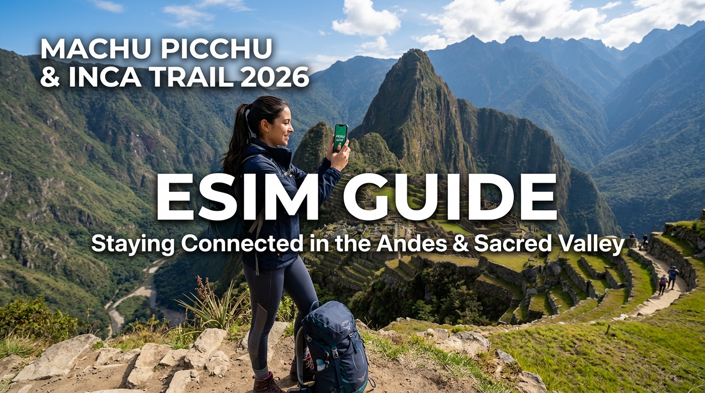
Machu Picchu & Inca Trail 2026 eSIM Guide: Staying Connected in the Andes & Sacred Valley
Andean Topography & Cellular Realities: Why High Altitudes Break Standard Roaming
Navigating the transition from Cusco’s high-altitude basin (3,400 meters) down through the Sacred Valley (2,870 meters) and across the jagged passes of the Vilcabamba mountain range (exceeding 4,200 meters) introduces severe physical constraints on radio frequency (RF) propagation. For international travelers relying on standard cellular roaming, the dramatic drop in connectivity is rarely an administrative glitch; it is an unavoidable consequence of alpine topography and RF physics.
       Cusco Basin (3,400m)
             ▲                Dead Woman's Pass (4,215m)
            / \                         ▲
           /   \   Sacred Valley       / \     Granite Massif / Signal Shadow
          /     \     (2,870m)        /   \           [NO SIGNAL]
         /  BTS  \_______|___________/     \_______________|_________
        [Tower]       Fresnel Zone       Line-of-Sight     Machu Picchu
                     Obstruction (Granite)   Cutoff          (2,430m)
The Physics of RF Attenuation in Granite Canyons
Peruvian mobile network operators (MNOs)—primarily Claro and Movistar—deploy LTE across low-band (Band 28, 700 MHz) and mid-band (Band 2, 1900 MHz; Band 4/AWS, 1700/2100 MHz) frequencies:
- Mid-Band LTE (1700–2100 MHz): While mid-band carriers deliver dense data throughput in downtown Cusco and Ollantaytambo, these higher frequencies suffer severe free-space path loss and zero penetration through the dense, high-dielectric granite formations that flank the Urubamba River.
- Low-Band 700 MHz (Band 28): Band 28 provides the primary long-range backbone across rural sectors. However, deep ravines create substantial Fresnel zone obstructions. As electromagnetic waves strike steep, vertical cliff walls, destructive multipath interference cancels out the direct signal, plunging trail sections into total radio silence.
Line-of-Sight Mast Coverage vs. Knife-Edge Diffraction
In mountainous terrain, cell site placement is constrained to accessible ridgelines or valley floors. A base transceiver station (BTS) erected on a plateau outside Urubamba may boast an unobstructed Line-of-Sight (LoS) to opposing peaks 15 kilometers away, yet it leaves the settlements tucked inside narrow river bends in an RF shadow.
When signals traverse sharp geological ridges (such as Warmiwañusqa, or "Dead Woman's Pass" at 4,215m), coverage depends entirely on knife-edge diffraction. This bending of radio waves over the ridgeline induces severe attenuation—often exceeding 20 to 30 dB of signal loss over a distance of just a few meters. Legacy roaming profiles, which require constant round-trip signaling authentication back to a foreign home network, cannot negotiate these rapid signal-to-noise ratio (SNR) drops and default straight to "No Service."
| Parameter / Factor | Sacred Valley Floor | High Mountain Passes (Inca Trail / Salkantay) |
|---|---|---|
| Dominant Spectrum | Band 28 (700 MHz), Band 4 (AWS) | Band 28 (700 MHz) exclusively (intermittent) |
| Signal Phenomenon | Direct LoS with multipath valley reflections | Severe knife-edge diffraction & terrain shadowing |
| Average Latency (Local) | 35–55 ms | 120–300+ ms (when connected) |
| BTS Power Source | Grid connected with diesel backup | Remote off-grid solar + deep-cycle battery banks |
Off-Grid Power Dynamics and Sub-Zero BTS Failures
The reliability of remote Andean cell towers is heavily dictated by localized environmental stress:
- Solar-Powered Repeater Nodes: Most cellular relays serving the fringes of the Historic Sanctuary of Machu Picchu operate off-grid via photovoltaic arrays and battery banks.
- Thermal Battery Degradation: Overnight temperatures at elevations above 3,500m regularly drop below freezing (0°C to -5°C). Cold-soaked lithium and gel-cell battery banks lose significant discharge capacity, causing remote repeaters to shut down autonomously between 02:00 and 06:00 to prevent critical voltage collapse.
- Morning Traffic Surges: When power restores at sunrise, dozens of trekking groups attempt concurrent authentication, instantly congesting the limited backhaul bandwidth (frequently narrow-band microwave links).
Why Modern eSIM Architecture Outperforms Legacy Roaming
When standard carrier roaming drops to low-signal fringe coverage, legacy data policies throttle throughput to an unusable 128kbps—causing offline map vector rendering, banking two-factor verifications, and ride-hailing interfaces to time out completely.
Modern travel eSIM solutions bypass these bottlenecks by utilizing low-latency local interconnects and resilient fallback policies. For instance, MollySIM enforces an optimized 384kbps Fair Use Policy (FUP) speed floor—three times faster than the standard 128kbps industry standard. Even when hiking through attenuated peripheral zones in the Sacred Valley where bandwidth drops, this sustained throughput keeps mission-critical tools like Google Maps navigation, trail GPX trackers, and Apple Pay operating reliably without network timeouts.
Peruvian Carrier Landscape: Claro vs. Movistar vs. Entel in Southern Peru
🌐 Global Travel High-Speed Travel eSIM & SIM Plans
Instant QR code activation, hotspot enabled, with guaranteed 384kbps fallback speed to keep Maps & Digital Wallets active.
Navigating mobile connectivity across the rugged topography of the Southern Peruvian Andes requires an understanding of how local Mobile Network Operators (MNOs) deploy their physical infrastructure. The dramatic elevation shifts between Cusco (3,400m), the Sacred Valley floor (~2,800m), and the cloud forests surrounding Machu Picchu (2,430m) create significant radio frequency (RF) propagation hurdles that expose the structural differences between Peru’s primary carriers.
Andean Spectrum Allocation and Frequency Propagation
Mobile data performance in mountainous terrain depends heavily on operating frequencies:
- Band 28 (700 MHz APT - Low-Band): The undisputed backbone of rural Andean coverage. Low-band 700 MHz spectrum delivers superior non-line-of-sight (NLOS) propagation, diffracting over mountain ridges and penetrating deep into the Sacred Valley canyon corridors where higher frequencies fail.
- Band 4 / AWS (1700/2100 MHz - Mid-Band): The primary urban capacity layer deployed across Cusco's historical center and high-density tourist transit points.
- Band 2 (1900 MHz) & Band 7 (2600 MHz - High-Band): High-throughput microcells used in localized nodes like Ollantaytambo train station and Aguas Calientes town center to handle transient tourist congestion.
       [High Elevation Ridge: 4,200m]
                  / \
                 /   \  <-- Band 28 (700MHz) diffracts over passes
                /     \
   [Cell Tower]        \  <-- Band 4/7 (1700/2600MHz) blocked by rock mass
  (Ollantaytambo)       \
                         \____ [Valley Trail Floor: 2,600m]
Carrier Infrastructure Breakdown
1. Claro Peru (América Móvil)
Claro maintains the most resilient regional macro-tower footprint across the Sacred Valley and Southern Highlands. Heavy investments in Band 28 base transceiver stations (BTS) allow Claro to broadcast stable signals along the railway route from Urubamba to Hydroelectric. In Aguas Calientes (Machu Picchu Pueblo), Claro utilizes localized split-sector microcells that maintain connection integrity even during morning and evening rush hours when thousands of tourists connect simultaneously.
2. Movistar (Telefónica del Perú)
Movistar holds dense legacy infrastructure in the historical center of Cusco (San Blas, Plaza de Armas) and broad capacity in urban Pisac. However, its coverage degrades rapidly once you leave paved transit corridors. Movistar's mast footprint in the peripheral gorges approaching Wayllabamba and Dead Woman's Pass features fewer rural repeaters, making single-carrier Movistar SIMs prone to prolonged dropouts along back-country trail segments.
3. Entel Peru
Entel delivers the highest peak download speeds within metropolitan Cusco and flat valley sectors, leveraging carrier aggregation across Band 4 and Band 7. However, its network architecture focuses primarily on dense population centers. Once in the rugged defiles of the Urubamba canyon or remote trekking corridors, Entel’s rural macro-site density falls behind Claro, leaving blind spots along peripheral trailheads.
Operator & eSIM Technical Comparison
| Feature / Metric | Claro Peru | Movistar Peru | Entel Peru | MollySIM |
|---|---|---|---|---|
| Primary LTE Bands | B28 (700MHz), B2, B7 | B28 (700MHz), B4 (AWS), B2 | B28 (700MHz), B4 (AWS), B7 | Multi-Band Dynamic (B28, B4, B2, B7) |
| Sacred Valley 4G/LTE Coverage | Superior: Broadest rural reach (Pisac, Urubamba, Ollantaytambo) | Moderate: Solid in towns, weak in canyon gaps | Fast Urban / Weak Rural: High speed in hubs, sparse fringe | Optimized: Automatic aggregation across Tier-1 backhauls |
| Inca Trail Mast Line-of-Sight | Intermittent (Km 82, Llactapata, Wiñay Wayna) | Spotty (Drops past Patallacta) | Minimal (Fails past Qoriwayrachina) | Redundant (Binds to strongest active regional BTS) |
| Aguas Calientes Capacity | High capacity (B28/B7 microcells) | Medium (Prone to peak tourist congestion) | Medium-Low (Localized cell capacity limits) | High (Dynamic priority routing) |
| Multi-Network Failover | ❌ Locked to Claro BTS | ❌ Locked to Movistar BTS | ❌ Locked to Entel BTS | ✅ Automated seamless switching |
| Throttled FUP Baseline | ~64–128 kbps (Frequent service timeouts) | ~64–128 kbps (Vector map failure) | ~64–128 kbps (App lockouts) | 384 kbps sustained (Maintains GPX, Maps, Apple Pay) |
The Dynamic Interconnect Advantage
Locking your device to a single local MNO introduces single-point-of-failure vulnerabilities when traversing dynamic microclimates and canyon terrain. Because mountain ridges frequently obstruct line-of-sight to a specific carrier's mast while leaving an alternative provider's repeater visible across the valley, a multi-network architecture is critical.
By leveraging eSIM platforms like MollySIM, international travelers benefit from unthrottled, multi-carrier network switching that automatically attaches to the strongest available Tier-1 tower (Claro or Movistar). Combined with a resilient 384kbps Fair Use Policy floor—triple the legacy 128kbps speed limit—essential applications such as GPX navigation engines, WhatsApp voice notes, and contactless payment protocols continue working seamlessly, even in edge-of-coverage alpine zones.
Trail-by-Trail Connectivity Map: Classic Inca Trail & Salkantay Trek
High-altitude topography creates distinct RF shadows throughout the Cusco region. Deep granite ravines, steep glacial passes, and dense cloud forest canopies act as physical barriers to 700MHz (Band 28) and 1900MHz (Band 2) cellular propagation.
Below is an operational breakdown of mobile data availability across the two most traversed trekking routes to the Sanctuary of Machu Picchu.
1. Classic Inca Trail (4-Day / 43 km)
The Classic Inca Trail features abrupt transitions between open valley corridors and fully shielded mountain passes.
- KM 82 (Piscacucho) to Wayllabamba (KM 0 – KM 12): Moderate to strong 4G LTE coverage via Ollantaytambo valley relays. Speeds average 15–30 Mbps through Miskay and Llactapata. Connectivity drops significantly as you enter the narrow Cusichaca valley approaching the Wayllabamba campsite (approx. 3,000m), degrading to intermittent 3G or total dropouts in canyon hollows.
- Wayllabamba to Pacaymayo via Warmiwañusqa (KM 12 – KM 23): Total RF Dead Zone. Ascending Dead Woman’s Pass (Warmiwañusqa, 4,215m), handsets lose all line-of-sight (LoS) to terrestrial towers. The entire descent into Pacaymayo Valley (3,600m) remains completely offline due to steep rock shielding.
- Pacaymayo to Phuyupatamarca (KM 23 – KM 35): Passing Runkurakay Pass (3,950m) and Sayacmarca, coverage is non-existent until reaching the exposed high ridge of Phuyupatamarca (3,680m). Here, direct LoS to Urubamba Valley microwave backhauls enables brief, intermittent bursts of 3G/4G data.
- Wiñay Wayna to Inti Punku & Citadel (KM 35 – KM 43): Dense cloud forest dampens signal through the Wiñay Wayna ruins (patchy 1-bar Edge/3G). As soon as you breach Inti Punku (The Sun Gate, 2,720m), your handset locks directly onto high-capacity microcells deployed around the Machu Picchu Citadel and Aguas Calientes, restoring full 4G/LTE speeds exceeding 40 Mbps.
2. Salkantay Trek (5-Day / 74 km)
Covering broader alpine terrain and dropping through the Santa Teresa subtropical valley, the Salkantay route presents alternating connectivity corridors.
| Trek Stage / Waypoint | Altitude | Expected Network State | Key Cellular Observations |
|---|---|---|---|
| Mollepata to Soraypampa | 2,900m – 3,900m | 4G LTE $\rightarrow$ Intermittent 3G | Solid coverage departing Mollepata; fades to isolated Movistar/Claro pockets at Soraypampa basecamp near Humantay Lake. |
| Salkantay Pass | 4,630m | Complete Dead Zone | Heavy glacial shielding blocks all macrocell penetration for approximately 12–16 km. |
| Chaullay / Collpapampa | 2,900m | Patchy 3G / Edge | Entering the cloud forest rim restores basic low-band signals; sporadic text-only transmission. |
| Lucmabamba / Santa Teresa | 2,000m – 1,550m | Moderate 4G LTE | Open agricultural valley allows stable cellular connection across multiple provider bands. |
| Llactapata Ridge to Hidroeléctrica | 2,720m – 1,800m | Strong 4G / LTE | Elevated LoS toward the backside of Machu Picchu mountain captures direct microcell signals. |
High-Altitude Battery Drain & RF Search Loops
Operating mobile devices across the Andean trail network exposes your hardware to a compounding challenge: battery capacity collapse coupled with aggressive RF amplification.
Sub-Zero Ambient Temps (<0°C) ──> Slowed Li-Ion Electrochemical Kinetics
                +
Fringe Network Boundary Coverage ──> Modem Increases Tx Power (+23 dBm Max)
                │
└──> Accelerated Battery Depletion (Up to 3x Normal Rate)- RF Power Escalation: When a device loses connection, the baseband modem cycles continuous search protocols, increasing RF transmission power to its maximum theoretical limit (+23 dBm). This causes rapid thermal and energy loss.
- Sub-Zero Pass Temperatures: At Warmiwañusqa (4,215m) and Salkantay Pass (4,630m), overnight and early morning temperatures frequently drop below freezing (0°C to -6°C). Cold slows down the electrochemical reactions inside Lithium-Ion cells, instantly reducing deliverable milliamp-hours (mAh).
Mitigation Protocol: Switch your device to Airplane Mode during major pass ascents to halt background search loops.
When connectivity returns at exposed ridges or valley floors, using MollySIM ensures that your handset instantly binds to whichever carrier maintains a live mast in that specific valley. Furthermore, should you exceed your high-speed quota mid-trail, MollySIM’s 384kbps sustained Fair Use Policy (FUP) provides 3x the baseline speed of standard 128kbps alternatives—ensuring vector mapping tiles on Google Maps, emergency GPS telemetry, and Apple Pay authentication remain fully operational without timing out.
The MollySIM Advantage: Dynamic Multi-Carrier Switching Across the Andes
Navigating the extreme topography of the Peruvian Andes exposes the primary flaw of standard cellular connectivity: single-carrier dependency. When you purchase a physical prepaid SIM at Alejandro Velasco Astete International Airport (CUZ) in Cusco, your device is hard-locked to one domestic operator—typically Claro, Movistar, or Entel.
In a flat metropolitan area, single-carrier access is sufficient. In the Sacred Valley and along the Vilcanota River canyon, it is a single point of failure.
┌─────────────────────────────────────────────────────────────────────────┐
│                    THE TOPOGRAPHICAL COVERAGE DILEMMA                   │
├───────────────────────────────────┬─────────────────────────────────────┤
│ Physical SIM / Static eSIM        │ MollySIM Dynamic Core Network       │
├───────────────────────────────────┼─────────────────────────────────────┤
│ • Locked to single MCC/MNC (e.g., │ • Multi-IMSI / Multi-Core roaming   │
│   Claro 716-10 or Entel 716-17)   │   profile across Claro & Entel      │
│ • Drops to "No Service" behind    │ • Autonomous handover to strongest  │
│   granite ridges (shadow zones)   │   active base station (dBm/RSRP)    │
│ • Requires manual APN resets and  │ • Zero manual network toggling in   │
│   reboots during transit          │   iOS / Android settings            │
└───────────────────────────────────┴─────────────────────────────────────┘
Dynamic Core Handover: Zero-Touch Switching
The Andean mountain range creates severe RF shadow zones where a granite massif can block an Entel macro-cell while leaving a Claro micro-cell unobstructed 500 meters down the valley. Standard single-carrier SIMs cling to a degrading, unusable signal (often dipping below -115 dBm RSRP) until the handset drops to "No Service," draining the battery in continuous transmission hunt loops.
MollySIM solves this topographical bottleneck through dynamic multi-carrier core routing. Instead of binding your device to an exclusive local operator, MollySIM's underlying architecture maintains tier-1 wholesale peering agreements across Peru’s leading mobile backbones.
- Autonomous Signal Arbitration: As you travel down from Cusco (3,400m) through the Sacred Valley toward the Amazonian cloud forest, your device automatically evaluates the downstream Reference Signal Received Quality (RSRQ) and switches to the strongest local mast—bouncing between Claro's high-capacity bands (Band 2/7) and Entel’s rural penetration frequencies (Band 28, 700 MHz) without requiring manual network toggling in your settings.
- Instant Handshake in Transition Hotspots: Cellular handovers occur seamlessly in high-interference transit zones such as the Ollantaytambo PeruRail/Inca Rail station, scenic view overlooks across Urubamba, and the deep granite basin of Aguas Calientes (Machu Picchu Pueblo).
Operational Comparison: Andean Connectivity Performance
| Connectivity Feature | Local Physical SIM (e.g., Claro / Entel) | Standard Travel eSIM | MollySIM Multi-Carrier eSIM |
|---|---|---|---|
| Network Redundancy | Single Carrier Only | Single Local Partner (Usually Movistar) | Dynamic Claro + Entel Dual-Core |
| Transit Zone Handovers | Manual Search Required | High Packet Loss During Switches | Seamless Autonomous Switching |
| Remote Activation | Requires Physical Passport Registration in Cusco | QR Code Scan | Instant eSIM Provisioning & QR Scan |
| Post-Quota Throttle (FUP) | Hard Cutoff (0 kbps) | 64 kbps – 128 kbps (Unusable) | 384 kbps Sustained High Baseline |
| Mission-Critical App Support | Fails when primary mast is obstructed | Times out on maps/payments after quota | Google Maps Vector Tiles, Apple Pay, WhatsApp Active |
Redundancy Where It Matters Most
The descent into the Urubamba Valley and the approach to the Sun Gate (Inti Punku) represent rapid microclimate and elevation shifts where local carrier coverage fluctuates minute by minute. By coupling multi-carrier failover with a 384kbps sustained Fair Use Policy (FUP)—which provides three times the throughput of the standard 128kbps throttle used by legacy travel SIMs—MollySIM ensures that your live navigation vectors, critical logistics check-ins, and biometric payment authentications remain fully operational throughout the Sacred Valley corridor.
Why MollySIM's 384kbps FUP Speed Floor is a Mountain Lifesaver
Running out of high-speed data while trekking the Inca Trail or traversing the Salkantay Pass is more than an inconvenience—it can quickly turn into a logistical hazard. Most standard international travel eSIMs impose an aggressive Fair Usage Policy (FUP) throttle down to 128kbps (or even a punitive 64kbps) once a daily or total allotment is exhausted.
In high-altitude environments where cellular signals contend with mountain deflection, high latency (often 150ms–300ms), and packet loss, a 128kbps throttle causes catastrophic network timeouts. In contrast, MollySIM deploys an industry-leading 384kbps sustained FUP speed floor—a 3x bandwidth multiplier that bridges the gap between total data isolation and critical backcountry utility.
Bandwidth and Packet Diagnostics: 128kbps vs. 384kbps
To understand why 128kbps fails in the Andes, you have to look at how modern mobile applications handle Transmission Control Protocol (TCP) handshakes and packet transport over degraded radio links.
When background processes compete for bandwidth on a 128kbps pipe, the effective throughput drops below the minimum threshold required by modern TLS/SSL-encrypted APIs:
| Mission-Critical Action | Typical Data Payload | 128kbps Competitor Performance | MollySIM 384kbps FUP Performance | |
|---|---|---|---|---|
| Vector Map Tile Fetch (Gaia GPS / Google Maps) | 80 KB – 250 KB per tile set | Fails / Infinite Spinner (TCP Socket Timeout) | Renders smoothly in 3–5 seconds | |
| WhatsApp Low-Bitrate Voice Call (Opus Codec) | 16 – 24 kbps (pre-overhead) | Severe packet drop / Dropped calls | Clear, uninterrupted audio stream | |
| Live GPS Location Broadcast | 2 KB – 5 KB per telemetry ping | Delayed by 45–120s or dropped | Near real-time push (1–2s sync) | |
| Biometric Payment Tokenization (Apple Pay) | 5 KB – 15 KB (Auth Handshake) | Gateway Timeout / Transaction Error | Instant Token Handshake & Auth | |
| Emergency SOS Message & Media | Text: 1 KB \ | Photo: 150 KB | Fails on media / Text queued indefinitely | Text transmits instantly; Photo loads in ~5s |
Preserving Live Vector Navigation (AllTrails, Google Maps, Gaia)
Navigating complex trail junctions between Wiñay Wayna and the Sun Gate requires dynamic map caching. Modern vector mapping platforms do not download static images; they pull continuous protobuf vector tiles that render elevation lines, waypoints, and topography locally.
- The 128kbps Bottleneck: At 128kbps, maximum throughput tops out at an absolute theoretical 16 KB/s. After factoring in network encapsulation overhead and mountain signal jitter, real-world throughput often lingers near 8 KB/s. A multi-layer 200 KB tile request easily exceeds the app's default 15-second request timeout, leaving you with an unrendered grey grid when you need trail orientation most.
- The 384kbps Advantage: Delivering a steady ~48 KB/s (real-world ~38–42 KB/s), MollySIM delivers sufficient headroom to complete multi-tile vector rendering cycles without triggering socket terminations, ensuring your live position against elevation profiles stays visible.
Low-Bitrate VoIP and Emergency Telemetry
If you suffer altitude sickness on the approach to Dead Woman’s Pass (Warmiwañusqa) at 4,215 meters, clear communication with your base operator or emergency services is vital.
The Opus audio codec utilized by WhatsApp and other VoIP tools requires between 12kbps and 24kbps of pure payload bandwidth. However, once wrapped in UDP/IP headers, SRTP encryption, and periodic cryptographic re-keying, voice streams demand burst capacities of at least 40kbps to prevent buffer underruns.
While a 128kbps throttled connection collapses under minor network jitter—causing broken syllables and automatic call drops—MollySIM's 384kbps baseline effortlessly absorbs these telemetry bursts. You can sustain a two-way emergency VoIP check-in, transmit your exact coordinates via pinned GPS messages, and authenticate emergency lodge payments without purchasing emergency data top-ups mid-hike.
Step-by-Step High-Altitude Setup & Battery Optimization Guide for 2026
Navigating high-altitude geography requires strict digital preparation before your boots touch Andean soil. Between thin air, remote terrain, and fluctuating sub-zero temperatures, improperly configured devices will rapidly drain their batteries or lock you out of crucial travel apps. Follow this technical preparation workflow to ensure seamless connectivity from Lima (LIM) and Cusco (CUZ) all the way through the Sun Gate (Inti Punku).
Phase 1: Pre-Departure Dual-SIM & Network Configuration
Set up your digital profile 24 to 48 hours before departing for Jorge Chávez International (LIM) or Alejandro Velasco Astete (CUZ). Complete the core installation over a secure home Wi-Fi network to eliminate airport captive-portal errors.
+-------------------------------------------------------------------------+
|                         DUAL-SIM ROUTING SETUP                          |
+-----------------------------------+-------------------------------------+
| Primary Line (Physical / Home)    | SMS & Calls ON (Roaming Active)     |
| Secondary Line (MollySIM eSIM)    | Cellular Data ON (Roaming Active)   |
| Cellular Data Switching           | OFF (Prevents home carrier charges) |
+-----------------------------------+-------------------------------------+- Install and Label the eSIM Profile:
- Scan your MollySIM QR code or install directly via the in-app profile installer.
- Label the newly added plan as "Peru Travel" or "MollySIM" within your device settings (Settings > Cellular / Mobile Service on iOS; Settings > Network & Internet > SIMs on Android).
- Preserve SMS for Two-Factor Authentication (2FA):
- Keep your home carrier active for Default Voice Line and SMS.
- Turn off Data Roaming exclusively on your home SIM to prevent accidental $10/day roaming triggers.
- Set your Cellular Data line to your Peru eSIM, and ensure Allow Cellular Data Switching is toggled OFF.
- Engage Operating System Data Conservations:
- iOS: Navigate to Settings > Cellular > [Your eSIM Line] and enable Low Data Mode.
- Android: Navigate to Settings > Network & Internet > Data Saver and toggle it ON.
- Disable automatic cloud backups over cellular (iCloud Photos, Google Photos, OneDrive) to prevent high-res trail photos from saturating your bandwidth.
Phase 2: Offline Asset Pre-Caching Checklist
High-altitude cloud cover and mountain shadows can drop satellite signal resolution and cellular reception without warning. Cache all mission-critical data while connected to hotel Wi-Fi in Cusco or Ollantaytambo:
- Vector Mapping Tiles: Download offline map zones for Cusco, the Sacred Valley (Urubamba, Pisac, Ollantaytambo), and the entire Aguas Calientes/Machu Picchu district in Google Maps or Organic Maps. Vector-based maps consume minimal storage (~150 MB) while providing granular trail topo-lines.
- WhatsApp Auto-Download Restrictions: Go to WhatsApp Settings > Storage and Data > Media Auto-Download. Set Photos, Audio, Videos, and Documents to Wi-Fi Only. This ensures that even when MollySIM's 384kbps unlimited baseline is active, your available throughput is reserved for emergency voice packets, live coordinates, and text telemetry rather than massive group-chat video downloads.
- Digital Ticketing & Permits: Save offline PDF copies of your Inca Trail permit, Machu Picchu Circuit entrance tickets, and PeruRail/Inca Rail boarding passes directly into Apple Wallet, Google Wallet, or local storage.
Phase 3: Alpine Battery Preservation & Power Bank Management
Sub-zero nights at high-altitude campsites like Pacaymayo (3,600m) and Chaquicocha (3,600m) induce immediate voltage sag in lithium-ion cells, causing sudden power cuts from 40% down to 1% in minutes. Combine physical thermal protection with radio management:
                  RADIO TRANSMIT POWER & BATTERY DRAIN
 Signal Level | Transmit Power | Battery Impact
 =========================================================================
 4-5 Bars     | ~20 - 50 mW    | Normal Consumption (Baseline)
 1-2 Bars     | ~500 - 1000 mW | 4x - 6x Acceleration in Battery Drain
 No Service   | Peak Scanning  | Max RF Polling (Extreme Battery Drain)
 Airplane On  | 0 mW (Radio Off| Zero Cellular Drain (GPS Remains Active)
1. Prevent "Signal Hunting" Drain on High Passes
When crossing unserviced zones such as Dead Woman’s Pass (Warmiwañusqa, 4,215m) or the Runkurakay pass, your phone’s baseband modem ramps transmission power to maximum (up to 2W / +33 dBm) searching for non-existent cell towers.
- The Rule: Switch to Airplane Mode whenever signal drops below 1 bar. GPS hardware runs on a passive receive-only frequency, meaning your offline trail tracking apps (e.g., Gaia GPS, AllTrails) will function with zero battery penalty while Airplane Mode is engaged.
2. Thermal Management for Sub-Zero Nights
- Sleep with Your Electronics: Never leave smartphones, camera batteries, or power banks on the tent floor or in exterior backpack pockets overnight. Store all lithium-ion devices inside a microfleece or wool pouch inside your sleeping bag near your core.
- Insulated Phone Cases: Use thermal barrier phone cases (such as aerogel or closed-cell neoprene sleeves) during early-morning summit departures to protect against cold air exposure.
3. Power Bank Sizing for the Inca Trail
| Trek Duration | Recommended Capacity | Form Factor / Spec | Notes |
|---|---|---|---|
| 1–2 Day Express Trek | 10,000 mAh (~37 Wh) | 20W PD / Slim Polymer | Fits in daypack pockets; 2–3 full smartphone cycles. |
| 4-Day Classic Inca Trail | 20,000 mAh (~74 Wh) | 30W–65W PD / Dual-Port | Keeps phone, GPS watch, and headlamp powered across 3 un-electrified camp nights. |
| 5-Day Salkantay / Choquequirao | 26,800 mAh (~99.1 Wh) | Multi-Port PD / Sub-100Wh Airline Legal | Maximum legal capacity allowed in carry-on baggage by international aviation regulations (FAA/IATA). |
Note: Never pack power banks in checked luggage on flights to Lima or Cusco; international aviation safety regulations mandate all standalone lithium batteries remain in your carry-on baggage.
🌐 Global Travel High-Speed Travel eSIM & SIM Plans
Instant QR code activation, hotspot enabled, with guaranteed 384kbps fallback speed to keep Maps & Digital Wallets active.