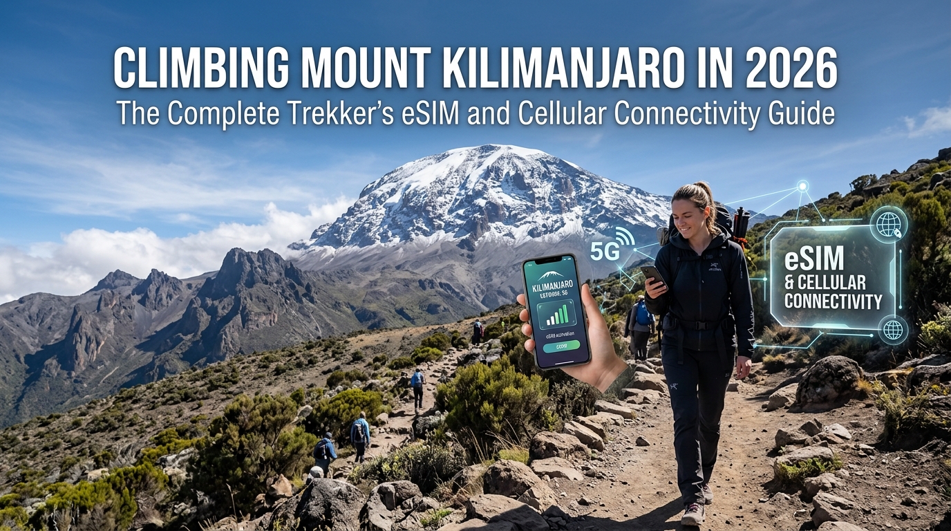
Climbing Mount Kilimanjaro in 2026: The Complete Trekker's eSIM and Cellular Connectivity Guide


The Physics of Mountain Signal: Line-of-Sight Propagation from Moshi and Arusha

Cellular reception on Mount Kilimanjaro is not an accident of infrastructure built along the trails; it is an artifact of high-power radio frequency (RF) propagation originating tens of kilometers away in the urban lowlands. Understanding why your phone displays full 4G bars at 4,600 meters only to drop into "No Service" five minutes later requires examining the interplay between radio line-of-sight (LoS), tropospheric mechanics, and volcanic geology.

`` 5,895m (Uhuru Peak) - Direct optical LoS to lowland macro towers /\ / \ <-- Mawenzi & Kibo massifs cast severe RF shadow cones / \ /------\ 4,000m (Alpine Desert: Thin, dry air; zero canopy loss) / ~~~~~~ \ 3,000m (Cloud Inversion Layer: Refraction & signal ducting) /##########\ 2,000m (Dense Montane Forest: 15-20 dB canopy attenuation) / \ ____/ \________________________________________________ [Moshi Plains ~800m] ==== 35km RF Beam (B3/B8/B20/B28) ====> ``

Macro Base Stations and Low-Band Uplinks

Tanzania’s primary telecommunications providers (principally Vodacom and Airtel) operate high-output macro base stations situated in the plains surrounding Moshi (elevation ~800m) and Arusha (~1,400m). These towers project cellular carrier frequencies—predominantly Band 8 (900 MHz), Band 20 (800 MHz), and Band 28 (700 MHz) for long-range coverage, alongside Band 3 (1800 MHz) for high-capacity LTE throughput—at upward-tilted sector angles.

Sub-1GHz radio waves possess exceptional propagation envelopes, capable of traveling 30 to 45 kilometers across clear airspace when uninhibited by physical obstacles. Because the southern and western slopes of Kilimanjaro face these lowland centers directly, high-altitude ridges receive strong, direct optical and RF line-of-sight beams.

Canopy Attenuation vs. Alpine Clarity: The 1,800m to 5,895m Transition

As you ascend through Kilimanjaro’s distinct ecological zones, the RF transmission medium changes radically:

Ecological ZoneElevation RangeSignal Propagation DynamicTypical Connectivity Behavior
Montane Rainforest1,800m – 2,800mHeavy vegetative attenuation; high moisture absorption (15–20 dB signal loss).Fragile 2G/Edge; frequent dropped packets and high latency.
Heath & Moorland2,800m – 4,000mLow vegetation profile; cloud-layer interference; intermittent direct LoS.Fluctuation between 3G and 4G depending on ridge exposure.
Alpine Desert4,000m – 5,000mThin, dry air; virtually zero atmospheric absorption; pristine Line-of-Sight.Surprising LTE bursts with high throughput on windward edges.
Glacial Summit5,000m – 5,895mExtreme LoS distance; RF reflections off ice fields; high battery drain from cold.Intermittent 3G/4G at Uhuru Peak facing south toward Moshi.
  1. The Forest Canopy Trap (1,800m – 2,800m): During Day 1 and Day 2 of routes like Machame, Marangu, or Lemosho, thick canopy coverage creates massive signal degradation. The high water content in wet leaves scatters and absorbs sub-2GHz frequencies, resulting in weak, intermittent Edge or 3G handshakes.
  2. The Cloud Inversion Barrier (2,500m – 3,500m): As warm lowland air meets cold alpine air, a dense temperature inversion layer forms. This dense moisture shelf causes RF refraction, multi-path fading, and signal ducting—trapping signals beneath the cloud deck or reflecting them away from the mountain slope.
  3. The High-Altitude Vacuum Effect (4,000m+): Once you breach the cloud layer into the alpine desert, atmospheric humidity drops near zero. Free from moisture-induced attenuation, radio waves travel with extreme clarity from Moshi straight to exposed ridgelines like the Shira Plateau and parts of the Lava Tower ridge.

Topographical Shadowing: Massifs, Ridges, and River Valleys

Kilimanjaro is not a uniform cone; it consists of three distinct volcanic centers: Shira, Mawenzi, and the central dome of Kibo.

These giant basalt formations act as impenetrable RF shields:

`` [Direct LoS Signal from Moshi] \ \ Ridge Crest \ Deep Valley (e.g., Karanga/Barranco) /\ \ | / \ \ | <-- Basalt Wall Blocks LoS / 4G \ \ | / Signal\ \| [DEAD ZONE / RF SHADOW] ______/ Active \___________V________________________________ ``

The Impact on Mobile Data and Packet Delivery

Because signal strength shifts abruptly from -85 dBm (excellent) to -120 dBm (edge of disconnect) within just a few meters of walking, smartphones constantly ramp up transmission power, rapidly draining batteries in the sub-zero alpine cold.

When your phone finally grabs a fragile micro-burst of cellular signal on an open ridge, bandwidth bottlenecks often choke essential applications. Utilizing an optimized travel eSIM like MollySIM becomes vital in these edge-of-coverage zones. Even if high-speed bucket data is consumed during heavy mountain usage, MollySIM maintains a 384kbps Fair Use Policy (FUP) speed floor—three times faster than the standard 128kbps cap enforced by most roaming providers. This 384kbps throughput is precisely calibrated to push through compressed offline map updates on Google Maps, send critical GPS coordinate pings, and execute secure authentication for digital transactions without timing out over unstable high-altitude uplinks.

Route-by-Route Signal Heatmap: Machame, Marangu, and Lemosho

Instant QR Delivery • Native 5G • 384kbps FUP Protection

🌐 Global Travel High-Speed Travel eSIM & SIM Plans

Instant QR code activation, hotspot enabled, with guaranteed 384kbps fallback speed to keep Maps & Digital Wallets active.

View Global Travel Plans & Pricing ➔Physical SIM Cards ➔Explore 150+ eSIMs ➔

Kilimanjaro’s cellular infrastructure is not uniformly distributed across its volcanic flanks. The quality of your uplink depends directly on your route’s physical orientation relative to the cell towers clustered around Moshi, Arusha, and the agricultural lowlands along the southeastern slopes.

Below is an operational breakdown of cellular performance across the mountain's primary trekking corridors.

`` [KIBO SUMMIT / UHURU PEAK] / | \ (West) / | \ (East) LEMOSHO / MACHAME \ MARANGU Wide LoS / Ridge-Valley \ Direct Tower LoS Plateau / Shadowing \ High Infrastructure ``


1. Machame Route ("Whiskey Route") Connectivity Analysis

The Machame Route traverses the southern face of Kilimanjaro, leading to dramatic fluctuations in radio frequency reception due to alternating ridges and deep river gorges.


2. Marangu Route ("Coca-Cola Route") Base Station Advantage

The Marangu Route features the most consistent network availability on Kilimanjaro because its path runs directly along the well-developed eastern infrastructure corridor.


3. Lemosho Route: The Shira Plateau RF Corridor

The Lemosho Route approaches from the west, beginning with zero connectivity in the remote Londorossi wilderness before transitioning to expansive coverage across the Shira Plateau.

Because signal availability on these routes often comes in fleeting 10-to-15-minute bursts at high-altitude camp perimeters, background processes can easily consume your primary high-speed allotment. Trekkers utilizing an international data profile from MollySIM benefit from an integrated 384kbps Fair Use Policy (FUP) speed floor. While alternative roaming providers throttle users to an unusable 128kbps after high-speed exhaustion, MollySIM’s sustained 384kbps throughput keeps critical mapping applications like Google Maps responsive, enables GPS telemetry uploads, and ensures seamless token authentication for digital wallets and banking apps even when operating on fringe alpine bandwidth.


Comprehensive Kilimanjaro Waypoint Signal Heatmap

Waypoint / CampRoute(s)Elevation (m)Signal QualityPrimary Carrier BandsOptimal Check-in Strategy
Machame GateMachame1,640mStrong 4G/LTEBand 3 (1800), Band 28Gate clearing prior to forest entry
Machame CampMachame2,835mPatchy 2G/3GBand 8 (900), Band 2050m south of ranger post
Shira 2 CampMachame / Lemosho3,850mStrong 3G/4GBand 3 (1800), Band 1Open western/southern perimeter
Barranco CampMachame / Lemosho3,976mDead ZoneNone / Sporadic 2GAirplane mode; wait for Barranco Wall
Barranco Wall (Top)Machame / Lemosho4,200mModerate 4GBand 20 (800), Band 3Southern ridgeline crest
Karanga CampMachame / Lemosho3,995mModerate 3G/4GBand 8 (900), Band 3Southern valley lip facing Moshi
Barafu Base CampMachame / Lemosho4,673mIntermittent 3G/4GBand 20 (800)Upper rocks near summit departure track
Mandara HutMarangu2,700mWeak 3GBand 8 (900)Side trail toward Maundi Crater
Horombo HutMarangu3,720mStable 4G/LTEBand 3 (1800), Band 1Hut veranda facing southeastern plains
Kibo HutMarangu4,703mWeak/IntermittentBand 20 (800)Southeastern exterior facing Mawenzi
Mweka CampDescent (All)3,100mModerate 3G/4GBand 3 (1800), Band 8Main registration clearing

Tanzanian Network Operators vs. Modern Travel eSIMs: A Technical Comparison

Deploying reliable cellular communications on a 5,895-meter stratovolcano requires understanding the terrestrial layout of Tanzania’s primary Mobile Network Operators (MNOs)—Vodacom Tanzania and Airtel Tanzania—alongside the physical and regulatory limitations of local hardware acquisition.

`` +-----------------------------------------------------------------------------+ | KILIMANJARO CELLULAR TOPOLOGY | | | | [Northern Slopes / Kenya Border] [Summit: Uhuru Peak 5,895m] | | | ^ | | v | (Line-of-Sight) | | Sporadic Kenyan B8/B20 | | | +-------------------+ | | | | | [Horombo / Base Ridge Masts] | [Moshi / Lowland Macro Towers] | | - Vodacom High-Site (B20 / 800MHz) -+ - Airtel / Vodacom Urban Hub | | - Airtel Intermediate (B3 / 1800MHz) - High-capacity B1 / B3 / B8 | | (Penetrates high-altitude valleys) (Fires southward into clouds) | +-----------------------------------------------------------------------------+ ``

Infrastructure & Spectrum Allocation: Vodacom vs. Airtel

Vodacom controls the largest market share in Tanzania and has invested aggressively in high-altitude installations under state-backed connectivity mandates. Their network relies heavily on Band 20 (800 MHz) for sub-1GHz long-range signal propagation across rocky massifs, alongside Band 3 (1800 MHz) for local capacity near transit huts like Horombo. This low-band deployment allows signals to diffract around topographical ridges, reaching high camps where line-of-sight to the southern plains is partially obstructed.

Airtel Tanzania operates a competitive rural footprint, utilizing Band 8 (900 MHz) and Band 1 (2100 MHz) macro-towers radiating upward from Moshi, Boma la Ng'ombe, and Machame Gate. While Airtel’s speeds often surpass Vodacom in direct line-of-sight corridors (such as Shira Plateau), its signal drops faster when entering topographical shadows like the Great Barranco Ravine.

Because single-carrier coverage shifts dramatically around the mountain's volcanic circumferences, relying on a single physical carrier leaves predictable dead zones.


Hardware, Regulatory, and Network Comparison

The following table evaluates the practical realities of provisioning connectivity for an alpine expedition:

ParameterVodacom Physical SIMAirtel Physical SIMSatellite Communicator (e.g., InReach)MollySIM Multi-Carrier eSIM
Kilimanjaro Signal RedundancySingle-network only (Vodacom towers)Single-network only (Airtel towers)Iridium/Globalstar orbital satellite meshDynamic Dual-Carrier (Automated switching: Vodacom + Airtel)
Activation ProcessIn-person registration at local kiosk/shopIn-person registration at local kiosk/shopPre-configured online account + active planInstant OTA profile install via QR code pre-departure
JRO Airport Wait Times45–90 minutes (long queues at terminal)45–90 minutes (queue & inventory dependent)None (pre-activated)0 minutes (immediate latch upon landing)
TCRA Biometric FrictionMandatory: Passport scans, live photo, physical fingerprintsMandatory: Passport scans, live photo, physical fingerprintsNone (bypasses terrestrial telco laws)None: No local biometric processing required
Cold-Weather ReliabilityMechanical tray opening required; freezing riskMechanical tray opening required; freezing riskHigh (Dedicated ruggedized hardware)Solid-state: No physical tray or slot exposure to sub-zero dust
Post-Cap Throttle Speed (FUP)Hard cutoff or costly top-up hurdlesHard cutoff or costly top-up hurdlesOverage fees or restricted character counts384 kbps Unlimited (Sufficient for Maps, VoIP, & telemetry)

The Dynamic Roaming Advantage on High-Altitude Trails

Physical SIM cards enforce carrier lock-in. If your expedition enters an acoustic shadow where Vodacom’s signal is deflected by the Mawenzi crags but an Airtel repeater in the southern lowlands is reachable, a single-SIM setup goes dead. Manually swapping physical nano-SIM cards at Barranco or Barafu Base Camp exposes the phone’s delicate internal tray to sub-zero air, high winds, and fine volcanic dust.

`` [Phone with MollySIM eSIM] | +---> Checks Vodacom Signal (B20 / 800MHz) ----> [Degraded / Blocked by Ridge] | +---> Auto-switches to Airtel (B3 / 1800MHz) --> [Strong Direct Line-of-Sight] | v (Uninterrupted connection without physical SIM tray exposure) ``

MollySIM eliminates this single-point-of-failure by running on a multi-network carrier profile. The underlying eSIM intelligently negotiates with whichever base transceiver station (BTS) delivers the highest Signal-to-Interference-plus-Noise Ratio (SINR)—transparently toggling between Vodacom and Airtel as you traverse distinct ridgelines.

``` Emergency Speed Thresholds on Active Data Sessions: ================================================================== Standard Competitor Throttling: 128 kbps [=====] Barely text-only WhatsApp; GPS map tiles fail to render.

MollySIM Throttled FUP Floor: 384 kbps [===============] Real-time GPS, Apple Pay/Banking, & Voice VoIP. ================================================================== ```

Furthermore, local Tanzanian Communications Regulatory Authority (TCRA) laws require strict, multi-step biometric registration—including live finger scanning and document notarization—for every locally sold physical SIM card. Arriving at Kilimanjaro International Airport (JRO) after an exhaustive long-haul flight often leads to severe queue bottlenecks at local carrier counters.

By staging a digital eSIM profile before departure, your handset latches onto local cell towers the moment the landing gear touches down at JRO, while ensuring critical continuous coverage up the mountain. If high-resolution media uploads deplete your primary high-speed data balance on the trail, MollySIM’s built-in Fair Use Policy (FUP) defaults to a generous 384 kbps baseline—triple the 128 kbps standard offered by conventional travel SIMs—keeping topographic map caching, messaging coordinates, and low-bandwidth emergency VoIP services functional throughout the summit push.

Summit Night Protocols: Battery Chemistries, Sub-Zero Drain, and Uhuru Peak Connectivity

Summit night—the grueling 6-to-8-hour push departing from Barafu Camp (4,673m) or Kibo Hut (4,720m) toward Uhuru Peak (5,895m)—presents the harshest operational environment for consumer mobile electronics. Ambient temperatures routinely oscillate between -10°C and -20°C, amplified by severe convective wind chill along the crater rim. Without rigorous power management, standard smartphones will suffer sudden, catastrophic voltage drop-offs long before reaching the summit marker.


The Physics of Lithium-Ion Voltage Sag at Sub-Zero Temperatures

Standard smartphone batteries rely on liquid or gel electrolytes to facilitate the flow of lithium ions between cathode and anode. As internal temperatures plummet below 0°C:

  1. Electrolyte Viscosity Increases: Ion mobility slows drastically, causing a sharp spike in internal resistance ($R_i$).
  2. Closed-Circuit Voltage Sag: When the phone demands peak current (such as opening the camera sensor, flash, or RF transmitter), the elevated internal resistance triggers an instantaneous voltage drop below the operating threshold ($V_{cutoff} \approx 3.2\text{V}$).
  3. Premature Shutdown: The device’s battery management IC (BMIC) misinterprets this momentary voltage drop as total cell depletion, triggering an automatic protective shutdown—even if the actual state of charge (SoC) shows 40% to 60% capacity remaining.

`` Sub-Zero Li-ion Discharge Curve Under Load: ==================================================================== Room Temp (20°C): [===========================> 3.7V Nominal] OK Sub-Zero (-15°C): [=======\ ] SHUTDOWN \--> Dynamic Voltage Drop (<3.2V) ==================================================================== ``


Pre-Ascent Hardware & Thermal Protocol

To guarantee your smartphone remains functional at the Roof of Africa, enforce the following physical and operational protocols during the midnight push:

Protocol StageAction RequiredEngineering Rationale
Ascent (Midnight to 06:00)Hard Airplane ModePrevents cellular baseband modems from transmitting at peak RF power (up to 23 dBm) while continuously searching for blocked azimuth signals.
Physical PlacementNext-to-Skin Base LayerKeep the phone in a zippered chest pocket inside your 250g/m² merino wool base layer. Rely on core body heat (~37°C) to counter ambient freezing air.
Power Bank CachingInsulated Internal PocketIf carrying a lithium-polymer power bank, insulate it within a thermal pouch or wool sock. Never leave a charging cable connected outside your jacket while walking; exposed copper wiring rapidly conducts cold back into the battery terminals.
Screen WakeupStella Point / Uhuru Peak OnlyRestrict wake cycles. Cold glass and OLED display drivers draw excessive surge currents when activated from a deep cold state.

Uhuru Peak RF Dynamics: Unobstructed Line-of-Sight

A little-known reality of Mount Kilimanjaro’s geography is that Uhuru Peak and Stella Point feature robust cellular reception.

Unlike lower, valley-shadowed portions of the Machame or Lemosho routes, the southern edge of Kibo's crater rim offers an uninterrupted physical Line-of-Sight (LOS) over 40 kilometers down to high-capacity Macro Base Transceiver Stations (BTS) situated across the Moshi municipality and the Sanya Juu plains.

`` Uhuru Peak (5,895m) \ \ Unobstructed RF Line-of-Sight (~40km Direct Path) \ v Macro BTS Towers (Moshi Basin / Boma la Ng'ombe) ``

Because there are zero geographical obstructions, your handset can lock onto direct 3G and 4G LTE carrier bands (principally B1/B3/B8 on Vodacom and Airtel).


Step-by-Step Summit Broadcast & Check-In Sequence

When you crest the crater rim at Stella Point (5,756m) or stand at the Uhuru Peak marker (5,895m), execute this rapid 4-step communications checklist to secure your check-in without freezing the device:

  1. Keep the Phone Warm Until Frame Setup: Frame your summit photos mentally before removing the device. Extract the phone from your inner base-layer pocket, power up the camera, snap your stills and 10-second video clips immediately, and return the device to your inner chest pocket for 60 seconds to stabilize core thermal mass.
  2. Disengage Airplane Mode: Turn off Airplane Mode while keeping background app refresh and automatic cloud backups (iCloud/Google Photos) paused.
  3. Execute Emergency Ping / Family Check-In: Dispatch a high-priority text and compressed photo via WhatsApp or iMessage. Coordinates and short messages take under 2 seconds to transmit over active LTE carriers.
  4. Leverage Resilient FUP Speeds for Heavy Congestion: If high-speed priority data was depleted over the preceding 6 days of trail logging, MollySIM&#39;s persistent 384 kbps Fair Use Policy (FUP) floor ensures that summit photos, live GPS pings, and low-bitrate emergency VoIP calls resolve cleanly. Competing travel SIMs throttled to 128 kbps frequently suffer complete TCP packet timeouts under high latency at altitude, whereas a 384 kbps continuous stream maintains reliable data link throughput.
  5. Re-engage Airplane Mode: Switch Airplane Mode back on before beginning the steep descent down the scree fields to Barafu or Mweka Camp, preserving remaining battery life for the descent.

Search & Rescue Safety: Continuous Location Sharing and MollySIM's 384kbps Lifeline

At altitudes above 4,000 meters, cellular connectivity ceases to be a convenience for social sharing and becomes an essential component of wilderness risk mitigation. Acclimatization failure on Mount Kilimanjaro can escalate with extreme rapidity. While mild Acute Mountain Sickness (AMS) is manageable through rest and hydration, progression to High-Altitude Pulmonary Edema (HAPE) or High-Altitude Cerebral Edema (HACE) requires immediate, rapid descent and coordinated emergency extraction.

Understanding how cellular infrastructure interfaces with evacuation logistics can significantly reduce emergency response times on the mountain.

`` +-------------------------------------------------------------------------+ | EMERGENCY EVACUATION ESCALATION LADDER | +-------------------------------------------------------------------------+ [ Stage 1: Mild AMS ] ──> Hydration & Rest at Camp (Guide Monitoring) │ ▼ [ Stage 2: Severe AMS / Early HAPE / HACE ] │ ├──> Cellular / VHF Radio Dispatch to Chief Guide & KINAPA │ ▼ [ Stage 3: Immediate Descent Protocol ] │ ├──> Terrain Passable: KINAPA Mechanical One-Wheel Stretcher └──> Critical / Remote: Kilimanjaro SAR Helicopter Evacuation ▲ │ (Requires Real-Time GPS Coordinates) └── [MollySIM 384kbps Data Lifeline] ``

High-Altitude Medical Crisis Protocols & Helicopter SAR

Medical evacuations within Kilimanjaro National Park are coordinated under the jurisdiction of the Kilimanjaro National Park Authority (KINAPA) alongside private emergency flight operators such as Kilimanjaro SAR.

Depending on the patient’s condition and current location:

The Role of Background GPS Location Sharing

When traversing high-exposure sections like the Great Barranco Wall, the Shira Plateau in heavy fog, or the scree descent from Stella Point, tracking stray or incapacitated climbers is time-critical.

Enabling continuous background location sharing via Apple Find My, Google Maps Location Sharing, or WhatsApp Live Location (set to 8 or 24-hour persistent tracking) provides the base-camp operations desk and home emergency contacts with an automated breadcrumb trail. If an incapacitated climber drops out of radio contact, search teams can pinpoint their last known cellular tower handoff within meters.


The 384kbps Safety Lifeline: Why FUP Throttling Matters

A critical hazard with standard prepaid tourist SIMs and generic travel eSIMs is the "hard cutoff" or aggressive 64–128 kbps Fair Use Policy (FUP) throttle. If a trekker depletes their high-speed data allowance while uploading summit videos at Kibo Hut, conventional plans sever the data pipeline entirely or drop the speed so low that the device suffers perpetual TCP packet timeouts over high-latency tower relays.

To solve this vulnerability, MollySIM implements an automated safety net: an uninterrupted 384 kbps baseline data stream that remains active even after 100% of the purchased high-speed data is exhausted.

Emergency Operational TaskStandard 128 kbps ThrottleMollySIM 384 kbps Floor
GPS Coordinate Packet TransmissionProne to network timeouts on lossy LTEInstant delivery (< 1.5 seconds)
WhatsApp / Signal Voice Call (VoIP)Severe audio clipping / frequent dropsStable, clear low-bitrate voice audio
Live Location Tracking (Find My / Google)High packet drop rate; sporadic updatesReal-time continuous background sync
Transmitting Patient O2 / Vital RecordsHigh latency; image uploads failLow-res photo / text metrics resolve cleanly
Over-the-Air Emergency Top-UpPortal fails to load due to connection timeoutPortal & payment gateway load smoothly

Operating at 3x the throughput of standard 128 kbps competitor limits, MollySIM's 384 kbps persistent floor ensures that your smartphone remains a functional search-and-rescue communication tool at all times—preventing a depleted data balance from compromising trail safety.

Arrival at JRO to Trailhead: Why Pre-Activating MollySIM Beats Airport Bureaucracy

Touching down on the tarmac at Kilimanjaro International Airport (JRO) after 15 to 24 hours of international transit is exhilarating, but the physical arrival process can quickly turn into a logistical headache. Coordinating your pre-arranged transfer to Moshi or Arusha, verifying your climbing operator's contact details, and confirming gear rental arrangements require instant, reliable data the moment your plane engines spool down.

Relying on local airport kiosks for physical SIM cards introduces friction at the exact moment you need speed and efficiency.


The JRO Airport Gauntlet vs. Pre-Trip eSIM Activation

Tanzania strictly enforces statutory telecom regulations mandated by the Tanzania Communications Regulatory Authority (TCRA). Purchasing a physical plastic SIM card on arrival at JRO or inside Arusha/Moshi kiosks involves a rigid, time-consuming bureaucratic pipeline:

Setup ParameterLocal Physical SIM (JRO / Arusha)Pre-Activated MollySIM
KYC / Biometric VerificationMandatory passport scan & fingerprintingZero biometric hurdles; instant digital delivery
Time to Connectivity30–90 minutes queueing & processingInstant upon landing (0 minutes)
Primary Number SMS / 2FASevered (unless using secondary phone)Retained via seamless Dual-SIM standby
Pricing TransparencyInflated airport rates; cash forex feesFixed upfront digital pricing; no hidden fees
Failsafe Speed GuaranteeHard cutoff when data quota is exhausted384 kbps baseline data floor (3x standard 128 kbps)

By setting up a MollySIM eSIM profile prior to boarding your departing flight, your smartphone automatically establishes an encrypted handshake with Tanzanian roaming towers the second your flight touches down at JRO.


Step-by-Step Dual-SIM Configuration (iOS & Android)

To maintain an uninterrupted data pipeline for transfers while keeping your home number active for verification texts, configure your device using the following workflow:

`` [Domestic Primary SIM] ---> Voice & SMS (2FA Active) ---> Data Roaming: OFF [MollySIM Travel eSIM] ---> Mobile Cellular Data ---> Data Roaming: ON ``

Apple iOS (iPhone XS and Newer)

  1. Install Profile: Go to Settings > Cellular (or Mobile Data) > Add eSIM. Scan your MollySIM QR code or input the SM-DP+ activation code.
  2. Label the Lines: Label your domestic carrier as "Primary" and MollySIM as "Travel Data".
  3. Configure Default Voice Line: Select Primary (ensuring local climb guides and domestic contacts can reach your standard number).
  4. Configure Cellular Data: Select Travel Data (MollySIM).
  5. Enable Roaming: Tap on the MollySIM line and toggle Data Roaming to ON. Ensure Data Roaming on your Primary line remains OFF to eliminate carrier roaming charges.

Android (Google Pixel, Samsung Galaxy, Modern Flagships)

  1. Install Profile: Open Settings > Network & Internet (or Connections) > SIMs > Add eSIM. Scan the MollySIM QR code.
  2. Assign Cellular Roles: Under Preferred SIM for Mobile Data, choose MollySIM. Under Preferred SIM for Calls and SMS, keep your home SIM highlighted.
  3. Activate Roaming: Tap the MollySIM profile and toggle Roaming to ON. Ensure mobile data roaming on your home SIM remains disabled.

Frictionless Transit: From the Tarmac to the Trailhead Gate

With your eSIM operational before deplaning, you bypass the crowded JRO arrivals concourse straight through customs to your shuttle driver.

`` Touchdown JRO ──> WhatsApp Driver ──> Lodge Check-in (Moshi) ──> GPS Trailhead Transfer ``

Instant cellular connectivity guarantees:

Even if you exhaust your high-speed quota while streaming transfer videos or downloading offline maps in Arusha, MollySIM's 384 kbps baseline speed floor ensures Google Maps navigation, Uber/driver communications, and banking 2FA run continuously without network drops.

Instant QR Delivery • Native 5G • 384kbps FUP Protection

🌐 Global Travel High-Speed Travel eSIM & SIM Plans

Instant QR code activation, hotspot enabled, with guaranteed 384kbps fallback speed to keep Maps & Digital Wallets active.

View Global Travel Plans & Pricing ➔Physical SIM Cards ➔Explore 150+ eSIMs ➔