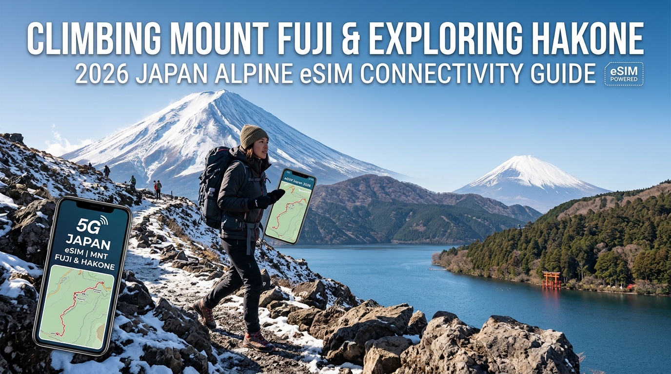
Climbing Mount Fuji & Exploring Hakone: 2026 Japan Alpine eSIM Connectivity Guide
High-Altitude Cellular Architecture: How Docomo, KDDI, and SoftBank Power Mount Fuji & Hakone
Delivering multi-gigabit cellular connectivity to an isolated 3,776-meter stratovolcano and a rugged volcanic caldera requires a masterclass in radio frequency (RF) engineering. Every climbing season (early July through early September), Japan’s major mobile network operators (MNOs)—NTT Docomo, KDDI (au), and SoftBank—deploy specialized alpine cellular infrastructure to blanket Mount Fuji’s trails and Hakone’s complex topography.
+-----------------------------------------------------------------------------------------+
|                    JAPAN ALPINE CELLULAR DEPLOYMENT MATRIX                              |
+------------------+------------------------------+--------------------+------------------+
| Operator         | Primary Low-Band (Sub-GHz)   | Mid/High-Band      | Alpine Footprint |
+------------------+------------------------------+--------------------+------------------+
| NTT Docomo       | Band 19 (800 MHz "Platinum") | Band 1 / Band 3    | Yoshida/Summit   |
| KDDI (au)        | Band 18/26 (800 MHz)         | Band 1 / Band 41   | Caldera/Gotemba  |
| SoftBank         | Band 8 (900 MHz) / Band 28   | Band 1 / Band 3    | Base/Subashiri   |
+------------------+------------------------------+--------------------+------------------+
Seasonal Alpine Base Stations and Beamforming Transceivers
Due to sub-zero winter temperatures, severe typhoons, and heavy snowpack, permanent cellular masts cannot survive year-round on the upper slopes of Mount Fuji. Instead, MNOs construct seasonal temporary base transceiver stations (BTS) across mountain huts from the 7th Station up to the summit rim (Kusushi Shrine and Kengamine Peak).
- Sub-GHz Propagation: Operators lean heavily on sub-1GHz spectrum—specifically Docomo’s Band 19 (800 MHz) and KDDI’s Band 18 (800 MHz). These low-frequency bands exhibit superior wave-bending characteristics, wrapping around ridges where line-of-sight is obstructed.
- Beamforming Microcells: High-capacity directional massive MIMO panels are positioned at the 5th and 8th stations, steering tightly focused RF beams upward along the Yoshida, Subashiri, Gotemba, and Fujinomiya climbing corridors.
RF Multipath Fading: Basalt Absorption and Caldera Topography
Providing coverage across Mount Fuji and Hakone presents harsh propagation environments:
- Volcanic Basalt Attenuation: Mount Fuji’s slopes consist of porous, iron-rich basalt and volcanic scoria. This rock composition absorbs and diffracts RF waves unpredictably, degrading standard signal propagation models and causing rapid Reference Signal Received Power (RSRP) drops over short linear distances.
- Caldera Multipath Interference in Hakone: In Hakone’s deep volcanic basin—particularly around the sulfuric ravines of Owakudani and the water surface of Lake Ashi—signals reflect off steep crater walls and water bodies. This creates destructive multipath interference (phase cancellation), causing single-carrier devices to display full signal bars while suffering massive packet loss.
        Direct Wave
BTS =========================> Mobile Device (OK)
     \                       /
      \  Reflected Wave     /
       \-> [Basalt Ridge] -/ (Phase Inversion = Packet Loss)
The 04:30 AM "Goraiko" Summit Congestion Spike
The steepest technical bottleneck on Mount Fuji is network congestion. Between 04:00 AM and 05:00 AM, over 5,000 climbers converge on the narrow summit crater rim to witness Goraiko (the sunrise). As thousands of devices simultaneously attempt to upload 4K video streams and high-resolution photos, the physical uplink (PUSCH) channels on local summit microcells experience severe spectrum exhaustion. Single-network eSIMs tied to a single local carrier frequently stall out completely due to local cell saturation.
Dual-Carrier Switching: Eliminating Alpine Blind Spots
To navigate these high-altitude bottlenecks, relying on a single network profile introduces serious failure points. MollySIM integrates an intelligent multi-carrier core network engine that provisions dynamic switching between NTT Docomo and KDDI.
If Docomo’s high-altitude transceivers on the Yoshida trail become congested during the morning peak, the eSIM dynamically routes data payloads through KDDI’s secondary ridge repeaters. Furthermore, if you exceed your high-speed allowance halfway up the mountain, MollySIM applies a 384kbps Fair Use Policy (FUP) threshold—nearly triple the industry-standard 128kbps throttle. This guarantees sufficient bandwidth to sustain continuous GPS trail tracking on YAMAP, load live topographic maps on Google Maps, and execute IC card top-ups via Apple Pay without dropping offline in the alpine backcountry.
Trail-by-Trail Alpine Network Analysis: Yoshida, Subashiri, Gotemba, and Fujinomiya
🇯🇵 Japan High-Speed Travel eSIM & SIM Plans
Instant QR code activation, hotspot enabled, with guaranteed 384kbps fallback speed to keep Maps & Digital Wallets active.
Signal propagation across Mount Fuji is governed by line-of-sight (LoS) geometry, base station elevation, and physical terrain masking. Each of the four official climbing routes presents a distinct radio frequency (RF) profile, requiring different carrier bands to sustain continuous data links.
       [ Summit Crater: 3,776m ]
       /           |           \
 [Yoshida]    [Subashiri]   [Gotemba]   [Fujinomiya]
 Dense Micro-  Tree Canopy   Sparse RF   Direct LoS to
 Cells / High  Attenuation  / Low-Band  Suruga Bay Macro
 Congestion    & Fast Drops  Required    Towers (Multipath)
1. Yoshida Trail (Yamanashi Side)
- RF Profile: High microcell density; heavy bandwidth throttling during peak hours.
- Coverage Landscape: As the most commercialized route, the Yoshida Trail features dedicated temporary alpine microcells installed from the 5th Station (2,305m) up to the 8.5th Station (Goraikokan). NTT Docomo and KDDI maintain robust LTE Band 1 (2100 MHz) and Band 3 (1800 MHz) coverage along the ascent path.
- Critical Bottleneck: Massive congestion occurs between the 8.5th Station and the summit torii gate from 02:30 AM to 05:00 AM. While your device may show four bars of signal, available physical resource blocks (PRBs) on local cells are completely saturated by thousands of idling devices.
2. Subashiri Trail (Shizuoka East Side)
- RF Profile: Heavy canopy attenuation transitioning to rapid cell handover along scree fields.
- Coverage Landscape: Starting at 1,970m, the first section winds through dense deciduous forest up to the 7th Station (2,700m). Foliage scattering significantly attenuates higher-frequency LTE bands, making lower-band frequencies (800 MHz) essential for preserving battery life and maintaining packet stability.
- *The Sunabashiri Challenge: The descent features the famous Sunabashiri* (sand-running scree slope). Hikers drop over 1,000 vertical meters in under an hour. This rapid altitude loss forces aggressive, repeated cell tower reselection. Single-network SIMs often experience radio link failures (RLF) here, whereas MollySIM transparently negotiates handovers across alternating Docomo and KDDI base stations to maintain active GPS telemetry.
3. Gotemba Trail (Shizuoka Southeast Side)
- RF Profile: Long exposure, sparse hut infrastructure, heavy reliance on lowland macro towers.
- Coverage Landscape: With the lowest trail-head elevation (1,440m) and the longest physical distance, Gotemba has minimal on-trail repeater infrastructure. Connectivity relies on macro base stations positioned around Gotemba City and the foothills.
- Technical Requirement: Devices must leverage KDDI Band 18/26 or Docomo Band 19 (800 MHz "Platinum Band"). High-frequency signals degrade over the massive volcanic gravel plains. Dual-carrier fallback is non-negotiable on this route; losing connection on this remote trail creates major navigation hazards during sudden whiteouts.
4. Fujinomiya Trail (Shizuoka South Side)
- RF Profile: Steep volcanic face with uninhibited line-of-sight to coastal macro sites.
- Coverage Landscape: The shortest and steepest route provides direct line-of-sight down to Suruga Bay, Fuji City, and Numazu. Signals beamed from coastal macro transceivers reach almost the entire trail directly.
- The Sea-of-Clouds Trap: When dense maritime cloud layers form below the 6th Station (2,490m), RF signals experience severe multipath scattering and ducting attenuation. Mountain huts along this route also feature heavy galvanized-steel cladding; stepping inside immediately creates a Faraday cage effect, dropping incoming signal strength by 15 to 25 dBm.
Alpine Route Connectivity Matrix
| Trail | Dominant Carrier | Primary Signal Challenge | Dead Zone / Bottleneck Risk | Recommended Network Strategy |
|---|---|---|---|---|
| Yoshida | Docomo / KDDI | Uplink spectrum exhaustion | Summit Torii & Hut interiors | Auto-switch carrier to bypass localized microcell saturation |
| Subashiri | Docomo | Canopy RF absorption (below 2,700m) | Scree descent (Sunabashiri) | Low-band (800 MHz) anchor with multi-carrier roaming |
| Gotemba | KDDI | Large transceiver distance | Mid-trail barren ridges (7th Stn) | Carrier fallback to KDDI Band 18/26 macro coverage |
| Fujinomiya | Docomo / KDDI | Cloud deck tropospheric scatter | Inside steel-roof rest shelters | Move to external veranda; rely on direct coastal macro links |
Mitigating Indoor Hut Attenuation and Bandwidth Depletion
Mountain huts on Mount Fuji rely on thick timber frames reinforced with external sheet metal to endure extreme winter blizzards. This structural profile turns hut dormitories into RF-shielded enclosures. If you need to verify tomorrow’s wind-shear forecast on Windy or transmit check-in messages via WhatsApp, position your device near perimeter windows or step outside onto exterior staging decks.
Furthermore, running continuous GPS tracking apps like YAMAP or Komoot while cross-referencing topographic offline layers on Google Maps consumes baseline background data. If your high-speed data tier runs out during a multi-day trek through the Fuji-Hakone-Izu national park corridor, standard eSIMs throttle bandwidth down to an unusable 128kbps, causing map tile rendering to fail.
MollySIM resolves this vulnerability by maintaining a 384kbps Fair Use Policy (FUP) speed limit—giving you three times the throughput of typical roaming profiles. This elevated floor ensures essential navigational tiles, emergency voice-over-IP calls, and Apple Pay payment authorizations process cleanly, even under continuous alpine throttling conditions.
Hakone Caldera Transit & Ryokan Connectivity: Cable Cars, Volcanic Valleys, and Onsens
Transitioning from the barren scree of Mount Fuji into the lush caldera of Hakone shifts your operational environment from high-altitude exposure to complex terrain masking. The Fuji-Hakone-Izu National Park’s dramatic elevation changes, thermal vents, and deeply incised river valleys create a fragmented radio frequency (RF) landscape across the multi-modal Hakone Loop.
Transit Telemetry: Navigating the Hakone Loop
Each stage of the Hakone Loop poses unique propagation challenges for your mobile device:
- Hakone Tozan Railway (Hakone-Yumoto to Gora): Carving through the Hayakawa River gorge, this switchback railway threads through dense cedar canopies and unlined rock tunnels. Mid-band frequencies (1.7–2.1 GHz) suffer rapid signal decay. KDDI and NTT Docomo maintain low-band Band 18/19 (800 MHz) repeaters along trackside corridors, ensuring baseline 4G LTE persists even when 5G drops out.
- Hakone Ropeway & Owakudani: Suspended over the sulfurous vents of Owakudani, gondolas enjoy unobstructed line-of-sight to macro towers on Mount Kami and Mount Komagatake. However, thermal plumes and dense ambient hydrogen sulfide ($H_2S$) monitors introduce localized radio interference near the crater station.
- Lake Ashi Sightseeing Cruise: Open-water transit between Togendai, Hakonemachi-ko, and Motohakone-ko provides strong line-of-sight reception. Occasional signal fading occurs near the southern cliff edges due to natural topographic shadowing.
The Ryokan Problem: Timber, Stone, and Subterranean Attenuation
Historic hot spring enclaves in Gora, Miyanoshita, and Tonosawa feature traditional ryokans constructed with heavy sugi (cedar) timbers, dense tsuchikabe (earthen clay/bamboo) walls, and reinforced slate roofs.
+-------------------------------------------------------------------------+
| RYOKAN RF PENETRATION PROFILE                                           |
+------------------------------------+------------------------------------+
| Construction Element               | RF Attenuation / Impact            |
+------------------------------------+------------------------------------+
| Earthen Clay & Bamboo (Tsuchikabe) | 8–14 dB loss on mid-band LTE / 5G  |
| Subterranean Basalt Onsen Baths    | Near-total RF blackout (dead zone) |
| Multi-Pane Thermal Glass           | 4–6 dB degradation on 800MHz bands |
+------------------------------------+------------------------------------+
Subterranean rotemburo (open-air stone hot springs) set into mountain ravines consistently block cellular reception. When stepping back into your room, local captive-portal Wi-Fi setups are often oversubscribed between 17:00 and 21:00 as guests return for kaiseki dinners, leading to dropped packets and latency spikes above 400ms.
Why Public Wi-Fi Fails in Hakone’s Mountain Passes
Relying exclusively on municipal bus Wi-Fi or regional hot spots creates severe friction points throughout your itinerary:
- Dynamic QR Ticket Invalidation: Digital transport passes—including the digital Hakone Freepass on the EMot app or Klook—require live cryptographic token refreshes at transfer gates. Spotty station Wi-Fi frequently stalls during ticket inspection.
- Serpentine Bus Route Tracking: Hakone Tozan Buses navigate steep, single-lane mountain switchbacks where delays are frequent. Real-time transit trackers like Navitime Japan Travel rely on continuous cellular polling to reroute you around traffic bottlenecks near Yumoto.
- Volcanic Hazard Advisories: Owakudani remains an active volcanic zone. The Japan Meteorological Agency (JMA) broadcasts real-time alerts regarding sulfur dioxide ($SO_2$) gas concentrations; intermittent public Wi-Fi leaves you blind to urgent site closures and bypass notices.
Reliable Caldera Data with MollySIM
An activated MollySIM profile bypasses congested municipal Wi-Fi by locking directly onto Tier-1 Japanese networks (NTT Docomo and SoftBank). This ensures unbroken connectivity across every transit leg:
- Continuous Digital Ticketing: Instantly render digital transit barcodes and reserve romancecar seats without waiting on captive Wi-Fi login splash screens.
- Live Transit Polling: Keep Navitime, Google Maps, and Hakone Tozan bus schedules updated in real time as you traverse the mountain switchbacks.
- 384kbps Safety Floor: If your primary data allocation runs low while exploring the outer rim of the caldera, MollySIM’s 384kbps Fair Use Policy (FUP) speed floor delivers triple the bandwidth of competitor 128kbps plans. This allows navigation vectors, real-time translation tools, and Apple Pay checkouts at ryokan gift shops to execute seamlessly.
Comparative Technical Matrix: Pocket Wi-Fi vs. Roaming SIM vs. MollySIM Alpine eSIM
Traversing alpine microclimates—from the humid, sulfurous valleys of Hakone to the sub-zero scree fields of Mount Fuji’s Kengamine peak (3,776m)—exposes severe technical disparities between legacy connectivity hardware and embedded modern SIM profiles.
The matrix below benchmarks the structural performance of each connectivity model under severe alpine conditions:
| Technical Parameter | Rental Pocket Wi-Fi | Standard Roaming SIM / Monolithic eSIM | MollySIM Japan Alpine eSIM |
|---|---|---|---|
| Sub-Zero Battery Reliability (-5°C to 0°C) | High Failure Risk: Lithium-ion electrolyte freeze causes sudden shutdown; adds charging cycle load. | Moderate: Dependent on host phone battery; single SIM radio draws baseline power. | Optimal: Zero peripheral draw; native baseband integration preserves host smartphone thermal management. |
| Carrier Architecture & Redundancy | Single MNO Lock-in: Hardcoded to one provider (usually SoftBank or Docomo MVNO). | Single Roaming Partner: Statically routed via a single local network; prone to dead zones behind ridgelines. | Dynamic Tier-1 Multi-Carrier: Auto-switches between NTT Docomo and KDDI base transceiver stations (BTS). |
| Uplink Bandwidth at 3,000m+ | Highly variable; throttled by shared Wi-Fi radio contention and device antenna loss. | Low-to-moderate; latency penalties from routing data back through home country gateways. | High Priority LTE/5G: Direct breakout via local routing nodes for real-time video and location pings. |
| Emergency Signal Latency (JMA Alerts) | 180ms – 420ms (double radio hop: Cellular $\to$ Pocket Wi-Fi $\to$ Smartphone Wi-Fi). | 250ms – 600ms (international roaming latency routing loops). | < 45ms Local Breakout: Direct-to-tower connection ensures rapid volcanic/earthquake notification reception. |
| Fair Use Policy (FUP) Safety Floor | Hard cut-off or 0–64kbps (unusable for map rendering or emergency packets). | 128kbps (frequent packet drops on encrypted SSL/TLS map layers). | 384kbps High-Floor FUP: 3x industry standard; maintains live GPS vectors, Apple Pay, and text telemetry. |
| Weight & Physical Footprint | 140g – 220g (device + required external power bank and micro-cables). | 0g (physical swap required; risk of losing primary nano-SIM). | 0g (100% digital provisioning via fast QR activation before departure). |
Thermal Vulnerability and Battery Passivation at Altitude
Pocket Wi-Fi routers rely on standalone, pouch-cell lithium-ion batteries. When ascending above Mount Fuji’s 8th Station (3,100m) into pre-dawn summit temperatures between -3°C and -8°C, these external units suffer from severe battery passivation. The internal resistance of the battery spikes, causing critical voltage drops under transmission load. As a result, pocket Wi-Fi devices routinely shut down unexpectedly—even when reporting a 40–50% charge—leaving climbers without telemetry or route mapping precisely when traversing dangerous scree terrain in the dark.
Furthermore, keeping an external Wi-Fi unit operational requires constant Wi-Fi tethering on your smartphone. Dual-radio active states (Wi-Fi receiver + cellular transceiver) drain your smartphone’s internal cell twice as fast.
With an embedded profile from MollySIM, connectivity is handled directly by your phone's integrated baseband modem. By keeping your device protected inside an insulated, windproof inner pocket next to your body heat, you eliminate hardware exposure, prevent cold-weather battery drop, and shed up to 250 grams of redundant electronics, cables, and battery packs from your summit gear loadout.
Multi-Carrier Dynamic Switching Across Fuji’s Shadowed Ridges
Mount Fuji's volcanic topography creates massive radio-frequency shadowing. A cell tower operating at the Subashiri Trailhead often fails to penetrate the crater rim or the deep switchbacks of the Gotemba route on the southeastern slope.
Single-network devices (including almost all rental pocket Wi-Fi units) lock your connection to one carrier:
- If your rental is provisioned solely on SoftBank, you will encounter complete dead zones on specific stretches between the 7th and 8th stations on the Fujinomiya trail.
- MollySIM’s multi-IMSI architecture continuously evaluates signal quality across Japan's top tier-1 carriers (NTT Docomo and KDDI). If a Docomo signal drops behind an alpine ridge, the profile handshakes with the nearest KDDI cell site, maintaining uninterrupted telemetry for topographic tracking apps like YAMAP and Strava.
The 384kbps Safety Floor: Why Bandwidth Caps Matter on the Mountain
Most travel data plans implement a punishing 128kbps throttle once you exhaust your high-speed daily data bucket. At 128kbps:
- Modern secure apps will fail due to SSL/TLS handshake timeouts.
- Dynamic map tiles on Google Maps or Apple Maps will fail to resolve, rendering your navigation screen blank.
- Digital payment processing at mountain huts (PayPay, Apple Pay) times out entirely.
MollySIM engineers its Japan alpine data profiles with an industry-leading 384kbps Fair Use Policy (FUP) safety floor. At 384kbps, your bandwidth is triple that of conventional providers. This provides enough throughput to keep HTTPS navigation sockets alive, stream real-time GPS coordinates to mountain rescue services, process contactless checkouts at high-altitude huts, and send compressed photo updates—ensuring you are never left digitally stranded on the mountain.
Alpine Data Budgeting: Weather Telemetry, GPS Telematics, and Sunrise 4K Streaming
Scaling Mount Fuji’s 3,776-meter volcanic terrain requires balancing high-bandwidth visual sharing with mission-critical safety telemetry. Understanding the exact network payload of your alpine toolchain prevents unexpected high-speed data exhaustion before reaching the crater rim.
Real-Time Alpine Telemetry: Payload Consumption Breakdown
The table below outlines real-world data consumption metrics across critical alpine apps, weather radar models, and summit streaming during a typical 8-to-12 hour Fuji ascent:
| Application / Use Case | Bandwidth Profile | Hourly / Event Payload | Primary Network Protocol & Notes |
|---|---|---|---|
| SCW (Super C weather) High-Res Mesh | High (Bursty) | 15 MB – 25 MB per full radar sweep | Uncompressed numerical weather prediction grids and cloud-top altitude maps. |
| Tenki.jp Clima / Lightning Radar | Medium | 8 MB – 12 MB / hour (active polling) | Dynamic radar layer over raster maps; updates every 5–10 minutes. |
| YAMAP / Komoot (Cached Basemap) | Minimal | 2 MB – 4 MB / hour | Vector coordinates, elevation delta, and peer-to-peer location beaconing. |
| YAMAP / Komoot (Uncached Map Tiles) | High | 45 MB – 85 MB / hour | Dynamic downloading of high-resolution 2.5D topographic tiles. |
| Instagram Stories / Reels (1080p upload) | Medium-High | 30 MB – 60 MB per 60s clip | H.264/H.265 video container with TLS uplink overhead. |
| Summit Sunrise (Goraiko) 4K Live Stream | Extreme | 1.8 GB – 3.2 GB per 10-min stream | 25–45 Mbps bitrate via RTMP/HLS; rapidly depletes non-optimized data plans. |
Alpine Data Optimization Playbook
To preserve your high-speed quota for emergency weather telemetry and summit documentation, apply these three field-tested configurations before departing your staging point in Shinjuku or Gotemba:
1. Pre-Cache Vector Basemaps over Hotel Wi-Fi
Streaming dynamic topographic map tiles over cellular radios while hiking not only consumes up to 85 MB per hour per app, but it also triggers continuous baseband handshakes that accelerate battery drain.
- YAMAP Action: Search "Mount Fuji (Yoshida / Subashiri / Gotemba / Fujinomiya)" and download the official 1:25,000 route map package (approx. 45 MB) while connected to hotel Wi-Fi.
- Komoot / Strava Action: Save your intended GPX track with offline topography enabled. Once cached, your active navigation relies purely on low-overhead GPS satellite trilateration, reducing cellular data transfer to under 4 MB per hour for background telemetry.
2. Prevent Baseband Battery Drain from "Cell Hunting"
When crossing the wind-swept ridges between the 7th and 8th stations, signal margins oscillate rapidly between standard LTE and Sub-6 5G micro-cells.
- iOS: Navigate to Settings > Cellular > Cellular Data Options > Voice & Data and select LTE instead of 5G Auto.
- Android: Go to Settings > Network & Internet > SIMs > Preferred network type and lock to LTE/4G.
Locking your device to LTE prevents the baseband processor from constantly cycling higher transmission power states to negotiate weak 5G carriers, conserving 18% to 25% of your device’s battery across a cold 6-hour night trek.
3. Throttle OS-Level Background Sockets
Operating systems aggressively fetch background assets unless strictly reined in:
- Enable Low Data Mode (iOS) or Data Saver (Android) across your active eSIM profile.
- Restrict automatic cloud backups (iCloud Photos, Google Photos) to Wi-Fi Only. A single 4K HDR sunrise video auto-syncing in the background will silently burn 1.5 GB of high-speed data in under four minutes.
The Fail-Safe Data Buffer: MollySIM's 384kbps Advantage
Even if an extended 4K live stream of the summit sunrise exhausts your allocated high-speed data bucket, maintaining connectivity is non-negotiable. Traditional providers drop connection speeds to an unworkable 128kbps—a threshold where HTTPS handshakes time out and live radar fails to render.
With MollySIM, your service steps down to a stable 384kbps Fair Use Policy (FUP) floor. Operating at three times the speed of competitor fallbacks, this persistent bandwidth keeps your critical data pipes functional: vector routes on Google Maps and Apple Maps update without hanging, local weather radar refreshes on schedule, and contactless payments (Apple Pay, digital mountain hut passes) process instantly at the summit.
Emergency Resilience & Safety Protocols: The MollySIM 384kbps Fallback Advantage
When ascending beyond the 7th Station into the alpine wilderness of Mount Fuji or traversing the remote ridgelines around Hakone's outer caldera, reliable data connectivity transforms from a convenience into an active safety system. Mountain search and rescue operations across the prefectural borders of Shizuoka and Yamanashi rely heavily on precise geolocation payloads and instant communication channels.
Understanding how your eSIM handles data exhaustion during a sudden weather deterioration or medical emergency can mean the difference between an immediate coordinated rescue and an unresolvable communication blackout.
+--------------------------------------------------------------------------------+
|                   JAPAN ALPINE EMERGENCY DISPATCH CHANNELS                     |
+--------------------------------------------------------------------------------+
|  Dial 110  -> Police Mountain Rescue Teams (Yamanashi / Shizuoka Prefectures)  |
|  Dial 119  -> Fire Department & Emergency Medical Dispatch (Ambulance / Air)   |
|  Dial 118  -> Japan Coast Guard (Maritime / Lake Ashi water incidents)         |
+--------------------------------------------------------------------------------+
The Architectural Failure of Conventional 64kbps/128kbps Throttling
Most international tourist eSIMs enforce punitive Fair Usage Policies (FUP) that slash connection throughput down to 64kbps or 128kbps once your daily or aggregate gigabyte allowance is spent. In standard city environments, this renders web browsing painfully slow; in high-altitude environments, it causes catastrophic socket failures:
- TLS 1.3 / SSL Handshake Timeouts: Modern encrypted web traffic requires multiple packet round-trips to negotiate security certificates. Under a 64kbps–128kbps throttle with high ping latency, the round-trip time (RTT) spikes over 2,500ms, causing the operating system to drop the connection before the handshake completes.
- Telemetry & API Dropouts: Critical navigation platforms (like Japan's premier alpine mapping app YAMAP or Google Maps) cannot refresh vector tiles or transmit continuous GPS telemetry over saturated, high-jitter pipes.
- VoIP Session Teardown: Voice-over-IP applications require sustained bitrates without packet loss. A 128kbps connection cannot accommodate the combined overhead of real-time transport protocol (RTP) packets and background OS synchronization, leading to immediate call drops.
The MollySIM 384kbps Safety Baseline
To eliminate telemetry blackouts, MollySIM implements a hard engineering floor: a sustained 384kbps FUP fallback speed across its Japanese network profiles. By providing three times the throughput of typical tourist eSIMs, this dedicated bandwidth pipeline preserves essential data sessions even if your high-speed bucket hits zero gigabytes at the summit.
| Survival / Operational Tool | Bandwidth Requirement | Competitor Fallback (64–128kbps) | MollySIM Fallback (384kbps) |
|---|---|---|---|
| YAMAP SOS Location Beacon | ~8–16 kbps burst | ❌ Fails (Socket Timeout) | ✅ Real-Time Transmission |
| WhatsApp Voice Note (Opus) | ~16–32 kbps | ⚠️ Severe Clipping / Delay | ✅ Crystal Clear Dispatch |
| Google Maps Live Pin Sharing | ~30–50 kbps | ❌ Fails to Render Base Map | ✅ Accurate Coordinates & Cache |
| VoWiFi / VoIP Emergency Audio | ~40–64 kbps (Low Jitter) | ❌ Call Drops / Unintelligible | ✅ Sustained Voice Channel |
| Emergency Alpine Radar (JMA) | ~120–200 kbps | ❌ Complete Timeout | ✅ Static Image Refreshes (~5s) |
Standard Tourist eSIM (128kbps Throttle):
[TLS Handshake] ---> [High Jitter / Packet Drop] ---> [Connection Timeout / SOS Fails]

MollySIM Alpine Baseline (384kbps Throttle):
[TLS Handshake] ---> [Stable Latency Pipeline]   ---> [YAMAP / WhatsApp / GPS Transmitted]
Protocol Execution in High-Stress Scenarios
If you encounter hypothermia, acute mountain sickness (AMS), or route displacement in poor visibility, this 384kbps bandwidth safety buffer enables critical emergency procedures:
- Yamap & Geolocation Beaconing: Alpine search teams in Shizuoka and Yamanashi utilize coordinates pulled directly from GPS tracking systems. MollySIM's continuous 384kbps pipeline allows background sync tokens to upload latitude, longitude, and elevation telemetry continuously without stalling.
- Asynchronous Emergency Dispatch: If mobile voice networks become congested around the peak, asynchronous audio messages via WhatsApp, LINE, or Apple Messages compress voice data using the Opus codec at 16–24kbps. At 384kbps, an emergency audio report transmitting your group status and visible trail markers uploads in seconds.
- Point-of-Sale Mountain Hut Access: Extreme weather often necessitates taking emergency shelter in summit or 8th Station mountain huts. Because mobile payment platforms (PayPay, Apple Pay) require stable SSL handshakes to verify localized tokens, the 384kbps floor ensures digital transactions clear instantly when cash is depleted.
🇯🇵 Japan High-Speed Travel eSIM & SIM Plans
Instant QR code activation, hotspot enabled, with guaranteed 384kbps fallback speed to keep Maps & Digital Wallets active.