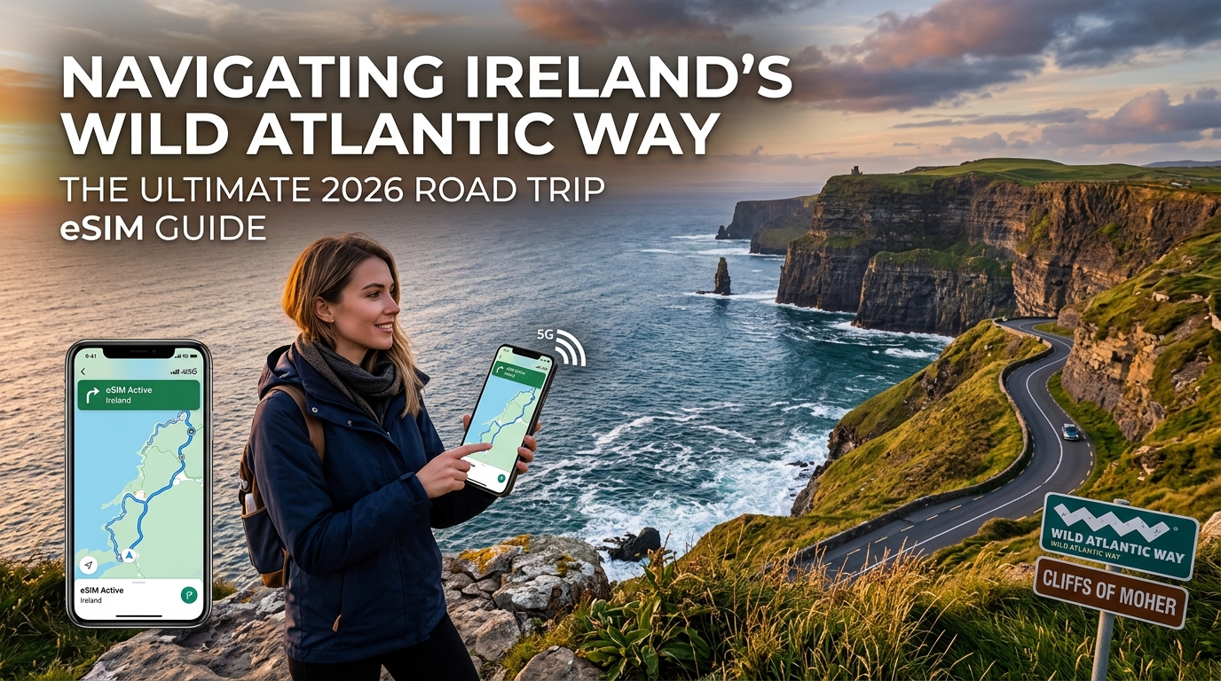
The Wild Atlantic Way Terrain: Connectivity Across Ireland's 2,500km Coastline
Stretching across 2,500 kilometers of untamed Atlantic fringe, the Wild Atlantic Way (WAW) is one of the longest defined coastal touring routes in the world. Beginning at the jagged rim of the Inishowen Peninsula in County Donegal and concluding in the culinary harbor town of Kinsale in County Cork, the route crosses nine counties, six distinct geographical zones, and some of the most cellular-hostile terrain in Western Europe.
Topographical RF Challenges: From Slieve League to the Healy Pass
Cellular signal propagation along Ireland’s western perimeter faces massive physical barriers. While major urban hubs like Galway, Sligo, and Tralee boast dense 5G millimeter-wave and sub-6GHz coverage, the coastal corridors present distinct radio frequency (RF) challenges:
- Maritime Cliff Shielding: Locations like the Slieve League cliffs (601m drop) in Donegal and the Cliffs of Moher in County Clare create severe "shadow zones." When driving in the lee of these sheer sea-facing escarpments, direct Line-of-Sight (LoS) to inland macro cell towers is completely obstructed, forcing handsets to hunt across high-attenuation reflected signals.
- Mountain Passes & Gap Valleys: Traversing the Conor Pass (the highest mountain pass in Ireland at 410m on the Dingle Peninsula) or the hairpinned Healy Pass across the Caha Mountains on the Beara Peninsula severely degrades cellular reception. Rock mass absorbs mid-band LTE frequencies (1800MHz/2100MHz), dropping connections down to low-band 800MHz (Band 20) or cutting off coverage altogether in deep switchbacks.
- Expansive Boglands: The vast blanket bogs and granite expanses of Connemara (Galway) and North Mayo lack physical utility infrastructure. Towers are spaced far apart along primary regional roads (like the N59), meaning cellular signal strength degrades rapidly once you turn off onto single-track coastal loops (L-roads).
The Friction of Traditional Tourist SIMs at DUB and SNN
Most international road trippers land at either Dublin Airport (DUB) or Shannon Airport (SNN). Historically, securing local connectivity meant purchasing a physical prepaid plastic SIM card upon arrival. However, this legacy method introduces distinct operational bottlenecks for road trips:
| Friction Point | Physical Airport Tourist SIM | Digital Travel eSIM |
|---|---|---|
| Arrival Logistics | Queuing at airport convenience kiosks or dedicated SIM desks. | Zero queues; instantly connects to local base stations upon landing. |
| Store Hours | Desks often closed during early-morning transatlantic red-eye arrivals. | 24/7/365 digital activation before departure or on airport Wi-Fi. |
| Hardware Risks | Swapping physical nano-SIMs with ejector pins; high risk of losing home SIM. | 100% digital; dual-SIM functionality keeps home number active for 2FA SMS. |
| KYC / Registration | Manual passport scanning, physical paper registration, and activation lag. | Instant profile provisioning via QR code without hardware interaction. |
Fumbling with plastic SIM trays in a rental car depot while trying to load initial navigation directions to your first stop in Mayo or Clare creates immediate travel friction.
The eSIM Advantage: Seamless Turn-by-Turn Navigation
Deploying an eSIM profile directly onto your device before arriving in Ireland mitigates the risks of coastal road tripping. Because a digital eSIM profile provisions over-the-air, your smartphone connects to Irish partner networks (such as Vodafone Ireland, Three, or Eir) the second your aircraft touches down on the runway.
Turn-by-turn GPS navigation apps (Google Maps, Apple Maps, and Waze) download essential vector tiles continuously. If you venture deep into rural Gaeltacht areas or isolated headlands like Loop Head or Mizen Head where heavy data usage caps might trigger throttling, standard roaming providers degrade connection speeds to an unusable 128kbps—causing mapping applications and digital transactions to fail.
To prevent navigation lockups on remote Irish backroads, providers like MollySIM implement an optimized Fair Use Policy (FUP) with a 384kbps speed limit. At 3x the standard throttle speed, a 384kbps fallback provides sufficient bandwidth to keep dynamic vector routing, turn-by-turn voice prompts, and Apple Pay/Google Wallet authentication fully operational, even in low-reception pockets of the Atlantic coast.
Irish Cellular Infrastructure: Vodafone, Three, and Eir Compared for Rural Road Trips
🇪🇺 Europe 33 Countries High-Speed Travel eSIM & SIM Plans
Instant QR code activation, hotspot enabled, with guaranteed 384kbps fallback speed to keep Maps & Digital Wallets active.
Navigating the 2,500 kilometers of the Wild Atlantic Way requires an understanding of how Ireland’s cellular networks are deployed across extreme topography. The rugged coastline—defined by sheer sea cliffs, deep glacial fjords (like Killary Harbour), and exposed peninsulas—presents significant physical barriers to radio frequency (RF) propagation.
Ireland’s Commission for Communications Regulation (ComReg) allocates spectrum across three physical Mobile Network Operators (MNOs): Vodafone Ireland, Three Ireland, and Eir. Each operator utilizes distinct frequency profiles that dictate signal strength and data throughput when traveling far from urban centers.
Low-Band vs. High-Band Spectrum on the Atlantic Edge
Mobile data reliability along rural coastal routes depends heavily on the carrier's deployment of sub-1GHz low-band frequency spectrum:
- Band 20 (800 MHz) & Band 28 (700 MHz): These low-frequency bands are the backbone of rural Irish 4G/LTE coverage. With long physical wavelengths, 700/800 MHz signals penetrate deep into mountainous valleys across Connemara, Kerry, and Donegal, bending around coastal headlands where higher frequencies attenuate. Vodafone and Eir maintain heavy macro-tower investments on Band 20 along rural national secondary routes (N-roads) and regional roads (R-roads).
- Band 3 (1800 MHz) & Band 1 (2100 MHz): Deployed primarily for capacity in suburban corridors and larger coastal towns like Westport, Clifden, and Bantry. These bands deliver fast 4G speeds but suffer rapid path loss when obstructed by coastal granite ridges.
- Band n78 (3.5 GHz 5G): High-capacity 5G spectrum is largely concentrated in major urban centers along the route (such as Galway City, Limerick, and Sligo). While Band n78 delivers gigabit-level throughput, its effective broadcast radius rarely extends beyond 2 to 3 kilometers from a cell site, making it practically non-existent on remote cliffside stretches like the Beara Peninsula or Loop Head.
+-------------------------------------------------------------------------+
|                  CELLULAR PROPAGATION ON COASTAL ROADS                  |
|                                                                         |
|  [3.5 GHz (n78) 5G]     ████ (Fast, drops within 2km / Urban Only)      |
|  [1.8/2.1 GHz 4G]       ████████████ (Moderate range / Towns & Hubs)     |
|  [700/800 MHz (B20/28)] ██████████████████████████████ (Deep Rural)    |
+-------------------------------------------------------------------------+
The Single-Network Pitfall: Coastal Shadow Zones
The primary issue with purchasing a single-carrier local prepaid SIM card (such as a standalone Three or Eir SIM) is geographic mast fragmentation.
Cellular coverage along the Atlantic seaboard is not distributed evenly among carriers:
- Eir boasts an extensive backhaul network utilizing legacy national telecom infrastructure, giving it a strong presence in remote Kerry and West Cork.
- Vodafone Ireland maintains the highest mast density across isolated stretches of Mayo, North Clare, and West Donegal.
- Three Ireland holds extensive commercial spectrum and delivers fast suburban data speeds, but its coverage can drop abruptly in deep coastal valleys where it lacks mast-sharing infrastructure.
When you purchase a local prepaid SIM locked to a single Irish MNO, entering a geographical "cell shadow" behind a coastal headland drops your connection entirely until you pass the next ridge.
Multi-network travel solutions like MollySIM eliminate this single point of failure. By partnering directly with multiple top-tier Irish networks, the eSIM dynamically switches your device to whichever carrier holds the dominant RF signal at that specific GPS coordinate.
MNO and Travel Data Architecture Matrix
The table below outlines how Ireland’s domestic mobile operators compare against international roaming solutions across infrastructure, cross-border functionality, and throughput reliability:
| Evaluation Metric | Vodafone Ireland | Three Ireland | Eir | Standard Travel SIMs / Roaming Passes | MollySIM Multi-Network eSIM |
|---|---|---|---|---|---|
| Network Core | Vodafone Single MNO | Three Single MNO | Eir Single MNO | Single Partner Steered Roaming | Dynamic Multi-Network Aggregation (Vodafone / Three / Eir) |
| Rural 4G Penetration (B20/B28) | Excellent (Broadest rural Atlantic footprint) | Moderate (Strong in hubs, weaker in isolated peninsulas) | Very Good (Extensive regional mast backhaul) | Variable (Locked to one partner's rural towers) | Optimized (Connects automatically to the strongest local mast) |
| 5G Availability | Hubs & Primary N-Roads | Major Urban Hubs | Hubs & Secondary Towns | Often restricted to 4G/LTE access only | 5G Enabled in all regional urban nodes |
| Cross-Border Continuity (Donegal / Northern Ireland) | Requires EU/UK roaming activation check | Separate roaming profile checks | Requires cross-border roaming toggling | Incurs regional add-on fees or daily charges | Seamless switching between Irish MNOs and UK networks (EE/O2) |
| Activation Architecture | In-store physical passport verification or complex KYC | Physical SIM retail purchase / Local KYC steps | In-store verification or delayed post-delivery | Standard QR profile deployment | Instant Over-The-Air (OTA) QR / Direct Digital Provisioning |
| FUP Throttling Speed (Post-High-Speed Cap) | Connection suspended or cut to 64–128kbps | Drops to 128kbps (Stalls dynamic mapping) | Suspended / Incurs out-of-bundle rates | Hard drop to unusable 128kbps | 384kbps Fail-Safe Floor (3x faster; maintains live GPS & Apple Pay) |
Cross-Border Routing: The Donegal to Northern Ireland Frontier
A unique infrastructural challenge of the Wild Atlantic Way occurs at its northern terminus. The official route concludes at the Inishowen Peninsula in County Donegal, but most drivers continue across the international border into Derry and along the Causeway Coastal Route in Northern Ireland (part of the United Kingdom).
Domestic Irish prepaid cards often encounter connectivity stalls, APN mismatches, or unexpected international roaming fees when crossing into Northern Ireland. A cross-border configured eSIM maintains continuous data aggregation by switching directly from Irish carriers over to British infrastructure (such as EE or O2 UK) without requiring SIM swaps or device restarts at the border.
Dual SIM Navigation Architecture: Apple CarPlay, Android Auto & Real-Time Telematics
Executing a seamless road trip along the rugged 2,500-kilometer Wild Atlantic Way requires an uninterrupted stream of telemetry data. Running live route recalculations on Apple CarPlay or Android Auto while fielding fraud-prevention two-factor authentication (2FA) SMS codes from your home bank requires a correctly segregated dual-SIM profile architecture.
Misconfiguring these lines risks triggering accidental roaming charges on your domestic carrier or dropping real-time GPS feeds in critical signal fringe zones.
Step-by-Step OS Provisioning: Segregating Data and 2FA
To prevent your home carrier from billing background international data roaming while ensuring essential SMS verification codes and emergency voice channels remain open, configure your operating system immediately upon arrival:
Apple iOS (iOS 16, 17, & 18)
- Navigate to Settings > Cellular (or Mobile Data).
- Under SIMs, tap your primary home line and ensure Data Roaming is toggled OFF. Set its label to Home.
- Tap your travel profile (MollySIM) and toggle Turn On This Line to ON. Set Data Roaming to ON.
- Return to the main Cellular screen, tap Cellular Data, and select MollySIM.
- Crucial Step: Toggle Allow Cellular Data Switching strictly OFF. This hard-locks data usage exclusively to the MollySIM profile, preventing accidental carrier fallback charges if local cell density dips.
- Set Default Voice Line to Home to preserve standard voice and inbound banking SMS alerts.
Android (Android 13, 14, & 15 / Samsung One UI)
- Go to Settings > Connections (or Network & Internet) > SIM Manager.
- Under the Preferred SIM section, set Mobile Data exclusively to MollySIM.
- Set Calls and Messages to your primary physical/home SIM.
- Tap your primary home SIM inside the menu and verify that Data Roaming is turned OFF.
- Tap the MollySIM profile, ensure Mobile Data is active, and toggle Roaming to ON to facilitate multi-network handovers across Ireland's regional masts.
Telematics Bandwidth Budgeting: CarPlay & Android Auto Optimization
In-cabin wireless projection platforms consume variable amounts of bandwidth depending on the rendering layers and media bitrates you select. When driving 6 to 8 hours daily along remote coastal headlands, unoptimized telemetry can consume your high-speed quota prematurely.
| Application / Service | Standard Consumption | Optimized Settings Profile | Data Savings |
|---|---|---|---|
| Vector Mapping (Google / Apple Maps) | 15–30 MB / hour | Default 2D vector geometry layer | Baseline |
| Photogrammetry / Satellite Hybrid Maps | 120–250 MB / hour | Disable Satellite Overlays in CarPlay settings | ~85% reduction |
| Waze Real-Time Incident Reporting | 20–40 MB / hour | Standard alerts (disable background media integrations) | ~30% reduction |
| Lossless Music Streaming (Apple / Tidal) | 150–300 MB / hour | Switch streaming quality to High/AAC (256 kbps) or Normal (160 kbps) | ~60% reduction |
| Connected 4K/1080p Cloud Dashcams | 500 MB–1.2 GB / hour | Set to Event-Only Cloud Sync; record continuous video to local MicroSD | ~90% reduction |
Managing R-Road Handover Latency & Offline-Hybrid Caching
The Wild Atlantic Way frequently transitions from primary corridors (such as the N59 in Mayo or the N70 on the Ring of Kerry) to isolated Regional Roads (R-roads like the R257 along the Inishowen Peninsula or the R559 Slea Head Drive).
These secondary coastal roads wind through technical terrain—including deep glacial valleys, sea-cliff shadow zones, and granite headlands—where base transceiver stations (BTS) can experience physical signal obstruction.
The Hybrid Caching Strategy
Do not rely on fully offline mapping apps; doing so strips dynamic road closure alerts, passing-place congestion reports, and live ferry schedules across the Shannon Estuary. Instead, implement a Hybrid Telemetry Model:
- Pre-Cache Vector Topography: While connected to Wi-Fi at your accommodation, open Google Maps or Apple Maps and download offline map rectangles covering the targeted counties (e.g., Cork, Kerry, Clare, Galway, Mayo, Sligo, Donegal).
- Preserve Live Metadata Ingestion: By having the heavy base map vector geometry stored locally in device flash memory, your mobile data connection is only tasked with handling tiny, lightweight telemetry payloads (live traffic vectors, ETA adjustments, hazard markers, and speed camera reports).
- Fail-Safe Bandwidth Floor: If deep topographical depressions cause temporary packet degradation, MollySIM's network architecture provides an active 384kbps Fair Use Policy (FUP) speed floor. Unlike standard travel eSIMs that throttle users down to an unusable 128kbps or sever data entirely, 384kbps is three times faster—providing sufficient throughput to process live Waze traffic re-routes, stream compressed navigation audio, and authenticate contactless Apple/Google Pay transactions at remote coastal tolls without stalling the head-unit interface.
Mission-Critical Digital Touchpoints on the Wild Atlantic Way: Ferries, Pubs & Tides
Driving Ireland’s western seaboard is not a passive sightseeing journey; it is an active logistical exercise governed by Atlantic weather fronts, maritime crossings, and dynamic schedules. From checking vessel clearances across tidal estuaries to authenticating a transaction in a thatched-roof pub, cellular connectivity serves as operational infrastructure.
┌─────────────────────────────────────────────────────────────────────────────────┐
│                 CRITICAL DIGITAL TOUCHPOINTS: BANDWIDTH VS LATENCY               │
├──────────────────────┬──────────────────────┬───────────────────────────────────┤
│ Operational Node     │ Data Type Required   │ Network Vulnerability Risk        │
├──────────────────────┼──────────────────────┼───────────────────────────────────┤
│ Shannon Estuary      │ Live Vessel Tracking │ Missed boarding = 137km detour    │
│ Ferry (Tarbert/      │ & QR Ticket Scans    │ via Limerick city bottleneck      │
│ Killimer)            │                      │                                   │
├──────────────────────┼──────────────────────┼───────────────────────────────────┤
│ Omey Island Tidal    │ Hydrographic Tide    │ Vehicle submersion hazard on      │
│ Causeway (Connemara) │ Tables & Radar Feed  │ saturated tidal sand causeway     │
├──────────────────────┼──────────────────────┼───────────────────────────────────┤
│ Skellig Michael      │ Instant API Booking  │ Lost reservation slot due to      │
│ Tours (Portmagee)    │ & Webhook Payments   │ latency drop during morning drop  │
├──────────────────────┼──────────────────────┼───────────────────────────────────┤
│ Rural Gaeltacht Pubs │ EMV / Apple Pay Host │ Failed card handshake; many rural │
│ & Seafood Shacks     │ Verification Tokens  │ venues operate entirely cashless  │
└──────────────────────┴──────────────────────┴───────────────────────────────────┘
1. Maritime Transit & Coastal Ferry Navigation
The Wild Atlantic Way weaves across rugged peninsulas where coastal car ferries shave hours off inland transit:
- Shannon Ferry (Killimer ⇄ Tarbert): Connecting County Clare to County Kerry, this 20-minute crossing bypasses a 137-kilometer detour through Limerick. During peak summer months, checking real-time queue estimates, buying digital priority boarding passes, and monitoring sea-state delays require sustained 4G/5G data while queueing on the N67 or N69 slipways.
- Offshore Island Connections: Ferries serving Bere Island (West Cork), Inishturk (Mayo), and the Aran Islands (Galway) are prone to abrupt timetable alterations caused by Atlantic swells. A dropped data connection can leave you stranded at an isolated pier with no physical ticket office open.
2. Met Éireann Marine Telemetry & Tidal Causeways
The North Atlantic climate creates localized microclimates that make generic weather forecasts useless. Drivers must pull live telemetry directly from Met Éireann’s Sea Area Forecasts and high-resolution rain radars to navigate coastal hazards safely.
- Omey Island (Connemara): Accessible only by driving across hard-packed sand at low tide, Omey Island has claimed dozens of submerged vehicles due to miscalculated crossings. Drivers must access live hydrographic charts and local tide tables on the move; a stale, cached webpage can result in vehicle loss.
- Mountain Passes & Coastal Cliffs: Negotiating the Conor Pass (Dingle) or the heights of Slieve League (Donegal) during an unpredicted Orange Gale Warning is perilous. Live meteorological push notifications allow you to reroute inland before entering single-lane mountain passes under heavy fog or gale-force crosswinds.
3. Cashless Micro-Transactions & High-Stakes Bookings
Rural Ireland has transitioned rapidly toward digital-first commerce:
- Remote Cashless Payments: From roadside lobster shacks in Doolin to traditional music sessions in Gaeltacht outposts like Gortahork, card readers rely entirely on local cellular links for host verification. If your device throttles or disconnects, completing an Apple Pay or Google Pay transaction stalls. MollySIM mitigates payment failures by maintaining a 384kbps Fair Use Policy baseline—three times the 128kbps throttle typical of standard travel providers—ensuring contactless cryptographic tokens and Revolut bill-splits resolve instantly without timing out.
- High-Demand Excursions: Landing permits for Skellig Michael (Portmagee) and boat tours of the Inishkea Islands release canceled slots dynamically. Snagging these high-demand bookings requires low-latency packet delivery while parked at remote coastal viewpoints.
Uninterrupted Safety: Cross-Border Roaming and MollySIM's 384kbps FUP Guarantee
Executing a comprehensive Wild Atlantic Way itinerary often entails crossing invisible geopolitical borders. The northern terminus of the route at Malin Head naturally feeds into the Inishowen Peninsula and traverses directly into Derry/Londonderry to link with the Causeway Coastal Route.
Because the border between the Republic of Ireland and Northern Ireland (UK) has no physical checkpoints, road trippers cross international telecommunications zones at 80 km/h without stopping. Standard single-country travel eSIMs immediately drop off the network the moment you cross the border into County Derry, severing active GPS routing and instant messaging feeds precisely when navigating complex roundabout systems and unfamiliar urban grids.
Invisible Border Crossing: Multi-IMSI and Regional Profile Handshakes
To maintain continuous telemetry, seasoned travelers rely on regional UK/Europe routing profiles. MollySIM solves the cross-border connectivity drop by deploying multi-IMSI (International Mobile Subscriber Identity) architecture across both its Ireland-specific and European regional profiles.
When your vehicle crosses the border on the N13/A2 corridor:
- Zero-Drop Handover: The eSIM profile detects signal degradation from Irish cell towers (e.g., Vodafone IE or Three IE) and executes an automatic Public Land Mobile Network (PLMN) handover to Tier-1 UK host networks (such as EE or Vodafone UK).
- Persistent IP Sessions: The packet data protocol (PDP) context transitions without forcing the user to toggle airplane mode, swap physical SIMs, or purchase separate cross-border data top-ups.
- Continuous Route Guidance: Turn-by-turn routing audio and live traffic re-routing remain active uninterrupted from the remote headlands of Donegal straight to the Giant's Causeway.
The 384kbps Engineering Baseline: Why Standard Throttling Fails
A critical hazard on remote coastal road trips is data exhaustion. Most travel eSIM providers advertise "unlimited" packages that hide punitive Fair Usage Policies (FUP). Once your high-speed allowance is consumed, legacy providers throttle connection speeds down to 64kbps or 128kbps—or sever packet transport completely.
At 64–128kbps, modern internet protocols experience catastrophic packet loss due to aggressive connection timeouts. Modern web pages, encrypted APIs, and cloud-based navigation assets fail to load entirely, effectively stranding the driver in a digital blackout.
+-----------------------------------+--------------------+--------------------+--------------------+
| Application / Protocol Use Case   | 64kbps (Legacy)   | 128kbps (Standard) | 384kbps (MollySIM) |
+-----------------------------------+--------------------+--------------------+--------------------+
| Google Maps Vector Tile Fetch     | Connection Timeout | Severe Latency/Lag | Smooth / Real-time |
| Apple Pay / Contactless Auth      | Cryptographic Fail | Intermittent Drop  | Instant Handshake  |
| WhatsApp VoIP Audio Call          | Unusable / Broken  | Robotic / Dropping | Crisp (Opus Codec) |
| Met Éireann Live Radar Refresh    | Failed to Render   | Partial Load (>45s)| Full Render (<8s)  |
| Waze Roadside Hazard Warnings     | Silent Failure     | High Packet Loss   | Active Real-Time   |
+-----------------------------------+--------------------+--------------------+--------------------+
Recognizing this operational vulnerability, MollySIM enforces an engineered 384kbps Fair Usage Policy baseline across its data plans. This exact bandwidth allocation represents the critical engineering threshold needed to keep essential low-latency services operational:
- Dynamic Vector Map Rendering: Google Maps and Apple Maps utilize compressed vector tiles rather than raster images. A steady 384kbps downstream pipe delivers these data payloads fast enough to render highway junctions, speed limit changes, and dynamic detour alerts in real time without buffering pauses.
- Emergency VoIP Telephony: Voice over IP platforms (such as WhatsApp, FaceTime Audio, and Skype) operating on adaptive codecs like Opus require roughly 24–64kbps of bidirectional throughput. While a 64kbps throttle suffers from jitter buffer overflow and dropped calls, 384kbps provides ample headroom for crystal-clear voice communication with emergency services, accommodation hosts, or breakdown recovery teams.
- Live Hydrological and Radar Data: Accessing Met Éireann’s high-resolution rainfall radar or checking real-time Atlantic swell charts requires transmitting lightweight JSON packets and compressed PNG overlays. At 384kbps, these security-critical meteorological assets resolve cleanly in seconds.
By maintaining this continuous 384kbps fail-safe floor, MollySIM ensures that running out of high-speed gigabytes on an isolated stretch of the Mayo coast never compromises your navigational safety or cross-border travel continuity.
Pre-Trip Activation, Network Optimization, and Field Troubleshooting Checklist
Setting out along the 2,500-kilometer expanse of the Wild Atlantic Way requires an intentional connectivity strategy. Between the sheer sea cliffs of Donegal and the winding mountain passes of Kerry, cell towers are frequently obscured by rugged granite terrain.
Follow this field-tested Standard Operating Procedure (SOP) to ensure your device transitions seamlessly across Irish networks from the moment your plane touches the tarmac.
Step 1: Pre-Departure Installation & Line Configuration (At Home)
Install your eSIM 24 to 48 hours before your flight using a stable home Wi-Fi connection. This prevents airport Wi-Fi captive-portal dropouts from interrupting profile provisioning.
- Direct Installation: If using the MollySIM app, select your Ireland/Europe data plan and tap Install eSIM for direct iOS/Android profile deployment.
- Manual QR Code Installation:
- iOS: Navigate to Settings > Cellular (or Mobile Data) > Add eSIM, then scan your setup QR code.
- Android (Samsung/Pixel): Go to Settings > Connections (or Network & Internet) > SIM Manager > Add Mobile Plan / eSIM, then scan the QR code.
- Label the Plan Accurately: Avoid configuration confusion by custom-labeling your lines:
- Primary line:
Home / Personal - Travel line:
MollySIM Data - Secure Your Primary Line for 2FA: Keep your domestic physical SIM active for banking and two-factor authentication (2FA) SMS messages, but verify that Data Roaming is set to OFF on that specific line to eliminate carrier roaming penalties.
┌─────────────────────────────────────────────────────────────┐
│ Recommended Dual-SIM Topology (Pre-Departure)               │
├───────────────────────┬─────────────────────────────────────┤
│ Default Voice Line    │ Home SIM (Primary)                  │
│ Mobile Data           │ Home SIM (Switch to MollySIM on-fly)│
│ Allow Data Switching  │ OFF (Prevents domestic data leaks)  │
│ MollySIM Roaming      │ ON (Pre-armed for destination)       │
└───────────────────────┴─────────────────────────────────────┘
Step 2: Wheels-Down Activation Protocol (DUB, SNN, or ORK)
Once your aircraft lands at Dublin Airport (DUB), Shannon Airport (SNN), or Cork Airport (ORK), execute the following five-point handoff:
- Disable Airplane Mode: Allow your phone to register initial cell signals.
- Assign Mobile Data: Set
Mobile Datastrictly to MollySIM Data. - Turn OFF "Allow Mobile Data Switching": This prevents your phone from silently using domestic carrier data if signal dips momentarily.
- Enable Data Roaming on MollySIM: Navigate to Settings > Cellular > MollySIM Data > Data Roaming > Toggle ON. (Local network interconnects require roaming flags to route traffic via local Tier-1 partner masts).
- Restart Device (Soft Reset): Cycling power triggers a fresh baseband handshake with local towers, clearing any lingering transit APN states.
Step 3: APN Verification and Data Channel Optimization
MollySIM profiles configure Access Point Name (APN) settings automatically. However, if your status bar shows cellular signal bars but fails to resolve a data connection (no 5G, LTE, or 4G indicator), perform a manual verification:
| Operating System | Navigation Path | Expected APN Field Value |
|---|---|---|
| Apple iOS | Settings > Cellular > MollySIM > Cellular Data Network | globaldata (or as listed in confirmation) |
| Android OS | Settings > Network & Internet > SIMs > MollySIM > Access Point Names | globaldata (Set APN Protocol to IPv4/IPv6) |
Leave the username and password fields blank unless explicitly instructed otherwise in your profile documentation.
Step 4: Forcing Manual Carrier Handover in Extreme Signal Shadows
In deep glacial valleys like the Black Valley (Kerry), remote stretches of the Beara Peninsula (Healy Pass), or the exposed bog roads of North Mayo, your device may cling to a degraded, unusable cell signal from one carrier instead of migrating to a stronger nearby mast from another.
When automatic switching stalls, manually override the carrier selection:
Manual Network Selection Walkthrough:
- Open Settings > Cellular / Mobile Data > Network Selection.
- Toggle Automatic to OFF. Wait 15–30 seconds while your device scans all local broadcast frequencies.
- A list of available local infrastructure providers will populate:
- Vodafone IE (Broadest geographic coverage across Western coastal peninsulas)
- 3 (Three Ireland) (High-capacity throughput across urban centers and major coastal hubs)
- Eir (Strong coverage along regional transit corridors and inland bypasses)
- Select an alternate network manually. Test data throughput by refreshing your navigation route or loading Met Éireann's rainfall radar.
- If one network displays "No Service," select the next provider on the list until full bidirectional data transfer resumes.
The Fail-Safe Advantage on Remote Roads
If your high-speed data tier is fully consumed while navigating remote stretches of County Galway or Donegal, MollySIM's engineered 384kbps Fair Usage Policy (FUP) floor keeps essential services running smoothly. Unlike the 128kbps throttle typical of standard travel eSIMs—which frequently causes navigation apps and transaction gateways to time out—a 384kbps throughput keeps dynamic Google Maps vector rendering, WhatsApp emergency voice calls, and Apple Pay/Google Wallet authentications fully functional until you reach your next destination.
🇪🇺 Europe 33 Countries High-Speed Travel eSIM & SIM Plans
Instant QR code activation, hotspot enabled, with guaranteed 384kbps fallback speed to keep Maps & Digital Wallets active.