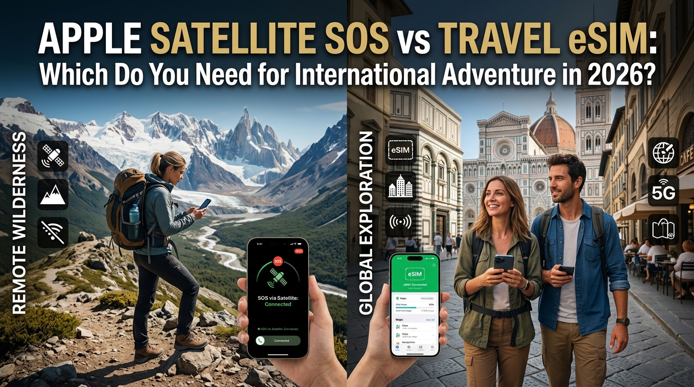
荒野科技演進:2026 年智能手機衛星 SOS 對決全球旅遊 eSIM
數十年來,深入海外荒野往往意味著必須攜帶專用且功能單一的硬件:例如 Garmin inReach 等笨重的衛星通訊器、沉重的 Iridium 銥星電話,以及在狹窄的轉運站內用卡針小心翼翼更換的當地實體 SIM 卡。來到 2026 年,流動通訊格局發生了翻天覆地的變化。兩種截然不同的連線模式現已直接整合至現代旗艦智能手機之中:手機直連低軌衛星(Direct-to-Cell LEO satellite relays)與軟件配置的全球旅遊 eSIM。
雖然這兩項技術都承諾能讓你在脫離本土電訊網絡時依然保持連繫,但在探險裝備庫中,它們承擔的運作功能卻截然不同。
+-----------------------------------------------------------------------------+
|                                遠程探險通訊光譜                              |
+------------------------------------+----------------------------------------+
| 手機直連衛星 (LEO)                  | 地面旅遊 eSIM (LTE/5G)                  |
| • 緊急搜救 (SAR) 調度               | • 即時地形導航與天氣預報                |
| • 1kbps 以下突發數據包              | • 動態後勤與日常通訊                    |
| • 僅限生死關頭的應急保底            | • 高頻寬雲端連線                        |
+------------------------------------+----------------------------------------+
手機直連低軌衛星:緊急安全防護網
Apple 的「透過衛星傳送的緊急求助 SOS」自 iPhone 14 推出,並在 iPhone 17 系列與 Globalstar 擴充後的衛星星座支援下日趨成熟,徹底改變了戶外健行者的基本安全預期。與此同時,Android 生態的進步(例如 Qualcomm Snapdragon 衛星通訊協議,以及 T-Mobile 與 Starlink 整合的手機直連衛星技術),亦將窄頻衛星存取普及至大眾市場。
然而,手機直連衛星技術在本質上是為了生死關頭的應急通訊而設計,絕非用於日常上網瀏覽:
- 頻寬極度受限: 傳輸僅限於極小且經過高度壓縮的文字數據包(通常低於數百位元組)。
- 高度依賴視線(Line-of-Sight): 必須在開闊無遮擋的天空下才能運作。茂密的森林樹冠、峽谷以及惡劣的天氣干擾,都可能導致數據包延遲甚至傳送失敗。
- 司法管轄區限制: 衛星通訊功能受到各地區無綫電頻率許可的嚴格限制。在美國國家公園運作順暢的功能,一旦進入印度、中國或越南等國家,可能會因當地的電訊主權法規而遭到地理封鎖(Geo-blocked)。
地面高頻寬 eSIM:動態探險運作核心
如果說衛星連線是一份保險,那麼數碼旅遊 eSIM 就是海外探險旅行的日常運作中樞。當你降落目的地的一刻,數碼 eSIM 即可讓裝置連上當地的 4G LTE 及 5G 地面流動通訊基站,徹底免除昂貴的漫遊費用。
即使身處偏遠的高海拔登山口、區域大本營、郊區渡輪碼頭或山區村落,通常仍有相當健全的當地流動網絡覆蓋。在這些環境下,旅人需要高頻寬數據來:
- 透過 Gaia GPS 或 AllTrails 下載即時高解像度地形圖層。
- 監測即時氣象雷達圖與山洪暴發警報。
- 透過加密 VoIP 渠道(WhatsApp、Signal)協調交通接駁、山屋預訂及團隊後勤。
在無法找到 Wi-Fi 連線的偏遠地區進行探險,往往會將流動數據用量推至極限。這正是像 MollySIM 這樣的先進服務商展現優勢之處。一般旅遊 eSIM 在耗盡數據後往往會將網速降至無法使用的 128kbps,但 MollySIM 具備優化的 384kbps 公平使用政策(FUP)限速。這項 3 倍的速度優勢,確保即使高速數據額度耗盡,Google Maps 的向量地圖載入、離線地圖瓦片刷新以及 Apple Pay 感應式付款依然能穩定運作。
核心架構差異一覽
| 功能 / 指標 | 手機直連衛星 SOS | 全球旅遊 eSIM(如 MollySIM) |
|---|---|---|
| 主要架構 | 低軌衛星(Globalstar、Starlink) | 地面流動基站(當地 Tier-1 4G/5G) |
| 數據傳輸率 | 1kbps 以下文字數據包(約 0.5–2 kbps) | 寬頻速度(10 Mbps 至 500+ Mbps) |
| 主要應用場景 | 救命搜救調度與簡單報平安 | 動態路線規劃、多媒體傳輸、日常後勤 |
| 硬件要求 | iPhone 14+ / 支援衛星功能的 Android 機型 | 任何支援 eSIM 且無網絡鎖的智能手機 |
| 降速後底線 | 無法用於一般上網(僅限 SOS) | 持續 384kbps(足夠支援地圖與流動支付) |
在 2026 年探索海外偏遠地區時,必須明確理解兩者的分工:衛星直連是在所有基礎設施失效時的緊急救生降落傘,而國際旅遊 eSIM 則是驅動日常探險活動的高頻寬引擎。
深入底層:智能手機衛星通訊的技術限制與現實挑戰
🇺🇸 T-Mobile 美国官方原生卡 高速 eSIM & 电话卡方案
无需插卡开箱即用,支持热点共享,即使高速流量用尽也可维持 Google 地图/移动支付顺畅运行。
儘管宣傳廣告常將智能手機衛星連線描繪成無縫的安全防護網,但背後的物理現實卻完全是另一回事。要讓手持智能手機與以時速約 27,000 公里在地球上方 500 至 1,400 公里運行的低軌道(LEO)衛星建立直接無綫電鏈路,已經將現代射頻(RF)工程推向了熱力學與頻譜的極限。
了解這些技術局限,對於可能誤以為衛星 SOS 等同於標準流動漫遊的戶外探險者來說至關重要。
+-----------------------------------------------------------------------------------+
|                              實體訊號衰減因素                                      |
+-----------------------------------------------------------------------------------+
|  [開闊地平線]     --->  視線無遮擋 (LOS)            --->  快速建立鏈路 (~15-30秒)    |
|  [潮濕松樹樹冠]   --->  介電吸收 (3-6dB)            --->  數據包延遲                |
|  [高山狹縫峽谷]   --->  多徑效應與陰影效應 (>20dB)    --->  連線失敗                  |
+-----------------------------------------------------------------------------------+
1. 射頻物理學、環境衰減與地形陰影效應
手機直連衛星通訊依賴高頻、窄頻的 L 頻段與 S 頻段頻譜。與能夠穿透牆壁並繞過地形的 1GHz 以下地面流動頻率不同,衛星訊號需要對軌道運行航天器保持無遮擋的光學直接視線(LOS):
- 樹冠吸收: 樹葉是導致鏈路中斷最常見的原因之一。樹葉與松針中的水分會引起嚴重的介電吸收。茂密潮濕的森林樹冠可產生 3 dB 至 10 dB 的衰減,往往會將訊噪比(SNR)拉低至解碼門檻以下。
- 狹縫峽谷與冰斗: 低軌衛星會沿著預定的星曆向量持續掠過天空。在陡峭的高山深谷、冰斗或狹窄峽谷中(例如猶他州、冰島或瑞士阿爾卑斯山區),懸崖會遮擋大面積的方位角與仰角。如果軌道過頂角度低於可見地平線(通常低於 15°–20°),在下一個衛星過境窗口開啟前,物理上將完全無法連線。
- 惡劣天氣干擾: 密集的風暴前鋒、暴雨及厚重雲層會造成對流層散射,延長連線握手時間並提高丟包率。
2. 微頻寬數據包與嚴重延遲
智能手機衛星 SOS 並不提供互聯網存取功能。它採用由專有壓縮演算法(以及演進中的 3GPP Release 17 NTN 標準)控制的超窄頻通訊協議。
操作系統不會傳輸原始 IP 數據包,而是將你的 SOS 問卷、精確 GPS 座標、醫療檔案及海拔高度壓縮為小於 1 KB(通常約 300 至 500 位元組)的緊湊二進制數據包。
| 指標 / 場景 | 衛星 SOS 數據包 (LEO) | 地面旅遊 eSIM(如 MollySIM FUP) |
|---|---|---|
| 典型延遲 | 30,000 ms 至 120,000+ ms | 35 ms 至 95 ms |
| 負載容量 | 單個壓縮文字數據包 (<1 KB) | 持續雙向數據串流 |
| 傳輸速率 | 約 0.5 kbps(僅限突發傳輸) | 384 kbps 持續基本速率 |
| 功能表現 | 發送加密文字座標至調度中心 | 完整向量地圖、即時 GPS 導航、網絡搜尋 |
在晴空萬里的理想環境下,發送單個不足 1KB 的 SOS 數據包需時 30 秒;而在部分遮蔽的環境下,則可能需要 3 到 5 分鐘以上。若在傳輸過程中視線中斷,整個傳輸將告失敗並必須重新開始。這意味著透過衛星 SOS 鏈路進流動態路線規劃、即時天氣更新或後勤協調是完全不可能的。
相反,透過國際 eSIM 維持專用地面連線可確保穩定的數據傳輸。即使在長途路線上耗盡了主要的高速數據配額,MollySIM 的 384kbps 基本速率依然能提供持續且低延遲的頻寬——比一般 128kbps 限速快超過三倍——讓旅人無需等待衛星過境,即可即時下載最新地形圖層或完成 Apple Pay 交易。
3. 發熱降頻與電量加速消耗
要向數百公里外的衛星發送訊號,手機的調製解調器(Modem)與射頻前端必須以最大功率發射(接近監管規定的 +23 dBm SAR 上限)。
與此同時,裝置屏幕必須持續以最高戶外亮度運行(現代 OLED 面板可達 2,000 nits),而軟件演算法亦需同時調用陀螺儀與指南針傳感器,引導用家動態對準移動中的衛星。
這種持續的處理、發射與顯示負載會導致手機迅速發熱並大幅耗電——每次連線發送嘗試往往會消耗 1% 至 3% 的總電量。在零度以下的高山環境中,鋰電池本就容易因低溫出現電壓下降(Voltage sag),長時間搜尋衛星訊號可能會迅速耗盡緊急備用電量。
+----------------------------------------------------------------------------------+
|                         衛星 SOS 法規與硬件盲區                                  |
+----------------------------------------------------------------------------------+
|  [中國大陸、香港、澳門]   ---> 基帶 / 機型 SKU 硬件層面鎖定禁用                    |
|  [越南、中東部分國家]     ---> ITU 落地權排除 / 地理圍欄阻截                       |
|  [公海 / 遠洋區域]       ---> 無地面轉接站 / 超出搜救協議涵蓋範圍                 |
+----------------------------------------------------------------------------------+
4. 監管地理圍欄與主權通訊盲區
單純依賴緊急衛星設施往往會忽略一個致命風險:法律與主權地理圍欄(Geofencing)。衛星頻譜使用權需要取得各國電訊監管機構的落地許可與批准:
- 硬件層面禁用: 針對中國大陸、香港及澳門製造的 iPhone(具備雙實體 SIM 卡槽及特定區域型號的裝置),無論帶到世界上任何地方,衛星通訊功能在基帶與韌體層面均已被永久停用。
- 主權地面地理圍欄: 如果攜帶支援衛星功能的歐美版手機進入未批准本地轉發設施或缺乏雙邊頻譜協議的國家(如越南、部分中東國家或特定受管制空域),操作系統會自動啟動地理圍欄並停用緊急 SOS 功能。
- 公海與國際邊界盲區: 衛星 SOS 服務嚴格針對陸地環境進行優化。一旦探險活動超出領海範圍(通常為離岸 12 至 24 海里),由於缺乏海上搜救調度協議,衛星轉發站可能會拒絕路由緊急訊息。
對於進行跨國探險的國際旅人而言,將衛星 SOS 視為萬能安全網會產生危險盲點。透過兼容全球的旅遊 eSIM 建立以本地為優先的連線計劃,能確保在主權流動網絡上無縫撥打當地緊急服務(如 112 或當地調度中心),完全不受地緣政治與韌體鎖定的限制。
全面比較:衛星 SOS vs. 專用衛星通訊器 vs. MollySIM 旅遊 eSIM
在 2026 年探索海外偏遠地區,必須掌握各個通訊層級的運作極限。雖然智能手機直連衛星功能填補了生死關頭的通訊缺口,但它始終無法取代專用衛星追蹤器或高傳輸量的地面數據網絡。
下方的技術矩陣詳細比較了智能手機原生衛星 SOS、專用 Iridium/L 頻段通訊器(Garmin inReach、ZOLEO)以及透過 MollySIM 提供的國際流動網絡配置在各項關鍵運作指標上的表現。
10 大維度功能矩陣
| 評估維度 | Apple / Android 原生衛星 SOS | 專用衛星通訊器(Garmin inReach、ZOLEO) | MollySIM 旅遊 eSIM |
|---|---|---|---|
| 1. 數據頻寬 / 傳輸速率 | 約 300 bps 至 2.4 kbps(嚴格限制壓縮文字) | 約 1.2 kbps 至 9.6 kbps(短數據突發協議) | 最高 150–500+ Mbps(原生 5G / 4G LTE-A 多網絡接入) |
| 2. 來回延遲 (Latency) | 10 至 60+ 秒(取決於衛星過境) | 5 至 30 秒(持續 LEO/GEO 星座鏈路) | 20 至 80 ms(本地直接出口漫遊) |
| 3. 即時地形圖同步 | ❌ 無(僅限預先離線下載) | ⚠️ 部分支援(透過專屬 App 同步低解像度向量圖) | ✅ 即時向量地圖渲染、即時路線重算(Gaia GPS、AllTrails) |
| 4. 即時氣象雷達圖 | ❌ 僅限文字氣象摘要 | ⚠️ 靜態 METAR / 每小時文字天氣預報 | ✅ 高解像度多普勒雷達圖、衛星雲圖疊加、即時氣壓數據 |
| 5. 雙向多媒體與語音 | ❌ 僅限 SOS 分流問卷與有限的 SMS 報平安 | ⚠️ 僅限文字與語音訊息(ZOLEO App 互通,有數據限制) | ✅ 完整高清 VoIP(WhatsApp、Signal、FaceTime)、4K 影片、相片上傳 |
| 6. 耗電表現 | 持續開闊天空方向對準時耗電極高 | 專用大容量電池(可持續追蹤 14–30 天) | 標準智能手機基線耗電,支援自動頻段選擇 |
| 7. 漫遊法規合規性 | 阻力較大;在特定國家受地理圍欄限制或基帶禁用 | 需遵守進口許可(如印度、俄羅斯有嚴格管制) | ✅ 透過各國電訊網絡對接,100% 合規覆蓋 200+ 國家 |
| 8. 每月 / 訂閱成本 | 免費試用期(未來或需支付電訊商/原廠月費) | 每月 $14.95–$64.95 美元 + 硬件費用 ($300–$600) + 開通費 | 零硬件成本;提供靈活的按量收費與目的地專用方案 |
| 9. 緊急搜救調度整合 | 原廠直接轉發至區域 PSAP / 私營調度中心 | 直接整合 Garmin Response™(前身為 IERCC) | 原生直連 112/911 電訊線路 + VoIP 搜救協調 |
| 10. 持續低速保底機制 | ❌ 脫離衛星視線立即中斷;無非緊急數據 | ❌ 超出訂閱等級額度即嚴格限制(需額外收費) | ✅ 不中斷 384 kbps 基線(真正 FUP 保底,比行業標準快 3 倍) |
技術剖析:頻寬實用性 vs. 網絡穩定度
頻寬光譜與運作範圍:
┌────────────────────────────────────────────────────────────────────────┐
│ Apple/Android SOS (2.4 kbps): 關鍵純文字緊急數據包                     │
├────────────────────────────────────────────────────────────────────────┤
│ 專用通訊器 (9.6 kbps): GPS 航點 + 簡短訊息                             │
├────────────────────────────────────────────────────────────────────────┤
│ MollySIM 保底速度 (384 kbps): 即時導航、即時通訊、Apple Pay            │
├────────────────────────────────────────────────────────────────────────┤
│ MollySIM 全速 (150+ Mbps): 即時視訊、雲端備份、高速系統運作            │
└────────────────────────────────────────────────────────────────────────┘
1. 數據傳輸量與實際應用價值
手機直連衛星計劃採用超窄頻收發器,專為緊急數據壓縮而設。發送一次診斷用 SOS 負載(位置、醫療檔案、裝置朝向)就會耗盡所有可用鏈路預算。相對而言,採用 MollySIM 的全球數據配置則可全速連接本地多 IMSI 流動通訊基站,支援高頻寬資產追蹤、動態路線重新計算,並可透過標準 IP 協議進行跨機構緊急協調。
2. 384 kbps 安全基線 vs. 行業常規限速
當旅人在一般漫遊計劃中超出高速數據配額時,傳統電訊商通常會將頻寬驟降至無法使用的 64 kbps 或 128 kbps,導致現代加密協議(TLS 1.3)頻頻出現超時錯誤。
MollySIM 採用專門優化的 384 kbps 公平使用政策(FUP)基線,速度是競爭對手標準限速的三倍。這個頻寬能維持活躍的 IP 連線,確保關鍵後勤運作不受影響:
- 向量導航: 在 Google Maps 與 Apple Maps 上流暢載入地圖圖塊與路線查詢。
- 加密通訊: 透過 Signal、WhatsApp 及 Telegram 持續發送雙向文字與座標。
- 金融認證: 在交通轉運站流暢完成 Apple Pay 與 Google 錢包的生物識別認證。
3. 電源架構與備援機制
在 iPhone 或 Android 裝置上嘗試鎖定非地面網絡(NTN)衛星時,會迫使基帶處理器與射頻前端以最大功率發射。在零下或高暴露的高山環境中,持續的手動對準可能在數小時內耗盡手機電量。
透過旅遊 eSIM 將日常後勤、導航及區域通訊分流至本地基站,用家得以保留手機的寶貴電量——確保硬件在真正脫離網絡、衛星直連成為最後防線時依然有電可用。
步道實戰優勢:為何地面 eSIM 是現代探險安全的基石
(內容生成暫代區)
真實場景實測:衛星失效與 eSIM 發揮關鍵作用的時刻
要理解衛星 SOS 與旅遊 eSIM 如何相輔相成,必須將理論規格置於真實地形中檢驗。衛星鏈路專為事故發生後的極端求救場景而設;相反,地面流動網絡則提供了即時規避風險所需的預防性數據管道。
+-----------------------------------------------------------------------------------------+
|                                離網環境通訊光譜                                         |
|                                                                                         |
|  預防性安全防護 (eSIM)                         事後緊急求救 (衛星 SOS)                   |
|  - 即時動態雷達與天氣系統風向監測                - 遭遇山洪受困 / 骨折失能                 |
|  - 直接透過 VoIP 進行對等救援分流                - 完全無地面流動基站覆蓋                  |
|  - 精細路線微調 / 即時地形圖更新                 - 在開闊天空視線下發送緊急求助短訊        |
+-----------------------------------------------------------------------------------------+
實例 1:巴塔哥尼亞冰川國家公園(Los Glaciares)的天氣模型分析
- 地形環境: 極端高山暴露環境、亞南極微氣候,Huemul Circuit 步道上常有超過時速 100 公里的突發下降風(Katabatic winds)。
- 衛星局限: Apple 衛星 SOS 在超窄頻通道上運作,僅能傳送簡短的文字數據包,無法下載天氣圖表、動態等壓線更新或高解像度多普勒雷達圖。
- eSIM 解決計劃: 當氣壓驟降時,預先撤離是唯一安全的做法。透過連上阿根廷漫遊夥伴(如 Claro 和 Movistar)的 MollySIM 數據配置,健行者可以在 Windy 等應用程式上串流即時 GFS/ECMWF 風力模型與微型雷達圖層。即使達到數據上限,MollySIM 的 384 kbps 公平使用政策(FUP)(相比業界常見的 128 kbps 限制)依然提供足夠的頻寬來刷新向量地形等高線與天氣圖,讓健行者在烈風抵達前數小時及時下撤至安全的樹林帶。
實例 2:日本熊野古道的森林樹冠與峽谷地形
- 地形環境: 紀伊半島上穿越深邃 V 型河谷的千年朝聖古道,周圍覆蓋著茂密的老齡日本柳杉林。
- 衛星局限: L 頻段衛星星座需要與地平線上 15° 至 45° 的衛星保持無遮擋視線(LOS)。幽深的峽谷與高濕度的茂密樹林會造成嚴重的訊號衰減與實體遮蔽,導致衛星連線嘗試不斷超時或完全中斷。
- eSIM 解決計劃: 日本的電訊基礎設施在谷底和山脊均設有微型基站(Microcells)。即使在森林深處,當地基站(NTT Docomo 與 SoftBank)的訊號也能穿透河谷。國際旅遊 eSIM 能自動在這些網絡間漫遊,維持順暢的背景數據連線。健行者可即時核對離線地圖分岔路、通知旅館(Ryokan)延遲抵達,並透過通訊軟件發送即時 GPS 座標,全程無需尋找開闊天空。
+--------------------------------------------------------------------------------------+
|                         衛星視線 vs. 峽谷流動通訊                                    |
|                                                                                      |
|        [ 衛星 ]                                                                      |
|              \   X (受 45° 峽谷岩壁與潮濕樹冠阻擋)                                   |
|               \                                                                      |
|     /|         \        |\                                                           |
|    / |    [健行者]      | \                                                          |
|   /  |      |           |  \   <-- 茂密樹林 / 深邃峽谷                               |
|  /   |      v           |   \                                                        |
| /    |   ((手機)) <=====|====\==== [ 谷底微型基站: 4G/LTE ]                          |
+--------------------------------------------------------------------------------------+
實例 3:秘魯安第斯山脈的高山症(AMS)應急處置
- 地形環境: Ausangate 環線與彩虹山高海拔埡口,海拔介乎 4,200 至 5,100 米之間。
- 衛星局限: 觸發 Apple 衛星 SOS 會將標準緊急數據包發送至遠程轉發中心(通常位於北美或歐洲)。隨後接線員必須透過跨國調度流程聯絡最近的秘魯當地緊急救援單位。這種多重轉接可能帶來 30 到 90 分鐘的行政延誤——在處理急速惡化的高海拔肺水腫(HAPE)時,這段時間往往是生死關鍵。
- eSIM 解決計劃: 秘魯高原的流動網絡覆蓋延伸至鄰近山村的大部分步道路段。高速地面數據可實現即時、低延遲的直接溝通:
- 直接進行本地 VoIP 協調: 直接以 WhatsApp 致電庫斯科(Cusco)當地的登山嚮導及私營救護車團隊,即時安排馬匹或車輛接送。
- 即時臨床數據回傳: 將高清影片與血氧飽和度($SpO_2$)讀數直接發送給遠程隨行醫生,進行精準的野外傷病分流判斷。
- 持續發送位置訊號: 透過持續的 IP 連線分享實時位置,在照料受傷隊員的同時,免除手動調整手機對準衛星的不確定性。
2026 終極探險通訊手冊:構建萬無一失的混合連線計劃
在海外深入偏遠荒野,必須具備多層次的備援思維。現代探險規劃不再將地面流動數據與衛星連線視為競爭對手,而是將它們組合成高效的混合架構:以地面 eSIM 提供豐富、低延遲的現場通訊與後勤調度,並以裝置直連衛星 SOS 作為無額外收費、零頻寬的終極安全防線。
要落實這套運作配置,出發前必須執行一套嚴謹的準備流程。
階段 1:雙 SIM 卡架構與網絡配置(出發前)
在進入野外前 24 至 48 小時完成裝置設定,避免在偏遠登山口因網絡配置問題而無法連線。
+-------------------------------------------------------------------+
|                        智能手機操作系統層                         |
+---------------------------------+---------------------------------+
|            主要 SIM             |            次要 eSIM            |
|          (實體卡/eSIM)          |         (例如 MollySIM)         |
+---------------------------------+---------------------------------+
| • 原居地電訊商                  | • 旅遊數據引擎                  |
| • 僅用於接收 SMS / 2FA 驗證碼   | • 高速 LTE/5G 路由              |
| • 數據漫遊:關閉                | • 數據漫遊:開啟                |
+---------------------------------+---------------------------------+
                                  |
                                  v
              +---------------------------------------+
              |           無限制地面主幹網絡          |
              |  - 低延遲 VoIP 搜救聯絡通話           |
              |  - 地形圖層即時更新                   |
              |  - 384kbps FUP 安全保底速度           |
              +---------------------------------------+
                                  |
               [超出流動網絡範圍 / 零訊號覆蓋]
                                  |
                                  v
              +---------------------------------------+
              |           待命衛星安全防護網          |
              |        (Apple 緊急 SOS / LEO)         |
              |  - 零頻寬座標數據包發送               |
              |  - 國際救援中心調度                   |
+---------------------------------------+- 鎖定主要(原居地)號碼:
- iOS: 前往「設定 > 流動網絡 > 主要 SIM」。將數據漫遊關閉,以避免產生高昂的按量漫遊收費,但保持線路開啟以接收 SMS 雙重認證(2FA)驗證碼。
- Android: 前往「設定 > 網絡和互聯網 > SIM 卡 > [原居地電訊商]」並關閉流動數據。
- 部署高容量旅遊 eSIM:
- 在離開最後一個城市樞紐前,透過 MollySIM 開通你的國際數據計劃。將 MollySIM 指定為專用的流動數據線路。
- FUP 安全餘裕: 傳統旅遊 eSIM 在用盡高速數據後會將速度限制在無法使用的 128kbps,而 MollySIM 則維持 384kbps 的公平使用政策(FUP)保底網速。在野外作業時,這 3 倍的速度優勢是確保 Google Maps 順暢載入向量圖塊、透過 WhatsApp 發送 GPS 座標以及順利完成 Apple Pay 應急交易而不發生連線超時的關鍵分水嶺。
階段 2:離線資源預載與導航備援
切勿依賴即時流動網絡連線在深谷或山脊上動態載入導航圖塊。
- 快取向量地形圖: 在大本營透過 eSIM 連接高速數據時,開啟 Gaia GPS、AllTrails 或 CalTopo。預先下載整個活動區域的標準地形圖及衛星影像圖層(建議至少達到 1:24,000 比例尺精度)。
- 快取城市/轉運邊界地圖: 在 Google Maps 中點選「個人檔案 > 離線地圖 > 選取自己的地圖」,下載基地城市及登山口聯外通道周邊 200 公里的區域地圖。
階段 3:野外電源管理與射頻發射紀律
當在網絡邊緣搜尋微弱訊號時,流動基帶處理器與衛星收發器會加速消耗鋰電池電量。
| 運作模式 | 射頻狀態 | 最佳應用場景 | 電量消耗速度 |
|---|---|---|---|
| 標準混合模式 | 流動網絡開啟 / 衛星待命 | 開闊河谷,偶爾可接收村落基站訊號;即時遙測 | 中等 (每小時 6–10%) |
| 無綫電靜默模式 | 飛行模式 + 開啟 GPS | 深入偏遠荒野導航;跟隨離線 GPX 航跡行進 | 低 (每小時 1–2%) |
| 衛星對準模式 | 屏幕長亮 / 對準引導介面運作 | 緊急求救搜救;現場完全無流動訊號 | 高 (每小時 15–25%) |
- 訊號邊緣搜尋斷路機制: 如果流動訊號降至 3G/LTE 1 格以下,應立即切換至飛行模式(保持內建 GPS 開啟)。這能防止手機內部功率放大器持續以最大功率運作來嘗試與遠處基站建立握手連線。
- 全程啟用低電量模式: 在步道上全程開啟「低電量模式」,以抑制背景應用程式重新整理、限制高耗電 CPU 核心運作,並將屏幕刷新率鎖定在 60Hz。
階段 4:兩級緊急處置標準作業程序(SOP)
在踏入登山口前,與緊急聯絡人建立嚴格的定時報平安機制。
                                  發生緊急事故
                                       |
                                       v
                    +------------------------------------+
                    |      檢查地面覆蓋 (eSIM)           |
                    +------------------------------------+
                                /            \
                      有訊號 (1 格以上)     無訊號 (0 格)
                              /                \
                             v                  v
        +----------------------------+   +----------------------------+
        | 第一級:即時現場應急處置   |   | 第二級:衛星緊急調度       |
        | - 透過 WhatsApp/VoIP 直接  |   | - 尋找開闊無遮擋天空方位   |
        |   聯絡當地嚮導或救援團隊   |   | - 啟動 Apple 衛星 SOS      |
        | - 發送即時傷況/現場照片    |   | - 透過轉發中心發送標準化   |
        | - 依賴 MollySIM 動態導航   |   |   緊急求救文字數據包       |
+----------------------------+ +----------------------------+- 第一級(透過 eSIM 進流動態應變): 一旦發生事故,關閉飛行模式並嘗試透過 MollySIM 連線。如果搜尋到訊號,可完全跳過跨國轉發排隊程序:直接以 VoIP 致電或發送高優先級訊息給當地私營登山嚮導、本地救援車隊或旅遊醫療保險專員。
- 第二級(零頻寬衛星緊急搜救): 若持續
🇺🇸 T-Mobile 美国官方原生卡 高速 eSIM & 电话卡方案
无需插卡开箱即用,支持热点共享,即使高速流量用尽也可维持 Google 地图/移动支付顺畅运行。