The Fjord Connectivity Challenge: Onboard Satellite vs. Coastal Cellular Infrastructure
The classic Norwegian Coastal Express—navigating 2,500 nautical miles from Bergen up to Kirkenes near the Russian border—is widely considered one of the world's most spectacular maritime routes. Traversing 34 ports of call, narrow straits, and dramatic waterways, this voyage presents a unique technical puzzle for staying connected.
While modern cruise liners advertise advanced maritime satellite internet, the realities of Norwegian geography create unexpected digital blackouts for passengers relying solely on shipboard Wi-Fi.
The Line-of-Sight Problem: Why Satellites Fail in the Fjords
Modern maritime connectivity predominantly relies on Low Earth Orbit (LEO) constellations like Starlink Maritime or legacy Geostationary (GEO) satellites. Both systems share a fundamental vulnerability: they require an unobstructed line-of-sight to orbiting spacecraft.
When your ship sails into narrow glacial inlets such as the Geirangerfjord, Hjørundfjord, or the knife-edge Trollfjord, you are enclosed by sheer gneiss cliffs rising 1,000 to 1,500 meters vertically from the water’s edge. These natural stone walls create severe satellite elevation angle cutoffs:
- Constellation Tracking Blockage: As the vessel navigates tight turns beneath towering cliffs, phased-array satellite dishes mounted on the ship’s mast lose their tracking arc. The vessel's superstructure and surrounding canyon walls physically block signal paths.
- Bandwidth Contention: When satellite signals are acquired, the aggregate bandwidth (often 100–220 Mbps per Starlink Maritime terminal) is split across hundreds of passengers and operational ship systems, causing speeds to crawl during peak evening hours.
- High Out-of-Pocket Expense: Shipboard Wi-Fi packages on coastal lines routinely cost between €15 and €35 per day per device, often restricted to single-device logins with aggressive port throttling.
       [ Satellite Signal Blocked by Cliffs ]
                 \
                  \  X
  [Cliff: 1,200m]  \        [Cliff: 1,200m]
   |~~~~~~~~~~~~|   \        |~~~~~~~~~~~~|
   |   ROCK     |    \       |   ROCK     |
   |   WALL     |   [Ship]   |   WALL     |
   |            |  ~~~~~~~~  |            |
   |~~~~~~~~~~~~~~~~~~~~~~~~~~~~~~~~~~~~~~|
          Narrow Fjord Channel (Water)
The Terrestrial Alternative: Norway’s Coastal Cellular Network
In contrast to satellite vulnerability, Norway possesses one of the most advanced terrestrial cellular infrastructures on earth. Because coastal shipping lanes serve as critical lifelines for local trade and passenger transport, the Norwegian government and domestic operators (primarily Telenor and Telia) have blanketed the coastline with ruggedized base stations.
Towers are strategically installed on outer skerries, elevated headlands, lighthouses, and island peaks along the inner lead (Indreled). These land-based antennas point directional sector beams directly across the navigation channels, delivering low-latency 4G and 5G signals straight to the water line.
| Connectivity Metric | Onboard Satellite Wi-Fi | Local Coastal eSIM Network |
|---|---|---|
| Typical Download Speed | 2 – 25 Mbps (shared across ship) | 50 – 300+ Mbps (dedicated cellular) |
| Average Latency | 65ms – 250ms+ (severe jitter in fjords) | 18ms – 35ms |
| Performance in Narrow Fjords | Frequent disconnects & high packet loss | Stable via coastal relay towers |
| Cost Profile | High (€100–€250+ per voyage) | Low (fraction of cruise Wi-Fi costs) |
| Multi-Device Utility | Usually limited to 1 active device | Native hotspot/tethering supported |
Unlocking Continuous Data with a Coastal Cruise Travel eSIM
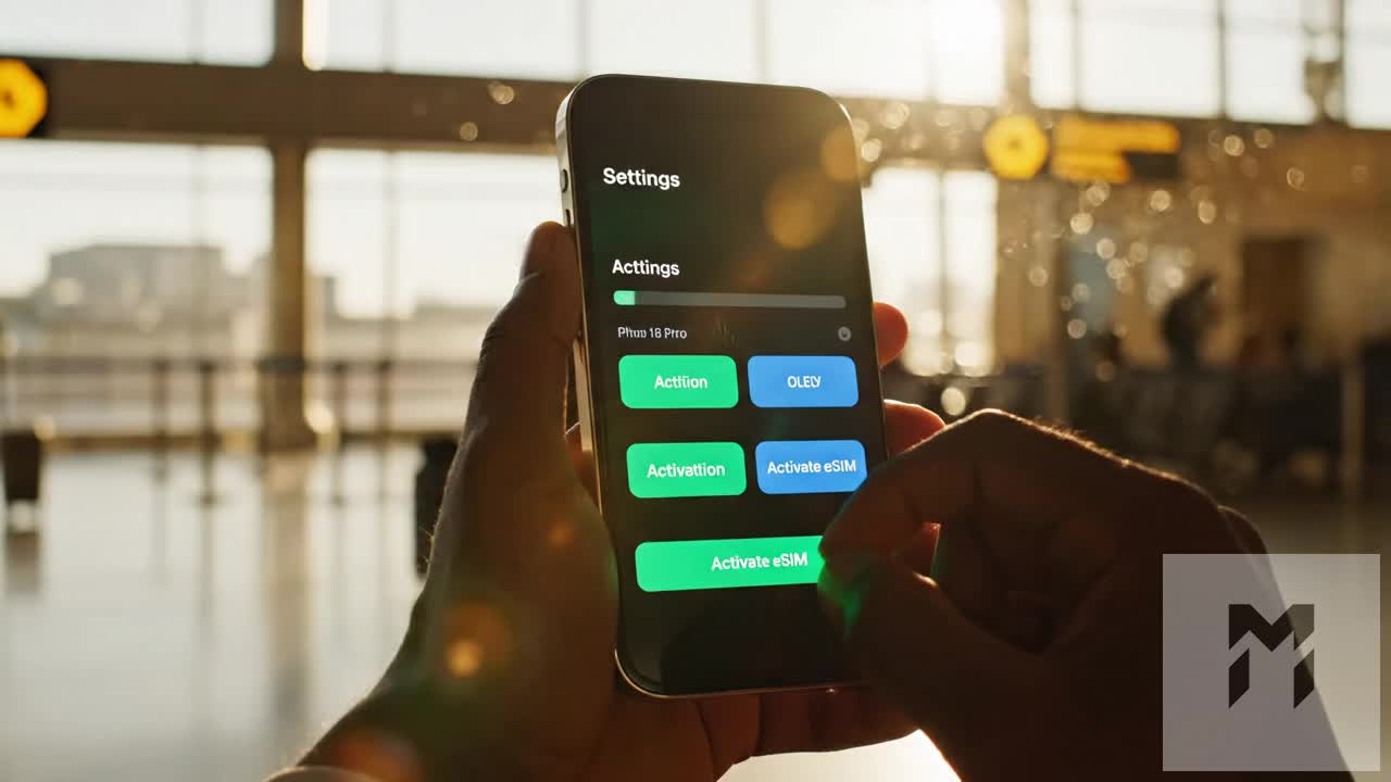
Bypassing overpriced, intermittent satellite plans requires tapping directly into Norway’s domestic cell grids. By installing a dedicated Norwegian cruise travel eSIM prior to departure, your smartphone automatically connects to local towers the moment the ship leaves Bergen.
When selecting an eSIM for this corridor, fail-safe data delivery is essential. Premium providers like MollySIM connect directly to top-tier local infrastructure across the Norwegian coast. Crucially, if you consume your high-speed allowance mid-voyage while uploading 4K footage of the Northern Lights, MollySIM’s 384kbps Fair Use Policy (FUP) keeps you connected. Unlike standard competitor throttle limits of 64kbps or 128kbps—which render modern apps completely unusable—a 384kbps baseline ensures mission-critical navigation tools, Google Maps, messaging apps, and Apple Pay continue to function smoothly as you step ashore at remote Arctic ports.
Comprehensive Breakdown: Cruise Ship Satellite Wi-Fi vs. MollySIM Travel eSIM
🌐 Global Travel High-Speed Travel eSIM & SIM Plans
Instant QR code activation, hotspot enabled, with guaranteed 384kbps fallback speed to keep Maps & Digital Wallets active.
Navigating Norway’s coastal corridor requires understanding the distinct architectural difference between maritime satellite internet and land-based cellular networks. While vessels like the Hurtigruten Coastal Express fleet and Havila Voyages have transitioned portions of their fleets to hybrid Starlink/GEO networks, satellite connectivity faces severe physical limitations in the Norwegian topography.
When your ship slips beneath the sheer 1,000-meter granite cliffs of the Geirangerfjord or Trollfjord, satellite dishes lose the line-of-sight required to track satellites in orbit. Conversely, Norway’s terrestrial network—engineered into the cliff faces and islands by telecom giants Telenor and Telia—delivers sustained, high-bandwidth 4G and 5G signals straight to the waterline.
The following matrix compares onboard satellite packages with modern digital travel eSIM alternatives like MollySIM.
| Feature / Metric | Cruise Line Satellite Packages (Starlink / GEO) | Standard Competitor Travel eSIMs | MollySIM Norway Travel eSIM |
|---|---|---|---|
| Cost Per Day | €18 – €35 / day ($20 – $38) | €4 – €8 / day ($4.30 – $8.60) | €1.50 – €3.50 / day |
| Typical Speeds (Down / Up) | 3 – 25 Mbps down / 1 – 5 Mbps up (shared pipe) | 25 – 100 Mbps down / 10 – 30 Mbps up | 50 – 300+ Mbps down / 20 – 60 Mbps up |
| Latency / Ping | 65ms – 300ms+ (high jitter in fjords) | 35ms – 60ms | 18ms – 35ms (direct local breakout) |
| Narrow Fjord Reliability | Frequent drops due to cliff face obstruction | Good (carrier dependent) | Flawless (Telenor/Telia coastal roaming) |
| Media Uploads (Aurora / 4K) | Heavily throttled or blocked entirely | Variable; data caps drain rapidly | Fast raw upload speeds on 5G coastal grid |
| Multi-Device Tethering | Locked to 1 device per login voucher | Allowed, but high data-exhaustion risk | Full personal hotspot support enabled |
| Post-Allowance Speed Buffer | Complete cutoff or €15/GB overage fees | Hard stop or throttled to 64–128kbps | 384kbps Fair Use Policy (FUP) buffer |
The Physics of Fjord Shadowing: Satellite Line-of-Sight vs. Terrestrial Cells
Cruise ship satellite antennas must maintain an unobstructed angle to the sky to communicate with Low Earth Orbit (LEO) or Geostationary (GEO) satellite constellations. In Western and Northern Norway, narrow sea channels feature vertical cliff faces that rise over 3,000 feet straight out of the ocean. This creates an optical "shadow." As your ship glides through these slots, satellite dishes regularly experience phased-array signal drops, causing dropped calls, failed cloud syncing, and high packet loss.
Norway solved this geography issue decades ago to protect its maritime shipping industry. Coastal base stations are strategically positioned along headlands, lighthouses, and island outcroppings, angling signal propagation down into the waterways. By utilizing an eSIM configured for direct access to these networks, your phone connects to shoreline relays, eliminating physical line-of-sight dropouts.
       [ Satellite Signal Blocked by Canyon Walls ]
             \      /
   [Cliff]    \ X  /    [Cliff]
    |████|     \  /     |████|
    |████|      \/      |████|
    |████|              |████|
    |████|   [Ship Wi-Fi] |████|   <-- Intermittent / Disconnected
    |████|     (Drops)  |████|
    |████|              |████|
    |████|══════════════|████|
    |████|  [MollySIM]  |████|   <-- Solid 5G Signal from Shore Relay
   /======\  (Connected) /======\
  [Cell Tower]          [Cell Tower]
The Real-World Economics: Per-Device Tolls vs. Shared Cellular Freedom
Cruise line Wi-Fi pricing relies on captive-audience monetization. Hurtigruten and international lines generally bill satellite internet on a per-device login basis. If a couple travels together and both wish to use smartphones while simultaneously syncing a laptop or tablet, costs can escalate past €400 for a 12-day classic round-trip voyage from Bergen to Kirkenes. Furthermore, most ship portals automatically kick the primary device off the moment a second device logs in with the same credentials.
A MollySIM data profile changes this paradigm completely. Because personal hotspot capabilities are unrestricted, a single high-capacity data bucket can be broadcast as a secure Wi-Fi hotspot to power your travel partner’s phone, e-reader, and laptop simultaneously without purchasing redundant subscriptions.
The 384kbps FUP Advantage: Real Safety When High-Speed Data Runs Out
Capturing high-bitrate video of the Aurora Borealis or panoramic fjord timelapses consumes mobile data faster than anticipated. On standard travel eSIMs, exceeding your high-speed quota triggers one of two frustrating outcomes:
- An immediate, total data cutoff leaving you stranded without connectivity.
- An aggressive throttle down to 64kbps or 128kbps.
At 128kbps, modern encrypted applications time out. Secure SSL certificates fail to negotiate, Google Maps stops loading map tiles, and contactless services like Apple Pay and Google Wallet freeze during authentication handshakes.
THROTTLED SPEED UTILITY COMPARISON:

Competitors (128kbps):
[■■■                  ] Critical app timeouts / Navigation broken

MollySIM (384kbps FUP):
[■■■■■■■■■            ] Full WhatsApp/Maps/Apple Pay & VoIP functionality
MollySIM resolves this with an industry-leading 384kbps Fair Use Policy (FUP) safety buffer—a connection speed three times faster than typical competitor limits. Even if your high-speed bucket reaches zero while you explore an Arctic port like Honningsvåg, your phone maintains enough bandwidth to handle uninterrupted VoIP voice calls, process contactless mobile payments in local shops, access live transit timetables, and download interactive walking routes in real time.
Norwegian Network Architecture: Telenor and Telia Coastal Dominance
Norway possesses what is widely recognized by network engineers as the most sophisticated coastal cellular infrastructure on the planet. Building reliable mobile broadband across a jagged 25,000-kilometer coastline—carved by deep glacial trenches, sheer granite cliffs, and sub-zero Arctic weather systems—required a monumental civil engineering investment.
The backbone of this maritime coverage relies on a dual-carrier ecosystem powered by Telenor and Telia. Both network operators have deployed thousands of hardened base stations mounted high on coastal peaks, offshore navigation beacons, and isolated island lighthouses. Utilizing long-range, low-band spectrum (principally Band 20 / 800MHz and Band 28 / 700MHz for 5G), these transmitters propagate signals up to 20 nautical miles across open saltwater, blanketing the Hurtigruten sea lanes in continuous 5G and 4G LTE.
Coastal Landmark Signal Analysis
Cruising the Norwegian Coastal Highway presents distinct topographical challenges. Understanding how cellular signals behave across critical navigational waypoints helps set realistic expectations for streaming, remote work, and navigation:
| Coastal Landmark / Waypoint | Topographical Challenge | Network Performance & Carrier Dynamics |
|---|---|---|
| Hustadvika Ocean Stretch | Unprotected open sea; notorious Atlantic swells. | Solid 4G LTE / 5G. Masts situated on the mainland and offshore skerries maintain line-of-sight signal across the shipping corridor. |
| The Lofoten Wall (Vestfjorden) | Massive granite mountain wall rising directly from the sea. | High-Speed 5G. Telenor and Telia base stations positioned on Svolvær and Stamsund peaks blanket the fjord approach. |
| Raftsundet & Trollfjorden | Narrow passage flanked by 1,000-meter vertical rock faces. | Variable 4G LTE. Steep canyon walls produce brief signal shadows; coverage recovers rapidly as the ship passes repeater stations. |
| North Cape (Honningsvåg) | High Arctic plateau (71°N) with extreme weather exposure. | Dense 5G Coverage. Subsea fiber links power redundant Arctic towers serving Honningsvåg and the iconic North Cape globe. |
| Barents Sea to Kirkenes | Sub-Arctic maritime approach near the Russian border. | Reliable 4G/5G. Telia and Telenor maintain critical border-region telecom infrastructure, keeping the port fully connected. |
COASTAL SIGNAL PROPAGATION:
[ Mountain Mast (700MHz/800MHz) ]
        \
         \ ~15-20 Nautical Miles Line-of-Sight over Water
          \
   ~~~~~~~~~[ Hurtigruten Vessel ]~~~~~~~~~~~~~
The Critical Role of Dynamic Dual-Carrier Access
Single-network travel SIMs expose coastal cruisers to localized cellular blackouts. In deep Arctic fjords like the Raftsundet or along the winding sea approaches to isolated settlements such as Ørnes or Mehamn, a towering granite wall can completely block one carrier's line-of-sight mast while leaving the other's unobstructed. If your eSIM is locked exclusively to Telia or exclusively to Telenor, you will experience dropped connections whenever the ship ducks behind a topographical blind spot.
MollySIM bypasses this vulnerability by provisioning non-steered access to both Telenor and Telia. Your device evaluates local radio metrics—such as Reference Signal Received Power (RSRP) and Signal-to-Noise Ratio (SNR)—and automatically handshakes with whichever local mast delivers the cleanest connection.
This carrier redundancy ensures that your vessel remains linked to shoreward base stations rather than defaulting to expensive maritime satellite networks. Combined with MollySIM’s baseline 384kbps safety buffer, your smartphone preserves functional location mapping, banking access, and text messaging even through transitional dead zones along the outer shelf.
Optimizing Device Performance: Arctic Battery Drain and Tower-Handover Management
Cruising the Norwegian littoral introduces an aggressive combination of environmental and cellular stressors that can drain a modern smartphone battery in less than three hours. When standing on the panoramic outer observation deck of a Hurtigruten ship traversing the Vestfjorden or rounding the North Cape, your device faces two distinct battery-depletion mechanisms: sub-zero electrochemical slowing and continuous radio-frequency (RF) power escalation.
The Physics of Arctic Maritime Battery Depletion
- RF Power Escalation & Rapid Cell Handovers: Coastal cruise vessels cruise at an average transit speed of 15 to 20 knots (28–37 km/h). As the ship moves parallel to the coastline, your phone constantly drops and renegotiates baseband radio handshakes with shoreward base transceiver stations (BTS) spaced along distant peninsulas and island peaks. To establish and maintain a connection across 10 to 15 nautical miles of open water, your phone's internal modem ramps its RF transmission power to its maximum operating threshold (typically up to +23 dBm / 200 mW).
- Electrochemical Resistance in Sub-Zero Temps: Lithium-ion battery chemistry relies on the movement of lithium ions between the anode and cathode through a liquid electrolyte. When ambient temperatures drop below 0°C (32°F)—compounded by 30-knot apparent wind chill on the ship's bridge wings—internal resistance surges. This triggers a sharp voltage drop, misleading the battery management system (BMS) into reporting a sudden shutdown even when 30% to 40% raw capacity remains.
Step-by-Step Settings: Mitigating Baseband and Data Load
To preserve device stability between port calls and ensure your navigation tools remain online for shore excursions in ports like Tromsø or Honningsvåg, configure the following software optimizations:
| Setting Category | Recommended Action (iOS & Android) | Technical Benefit |
|---|---|---|
| Data Throttling Mode | Enable Low Data Mode (iOS) or Data Saver (Android) under cellular settings. | Halts non-essential background network tasks and pauses automatic cloud backups (iCloud/Google Photos). |
| Background Sync | Set Background App Refresh to Wi-Fi Only or Off. | Stops social media feeds and mail clients from polling data during high-attenuation signal handovers. |
| Cellular Voice Standard | Toggle VoLTE / 5G Auto rather than 5G On. | Prevents the modem from continuously hunting for high-frequency 5G NR carriers when stable LTE (Band 20/28) provides superior line-of-sight range. |
| Photo Upload Buffering | Pause automatic cloud sync until docked and connected to shore power. | Stops raw 48MP RAW/HEIC files from attempting upload over weak over-water signals, which causes endless retransmissions. |
Managing Data Continuity with Low-Power Retransmissions
When data connections fluctuate in remote sounds like the Trollfjord, aggressive packet loss forces devices to repeatedly transmit identical data packets, burning significant battery reserves.
This is where network configuration directly impacts battery longevity. Travel eSIMs with unoptimized routing or overly punitive throttles create prolonged connection timeouts. MollySIM optimizes connection stability through non-steered access to both Telenor and Telia, pairing your handset with the strongest physical carrier frequency available on the nearest headland.
Furthermore, if you cross your high-speed data tier while documenting the Lofoten archipelago, MollySIM’s baseline 384kbps safety buffer provides three times the throughput of the standard 128kbps throttles used by generic providers. This 384kbps floor ensures lightweight protocols—such as Google Maps vector tiles, Apple Pay tokenization handshakes, and WhatsApp messaging—resolve cleanly on the first transmission cycle without triggering power-draining timeout-and-retry loops.
Arctic Hardware Protection and Power Bank Strategy
Software configuration alone cannot fully counter polar ambient conditions. Implement these hardware measures before stepping onto open observation decks or boarding zodiac tenders:
- Insulated Core-Layer Storage: Never carry your smartphone in an outer parka shell pocket. Store it in an interior, zippered chest pocket directly adjacent to your mid-layer fleece or down insulation, allowing body heat to keep the battery core above 15°C (59°F).
- Cold-Tolerant Power Delivery (PD) Packs: Carry a portable power bank featuring a dedicated Low-Current Charging Mode and internal temperature protection circuitry. Premium power banks utilizing nickel-manganese-cobalt (NMC) or cold-resistant lithium-polymer cells maintain stable output efficiency down to -10°C.
- Tethered Cable Protocol: Run a short, braided silicone or rubberized charging cable (which resists cold-induced stiffening and cracking) from your interior coat pocket directly to your device while framing landscape shots. Keeping a slow 5V/1A or 9V PD trickle charge into the handset actively warms the battery cell via normal internal charging resistance, completely eliminating cold-induced sudden shutdowns.
Real-Time Media Routing: Uploading Aurora Borealis 4K Footage Without Throttling
Capturing the Aurora Borealis along the Norwegian littoral zone generates massive data payloads. Modern mirrorless bodies and flagship smartphones shoot 10-bit 4K ProRes video at bitrates exceeding 220 Mbps, while high-resolution RAW stills (such as Sony .ARW or Canon .CR3 files) consume 45 MB to 85 MB per frame. Content creators and enthusiasts seeking to back up continuous night-sky time-lapses or stream real-time footage to social platforms encounter severe bottlenecks when relying on standard maritime connections.
+-----------------------------------------------------------------------------+
|                          PACKET ROUTING ARCHITECTURE                        |
|                                                                             |
|  [Hurtigruten Ship] ---> [Coastal 5G/4G Tower]                              |
|                                 |                                           |
|         +-----------------------+-----------------------+                   |
|         | (Standard Global eSIM)                        | (MollySIM Direct) |
|         v                                               v                   |
|  [Hong Kong/US Breakout Node]                 [Oslo/Frankfurt Local Node]   |
|  RTT: 280ms - 420ms                           RTT: 18ms - 35ms              |
|  High TCP Packet Drop Rate                    Sustained Max Uplink Throughput|
|  Lightroom/iCloud Timeouts                    Seamless 4K Cloud Ingestion   |
+-----------------------------------------------------------------------------+
The Inherent Failure of Shipboard Satellite Uplinks
Cruise Wi-Fi networks allocate bandwidth asymmetrically, heavily favoring downstream web traffic while restricting individual uplink streams to sub-2 Mbps ceilings. When hundreds of passengers simultaneously attempt to upload video clips of an active auroral display, the shipboard satellite multiplexer suffers severe bufferbloat. High latency (often 600ms+ on legacy geostationary links and 80ms–150ms on congested LEO terminals) causes aggressive packet dropping, causing background synchronization in Adobe Lightroom Mobile, Apple iCloud, and Google Photos to stall completely.
Low-Latency European Breakout Nodes
To achieve uninterrupted transfers, your cellular routing must avoid high-latency transit detours. Budget travel eSIMs often route traffic through centralized data hubs located in Hong Kong, Singapore, or the United States, adding 300ms of latency and crippling TCP throughput via artificial window-size throttling.
MollySIM utilizes localized European Packet Data Network (PDN) gateways deployed in key Scandinavian and Western European telehouses (including Oslo, Stockholm, and Frankfurt). By pairing direct regional breakouts with the native high-capacity coastal towers of Telenor and Telia, your device connects with Round-Trip Times (RTT) between 18ms and 35ms. This architecture enables:
- Sustained Uplink Saturation: Upload multi-gigabyte 4K 60fps clips directly to cloud storage (Google Drive, Dropbox, Frame.io) at native 5G upload speeds up to 120 Mbps.
- Zero-Buffer Live Broadcasting: Stream 1080p60 or 4K HDR live feeds on Instagram, YouTube, or TikTok directly from the ship's outdoor observation decks as the vessel navigates open stretches like the Folda or Vestfjorden.
- Rapid RAW Batch Syncing: Automatically ingest hundreds of uncompressed astrophotography RAW files into desktop-class cloud editors before disembarking at the next port of call.
Failsafe Creative Operations: The 384kbps Tier Advantage
Exhausting a high-speed data tier midway through an offshore transit normally severs your device's connection completely or degrades it to an unusable 64kbps–128kbps trickle. Under those legacy limits, standard handshakes time out, disabling basic navigational tools and communications.
| Functional Protocol / Service | Legacy Competitor Fallback (64kbps - 128kbps) | MollySIM Fair Use Tier (384kbps Floor) |
|---|---|---|
| Google Maps / Apple Maps | Vector tile timeouts, route recalculation failures | Instant vector tile rendering & GPS tracking |
| Apple Pay / Tokenized Wallets | Handshake timeout, payment terminal failure | Sub-second clearance of cryptographic tokens |
| WhatsApp / iMessage Media | Text only; voice notes and compressed stills fail | Reliable voice notes and optimized image sends |
| Aurora Alert API Webhooks | Delayed alerts (10-30 min lag), app freeze | Real-time geomagnetic Kp-index notifications |
| Aurora Cloud Metadata Sync | Complete lockup | Seamless background metadata & EXIF syncing |
By sustaining an unthrottled 384kbps Fair Use Policy baseline—three times faster than conventional market alternatives—MollySIM keeps your real-time Aurora alert telemetry, GPS coastal tracking, and vital field communications fully functional, even if heavy raw-media uploads consume your primary high-speed allocation before you reach Kirkenes.
Port-by-Port Connectivity Playbook: From Bergen to Kirkenes
Sailing the 1,200-nautical-mile Norwegian Coastal Highway demands a proactive connectivity strategy. Between sheer rock faces, open sea crossings like Hustadvika and the Folda, and sub-Arctic deep-water fjords, your device negotiates a complex patchwork of terrestrial base stations and offshore repeaters.
Pre-Departure Checklist: Activating MollySIM in Bergen
To eliminate international roaming charges from your domestic carrier while maintaining critical two-factor authentication (2FA) for banking and travel apps, configure your device at the Hurtigruten Terminal (Nøstegaten 30) before casting off.
[Primary SIM: Home Carrier]  --->  Data Roaming: OFF  | Voice/SMS: ON  (Retains Bank 2FA)
[eSIM: MollySIM Norway] ---> Data Roaming: ON | Cellular Data: ON (Primary Data Route)- Install Profile via QR or Direct Provisioning: Prior to boarding, connect to the terminal Wi-Fi or local cellular network and install your MollySIM profile.
- Designate Cellular Data Channels:
- iOS: Go to Settings > Cellular > Cellular Data $\rightarrow$ Select MollySIM. Toggle off Allow Cellular Data Switching to stop unintended domestic carrier leaks.
- Android: Go to Settings > Network & Internet > SIMs $\rightarrow$ Set MollySIM as the dedicated Mobile Data provider.
- Verify APN & Roaming Parameters:
- Access the MollySIM SIM configuration menu and verify that Data Roaming is toggled ON (required for accessing Tier-1 host networks Telenor and Telia across Norway).
- Ensure the Access Point Name (APN) is set according to your activation instructions (most modern devices populate this automatically upon handshake).
- Isolate Primary Line for 2FA SMS: Set your home carrier SIM to "Voice and SMS Only". Ensure Data Roaming on your home card is explicitly turned OFF to avoid unexpected cross-border roaming fees.
Tactical Port-by-Port Connectivity Matrix
| Port / Waypoint | Geographic Profile | Dominant Cellular Architecture | Tactical Connectivity Strategy |
|---|---|---|---|
| Bergen (Departure) | Urban coastal basin | Multi-carrier 5G NR (n78/n28) | High-speed cache of offline maps, route waypoints, and streaming audio. |
| Ålesund (Mount Aksla) | Art Nouveau peninsula | Elevated microcells & macro towers | Clear line-of-sight from Mount Aksla viewpoint; stable sub-15ms latency for live 4K streams. |
| Trondheim | Historic fjord basin | Dense urban 5G standalone (SA) | Reliable indoor penetration through Nidaros Cathedral's thick stone via mid-band LTE/5G. |
| Bodø | Arctic Circle threshold | High-capacity coastal maritime nodes | Key transition point to Arctic high-latitude cells; optimal window to backup media. |
| Svolvær / Lofoten | Granitic fjord walls | Deep-fjord directional repeaters | Reflection off sheer rock can cause jitter; lock connection to band 20 (800MHz) or 28 (700MHz) for range. |
| Tromsø | Arctic metropolis | Full Polar 5G array | Heavy cloud metadata sync, Aurora telemetry app updates, and high-bandwidth uploads. |
| Honningsvåg (North Cape) | Exposed $71^\circ\text{N}$ plateau | Long-range low-band LTE (B20/B28) | High winds and topography shadow coverage; rely on MollySIM's 384kbps baseline for real-time wind/temp telemetry. |
| Kirkenes | Barents border zone | Single-node borderland macro arrays | Proximity to the border can trigger manual network prompts; lock to MollySIM's Norwegian partner network. |
Key Shore Excursions: Practical Field Advice
Ålesund (Mount Aksla Viewpoint)
Climbing the 418 steps up Mount Aksla provides direct, unhindered line-of-sight to Ålesund’s primary coastal masts. Cell handshakes switch rapidly between microcells along the staircase. If you run multiple concurrent syncs, bandwidth remains stable across both Telenor and Telia infrastructures.
Trondheim (Nidaros Cathedral)
The heavy soapstone architecture of Nidaros Cathedral presents a challenging environment for RF signals. Modern low-band LTE deployment (700/800MHz) via MollySIM penetrates these historic perimeters, allowing instant validation of digital entry passes and Apple Pay transactions at the crypt entrance without dropped sessions.
Svolvær & The Lofoten Wall
When cruising past the Lofoten Wall into the narrow Trollfjord, vertical granite cliffs can temporarily obstruct direct tower line-of-sight. Your device will automatically switch between marine repeaters and mainland coastal arrays. Even in shadowed coves where high-speed links fluctuate, MollySIM's 384kbps Fair Use Policy baseline guarantees your offline vector maps keep tracking your location without frozen interfaces.
Honningsvåg & The North Cape Plateau
At $71^\circ 10' 21''\text{N}$, you are standing on a steep cliff edge above the Arctic Ocean. The extreme northern latitude makes connectivity vulnerable to severe sub-polar weather fronts. Low-band frequencies (Band 20/28) dominate here, engineered for structural coverage over raw speed. This makes a lightweight, persistent connection essential for verifying transfer bus departures, running local weather radar, and checking real-time geomagnetic Kp-index notifications for evening Aurora hunting.
🌐 Global Travel High-Speed Travel eSIM & SIM Plans
Instant QR code activation, hotspot enabled, with guaranteed 384kbps fallback speed to keep Maps & Digital Wallets active.