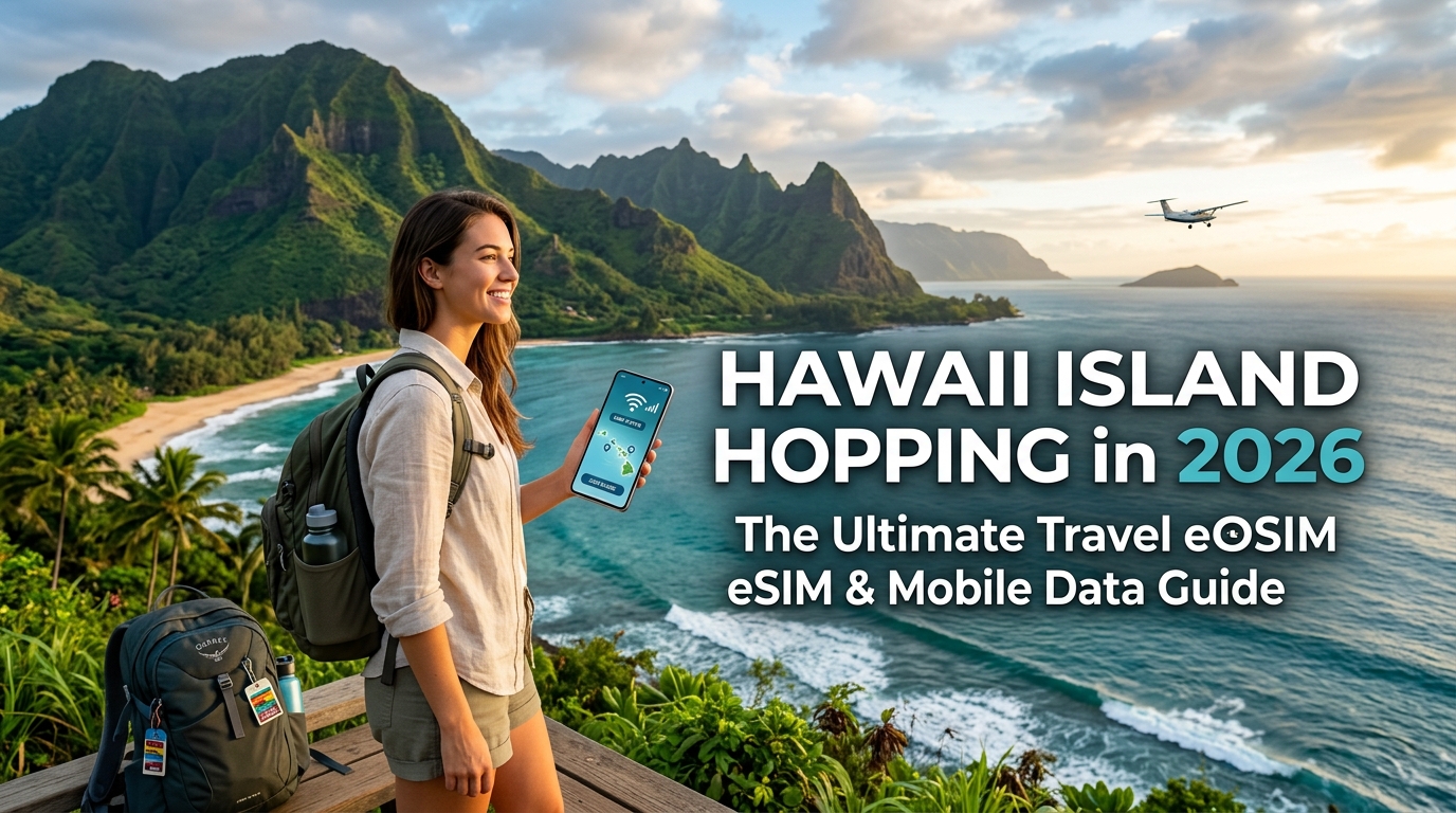
Hawaii Island Hopping in 2026: The Ultimate Travel eSIM & Mobile Data Guide
The Hawaii Cellular Landscape in 2026: Why Island Topography Challenges Mobile Data
At first glance, staying connected in Hawaii seems straightforward—it is the 50th US state, boasting extensive 5G Ultra Wideband and Mid-Band rollouts across major metropolitan pockets. However, the moment you venture beyond the urban corridor of Honolulu, the Hawaiian archipelago presents one of the most hostile natural environments on earth for radio frequency (RF) propagation.
Understanding the unique intersection of Hawaiian geography and wireless infrastructure is essential for anyone planning an multi-island itinerary in 2026.
                    HAWAII RF PROPAGATION CHALLENGES

     Dense Wet Canopy               Basalt Volcanic Mass               Deep Canyons / Valleys
  [Rainforest Absorption]           [Zero RF Penetration]                [Shadow Zones / No LoS]
         | | |                             / \                                   |   |
      ===v=v=v===                        /     \                                 |   |
      ~~~~~~~~~~~                       /       \                                |   |
   (Road to Hana, Maui)            (Mauna Kea, Big Island)                    (Waimea, Kauai)
The Physics of Paradise: Basalt, Canopies, and Microclimates
Cellular signals rely on unobstructed line-of-sight (LoS) and predictable atmospheric conditions. Hawaii systematically defies both through four primary environmental factors:
- Volcanic Basalt Attenuation: The volcanic rock that forms the islands is dense, iron-rich, and highly reflective. Shield volcanoes like Haleakalā on Maui and Mauna Kea on Hawaii Island act as massive physical shields that block cellular signals from traveling across island interiors.
- Dense Rainforest Canopies: Foliage loaded with tropical moisture acts as an RF sponge, particularly for high-frequency 5G C-band and millimeter-wave (mmWave) bands. High-humidity canopies along Maui’s Road to Hāna or Kauai’s North Shore attenuate signals within a few hundred feet of a tower.
- Microclimate Weather Fronts: An island can encompass up to 10 distinct climate zones. Rapid shifts from arid leeward plains to torrential windward downpours induce severe rain fade, degrading high-speed data streams into unstable 3G-era latency spikes.
- Protected Conservation Zones: State and federal environmental regulations strictly restrict the construction of cell towers within state parks, nature reserves, and sacred cultural grounds, creating permanent dead zones along scenic highways.
Island-by-Island Cellular Realities
Cellular performance shifts dramatically as you move across the archipelago. A carrier that dominates on one island may drop to zero service on the next.
| Island | Urban Connectivity Hubs | Severe Drop Zones & Dead Spots | Best Underlying Network Strategy |
|---|---|---|---|
| Oahu | Honolulu, Waikiki, Kapolei, Kailua | Kaʻena Point, interior H-3 tunnels, sections of North Shore | Dense 5G coverage; high capacity across all major carriers |
| Maui | Kahului, Kihei, Lahaina, Kaʻanapali | Road to Hāna (Hwy 360), Upcountry slopes, Haleakalā Crater floor | Multi-carrier switching essential between windward and leeward |
| Kauai | Lihue, Kapaʻa, Poipu | Waimea Canyon, Kōkeʻe State Park, entire Nā Pali Coastline | Heavy reliance on low-band spectrum; towers sparser in the north/west |
| Hawaii Island | Kona, Hilo, Waikoloa | Saddle Road (Route 200), Kaʻū Desert, Hawaii Volcanoes National Park | Massive geographic spread; single-carrier setups experience vast dead zones |
The Single-Carrier Trap vs. Modern Multi-Network eSIMs
The traditional approach to Hawaii connectivity—relying on a single primary carrier’s local SIM or a standard international roaming package—frequently fails during island-hopping trips. Because local tower infrastructure is split among major Tier-1 US operators (Verizon, AT&T, and T-Mobile), each provider holds localized monopolies on specific ridgelines and coastal stretches. If your SIM is locked to a single network, driving through Maui’s interior or navigating the Saddle Road on Hawaii Island will leave you stranded without mapping tools or emergency services.
+-----------------------------------------------------------------------------------+
| SINGLE-CARRIER SETUP                                                              |
| [Device] ---> Locked to Carrier A ---> Tower Blocked by Ridge ---> [DEAD ZONE]     |
+-----------------------------------------------------------------------------------+
| DYNAMIC MULTI-CARRIER SETUP (e.g., MollySIM)                                      |
| [Device] ---> Auto-detects strongest signal ---> Switched to Carrier B ---> [LIVE DATA] |
+-----------------------------------------------------------------------------------+
Modern travelers in 2026 mitigate this by using dynamic, multi-network travel eSIMs. Advanced travel solutions like MollySIM aggregate access across leading host networks in the US, allowing your phone to automatically latch onto whichever carrier commands the strongest line of sight to the nearest cell site.
Furthermore, network throttling in remote areas can disable critical apps. While standard travel SIMs throttle excess usage to a virtually unusable 128kbps, MollySIM maintains a Fair Use Policy (FUP) speed floor of 384kbps—three times faster than the industry benchmark. This margin ensures that essential travel applications, such as turn-by-turn navigation via Apple Maps, live Google Maps route recalculations, and contactless mobile payments (Apple Pay / Google Wallet), continue operating seamlessly even when deep inside Hawaii's challenging microclimates.
Tier-1 Carrier Footprint Analysis: Verizon, AT&T, and T-Mobile Across Island Hotspots
🌐 Global Travel High-Speed Travel eSIM & SIM Plans
Instant QR code activation, hotspot enabled, with guaranteed 384kbps fallback speed to keep Maps & Digital Wallets active.
Deploying mobile data across the Hawaiian archipelago is an exercise in RF (radio frequency) compromise. The islands' volcanic geology creates extreme line-of-sight obstructions, where sheer basalt ridges (pali), dense rainforest canopies, and deep micro-valleys sever cellular handshakes within meters. No single US carrier holds a monopoly on statewide connectivity; instead, each network exhibits distinct structural strengths and blind spots.
+---------------------------------------------------------------------------------------+
|                       HAWAII CARRIER TOPOGRAPHY & BAND PROFILE                        |
+-------------------+--------------------------------+----------------------------------+
| CARRIER           | CORE BANDS IN HAWAII           | PRIMARY NETWORK ADVANTAGE        |
+-------------------+--------------------------------+----------------------------------+
| AT&T              | Band 12/14/17 (Low), n77 (Mid) | FirstNet infrastructure in Parks |
| Verizon           | Band 13/5 (Low), n77 (C-Band)  | Deep legacy macro-site footprint |
| T-Mobile          | Band 71/n71 (Low), n41 (Mid)   | Fastest urban/coastal 5G speeds  |
+-------------------+--------------------------------+----------------------------------+
Carrier Profiles: Strengths and Blind Spots
- AT&T (The Public Lands Leader): Benefiting heavily from its federal FirstNet (Band 14) buildout, AT&T delivers the most consistent coverage across state parks, conservation areas, and elevated volcanic ridges. Its low-band 700MHz signals refract remarkably well over rugged terrain, making it the most resilient option for deep wilderness corridors.
- Verizon (The Rural Backbone): Built on a mature grid of low-band 850MHz (Band 5) and 700MHz (Band 13) macro-towers, Verizon reliably serves rural agricultural belts and remote coastal routes. However, its mid-band 5G Ultra Wideband (C-Band) can struggle with capacity constraints in ultra-dense resort zones like Waikiki or Kaʻanapali during peak tourist hours.
- T-Mobile (The High-Speed Coastal Powerhouse): Dominating standalone 5G availability via 2.5GHz (n41) mid-band spectrum, T-Mobile delivers industry-leading throughput in urban centers, coastal resort strips, and transit corridors. However, because higher-frequency signals fail to bend around volcanic basalt, T-Mobile drops to "No Service" faster than AT&T or Verizon once you venture behind windward ridgelines.
Attraction-by-Attraction Network Reliability Matrix
| Major Hawaiian Attraction | Island | AT&T Performance | Verizon Performance | T-Mobile Performance | Critical Dead Zone Notes |
|---|---|---|---|---|---|
| Road to Hana (Hwy 360) | Maui | Moderate (Intermittent) | Moderate (Intermittent) | Poor / Mostly Offline | Blackouts between Mile Markers 12–28 across all carriers; AT&T recovers fastest near Keʻanae. |
| Haleakalā Summit | Maui | Strong (5G/LTE) | Strong (LTE) | Moderate (Line-of-Sight) | Summit stations provide direct line-of-sight; signal drops sharply descending the backside toward Kaupō. |
| Waimea Canyon & Kōkeʻe | Kauai | Strong (LTE) | Moderate (3G fallback) | Poor / No Service | AT&T holds signal at Kalalau Lookout via emergency repeaters; T-Mobile cuts out past Mile 10. |
| Nā Pali Coast (Sea Level) | Kauai | No Service | No Service | No Service | Blocked by 4,000-ft cliffs. Minimal offshore signal catches Verizon/AT&T towers near Polihale. |
| Saddle Road (Route 200) | Big Island | Strong (LTE/5G) | Strong (LTE) | Moderate (Pockets of 2G/EDGE) | Excellent high-elevation line-of-sight across the plateau; localized drops near Mauna Kea Access Rd. |
| HVNP (Kīlauea Caldera) | Big Island | Strong (5G) | Moderate (LTE) | Moderate (LTE) | Solid around the Visitor Center; reception vanishes entirely inside the Thurston Lava Tube and Chain of Craters lower switchbacks. |
| North Shore (Haleiwa to Turtle Bay) | Oahu | Strong (5G) | Strong (5G) | Exceptional (Ultra Capacity 5G) | T-Mobile leads in throughput; slight attenuation occurs along dense residential stretches of Pupukea. |
The Risk of Single-Carrier Lock-In
Relying on a single domestic carrier or a rigid travel SIM locks your device to that provider's specific infrastructure gaps. If your SIM only negotiates with T-Mobile, driving Maui's remote backroad from Hana to Kula leaves you without GPS data for hours. Conversely, relying solely on Verizon might leave you with congested data speeds in high-density hotel corridors.
Multi-network travel solutions like MollySIM eliminate these single-point failures by granting your phone dynamic access to top-tier US host towers. If AT&T holds the only functional transmitter overlooking Waimea Canyon while T-Mobile dominates your resort in Poipu, a dynamic eSIM switches profiles to maintain uninterrupted connectivity.
Furthermore, when network congestion or fringe coverage forces speed throttling, MollySIM’s built-in 384kbps Fair Use Policy (FUP) speed floor keeps essential tools operational. While competitors restrict throttled users to 128kbps—a latency-heavy speed that completely breaks map rendering—384kbps delivers three times the data throughput, ensuring continuous turn-by-turn navigation on Google Maps, secure authentication for Apple Pay, and stable messaging across the islands.
Mobile Connectivity Options Compared: Pocket Wi-Fi, Roaming, Local SIMs vs. Travel eSIM
Navigating multiple Hawaiian islands requires an agile mobile setup. Between inter-island ferry transits, rental car pickups, and remote valley excursions, your data link powers critical logistics: digital boarding passes, dynamic trail maps, emergency weather alerts, and contactless payments.
To determine the most efficient pathway for your 2026 itinerary, we evaluated the four primary connectivity methods across real-world island conditions.
Head-to-Head Comparison
| Feature / Metric | International Roaming Pass | Local US Physical SIM | Rental Pocket Wi-Fi Router | Multi-Carrier Travel eSIM (MollySIM) |
|---|---|---|---|---|
| Setup Convenience | Zero setup; auto-activates on arrival | Low; requires store visit or domestic shipping | Low; airport pickup/drop-off queues | Instant; scan QR code before boarding |
| Average Cost (10–14 Days) | High ($100 – $210 via daily fees) | Moderate ($40 – $65 + activation fee) | High ($90 – $140 + device deposit) | Low ($12 – $35 depending on data pool) |
| Island-Hopping Reliability | Variable; tied to home carrier roaming pacts | Single-carrier locked (T-Mobile or AT&T only) | Tied to single router SIM network | High; dynamic switching across tier-1 US towers |
| Network Redundancy | Poor; rarely permits manual carrier swaps | None; dead zones remain dead zones | None; single APN hardware locked | Exceptional; fails over to strongest signal |
| Throttled Speed Floor (FUP) | 64kbps – 128kbps (unusable for maps) | 128kbps (frequent timeouts) | 128kbps – 256kbps | 384kbps (smooth GPS routing & payments) |
| Battery & Hardware Burden | Standard phone battery draw | Standard phone battery draw | Heavy drain; must charge 2 separate devices | Optimized native device power consumption |
| Personal Hotspot / Tethering | Often restricted or billed separately | Included on select prepaid tiers | Included (broadcasts local Wi-Fi SSID) | Fully supported; native tethering enabled |
The Hidden Costs of International Roaming Passes
Major international telcos market domestic day passes (typically $10 to $15 per 24-hour cycle) as a frictionless solution. However, over a two-week multi-island vacation, roaming charges quickly escalate to over $150 per line—often while delivering degraded service.
International roaming routes your data traffic through "home routing" tunnels back to your domestic carrier’s gateway servers before returning to your device in Hawaii. This routing path introduces severe latency (often exceeding 250–400ms), causing noticeable lag when loading cloud-heavy satellite terrain maps or processing real-time ride-hailing requests.
Furthermore, once your daily roaming high-speed allotment (usually 500MB to 2GB) is exhausted, carriers slash throughput to an abysmal 64kbps to 128kbps, rendering essential navigation tools completely non-functional.
The Operational Drag of Rental Pocket Wi-Fi
While pocket Wi-Fi units remain popular for group travel in parts of Asia, they present major logistical friction in Hawaii:
- Airport Queues & Return Windows: Securing a unit at Daniel K. Inouye International (HNL) or Kahului (OGG) requires navigating terminal service desks. Returning hardware before early-morning inter-island flights adds unnecessary stress, with steep penalty fees if the device or its accessories are misplaced during active excursions.
- Thermal Throttling & Hardware Burden: Operating a lithium-ion battery hotspot under direct Hawaiian sun—such as on an open Jeep dashboard or a boat charter off the Na Pali Coast—triggers thermal shutdowns.
- Tether Range Constraints: Group members must stay within 15–30 feet of the hotspot bearer. If your party splits up at Ala Moana Center or along separate trail forks at Haleakalā, disconnected members lose all communication.
┌─────────────────────────────────────────────────────────────┐
│                 POCKET WI-FI PAIN POINTS                    │
├──────────────────────────────┬──────────────────────────────┤
│ Logistical Bottlenecks       │ Hardware Vulnerabilities     │
├──────────────────────────────┼──────────────────────────────┤
│ • Terminal pickup lines      │ • Overheats in rental cars   │
│ • Mandatory return drop-offs │ • Double device charging     │
│ • Heavy loss/damage deposits │ • Battery drains in humidity │
│ • Group distance separation  │ • Bulky pocket footprint     │
└──────────────────────────────┴──────────────────────────────┘
Local Physical SIMs: The Inconvenience of Retail Sourcing
Buying a prepaid physical SIM card from a local carrier store (such as AT&T or T-Mobile) or retail outlets like Walmart in Kahului or Honolulu requires spending the first hours of your trip dealing with retail bureaucracy, inventory shortages, and mandatory identity registrations.
Swapping physical nano-SIMs also introduces the risk of misplacing your home carrier card. More critically, physical prepaid SIMs permanently lock you to a single domestic provider. When your route enters an area where your chosen network lacks infrastructure—such as the eastern coastal valleys of Molokai or the switchbacks of the Hana Highway—you are left with zero signal redundancy.
The Modern Standard: Multi-Carrier Travel eSIM
A digital travel eSIM completely eliminates physical logistics. Installed via a simple QR code prior to departure, an eSIM activates automatically the moment your aircraft touches down in the islands.
By deploying solutions like MollySIM, you gain the operational security of a software-defined SIM that interfaces directly with top US mobile backbones. Rather than accepting complete signal blackouts in remote geographic pockets, your device maintains high-speed access across both urban resort centers and isolated rural stretches.
Equally vital is MollySIM's 384kbps Fair Use Policy (FUP) baseline. Standard travel SIMs throttle depleted data lines to 128kbps, which causes API handshakes to fail and breaks map vector rendering. At 384kbps—a threefold speed improvement over market averages—your device preserves uninterrupted turn-by-turn navigation on Apple/Google Maps, instant messaging updates, and reliable Apple Pay authentication throughout your entire journey.
Why Multi-Carrier Auto-Switching is Critical for Hawaii Island Hopping
Hawaii presents one of the most topographically complex mobile networking environments in the United States. The archipelago’s dramatic volcanic geography—featuring sheer sea cliffs (pali), dense rainforest canopies, volcanic calderas, and massive elevation shifts—shatters cellular signals into fragmented micro-coverage zones.
While a single carrier like T-Mobile might offer blazing 5G speeds along the high-density beachfronts of Waikiki, its mid-band signal rapidly attenuates when you ascend the volcanic slopes of Upcountry Maui. Conversely, AT&T or Verizon infrastructure may dominate the sparse valleys of Kauai or the rugged volcanic expanses of the Big Island.
For travelers executing an island-hopping itinerary, being bound to a single local carrier is a structural vulnerability.
       [ MollySIM Dynamic Profile ]
                   |
     +-------------+-------------+
     |             |             |
[ AT&T RAN ]  [ T-Mobile RAN ]  [ Verizon RAN ]
(Rural/Valleys) (Metro/Airports) (High Altitude)
The Dynamics of Inter-Island Transit and Elevation Changes
Hopping between islands introduces radical shifts in network tower density within minutes. Consider a typical multi-island routing:
- Urban Takeoff: Boarding an inter-island flight at Daniel K. Inouye International Airport (HNL) on Oahu, served by high-density urban small cells.
- Rural Landing: Touching down 35 minutes later at Kahului Airport (OGG) on Maui, Lihue Airport (LIH) on Kauai, or Ellison Onizuka Kona International Airport (KOA) on Hawaii Island, where regional macro towers take over.
- Severe Elevation Shifting: Driving from sea level to 10,023 feet at Haleakalā National Park (Maui) or crossing Saddle Road at 6,632 feet between Mauna Kea and Mauna Loa (Big Island).
Single-network SIMs frequently hang on a degraded single bar of an edge signal rather than disconnecting, leaving your device completely non-functional.
Seamless Core-Network Switching Architecture
MollySIM solves this geographic bottleneck through multi-carrier auto-switching profiles. At an architectural level, the software-defined eSIM stores multiple roaming agreements on an international IMSI core. Your device continuously monitors local Base Transceiver Stations (BTS), measuring Reference Signal Received Power (RSRP) and Reference Signal Received Quality (RSRQ).
| Hawaiian Island Route / Region | Dominant Infrastructure Backbone | MollySIM Dynamic Action |
|---|---|---|
| Oahu: Honolulu, Waikiki, HNL Airport | T-Mobile Ultra Capacity (Mid-band 5G) | Locks onto ultra-fast urban 5G spectrum |
| Maui: Hana Highway & Upcountry | AT&T Low-Band Sub-6GHz | Auto-routes through deep valley coverage |
| Kauai: Waimea Canyon & North Shore | Verizon / AT&T Macro Cells | Switches off degraded metro bands instantly |
| Big Island: Saddle Road & Volcanoes NP | Verizon Long-Range Towers | Seamless failover without manual reboot |
When you exit the terminal at KOA or drive into the transmission shadows of West Maui, MollySIM automatically re-handshakes with the strongest available host network—transitioning between AT&T, T-Mobile, and Verizon partner towers. This process occurs silently in the background:
- Zero APN Reconfiguration: You never need to enter your phone’s settings to manually rewrite cellular access points.
- No Device Reboots: Network re-registration happens on the fly without cycling Airplane Mode.
- Continuous IP Session Continuity: Dynamic rerouting minimizes dropped data streams.
Mission-Critical Resilience with 384kbps Data Baselines
Even in remote dead zones where high-speed LTE/5G bands compress, network latency and throttling policies dictate whether your phone remains a functional travel tool.
Standard tourist eSIMs enforce aggressive Fair Use Policies (FUP) that cap depleted or congested lines at 128kbps. At 128kbps, basic TCP handshakes time out, completely breaking mapping APIs, rideshare apps, and digital wallet authentications.
MollySIM maintains a 384kbps FUP baseline speed—precisely 3x faster than typical market alternatives. This bandwidth headroom ensures that as your phone auto-switches across Hawaiian towers, mission-critical operations remain fully operational:
- Real-Time Vector Rendering: Apple Maps and Google Maps download offline terrain tiles and reroute traffic without UI freezes.
- Cryptographic Tokenization: Apple Pay and Google Wallet securely process payment tokens at local food trucks and national park kiosks.
- API Polling: Uber and Lyft location telemetry functions reliably during airport pickups across HNL, OGG, and KOA.
The 384kbps FUP Safety Net: Surviving Remote Volcanic Valleys and Data Depletion
When island hopping across the Hawaiian archipelago, data depletion is an inevitable reality. High-resolution photo backups, Instagram reels uploaded from the summit of Haleakalā, and continuous GPS tracking quickly exhaust standard high-speed allocations. When your primary data bucket drops to zero in the middle of Maui’s Road to Hana, Kauai’s Waimea Canyon, or the isolated Saddle Road (Route 200) on Hawaii Island, your provider’s Fair Usage Policy (FUP) dictates whether your device remains a functional navigation lifeline or turns into an unresponsive brick.
Most budget travel eSIM providers throttle depleted accounts to a punishing 64kbps or 128kbps. While marketed as "unlimited low-speed data," these tiers represent a functional blackout on modern mobile operating systems.
+-------------------------------------------------------------------------------+
|                      BANDWIDTH vs. PROTOCOL SURVIVAL                         |
|                                                                               |
|  64 kbps   [XX] TLS 1.3 / OAuth Handshake Timeout (Connection Failed)         |
|  128 kbps  [--] Intermittent API Polling (Heavy Packet Dropping / App Freezes)|
|  384 kbps  [OK] Stable Vector Maps, GPS Polling, Encrypted Messaging & Auth   |
+-------------------------------------------------------------------------------+
The Technical Reality: Why Legacy Throttling Breaks Modern Apps
Modern smartphone applications do not operate like legacy 3G web pages. Even a simple background data fetch involves complex network negotiations:
- TLS 1.3 Cryptographic Handshakes: Security layers require multiple round trips to establish cipher keys. At 64kbps with 300ms+ latency, the handshake packet often exceeds timeout thresholds, throwing connection errors before data payload transmission begins.
- OAuth 2.0 Token Refreshes: Location-based apps constantly cycle authorization tokens. At 128kbps, dropped packets during token exchange freeze app interfaces.
- JSON REST API Payloads: Real-time apps pull structural telemetry (JSON/Protobuf) alongside map coordinates. If bandwidth drops below the incoming payload rate, the UI stalls entirely.
By contrast, MollySIM enforces an industry-leading 384kbps FUP baseline—providing 48 KB/s of sustained throughput, exactly 3x the speed of standard 128kbps throttles. This deliberate bandwidth floor crosses the critical threshold required to maintain modern TCP session continuity.
Critical App Performance Under FUP Throttle
The operational differences between typical market limits and MollySIM’s 384kbps baseline determine whether you can navigate out of an isolated volcanic valley or summon roadside assistance:
| Essential Travel Function | Standard 64kbps Throttle | Common 128kbps Throttle | MollySIM 384kbps Baseline |
|---|---|---|---|
| Google/Apple Maps Navigation | Complete failure; map blank | Vector tiles lag; rerouting fails | Smooth vector rendering (<1.2s) |
| AllTrails GPS & Offline Sync | Times out; cannot pull topo | Elevation profiles freeze | Immediate track & GPS updates |
| Uber / Lyft API Telemetry | Session timeout at checkout | Driver location updates lag >45s | Real-time driver location & polling |
| iMessage / WhatsApp Text | 10–30s delay; media fails | 3–5s delay; voice notes fail | Instant text; compressed voice notes |
| Apple Pay / Google Wallet | Token validation failure | Intermittent terminal timeout | Instant merchant tokenization |
Vital Safety on Remote Hawaiian Corridors
Isolated trailheads such as the Pololū Valley Overlook on Hawaii Island, the Kalalau Trail on Kauai’s Na Pali Coast, and the windward ridges of Oahu feature sharp microclimatic shifts, sudden flash floods, and rapid drop-offs in visibility. In these environments, losing network utility due to mid-trip data exhaustion is a dangerous safety hazard.
At 384kbps, your device retains the throughput necessary to download dynamic vector map tiles (typically 25–40KB per viewport chunk via Protocol Buffers), transmit SOS coordinates over encrypted messaging channels, and continuously ping cell towers for accurate GPS location triangulation. This safety net guarantees that even if your high-speed tier runs dry while navigating remote volcanic terrain, your essential digital toolkit remains 100% operational.
Step-by-Step Setup & Optimization Guide for Your Hawaii 2026 eSIM
Setting up your travel connectivity before departing the mainland or your international origin point eliminates the stress of hunting for airport Wi-Fi or local retail kiosks upon landing in Honolulu (HNL), Kahului (OGG), or Kona (KOA). Follow this systematic deployment workflow to ensure seamless data performance across all Hawaiian islands.
Phase 1: Pre-Departure Installation (At Home or Gate)
Install your digital profile while connected to a stable Wi-Fi network before boarding your Hawaii-bound flight.
On Apple iOS (iPhone XS / 11 / 12 / 13 / 14 / 15 / 16 Series)
- Navigate to Settings > Cellular (or Mobile Service) > Add eSIM.
- Select Use QR Code and scan the activation QR code delivered in your MollySIM order confirmation email. (If using a single device, select Enter Details Manually and paste the provided SM-DP+ Address and Activation Code).
- When prompted, label the new profile as "MollySIM" or "Hawaii Travel" to distinguish it from your primary line.
- Keep your Primary SIM designated as the Default Voice Line to continue receiving incoming SMS verification codes.
On Google Android (Pixel, Samsung Galaxy S20–S25, Fold/Flip)
- Go to Settings > Network & internet (or Connections) > SIMs (or SIM Manager) > Add eSIM.
- Select Scan QR code from service provider and capture your MollySIM QR code.
- Confirm the profile download and assign a custom label like "Hawaii Data".
Phase 2: Dual SIM Configuration for 2FA Security
To prevent unexpected roaming fees from your domestic carrier while maintaining access to critical two-factor authentication (2FA) codes for banking, airline check-ins, and hotel verifications, configure your device settings exactly as outlined below:
| Setting Field | Domestic Primary SIM | MollySIM Travel Profile | Purpose / Protection Metric |
|---|---|---|---|
| Mobile Data | OFF | ON (Selected Default) | Routes all megabytes through your prepaid bucket |
| Data Roaming | OFF | ON | Prevents domestic carrier roaming penalties; enables MollySIM local partner networks |
| Default Voice Line | ON | OFF | Preserves standard cellular calls and incoming carrier SMS |
| Cellular Data Switching | OFF | — | Prevents automatic, billable fallback to domestic data if signal drops |
Critical iPhone Setting: Ensure "Allow Cellular Data Switching" is toggled OFF in Settings > Cellular > Cellular Data. If left active, iOS may seamlessly switch back to your home SIM during momentary coverage handoffs along rural island highways, triggering carrier daily roaming charges (e.g., $10–$12/day).
Phase 3: Touchdown Activation & Network Handshake
Once your aircraft reaches the gate at any Hawaiian airport:
- Turn off Airplane Mode.
- Verify that Data Roaming is enabled specifically under the MollySIM cellular profile.
- APN Configuration (Automated in 98% of cases): Most devices automatically populate the Access Point Name. If your status bar displays signal bars but no
5GorLTEindicator within 3 minutes, enter the APN parameters manually:
- iOS: Settings > Cellular > MollySIM Profile > Cellular Data Network > set APN to the string specified in your MollySIM setup instructions (leave Username and Password blank).
- Android: Settings > Connections > Mobile Networks > Access Point Names > tap Add, enter the designated APN, tap the three dots, and select Save.
Phase 4: Proactive Bandwidth Optimization & Island Caching
High-resolution map rendering and cloud synchronization consume significant data overhead. To preserve your high-speed quota for browsing, content streaming, and communication, execute these caching steps over hotel Wi-Fi prior to venturing out:
- Download Vector Offline Maps: Open Google Maps or Apple Maps and download the entire landmasses of Oahu, Maui, Kauai, and Hawaii Island. Pre-downloading these vector tiles saves up to 400MB of cellular data per island when navigating winding corridors like the Hana Highway or the Kohala Mountain Road.
- Pre-Load National & State Park Reservations: Offline-sync your digital permits and entry passes (e.g., Haleakalā Sunrise via Recreation.gov, Diamond Head reservations via GoHawaii, and Haena State Park vouchers) to your Apple Wallet, Google Wallet, or local photo gallery. Cellular reception at park validation gates is frequently restricted by deep volcanic valley topography.
- Disable Background Cloud Syncing: Restrict iCloud Photos, Google Photos backup, and automatic app updates to Wi-Fi only (Settings > App Store / Photos > Cellular Data > OFF).
By adopting this operational workflow, you maximize your high-speed data efficiency. And should your intensive media usage exceed your high-speed tier during long island exploration days, MollySIM's uncapped 384kbps safety baseline ensures real-time navigation, rideshare tracking, and mobile payments continue functioning without interruption.
🌐 Global Travel High-Speed Travel eSIM & SIM Plans
Instant QR code activation, hotspot enabled, with guaranteed 384kbps fallback speed to keep Maps & Digital Wallets active.