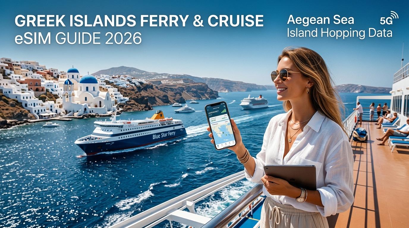
The Aegean Connectivity Paradox: Maritime Satellite Traps vs. Coastal Cellular Propagation
Navigating the transit corridors between Piraeus, Rafina, and the Cycladic archipelago exposes a stark technical divide between two radically different connectivity architectures: high-latency maritime satellite relays and line-of-sight coastal cellular propagation. Understanding the underlying physics and network economics prevents both crippling connection lag and accidental roaming charges running into hundreds of euros.
+-----------------------------------------------------------------------------------+
|                        AEGEAN SEA RF PROPAGATION DYNAMICS                         |
|                                                                                   |
|  [ Island Cell Tower ] (Elevation: 300m-600m)                                     |
|           \                                                                       |
|            \ Direct Line-of-Sight (Fresnel Zone Unobstructed)                     |
|             \                                                                     |
|              \ 15 - 25 km Sea-Level Reach                                         |
|  ~~~~~~~~~~~~~\~~~~~~~~~~~~~~~~~~~~~~~~~~~~~~~~~~~~~~~~~~~~~~~~~ [ Ferry / Ship ] |
|               Aegean Sea Surface (Flat RF Reflector)                              |
+-----------------------------------------------------------------------------------+
The Physics of Over-Water RF Propagation
While cellular coverage on land is frequently degraded by terrain diffraction, concrete infrastructure, and foliage attenuation, open-water radio frequency (RF) propagation benefits from unobstructed optical line-of-sight (LOS). Greek mobile operators (Cosmote, Vodafone GR, and Nova) place high-power macro base stations on elevated ridgelines across Aegean islands—such as Mount Profitis Ilias on Santorini or Mount Zeus on Naxos.
Because the sea surface acts as an RF reflector and the first Fresnel zone remains completely clear of physical clutter, sub-3GHz frequencies (B1, B3, B8, and B20) and mid-band 5G (n78/n28) routinely propagate 15 to 25 kilometers offshore. Under favorable atmospheric conditions, tropospheric ducting across the Aegean temperature gradient can push usable terrestrial 4G signals beyond 30 kilometers. For passengers on standard ferry routes—such as Mykonos to Paros or Naxos to Ios—vessels rarely break direct line-of-sight with an island-based cell tower for more than 15 to 20 minutes at a time.
The Maritime Satellite Trap: Latency, Throttling, and Rogue Roaming
In contrast, paid Wi-Fi networks on vessels operated by Blue Star Ferries, Hellenic Seaways, or Seajets route their uplink through Geostationary (GEO) maritime satellite terminals or low-bandwidth VSAT links. This architecture introduces severe performance bottlenecks:
- Elevated Round-Trip Time (RTT): Signal transmission to geostationary orbit (35,786 km) introduces a physical latency floor of 600ms to 900ms, rendering real-time applications, secure VPN handshakes, and voice over IP (VoIP) unstable.
- Severe Bandwidth Contention: A single vessel often splits a 10 Mbps to 25 Mbps downlink pipeline across 500 to 1,500 simultaneous passenger connections, resulting in frequent packet loss and sub-dialup speeds during peak daytime sailings.
- Rogue Cellular "At Sea" Billing: Many cruise ships and select long-haul overnight ferries host standalone maritime base stations (such as Telenor Maritime or MCP). If your device is set to automatic network selection without data roaming safeguards, it can lock onto these satellite transponders. Maritime satellite data rates frequently exceed €12.00 to €20.00 per megabyte, resulting in catastrophic bills from background cloud synchronizations.
| Connection Type | Average Latency | Real-World Speeds | Typical Cost Structure | Vulnerability / Risk |
|---|---|---|---|---|
| Terrestrial eSIM (e.g., MollySIM) | 25ms – 55ms | 35 – 250+ Mbps (4G/5G) | Fixed upfront prepaid rate | Line-of-sight loss in deep open waters (>25km from land) |
| Onboard Ferry Wi-Fi (VSAT) | 600ms – 1,100ms | 0.2 – 3.0 Mbps | €3.00 – €10.00 per crossing | Extreme bandwidth throttling and packet loss |
| Maritime Satellite Cells (Telenor) | 700ms – 1,200ms | 0.5 – 2.0 Mbps | €12.00 – €20.00 / MB (PayG) | Hidden background roaming fees totaling hundreds of euros |
Strategic Implementation: Locking to Terrestrial Infrastructure
To maximize uptime and eliminate satellite billing risks while crossing the Aegean, rely on a dedicated regional data profile rather than onboard paid portals. Using a travel eSIM like MollySIM allows your handset to connect directly to terrestrial Greek mobile networks across the maritime corridors.
DEVICE SETTINGS CONFIGURATION:
Settings > Cellular / Mobile Data > Network Selection > Disable "Automatic"
└── Select: COSMOTE, VODAFONE GR, or NOVA directly.
Disabling automatic network selection on your smartphone ensures the modem does not jump from a faint coastal cell to an aggressive onboard maritime transponder.
Furthermore, prolonged streaming or tethering while island hopping can exhaust high-speed data buckets unexpectedly. Whereas standard international travel eSIMs throttle speeds down to an unusable 128 kbps under Fair Use Policies (FUP), MollySIM provisions a sustained 384 kbps FUP safety floor. This 3x bandwidth advantage is sufficient to keep interactive vector routing via Google Maps, terminal access, messaging protocols, and dynamic Apple Pay/Google Pay tokens operational even if standard high-speed allowances deplete mid-transit.
Aegean Island Hopping Corridors: Tower Coverage Analysis of Cosmote and Vodafone Greece
🇺🇸 United States High-Speed Travel eSIM & SIM Plans
Instant QR code activation, hotspot enabled, with guaranteed 384kbps fallback speed to keep Maps & Digital Wallets active.
Navigating the maritime expanses of the Aegean Sea presents unique radio-frequency (RF) propagation challenges. While terrestrial cellular networks on the Greek mainland rely on dense microcell grids, connectivity across the Aegean relies on high-power macro base transceiver stations (BTS) strategically placed on island mountain peaks, paired with low-band spectrum channels capable of over-water ducting.
Understanding how Cosmote and Vodafone Greece architect their island infrastructure allows you to anticipate dead zones and maintain continuous connectivity throughout major ferry crossings.
       [ Cosmote High-Site BTS ]                   [ Vodafone Harbor Microcell ]
       (Mountaintop: 500m - 1000m ASL)             (Port Terminal Level)
             /           \                                  |
            /             \                                 |
           /   15-25 NM    \                                | 2-5 NM
          /  Over-Water Span \                              | Localized
         v                    v                             v
[ Open Maritime Channel ]   [ Outer Island Coast ]    [ Ferry Docking / Choke Point ]
Infrastructure Divergence: Cosmote High-Sites vs. Vodafone Coastal Densification
The two dominant Greek operators utilize fundamentally different topological strategies to cover maritime travel lanes:
- Cosmote (OTE): Leverages strategic, high-altitude ridge deployments. By situating high-power mast arrays on peaks like Mount Zas on Naxos (1,003m), Profitis Ilias on Santorini (567m), and Mount Ochi on Evia, Cosmote broadcasts Band 20 (800 MHz) and Band 28 (700 MHz) signals up to 25 nautical miles (NM) out to sea under clear atmospheric conditions. This makes Cosmote the superior backbone provider for wide-open maritime transit corridors.
- Vodafone Greece: Employs an aggressive coastal and port-densification strategy. Vodafone focuses massive mid-band capacity (Band 3 [1800 MHz] and Band 1 [2100 MHz]) and dynamic 5G (n78) microcells around ferry hubs, caldera docking bays, and inter-island approach channels. While Vodafone offers exceptional throughput within 5 nautical miles of port approaches (e.g., Tourlos Port in Mykonos or Athinios in Santorini), its deep-water footprint drops off faster than Cosmote’s mountaintop arrays.
Route-by-Route Signal Profiles: Piraeus & Rafina to the Cyclades and Crete
When transiting the Aegean on conventional ferries (Blue Star Ferries) or high-speed catamarans (SeaJets), signal strength fluctuates dynamically based on vessel hull material, speed, and line-of-sight to the nearest island mast.
| Ferry Route Segment | Primary Network Dominance | Expected Signal / Speeds | Known Dead Zones & Coverage Drops |
|---|---|---|---|
| Piraeus $\to$ Paros / Naxos | Cosmote (Long-range B20) | 4G LTE-A (25–75 Mbps) | Deep trough between Kea and Kythnos channels (15–20 min outage) |
| Rafina $\to$ Andros $\to$ Tinos $\to$ Mykonos | Dual (Cosmote / Vodafone) | 4G/5G (50–150 Mbps) | Near-continuous line-of-sight; minor flutter in the Doro Passage |
| Naxos $\to$ Ios $\to$ Santorini | Cosmote (Mt. Zas & Profitis Ilias) | 4G/5G (40–120 Mbps) | Deep open water 8 NM south of Naxos before picking up Ios coastal cells |
| Santorini $\to$ Heraklion (Crete) | Cosmote (Intermittent) | 3G / Low-Band 4G (2–10 Mbps) | Major Open-Sea Gap: 45–60 min complete terrestrial blackout mid-crossing |
1. The Central Cyclades Corridor (Piraeus to Paros, Naxos, and Ios)
Departing Piraeus, high-speed 5G coverage persists through the Saronic Gulf until clearing the southern tip of Attica. Once entering the open channel between Kea and Kythnos, signals drop to 1–2 bars of Band 20 LTE before locking onto Syros and Kythnos transmitters. Approaching the Paros-Naxos strait, signal quality surges back to multi-carrier 5G speeds exceeding 150 Mbps.
2. The Northern Cyclades Route (Rafina to Andros, Tinos, and Mykonos)
This corridor benefits from tight island spacing. Ferries tracking close to the southern coastline of Andros and Tinos maintain uninterrupted line-of-sight terrestrial coverage. The Doro Strait (between Evia and Andros) occasionally experiences RF attenuation during rough seas due to sea-spray scatter, but drops rarely exceed 5 consecutive minutes.
3. The Southern Gap (Santorini to Crete)
The Sea of Crete crossing represents the most significant terrestrial dead zone in the Aegean. Once a ferry sails more than 18 NM south of Santorini’s caldera, Profitis Ilias’s low-band signal falls below the -120 dBm RSRP threshold. Handsets remain offline until approximately 15 NM north of Crete, where Cosmote and Vodafone base stations along Mount Ida (Psiloritis) and the Heraklion coastline recapture the connection.
Why Multi-Network Fallback Is Essential in the Aegean
Relying on a single domestic carrier leaves you vulnerable to localized topological shadows. An island's volcanic caldera walls (such as Santorini's western face) or jagged promontories can block Cosmote's mountaintop azimuth while leaving Vodafone's harbor-facing sector antenna wide open, or vice versa.
       [ West Caldera Wall ]
              |
   (Cosmote BTS Shadowed)  <--- High cliff blocking signal
              |
              v
       [ Ferry Vessel ] ====> Receives direct line-of-sight from [ Vodafone Coastal Cell ]
Deploying a flexible profile like MollySIM eliminates single-carrier vulnerabilities by provisioning dynamic switching across primary Greek infrastructures. If Cosmote's signal fades in an inter-island shadow between Naxos and Ios, your handset seamlessly transitions to an active Vodafone or Nova sector without administrative reconnection delays.
Furthermore, when continuous maritime tracking, live ETA navigation, and vessel Wi-Fi tethering deplete your primary data bucket mid-voyage, MollySIM’s 384 kbps Fair Use Policy (FUP) floor prevents total communication failure. Operating at 3x the industry-standard 128 kbps restriction, this baseline bandwidth maintains smooth map tile rendering on Google Maps, processes Apple Pay/Google Pay authentication tokens at disembarkation gates, and guarantees uninterrupted WhatsApp and VoIP messaging while your ferry maneuvers into port.
Aegean Sea Transit Connectivity Comparison: Maritime Wi-Fi vs. Local SIMs vs. Travel eSIM
Navigating the transit corridors of the Cyclades, Dodecanese, and Saronic Gulf requires balancing cost, coverage continuity, and hardware resilience. Ferry passengers moving at 25 to 35 knots through open channels quickly discover that relying on a single connection vector introduces distinct operational vulnerabilities.
The matrix below benchmarks the four primary data conduits used by maritime travelers across Greek territorial waters:
| Evaluation Metric | On-Board Maritime Satellite Wi-Fi | Local Greek Prepaid SIM (Airport Kiosk) | Pocket Wi-Fi Router Rental | MollySIM Multi-Network Travel eSIM |
|---|---|---|---|---|
| Setup Friction | Low (Captive portal splash page) | High (Passport verification, kiosk queues, physical tray swap) | Medium (Counter pickup, return logistics, daily recharging) | Zero (Instant digital QR profile activation via eSIM) |
| Cost per Voyage / Trip | High (€8–€25 per voyage or per 24 hrs) | Moderate (€20–€35 for tourist bundle) | High (€7–€12/day + deposit) | Low/Transparent (Direct data tiers from MollySIM) |
| Open-Water Latency | 600ms–1200ms (VSAT) / 80ms–150ms (LEO) | 35ms–70ms (LTE/5G Line-of-Sight) | 40ms–80ms (LTE/5G Line-of-Sight) | 35ms–65ms (Direct terrestrial breakout) |
| Open-Sea Coverage Range | Unrestricted (Vessel-dependent) | 0–12 nautical miles from island masts | 0–12 nautical miles from island masts | 0–15 nautical miles via multi-carrier towers |
| Carrier Redundancy | Single satellite link (Zero terrestrial backup) | None (Locked to Cosmote or Vodafone only) | None (Locked to single provisioned SIM) | High (Dynamic roaming across Cosmote, Vodafone & Nova) |
| Vessel Hull Penetration | Strong (Internal cabin access points) | Weak inside lower vehicle/steel decks; strong on open decks | Weak inside lower vehicle/steel decks; requires positioning near windows | Strong on open decks; optimized band selection (Band 20 / 800MHz) |
| Low-Data Fallback Protection | Hard disconnect / Expensive top-ups | Complete disconnection upon exhaustion | Hard cap throttled to 64 kbps (unusable) | 384 kbps Fair Use Policy (FUP) Floor (3x standard) |
Key Takeaways from the Maritime Connectivity Matrix
1. The Redundancy Deficit of Single-Carrier Solutions
Purchasing a physical prepaid SIM from an Athens International Airport (ATH) arrivals kiosk locks your handset to one domestic operator. While Cosmote boasts the broadest aggregate footprint across the mainland, its maritime azimuth coverage in the central Aegean Sea features known signal dead zones—particularly in deep corridors between Paros, Sifnos, and Serifos. In these specific pockets, Vodafone or Nova masts positioned on opposite headlands often deliver the only viable carrier signal.
A multi-carrier eSIM profile like MollySIM continuously registers the strongest radio signal across all operational Greek networks, dynamically switching endpoints without requiring manual network configuration or physical card swaps.
2. Terrestrial Cellular vs. Maritime Satellite Economics
On-board ferry Wi-Fi packages provided by operators like Blue Star Ferries, Seajets, and Minoan Lines route traffic through satellite uplinks (primarily geostationary VSAT systems). These connections suffer from high packet loss during peak sailing hours when hundreds of passengers authenticate concurrently.
Because modern high-speed catamarans and conventional ferries rarely stray more than 10 to 12 nautical miles from island coastlines, direct line-of-sight LTE/5G terrestrial roaming provides far lower latency (under 50ms versus 800ms+), significantly higher bandwidth, and bypasses recurring shipboard paywalls entirely.
3. Low-Data FUP: Preserving Mission-Critical Navigation
Standard travel SIMs and rental pocket Wi-Fi units enforce severe Fair Use Policies, cutting speeds down to an unusable 64 kbps or 128 kbps once high-speed caps are reached. At 128 kbps, modern HTTPS encryption handshakes time out, transport apps fail to refresh live ship-tracking telemetry (MarineTraffic, VesselFinder), and digital payment gateways cannot authenticate dynamically generated security tokens.
MollySIM integrates an industry-leading 384 kbps baseline fallback speed—three times higher than legacy providers. This critical bandwidth floor maintains background communication, allowing:
- Live routing updates and turn-by-turn map rendering on Google Maps and Apple Maps upon reaching port.
- Immediate token validation for Apple Pay, Google Pay, and online ticketing check-ins at ferry ramps.
- High-priority messaging, email transfers, and compressed VoIP calls without paying punitive mid-voyage overage fees.
Vessel Dynamics & Signal Optimization: Mastering Seajets Catamarans and Blue Star Ferries
The physical architecture of your transit vessel dictates cellular performance across the Aegean just as much as carrier tower topography. Cellular signals operating on standard European LTE/5G bands (Band 20 @ 800 MHz, Band 3 @ 1.8 GHz, Band 7 @ 2.6 GHz, and Band n78 @ 3.5 GHz) behave radically differently depending on whether you are boarding a high-speed hydrofoil or a massive conventional roll-on/roll-off (Ro-Pax) vessel.
Architectural Radio Frequency (RF) Attenuation: Catamarans vs. Conventional Ferries
+---------------------------+-----------------------------------+-----------------------------------+
| Vessel Class              | Typical Models                    | RF Propagation Environment        |
+---------------------------+-----------------------------------+-----------------------------------+
| High-Speed Catamarans     | Seajets WorldChampion Jet,        | Enclosed aluminum superstructure, |
|                           | Champion Jet 1/2, Power Jet       | heavy metallized window tinting;  |
|                           |                                   | severe signal loss (15–25 dBm).   |
+---------------------------+-----------------------------------+-----------------------------------+
| Conventional Ro-Pax       | Blue Star Delos, Naxos,           | Steel displacement hull with      |
|                           | Paros, Myconos, Patmos            | wide, multi-tier open sun decks;  |
|                           |                                   | direct coastal line-of-sight.     |
+---------------------------+-----------------------------------+-----------------------------------+
1. High-Speed Enclosed Catamarans (Seajets Fleet)
Vessels like the WorldChampion Jet and Champion Jet 2 prioritize hydrodynamic efficiency and passenger containment. Constructed with lightweight aluminum hulls and reinforced, UV-reflective metallized window panes, these vessels inadvertently create a partial Faraday cage.
- The Cabin Trap: Inside the main tourist or business class lounges, incoming RF signals from coastal base transceiver stations (BTS) suffer an attenuation penalty between 15 dBm and 25 dBm. This drop frequently degrades a robust 4-bar 5G signal down to an unstable 1-bar 3G/EDGE connection.
- Tactic: Secure a seat immediately adjacent to an untinted composite window section, or position your device along upper-tier panoramic lounges where composite fiberglass roof panels offer lower RF resistance than lower-deck aluminum plating.
2. Conventional Displacement Ferries (Blue Star Fleet)
Vessels like the Blue Star Delos and Blue Star Naxos cruise at lower speeds (20–24 knots) and feature vast exterior passenger decks.
- The Sun Deck Advantage: Stepping out onto the port or starboard promenade deck removes all physical vessel shielding, providing unobstructed optical and electromagnetic line-of-sight (LOS) to mountain-top cellular masts on nearby islands (e.g., Tinos, Syros, or Naxos).
- Tactic: When downloading large media assets, syncing critical work files, or initiating video calls, relocate temporarily to an exterior deck facing the nearest landmass.
Mitigating Rapid Handover Drain and Doppler Degradation
When cruising at 30 to 38 knots across maritime corridors—such as the passage between Mykonos and Santorini—your smartphone executes rapid cellular handovers. The device continually negotiates handshakes between island-based cell towers located 8 to 15 nautical miles apart.
[Island BTS Alpha] <--- (Handover Negotiation) ---> [Island BTS Beta]
          \                                              /
           \                                            /
            \                                          /
             ===> [ Catamaran Moving at 35 Knots ] ===>
This rapid switching triggers two major technical challenges:
- RF Power Amplifier Drain: When your handset senses fluctuating signal strength inside a shielded cabin, its internal modem drives power amplifier output to its absolute maximum (+23 dBm / 200 mW) to maintain connectivity. Combined with constant network re-authentication, this accelerates battery consumption by up to 300% compared to stationary terrestrial usage.
- Packet Transmission Jitter: Handover latency interrupts active TCP data streams, causing session drops in live tracking applications.
Field-Tested Device Optimization Checklist
- Pre-Cache Marine Telemetry Offline: Before casting off from Piraeus, Rafina, or Heraklion, open MarineTraffic and Ferryhopper. Pre-render your specific vessel route and download the offline regional vector maps inside Google Maps or Apple Maps. This prevents your device from burning cellular data on base-map rendering during weak coverage gaps.
- Toggle Low Data Mode: On iOS (
Settings > Cellular > Cellular Data Options) or Android (Settings > Network & internet > Data Saver), enable Low Data Mode. This halts background iCloud/Google Photos syncing, automatic app updates, and telemetry polling, reserving available maritime bandwidth strictly for active foreground tasks. - Deploy High-Floor Fallback Data: High-speed travel through island shadow zones (such as passing behind the dramatic cliffs of southern Ios or Amorgos) will inevitably test your network limits. While legacy travel eSIMs drop to an unusable 64 kbps, MollySIM enforces a 384 kbps baseline speed floor. This ensures that even during temporary network throttling or edge-of-cell coverage, mission-critical operations—such as biometric Apple Pay/Google Pay processing at the disembarkation gate and live port navigation—execute without latency timeouts.
Port Transfer Mastery: Digital Boarding Passes, Athinios Logistics, and Taxi Coordination
The most data-critical moments of an Aegean island-hopping itinerary do not occur in open water—they happen on the quay. Navigating the operational bottlenecks of Greek port infrastructure requires sustained cellular throughput exactly when local telecommunications infrastructure is under peak strain.
                                  PORT DISEMBARKATION BOTTLENECK

   [ Ferry Docks: 1,500+ Pax ] ---> [ Local Macro Base Station (BTS) ] <--- [ 40+ Transfer Vans / Taxis ]
                 |                                  |                                   |
                 v                                  v                                   v
       Instant Data Surge:                RRC Connection Storm:                Real-Time Coordination:
    Dynamic QR Pass Retrieval            Packet Queueing & Drops              WhatsApp Live Location / Maps
The Boarding Bottleneck: Piraeus Gates E6–E9 & Web Check-In Systems
Boarding major ferry lines—including Blue Star Ferries, Seajets, and Hellenic Seaways—has transitioned almost entirely to digital boarding passes. Passengers must complete online web check-ins between 48 and 2 hours prior to departure to generate digital passes.
- Dynamic Rendering Issues: Major Greek operators utilize dynamic web-based boarding passes or embedded dynamic PKPASS tokens that require active network pings to authenticate validity upon gate entry.
- The Piraeus Chokepoint: Gates E6 and E7 (serving Paros, Naxos, and Santorini) and Gate E9 (Western Cyclades) experience massive pedestrian density during morning departure windows (06:30–07:45 AM).
- Public Wi-Fi Vulnerabilities: Port authority Wi-Fi around the Piraeus perimeter is unencrypted, highly unstable, and exposes travelers to captive portal authentication loops and packet sniffing. Relying on an open public hotspot to render boarding passes seconds before walking up the ferry ramp risks missed departures.
Disembarkation Tower Crunches: Athinios (Santorini) and Tourlos (Mykonos)
When a high-speed catamaran like the WorldChampion Jet or a conventional vessel like the Blue Star Delos docks, between 1,200 and 2,500 passengers disembark simultaneously into compact port zones. This sudden surge triggers an RRC (Radio Resource Control) connection storm on localized cell towers.
+--------------------------+------------------------------------------------+-------------------------------------------------+
| Port                     | Geographic / Infrastructure Bottleneck          | Telemetry & Connectivity Challenge              |
+--------------------------+------------------------------------------------+-------------------------------------------------+
| Athinios (Santorini)     | Sheer 260m caldera cliffs; single switchback   | Macro cell signals bounce off cliff faces;      |
|                          | access road with massive vehicle gridlock.     | instant cell-tower saturation upon ferry arrival.|
+--------------------------+------------------------------------------------+-------------------------------------------------+
| Tourlos (Mykonos)        | Exposed concrete quay; heavy crosswinds;       | Simultaneous cruise ship + high-speed ferry     |
|                          | multi-vessel convergence zone.                 | docking overloads localized micro-cells.        |
+--------------------------+------------------------------------------------+-------------------------------------------------+
| Piraeus (E6 / E7 / E9)   | High-density commercial hub; concrete ramps    | Heavy background RF interference; aggressive    |
|                          | and steel ship hulls create signal refraction. | network throttling during morning rush hours.   |
+--------------------------+------------------------------------------------+-------------------------------------------------+
At Athinios Port in Santorini, geography compounds the problem. Squeezed between vertical caldera cliffs and the water, the port relies on a limited number of line-of-sight base transceiver stations (BTS). When multiple ferries arrive concurrently:
- Local mobile masts become congested, leading to dropped TCP sessions and soaring ping rates.
- Direct-dial cellular voice channels fail, forcing reliance on IP-based communication (WhatsApp, Apple iMessage, Signal) to locate private transfer drivers parked along the switchbacks.
- Ride-hailing apps (such as Freenow or local driver dispatch systems) time out if your device cannot maintain active data handshakes.
Real-Time Marine Telemetry vs. Published Schedules
Ferry transit in the Aegean is subject to the Meltemi—strong, dry northern winds that routinely cause unannounced 30- to 90-minute operational delays. Port display boards in secondary islands (such as Milos, Naxos, or Folegandros) are often non-functional or out of sync with actual vessel movements.
       OFFICIAL TIMETABLE                  LIVE AIS TELEMETRY (MarineTraffic)
  [ Scheduled Arrival: 14:15 ]    --->    [ Speed: 31.2 kts | ETA: 15:05 (Delayed) ]
                |                                             |
                v                                             v
     Wasted waiting on hot quay                  Comfortable cafe wait / Driver updated
Tracking your inbound vessel on MarineTraffic via real-time satellite/terrestrial AIS (Automatic Identification System) prevents premature arrivals at chaotic quays. To run live vessel tracking, render route maps, and update your private driver simultaneously, uninterrupted data throughput is mandatory.
Port Transit Connectivity Specifications
To maintain seamless communications during port transit, ensure your connectivity setup meets these minimum operational standards:
- Dual-Carrier Fallback: Island ports frequently experience carrier-specific outages. An eSIM solution that dynamically switches between Cosmote and Vodafone GR ensures you can hop to an un-congested carrier channel when thousands of passengers ping the same primary mast.
- Fail-Safe Bandwidth Floor: During extreme port cell congestion, basic travel eSIMs with aggressive Fair Use Policies (FUP) throttle users to 64 kbps or 128 kbps—rendering mapping platforms and rideshare apps completely unusable. MollySIM provides a high 384 kbps baseline speed floor (three times faster than legacy 128 kbps limits). This ensures mission-critical apps—such as Google Maps vector rendering, WhatsApp live location tracking, and Apple Pay processing—execute without timeout errors, even amid peak port transfer gridlock.
Frictionless Island Hopping with MollySIM: Multi-Network Agility and the 384kbps Lifeline
Navigating the complex topography of the Cyclades and Dodecanese requires a connectivity architecture that adapts in real time. Between high-speed catamarans carving through open maritime corridors and steep caldera cliffs deflecting cellular arrays, single-network reliance is the primary point of failure for Aegean travelers.
MollySIM eliminates maritime dead zones and portside bottlenecks by combining automated dual-carrier aggregation with an industry-leading fallback protocol.
Dynamic Carrier Switching: Cosmote & Vodafone Greece
Rather than locking your handset to a single domestic Greek operator, MollySIM operates via an intelligent multi-network EU profile. The eSIM continuously monitors signal-to-noise ratios (SNR) and cell tower load, dynamically switching between Cosmote and Vodafone Greece without requiring manual network selection or device restarts.
- Coastal & Open-Water Reach: As your ferry crosses open waters where standard signals degrade, the profile prioritizes Cosmote’s low-band LTE (Band 20 / 800 MHz), which travels greater distances over water from high-elevation island transmitters.
- Port Congestion Relief: Upon docking in congested harbors like Mykonos Tourlos or Santorini Athinios—where thousands of disembarking passengers overwhelm primary local base stations—the profile automatically negotiates a handover to an un-congested Vodafone microcell, maintaining active throughput while other travelers experience total data stalls.
The 384kbps Lifeline: Eliminating the Mid-Journey Blackout
The most dangerous failure point for island hoppers is running out of high-speed data mid-transit. Standard travel eSIMs enforce severe Fair Use Policies (FUP), throttling exhausted plans to 64 kbps or 128 kbps. At 128 kbps, modern HTTPS connections and secure app protocols experience severe packet loss and TLS handshake timeouts, effectively severing your connection to essential travel utilities.
MollySIM deploys a guaranteed 384 kbps baseline speed floor—three times the industry standard—ensuring you maintain an unmetered, functional data link even if your primary high-speed balance hits zero midway through an Aegean crossing.
| Travel Function / Application | MollySIM 384 kbps Floor | Standard eSIM 128 kbps Throttling |
|---|---|---|
| MarineTraffic AIS Tracking | Instant live refresh of vessel position & ETA | Timeout / Map tiles fail to load |
| Apple Maps / Google Maps | Smooth vector rendering & dynamic rerouting | Blank gray grid; routing engine fails |
| WhatsApp / iMessage | Real-time text & voice notes to drivers/hosts | Extreme lag; voice notes fail to upload |
| FerryHopper / PDF Boarding Passes | Immediate ticket retrieval from cloud storage | Gateway timeout errors at gate |
| 3D Secure Banking & Apple Pay | Instant SMS/In-app 2FA validation | Transaction aborted due to slow handshake |
At 384 kbps, core travel logistics remain fully operational. You can verify sudden gate alterations on digital ferry passes, push live coordinates to your hotel transfer via WhatsApp, and authorize 3D Secure banking transactions on the spot—ensuring complete digital self-reliance across every nautical mile of your Greek itinerary.
🇺🇸 United States High-Speed Travel eSIM & SIM Plans
Instant QR code activation, hotspot enabled, with guaranteed 384kbps fallback speed to keep Maps & Digital Wallets active.