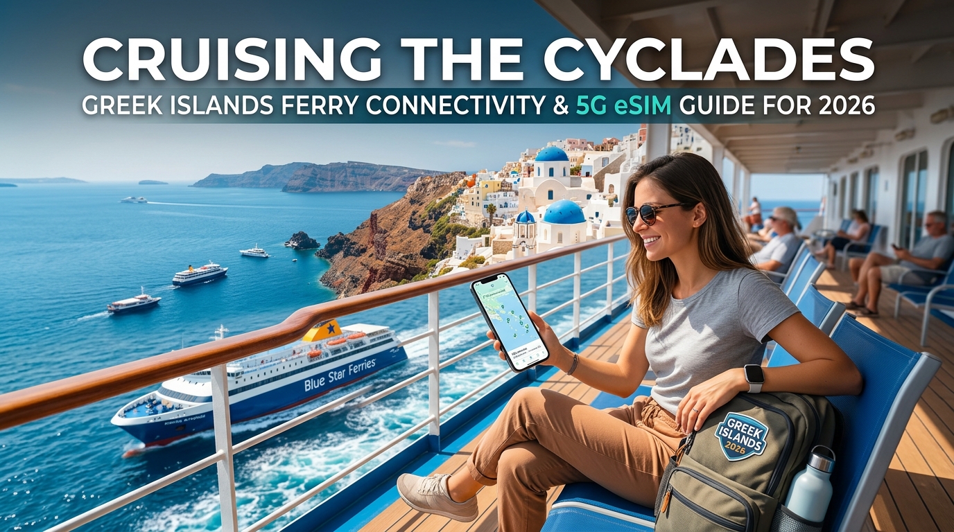
Cruising the Cyclades: Greek Islands Ferry Connectivity & 5G eSIM Guide for 2026
The Aegean Connectivity Dilemma: Maritime Satellite Wi-Fi vs. Coastal 5G Line-of-Sight
Stepping onto the open vehicle deck of a Blue Star conventional ferry at Piraeus or boarding a high-speed Seajets catamaran at Rafina instantly triggers a common travel dilemma: how do you stay connected across a multi-hour crossing through the Cyclades?
Ferry operators actively market onboard Wi-Fi portals to captive passengers, but relying on these maritime systems is almost universally a frustrating, overpriced mistake. Understanding the physical geography of the Aegean Sea—and how cellular signals propagate across open water—reveals why terrestrial 5G/4G networks offer a vastly superior alternative.
+-------------------------------------------------------------------------------+
|                        AEGEAN CELLULAR PROPAGATION                            |
|                                                                               |
|   [ Island Peak Mast ] (~500m-1000m)                                          |
|            \                                                                  |
|             \   Direct Line-of-Sight (15-25 km)                               |
|              \                                                                |
|~~~~~~~~~~~~~~~\~~~~~~~~~~~~~~~[ Ferry Deck ]~~~~~~~~~~~~~~~~~~~~~~~~~~~~~~~~~~|
|                \== Seawater Surface (RF Reflection / Ducting) ==              |
+-------------------------------------------------------------------------------+
The Costly Reality of Onboard Satellite Wi-Fi
Major Greek operators—including Blue Star Ferries, Hellenic Seaways, and Seajets—route their onboard guest Wi-Fi through maritime satellite links (typically VSAT or legacy geostationary arrays). Because bandwidth must be shared across hundreds of passengers and vessel operational systems, the performance degrades immediately after departure.
- Extortionate Pricing: Packages routinely cost between €5 and €15 for restrictive data caps (often as low as 100MB to 500MB) or time-locked access windows.
- Severe Latency: Ping times frequently exceed 600ms to 1,200ms, rendering real-time messaging, VoIP calling, and remote work applications unusable.
- Artificial Throttling: Once high-bandwidth consumption is detected, packet-shaping algorithms aggressively throttle speeds down to single-digit kilobits.
Radio Physics at Sea: Terrestrial 5G Line-of-Sight Propagation
Unlike transoceanic voyages, cruising the Cyclades is an archipelago transit. You are rarely isolated in deep water; instead, your vessel threads through narrow straits flanked by mountainous islands like Kea, Kythnos, Syros, Tinos, Mykonos, Naxos, and Ios.
Greek mobile network operators (Cosmote, Vodafone Greece, and Nova) place high-power cellular base stations on elevated ridgelines and summit peaks—such as Mount Zeus on Naxos (1,001m) and Profitis Ilias on Santorini (567m). This high placement exploits two critical principles of RF (radio frequency) physics:
- Optical and Radio Line-of-Sight (LoS): Over flat water, elevated radio masts encounter zero structural interference (buildings, dense foliage, or complex terrain). A mast positioned 500 meters above sea level achieves a theoretical radio horizon exceeding 80 kilometers, providing solid practical coverage 15 to 25 kilometers offshore.
- Sea Surface Ducting and Reflection: The smooth dielectric surface of calm summer seawater reflects sub-6 GHz and mid-band 5G signals, allowing cellular waves to skim across the surface with minimal attenuation compared to landlocked corridors.
| Feature | Maritime Satellite Wi-Fi | Terrestrial Coastal 5G / 4G LTE |
|---|---|---|
| Typical Cost | €5 – €15 per voucher / crossing | Included in your standard eSIM data plan |
| Latency (Ping) | 600ms – 1,500ms | 25ms – 65ms |
| Average Speeds | 0.5 – 2 Mbps (heavily throttled) | 50 – 350+ Mbps (mid-band 5G) |
| Coverage Continuity | Vessel-wide, but drops in heavy seas | Continuous across 80–90% of Cycladic routes |
| Device Flexibility | Locked to 1 MAC address per purchase | Shared via native mobile hotspot / tethering |
Bypassing the Paywall with Localized eSIM Routing
Because passenger ferries spend the vast majority of their routes within line-of-sight range of island base stations, savvy travelers bypass satellite paywalls by relying directly on digital eSIM profiles.
Deploying a regional travel eSIM like MollySIM allows your handset to connect automatically to local Greek masts as your vessel cruises along coastal shipping lanes. Even in rare transition zones between distant island ridges where high-speed buckets temporarily drop, MollySIM’s 384kbps Fair Use Policy (FUP) speed limit ensures uninterrupted navigation. While competitor eSIMs throttle down to an unusable 128kbps, a 384kbps baseline maintains enough throughput to load Apple Pay passes, verify digital ferry boarding QR codes, and refresh Google Maps coordinates as you approach port.
Aegean Island Ferry Routes: Analyzing Real-World Coverage from Piraeus to Santorini
🇺🇸 United States High-Speed Travel eSIM & SIM Plans
Instant QR code activation, hotspot enabled, with guaranteed 384kbps fallback speed to keep Maps & Digital Wallets active.
Navigating the Cycladic maritime network means traversing a mosaic of micro-cellular environments. While land-based mobile networks often rely on closely spaced urban small cells, maritime coverage in the Aegean relies on high-elevation macro base stations anchored atop island peaks—such as Mount Zas on Naxos (1,001m) and Mount Attavyros on Rhodes.
Understanding how these line-of-sight signals propagate across water lets you anticipate when your 35-knot high-speed catamaran (like a SeaJets WorldChampion Jet or Hellenic Seaways Highspeed 4) will enjoy Gigabit 5G and when signal degradation might occur.
1. Athens Departures: Piraeus vs. Rafina & The Cavo D'Oro Passage
- Piraeus Exit (Saronic Gulf): As vessels depart Piraeus, terrestrial 5G (n78 band at 3.5 GHz) remains robust through the coastal waters off Glyfada and Vouliagmeni. Signal continuity holds at 150–400 Mbps until passing the southern tip of Attica near Cape Sounion.
- Rafina Exit & Cavo D'Oro (Strait of Kafireas): Ferries departing Rafina immediately encounter the Cavo D'Oro—a notorious stretch of open water between Euboea (Evia) and Andros. This channel experiences rapid signal handoffs. While the wind-whipped channel causes physical ship roll, mobile devices switch between Euboean coastal masts and western Andros ridge sites. Coverage momentarily drops to low-band LTE (Band 20 / 800 MHz) for a 15-to-20-minute window before locking back onto high-capacity cells near Gavrio (Andros).
2. The Central Hub: Syros, Tinos, Delos & Mykonos
Once past the northern gateways, ferries enter the tightly clustered central Cyclades. This is the highest-throughput maritime corridor in the Aegean:
- The Syros Handoff: Because Ermoupoli (Syros) is the administrative capital of the Cyclades, its mountain towers deploy high-density multi-band arrays. Even when cruising 8 nautical miles offshore, vessels catch overlapping signals from Syros and Tinos.
- Delos / Mykonos Transit: Cruising between Delos and Mykonos offers direct line-of-sight to the coastal towers of Tourlos and Paradise Beach. Streaming 4K video or conducting multi-party video conferences is seamless here, with latency staying under 35ms.
3. The Open Channel: Paros to Naxos and the Southern Leap to Ios
The stretch between Paroikia/Piso Livadi (Paros) and the port of Naxos is essentially an inland sea; line-of-sight is never lost, delivering sustained 5G speeds exceeding 250 Mbps.
The primary drop occurs on the southern approach toward Ios:
- The Naxos–Ios Deep Channel: As vessels leave the lee of Naxos and pass south of the Small Cyclades (Irakleia and Schinoussa), ferries cross a wide trench of open water. Here, Doppler shift and rapid distance attenuation from 35-knot speeds can cause short-lived cellular reconnections.
- Fail-Safe Connectivity: If heavy network traffic throttles your priority high-speed data while transiting this channel, having a reliable eSIM profile like MollySIM prevents dropped sessions. Even when falling back to the Fair Use Policy (FUP), MollySIM throttles to 384kbps—three times the industry standard of 128kbps. This 384kbps baseline provides ample bandwidth to load Apple Wallet ferry boarding passes, send live WhatsApp location pins, and cache Google Maps routes before docking.
4. Entering the Santorini Caldera: Volcanic Topography vs. Signal Reflection
The arrival into Santorini (Thira) via the caldera rim presents a unique radio-frequency landscape:
As your ferry cuts past the volcanic islets of Nea Kameni and Palea Kameni toward Athinios Port, the 300-meter vertical volcanic cliffs act as giant RF reflectors. Base stations perched along the cliff edges of Fira and Oia beam directly down into the caldera basin.
While the sheer cliff base can create minor multi-path interference, modern 5G handsets aggregate mid-band (n78/n1) and low-band (n28) frequencies to deliver burst speeds up to 500 Mbps as you queue for disembarkation.
Cyclades Ferry Route Real-World Connectivity Matrix
| Corridor / Route Leg | Typical Network Generation | Estimated Speeds | Potential Intermittent Dead Zones |
|---|---|---|---|
| Piraeus $\rightarrow$ Cape Sounion | 5G (n78 / n1) | 200 – 450 Mbps | None; continuous coastal mast coverage |
| Cavo D'Oro (Rafina $\rightarrow$ Andros) | 4G LTE / 5G (n28) | 25 – 70 Mbps | 10–15 min window mid-channel |
| Tinos $\rightarrow$ Mykonos $\rightarrow$ Syros | 5G Dual Carrier | 150 – 350 Mbps | None; overlapping island base stations |
| Paros $\rightarrow$ Naxos Strait | 5G Ultra-Wide | 250 – 500 Mbps | Flawless channel coverage |
| South Naxos $\rightarrow$ North Ios | 4G LTE / Low-Band 5G | 15 – 45 Mbps | 10 min window south of Irakleia |
| Santorini Caldera Approach | 5G (Clifftop Arrays) | 100 – 400 Mbps | Brief shadow right under Athinios sheer cliff |
Carrier Landscape & Performance Comparison: Cosmote, Vodafone, Nova vs. Travel eSIMs
Understanding the local telecommunications topography in Greece is vital when navigating the maritime transit corridors of the Cyclades. Greece’s cellular infrastructure is operated by three primary Mobile Network Operators (MNOs)—Cosmote, Vodafone Greece, and Nova (formerly Wind Hellas). Each approaches Aegean maritime coverage with distinct tower placements, spectral power, and backhaul architectures.
The Big Three Greek Operators at Sea
- Cosmote (OTE Group / Deutsche Telekom): Cosmote is widely recognized as the infrastructure leader across the Aegean Sea. By leveraging high-elevation mountain peaks—such as Mount Zas on Naxos and Mount Profitis Ilias on Santorini—Cosmote deploys high-gain directional panel antennas beaming low-band 700 MHz (Band n28) and mid-band 3.5 GHz (Band n78) directly across open-water channels. Cosmote consistently delivers the lowest latency and longest offshore reach.
- Vodafone Greece: Vodafone maintains exceptionally dense 5G capacity in primary tourist ports (Mykonos Town, Athinios in Santorini, Adamas in Milos). However, its maritime signal dispersion falls off slightly faster than Cosmote's when cruising through wide channels like the Ikarian Sea or the central stretch between Paros and Ios.
- Nova: Following significant infrastructure investments post-merger, Nova offers competitive 5G speeds in port towns and urban hubs. However, its low-band Aegean maritime repeater network is less dense, resulting in earlier drop-offs to legacy 3G/4G fallback modes during long mid-channel ferry legs.
The Single-Network Bottleneck vs. Multi-Network Agility
Purchasing a local prepaid SIM from a single Greek MNO binds your device to that carrier’s specific tower grid. If your ferry enters a topographical blind spot behind the cliffs of Sifnos where Cosmote is weak but Vodafone has an active relay, your connection drops.
Next-generation multi-network eSIMs solve this by eliminating single-carrier lock-in. A global travel eSIM configured for Greece dynamically handshakes with the strongest available tower—switching seamlessly between Cosmote, Vodafone, or Nova as your ferry glides through overlapping coverage zones.
Maritime Connectivity Method Comparison Matrix
| Solution | Typical Cost / GB | Open-Sea Speeds | Port Arrival Reliability | Setup Friction | Fair Usage Policy (FUP) & Throttle |
|---|---|---|---|---|---|
| Onboard Satellite Wi-Fi (Ferry Provider) | €10 – €25 / day (metered) | 0.5 – 5 Mbps (High Ping) | Low (Severe congestion in port) | High (Voucher codes, captive portal logins) | Strict caps; cuts off completely or throttles to sub-32 kbps |
| Home Carrier Roaming (US/CA/UK Day Passes) | $10 – $15 / day ($10+/GB) | 10 – 50 Mbps | Moderate (High latency due to home routing) | Zero (Automated) | Heavy throttling to 2G/128 kbps after 500 MB – 2 GB daily limit |
| Local Greek Tourist SIM (Cosmote / Vodafone) | €2 – €4 / GB | 50 – 300 Mbps | Moderate (Locked to single carrier) | High (Passport validation, physical shop queuing) | Hard stop after package exhaustion; manual top-ups required |
| MollySIM 5G eSIM | €1.20 – €2.50 / GB | 100 – 500 Mbps | Ultra-High (Multi-carrier auto-switching) | Instant (Zero physical swap, QR/Direct Install) | Uninterrupted 384 kbps fallback (3x faster than industry standard) |
Why FUP Architecture Matters for Island Hoppers
The true test of an Aegean ferry connectivity setup is what happens when you hit a high-speed data limit while mid-voyage. Most standard travel SIMs and roaming plans enforce brutal Fair Usage Policies (FUP), throttling your speed down to a crippling 64 kbps or 128 kbps—rendering mapping applications and travel logistics completely inoperable.
By contrast, MollySIM enforces an industry-leading 384 kbps fallback speed. At 384 kbps, your connection remains robust enough to:
- Load dynamic vector tiles in Google Maps and Apple Maps as your vessel enters unfamiliar harbors.
- Authenticate contactless payments via Apple Pay and Google Wallet at dockside transit kiosks.
- Maintain clear VoIP audio on WhatsApp or FaceTime, update your digital ferry boarding pass via the ferry operator's app, and hail ride-share services without timeout errors.
Vessel Physics & Device Optimization: Beating the Steel Hull Faraday Cage and Battery Drain
Getting stranded without a connection in the middle of the Aegean Sea often has less to do with carrier coverage maps and everything to do with vessel architecture. Modern commercial Greek ferries—from the conventional displacement vessels operated by Blue Star Ferries to high-speed catamarans run by SeaJets—are essentially floating fortresses of reinforced maritime steel, treated structural glass, and composite metals.
To maintain reliable connectivity across open water, you must understand both the physical environment of the vessel and how your smartphone’s baseband modem behaves under extreme fringe-signal conditions.
The Steel Hull Dilemma: Understanding the Maritime Faraday Effect
Radio Frequency (RF) signals transmitted from terrestrial Base Transceiver Stations (BTS) perched on Cycladic peaks operate across varying cellular spectrums. While low-band frequencies (like Band 20 at 800 MHz or Band 28/n28 at 700 MHz) possess long wavelengths capable of traveling 20+ kilometers over water, they struggle to penetrate multiple layers of marine-grade steel. High-capacity mid-band 5G (Band n78 at 3.5 GHz) is blocked almost completely by ferry bulkheads.
If you sit inside lower-deck interior seating or remain in vehicle hold areas, the vessel behaves as a physical Faraday cage. Electromagnetic waves induce electrical currents within the conductive steel hull, canceling out the exterior RF fields before they can reach your smartphone's integrated antenna array.
       [ Coastal Island Cell Tower (BTS) ]
                    \
                     \  RF Signals (B20/B28/n78)
                      \
       +---------------------------------------------+
       |   [ Upper Outdoor Sundeck ]  <-- DIRECT LoS | (Optimal Signal)
  =====+=============================================+=====
  |    |   Upper Panorama Lounge (Clear Glass)       |    | (Moderate Signal)
  |    +---------------------------------------------+    |
  |    |   Interior Economy Seating (Steel Enclosed) |    | (Dead Zone / Faraday)
  |    +---------------------------------------------+    |
  |    |   Lower Cargo / Vehicle Holds               |    | (Complete RF Blackout)
  +====+=============================================+====+
Strategic Vessel Positioning for Maximum Signal Gain
Your physical location on the ferry directly determines your signal-to-noise ratio (SNR) and received signal strength indicator (RSSI).
| Deck Location | Structural Impediment | Expected Signal Quality | Recommended Tactical Use |
|---|---|---|---|
| Upper Outdoor Sundeck (Aft / Stern) | None (Zero metal overhead) | Maximum (4G/5G Line-of-Sight) | High-bandwidth tasks, voice calls, streaming logistics |
| Forward Observation Lounge | Heavy tinting / Solar metallic coating | Moderate to Low | General browsing; move closer to non-coated side windows |
| Mid-Ship Interior Cabins | Double-walled steel bulkheads | Poor (Signal drops to 2G or 'No Service') | Rest only; disable data to prevent battery drain |
| Lower Vehicle / Cargo Decks | Enclosed structural steel cage | Zero RF Penetration | N/A (Total blackout) |
Stern vs. Bow Line-of-Sight Dynamics
- The Stern Advantage: As your vessel steams away from an island, coastal high-elevation antennas remain within clear, unobstructed Line-of-Sight (LoS) across the wake. The stern (aft deck) maintains connectivity with the departing island's infrastructure far longer than indoor areas.
- The Bow Transition: The forward bow catches the incoming signal from your destination island first, but high-speed catamarans often restrict passenger access to forward exterior decks due to wind resistance. When approaching ports like Parikia (Paros) or Athinios (Santorini), station yourself near panoramic side windows on the vessel’s port or starboard sides rather than deep in the center salon.
Beating "Tower Hunting" and Rapid Battery Depletion
When a smartphone loses a stable cellular lock, its radio baseband switches to high-power tower-hunting mode.
To reach distant island masts across 15 to 30 kilometers of open water, your device’s Power Amplifier (PA) ramps transmission power up to its maximum limit (+23 dBm / 200 mW). If you are running an active physical home SIM alongside a travel eSIM, both internal modems search simultaneously. This dual-radio load generates significant thermal buildup and can drain a fully charged smartphone battery in under 90 minutes.
[ Island Tower ] <--- 20 km Open Water ---> [ Phone Ramp: +23 dBm Max Power ]
                                                      |
                                            [ High Thermal Load ]
                                                      |
                                            [ Rapid Battery Drain ]
Step-by-Step Battery & Radio Optimization Checklist
- Disable Home SIM Roaming Underway: Turn off your domestic physical SIM via your device's cellular settings once out of harbor to stop redundant dual-SIM network scanning. Keep your data path dedicated exclusively to your active eSIM.
- Lock Out Background Cloud Bandwidth: Toggle Low Data Mode (iOS) or Data Saver (Android). This stops iCloud, Google Photos, and background system syncs from monopolizing the limited RF pipeline when signal margins drop mid-crossing.
- Utilize Carrier Auto-Switching: Maintain automatic network selection. When cruising the Naxos-to-Mykonos channel, a resilient service like MollySIM allows your device to seamlessly switch from a degrading Cosmote cell to a stronger incoming Vodafone or Nova coastal tower without forcing a hard modem reboot.
- Rely on Resilient FUP Floor Speeds: When transitioning through fringe sea corridors where signal briefly drops and data limits are reached, standard travel eSIMs throttle down to an unusable 64–128 kbps. MollySIM maintains a 384 kbps baseline—three times faster than standard providers. This ensures critical functions like Apple Pay, Google Maps navigation, and digital boarding pass retrieval remain fully operational without triggering continuous network reconnection attempts that exhaust battery reserves.
Port Arrival Logistics: Real-Time Ferryhopper Tracking and Smooth Disembarkation
The final twenty minutes of any Cycladic ferry crossing represent the most logistically intense phase of your journey. As massive vessels maneuver into notorious bottleneck harbors—such as Athinios Port in Santorini, Tourlos New Port in Mykonos, or Parikia in Paros—thousands of foot passengers, rental cars, and tour buses converge simultaneously. Navigating this environment without immediate, high-throughput mobile connectivity leaves travelers vulnerable to schedule miscommunications, transit price-gouging, and terminal chaos.
+-----------------------------------------------------------------------------+
|                          CYCLADIC PORT ARRIVAL TIMELINE                     |
|                                                                             |
|  [ 5 NM Out: Line-of-Sight 5G ] ---> [ 2 NM Out: Logistics Dispatch ]       |
|    • MarineTraffic/Ferryhopper AIS      • Coordinate Welcome Pickups/Hotel   |
|    • Refresh berth assignment           • Cache onward booking confirmations |
|                                                                             |
|  [ 0 NM: Disembarkation Ramp ] ----> [ Port Terminal: Secure Transit ]      |
|    • Offline digital boarding passes    • Bypass dock touts                  |
|    • Continuous 384 kbps telemetry      • Live GPS navigation                |
+-----------------------------------------------------------------------------+
Leveraging Line-of-Sight 5G for Real-Time Vessel Telemetry
Ferry timetables in the Aegean are fluid. Strong Meltemi winds, port authority holding patterns, and heavy embarkation loads frequently cause unannounced 20- to 60-minute delays that onboard crew rarely broadcast in advance.
Approximately 3 to 5 nautical miles out from your destination, your device re-establishes direct line-of-sight with high-capacity terrestrial 5G macro towers located on the island’s headlands. This window is critical:
- Live AIS Vessel Tracking: Instead of guessing your arrival time, launch Ferryhopper or MarineTraffic. These apps utilize Automatic Identification System (AIS) transponder data, giving you the vessel's exact speed over ground (SOG), bearing, and true Estimated Time of Arrival (ETA) at the designated quay.
- Berth Identification: Larger multi-basin ports like Tourlos (Mykonos) or Piraeus assign specific gates and berths dynamically. Live app telemetry confirms where the ramp will drop, allowing you to position yourself on the correct garage deck before the disembarkation rush begins.
Onward Transit Coordination and Avoiding Dockside Scams
Stepping off the car deck ramp into the blazing Aegean sun puts you directly into a swarm of unlicensed private taxi touts and overcrowded municipal bus stops. Having uninterrupted data access allows you to bypass this friction entirely.
                              [ Ramp Drops ]
                                    |
          +-------------------------+-------------------------+
          |                                                   |
   [ Active 5G eSIM ]                                  [ No Data / Stalled ]
          |                                                   |
  • Real-time driver chat via WhatsApp               • Hunt for saturated public Wi-Fi
  • Welcome Pickups live map tracking                • Trapped in 45-min taxi queues
  • Vector map navigation to private bays            • Overpay unlicensed port touts
1. Synchronizing Hotel Shuttles and Private Transfers
If you have arranged a transfer with your hotel or a private service like Welcome Pickups, drivers rarely wait inside the chaotic passenger terminal. They monitor the ferry's actual docking time via AIS and stage their vehicles in designated outer parking zones. Having active cellular data enables seamless real-time driver messaging via WhatsApp or app-based vehicle tracking to identify the exact license plate and bay allocation.
2. Localized Ride-Hailing vs. Cash Touts
Traditional rideshares like Uber have strictly limited, localized operating models in the Greek islands, often dispatching metered Aegean taxis instead. Unregulated dock touts at Athinios Port frequently demand €60–€80 cash for short uphill transfers to Fira. With continuous connectivity, you can instantly hail licensed transport via local dispatch platforms or confirm accurate upfront fares.
3. Ticket and Voucher Retrieval Under Network Congestion
Port terminals create temporary RF micro-congestion when 1,500 passengers disembark simultaneously and ping the same cell sector. Ensure your onward connecting high-speed ferry QR codes, car rental vouchers, and accommodation access codes are synced before stepping onto the concrete pier.
| Port | Primary Congestion Bottleneck | Recommended Connectivity Action |
|---|---|---|
| Athinios (Santorini) | Single, narrow cliffside switchback road; intense signal shadowing at sea level | Track shuttle driver's descent 10 minutes prior to docking to confirm pickup point. |
| Tourlos (Mykonos) | Wind-exposed open quay; extreme passenger convergence from cruise liners | Pre-load SeaBus departure schedules or hail transfer before exiting the security gate. |
| Parikia (Paros) | Dense pedestrian traffic mixed with vehicle exit corridors near the windmill | Download offline vector maps on Google Maps to navigate directly to rental desks on foot. |
Failsafe Logistics with MollySIM's Fair Use Architecture
Peak-season port congestion is precisely when standard travel eSIMs fail. When cheap provider connections throttle down to a dead-stop 64–128 kbps upon reaching a daily cap, mapping applications freeze and ride-hailing interfaces time out.
By operating with a 384 kbps Fair Use Policy (FUP) floor speed—three times the industry standard—MollySIM guarantees that mission-critical data pathways remain open. Even if you exhaust your high-speed quota streaming video mid-crossing, your connection will reliably support live Google Maps vector rendering, real-time driver messaging, and Apple Pay or Google Wallet payment verifications the moment your foot hits the dock.
Why MollySIM 5G eSIM is the Ultimate Cyclades Travel Companion
Navigating the maritime expanses of the Aegean Sea demands an eSIM architecture that adapts dynamically to radical shifts in signal environments. Moving from an ultra-dense urban macro-cell at the Port of Piraeus to a distant shoreline mast on a remote cove in Sifnos requires seamless network switching, robust data throughput, and a failsafe backend. MollySIM is engineered specifically to eliminate the connectivity dropouts, throttling bottlenecks, and maritime roaming traps that plague conventional travel SIMs across the Greek islands.
Zero-Friction Setup: Pre-Boarding Activation
Physical SIM swapping while balancing luggage on a high-speed catamaran is an unnecessary travel hazard. MollySIM eliminates this point of failure through fully digital provisioning:
- Instant QR Delivery: Purchase your plan prior to departure and receive an activation profile via email instantly.
- Pre-Departure Staging: Install the profile while connected to Wi-Fi at Athens International Airport (ATH) or your hotel in Plaka.
- Dual-SIM Dual-Standby (DSDS) Optimization: Keep your primary carrier line active exclusively for incoming bank verification SMS messages (2FA) while designating MollySIM as your dedicated cellular data pathway.
- Automated APN Configuration: The moment your ferry pushes away from the quay at Piraeus or Rafina, the eSIM automatically negotiates local APN handshakes without requiring manual network edits or device restarts.
Tier-1 Network Peering & Native 5G Greek Carrier Priority
Unlike generic global roaming profiles that route traffic through distant third-country proxy servers—introducing crippling 400ms+ latency—MollySIM utilizes direct, low-latency roaming interconnects with Greece’s premier mobile operators (Cosmote and Vodafone Greece).
┌─────────────────────────────────────────────────────────────┐
│                 MollySIM Network Tiering                    │
├───────────────────┬─────────────────────────────────────────┤
│ Primary Partner    │ Cosmote (Broadest Aegean maritime band) │
├───────────────────┼─────────────────────────────────────────┤
│ Secondary Failover│ Vodafone GR (Dense port macro-cells)    │
├───────────────────┼─────────────────────────────────────────┤
│ Frequency Bands   │ Band 20 (800 MHz) & Band 28 (700 MHz)   │
│ Supported         │ + Mid-Band n78 (3.5 GHz) at Port Basins │
└───────────────────┴─────────────────────────────────────────┘
This multi-carrier redundancy provides crucial operational advantages:
- Deep Maritime Penetration: Automatic fallback to low-band 700 MHz (Band 28) and 800 MHz (Band 20) frequencies provides maximum range from land-based coastal towers while transiting open water passages between Naxos, Ios, and Amorgos.
- Congestion Bypass: When thousands of passengers disembark simultaneously at Santorini’s Athinios port, MollySIM's dynamic roaming profile hands off to the least congested carrier frequency, bypassing localized capacity chokepoints.
The 384 kbps Safety Net: Resilient Data for Mission-Critical Logistics
The defining differentiator for island-hoppers is MollySIM’s 384 kbps Fair Use Policy (FUP) floor speed. Standard international travel eSIMs cut users down to 64 kbps or 128 kbps once their high-speed allowance is exhausted—a bandwidth ceiling that effectively breaks modern application protocols.
| Application Layer | Competitor Cap (64–128 kbps) | MollySIM FUP Floor (384 kbps) |
|---|---|---|
| Google Maps Navigation | Vector rendering fails; blank tiles | Smooth map rendering & live GPS updates |
| Ferryhopper / SeaJets App | Connection timeouts during gate changes | Instant schedule & delay refresh |
| WhatsApp / iMessage | Text-only; media & voice notes stall | Instant voice notes & crisp VoIP calls |
| Apple Pay / Google Wallet | Token validation errors on poor connections | Instant transaction & payment verification |
| Ride-Hail (Uber / FREENOW) | Map pinning and driver tracking time out | Real-time driver location tracking |
If you burn through your high-speed quota while uploading high-resolution video of the Little Venice sunset in Mykonos, your logistics won't be compromised. Your ferry tickets, port transfers, hotel check-in coordinates, and banking apps remain 100% operational with zero service interruption.
Transparent Pricing with Absolute Maritime Protection
Accidental connections to onboard maritime satellite networks (such as MCP or Telenor Maritime) on large overnight ferries can result in catastrophic roaming bills exceeding $15 per megabyte on conventional home carrier plans.
MollySIM operates on a strict, prepaid data container model:
- Zero Shock Roaming: It is physically impossible to accrue background satellite charges or unexpected out-of-plan roaming fees.
- Granular Plan Flexibility: Select exact data buckets and durations tailored to your Cycladic itinerary, from a quick 5-day escape between Paros and Antiparos to month-long island-hopping expeditions across the entire archipelago.
- Instant Top-Ups: If additional high-speed data is required mid-trip, top up your existing profile via the self-service web portal without needing to scan a new QR code or delete your active eSIM.
🇺🇸 United States High-Speed Travel eSIM & SIM Plans
Instant QR code activation, hotspot enabled, with guaranteed 384kbps fallback speed to keep Maps & Digital Wallets active.