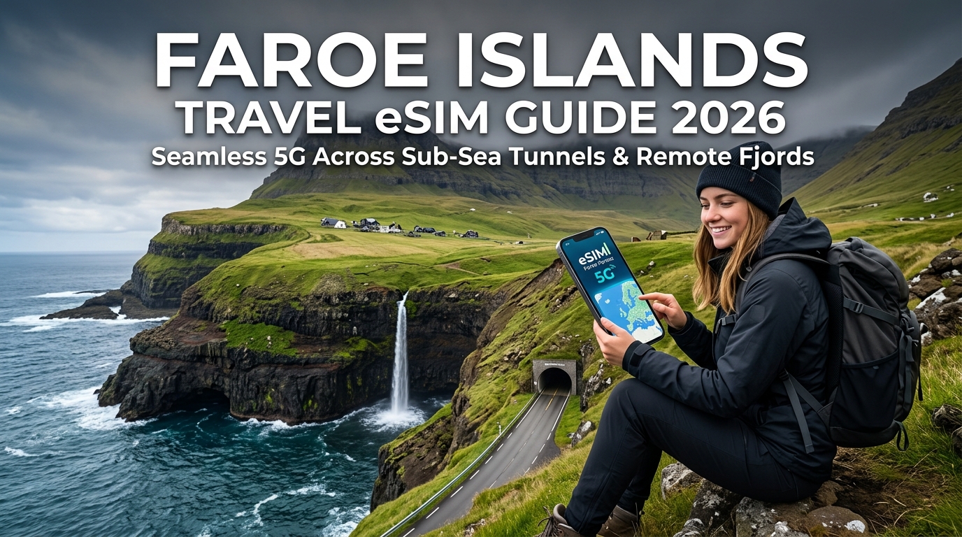
Faroe Islands Travel eSIM Guide 2026: Seamless 5G Across Sub-Sea Tunnels & Remote Fjords
The North Atlantic Connectivity Paradox: Why Standard EU Roaming Fails in the Faroe Islands
For most European travelers, crossing international borders within the continent is digitally frictionless. Under the European Union’s Regulation (EU) 2026/612 ("Roam Like at Home"), domestic voice, text, and data allowances transfer seamlessly across member states without surcharges.
However, landing at Vágar Airport (FAE) triggers an immediate, costly digital trap.
The Geopolitical Trap: Part of Denmark, Outside the EU
While the Faroe Islands form an autonomous territory within the Kingdom of Denmark, they deliberately opted out of the European Community in 1973 and remain outside both the European Union and the European Economic Area (EEA). Consequently, Faroese telecom operators are completely exempt from EU roaming caps.
When your smartphone negotiates a handshake with local cell towers operated by Føroya Tele or Nema, standard carrier profiles categorize the archipelago under "Rest of World," "Zone 2," or "Zone 3." The financial consequences are severe:
- Pay-As-You-Go Data: Major European and North American carriers regularly bill between €5.00 to €15.00 ($6.00 to $17.00) per megabyte. A single automated iOS photo backup or background app refresh can generate a €200 bill before you leave the airport terminal.
- Daily Roaming Passes: US carriers often charge $10 to $12 per day for "international day passes" that throttle speeds down to 2G/3G levels after a meager 500MB daily allotment.
- Complete Data Blackouts: Many budget MVNOs (Mobile Virtual Network Operators) offer zero data roaming support in the Faroes, leaving your device with "No Service" upon arrival.
| Carrier Origin / Type | Typical Faroes Roaming Classification | Average Cost / Penalty | Functional Experience |
|---|---|---|---|
| Standard EU Carrier | Non-EEA / World Zone 2 | €6.00 – €12.50 per MB | Instant bill shock or forced blocking |
| US/UK Major Carrier | International Add-On Zone | $10–$15 / day (500MB high-speed cap) | Heavy throttling; inconsistent routing |
| Budget MVNOs | Unsupported | No roaming agreements | Zero cellular connectivity |
| Dedicated Travel eSIM (MollySIM) | Native Local Breakout | Flat-rate prepaid bundles | Uncapped 5G/4G local network access |
Terrain, "Mjørki," and Digital Safety: Why Data is Critical Infrastructure
In the Faroe Islands, mobile broadband is not merely a convenience for uploading photography to social media—it is an indispensable safety line.
The archipelago’s geography comprises 18 volcanic islands carved by deep fjords, sheer 700-meter sea cliffs, and narrow single-track mountain roads. The sub-polar oceanic climate produces hyper-localized weather shifts. A sunny ascent from Klaksvík can transform into a disorienting, zero-visibility mjørki (dense Faroese sea fog) within three minutes.
When navigating high-elevation passes like the Oyggjarvegur or monitoring ocean swell forecasts at the remote village of Tjørnuvík, uninterrupted access to real-time resources is vital:
- Landsverk.fo (Road Authority): Real-time webcams, automated wind sensors, and icy road warnings that dictate whether mountain passes are passable.
- Sub-Sea Tunnel Telematics: Tracking traffic flow and variable speed limits inside deep underwater infrastructure, including the Eysturoyartunnilin and Sandoyartunnilin.
- Search & Rescue (MRCC Tórshavn): Instant geolocation transmission in terrain where trails are marked only by weathered stone cairns.
Because maintaining connectivity in these remote fjords can be a matter of safety, relying on services with aggressive data shutoffs poses a legitimate hazard. Digital travelers utilizing MollySIM benefit from an essential fail-safe: an optimized 384kbps Fair Use Policy (FUP) throttled floor. While conventional travel eSIMs drop speeds to an unusable 128kbps once high-speed caps are reached, a 384kbps baseline provides triple the throughput—ensuring vector-based Apple/Google Maps rendering, emergency VOIP calls, and Apple Pay authorization continue to function flawlessly anywhere on the islands.
Undersea Roundabouts and 5G Relays: How Faroese Mobile Networks Actually Work
🇬🇧 United Kingdom High-Speed Travel eSIM & SIM Plans
Instant QR code activation, hotspot enabled, with guaranteed 384kbps fallback speed to keep Maps & Digital Wallets active.
To understand how high-speed mobile data functions in an archipelago carved by glaciers and fractured by deep North Atlantic trenches, one must examine the extraordinary telecommunications architecture of the Faroe Islands. Unlike typical island territories that rely on patchy satellite links or underpowered microwave hops, the Faroese network is one of the most sophisticated, densely engineered telecom ecosystems on Earth.
The MNO Landscape: Føroya Tele vs. Hey
The domestic telecommunications market is anchored by two primary Mobile Network Operators (MNOs):
- Føroya Tele (FT): The state-backed incumbent operator. Føroya Tele has invested heavily in partnership with global telecom leaders (notably deploying an end-to-end Ericsson 5G Standalone and Non-Standalone network). Their macro base stations sit perched on the highest sea cliffs, utilizing low-band spectrum (Band 20 / 800 MHz and Band 28 / 700 MHz) to blast high-speed data up to 100 kilometers offshore, covering fishing vessels, passenger ferries, and isolated coastal homesteads.
- Hey: The agile challenger brand. Hey operates robust modern LTE and 5G networks focused primarily on populated centers like Tórshavn, Klaksvík, and Runavík, relying on local roaming agreements to fill fringe coverage zones.
For international travelers using an eSIM, connecting to infrastructure powered by Føroya Tele is the gold standard for continuous, uninterrupted telemetry across uninhabited mountain passes and deep maritime corridors.
Sub-Sea Tunnel Engineering: Telecom 180 Meters Below the Atlantic
The Faroe Islands are linked by an ambitious network of deep sub-sea vehicular tunnels (undirsjóvartunlar). Driving beneath the ocean floor here does not mean dropping into a communications black hole. Instead, you experience multi-hundred-megabit 5G speeds inside subterranean networks that would challenge land-based setups in continental Europe.
| Sub-Sea Tunnel | Length (km) | Max Depth (Below Sea Level) | RF Distribution Technology |
|---|---|---|---|
| Eysturoyartunnilin | 11.24 km | -187 meters | Leaky Feeder Radiating Coax + 5G Micro-Relay Clusters at the Roundabout |
| Sandoyartunnilin | 10.80 km | -155 meters | Continuous Radiating Cable + Distributed Antenna System (DAS) |
| Norðoyatunnilin | 6.20 km | -150 meters | High-Capacity Leaky Coax Repeater Runs |
| Vágatunnilin | 4.90 km | -105 meters | Bi-Directional RF Amplifiers & Cell-Edge Handover Relays |
The Physics of Subterranean 5G
In conventional driving environments, mobile signals bounce off open terrain and standard cellular towers. In solid basalt tubes hundreds of meters underwater, standard RF propagation faces total attenuation within tens of meters.
Engineers solved this inside the Eysturoyartunnilin—famed for hosting the world's first undersea roundabout, illuminated with shifting turquoise and emerald art installations by Tróndur Patursson—by deploying Continuous Radiating Leaky Feeder Cables.
- Slotted Coaxial Transmission: Slotted coaxial cables run along the entire ceiling arc of the tunnel tubes. These cables act as extended, linear antennas that deliberately "leak" controlled RF signals (spanning 4G LTE B3/B20 up to 5G mid-band n78 frequencies) continuously along the roadway.
- Zero-Latency Handovers: As your vehicle transitions from open air into the tunnel mouth at 80 km/h, automated Doppler-shift compensation and optimized core handshakes guarantee that your data stream does not drop a single packet.
- Roundabout Micro-Relays: The massive cavern housing the central roundabout contains high-density micro-relays that provide localized mid-band capacity, allowing thousands of simultaneous telemetry and streaming connections without cell congestion.
Why Direct Tier-1 Infrastructure Access Matters for Your eSIM
Many budget travel eSIM providers aggregate low-cost wholesale data routes that route traffic through third-party multi-hop proxy servers in continental Europe or Asia. When driving into an undersea tunnel, this excessive latency frequently causes the baseband modem in your phone to timeout during the rapid handover between surface towers and tunnel DAS systems—leaving your navigation offline precisely when you need to choose an exit under the ocean.
Selecting MollySIM eliminates this bottleneck by routing your device directly through premier Faroese tier-1 network paths. This ensures immediate synchronization with local radio nodes across both sub-sea tunnels and extreme mountain elevations.
Even if you exhaust your core high-speed data balance halfway down the Sandoyartunnilin, MollySIM's built-in 384kbps Fair Use Policy (FUP) baseline maintains a live, stable socket. Unlike standard competitor cards that throttle speeds down to a crippling 128kbps, MollySIM's 3x-faster throttled floor ensures vector map layers render instantly, live GPS routing stays synced, and payment gateways like Apple Pay remain instantly authorized wherever your Faroese road trip leads.
Faroe Islands Data Options Compared: eSIM vs. Local Physical SIM vs. Pocket Wi-Fi vs. Carrier Roaming
Navigating the rugged 18-island archipelago requires constant access to marine weather forecasts, ferry timetables, road tunnel alerts, and satellite maps. However, data delivery methods perform drastically differently when subjected to the North Atlantic’s unique geographical and logistical hurdles.
Crucially, the Faroe Islands are not part of the European Union or the EEA. Consequently, standard EU "Roam Like at Home" regulations do not apply. Relying on an EU SIM or standard domestic carrier roaming often triggers catastrophic per-megabyte pay-as-you-go surcharges or immediate data throttling.
The table below breaks down the technical and economic realities of the four primary connectivity methods for traveling across the Faroes:
| Comparison Metric | MollySIM Travel eSIM | Local Physical SIM (Føroya Tele / Hey) | Rental Pocket Wi-Fi | International Carrier Roaming |
|---|---|---|---|---|
| 5G & LTE Network Access | Direct access to primary local Tier-1 5G/4G networks | Native 5G/4G access | 4G LTE only (hardware-constrained) | 3G/4G throttled roaming profiles |
| Sub-sea Tunnel Handover | Instantaneous; direct local routing avoids packet drop | Native; zero handover latency | Moderate; occasional packet loss during cell shifts | Poor; high latency causes timeouts in tunnels |
| Setup Friction at Vágar (FAE) | Zero (Instant QR activation before departure) | High (Queue at airport kiosk or drive to Tórshavn) | High (Counter pickup and return logistics) | Low (Automatic, but at extreme cost) |
| Average Cost per GB | Low ($1.50 – $3.50 / GB via flexible bundles) | Moderate ($4.00 – $6.00 / GB + SIM kit fee) | Very High ($8.00 – $14.00/day flat rate) | Extreme ($10.00+/day or $0.05+/MB) |
| Outer-Island Reliability | Full coverage (Kalsoy, Suðuroy, Mykines) | Full native coverage | Dependent on device battery in low temps | Inconsistent; frequent loss of signal |
| Emergency Fallback Speed | 384kbps unmetered (Runs Maps & Apple Pay smoothly) | Cut off completely upon balance depletion | Hard disconnect or throttled to 64kbps | Cut off or billed punitive overage rates |
The Reality of Airport Swaps in Faroese Weather
While purchasing a local plastic SIM card from providers like Føroya Tele or Hey historically offered the lowest local latency, the physical procurement process introduces severe friction at Vágar Airport (FAE):
- Restricted Retail Hours: Flights landing from Copenhagen, Reykjavík, or Edinburgh outside standard business hours (such as late-evening Atlantic Airways arrivals) frequently touch down when airport retail vendors are closed. Travelers without an active eSIM are forced to drive to their accommodation with zero live GPS or road condition updates.
- The "Horizontal Rain" SIM Swap Hazard: The Faroe Islands average over 200 rainy days per year with sudden 40-knot wind gusts. Attempting to balance a luggage trolley, open an iPhone SIM tray using a delicate paperclip, and swap a microscopic nano-SIM in the airport parking lot routinely leads to lost domestic SIMs or water-damaged trays.
- Dual-SIM Loss: Removing your domestic physical SIM cuts off access to two-factor authentication (2FA) SMS codes from banks, travel insurance portals, and airline apps precisely when you need them to verify rental car deposits or hotel check-ins.
The Problem with Pocket Wi-Fi in Sub-Zero Fjords
Rental pocket Wi-Fi routers introduce a distinct hardware failure point during Faroese expeditions. The sub-polar oceanic climate and biting wind chills rapidly degrade the lithium-ion batteries powering portable hotspots, cutting operational lifespans from eight hours down to less than three when hiking exposed paths like Trælanípa or the Kallur Lighthouse.
Furthermore, carrying an auxiliary device that requires nightly charging adds unnecessary weight to trail packs.
By contrast, an active profile from MollySIM provisions digitally in under two minutes via an encrypted eSIM profile. It maintains your home carrier line active for verification codes while seamlessly delegating cellular data to low-latency local cells. Combined with an unmetered 384kbps safety net (unlike standard 128kbps competitor throttles), your device retains instant navigation rendering and point-of-sale terminal authorization even under worst-case data depletion scenarios.
Off the Grid, Not Offline: Trail Connectivity for Kallur Lighthouse, Sørvágsvatn, and Mykines
The Faroese wilderness is notoriously unpredictable. Sudden blinding sea fogs—locally known as mjørki—can roll in within minutes, dropping visibility to less than five meters along sheer vertical cliffs. In this terrain, uninterrupted mobile data is not a luxury for sharing trail photos; it is a critical survival layer.
Cellular coverage across the Faroe Islands' hiking routes is among the most robust in the North Atlantic, provided your eSIM routes through localized tier-1 infrastructure rather than roaming through deprioritized, high-latency overseas relays.
+---------------------------+-----------------------+-----------------------------+
| Trail / Region            | Typical Coverage      | Primary Hazards / Use Case  |
+---------------------------+-----------------------+-----------------------------+
| Kallur Lighthouse (Kalsoy)| 4G LTE / Strong 5G    | Ridge gusts, mud slips      |
| Trælanípa (Sørvágsvatn)   | Solid 5G throughout   | Edge drops, sudden fog      |
| Saksun Lagoon (Streymoy)  | 4G (Drops in valleys) | Rising tides, dead zones    |
| Mykines Island            | Variable 4G LTE       | Rapid sea squalls, isolation|
+---------------------------+-----------------------+-----------------------------+
Real-World Field Performance on Iconic Hikes
- Kallur Lighthouse & The Kalsoy Ridge: Hiking north along the knife-edge ridge of Kalsoy exposes you to direct line-of-sight transmissions from cellular masts on neighboring Kunoy and northern Eysturoy. You will maintain consistent high-speed 5G connectivity all the way to the iconic lighthouse promontory.
- Trælanípa and Lake Sørvágsvatn (Vágar): The famous "lake above the ocean" hike benefits from flat terrain and proximity to transmitters stationed near Miðvágur and Vágar Airport. Coverage remains consistently at full bars across the entire cliffside loop.
- Saksun Lagoon and Gjogv (Streymoy & Eysturoy): Natural basalt amphitheaters can create localized signal shadows. While the tidal basin floor at Saksun can drop signal intermittently near the base of the cliffs, ascending just 30 meters up the trail reconnects your device to regional backhaul towers.
- Mykines Puffin Sanctuary: As the westernmost island, Mykines relies on microwave relay links. Coverage in the village and up to the bird sanctuary ridge delivers steady 4G LTE, though speeds fluctuate during heavy rain squalls.
The Critical Role of MollySIM's 384kbps Emergency Safety Buffer
A major hazard of standard travel eSIMs is the abrupt data cutoff. When an unmonitored cloud backup or high-resolution video upload silently drains your data allotment mid-hike, budget eSIM providers throttle bandwidth down to an unusable 64kbps or 128kbps—effectively severing your connection to the modern web.
MollySIM prevents field blackouts by backing every plan with an unmetered 384kbps fair-use safety net—three times faster than standard competitor throttles. If your high-speed gigabytes run out along an exposed trail, this baseline bandwidth ensures mission-critical services continue operating without interruption:
- Meteorological Monitoring: Real-time satellite wind barbs and precipitation radars on Vedur.fo and DMI refresh continuously without timing out.
- Road Infrastructure Cams: Access live mountain pass webcams and wind-gust monitors on Landsverk.fo before descending to your vehicle.
- Emergency Geolocation & Navigation: Vector data on Google Maps and Apple Maps remains fully interactive, and emergency pin-sharing via WhatsApp or Apple Find My transmits instantly.
- Offline Payment Integrity: Point-of-sale contactless authorizations (Apple Pay / Google Wallet) authenticate smoothly at remote village self-service honesty boxes.
Step-by-Step Installation: Setting Up Your MollySIM Profile Before Touching Down at Vágar
Installing your travel eSIM before boarding your flight ensures that your device latches onto local Føroya Tele or Nema cellular towers the second your aircraft wheels hit the runway at Vágar Airport (FAE). Provisioning your profile over a stable home or airport Wi-Fi network eliminates the friction of troubleshooting connectivity in a foreign terminal.
Follow these platform-specific configuration steps to secure reliable data throughput while safeguarding your home SIM against unexpected roaming fees.
iOS (iPhone) Configuration Walkthrough
- Scan and Install Profile: Navigate to Settings > Cellular (or Mobile Data) > Add eSIM. Select Use QR Code and scan the activation code provided in your MollySIM confirmation email or app dashboard.
- Label Your Cellular Plans: Assign clear custom labels to prevent confusion. Set your physical home carrier SIM as "Primary" and the newly added profile as "MollySIM" (or "Faroe Islands").
- Configure Voice and SMS Routing: Set your Default Voice Line to "Primary". This keeps your home carrier active for incoming verification texts (2FA SMS) from your banking apps and flight portals without triggering international calling rates (provided incoming SMS is free under your domestic plan).
- Designate Mobile Data: Under Cellular Data, select "MollySIM".
- Disable "Allow Cellular Data Switching": Critical Step: Toggle this setting to OFF. If left enabled, your iPhone will silently fail over to your home carrier’s expensive international data roaming whenever you pass through momentary shadow zones in deep valleys.
- Enable Data Roaming on MollySIM: Tap on the MollySIM profile under the SIMs menu, select Data Roaming, and toggle it to ON. (MollySIM relies on authorized local partner networks across the archipelago; roaming must be active on this specific profile).
Android (Samsung Galaxy & Google Pixel) Configuration
- Download the eSIM Profile: Open Settings > Connections (or Network & internet) > SIM Manager > Add eSIM. Select Scan QR code from service provider and capture your MollySIM activation code.
- Assign Network Roles:
- Calls: Primary (Home SIM)
- Messages: Primary (Home SIM)
- Mobile Data: MollySIM
- Enable Roaming on the MollySIM Line: Go to Settings > Connections > Mobile networks, ensure the MollySIM slot is selected, and turn Data Roaming ON. Verify that your physical/home carrier SIM has data roaming turned strictly OFF.
- Verify Access Point Name (APN): MollySIM auto-configures APN settings upon connection. If manual entry is ever required, navigate to Access Point Names, select Add, and enter the APN name specified in your MollySIM setup instructions (leaving Username and Password blank).
Dual-SIM Matrix: Avoiding Carrier Roaming Leakage
To guarantee zero surprise roaming charges from your domestic carrier while maintaining banking and security access, configure your lines exactly as structured below:
| Feature / Setting | Primary Line (Domestic SIM) | MollySIM Line (Faroe Islands) |
|---|---|---|
| SIM Status | Active (ON) | Active (ON) |
| Cellular Data | Disabled (OFF) | Enabled (ON) |
| Data Roaming | Strictly OFF | Strictly ON |
| 2FA / SMS Reception | Active (Receive-only) | Not Applicable (Data-only) |
| Data Switching / Backup | Disabled (OFF) | Not Applicable |
| FUP Safety Throttle | N/A (Carrier-dependent) | 384 kbps Unlimited Fallback |
Cold-Weather Battery Management for Remote Hiking
The North Atlantic climate creates unique operational challenges for mobile devices. Freezing winds on exposed clifftops (such as the Trælanípa or Kallur Lighthouse routes) rapidly drop internal lithium-ion cell temperatures, spiking internal resistance and causing sudden battery percentage drops from 40% to zero.
- Mitigate Network Search Drain: In deep fjords where signals transition between high-band 5G and low-band 800MHz LTE, transceivers consume peak wattage searching for optimal frequencies. If you plan to spend hours off-grid, switch your cellular voice line to Airplane mode while keeping the MollySIM data line active.
- Leverage Vector-Data Efficiency: Even if you deplete your high-speed allowance mid-trek, MollySIM's 384kbps baseline speed—3x the industry standard—handles live vector map rendering and GPS updates without forcing your phone into resource-heavy reconnection loops.
- Store Near Core Body Heat: Never carry your device in outer shell pockets where ambient wind chill can freeze the casing. Store it inside an internal zippered mid-layer pocket close to your chest, bringing it out only for navigation checkpoints and landscape photography.
The 2026 Faroes Digital Toolkit: Essential Apps for Tunnel Tolls, Ferries, and Weather Routing
Navigating the Faroe Islands requires dynamic, real-time situational awareness. With volatile North Atlantic weather patterns, tight ferry vehicle capacities, and an extensive network of automated toll infrastructure, uninterrupted connectivity transforms a rental car into an intelligent expedition hub.
Below are the mandatory digital portals and applications every traveler must configure before departing Vágar Airport.
1. Tunnil.fo: Automated Sub-Sea Toll Clearance
The Faroese sub-sea infrastructure features four high-tech sub-sea tunnels, including the engineering marvel Eysturoyartunnilin (home to the world’s first undersea roundabout) and the Sandoyartunnilin.
┌───────────────────────┬──────────────────────────┬──────────────────────┐
│ TUNNEL NAME           │ CONNECTS                 │ STANDARD TOLL (DKK) │
├───────────────────────┼──────────────────────────┼──────────────────────┤
│ Vágatunnilin          │ Vágar – Streymoy         │ ~100 DKK             │
│ Norðoyatunnilin       │ Eysturoy – Borðoy        │ ~100 DKK             │
│ Eysturoyartunnilin    │ Streymoy – Eysturoy      │ ~175–225 DKK         │
│ Sandoyartunnilin      │ Streymoy – Sandoy        │ ~175 DKK             │
└───────────────────────┴──────────────────────────┴──────────────────────┘- How It Works: Sub-sea tunnels use automatic number-plate recognition (ANPR). There are no physical toll booths.
- The Digital Requirement: If your rental agency does not bundle an automated transponder (Hold-all), you must register your plate and settle payments on Tunnil.fo within 6 days of passage.
- The Connectivity Anchor: Settling tolls on the move requires reliable cellular coverage to process 3D-Secure credit card verification and Apple Pay transactions. With MollySIM, secure payment authentication payloads and one-time verification tokens process instantly, even when running on the network's 384kbps Fair Use baseline.
2. Landsverk.fo: Critical Road & Wind Telemetry
The Faroese transport authority, Landsverk, operates an essential live telemetry network across the archipelago's most treacherous mountain passes, such as Norðradalsskarð, Oyndarfjørður, and the exposed ridges toward Gjógv.
- Real-Time Wind Warning System: Arctic gale gusts frequently exceed 30–40 m/s (67–90 mph), presenting severe rollover risks for high-profile campervans and compact rental cars.
- Live Webcam Feeds & Friction Telemetry: Landsverk updates live optical camera stills and road-surface temperature gauges every few minutes.
- Why Continuous Data Is Mandatory: Mountain weather changes over fractions of a mile. Having low-latency 5G enables drivers to pull over and inspect upcoming pass conditions before ascending into cloud-deck blizzards or severe wind corridors.
3. Strandfaraskip Landsins (SSL.fo): Inter-Island Maritime Transit
Accessing remote outposts like Kalsoy (for the Kallur Lighthouse hike) or the southern island of Suðuroy requires travel via the government-operated ferry operator, Strandfaraskip Landsins (SSL).
- Dynamic Capacity Management: Vehicle space on Route 56 (Klaksvík–Syðradalur/Kalsoy) is strictly limited (typically accommodating only 12–17 cars per crossing).
- Real-Time Timetable Adjustments: Heavy ocean swells frequently alter or cancel departures on short notice. SSL updates schedule disruptions in real time via their digital platform.
- Digital Ticketing: Booking vehicle slots and passenger tickets online via SSL.fo guarantees priority boarding over drive-up standbys.
4. Microclimate Radar Tracking: DMI & Yr.no
The Faroe Islands’ hyper-localized topography creates distinct microclimates within adjacent valleys. While Tórshavn may experience dense coastal fog (mjørki), Klaksvík might enjoy clear skies.
- Yr.no & DMI (Danish Meteorological Institute): These regional models deliver localized precipitation radar and wind-vector simulations that global generic weather apps fail to forecast accurately.
- Windy.com: Indispensable for drone pilots and hikers to evaluate cloud ceiling levels and surface gusts before embarking on high-exposure trails like Trælanípa or Enniberg.
Faroes Logistics & Connectivity Matrix
| Platform / App | Core Function | Primary Risk of Signal Loss | MollySIM Operational Advantage |
|---|---|---|---|
| Tunnil.fo | Sub-sea toll clearance | Rental agency penalty surcharges (up to 300 DKK) | 3D-Secure banking tokens load without timeouts |
| Landsverk.fo | Real-time wind & road ice sensors | Entering dangerous 35+ m/s gale zones blind | Live webcam stills and wind telemetry stream instantly |
| SSL.fo | Ferry booking & cancellation alerts | Stranding your vehicle at remote ferry terminals | Dynamic schedule changes push without delay |
| Yr.no / Windy | High-resolution microclimate radar | Hypothermia risk on exposed mountain trails | Radar loops buffer smoothly on low-band 800MHz LTE |
Uninterrupted Digital Execution Across the Archipelago
The digital transformation of Faroese travel infrastructure makes an active, reliable data connection essential for safe transit. Whether clearing sub-sea tolls beneath the Atlantic seabed or checking Landsverk wind telemetry before navigating an exposed mountain road, the digital toolkit is your primary safety layer.
By utilizing MollySIM's dual-network roaming across Føroya Tele and Nema—backed by an industry-leading 384kbps safety-net speed limit—your critical navigation, payment platforms, and emergency road services remain operational across every fjord, pass, and tunnel in the archipelago.
🇬🇧 United Kingdom High-Speed Travel eSIM & SIM Plans
Instant QR code activation, hotspot enabled, with guaranteed 384kbps fallback speed to keep Maps & Digital Wallets active.