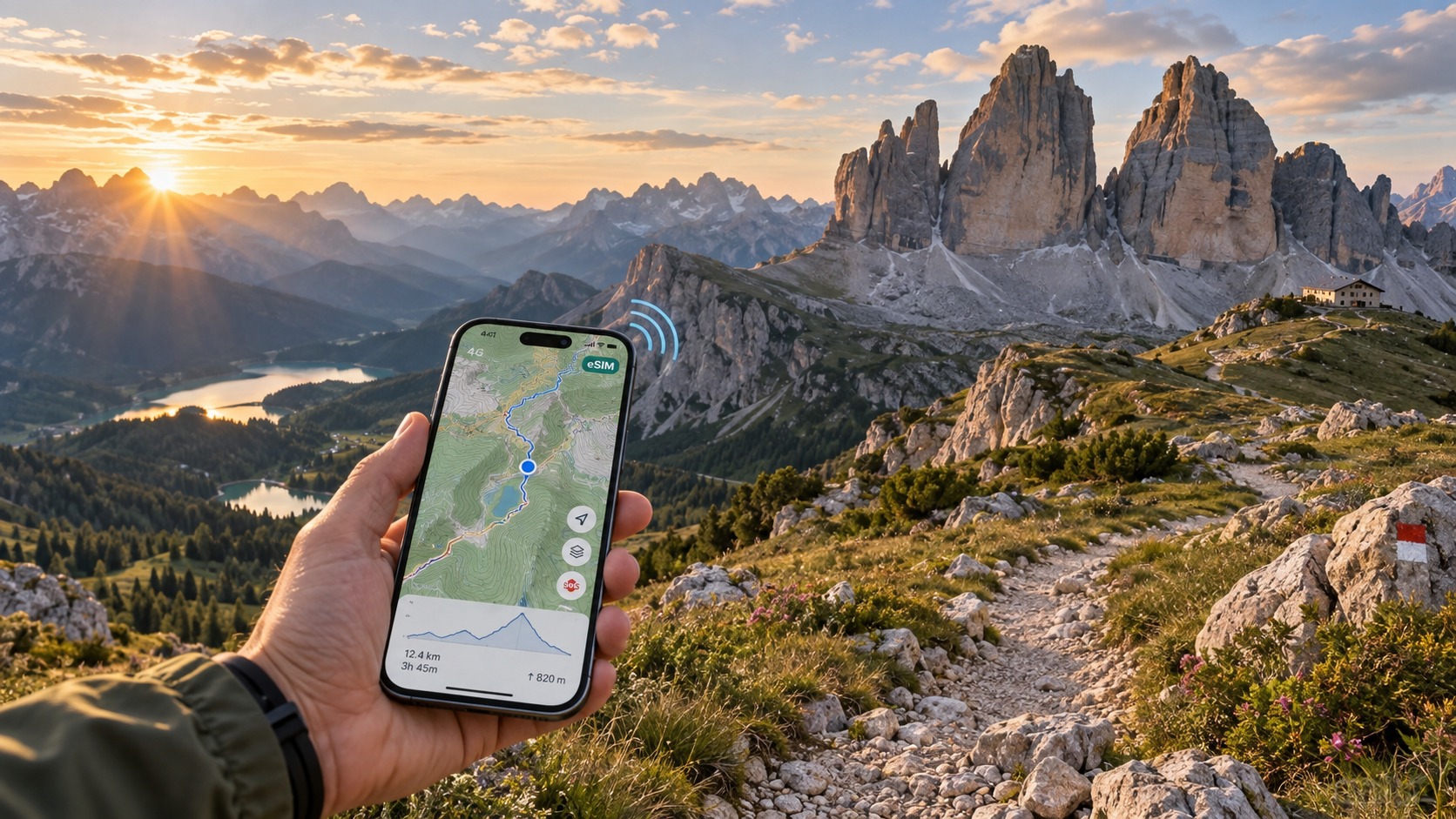
Dolomites Alta Via Trekking eSIM Guide (2026): Mountain Coverage & GPS Safety
Alpine Topography & Cellular Physics: Navigating Alta Via 1 and Alta Via 2
Traversing the Alta Via 1 (AV1) or the more technically demanding Alta Via 2 (AV2) exposes mobile devices to one of the most hostile Radio Frequency (RF) environments in Europe. The Dolomites are characterized by towering, perpendicular carbonate rock massifs rising abruptly from narrow glacial troughs. Understanding how these geological formations interact with cellular frequencies is critical for maintaining digital navigation and safety communication.
       [High BTS on Peak / Ridge]
               /        \  (Direct Line-of-Sight)
              /          \
  [Rifugio Lagazuoi]    [Passo Giau]
         |                     \
  (Signal Attenuation)     (Shadow Zone)
         v                       v
 [Sheer Rock Wall]        [Val Travenanzes]
  (Multipath Fading)     (Zero Direct Signal)
The Physics of Rock Walls: Reflection, Attenuation, and Shadowing
Cellular communications in mountainous terrain rely primarily on direct Line-of-Sight (LOS) and knife-edge diffraction over ridges. In the Dolomites, cellular signals face specific physical bottlenecks:
- Massive Attenuation & Signal Blockage: Dense dolomite limestone acts as an impenetrable barrier to ultra-high frequency (UHF) LTE and 5G bands (ranging from 700 MHz up to 3.7 GHz). When you descend into deeply incised glacial ravines like Val Travenanzes on the AV1 or low gorges in Val di Zoldo, direct paths to macro Base Transceiver Stations (BTS) are severed. The result is an instantaneous drop into an RF "shadow zone."
- Multipath Interference off Vertical Faces: The sheer vertical faces of the Civetta, Pelmo, and Marmolada massifs cause severe multipath propagation. Radio waves bounce off rock faces, arriving at your handset slightly out of phase. This destructive interference causes rapid battery drain as your phone's modem increases transmission power to compensate for packet loss.
- High-Altitude Line-of-Sight Traps: Conversely, elevated vantages such as Rifugio Lagazuoi (2,752m), Passo Giau (2,236m), and Forcella del Lago frequently pick up direct line-of-sight signals from transceivers positioned tens of kilometers away in the Cortina d'Ampezzo or Badia valleys. However, these signals can suffer from timing advance errors, where your phone detects a tower but cannot synchronize due to extreme distance.
Terrain vs. Cellular Propagation Characteristics
| Terrain Type / Location | Dominant Cellular Behavior | Operational Risk | Recommended Protocol |
|---|---|---|---|
| Deep Glacial Cuts (e.g., Val Travenanzes) | Total shadow zone; near-zero RF penetration. | Zero live data, impossible to pull dynamic vector tiles. | Cache offline maps via GPX prior to descent. |
| Exposed Ridges & Cols (e.g., Forcella del Lago, Passo Selle) | Multi-tower line-of-sight; frequent network switching. | Rapid battery depletion due to continuous tower handshakes. | Lock device to Low Power Mode or Airplane Mode. |
| High Plateaus & Peaks (e.g., Lagazuoi, Cima Pisciadù) | Strong 4G/5G signals via high-altitude sectoral antennas. | False sense of constant connectivity before dropping into cols. | Send location check-ins and download weather updates here. |
Border Fragmentation: Trentino-Alto Adige vs. Veneto
A technical challenge unique to the Alta Via routes is administrative boundary crossing. The trails constantly weave across the regional borders of Trentino-Alto Adige/Südtirol (provinces of Bolzano and Trento) and Veneto (province of Belluno).
[Trentino-Alto Adige / Südtirol]  <--- Trail Ridge Boundary --->  [Veneto / Belluno]
       (Local Tower: TIM)                                       (Local Tower: Vodafone)
                \                                                        /
                 \---> [Locked Tourist eSIM: Connection Drops] <--------/
                 \---> [MollySIM: Auto-Handover to Active Carrier] <----/
Local infrastructure varies drastically between these regions:
- A cell tower on the Südtirol side may be operated exclusively by TIM, while the nearest repeater on the Veneto slope is owned by Vodafone or WindTre.
- Standard single-carrier tourist eSIMs locked to an individual operator often fail completely when crossing cols like Passo San Pellegrino or the Puez-Odle boundaries, leaving hikers without service for hours.
- Multi-network routing is non-negotiable. Travel eSIMs like MollySIM mitigate this by dynamic roaming across all major Italian tier-1 backbones (TIM, Vodafone, WindTre), automatically switching to whichever carrier holds the dominant signal along high ridges.
Even if high-speed data caps are exhausted mid-trek, MollySIM's built-in 384kbps Fair Use Policy (FUP) throttled baseline ensures vital navigation tools (such as live Google Maps rendering, text communication, and Apple Pay checkouts at remote rifugi) remain fully operational—tripling the speed of standard 128kbps limits found on conventional tourist profiles.
Network Benchmark: TIM vs. Vodafone Italia across Dolomite High Routes
🇪🇺 Europe 33 Countries High-Speed Travel eSIM & SIM Plans
Instant QR code activation, hotspot enabled, with guaranteed 384kbps fallback speed to keep Maps & Digital Wallets active.
Radio frequency propagation inside vertical alpine environments behaves fundamentally differently than in flat terrain. In the Dolomite massif, steep limestone walls (Dolomia) act as physical attenuators, reflecting high-frequency micro-waves and creating severe non-line-of-sight (NLOS) signal shadows in deep glacial troughs like the Val Badia or along the shear drops of the Civetta wall.
To maintain continuous connectivity on remote stretches of Alta Via 1 (AV1) and Alta Via 2 (AV2), your device relies on low-band spectrums—specifically Band 20 (800 MHz) and Band 28 (700 MHz). These lower frequencies feature wide propagation radiuses and superior diffraction around sharp ridgelines, punching through weather fronts and sparse coniferous canopies where mid-band frequencies (Band 3 / 1800 MHz and Band 7 / 2600 MHz) fail completely.
Technical Spectrum & Alpine Coverage Matrix
| Network Operator | Core Alpine LTE/5G Bands | Low-Band Diffraction Capability | High-Altitude Cell Footprint (Südtirol vs. Veneto) | Performance at Key Rifugios | Roaming Protocol & Handover |
|---|---|---|---|---|---|
| TIM (Telecom Italia) | Band 20 (800 MHz), Band 3 (1800 MHz), n28 (700 MHz 5G) | Superior: Extensive Band 20 deployment penetrating high valleys and cols. | Dominant in Trentino-Alto Adige / Südtirol; extensive micro-cell relays on telecommunication towers. | • Rifugio Fanes: Strong LTE (B20)<br>• Rifugio Nuvolau: Variable 4G/3G<br>• Rifugio Rosetta: Intermittent | Fixed single-network lock; no failover when crossing provincial borders. |
| Vodafone Italia | Band 20 (800 MHz), Band 1 (2100 MHz), Band 8 (900 MHz) | High: Excellent long-range B20/B8 rural coverage. | Dominant in Veneto / Belluno sectors; strong ridgeline macro-sites. | • Rifugio Fanes: Weak/Edge<br>• Rifugio Nuvolau: Robust LTE (B20/B1)<br>• Rifugio Rosetta: Strong 4G | Fixed single-network lock; service drops in northern Südtirol valleys. |
| WindTre | Band 20 (800 MHz), Band 38 (2600 MHz), n78 (3500 MHz) | Moderate: High raw bandwidth, but weaker deep-canyon penetration. | Well-deployed around populated valleys (Cortina, Ortisei), sparser at extreme elevations (>2,500m). | • Rifugio Fanes: Inconsistent<br>• Rifugio Nuvolau: Moderate 4G<br>• Rifugio Rosetta: Weak Edge/No Signal | Fixed single-network lock; prone to tower congestion in peak summer. |
| MollySIM (Multi-IMSI) | Dynamic Agnostic Access: B20, B28, B1, B3, B8 across all Tier-1 backbones | Optimal: Selects the strongest active transceiver frequency automatically. | Complete Coverage: Hops seamlessly between TIM, Vodafone, and WindTre infrastructure. | • Rifugio Fanes: Auto-hops to TIM<br>• Rifugio Nuvolau: Auto-hops to Vodafone<br>• Rifugio Rosetta: Auto-hops to Vodafone | Dynamic Core Switching: Auto-attaches to highest RSSI/RSRP signal without manual SIM swaps. |
Real-World Field Performance at Strategic Alpine Shelters
[Rifugio Fanes (2,060m)]    ---> Best Carrier: TIM (B20 Sector Antenna from San Vigilio)
[Rifugio Nuvolau (2,575m)]  ---> Best Carrier: Vodafone (Direct line-of-sight from Cortina basin)
[Rifugio Rosetta (2,581m)] ---> Best Carrier: Vodafone (Relayed via Pale di San Martino mast)- Rifugio Fanes (AV1 Northern Sector): Tucked inside the Fanes-Sennes-Braies Natural Park, high rock ramparts isolate western and southern transmissions. TIM maintains the sole reliable low-band B20 sector link pointed directly through the valley gap from San Vigilio di Marebbe. Standard Vodafone or WindTre connections often drop to unusable 2G or complete dead zones here.
- Rifugio Nuvolau (AV1 Central Sector): Perched on a jagged 2,575-meter summit crag, Nuvolau receives line-of-sight transmissions from repeaters scattered across the Cortina basin in Veneto. Vodafone delivers the highest RSRP (Reference Signal Received Power) values at this exposed peak, outperforming TIM’s regional backhaul.
- Rifugio Rosetta - Giovanni Pedrotti (AV2 Pale di San Martino Plateau): Situated atop a barren, high-altitude karst plateau, Rosetta suffers from severe signal dispersion. Vodafone’s high-gain transmitters on the surrounding peaks provide the most consistent data connection, whereas WindTre and regional MVNOs frequently lose synchronization.
Solving the Border-Switching Bottleneck with Dynamic Multi-Carrier Roaming
Relying on a local, single-operator tourist eSIM introduces severe operational risks. If you buy a local TIM eSIM, you enjoy top-tier throughput in northern Südtirol, but the moment your route drops south across the Venetian border toward Passo Duran or Belluno, your connectivity degrades significantly. Conversely, a Vodafone-only profile leaves you in radio silence across multiple northern side-valleys.
MollySIM eliminates single-carrier vulnerability by utilizing dynamic multi-carrier IMSI switching. Rather than tying your phone’s baseband modem to one Italian carrier, the MollySIM profile continuously samples signal quality (RSRP/RSRQ parameters) across TIM, Vodafone Italia, and WindTre. When you traverse from the TIM-dominated Fanes plateau over into the Vodafone-dominated Cortina ridge, the underlying profile autonomously re-routes data sessions to the strongest local cell tower without user intervention.
Furthermore, if heavy terrain mapping or video updates consume your allocated high-speed data volume mid-trail, MollySIM’s embedded 384kbps Fair Use Policy (FUP) baseline keeps critical data pipelines active. While standard tourist cards throttle to an unusable 128kbps—which fails to load high-resolution vector tiles on GPS mapping engines—384kbps provides 3x the data throughput, effortlessly maintaining real-time GPS coordinate caching, live location sharing on tracking platforms, and frictionless Apple Pay/Google Wallet authentication at remote mountain rifugio terminals.
Mitigating Cold-Induced Battery Drain from Cellular Radio Hunting
Traversing high-alpine passes above 2,500 meters—such as the exposed scree fields of the Pisciadù plateau or the knife-edge via ferrata sections of Alta Via 2—places compounding physical stress on your smartphone's battery architecture. Navigating this environment safely requires understanding how low ambient temperatures interact with cellular baseband processing.
       Alpine Cold (<0°C)               Fringe Signal / Deep Gorges
               │                                      │
               ▼                                      ▼
      ↑ Internal Resistance                 Continuous Cell Search
      ↓ Usable Li-ion Capacity              Max PA Output (+23 dBm)
               │                                      │
               └───────────────┬──────────────────────┘
                               ▼
                   Severe Terminal Voltage Sag
                               │
                               ▼
               Sudden OS Shutdown & Lost Navigation
The Thermodynamics of Alpine Voltage Sag
Modern smartphones rely on Lithium-ion (Li-ion) chemistry, which depends on liquid electrolyte solutions for ion transfer between cathode and anode. When dawn temperatures plummet toward or below 0°C on alpine ridges, the kinetic reaction slows dramatically:
- Internal Resistance ($R_{int}$) Spikes: The electrolyte thickens, increasing internal cell resistance.
- Transient Voltage Drops: Under nominal idle loads (50–100 mA), the battery maintains adequate terminal voltage. However, when the internal power amplifier fires at maximum transmission output (+23 dBm / 200 mW) to reach a distant valley cell tower, the resulting high current draw produces instantaneous voltage sag below the operating threshold (~3.4V).
- Premature Shutdown: The power management integrated circuit (PMIC) interprets this localized voltage sag as cell exhaustion, triggering an emergency thermal/undervoltage shutdown—even if the battery state-of-charge reads 40% or higher.
The Cellular Radio Hunting Cycle
In marginal coverage zones along deep Dolomite ravines, your smartphone's baseband modem enters an aggressive signal acquisition routine:
- Active Scanning Across Multiple Frequencies: The modem sweeps standard 4G and 5G New Radio (NR) frequency rasters (Band 20, Band 3, Band 7, Band n28, Band n78).
- Elevated Power Amplifier Output: To complete random access channel (RACH) preambles with distant base transceiver stations, the transceiver runs at maximum transmit power continuously.
- 5G Standalone/Non-Standalone (NSA) Polling: In 5G Auto mode, the device constantly hunts for high-band secondary synchronization signals (SSS). This dual-connectivity setup rapidly exhausts the battery within 3 to 4 hours of active hiking.
Step-by-Step Baseband and OS Optimization Protocols
To prevent premature battery failure and preserve your device for emergency navigation, apply these operating system adjustments at the trailhead:
1. Disable 5G and Lock Baseband to LTE
5G NR sub-6GHz and mid-band frequencies have severe penetration limitations through solid dolomite limestone. Forcing a direct LTE lock saves significant baseband processing power while retaining full access to low-band LTE frequencies (such as 800MHz Band 20), which carry the furthest into alpine valleys.
2. Terminate Background Data Retry Loops
When cellular data drops along technical traverses, background apps get stuck in infinite TCP retransmission loops. Restrict application networking parameters so that only your dedicated topography engines (e.g., Gaia GPS, FATMAP, Outdooractive) access baseband pipelines:
- iOS: Go to Settings → General → Background App Refresh and set it to Off (or selectively restrict it to essential mapping software). Toggle Low Power Mode on from the start of your trek; this automatically throttles extraneous background syncs, limits display refresh rates to 60Hz, and extends modem sleep cycles between discontinuous reception (DRX) intervals.
- Android: Navigate to Settings → Battery → Battery Saver and enable standard power saving. Go to Settings → Apps → Special App Access → Background Data and deny background connectivity to social media, cloud sync utilities, and streaming apps.
3. Prevent GPS Tile-Fetch Failures
When mapping software encounters dropped connections, it continuously re-requests missing vector map tiles, driving up baseband current draw.
Pre-download your entire Dolomite topographic map cache offline before departing your rifugio. Pairing pre-downloaded offline tiles with a reliable connectivity engine prevents this issue.
When you pass through fringe coverage corridors, MollySIM automatically roams across TIM, Vodafone, and WindTre networks. If you exceed your primary high-speed data tier, its baseline 384kbps Fair Use Policy (FUP) maintains enough bandwidth to keep GPS coordinate telemetry, Google Maps caching, and mobile wallet payments functioning smoothly. In contrast, standard competitor throttles drop to 128kbps, which often causes network timeouts, continuous background retries, and rapid battery drain.
┌────────────────────────────────────────────────────────────────────────────────────────┐
│ PRO TIP: PHYSICAL THERMAL MANAGEMENT                                                   │
├────────────────────────────────────────────────────────────────────────────────────────┤
│ Store your phone inside a zipped interior chest pocket against your base layer, rather │
│ than in an exterior backpack pouch or hip-belt pocket. Body heat keeps the battery     │
│ above 15°C, preventing high internal resistance and sudden cold-induced shutdowns     │
│ during critical navigation moments.                                                    │
└────────────────────────────────────────────────────────────────────────────────────────┘
MollySIM 384kbps Safety Fallback: Emergency Rescue & Essential Navigation
In alpine environments like the Dolomites, running out of cellular data is not just an inconvenience—it is a critical safety hazard. On remote sections of the Alta Via 1 or Alta Via 2, losing connectivity while navigating a technical scree field or traversing an exposed pass (such as Forcella del Lago or the Bocchette route) leaves you cut off from weather updates, hut communications, and alpine rescue dispatch.
Most standard travel eSIMs operate on a hard-stop architecture: the moment your high-speed quota hits zero megabytes, data cuts off completely until you connect to Wi-Fi to top up. Others drop speeds to an unusable 64kbps or 128kbps—thresholds where modern SSL/TLS handshakes and API queries routinely time out, triggering continuous retry loops that drain your battery in minutes.
MollySIM implements a continuous, zero-cutoff 384kbps Fair Use Policy (FUP). By sustaining an active 48 KB/s downstream and upstream pipeline even after primary high-speed data exhaustion, the connection remains viable for essential backcountry survival tools.
┌────────────────────────────────────────────────────────────────────────────────────────┐
│ BANDWIDTH COMPARISON: 128kbps THROTTLE VS. MOLLYSIM 384kbps SAFETY FALLBACK           │
├────────────────────────────┬──────────────────┬──────────────────┬─────────────────────┤
│ Critical Trail Action      │ Payload Size     │ Time @ 128kbps   │ Time @ 384kbps      │
│                            │                  │ (Competitor)     │ (MollySIM FUP)      │
├────────────────────────────┼──────────────────┼──────────────────┼─────────────────────┤
│ WhatsApp GPS Coordinate Pin│ ~5 KB – 10 KB    │ 1.2s (Packet lag)│ < 0.3s (Instant)    │
│ GeoResQ / CNSAS SOS Packet │ ~15 KB           │ 2.5s – Timeout   │ 0.4s (Guaranteed)   │
│ Vector Map Tile (Gaia GPS) │ ~35 KB – 75 KB   │ 6.0s – 12.0s     │ 0.8s – 1.6s         │
│ MeteoMont Weather Bulletin │ ~120 KB (JSON)   │ 15.0s+ (Timeout) │ 2.5s (Smooth)       │
│ Apple Pay / POS Auth Token │ ~8 KB            │ Fails handshake  │ Instant validation  │
└────────────────────────────┴──────────────────┴──────────────────┴─────────────────────┘
1. Direct Integration with Alpine Rescue (CNSAS & GeoResQ)
Italy's National Alpine and Speleological Rescue Corps (Corpo Nazionale Soccorso Alpino e Speleologico – CNSAS) relies heavily on the GeoResQ smartphone service to locate distressed hikers.
When you trigger an alert or transmit an automatic tracking trackpoint, the app transmits an encrypted payload containing your exact WGS84 GPS coordinates, altitude, battery percentage, and heading. At 384kbps—which is 3x faster than standard 128kbps limits—this telemetry packet transmits in milliseconds without stalling the transmission queue.
2. Live Vector Tile Rendering (Komoot, Gaia GPS, AllTrails)
Unlike legacy raster maps that require megabytes of heavy image files, modern navigation platforms use lightweight vector map tiles (typically 20 KB to 80 KB per tile).
At 384kbps, your navigation app can dynamically fetch surrounding contour lines, trail junctions, and elevation profiles in under two seconds if you stray off-route and need to download an adjoining sector outside your pre-cached zone.
3. Real-Time Weather & Avalanche Bulletins (MeteoMont & ARPA)
Dolomite weather shifts rapidly; afternoon supercells and lightning on exposed via ferrata cables demand early evacuation. Text-based weather feeds and radar updates from:
- ARPA Veneto / MeteoTrentino / Meteo Alto Adige
- MeteoMont (snowpack, freeze level, and avalanche risk data)
These services transmit via lightweight JSON/XML APIs. MollySIM’s sustained 384kbps safety pipeline allows your browser or weather client to parse incoming meteorological radar maps and storm warnings without hanging.
4. Rifugio Digital Check-Ins & Emergency Overbooking
Alpine huts enforce strict arrival windows (often requiring check-in confirmation by 17:00 or 18:00 before releasing reserved bunks). When delayed by terrain or weather, sending a low-bandwidth message via WhatsApp, iMessage, or email ensures the rifugio keeper maintains your reservation and does not dispatch an unnecessary search party.
MollySIM's baseline connection ensures you retain this lifeline across the entire Dolomite network without fearing data cutoffs.
Step-by-Step Pre-Trek eSIM Setup & Mountain Emergency Protocol (2026)
Traversing the Alta Via 1 or Alta Via 2 demands total self-reliance once you leave gateway trailheads. Cellular handoffs between valley base stations and high-alpine transceivers can be erratic. Configuring your digital connectivity while still connected to high-speed fiber broadband in transition hubs like Cortina d’Ampezzo, Dobbiaco (Toblach), or Bressanone (Brixen) is critical to preventing field activation failures.
Phase 1: Gateway Town eSIM Installation & Verification
Execute this installation sequence at your hotel or valley base before boarding the trailhead shuttles to Lago di Braies or Passo Gardena:
1. QR Code Installation & Labeling
- Connect to a stable Wi-Fi network in your gateway town.
- Navigate to your device settings:
- iOS: Settings > Cellular (or Mobile Data) > Add eSIM.
- Android: Settings > Network & Internet > SIMs > Add SIM / Download eSIM.
- Scan the QR code provided by your provider or complete direct one-tap activation via the MollySIM platform.
- Label the newly installed profile as "Dolomites Data" to avoid confusion with your home primary carrier.
2. Network Routing & Data Roaming Configuration
- Cellular Data Switch: Assign "Dolomites Data" as your dedicated cellular data line. Turn off “Allow Cellular Data Switching” to prevent unexpected home-carrier roaming fees.
- Default Voice Line: Keep your primary physical SIM/eSIM active for incoming SMS/2FA verification codes, but ensure international data roaming on that specific card is disabled.
- Enable Data Roaming on the Travel eSIM: Toggle Data Roaming to ON under the "Dolomites Data" profile. MollySIM requires roaming active to dynamically latch onto the strongest local partner towers (TIM or WindTre).
- APN Verification: Most modern profiles configure Access Point Names automatically. If manual setup is prompted, input the APN string provided in your MollySIM activation voucher (leave Username and Password blank) and toggle Airplane Mode on/off to force a handshake.
Phase 2: Pre-Trek Digital Asset Caching Checklist
Before stepping past the trailhead marker, verify that all mission-critical data assets are downloaded locally to flash storage:
| Asset Type | Primary Application | Pre-Trek Action Item | Bandwidth Safeguard |
|---|---|---|---|
| Topographic Tracks | Gaia GPS / Komoot / FATMAP | Download full Alta Via sector (offline vector layer + 1:25k topo). | Offline vector caching uses <150 MB. |
| Hut Reservations | Email / PDF Wallet / Notes | Export all confirmation PDFs and alpine club membership cards locally. | Saves data bandwidth during check-in. |
| Digital Payments | Apple Pay / Google Wallet | Pre-tokenize and verify cards in gateway town. | MollySIM's 384kbps throttle allows token exchange at alpine POS. |
| Emergency Telemetry | GeoResQ / 112 Where ARE U | Register account, grant background GPS permissions, link SMS dispatcher. | Operates over ultra-low-bandwidth cellular channels. |
Phase 3: Mountain Emergency Protocol & 112 Dispatch
If an accident occurs on an isolated scree slope or an exposed via ferrata, execute the following structured communications protocol:
1. Alpine Rescue Dispatch (Soccorso Alpino / CNSAS via 112)
- Single Emergency Number: Dial 112. In Italy, 112 connects directly to the Centrale Unica di Risposta (CUR), which routes alpine trauma calls to the *CNSAS (Corpo Nazionale Soccorso Alpino e Speleologico)* helicopter rescue dispatch in Bolzano (Trentino-Alto Adige) or Pieve di Cadore (Veneto).
- Universal Emergency Roaming: If your screen displays "Emergency Calls Only," your phone has lost its primary carrier but has detected another operational base station. Emergency voice calls bypass standard carrier locks and route over any active transceiver in the valley.
2. Transmitting Digital Coordinates
Voice descriptions of alpine landmarks are prone to error in multinational rescue operations. Transmit your position digitally:
- "112 Where ARE U" App: The official Italian emergency app automatically transmits your exact GPS location via an encrypted low-bandwidth data burst or background SMS directly to the CUR 112 operator during the call.
- Manual Coordinate Format: If communicating over voice, state coordinates using the WGS84 decimal degrees or UTM format directly from your offline navigation app (e.g.,
46.5381° N, 12.1362° E).
3. Low-Bandwidth Contact Automations & FUP Resilience
When operating beyond nominal 5G/4G coverage zones or when high-speed allowances are depleted, standard 128kbps speed throttles from budget eSIM providers drop secure TLS/SSL handshakes, rendering web forms and cloud messaging unresponsive.
Because MollySIM enforces a sustained 384kbps Fair Use Policy (FUP) safety baseline—three times the speed of traditional travel eSIMs—your device maintains active data sessions. This enables you to:
- Push real-time live location pins to family or emergency contacts via WhatsApp or Apple Find My without connection timeouts.
- Synchronize modified arrival times directly with rifugio web portals to avoid bed cancellations when weather slows your pace.
- Refresh alpine radar sweeps on MeteoTrentino or ARPA Veneto to evaluate lightning risks before crossing exposed high passes.
🇪🇺 Europe 33 Countries High-Speed Travel eSIM & SIM Plans
Instant QR code activation, hotspot enabled, with guaranteed 384kbps fallback speed to keep Maps & Digital Wallets active.