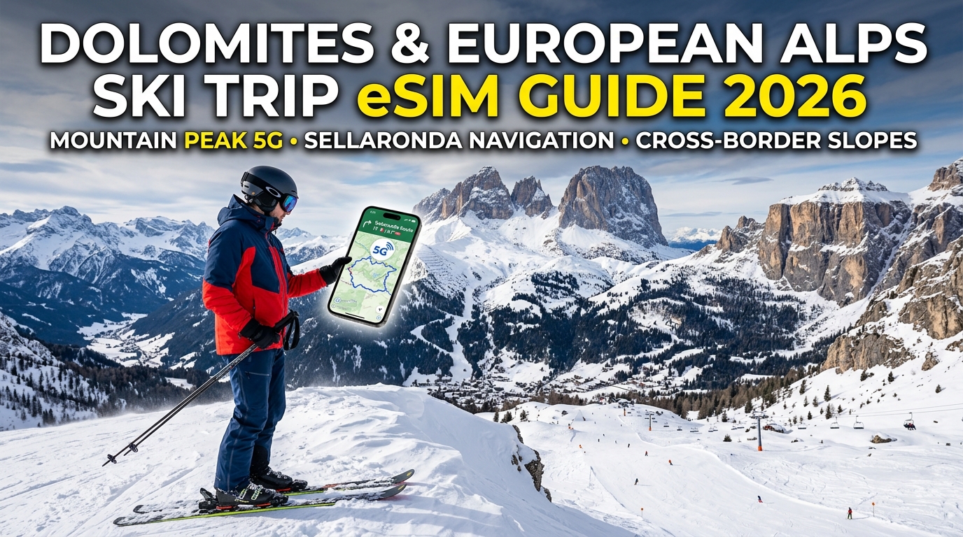
Tantangan Konektivitas Alpen: Topografi, Suhu Ekstrem di Bawah Nol & Bayangan Sinyal Puncak Gunung
Berseluncur di antara puncak-puncak terjal Dolomites—mulai dari tebing vertikal Sella Massif dan Marmolada hingga menara spektakuler Tre Cime di Lavaredo—menghadirkan lingkungan RF (Radio Frequency) yang sangat berbeda dari area perkotaan atau dataran rendah. Meskipun sirkuit ski utama seperti Dolomiti Superski dan Sellaronda berinvestasi besar-besaran dalam infrastruktur, menjaga transmisi seluler tetap stabil di atas ketinggian 2.500 meter tetap dibatasi oleh tantangan fisik, geografis, dan termodinamika yang ekstrem.
       [ Puncak Gunung / Relai 5G Puncak ]
                  /            \
                 /  Bayangan RF \  <-- Non-Line-of-Sight (NLOS)
                /   (Zona Mati)  \     Penurunan Sinyal: 20–40 dB
               /                  \
   [ Dasar Lembah ]              [ Lereng Belakang / Piste ]
   Stasiun Pemancar (gNodeB)     (Pencarian Sinyal Tinggi & Baterai Boros)
1. Fisika di Balik Bayangan Sinyal RF di Dolomites
Hambatan konektivitas utama di seluruh lembah Alpen seperti Val Gardena, Cortina d'Ampezzo, dan Alta Badia bersifat struktural:
- Refleksi dan Atenuasi RF Geologis: Batuan kapur dolomit tersusun dari formasi magnesium-kalsium karbonat padat yang berfungsi sebagai perisai alami sinyal radio (RF). Alih-alih menembus batuan, sinyal seluler mengalami hamburan parah, interferensi multi-path, hingga pemblokiran total.
- *Topografi Non-Line-of-Sight (NLOS): Sebagian besar menara makro seluler (gNodeB untuk 5G, eNodeB untuk 4G LTE) ditempatkan di dasar lembah untuk melayani populasi permukiman permanen. Saat menuruni lereng curam di balik gunung atau bermain ski di dasar dinding vertikal yang masif, jalur pandang langsung (Line-of-Sight* / LOS) ke antena ini langsung terputus, menyebabkan penurunan kekuatan sinyal sebesar 20 dB hingga 40 dB hanya dalam hitungan detik.
- Mikro-Reflektor: Kadar air pada lapisan salju, orientasi kristal es di permukaan, dan kelembapan udara yang dinamis menciptakan jalur propagasi yang berfluktuasi, memicu packet loss berkala bahkan ketika ponsel Anda menunjukkan indikator bar sinyal penuh.
2. Termodinamika Suhu di Bawah Nol: Penurunan Voltase Baterai & Pencarian Sinyal
Lingkungan Alpen bersuhu di bawah nol derajat memicu penurunan kinerja biokimia secara langsung pada baterai smartphone:
- Lonjakan Impedansi Internal: Saat suhu anjlok di atas kereta gantung (chairlift) terbuka atau punggung bukit yang berangin kencang (sering mencapai $-10^\circ\text{C}$ hingga $-20^\circ\text{C}$ akibat windchill), cairan elektrolit di dalam sel litium-ion mengental. Hal ini memicu lonjakan resistansi internal dan menyebabkan penurunan voltase operasional seketika.
- Throttling Agresif OS dan Mati Mendadak: Sistem operasi modern (iOS dan Android) memantau ambang batas voltase secara ketat. Ketika lonjakan daya terjadi dalam kondisi voltase rendah, OS akan mengaktifkan throttling defensif atau mematikan perangkat secara mendadak—sering kali membuat indikator baterai anjlok dari 40% langsung ke 1%.
- Siklus Boros Baterai Akibat "Pencarian Jaringan": Ketika perangkat kehilangan sinyal Line-of-Sight di balik punggung gunung, modem baseband ponsel akan memompa daya transmisi ke tingkat maksimum (hingga $+23\text{ dBm}$ / $200\text{ mW}$) untuk mencoba terhubung kembali. Pencarian sinyal RF berdaya tinggi yang berkelanjutan ini menguras daya baterai secara drastis tepat ketika efisiensi termodinamika sel baterai berada di titik terendahnya.
3. Ketergantungan Kritis pada Koneksi Data Alpen yang Berkelanjutan
Mempertahankan saluran data yang stabil dan persisten sangat penting demi keselamatan di lereng ski dan kelancaran navigasi harian:
- Telemetri GNSS yang Efisien: Assisted GPS (A-GPS) mengandalkan data seluler untuk mengunduh data efemeris satelit dalam hitungan milidetik. Tanpa koneksi data aktif, penguncian sinyal GPS membutuhkan waktu pemrosesan beberapa menit yang menguras baterai secara signifikan.
- Peringatan Keselamatan Dinamis: Pembaruan buletin longsoran salju waktu nyata (seperti peringatan AINEVA), pemberitahuan penundaan operasi lift ski akibat angin kencang, dan pergerakan badai lokal di celah-celah gunung tinggi membutuhkan transfer data instan.
- Konektivitas Cadangan Tanpa Hambatan: Saat menjelajahi jalur-jalur ski terpencil, konektivitas kelas atas mencegah modem perangkat terjebak dalam siklus pencarian koneksi (handshake loop).
Memilih profil perjalanan khusus Alpen seperti MollySIM mengoptimalkan proses ini dengan menegosiasikan akses prioritas ke jaringan lokal terdepan (seperti TIM dan Vodafone di Italia, atau A1 di Austria).
Selain itu, MollySIM dilengkapi dengan Fair Use Policy (FUP) berkecepatan dasar 384 kbps—tiga kali lebih cepat daripada batas standar 128 kbps yang biasa diterapkan oleh penyedia roaming tradisional. Ini memastikan bahwa meskipun Anda menghabiskan kuota data berkecepatan tinggi di tengah jalur Sellaronda, operasi kritis seperti memuat peta vektor Google Maps, mengirim koordinat lokasi langsung, dan transaksi tiket lift via Apple Pay tetap berjalan lancar tanpa mengalami timeout.
Navigasi Gunung Real-Time: Menjalankan Sellaronda, Peta Lereng 3D & Pembayaran di Pondok Gunung
🇬🇧 United Kingdom High-Speed Travel eSIM & SIM Plans
Instant QR code activation, hotspot enabled, with guaranteed 384kbps fallback speed to keep Maps & Digital Wallets active.
Menjelajahi jaringan Dolomiti Superski sepanjang 1.200 kilometer kini bukan lagi sekadar melihat peta jalur kertas di puncak chairlift. Ski mountaineering modern dan jelajah resor berintensitas tinggi membutuhkan aliran data berkecepatan tinggi yang stabil untuk merender vektor topografi yang kompleks, memantau antrean lift ski secara langsung, serta melakukan transaksi pembayaran tanpa hambatan di pondok-pondok gunung (rifugi) dataran tinggi.
Menyelesaikan rute legendaris Sellaronda—sirkuit ski sepanjang 40 kilometer yang mengitari Dataran Tinggi Sella melintasi empat lembah berbeda (Val Gardena, Alta Badia, Arabba, dan Val di Fassa)—menuntut kesadaran situasional mutlak. Satu penutupan lift tak terduga akibat angin kencang di Passo Gardena atau Passo Pordoi dapat membuat pemain ski terdampar di sisi gunung yang salah, memaksa Anda membayar taksi lebih dari €200 untuk kembali melintasi jalan pegunungan yang berkelok-kelok.
Aplikasi Ski Berbeban Data Berat: Kebutuhan Telemetri dan Rendering
Aplikasi navigasi ski penting saat ini membutuhkan bandwidth seluler yang konsisten, mengandalkan komunikasi klien-ke-server yang intensif untuk menjaga akurasi rute dan pembaruan keselamatan:
| Aplikasi | Fungsi Utama | Beban Data & Mekanisme Khas | Risiko Operasional jika Terputus |
|---|---|---|---|
| FATMAP / Strava 3D | Medan satelit resolusi tinggi, bayangan gradien & peta celah es (crevasse) | 15–40 MB per cache zona dinamis; streaming ubin WebGL progresif | Ketidakmampuan menilai zona limpasan longsoran salju atau sudut jalur off-piste |
| Dolomiti Superski 3D | Perutean 3D interaktif, status lift real-time, dan estimasi waktu transit | 5–15 MB pembaruan vektor dinamis; polling API berkala setiap 60 detik | Ketinggalan lift penghubung terakhir antar-lembah |
| OpenSnow / Bergfex | Radar resolusi tinggi, batas ketinggian pembekuan es, dan peringatan angin iklim mikro | 2–8 MB per pembaruan loop Doppler/radar | Memasuki badai salju (whiteout) bersuhu ekstrem tanpa persiapan |
| Slopes GPS | Telemetri langsung, pelacakan vertikal, dan berbagi lokasi grup ski | 50–150 KB/menit sinkronisasi Webhook/MQTT konstan | Kehilangan jejak anggota rombongan di jalur pepohonan lebat atau bowl multi-tahap |
Keselamatan di wilayah Alpen juga sangat bergantung pada peringatan meteorologi regional. Mengintegrasikan buletin risiko longsoran salju resmi—seperti ARPAV di Veneto, Lawinenwarndienst Südtirol, dan SLF di Swiss—memerlukan transfer data instan. Saat inversi suhu mengganggu stabilitas lapisan salju di sore hari, layanan ini akan mengirimkan pembaruan status darurat yang sangat penting bagi para pemain ski freeride.
Pembayaran Digital Tanpa Gangguan di Ketinggian 2.500+ Meter
Di rifugi ketinggian tinggi seperti Rifugio Emilio Comici (Val Gardena) atau Rifugio Lagazuoi (Cortina d'Ampezzo), uang tunai sudah mulai ditinggalkan, tetapi terminal kartu kredit fisik sering kali menghadapi keterbatasan infrastruktur.
Pondok gunung terpencil sering kali mengandalkan koneksi satelit atau jaringan Wi-Fi publik bersama yang mengalami packet loss parah, jitter latensi tinggi (>600ms), dan masalah captive portal. Menggunakan pembayaran nirkontak (Apple Pay, Google Wallet) atau mengisi ulang tiket lift digital darurat melalui Wi-Fi pondok yang padat kerap kali memicu galat gateway timeout.
Ketika ponsel Anda mempertahankan koneksi seluler 5G/4G langsung yang terenkripsi:
- Permintaan Tokenisasi EMV diselesaikan dalam hitungan sub-detik tanpa kegagalan handshake SSL/TLS.
- Pembaruan Dompet Digital Instan berjalan lancar di terminal pembayaran, melewati kemacetan Wi-Fi publik.
- Pengisian Ulang Tiket Lift Dinamis (seperti menambah kredit MyDolomiti secara langsung) diproses seketika di pintu masuk lift, mencegah Anda tertahan dalam cuaca dingin.
Koneksi seluler Anda bukan hanya sekadar sarana komunikasi, melainkan perangkat keselamatan penting. Dengan MollySIM, perangkat Anda secara otomatis terhubung ke menara seluler regional terkuat di seluruh Alpen. Bahkan ketika kuota data habis, fitur bawaan Fair Use Policy (FUP) 384 kbps dari MollySIM memastikan layanan penting—peta vektor, pesan darurat, dan tokenisasi pembayaran nirkontak—tetap berfungsi tanpa hambatan.
Perjalanan Lintas Batas Alpen: Berselancar Mulus Antara Italia, Austria, dan Swiss
Salah satu keistimewaan bermain ski di Alpen Eropa adalah kemudahan meluncur dari punggung gunung di satu negara dan tiba di negara lain untuk makan siang. Namun, sirkuit ski trans-Alpen ini menghadirkan tantangan teknis yang berat untuk konektivitas seluler:
- Matterhorn Ski Paradise: Meluncur dari gletser Plateau Rosa dari Zermatt (Swiss) turun menuju Breuil-Cervinia (Italia).
- Silvretta Arena: Menjelajahi mangkuk salju Alpen dari Ischgl (Austria) menuruni jalur bebas bea menuju Samnaun (Swiss).
- Via Lattea (Milky Way): Menyeberangi puncak antara Sestriere/Claviere (Italia) dan Montgenèvre (Prancis).
"Jebakan Roaming Swiss" di Punggung Pegunungan Tinggi
Jebakan paling umum dalam roaming di Alpen berasal dari status geopolitik Swiss. Karena Swiss bukan anggota Uni Eropa (UE) maupun Area Ekonomi Eropa (EEA), negara ini dikecualikan sepenuhnya dari regulasi bebas roaming UE ("Roam Like at Home").
Saat Anda meluncur melintasi perbatasan dari Ischgl ke Samnaun atau dari Cervinia ke Zermatt dengan kartu SIM operator UE biasa atau paket internasional yang tidak dikonfigurasi dengan benar, perangkat Anda akan langsung terhubung ke jaringan Swiss. Dampaknya terjadi seketika:
- *Tarif Pay-As-You-Go yang Sangat Mahal: Operator seluler domestik umumnya mengenakan tarif data Swiss mulai dari \$5,00 hingga \$15,00 per megabita, memicu tagihan membengkak ratusan dolar (bill shock*) hanya karena sinkronisasi foto di latar belakang atau pengunduhan peta otomatis.
- Pemblokiran Sinyal Otomatis: Untuk mencegah tagihan membengkak secara tidak sengaja, banyak penyedia layanan memblokir roaming Swiss secara otomatis, memutus koneksi data seluler Anda tepat saat Anda tiba di punggung gletser setinggi 3.800 meter tanpa rambu petunjuk—tempat navigasi paling dibutuhkan.
- Keterlambatan Konfigurasi APN Manual: SIM perjalanan tradisional sering kali mewajibkan Anda mengubah pengaturan APN secara manual atau me-restart ponsel di tengah terpaan angin dingin bersuhu -15°C sambil mengenakan sarung tangan tebal.
Peralihan Operator Multi-IMSI Dinamis Bersama MollySIM
Untuk menghilangkan kendala lintas batas, eSIM regional harus mampu mengelola peralihan jaringan di tingkat sistem tanpa memerlukan tindakan manual yang merepotkan. eSIM regional Eropa multi-negara dari MollySIM menyematkan profil PLMN (Public Land Mobile Network) dinamis yang menegosiasikan peralihan jaringan (handover) secara otomatis dan real-time.
       Melintasi Punggung Batas Negara (misal: Ischgl -> Samnaun)
                                  │
             ┌────────────────────┴────────────────────┐
             ▼                                         ▼
SIM Perjalanan Tradisional                 Profil Regional MollySIM
  • Wajib reset APN manual                   • Handshake PLMN Dinamis
  • Pemutusan sinyal 5-15 menit              • Koneksi tanpa jeda (0 detik)
  • Throttling ketat hingga 128 kbps         • 5G / 4G Tier-1 tanpa batas kecepatan
  • Navigasi peta berhenti berfungsi         • Batas aman FUP 384 kbps
Saat ponsel Anda meninggalkan jangkauan menara Austria di Idalp dan mendeteksi jangkauan pemancar Swiss di atas Samnaun, MollySIM secara otomatis memulai handshake multi-operator. Tidak ada paket data yang terputus, Anda tidak perlu membuka menu pengaturan seluler iOS/Android, dan tidak ada risiko kesalahan konfigurasi APN.
| Sirkuit Ski Lintas Batas | Titik Lintas Batas | Operator Asal Utama | Operator Tujuan Tanpa Hambatan |
|---|---|---|---|
| Matterhorn Ski Paradise | Plateau Rosa / Theodulpass (3.480m) | Swisscom / Sunrise (Swiss) | TIM / Vodafone IT (Italia) |
| Silvretta Arena | Greitspitze / Viderjoch (2.872m) | A1 Telekom / Magenta (Austria) | Swisscom (Swiss) |
| Via Lattea (Milky Way) | Col de Montgenèvre (1.850m) | Wind Tre / TIM (Italia) | Orange / SFR (Prancis) |
| Portes du Soleil | Pointe de Mossette (2.277m) | Orange France (Prancis) | Swisscom (Swiss) |
Navigasi Tanpa Putus dan Batas Keamanan Data
Jalur lintas batas sangat rentan terhadap inversi awan mendadak dan badai salju tebal. Jika Anda salah mengambil jalur dari punggung bukit Viderjoch tanpa koneksi data aktif, Anda berisiko meluncur turun ke lembah negara yang salah, ketinggalan lift penghubung terakhir, dan harus menempuh perjalanan taksi internasional selama empat jam yang sangat mahal untuk memutari gunung.
Dengan memanfaatkan jaringan operator Tier-1 terkemuka di Italia, Austria, Prancis, dan Swiss secara simultan, MollySIM memastikan aplikasi pelacak GPS langsung (FATMAP, Slopes, Outdooractive) tetap terhubung di setiap punggung gunung.
Bahkan jika kuota data berkecepatan tinggi Anda habis di tengah jalur ski, Fair Use Policy (FUP) 384 kbps bawaan MollySIM menyediakan kecepatan tiga kali lipat lebih tinggi dari batas standar kompetitor (128 kbps). Kecepatan ini sangat memadai untuk memuat garis kontur topografi vektor, mengirim pesan suara WhatsApp ke rekan ski Anda, serta mengesahkan pembayaran nirkontak Apple Pay atau Google Wallet di pos perbatasan pegunungan tanpa kendala.
Analisis Komparatif: Solusi Konektivitas Alpen untuk Pemain Ski dan Snowboarder
Memilih perangkat keras komunikasi dan protokol jaringan yang tepat untuk ekspedisi olahraga musim dingin di Pegunungan Alpen memerlukan evaluasi faktor lingkungan yang tidak ada di dataran rendah: penurunan performa baterai akibat suhu minus, hilangnya sinyal di balik punggung gunung terjal, serta perpindahan perbatasan berkala antara zona roaming Uni Eropa (Italia, Austria, Prancis) dan non-UE (Swiss).
Tabel berikut membandingkan empat strategi konektivitas utama di Alpen untuk rencana perjalanan musim dingin standar 7 hingga 14 hari:
| Metrik Evaluasi | Paket Harian Operator Domestik (Telkomsel/Indosat/XL Pass) | SIM Fisik Turis Lokal (TIM/Orange/A1) | Unit Pocket Wi-Fi (Sewa Modem MiFi) | eSIM Regional Eropa MollySIM |
|---|---|---|---|---|
| Ketahanan Perangkat di Suhu Minus | Terintegrasi di ponsel; hanya terdampak penurunan suhu normal perangkat. | Terintegrasi di ponsel; berisiko saat menukar kartu SIM fisik di udara dingin. | Tingkat kegagalan tinggi. Baterai Li-ion eksternal cepat beku di saku jaket luar pada suhu di bawah -5°C. | Terintegrasi di ponsel; bebas komponen bergerak atau ketergantungan baterai eksternal. |
| Peralihan Otomatis Multi-Operator di Puncak | Terbatas pada 1 mitra jaringan per negara; rentan terhadap blank spot di lembah. | Terkunci pada satu jaringan. Kehilangan sinyal saat mengitari lereng gunung. | Profil SIM tunggal di dalam unit; tidak dapat beralih ke operator Tier-1 pesaing. | Roaming multi-jaringan dinamis. Otomatis terhubung ke pemancar lokal terkuat (TIM/Vodafone/A1/Swisscom). |
| Latensi Transit Lintas Batas | Latensi paket tinggi; memicu tarif mahal non-EEA saat memasuki Swiss. | Terputus di perbatasan internasional (misal: Zermatt ke Cervinia) kecuali paket tambahan aktif. | Memerlukan sewa multi-SIM regional; latensi perutean tinggi dan perangkat berat. | Peralihan perbatasan mulus. Tanpa konfigurasi ulang antara Italia, Austria, Prancis, dan Swiss. |
| Kemudahan Pengaturan saat Mengenakan Perlengkapan Ski | Aktivasi otomatis, namun berisiko tagihan membengkak akibat biaya harian tinggi. | Sangat merepotkan. Harus mencari toko di lembah, registrasi paspor, dan membuka slot SIM kecil. | Sedang. Harus mengambil unit di bandara, mengisi daya perangkat, dan membawa kabel ekstra. | Instalasi QR instan via Wi-Fi rumah sebelum berangkat; aktifkan profil dengan satu ketukan. |
| Batas Keamanan Darurat (FUP) | Pemutusan total atau throttling ekstrem hingga 64 kbps (peta & dompet digital tidak dapat digunakan). | Kuota langsung terputus jika habis; pengisian ulang saldo rumit di portal berbahasa lokal. | Throttling berat setelah kuota harian habis (sering kali dibatasi maks. 128 kbps). | Batas aman 384 kbps tanpa batas. Peta vektor, lokasi real-time, dan Apple/Google Pay tetap berfungsi. |
| Estimasi Biaya (Perjalanan 10 Hari / 10–20GB) | Tinggi (akumulasi biaya harian mahal + biaya tambahan non-UE). | €35 – €50 (ditambah SIM kedua untuk area Swiss). | €70 – €110 (biaya sewa + asuransi perangkat + deposit). | Tarif regional sangat kompetitif (jauh lebih hemat dibanding roaming operator konvensional). |
Penjelasan Teknis: Faktor Kinerja di Medan Alpen
1. Kejutan Termal dan Keandalan Perangkat Keras
Perangkat Pocket Wi-Fi sangat tidak ideal untuk bermain ski freeride atau ski touring. Suhu dataran tinggi yang berkisar antara -5°C hingga -18°C menyebabkan sel baterai litium-ion eksternal mengalami penurunan voltase drastis, mengakibatkan perangkat mati mendadak di tengah gunung. Karena MollySIM beroperasi langsung pada chip eUICC internal ponsel Anda, konektivitas terlindungi oleh panas internal smartphone dan kehangatan tubuh Anda di dalam saku jaket lapisan dalam (mid-layer).
2. Fleksibilitas Operator Multi-IMSI vs. Terkunci Satu Jaringan
SIM fisik yang dibeli dari penyedia Italia (seperti TIM atau Wind Tre) mengunci modem ponsel Anda ke stasiun pemancar milik operator tersebut. Meskipun jangkauan di lembah Dolomites sangat baik, area punggung gunung tinggi sering kali mengandalkan pemancar bersama atau antena lokal yang dioperasikan oleh Vodafone atau Swisscom.
Saat menjelajahi rute sirkuit luas seperti Sellaronda atau Silvretta Arena, perangkat yang terkunci pada satu jaringan akan sering mengalami blank spot. Profil regional MollySIM memanfaatkan kemitraan roaming Tier-1 dengan operator nasional terkemuka secara simultan, memungkinkan prosesor ponsel Anda mendeteksi dan terhubung ke pemancar mana pun yang menawarkan Signal-to-Noise Ratio (SNR) terbaik di lereng gunung tersebut.
3. Jebakan Roaming Non-UE: Jalur Perbatasan Swiss
Pemain ski yang melintasi jalur antara Italia (Cervinia) dan Swiss (Zermatt) atau Austria (Ischgl) dan Swiss (Samnaun) sering kali terkena tagihan roaming yang sangat mahal pada paket standar Uni Eropa. Karena Swiss bukan anggota Area Ekonomi Eropa (EEA), SIM domestik UE membebankan tarif di luar paket yang sangat tinggi untuk konsumsi data di jaringan Swiss.
MollySIM mengintegrasikan Swiss ke dalam satu profil perutean terpadu Eropa Barat & Tengah, menghilangkan risiko lonjakan tagihan tak terduga saat Anda melintasi punggung gunung.
4. Kecepatan Setelah Kuota Habis dan Navigasi Keselamatan Kritis
Paket harian internasional biasa akan menurunkan kecepatan Anda menjadi 64–128 kbps begitu kuota harian habis. Dalam skenario navigasi gunung, koneksi 128 kbps tidak mampu mengunduh peta topografi beresolusi tinggi di aplikasi seperti FATMAP atau memproses verifikasi tiket ski nirkontak dan koordinat lokasi darurat.
Infrastruktur MollySIM menetapkan kecepatan dasar Fair Use Policy (FUP) sebesar 384 kbps—tiga kali lipat lebih cepat daripada standar industri. Ini memastikan bahwa meskipun kuota utama telah habis, Anda tetap dapat memuat kontur vektor, membagikan koordinat langsung ke tim penyelamat, dan melakukan pembayaran nirkontak di pondok gunung tanpa gangguan.
Panduan Instalasi Langkah demi Langkah & Konfigurasi Jaringan Hemat Baterai untuk Lereng Bersuhu Minus
Lingkungan Alpen bersuhu di bawah nol menghadirkan dua ancaman utama bagi ponsel: penurunan voltase baterai litium-ion yang cepat dan pemborosan kuota data di latar belakang oleh aplikasi navigasi beresolusi tinggi. Mengoptimalkan konfigurasi perangkat sebelum menaiki lift memastikan koneksi Anda tetap stabil di seluruh wilayah ski trans-nasional seperti Sellaronda atau Matterhorn Ski Paradise.
1. Pengaturan Pra-Keberangkatan & Pelabelan Profil
Pasang profil digital eSIM Anda 24 hingga 48 jam sebelum penerbangan saat masih terhubung ke Wi-Fi rumah yang aman untuk menghindari ketergantungan pada portal Wi-Fi bandara atau hotel yang lambat.
iOS (iPhone 12 hingga iPhone 16 Pro):
- Buka menu Pengaturan > Seluler (atau Layanan Seluler) > Tambah eSIM.
- Pindai kode QR yang tersedia di dasbor aktivasi MollySIM Anda atau masukkan alamat SM-DP+ secara manual.
- Berikan label khusus: beri nama paket baru "MollySIM Alps" dan biarkan kartu operator utama Anda berlabel "Primer".
- Atur Saluran Suara Default ke saluran Primer Anda (agar tetap dapat menerima SMS OTP/2FA jika diperlukan).
- Atur Data Seluler ke MollySIM Alps.
Android (Google Pixel, Samsung Galaxy S21–S25, Seri Ultra):
- Buka Pengaturan > Koneksi > Pengelola SIM > Tambah eSIM.
- Pindai kode aktivasi dan beri label profil sebagai "MollySIM Alps".
- Atur SIM Pilihan untuk Data Seluler ke MollySIM Alps.
- Atur Panggilan dan Pesan ke SIM fisik/eSIM primer domestik Anda.
2. Penguncian Pengaturan Roaming Data Dual-SIM
Untuk mencegah tagihan roaming yang tidak disengaja dari operator primer Anda saat melintasi perbatasan gunung, atur opsi pengaturan berikut:
| Parameter Pengaturan | Konfigurasi Target iOS | Konfigurasi Target Android | Tujuan Operasional |
|---|---|---|---|
| **Roaming |
🇬🇧 United Kingdom High-Speed Travel eSIM & SIM Plans
Instant QR code activation, hotspot enabled, with guaranteed 384kbps fallback speed to keep Maps & Digital Wallets active.