Sailing the Adriatic: Croatia Yacht Week & Island Hopping Travel eSIM Guide (2026)
Sailing the Dalmatian Coast: Why Croatia Yacht Week Demands Bulletproof Connectivity
Slipping the lines at Marina Kaštela or ACI Marina Split marks the transition from mainland convenience to an unpredictable marine environment. The classic central Adriatic sailing corridor—tracking south through the Brač Channel, weaving past the Pakleni Islands off Hvar, making the open-sea crossing to Vis, skirting the dense pine forests of Korčula, and concluding along Dubrovnik’s limestone ramparts—is globally celebrated for a reason. However, modern flotilla sailing demands constant, low-latency data far beyond what typical leisure travelers require.
The Digital Demands of Modern Flotilla Island Hopping
A Yacht Week or private bareboat itinerary requires real-time digital orchestration:
- Flotilla Logistics & Lead Boat Directives: Maintaining contact with the lead skipper via low-latency messaging platforms (WhatsApp, Telegram) to coordinate intricate circle rafts, anchor drops, and regatta start lines.
- Split-Second Mooring Reservations: High-season berthing in places like Palmižana, Komiža, or Korčula Town is fiercely competitive. Securing a mooring ball or marina berth requires active monitoring on platforms like Navily, MySea, or direct ACI Marina booking engines the minute booking windows open.
- Dynamic Weather Tracking: The Adriatic is notorious for rapid meteorological shifts. Skippers must continuously pull high-resolution GRIB files and monitor live radar updates via Windy or DHMZ (Aladin HR) to anticipate sudden Bura (violent, cold katabatic winds descending from coastal mountains) or the heavy southerly swells of the Jugo.
- Emergency Coastal Support: Quick access to the SeaHelp or EmergenSea apps for marine salvage, prop clearance, or medical assistance while underway.
- Social & Entertainment Bandwidth: Continuous high-bitrate Spotify or Apple Music streaming on deck, coupled with crew members uploading 4K video dispatches and drone footage to social channels from remote anchorages like Stiniva Bay.
The Physics of Over-Water RF: Why Standard Tourist SIMs Fail
Once your monohull or catamaran clears the mainland harbor walls, traditional cellular assumptions break down. Terrestrial cellular towers (Base Transceiver Stations) situated on the Dalmatian mainland are directional, optimized to tilt their radio frequency (RF) beams downward toward population centers, not out to sea.
       [Mainland BTS Tower]
           \  (RF Beam Tilted Downward)
            \
~ ~ ~ ~ ~ ~ ~ \ ~ ~ ~ ~ ~ ~ ~ ~ ~ ~ ~ ~ ~ ~ ~ ~ ~ ~ ~ ~ ~ ~ ~ ~ ~ ~ ~ ~ ~ ~ ~ ~ ~ ~ ~
               \             [Multipath Fading]
                \               /\    /\
                 v             /  \  /  \
[Yacht] <--------' \/ '---> [Signal Drop / Packet Loss]- Specular Reflection & Multipath Interference: The calm Adriatic surface acts as an RF mirror. Transmitted signals bounce off the water and hit your smartphone’s internal antennas slightly out of phase with direct line-of-sight signals, causing destructive interference, packet loss, and immediate battery drain as the modem ramps up power to compensate.
- Karst Topography Shadowing: The dramatic, near-vertical limestone cliffs characterizing islands like Vis and Brač create acute RF shadow zones. Rounding a headland into an anchorage can instantly drop a single-network connection from full 5G to "No Service."
- Marina Wi-Fi Spectrum Congestion: Relying on marina Wi-Fi is rarely viable. When 300 yachts dock simultaneously at an island marina, thousands of client devices instantly saturate the local 2.4 GHz and 5 GHz bands, rendering marina access points functionally useless.
Building Resilience with Multi-Network Cellular Architecture
Navigating these dead zones requires an eSIM solution capable of dynamically switching between Croatia’s primary national carriers—Hrvatski Telekom (HT), A1 Hrvatska, and Telemach—latching onto whichever island-based cell tower maintains the strongest line-of-sight signal.
Furthermore, data caps during heavy maritime media usage can leave a crew stranded without navigational aids. Choosing a provider like MollySIM provides an operational safety net: even if your high-speed data allocation is fully consumed during an offshore passage, MollySIM’s Fair Use Policy (FUP) throttles down to a functional 384 kbps. Unlike the industry standard 128 kbps cutoff—which breaks modern web applications—384 kbps is roughly three times faster, keeping vector chart downloads on Google Maps, emergency SeaHelp pings, lead boat WhatsApp messages, and Apple Pay port payments fully operational when you need them most.
Offshore Cellular Coverage: A1 vs Hrvatski Telekom vs Telemach at 5–10 Nautical Miles
🌐 Global Travel High-Speed Travel eSIM & SIM Plans
Instant QR code activation, hotspot enabled, with guaranteed 384kbps fallback speed to keep Maps & Digital Wallets active.
Cellular connectivity across the central and southern Dalmatian archipelago relies on high-elevation macro cell towers strategically installed on the Adriatic’s most prominent geological peaks. Understanding how these towers propagate RF (radio frequency) signals across open water—and where geographical relief cuts them off—is critical for maintaining reliable navigation, telematics, and communication while underway.
       [Vidova Gora Mast - Brač (778m)]
                     \
                      \  Line-of-Sight (~8–12 NM)
                       \
~~~~~~~~~~~~~~~~~~~~~~~~[Yacht in Open Channel]~~~~~~~~~~~~~
                                    |
                            [Limestone Ridge]
                                    |
                           [Dead Zone Cove] ❌ (RF Shadow)
High-Altitude Base Stations and Open-Water Propagation
Over open water, low-frequency cellular bands—specifically LTE Band 20 (800 MHz) and Band 28 (700 MHz)—benefit from unobstructed line-of-sight (LoS) conditions and sea-surface reflection, allowing signals to travel substantially farther than over land.
Two primary coastal installations dictate marine reception in the Split-to-Dubrovnik sailing corridors:
- Vidova Gora (Brač, 778 m): The highest elevation in the Adriatic islands. Transmitters here project high-gain sectoral beams southwest across the Hvar Channel and south toward the Korčula Channel, delivering usable LTE connectivity up to 10 to 12 nautical miles offshore.
- Mount Hum (Vis, 587 m): Anchors the outer maritime boundary. Base stations on Hum project north toward the Biševo Channel and east toward Hvar, maintaining an essential communications corridor for offshore passages between Split, Hvar, and the remote outer islands.
Carrier Benchmark: HT vs. A1 vs. Telemach
While all three mobile network operators (MNOs) deploy coastal infrastructure, their maritime coverage profiles diverge significantly once a yacht clears the mainland harbors.
| Carrier | Primary Spectrum Bands | Offshore Range (LoS) | Network Strengths & Maritime Performance |
|---|---|---|---|
| Hrvatski Telekom (HT) | B20 (800 MHz), B3 (1800 MHz), n78 (3.5 GHz) | 8–12 Nautical Miles | Dominant offshore footprint. Extensive rural/coastal cell grid with high transmit power. Best performance along outer passages (Vis Channel, Lastovo approaches). |
| A1 Hrvatska | B20 (800 MHz), B1 (2100 MHz), n78 (3.5 GHz) | 7–10 Nautical Miles | High capacity in yachting hubs. Dense 5G microcells in high-traffic anchorages (Hvar Town, Trogir, Palmižana marina). Highly reliable in the Brač and Split Channels. |
| Telemach | B20 (800 MHz), B3 (1800 MHz), n1 (2100 MHz) | 4–7 Nautical Miles | Variable island coverage. Performs well along mainland coastal routes and major island towns (Supetar, Stari Grad), but suffers noticeable power drop-offs in open passages and remote southern chains. |
The Topographical Trap: Limestone Coves and Shadow Zones
While open-water channels enjoy long-distance coverage, Dalmatian karst topography produces severe RF shadow zones. High-frequency cellular signals cannot penetrate dense limestone walls, and when a yacht enters a deep cove, the cliffs obstruct direct line-of-sight to the nearest mountain mast.
+--------------------------+-------------------------------------------------------------+
| High-Risk Dead Zone      | Topographical Obstruction & Network Behavior                |
+--------------------------+-------------------------------------------------------------+
| Stiniva Cove (Vis)       | Sheer 80-meter vertical cliff amphitheater completely blocks |
|                          | Mount Hum transmitters. Instant signal loss upon entry.     |
+--------------------------+-------------------------------------------------------------+
| Southern Bays of Šolta   | Steep southern drop-offs isolate coves like Stračinska and   |
| (Livka, Stračinska)      | Tatinja from mainland and Brač macro towers.               |
+--------------------------+-------------------------------------------------------------+
| Outer Pakleni Islands    | Low-lying rocky islets create multipath interference;       |
| (Vodnjak, Dobri Otok)    | southern anchorages lose Hvar Town base station alignment.  |
+--------------------------+-------------------------------------------------------------+
The Single-SIM Point of Failure
A frequent mistake among visiting sailors is purchasing a local physical SIM card from a single carrier (such as a promotional HT or A1 prepaid pack) at Split Airport or Marina Kaštela.
Because local prepaid SIMs are locked to a single provider's proprietary network, the vessel's connectivity is tied to that specific carrier's cell sector azimuths. If your yacht anchors in a bay where an A1 sector is blocked by a headland but an HT repeater on an adjacent ridge has line-of-sight, a single-network SIM drops to "No Service."
Deploying a dynamic multi-network profile like MollySIM eliminates this single point of failure. The eSIM core switches between HT, A1, and Telemach automatically, latching onto whichever carrier maintains the highest Signal-to-Interference-plus-Noise Ratio (SINR) in that specific bay.
Even if intensive daily hotspotting exhausts your primary high-speed data tier midway through the passage, MollySIM’s 384 kbps Fair Use Policy safety net preserves roughly three times the bandwidth of standard 128 kbps throttles. This throughput ensures essential marine operations—downloading coastal grib files, rendering vector tiles on digital charts, or processing marina payments via Apple Pay—remain fully functional while underway.
Connectivity on Deck: Maritime Satellite Wi-Fi vs Local SIMs vs MollySIM Multi-Carrier eSIM
When outfitting a bareboat or flotilla yacht for a week along the Dalmatian coast, skippers and crew generally weigh four connectivity pathways. Choosing the wrong setup risks high hardware costs, severe 12V domestic battery drain at anchor, or complete communication blackouts behind limestone headlands.
The following matrix benchmarks the primary offshore and coastal data options available for Adriatic routes:
| Parameter | Starlink Maritime / Iridium GO! | Charter Fleet Wi-Fi Router Add-On | Local Prepaid SIM (HT / A1) | MollySIM Multi-Carrier eSIM |
|---|---|---|---|---|
| Initial Hardware Cost | €450 – €2,800+ (dish/transceiver) | €0 (hardware loaned by base) | €0 (uses smartphone tray) | €0 (digital download to device) |
| Weekly / Monthly Service Fee | €280 – €1,000+/mo | €40 – €80/week rental | €15 – €25 per physical SIM | Affordable short-term regional tiers |
| Offshore Reach (Nautical Miles) | Unlimited global ocean coverage | 8–12 NM (antenna dependent) | 8–12 NM (internal phone antenna) | 8–15 NM (picks strongest coastal mast) |
| Average Latency | 35–65 ms (Starlink) / 800+ ms (Iridium) | 45–90 ms | 25–45 ms (when in direct line of sight) | 25–45 ms (optimal local breakout) |
| Multi-Carrier Redundancy | N/A (Satellite constellation) | ❌ No (Single SIM locked to one network) | ❌ No (Single network profile) | ✅ Yes (Dynamically switches HT, A1, Telemach) |
| Setup & Provisioning | Heavy rigging, bracket mounting, cabling | Pre-installed, picked up at check-in desk | Airport kiosk queue, physical swap, passport ID | Instant QR scan prior to departure |
| FUP / Post-Cap Throttle Speed | Hard caps or high overage billing | Hard stop / 64 kbps severe throttle | Hard stop requiring manual recharge voucher | 384 kbps unlimited baseline |
The Yacht Power Budget: Inverter Draw vs Native 5G
Dedicated low-earth-orbit (LEO) satellite setups like Starlink deliver robust bandwidth during long open-sea crossings, but their power profile conflicts with standard yacht operations. A marine satellite terminal draws between 50W to 75W of continuous AC power.
Running an inverter around the clock to power a satellite dish while anchored in quiet coves—such as Uvala Tiha or Stiniva—rapidly depletes the yacht's 12V domestic service battery bank. This forces skippers to run the diesel auxiliary engine or generator at anchor simply to maintain Wi-Fi, disrupting the anchorage and burning expensive marine fuel.
In contrast, cellular solutions rely entirely on your device's internal battery, charged via standard 12V USB helm sockets with zero inverter conversion loss.
                    12V HOUSE BATTERY IMPACT AT ANCHOR (OVERNIGHT - 8 HRS)
──────────────────────────────────────────────────────────────────────────────────────────
Starlink Terminal (via Inverter)  │ ████████████████████████████████████ 40–50 Ah consumed
Charter 4G MiFi Box (Micro-USB)    │ ███████ 8–12 Ah consumed
Individual MollySIM eSIM (On-Device)│ █ 1–2 Ah consumed (Direct device top-up)
──────────────────────────────────────────────────────────────────────────────────────────
Why Charter Fleet "Wi-Fi Boxes" Consistently Disappoint
Charter fleet add-on routers (frequently branded as "Unlimited Marine Wi-Fi" for €50 to €80 per charter week) present two major vulnerabilities:
- Single-Provider Lock-In: Charter bases equip their 4G/LTE mobile routers with bulk SIM cards from a single budget operator (most commonly Telemach or wholesale MVNOs). When your yacht tracks along the outer shores of Vis, Lastovo, or the Kornati archipelago where that specific carrier lacks coastal repeaters, the entire crew loses internet access simultaneously.
- Aggressive Micro-Throttles: Most charter fleet data pools are not truly unlimited; they carry hidden daily fair-use thresholds that throttle bandwidth down to an unusable 64 kbps once 5–10 GB have been consumed by crew members uploading video clips.
Dynamic Roaming: The High-Throughput, Low-Drag Solution
Because the Croatian coast is exceptionally dense with high-altitude 4G and 5G cellular repeaters placed on mountain ridges (such as Vidova Gora on Brač at 778m elevation), high-speed cellular signals extend 10 to 15 nautical miles offshore.
Deploying MollySIM provides direct access to this high-bandwidth coastal corridor without satellite expense or single-carrier dead zones. By functioning as a virtual clearinghouse across Hrvatski Telekom, A1, and Telemach, your smartphone continually handshakes with whichever tower provides the highest Signal-to-Interference-plus-Noise Ratio (SINR).
If the crew exhausts the primary high-speed data tier while streaming music or uploading passage logs, MollySIM’s 384 kbps Fair Use Policy (FUP) safety net prevents dropouts. Unlike standard European carrier throttles that restrict depleted lines to 64 or 128 kbps (rendering encrypted HTTPS handshakes inoperable), a 384 kbps stream maintains sufficient throughput to:
- Refresh live marine radar overlays and coastal GRIB wind models.
- Render interactive vector tiles on Navionics, Google Maps, and Garmin ActiveCaptain.
- Process contactless Apple Pay and digital credit authorization requests at municipal harbor master offices without transaction timeouts.
The Nautical Safety Net: Dynamic Network Switching & MollySIM's 384kbps FUP Backup
Navigating the Dalmatian archipelago is not a static open-water cruise; it is a dynamic exercise in managing topographical radar and cellular shadows. The dramatic limestone topography of the Croatian coastline—while breathtaking—creates severe propagation barriers. As your catamaran tacks behind the sheer southern cliffs of Hvar, maneuvers through the narrow Pakleni straits, or beats upwind into the Vis channel, single-carrier terrestrial lines consistently drop into deep signal nulls.
During an unexpected Bura or Jugo squall, an isolated carrier dropout transforms from a minor inconvenience into an immediate navigational hazard.
                   [ Vidova Gora Mast (Brač) - A1 / HT ]
                                /        \
                               /          \  (Direct Line of Sight)
                              /            \
  [ Island Shadow / Deadzone ]              \
  ~~~~~~~~~~~~~~~~~~~~~~|~~~~~~~~~~~~~~~~~~~~\~~~~~~~~~~~~~~~~~~~~~~
     (South Shore Hvar) |                     \  [ Catamaran Route ]
     Telemach drops out |                      ===> MollySIM dynamically
                        |                           switches to A1/HT
Tri-Network Redundancy: Seamless Marine Handshakes
Traditional single-network travel SIMs lock your device to a designated roaming host (e.g., strictly A1 or strictly Telemach). If your vessel enters an inlet where high-frequency Band 3 (1800 MHz) or Band 7 (2600 MHz) signals are obstructed by a headland, your device stalls in an endless No Service search loop while depleting your battery.
By operating across Hrvatski Telekom, A1, and Telemach, MollySIM provides non-steering dynamic network switching. The embedded SIM profile continuously monitors Reference Signal Received Quality (RSRQ) and Signal-to-Interference-plus-Noise Ratio (SINR). When the signal from a primary tower degrades below usable navigational thresholds as you clear an island's lee, the modem automatically transitions to the strongest alternate carrier without dropping your active IP session or requiring a manual device reboot.
The 384 kbps Threshold: Why Standard Throttling Fails at Sea
Most generic travel eSIMs market "unlimited data," but conceal an operational trap in their Fair Usage Policy (FUP): once your daily or aggregate allotment is consumed, bandwidth is throttled to 64 kbps or 128 kbps.
In a modern mobile operating system, a 64–128 kbps pipe is functionally dead:
- Cryptographic Handshake Timeouts: Modern HTTPS/TLS 1.3 handshakes combined with background OS telemetry demand sudden packet bursts. At 64 kbps, these handshakes exceed standard TCP timeout windows (typically 10–15 seconds), causing marine apps to return generic network connection errors.
- Packet Loss on Moving Vessels: As a vessel rolls and pitches, antenna polarization shifts, introducing micro-packet loss. Sub-128 kbps connections cannot manage the retransmission overhead required for secure navigational data streams.
MollySIM implements a 384 kbps FUP safety floor—a speed profile three to six times higher than conventional alternatives. This bandwidth floor guarantees that essential navigational data packets clear the physical layer reliably, ensuring continuous operation for critical marine tools:
| Navigational & Safety Tool | Typical Data Payload | Performance at 64–128 kbps (Standard eSIM) | Performance at 384 kbps (MollySIM Safety Floor) |
|---|---|---|---|
| Navionics Boating | Vector chart tiles & community layer updates (~1.2 MB) | Failure: App times out; chart tiles display as blank gray grids. | Operational: Vector layers render smoothly within 15–25 seconds. |
| PredictWind / Windy | High-resolution ECMWF / ICON-D2 GRIB2 models (~800 KB) | Failure: TCP reset mid-stream; corrupted weather payloads. | Operational: Full GRIB forecast downloads complete in under 20 seconds. |
| Anchor Watch GPS | Telemetry pings, geofence alerts, and remote push notifications | High Risk: Notification delays of 2–10 minutes due to queued packets. | Operational: Real-time push delivery (<1.5s latency) if your anchor drags. |
| Emergency Messaging | WhatsApp voice notes, GPS coordinate transmission, VoIP | Failure: Voice calls drop instantly; compressed audio fails to upload. | Operational: Crystal-clear low-bitrate VoIP calls and instant coordinate sharing. |
By maintaining this 384 kbps baseline, skippers and crew retain vital situational awareness, secure harbor communications, and live meteorological tracking across every leg of their Adriatic itinerary—even if the crew has completely burned through the high-speed data allowance streaming media.
Step-by-Step Setup Guide: Pre-Departure eSIM Activation & On-Board Power Management
Configuring your connectivity should take place while tied to the pontoon at departure hubs like ACI Marina Split, Marina Kaštela, or ACI Marina Dubrovnik. Once your yacht slips its mooring lines and hits open water, spotty transient signals make profile provisioning significantly harder.
Follow this deployment sequence to establish an uninterrupted data pipeline before leaving marina Wi-Fi range.
1. Pre-Departure eSIM Deployment (iOS & Android)
Provisioning your digital SIM profile takes less than three minutes when done dockside.
Step-by-Step OS Configuration
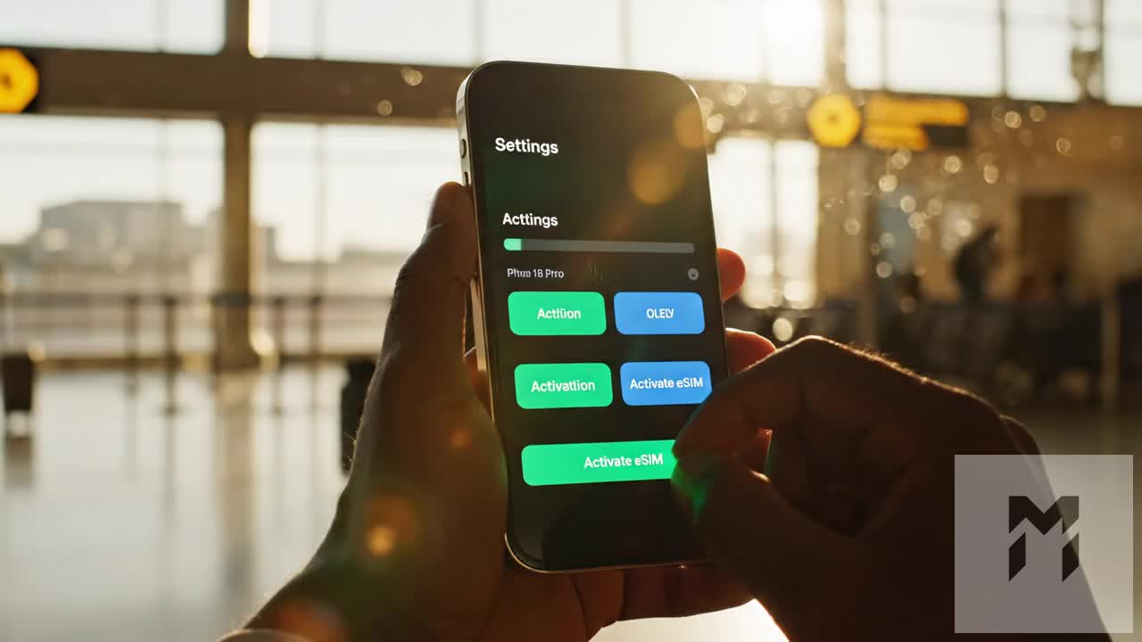
- Step 1: Install Profile: Go to Settings > Cellular / Mobile Service > Add eSIM (iOS) or Settings > Network & internet > SIMs > Add SIM (Android). Scan the QR code delivered in your MollySIM confirmation email.
- Step 2: Assign Line Labels: Label your physical home carrier as Primary (for incoming emergency 2FA SMS) and your travel profile as Croatia Marine Data.
- Step 3: Route Cellular Data: Select your travel eSIM as the dedicated Cellular Data line.
- Step 4: Lock Data Switching: Toggle "Allow Cellular Data Switching" OFF on iOS (or "Auto Data Switching" OFF on Android). This prevents your phone from silently burning through exorbitant international roaming rates on your domestic carrier when offshore signals dip.
- Step 5: Enable Data Roaming: Tap into your travel profile settings and toggle Data Roaming ON. Because regional travel eSIMs leverage multi-network agreements (roaming seamlessly across A1, HT, and Telemach towers), roaming must be enabled to register on local base stations.
- Step 6: APN Configuration: Leave the Access Point Name (APN) set to Auto. MollySIM profiles auto-detect and populate correct carrier APN parameters immediately upon local handshake.
2. Dockside Marina Wi-Fi Pre-Caching Checklist
High-bandwidth maritime assets should be downloaded over land-based high-speed broadband before casting off to save your cellular payload for live routing and safety telemetry:
- Pre-Cache High-Res Bathymetry: Open Navionics Boating or C-MAP, set your map selection to cover the entire Dalmatian Coast (from Zadar down to Kotor), and download all vector tiles, depth contours, and SonarCharts for offline rendering.
- Download Offline Satellite Layers: In Google Maps and Apple Maps, download regional offline bounding boxes for the islands on your float plan (Brač, Hvar, Vis, Korčula, and Lastovo).
- Save Windy / ECMWF Base Maps: Pre-load high-resolution satellite topography overlays to minimize payload requests to raw numeric GRIB updates when downloading live weather offshore.
3. Vessel Battery Management & Data Optimization Under Sail
Living aboard a charter yacht requires active conservation of the boat’s 12V DC service battery banks, especially during multi-day anchorages in remote coves without shore power.
| Optimization Layer | Action Required | Marine & Power Benefit |
|---|---|---|
| Direct 12V DC Charging | Charge devices using 12V cigarette-lighter USB-C PD adapters rather than yacht 230V AC inverters. | Eliminates the 15–20% inverter conversion power loss, preserving boat house batteries while anchored. |
| Disable Cloud Auto-Sync | Pause background sync in Settings > Photos > Cellular Data (iOS) and Google Photos > Backup (Android). | Prevents 4K sailing clips from quietly devouring high-speed data allowances mid-passage. |
| Engage Low Data Mode | Toggle Low Data Mode ON inside your travel eSIM cellular profile settings. | Blocks background app refresh, automatic firmware updates, and unprompted video caching while under sail. |
Even if heavy media uploads temporarily exhaust your high-speed quota, MollySIM automatically engages a 384 kbps Fair Use Policy (FUP) safety baseline—nearly triple the industry-standard 128 kbps throttles. This ensures critical operational tools like Apple Pay, Google Maps land navigation in harbor towns, anchor dragging alarms, and WhatsApp emergency pings continue running without disruption.
Dalmatian Route Guide: Real-World Coverage Insights from Split to Dubrovnik
The Dalmatian coastline presents a unique radio frequency environment. Coastal towers (bazne stanice) mounted on mainland mountain ridges—such as Mount Biokovo and Vidova Gora—broadcast high-band LTE and 5G signals far across the water. However, dramatic karst limestone geology creates severe terrain shadowing in deep southern bays and behind uninhabited outer islets.
Navigating this corridor requires knowing where your connection will peak and where local topography demands offline preparation.
Port-by-Port Network Performance & Anchorages
| Port / Anchorage | Dominant Network Tier | Average Speeds (Down / Up) | Tactical Marine & Tech Insight |
|---|---|---|---|
| Split (ACI Marina & Marina Kaštela) | 5G Ultra-Wideband | 350 / 65 Mbps | Dense macro-cell coverage across the Split peninsula. Optimal location to install your MollySIM profile, run firmware updates, and download offline nautical charts. |
| Brač (Zlatni Rat & Bol) | 5G / 4G+ Carrier Aggregation | 180 / 40 Mbps | Direct line-of-sight from the Vidova Gora transmitter (778m elevation). High-speed coverage extends over 6 nautical miles south into the Hvar Channel. |
| Hvar Town & Palmižana (Pakleni Otoci) | 5G (Hvar) / 4G+ (Pakleni) | 85 / 25 Mbps | Hvar Town harbor suffers severe RF congestion during peak July/August Yacht Week flotillas. Anchoring in Palmižana’s Vinogradišće Bay provides cleaner carrier handshakes with lower latency. |
| Vis (Komiža & Stiniva Cove) | 4G LTE | 45 / 15 Mbps | Outer island perimeter. Komiža harbor retains stable 4G, but the high cliff walls of Stiniva Cove completely block cellular signal at sea level. Log anchor alarms before entering. |
| Biševo (Blue Cave) | Intermittent 3G / 4G | 10 / 2 Mbps | Outer oceanic exposure. High rock faces shadow mainland signals. Expect intermittent dropouts while staging on mooring buoys outside the cave entrance. |
| Korčula Town & Pelješac Channel | 5G / 4G+ | 210 / 50 Mbps | The narrow channel acts as a natural signal corridor, illuminated by multi-band towers on both the Pelješac peninsula and Korčula's eastern ridge. Exceptional stability while under sail. |
| Mljet (Polače & Pomena) | 4G LTE | 35 / 10 Mbps | Deep fjord-like anchorages sheltered by dense aleppo pine forests. High-speed 5G is unavailable inside the National Park boundaries, but 4G remains rock-solid for remote work. |
| Elafiti Archipelago (Šipan & Lopud) | 5G / 4G+ | 140 / 35 Mbps | Unobstructed line-of-sight to the Dubrovnik coastal array. Seamless streaming and reliable data while anchored in Šipan’s Luka cove. |
| Dubrovnik (Old Town Anchorage & ACI) | 5G Ultra-Wideband | 400 / 80 Mbps | Massive network density. Full gigabit-tier mobile performance returns from Gruž Harbor down to the outer anchorage below Lovrijenac fortress. |
Tactical Connectivity Strategies for Outer Anchorages
- Pre-Cache Charts Before Rounding Southern Capes: The outer southern coasts of Vis, Sušac, and Lastovo face the open Adriatic toward Italy. While MollySIM automatically latches onto the strongest available Croatian infrastructure (roaming seamlessly between Hrvatski Telekom and A1 Hrvatska), physical stone headlands will block high-frequency bands. Pre-load your Navionics tiles, Windy ECMWF weather models, and harbor reservation confirmations before dropping anchor in steep-walled coves.
- Anchor Watch Resiliency: If your boat swings deep into an RF blind spot, high-bandwidth apps will pause. Because MollySIM enforces an active 384 kbps Fair Use baseline even under extreme network deprioritization or data exhaustion, critical low-bandwidth sockets—such as GPS anchor dragging telemetry, NMEA Wi-Fi bridge alerts, and emergency messaging—remain operational without requiring shore Wi-Fi.
The Skipper & Crew Pre-Sail Tech Checklist
Before dropping mooring lines at the charter base, complete this seven-point technical audit:
- [ ] eSIM Provisioning: Install and label your MollySIM profile prior to boarding; set it as the dedicated Cellular Data line while retaining your primary physical SIM for home-bank 2FA SMS.
- [ ] Offline Navigation Assets: Download offline map areas inside Google Maps and Apple Maps for Split-Dalmatia and Dubrovnik-Neretva counties.
- [ ] Marine Chart Synchronization: Update and cache all Navionics / C-MAP regional charts over marina high-speed Wi-Fi.
- [ ] Cloud Upload Restraint: Switch iCloud Backup, Google Photos, and OneDrive syncing to Wi-Fi Only to prevent continuous 4K video uploads while sailing offshore.
- [ ] 12V Charging Redundancy: Verify you have at least two 12V DC cigarette-lighter USB-C Power Delivery (PD) plugs (45W+ recommended) to charge navigation tablets directly from house batteries.
- [ ] Roaming Data Mode: Confirm that Data Roaming is toggled ON within your eSIM settings menu to permit instant handovers between island-based cellular towers.
- [ ] Emergency Contact Storage: Store local VHF channels (Split Radio VHF Ch 07/21/28, Dubrovnik Radio VHF Ch 04/07), harbor master frequencies, and maritime rescue (MRCC Rijeka: +385 1 195) directly in your phone’s local memory.
🌐 Global Travel High-Speed Travel eSIM & SIM Plans
Instant QR code activation, hotspot enabled, with guaranteed 384kbps fallback speed to keep Maps & Digital Wallets active.