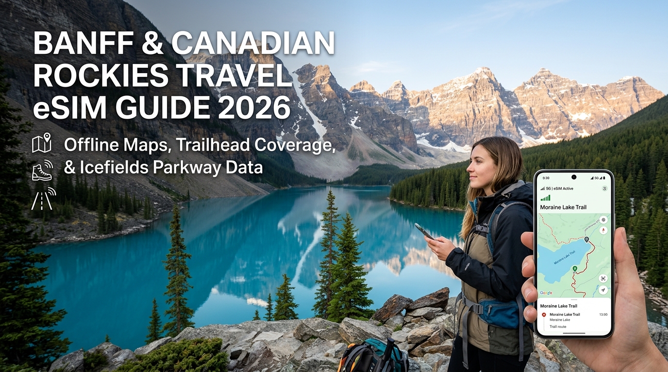
Canadian Rockies Mobile Infrastructure: Telus, Bell, and Rogers Mountain Coverage Breakdown
Understanding mobile coverage across Banff, Jasper, Yoho, and Kootenay National Parks requires examining the physical deployment of Radio Access Networks (RAN) through jagged glacial geography. Unlike flat metropolitan zones where cell towers are arranged in dense hexagonal grids, alpine mobile infrastructure in Western Canada is strictly linear, constrained by towering limestone massifs, deep valley cuts, and strict environmental development caps enforced by Parks Canada.
The Physics of Mountain Telephony: Low-Band Spectrum Deployment
In Western Canada, Telus and Bell operate an extensive infrastructure-sharing partnership. Under this Multi-Operator Core Network (MOCN) agreement, Telus builds and maintains the physical cellular towers and radio equipment throughout Alberta and British Columbia, while Bell leases access to that shared RAN.
To achieve maximum signal propagation through rock-walled corridors, carriers rely heavily on sub-1GHz low-band spectrum:
- 600 MHz (Band 71 / n71): Deployed primarily by Telus and Rogers, this ultra-low frequency provides long-range coverage and penetrates dense subalpine spruce-fir canopies.
- 700 MHz (Bands 12, 13, 17): The structural backbone of highway coverage in the Rockies. With wavelengths measuring roughly 40–43 cm, these signals refract more effectively around mountain spurs than higher-frequency mid-band spectrum (AWS/1900 MHz).
- Rogers Independent RAN: Unlike Bell, Rogers deploys and operates its own discrete cell network in Alberta. While Rogers has expanded its footprint along primary transport corridors using 600 MHz and 700 MHz spectrum, its overall macro-site density along secondary mountain arteries remains lower than the shared Telus/Bell grid.
| Carrier Network | Primary Alpine Bands | Deployment Model | Banff / Lake Louise Townsite Performance | Remote Highway / Backcountry Density |
|---|---|---|---|---|
| Telus | B71 (600MHz), B12/13 (700MHz), B4/66 (AWS) | Primary Western RAN Host | Excellent (LTE-A / 5G sub-6) | High along Hwy 1; drops in deep valleys |
| Bell | Shared with Telus RAN | MOCN Virtual Host | Identical to Telus | Identical to Telus |
| Rogers | B71 (600MHz), B12 (700MHz), B4/66 (AWS) | Independent RAN | Excellent (LTE / 5G) | Moderate; localized gaps between park boundaries |
Topographical Bottlenecks & Ridge-Line Blind Spots
Cell sites in the Canadian Rockies are heavily concentrated along the Bow Valley Corridor (Highway 1A and Trans-Canada Highway 1). These macro towers are engineered to direct radio frequency (RF) energy parallel to the valley floor to maximize highway transit coverage.
This layout creates sharp signal drops for hikers and sightseers:
- The Knife-Edge Shadow: The moment a trail ascends behind an arête, cirque, or ridge—such as the rear switchbacks of Ha Ling Peak, the Sulphur Mountain West Ridge, or Cory Pass—the physical rock mass completely blocks the transceiver’s line of sight (LoS). Signal levels drop instantly from full LTE to
No Service. - Upward Attenuation: Highway-facing macro antennas feature electrical downtilt to focus transmission at ground-level vehicle traffic. As you climb 600 to 1,000 meters above the valley floor, you enter the upper null lobes of the antenna pattern, resulting in weak, intermittent data connections despite clear visual line-of-sight to the town below.
Overcoming Coverage Traps with Multi-Network Dynamic Switching
Because carrier infrastructure shifts between Alberta's provincial lands and federal national parks, relying on a single domestic carrier's SIM card often means getting trapped in localized dead zones. An area where a Rogers tower sits behind a ridge might still have a clear line-of-sight to a Telus site down the pass.
International travelers can resolve this by using an advanced eSIM with dynamic multi-carrier core routing. Rather than locking to a single Canadian carrier, platforms like MollySIM support direct cross-network roaming across tier-1 Canadian infrastructure (switching between Telus, Bell, and Rogers depending on local signal strength).
Additionally, remote trailheads frequently suffer from network congestion during peak summer hours, which can throttle high-speed buckets. If your high-speed quota runs out mid-trek, MollySIM enforces a 384kbps Fair Use Policy (FUP) speed limit. This is three times faster than the restrictive 128kbps throttles common among standard travel eSIMs, ensuring vector mapping on Google Maps, emergency GPS coordinate sharing, and Apple Pay transactions continue functioning at off-grid trail outposts.
Corridor-by-Corridor Connectivity Guide: Banff, Lake Louise, Moraine Lake, and Jasper
🌐 Global Travel High-Speed Travel eSIM & SIM Plans
Instant QR code activation, hotspot enabled, with guaranteed 384kbps fallback speed to keep Maps & Digital Wallets active.
Topographical shielding dictates cellular accessibility across the Canadian Rockies. High-frequency RF signals degrade rapidly when obstructed by limestone massifs, turning narrow valleys and glacial cirques into localized Faraday cages. Below is the ground-level connectivity audit across the primary transit and backcountry corridors.
1. Banff Townsite, Tunnel Mountain, and Sulphur Mountain
- Banff Commercial Core (1,383 m): Robust multi-carrier 5G coverage powered by dense macro sites along Banff Avenue and Tunnel Mountain Road. Expect download speeds exceeding 150 Mbps on both Telus/Bell shared infrastructure and Rogers.
- Tunnel Mountain Trails & Campgrounds: Unobstructed line-of-sight to the townsite ensures strong LTE-Advanced/5G across the Tunnel Mountain Summit Trail. Shadowing occurs only on the eastern perimeter of the Trailer Court campgrounds.
- Sulphur Mountain (2,281 m): The lower Gondola terminal features stable LTE. At the upper summit terminal, receivers maintain a direct, unhindered line-of-sight to Bow Valley cell towers, delivering strong LTE/5G. However, hiking along the boardwalk toward the Sanson Peak Cosmic Ray Station pushes past terrain crests, where signal jitter increases significantly.
2. Lake Louise: Village, Lakeshore, and High-Elevation Teahouses
- Lake Louise Village (1,540 m): Full sub-6 GHz 5G and LTE-A coverage centered around Samson Mall and the Highway 1 interchange.
- Fairmont Chateau Lakeshore (1,731 m): Cell towers situated along the lower access road deliver strong LTE, but severe RF congestion occurs between 09:00 and 17:00 due to high tourist density.
- Lake Agnes & Big Beehive: Cellular handshakes drop rapidly once you ascend the switchbacks past Mirror Lake. The Lake Agnes Teahouse sits inside a natural cirque that completely shields signals from the valley floor.
- Plain of Six Glaciers: Signal drops to zero approximately 2.5 km past the Chateau boathouse as the trail cuts into the high alpine moraine beneath Mount Lefroy.
3. Moraine Lake Shuttle Corridor, the Rockpile, and Sentinel Pass
Access to Moraine Lake is restricted to commercial transit and Parks Canada shuttles, making real-time ticket scanning and offline navigation critical.
- Moraine Lake Road Transit Corridor: Cellular availability is fragmented. Expect intermittent 1-bar LTE for the first 4 km from the Moraine Lake Road junction; coverage terminates entirely near the Paradise Creek trailhead.
- The Rockpile & Shoreline Trail: Low-band LTE bounces into the shoreline area, but high visitor volume causes severe packet loss. While basic SMS transmits intermittently, loading rich media fails. If network saturation pushes your data bucket into throttle mode, using MollySIM guarantees a minimum baseline speed of 384kbps (compared to the industry-standard 128kbps), providing enough sustained throughput for vector map re-routing and digital shuttle pass validation.
- Larch Valley & Sentinel Pass (2,611 m): Cellular connectivity ceases within the first 400 meters of vertical gain above the lake. Sentinel Pass occasionally registers faint, non-functional signal reflections from distant Trans-Canada Highway repeaters, but stable data sessions cannot be established.
4. Jasper Townsite, Maligne Valley, and Mount Edith Cavell
- Jasper Townsite (1,062 m): Fully restored LTE/5G coverage throughout the town footprint, Connaught Drive, and the Jasper Train Station.
- Maligne Canyon to Maligne Lake: Maligne Canyon offers stable LTE. As you drive south along Maligne Lake Road past Medicine Lake, coverage drops out permanently. The Maligne Lake boathouse and Mary Schäffer loop are total blackouts.
- Mount Edith Cavell: Cavell Road loses cellular access past the 4 km marker. The Cavell Meadows Day Use Area and the Path of the Glacier trail are entirely offline due to the massive north-face bulk of Mount Edith Cavell shielding the Athabasca Valley transmitters.
Canadian Rockies Corridor Coverage Matrix
| Region / Trailhead | Primary Network Tech | Typical Download / Latency | Dead Zone Boundary Point | Offline Maps Required? |
|---|---|---|---|---|
| Banff Core & Bow Falls | Multi-Carrier 5G / LTE | 120–250 Mbps / <35ms | None within town perimeter | Optional |
| Sulphur Mountain Summit | Line-of-Sight 5G | 45–90 Mbps / 40ms | 200m south of Cosmic Ray Station | Recommended |
| Lake Louise Lakeshore | Congested LTE / LTE-A | 5–25 Mbps / 85ms | 1 km past Chateau boathouse | Highly Recommended |
| Lake Agnes Teahouse | No Service (0 Bars) | 0 Mbps / N/A | Mirror Lake Junction | Mandatory |
| Moraine Lake / Rockpile | Fringe Band 12/13 LTE | 1–5 Mbps / 150ms+ | Switchbacks above Moraine Lake | Mandatory |
| Sentinel Pass | No Service | 0 Mbps / N/A | Larch Valley ascent base | Mandatory |
| Jasper Townsite | Tier-1 LTE / 5G | 80–160 Mbps / <40ms | 3 km outside town boundaries | Optional |
| Maligne Lake | No Service | 0 Mbps / N/A | South end of Medicine Lake | Mandatory |
| Mount Edith Cavell | No Service | 0 Mbps / N/A | Cavell Road Km 4 | Mandatory |
The Icefields Parkway (Highway 93) Blackout: Offline Maps, Safety Alerts & Alpine Workflows
The 232-kilometer stretch of Highway 93 North connecting Lake Louise to Jasper is widely considered one of the world’s most scenic alpine corridors—and one of its most unforgiving digital dead zones. Framed by towering 3,000-meter peaks and the expansive Columbia Icefield, the highway cuts through deep glacial trenches that completely block line-of-sight propagation from regional macro towers.
Outside of a hyper-localized, often congested microcell at Saskatchewan River Crossing (KM 76), you will experience zero cellular reception for nearly four hours of continuous driving. Navigating this corridor safely requires shifting from an active cellular workflow to a fully cached, offline-first digital protocol before departing town hubs.
Step 1: Pre-Cache Offline Vector Maps & Elevation Data
Relying on dynamic map tile rendering inside the parkway will leave you stranded with blank grey grids. Download your geographic data over broadband in Banff, Lake Louise, or Jasper using this three-tier mapping workflow:
- Google Maps Offline Areas:
- Open the app, tap your profile icon, select Offline Maps > Select Your Own Map.
- Drag the bounding box to capture the entire corridor from Canmore in the south to Hinton in the north, ensuring Highway 93 and all adjacent pullouts (Peyto Lake, Mistaya Canyon, Sunwapta Falls) fall within the boundary. This cache takes roughly 450 MB to 1.2 GB of local storage.
- Organic Maps (OpenStreetMap Engine):
- Download the complete Alberta (South & Central) and Alberta (North) offline regional packs.
- Why it matters: OpenStreetMap vectors render topographic contours, unpaved logging access paths, and off-grid mountain trails that Google Maps omits entirely.
- AllTrails+ / Gaia GPS Layer Caching:
- Download both the vector topographic layer and high-resolution satellite imagery for your target trailheads (e.g., Wilcox Pass, Parker Ridge, Valley of the Five Lakes).
- Ensure offline caching includes the Elevation Profile layer so you can monitor your ascent rate without network telemetry.
Step 2: Pre-Buffer Parks Canada Bulletins and Alpine Safety Feeds
Because Highway 93 passes through active avalanche paths and dense grizzly habitats, safety conditions change hourly. Cellular signals drop abruptly at the Herbert Lake pullout heading north and Athabasca Falls heading south. Load and screenshot the following real-time data feeds immediately before leaving your hotel:
- 511 Alberta Road Conditions: Take full-page offline screenshots of the Highway 93 chain-up requirements, seasonal gate closures (especially between Saskatchewan Crossing and Athabasca Falls during winter/shoulder season), and construction alerts.
- Parks Canada Trail & Area Closures: Check the official Banff and Jasper Field Unit Bulletins. Note seasonal restrictions, mandatory minimum group sizes (often enforced around seasonal berry crops to mitigate bear encounters), and bridge washouts.
- Avalanche Canada Forecasts (October through June): Download the current backcountry avalanche hazard rating for the North Rockies, Cariboos, and Banff/Yoho/Kootenay zones if you plan to step off the asphalt for backcountry ascents like Bow Hut or Cirque Peak.
Step 3: Alpine Battery Preservation & Lithium-Ion Cold Mitigation
Sub-zero ambient temperatures along the Columbia Icefield accelerate voltage sag in lithium-ion smartphone batteries. When ambient temperatures plunge below freezing:
- Internal Chemical Resistance Increases: The liquid electrolyte inside standard phone batteries thickens, increasing internal resistance. This causes the battery management system (BMS) to misread the sudden voltage drop as a depleted cell, triggering spontaneous device shutdown even at 30%–40% reported capacity.
- Aggressive Network Search Exhaustion: In dead zones, baseband modems cycle through maximum transmission power (up to 23 dBm) attempting to handshake with non-existent cell towers. This generates rapid thermal battery cycling and drains power up to 400% faster than normal.
Alpine Cold-Weather Checklist:
- Force Airplane Mode: Keep GPS/Location services active while disabling cellular and Wi-Fi radios. The GPS receiver is purely passive and does not broadcast an outbound signal, preserving critical watt-hours.
- Body-Core Device Storage: Keep your phone in an internal zippered jacket pocket directly over your base layer, using your body heat to keep the cell above 15°C (59°F). Avoid outer shell pockets or uninsulated backpack sleeves.
- Thermal Isolation During Mount Use: If using a windshield or dashboard phone mount for offline car navigation, position the cradle directly in front of an active cabin heater vent to prevent terminal cooling.
Border Reconnection & Edge-Data Resumption
When you eventually exit the Highway 93 blackout zone—reaching the outskirts of Jasper Townsite or returning south into Lake Louise—your device will immediately face high network demand as queued background processes sync.
Using an optimized provider like MollySIM guarantees that once you hit the micro-LTE coverage fringe at Saskatchewan River Crossing or re-enter municipal boundaries, your connection resolves instantly across multi-network footprints (Telus, Bell, and Rogers). Furthermore, if you exhaust your primary high-speed data tier while caching satellite imagery, MollySIM’s 384 kbps Fair Use Policy (FUP) speed floor—nearly 3x faster than the industry standard 128 kbps throttles—delivers enough continuous bandwidth to process live Google Maps vector reroutes, verify digital park gate passes, and complete Apple Pay transactions without stalling.
Connectivity Comparison for Rockies Travelers: Local SIM vs. Pocket Wi-Fi vs. Multi-Network eSIM
Navigating remote alpine corridors across Banff, Jasper, Yoho, and Kootenay National Parks demands a connectivity strategy engineered for challenging topographies and severe weather. Unlike standard urban travel where single-carrier coverage suffices, the Canadian Rockies present a patchwork of infrastructure: Bell and Telus operate shared radio access network (RAN) towers along certain highway stretches, while Rogers maintains distinct proprietary cell sites around specific town perimeters and recreation hubs.
Selecting the wrong hardware setup can leave you stranded without navigation or emergency communication when crossing between cellular coverage zones.
| Metric | Local Physical SIM (Telus / Rogers) | Pocket Wi-Fi Rental Unit | Single-Network Roaming eSIM | Multi-Network Travel eSIM (MollySIM) |
|---|---|---|---|---|
| Network Redundancy | None (Locked to single domestic network) | None (Locked to rental vendor's contracted SIM) | Poor (Tied to a single Canadian partner) | Excellent (Dynamically switches between Telus, Bell, & Rogers) |
| Sub-Zero Cold Resilience | High (Protected inside phone chassis) | Critical Failure Risk (External unit freezes quickly) | High (Embedded software profile) | High (Embedded software profile) |
| Hardware Overhead | Replaces home SIM (physical swap required) | High (Requires carrying & charging secondary unit) | None (Instant digital download) | None (Instant zero-waste digital activation) |
| Backcountry Fringe Recovery | Slow (Manual re-scan often required) | Moderate (Dependent on Wi-Fi relay latency) | Slow to Moderate (Limited carrier handshake) | Fast (Instant IMSI switching to strongest tower) |
| Data Cap / FUP Behavior | Hard shutoff or expensive domestic overage ($15/GB) | Extreme throttling (Typically capped at 64–128 kbps) | Aggressive throttling (Standard 128 kbps cutoff) | Sustained 384 kbps FUP (3x standard speed; runs Maps & Apple Pay) |
| Cost Efficiency | Low (High activation fees + tourist rate markups) | Low (Daily hardware rental + deposit + return shipping) | Moderate (Pay per fixed gigabyte tier) | High (Tiered data packages with no hardware overhead) |
The Hardware Vulnerability: Why Pocket Wi-Fi Fails in Alpine Environments
While portable Pocket Wi-Fi hot spots remain common rentals at Vancouver (YVR) and Calgary (YYC) airports, they represent a significant single point of failure in sub-alpine conditions:
- Dual Thermal Depletion: Operating a Pocket Wi-Fi unit requires maintaining two active lithium-ion batteries in freezing ambient temperatures—your smartphone and the hotspot unit itself. When pack temperatures drop below 0°C (32°F) on trails like Plain of Six Glaciers or Sentinel Pass, the uninsulated battery inside a pocket hotspot suffers rapid voltage drops, prompting unexpected system shutdowns.
- Signal Latency Cascades: Transmitting data through a mobile hotspot introduces an extra Wi-Fi hop between your phone and the cellular tower. In edge-coverage environments where signal-to-noise ratios (SNR) are already degraded by mountain topography, this extra relay often results in packet loss, stalled offline map downloads, and high battery consumption as your phone struggles to maintain the local Wi-Fi link.
Dynamic Roaming: Why Multi-Network eSIM Architecture Wins
The distinct advantage of deploying a multi-carrier profile like MollySIM in Western Canada lies in its ability to negotiate with multiple tier-1 host networks. If a Telus transponder behind Mount Rundle is obstructed by sheer limestone topography, a multi-network profile can auto-switch to a line-of-sight Rogers microcell without requiring you to remove gloves, reboot your device, or search for physical SIM trays in sub-zero winds.
Furthermore, if high-resolution topographical caching or route streaming consumes your high-speed allowance, MollySIM’s built-in 384 kbps Fair Use Policy (FUP) speed floor keeps your device functional. While standard single-carrier travel eSIMs throttle down to an unusable 128 kbps—rendering vector map updates and dynamic GPS routing non-functional—a 384 kbps continuous data stream maintains real-time satellite positioning, processes park entrance QR verifications, and authorizes digital wallet transactions seamlessly.
Why MollySIM Is Built for Mountain Travel: Multi-Carrier Switching & The 384kbps Navigation Lifeline
Operating cellular devices in high-altitude, variable-terrain environments like Banff, Yoho, and Jasper requires an architecture engineered specifically for geographic dead zones and dynamic RF (radio frequency) variance. Standard single-network travel eSIMs tether your handset to a single Canadian carrier's roaming agreement. If you traverse an arête or enter a glacial trench where that specific carrier lacks tower density, your connection drops entirely—even if an alternate carrier has an active microcell within visual range.
Dynamic IMSI Switching: Auto-Negotiating Carrier Dominance
MollySIM solves the fragmentation of Canadian wilderness coverage by deploying dynamic International Mobile Subscriber Identity (IMSI) switching. Rather than binding your device to a static routing path, the underlying SIM profile continuously monitors baseband signal metrics—specifically Reference Signal Received Power (RSRP) and Signal-to-Interference-plus-Noise Ratio (SINR).
When you navigate deep bends along the Bow Valley Parkway or climb toward Bow Pass where Telus’s low-band B12/B13 signals might degrade behind limestone massifs, the profile automatically negotiates an OTA (Over-The-Air) handover to Rogers’ line-of-sight transponders. This dual-core tier-1 redundancy eliminates the need to manually toggle network operators in your device settings while driving, preventing connection drops during critical navigation junctions.
The 384kbps Safety Baseline: Engineered for Redundancy
A major hazard for alpine travelers using budget eSIMs is the data cliff. Most international roaming providers implement one of two aggressive policies once your high-speed quota is reached:
- Hard Disconnects: Zero packet transmission, instantly disabling live routing and cloud-dependent services.
- Severe Throttling (64 kbps – 128 kbps): At this rate, standard HTTPS/TLS cryptographic handshakes fail due to packet timeouts, rendering modern smartphone apps completely non-responsive.
MollySIM integrates a guaranteed 384 kbps Fair Use Policy (FUP) speed floor across all its unlimited and fixed-tier data plans. Operating at three times the speed of conventional 128 kbps throttles, 384 kbps represents the exact technical threshold required to keep core navigation, transactional, and emergency telemetry active.
| Functionality | Standard Throttled eSIM (64–128 kbps) | MollySIM Safety Baseline (384 kbps) |
|---|---|---|
| Vector Map Streaming (Google / Apple Maps) | ❌ Fails (Network Timeout) | ✅ Smooth Turn-by-Turn Dynamic Rerouting |
| Emergency Text Messaging (WhatsApp / iMessage) | ⚠️ Unreliable / High Packet Loss | ✅ Instant Delivery & GPS Coordinate Sharing |
| Digital Wallet / Passes (Apple Pay / Parks Canada QR) | ❌ Token Authorization Fails | ✅ Instant POS Authentication |
| Trail Condition Updates (Parks Canada Bulletins) | ❌ Browser Stalls | ✅ Lightweight Mobile Web Rendering |
| Topographic Tile Caching (AllTrails / Gaia GPS) | ❌ Stalls | ✅ Progressive Vector Loading |
Even if you exhaust your high-speed data tier while documenting the Athabasca Glacier, your phone does not transform into a brick. The sustained 384 kbps pipeline ensures you can continuously stream low-overhead map data, look up trail condition warnings, authenticate mobile park entry passes, and send text-based SOS updates to local dispatchers or travel companions without purchasing an immediate top-up.
Step-by-Step eSIM Setup & Optimal Roaming Settings for Alberta Travel
Configuring your smartphone properly before boarding your flight ensures you hit the ground in Calgary (YYC) or Edmonton (YEG) with instant, low-latency connectivity—without accidentally triggering extortionate international roaming day passes from your home carrier.
Follow this battle-tested configuration workflow to ensure your primary line remains active for critical two-factor authentication (2FA) SMS while routing all cellular data through MollySIM.
   ┌────────────────────────────────────────────────────────┐
   │            OPTIMAL DUAL-SIM ARCHITECTURE               │
   ├──────────────────────────┬─────────────────────────────┤
   │ Primary SIM (Home)       │ • Calls & SMS (2FA) Active  │
   │                          │ • Data Roaming: OFF         │
   ├──────────────────────────┼─────────────────────────────┤
   │ MollySIM (Travel eSIM)   │ • Cellular Data: ACTIVE     │
   │                          │ • Data Roaming: ON          │
   │                          │ • Backup Speed: 384 kbps    │
   └──────────────────────────┴─────────────────────────────┘
1. Pre-Departure: Install the Profile on Stable Wi-Fi
Never wait until you land at the airport to install your eSIM on congested public Wi-Fi. Provision the profile at home 24 hours before your departure.
- iOS (iPhone XS & Newer):
- Navigate to Settings > Cellular (or Mobile Data) > Add eSIM.
- Select Use QR Code and scan the activation QR provided in your MollySIM confirmation email.
- When prompted to label your plans, rename your domestic carrier as "Home" and the new profile as "MollySIM Canada".
- Android (Google Pixel / Samsung Galaxy S20+):
- Go to Settings > Network & Internet (or Connections) > SIM Manager.
- Tap Add Mobile Plan / Add eSIM > Scan QR Code.
- Scan your code, confirm the download, and label the eSIM profile accordingly.
2. Configure Dual-SIM Lines to Prevent Carrier Bill Shock
To receive banking verification codes via SMS without paying $12–$16/day in domestic carrier roaming fees, isolate your data pipeline:
| Setting Field | Target Configuration | Technical Purpose |
|---|---|---|
| Default Voice Line | Primary / Home SIM | Keeps your native number reachable for direct calls and emergency contacts. |
| Cellular Data | MollySIM Canada | Routes all mobile data traffic through local Canadian carrier infrastructure. |
| Allow Cellular Data Switching | DISABLED / OFF | Critical: Prevents your phone from silently using expensive home data if MollySIM hits a temporary dead zone. |
| Home SIM Data Roaming | DISABLED / OFF | Blocks accidental background data sync on your domestic SIM plan. |
3. Arrival in Alberta: Toggle Roaming & Verify Network Attach
Once your flight touches down in Alberta, finalize the data handshake:
- Go to your MollySIM profile settings and switch Turn On This Line to ON.
- Toggle Data Roaming to ON under the MollySIM profile. (Note: Roaming must be active for travel eSIMs to access partner towers like Telus and Rogers).
- APN Configuration: MollySIM automatically populates the Access Point Name (APN). If your device does not connect within 60 seconds, ensure the APN field matches the instructions in your activation email (typically
globaldataor auto-assigned) and restart your device.
4. Cold-Weather Battery & Data Optimization for Backcountry Treks
Sub-zero temperatures in places like Lake Louise and Johnston Canyon accelerate battery depletion, while constant signal-hunting in fringe zones drains reserves even faster. Optimize your device before heading past the park gates:
- Disable Non-Essential Background App Refresh: Go to Settings > General > Background App Refresh and disable social media, video, and cloud backup apps. Keep navigation (Gaia GPS, AllTrails, Google Maps) enabled.
- Pre-Cache Media and Vector Maps: Download your Spotify playlists and offline map boundaries over hotel Wi-Fi.
- Leverage the 384 kbps Safety Baseline: If you consume your high-speed quota while recording high-resolution alpine videos, MollySIM’s built-in 384 kbps Fair Use Policy (FUP) floor ensures your background telemetry—such as live GPS trail tracking, Apple Pay park passes, and instant messaging—continues working without requiring an emergency top-up in the field.
5. Backcountry Emergency Communication Protocol
When entering remote territory such as the Skoki Valley, Rockwall Trail, or deep sections of the Icefields Parkway:
- True Emergency (911): Canadian CRTC regulations mandate that any mobile phone can connect to any available carrier tower for emergency 911 calls, regardless of whether your specific SIM has active coverage on that specific network.
- Text-Based SOS via Messenger: SMS and low-overhead data packets punch through weak, fluctuating single-bar signals far more reliably than voice calls. Use MollySIM to transmit your exact GPS coordinates via WhatsApp, iMessage, or email to your emergency contact before descending into steep valley floors.
🌐 Global Travel High-Speed Travel eSIM & SIM Plans
Instant QR code activation, hotspot enabled, with guaranteed 384kbps fallback speed to keep Maps & Digital Wallets active.