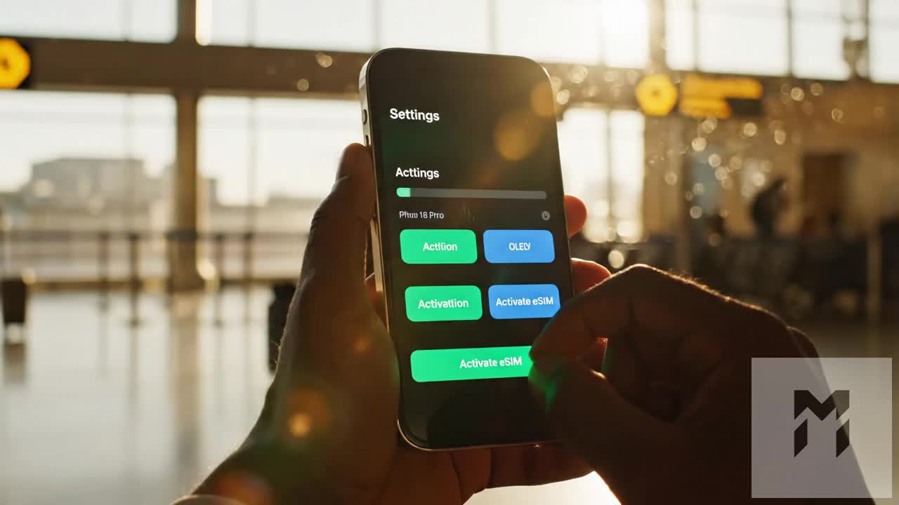
Bali to Komodo & Flores: The Ultimate 2026 Island-Hopping Travel eSIM & Liveaboard Data Guide
The 2026 Island-Hopping Blueprint: Transit Routes from Bali to Komodo and Beyond
Navigating the Indonesian archipelago from the hyper-connected hubs of Bali to the rugged, untamed frontiers of East Nusa Tenggara (NTT) requires a distinct tactical shift in how you manage travel logistics and mobile connectivity. In 2026, the classic island-hopping itinerary no longer ends at the resort enclaves of Uluwatu or Canggu; it pushes eastward across the Wallace Line into the world-class marine reserves of Komodo National Park and deep into the volcanic interior of Flores.
The Transit Pipeline: Sea Corridors and Volcanic Arteries
The route typically unfolds across three distinct geographic stages:
- The Air Transit Bridge (DPS to LBJ): A 60-minute domestic hop taking you from Ngurah Rai International Airport (DPS) over the Lombok Strait and Sumbawa to Komodo Airport (LBJ) in Labuan Bajo.
- The Marine Perimeter (Komodo National Park): Multi-day expeditions aboard traditional phinisi schooners or motorized yachts cruising between Padar Island, Rinca, Komodo Island, and remote dive sites like Batu Bolong and Castle Rock.
- The Overland Traverse (The Trans-Flores Highway): A grueling yet breathtaking 660-kilometer overland route tracing winding mountain passes from Labuan Bajo through the spiderweb rice fields of Ruteng, the traditional megalithic villages of Bajawa, the tri-colored volcanic crater lakes of Mount Kelimutu near Ende, and ending at the coastal port of Maumere.
The Connectivity Divergence: Bali Infrastructure vs. East Nusa Tenggara (NTT)
While Bali offers dense LTE-A and expanding urban 5G networks, the telecommunications landscape shifts radically once you enter East Nusa Tenggara.
| Transit Leg | Primary Terrain | Network Architecture | Connectivity Reality |
|---|---|---|---|
| Bali (Denpasar/Ubud) | Urban / Suburban Plains | High-density 4G/5G Microcells | Seamless, high-bandwidth streaming |
| Labuan Bajo Town | Coastal Harbor Basin | 4G Macro Towers | Stable near the marina; drops inland |
| Komodo National Park | Open Water / Karst Islands | Isolated Island Towers (Telkomsel base) | Intermittent; line-of-sight dependent |
| Trans-Flores Highway | Mountain Ridges & Valleys | Single-carrier terrestrial masts | Signal dead-zones in deep river canyons |
In the open waters of the Lintah Strait or inside the caldera valleys of central Flores, cellular coverage relies on line-of-sight connections to solitary transmission towers perched atop high volcanic peaks. Bandwidth fluctuations are constant, making network priority and fallback speeds critical for maintaining navigation and communication.
Eliminating the 2026 Bea Cukai Airport Bottleneck
A major pain point for international travelers landing in Indonesia is the strict *IMEI registration mandate enforced by Indonesian Customs (Bea Cukai)*.
Under Indonesian regulations, foreign devices using local physical SIM cards purchased at street kiosks must undergo device registration, IMEI tax assessments, and biometric verification at airport customs counters. Attempting to navigate this process upon landing at Bali (DPS) before a tight regional connection to Labuan Bajo frequently leads to:
- Severe Terminal Delays: Waiting in multi-hour customs queues during peak international arrival banks.
- Unnecessary Import Taxes: Potential duty assessments on high-end hardware if remaining in Indonesia beyond standard tourist allowances.
- Bureaucratic Rejections: Device blacklisting on regional base transceivers if registration paperwork contains typographical errors.
Deploying a pre-configured digital solution such as a travel eSIM completely bypasses local hardware tax registration queues. By utilizing an authorized roaming profile, your foreign device connects directly to local partner networks—such as Telkomsel and Indosat Ooredoo Hutchison—the moment your flight touches down at LBJ.
Sustaining Mission-Critical Data in Fringe Zones
When choosing a digital setup for remote travel, standard low-tier roaming plans often fall short due to aggressive Fair Use Policies (FUP). Many conventional travel SIMs throttle background bandwidth to an unusable 128kbps once high-speed limits are reached, completely breaking basic vector rendering in mapping apps and causing digital payment verification to time out.
Modern solutions like MollySIM address this geographic reality by maintaining an optimized 384kbps FUP speed floor—three times the baseline speed of standard competitors. This ensures that even when operating on throttled data or navigating low-signal anchorages in Komodo, essential lightweight protocols like Google Maps routing, Apple Pay authentication, and encrypted text messaging continue to function reliably without stranding you mid-transit.
Marine Cell Towers and Carrier Infrastructure: Telkomsel vs. Indosat Across East Nusa Tenggara
🇺🇸 United States High-Speed Travel eSIM & SIM Plans
Instant QR code activation, hotspot enabled, with guaranteed 384kbps fallback speed to keep Maps & Digital Wallets active.
Navigating the waters between Flores, Rinca, and Komodo Island presents unique radio frequency (RF) propagation challenges. East Nusa Tenggara’s (NTT) rugged volcanic topography acts as both a natural antenna platform and a physical line-of-sight barrier. To provide telecommunication coverage across the Komodo Strait and the Sape Strait, Indonesian mobile network operators deploy Base Transceiver Stations (BTS) along elevated ridges, extinct volcanic calderas, and coastal hilltops.
                                  [Coastal/Island BTS]
                                      /         \
                 LTE Band 8 (900MHz) /           \  LTE Band 3 (1800MHz)
                 Long-Range Marine  /             \ Dense Anchorages
                 (Up to 15-20 NM)  /               \ (3-5 NM High Speed)
                                  v                 v
               [Open Water Liveaboard]          [Harbor / Island Bay]
Marine RF Propagation and LTE Band Allocation
Cellular coverage across marine corridors relies on three primary Long-Term Evolution (LTE) frequency spectrums:
- Band 8 (900 MHz E-GSM): The workhorse of offshore coverage. Due to its sub-1GHz propagation characteristics, Band 8 suffers lower atmospheric attenuation and penetrates oceanic corridors up to 15 to 20 nautical miles (NM) offshore when an uninterrupted line of sight (LoS) to coastal masts exists.
- Band 3 (1800 MHz DCS): Deployed closer to population nodes and key tourist anchorages (such as Labuan Bajo port and northern Rinca). Band 3 provides higher capacity and bandwidth but decays rapidly over 5 to 7 NM from the transmitter.
- Band 1 (2100 MHz IMT): Primarily reserved for high-density voice and data traffic in urban Labuan Bajo, rarely reaching deep into the Komodo National Park.
While open seawater offers zero terrain interference, signal stability is heavily subject to tropospheric ducting, sea surface multipath reflections, and vessel shadow effects—where the steel or heavy fiberglass hull of a liveaboard cuts signal strength by 10 to 15 dBm when turned away from coastal masts.
Carrier Performance Breakdown: Telkomsel vs. Indosat vs. XL Axiata
                      TELKOMSEL               INDOSAT (IOH)               XL AXIATA
Marine Reach:   ███████████████ 15-20 NM   ████████░░░░░░ 5-8 NM      ████░░░░░░░░░░ 2-3 NM
Remote BTS:     Highest (BAKTI/USO)        Moderate                   Low / Urban Only
Komodo Park:    Reliable (Padar/Rinca)     Spotty / Fringe            Near Zero Offshore
1. Telkomsel (PT Telekomunikasi Selular)
Telkomsel maintains the most extensive cellular footprint in Eastern Indonesia, supported by government-subsidized Universal Service Obligation (USO) and BAKTI infrastructure projects. In Komodo National Park, Telkomsel operates elevated BTS installations on Mount Mbeliling (Flores mainland), high elevations on Padar Island, and coastal vantage points around Rinca Island. It offers the most consistent Band 8 marine coverage, maintaining active LTE signals through the Laju Pemana passage and northern dive hubs.
2. Indosat Ooredoo Hutchison (IOH)
Following its network integration, Indosat operates strong 4G/LTE carrier aggregation within Labuan Bajo town, Ruteng, and Ende. However, offshore penetration drops sharply beyond 5 to 8 NM from mainland Flores. While reliable for shore excursions and harbor anchorages, Indosat experiences sustained blind spots across western Komodo Island and the southern dive sites of Horseshoe Bay.
3. XL Axiata
XL Axiata focuses capital expenditure on high-density tourism corridors in Bali and Lombok. In East Nusa Tenggara, XL’s infrastructure is largely limited to urban municipal centers along the Trans-Flores Highway. Offshore marine coverage within the National Park is practically non-existent once a vessel departs Labuan Bajo Marina.
Infrastructure and Deployment Matrix
The table below evaluates real-world carrier performance, hardware friction, and remote fail-safes across the Lesser Sunda marine corridor:
| Metric / Evaluation Feature | Telkomsel (Local Prepaid) | Indosat OOH (Local Prepaid) | Airport Tourist Physical SIM | MollySIM Travel eSIM |
|---|---|---|---|---|
| Labuan Bajo Core Speeds (DL/UL) | 65–120 Mbps / 25 Mbps | 40–85 Mbps / 18 Mbps | 30–60 Mbps / 10 Mbps | 75–130 Mbps / 30 Mbps |
| Marine Park Line-of-Sight Range | 12–20 Nautical Miles | 5–8 Nautical Miles | 5–12 Nautical Miles (carrier-dependent) | 15–20 Nautical Miles (Tier-1 Routing) |
| Active LTE Marine Bands | B8 (900MHz), B3 (1800MHz) | B3 (1800MHz), B1 (2100MHz) | Variable | B8, B3, B1 Auto-Switching |
| KYC / Device IMEI Friction | High (Store queues, Passport/IMEI forms) | High (Store queues, Passport/IMEI forms) | Extreme (Airport line, hardware tax verification) | Zero (Instant QR activation, No IMEI tax) |
| Multi-Carrier Redundancy | Single Carrier Locked | Single Carrier Locked | Single Carrier Locked | Dynamic Multi-Network Auto-Switching |
| FUP Throttling Speed Floor | 64 kbps – 128 kbps | 64 kbps – 128 kbps | 64 kbps – 128 kbps | 384 kbps (High-Floor FUP) |
| Operational Impact of FUP | Times out Maps / Apple Pay | Times out Maps / Apple Pay | Complete payload drop | Smooth Maps, Messaging & Wallet Auth |
When transiting between island shadow zones, carrier routing flexibility is critical. While a localized physical SIM tethers your hardware to a single operator's tower availability, using an optimized roaming profile via MollySIM allows your device to seamlessly negotiate connections with the strongest local transceivers.
Furthermore, if daily high-speed allocations are exhausted while tracking navigational waypoints or processing harbor clearances, MollySIM’s built-in 384kbps Fair Use Policy floor prevents terminal packet loss—delivering three times the bandwidth of standard 128kbps throttles and keeping vector navigation, live messaging, and digital wallets fully operational in remote waters.
Liveaboard Cruise Dead Zones: Managing Connectivity Around Padar, Rinca, and Manta Point
Navigating the waters of Komodo National Park aboard a multi-day Phinisi liveaboard presents unique Radio Frequency (RF) challenges. The park’s volcanic topography creates a patchwork of razor-sharp signal cliffs, where a shift of just 200 meters behind an island ridge can drop a 4G connection from full capacity to absolute radio silence.
Understanding how base transceiver stations (BTS) propagate across the Savu Sea allows you to anticipate dead zones, plan critical communications, and keep navigational data flowing.
Marine Coverage Map: Key Liveaboard Micro-Zones
| Micro-Zone / Waypoint | Coverage Reliability | Primary Band | Operational Reality & Propagation Notes |
|---|---|---|---|
| Padar Island (East Bay) | High (4G LTE) | Band 8 (900MHz), Band 3 | Strong line-of-sight (LoS) back toward mainland Flores towers. Fast uplink for photo backups at the main trail launch. |
| Padar (West Coast & Pink Beach) | None (Dead Zone) | N/A | Total topographic masking. The island’s central spine completely deflects RF propagation. |
| Rinca Island (Loh Buaya) | Moderate–High | Band 8 (900MHz) | Reliable coverage near the park ranger station and jetty via localized macro-cells; fades quickly in southern bays. |
| Manta Point (Makassar Reef) | Unstable (1–2 Bars) | Band 8 (900MHz) | Open-water fringe coverage. Prone to severe RF multipath interference off the water surface, causing latency spikes and dropped voice packets. |
| Batu Bolong & Current Slings | Intermittent (Edge/4G) | Band 8 (900MHz) | Low-elevation signal bouncing off surrounding islets. Suitable for text-based payloads only. |
| Gili Lawa Darat / Laut | None (Dead Zone) | N/A | Deep topographic shadow behind northern Komodo. Zero cellular reach across all commercial bands. |
| Horseshoe Bay (South Rinca) | None (Dead Zone) | N/A | Towering volcanic caldera walls block all mainland and coastal transmissions. Complete radio isolation. |
Phinisi Hull Attenuation and the "Below-Deck Blackout"
Traditional Indonesian Phinisi yachts are hand-crafted from dense tropical hardwoods—primarily *Ironwood (kayu ulin) and Teak*. While structurally magnificent, ironwood has a high specific gravity and moisture retention, making it an aggressive RF attenuator.
Taking your handset down into a lower-deck cabin frequently results in a -15 dBm to -28 dBm signal penalty, pushing an otherwise usable edge signal into terminal disconnection.
Deck Placement Strategies:
- Position for Uplink: Leave your device on the open-air sun deck, covered bridge, or high aft-lounge when attempting to download marine weather updates or sync cloud drives.
- Avoid Handset Traps: Never leave your device inside metal storage lockers or low wooden nightstands, which compound material attenuation.
Combating Battery Drain and Tower-Search Cycles
When cruising past the northern capes of Komodo into known dead zones like Gili Lawa Darat, your smartphone’s baseband processor detects the falling Signal-to-Noise Ratio (SNR) and ramps its internal RF power amplifier to maximum (+23 dBm / ~200 mW). Left unmanaged, this aggressive loop of continuous tower-polling rapidly drains battery banks and causes excessive thermal throttling.
- Pre-Cache Vector Charts: Download offline tiles on Navionics, Windy, or Google Maps before lifting anchor from Labuan Bajo or Padar East.
- Engage Flight Mode During Island Transits: If transiting through the northern straits, force Flight Mode to save 40–60% of your battery for photography and GPS logging.
- Deploy Auto-Switching eSIM Architecture: Because cellular footprints flicker across isolated straits, hardware locked to a single local network will fail indefinitely once that specific carrier's node drops off.
Using MollySIM mitigates this by dynamically routing through the strongest prevailing transceiver along the coast. Even when data allocations run low during heavy shipboard usage, MollySIM’s built-in 384kbps Fair Use Policy floor—running at triple the bandwidth of standard 128kbps limits—maintains continuous packet streams for vector GPS tracking, GRIB weather file updates, and emergency messaging the exact moment your Phinisi clears an island headland.
Step-by-Step Technical Setup: APN Configuration, Offline Navigation, and Diving Log Syncing
Configuring your operating system prior to stepping onto the dive deck at Labuan Bajo Harbour guarantees your handsets won’t get trapped in infinite roaming handshakes or exhaust monthly quotas during brief offshore line-of-sight (LoS) transmissions. Complete these hardware and software adjustments before casting off.
1. Cellular APN Verification & Network Selection
Modern travel eSIMs automatically provision their Access Point Names (APNs), but multi-network profiles can occasionally default to generic carrier strings that fail to establish PDP contexts on regional Indonesian towers (Telkomsel/Indosat).
On iOS (iPhone 13 through iPhone 16 / Pro):
- Navigate to Settings > Cellular / Mobile Data.
- Select your travel eSIM line under SIMs and toggle Turn On This Line to active.
- Tap Cellular Data Network. Ensure the APN field under Cellular Data and LTE Setup matches your provider’s profile (for MollySIM, this automatically populates; if blank, enter the string provided in your installation email). Leave Username and Password blank.
- Return to the eSIM menu, toggle Data Roaming to ON, and engage Low Data Mode.
- Tap Network Selection and leave it on Automatic. If anchored near Padar or North Komodo where signals flicker, toggle Automatic to OFF and manually force-select Telkomsel to stop the modem from hunting for non-existent Indosat or XL transceivers.
On Android (Google Pixel, Samsung Galaxy S-Series):
- Navigate to Settings > Connections / Network & Internet > SIMs.
- Select your eSIM and verify Mobile Data and Roaming are toggled ON.
- Scroll to Access Point Names (APN). Confirm the active radio button matches your eSIM's configuration.
- Go to Network Operators > toggle off Select automatically to inspect available local PLMN codes (e.g.,
510 10for Telkomsel) when traversing fringe coverage zones.
2. Dive Computer Telemetry & Cloud Sync Parameters
Dive loggers like Shearwater Cloud, Garmin Dive, and Subsurface are engineered to sync high-resolution pressure and depth sensor profiles to the cloud via Bluetooth Low Energy (BLE) as soon as a dive concludes. In offshore waters, repeated failed upload attempts loop endlessly, causing thermal load and rapid battery depletion.
| Diving Software | Recommended Sync Setting | Bandwidth per Log File |
|---|---|---|
| Garmin Dive / Connect | Disable Auto Upload over Cellular; switch to Manual Sync | ~45 KB (Compressed fit) |
| Shearwater Cloud | Set to Local Storage Only; trigger cloud backup in port | ~120 KB (Full sample array) |
| Subsurface Mobile | Toggle Sync to Cloud Storage to Off until docking | ~35 KB (XML/Divelogs format) |
| Suunto App | Turn off Background Activity under OS settings | ~80 KB (Activity profile) |
Best Practice: Transfer logs via BLE from your wrist unit to your smartphone immediately after each dive to preserve local telemetry. Defer cloud synchronization until your vessel drops anchor in high-bandwidth bays (e.g., Labuan Bajo, Komodo Resort anchorage) or relies on cellular bursts when cruising past elevated coastal BTS towers.
3. Pre-Caching Vector Charts, Weather, and Topographic Tiles
Never depend on real-time data fetching when navigating isolated marine corridors like the Lintah Strait or the southern breaks of Rinca. Pre-load critical assets to local NAND storage over the high-speed optical fiber connection at your Labuan Bajo hotel:
- Navionics Boating: Open Menu > Download Maps > drag the bounding box over the entire Sape Strait, Komodo Island, Rinca, and Western Flores. Ensure high-resolution bathymetry layers and sonar charts are fully rendered offline.
- Windy / PredictWind: Download the latest ECMWF, GFS, and ICON 8km forecast models. Set updates to pull only minimal GRIB weather packets when crossing low-bandwidth zones.
- Google Maps: Search
Komodo National Park, tap the profile icon, select Offline Maps > Select Your Own Map, expand the zone to cover from Bima (Sumbawa) across to Ruteng (Flores), and save the ~250MB vector block.
4. Background Data Throttling & Bandwidth Safeguards
High-bandwidth background tasks will consume your high-speed quota within minutes of hitting an offshore 4G/LTE micro-repeater:
- Disable System Cloud Backups: Temporarily switch off iCloud Photos, Google Photos Auto-Sync, and OneDrive Camera Upload. A single 4K underwater video from an action camera can silently burn 3GB to 8GB of mobile data in the background.
- Lock Down App Store Updates: Set Automatic App Updates to Wi-Fi Only or toggle them completely off.
High-Speed Allowance Depleted
              │
              ▼
    Standard Travel eSIM (128kbps) ──► Latency Spike & Timeouts ──► Google Maps/Apple Pay Fails
              │
              ▼
      MollySIM FUP (384kbps)       ──► Stable Packet Delivery   ──► Navigation & Messaging Live
If you exceed your high-speed tier during long liveaboard passages, relying on standard travel eSIMs typically caps bandwidth at a restrictive 128kbps, causing navigation queries and vector tile downloads to drop completely.
Deploying an eSIM with a higher baseline like MollySIM gives you an integrated 384kbps Fair Use Policy (FUP) floor—three times the throughput of generic providers. This provides sufficient bandwidth to stream vector map tiles, render Google Maps, execute tokenized Apple Pay/Google Wallet transactions at remote harbor kiosks, and process WhatsApp/iMessage text updates without timing out during offshore transits.
Trans-Flores Overland Corridor: Cellular Realities from Labuan Bajo to Maumere
Leaving the sheltered anchorages of Komodo National Park for the rugged 660-kilometer Trans-Flores Highway exposes mobile hardware to severe topographical stress. Flores is defined by a spine of active volcanoes, jagged calderas, and deep jungle ravines that rise from sea level to elevations exceeding 1,500 meters.
Cellular coverage across this interior route is fragmented. Base stations are clustered exclusively around major highland trading hubs, leaving massive dead zones through winding mountain passes where offline navigation and emergency communication become critical.
Trans-Flores Route Breakdown: Signal Strength by Landmark
| Location & Elevation | Primary Terrain Profile | Cellular Reality & Dominant Carrier | Practical Recommendation |
|---|---|---|---|
| Cancar (Spider Web Rice Fields) (~1,050m) | Tiered agricultural valley flanked by basalt hills | Patchy 4G near the highway; signal degrades to 3G/Edge inside the lookout valley. Telkomsel dominant. | Cache offline topo maps before departing Ruteng. |
| Wae Rebo Mountain Trail (~1,100m) | Dense montane rainforest with steep switchbacks | Absolute Zero Signal once past Dintor trailhead. No carrier reaches the UNESCO valley floor. | Enable Airplane Mode to prevent battery drain from constant tower polling. |
| Bajawa & Bena Village (~1,200m) | High volcanic plateau below Mount Inerie | Stable 4G in Bajawa town center (Telkomsel/Indosat); drops to intermittent 1-bar LTE at traditional megalithic sites. | Multi-network failover required for driver coordination. |
| Moni & Kelimutu Craters (~1,690m) | High-altitude volcanic rim and alpine brush | Micro-cell on the summit path handles voice and low-bandwidth data; heavy sunrise congestion stalls standard eSIMs. | Rely on high FUP floor for vector map caching during peak morning traffic. |
| Maumere Coastal Plain (~10m) | Wide coastal flatlands and open bays | Broad 4G/LTE coverage across Telkomsel, XL, and Indosat networks. | Ideal hub for backing up field footage over full-speed data. |
The Single-Network Failure Point in Mountain Passes
Travelers relying on single-network physical SIM cards or standard travel eSIMs locked to one domestic carrier face routine blackouts between Ruteng, Bajawa, and Ende. While Telkomsel maintains the widest rural footprint, its remote mountain towers frequently suffer from backhaul congestion when local microwave links degrade during tropical downpours. In contrast, peripheral towns and highway valleys may only carry functional micro-cells operated by Indosat or XL Axiata.
When a single-carrier connection drops along these isolated stretches, your device loses:
- Turn-by-turn vector map updates during unpaved highland detours.
- Instant messaging with private overland drivers for logistical coordination.
- Emergency voice-over-IP or SOS dispatch in areas with zero roadside infrastructure.
Multi-Network Redundancy and High-Floor Continuity
To maintain unbroken telemetry across the Trans-Flores corridor, your hardware must utilize dynamic network switching. Multi-network profiles automatically hand off your connection to whichever carrier maintains active tower line-of-sight in that specific valley.
Furthermore, running low on full-speed data in the middle of a remote mountain pass shouldn't cut off your essential travel tools. By utilizing MollySIM, your connection dynamically bridges Indonesia's top tier-1 networks while safeguarding your baseline bandwidth with a 384kbps Fair Use Policy (FUP) floor.
Unlike standard travel eSIMs that drop down to a non-functional 128kbps—causing navigation queries to fail and banking authorization requests to time out—MollySIM’s 384kbps throughput keeps Google Maps rendering, authenticates tokenized Apple Pay/Google Wallet transactions at roadside fuel kiosks, and guarantees unthrottled WhatsApp text and GPS pin updates throughout the entire Trans-Flores expedition.
The MollySIM Advantage: Seamless Local Roaming and the 384kbps Offshore Safety Net
Navigating the transition from Bali’s hyper-connected digital nomad hubs to the remote straits of Komodo National Park and the mountainous backbone of Flores requires an eSIM architecture engineered for extreme variability. MollySIM delivers a dual-tier connectivity strategy designed specifically for maritime expeditions and remote overland traverses: unthrottled high-speed local data via Indonesia’s primary tier-1 cellular backbones, paired with a guaranteed 384kbps unlimited Fair Usage Policy (FUP) baseline.
384kbps vs. 128kbps: The Technical Lifeline in Remote Waters
Standard travel eSIM providers typically drop throughput to a restrictive 64kbps or 128kbps once your high-speed bucket is exhausted. In remote maritime sectors—such as an overnight liveaboard anchorage off Padar Island or Gili Lawa Darat—a 128kbps connection creates an effective "data dead-zone" where TCP packet handshakes time out, SSL certificates fail to resolve, and mobile operating systems flag the network as having "No Internet Connection."
MollySIM’s 384kbps minimum floor provides a 3x throughput multiplier over traditional roaming limits. This specific bandwidth tier represents the critical threshold where modern encrypted mobile services remain operational.
| Critical Travel Operation | Competitor Standard (128kbps) | MollySIM Safety Net (384kbps) | Operational Impact |
|---|---|---|---|
| WhatsApp Voice Notes | Fails / Frequent Dropouts | Smooth Transmission | Real-time voice comms with boat captains & drivers |
| GPS Coordinate Sharing | Latency > 45s / Timeouts | Instant Packet Push (<3s) | Precise anchor/pickup coordinate relays |
| 2FA & Banking Auth | SSL Handshake Failures | Sub-Second Token Sync | Seamless Apple Pay / Google Wallet verification |
| Vector Map Caching | Stalls / Blank Gray Tiles | Continuous Dynamic Refresh | Unbroken offline routing adjustments |
| Nautical Weather Pings | App Connection Errors | Functional GRIB / Windy sync | Real-time tide and swell safety tracking |
Maritime Operational Continuity
When tracking unpredictable nautical swells or coordinating tender pick-ups from isolated dive sites, losing connectivity entirely due to a background cloud backup draining your high-speed balance is a severe operational risk.
With MollySIM's 384kbps persistent connection, your critical telemetry remains online indefinitely:
- Asynchronous Voice Dispatch: Send and receive compressed WhatsApp or Signal audio dispatches with dive operators or harbor masters even when anchored outside full 4G/5G cell radii.
- Live Location Beacons: Continuously transmit live telemetry pings via Google Maps or Apple Find My without exhausting bandwidth.
- Authentication Security: Finalize emergency port fees, domestic flight re-bookings, or gear replacements via banking apps without session drops caused by restrictive throttling.
Blueprint: Selecting Your Indonesian Archipelago Data Bundle
To prevent early throttling while preserving the 384kbps safety net throughout an extended 2-to-3-week voyage across Bali, Komodo, and the Trans-Flores highway, align your bundle configuration with the specific legs of your journey:
- The 10–14 Day Liveaboard & Island Hopper (10GB – 15GB Tier): Ideal for travelers utilizing hotel Wi-Fi in Bali and Labuan Bajo, relying on cellular data primarily for liveaboard transits, coastal tender rides, remote road mapping, and regular social uploads.
- The 21–30 Day Extended Flores Overland & Remote Work Route (20GB+ Tier): Recommended for digital nomads running hotspot sessions during long transits along the Trans-Flores route, tracking live marine charts, or uploading high-resolution media from remote anchorages.
Deploying a flexible, multi-network profile via MollySIM eliminates the need to source disposable physical SIM cards across regional ports, ensuring continuous, high-performance data from the moment your vessel leaves Benoa Harbor until your overland trek concludes in Maumere.
🇺🇸 United States High-Speed Travel eSIM & SIM Plans
Instant QR code activation, hotspot enabled, with guaranteed 384kbps fallback speed to keep Maps & Digital Wallets active.