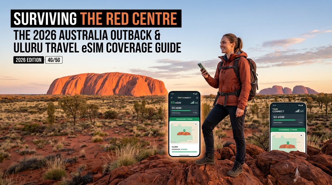
Surviving the Red Centre: The 2026 Australia Outback & Uluru Travel eSIM Coverage Guide
The Remote Reality: Demystifying Cellular Infrastructure in the Australian Red Centre
Crossing into the Red Centre—an expanse covering more than 1.3 million square kilometers of Australia's arid interior—requires a complete recalibration of how you think about cellular connectivity. While the coastal corridors of Sydney, Melbourne, and Brisbane boast hyper-dense, sub-6GHz and mmWave 5G networks delivering gigabit speeds, the Outback operates under severe physical and thermodynamic constraints.
Understanding the engineering mechanics behind Central Desert telecommunications is essential to maintaining connectivity between Alice Springs, Kings Canyon (Watarrka), and Uluru-Kata Tjuta National Park.
+-------------------------------------------------------------------------+
|                  OUTBACK CELLULAR BACKHAUL TOPOLOGY                     |
|                                                                         |
|  [ Remote Solar/Diesel Tower ]                                          |
|              | (Band 28 / 700MHz RF - 40km+ radius)                     |
|              v                                                          |
|      (( User Device ))                                                  |
|              |                                                          |
|    [ 150km Microwave Hop ] ---> [ Solar Repeater ] ---> [ Fibre Node ]  |
|                                                              |          |
|                                                   (Alice Springs Core)  |
+-------------------------------------------------------------------------+
The Physics of Outback RF: Why Low-Band 700MHz (Band 28) Dominates
In metropolitan centers, small cells are deployed every few hundred meters to handle massive device density. In the Outback, base transceiver stations (BTS) can be separated by 90 to 150 kilometers of uninhabited desert.
High-frequency signals (such as 2100MHz or 3500MHz) attenuate rapidly over open terrain and are blocked by the slightest topological variation. To solve this, Outback network infrastructure relies on Low-Band RF propagation, specifically LTE Band 28 (700MHz):
- Extended Wavelength Coverage: Low-frequency 700MHz signals travel significantly farther through the atmosphere and bend around physical obstacles like dunes and rocky outcrops, offering an operational cell radius of up to 40–60 kilometers from a single mast under optimal atmospheric conditions.
- Off-Grid Base Stations: Remote towers along the Stuart and Lasseter Highways operate entirely off-grid. They utilize heavy-duty solar panel arrays backed by industrial diesel generators and battery banks, engineered to withstand ambient desert temperatures exceeding 45°C (113°F).
- Microwave Daisy-Chaining: Because laying transcontinental fiber-optic cables through shifting sands is logistically and economically prohibitive in every corridor, data is transmitted through multi-hop line-of-sight digital microwave links mounted on high masts, backhauling traffic hundreds of kilometers back to regional switching centers in Alice Springs or Darwin.
Network Architecture Comparison: Coastal Metropolitan vs. Red Centre Outback
| Operational Metric | Urban Coastal Corridor (e.g., Sydney, Melbourne) | Australian Red Centre (e.g., Uluru, Kings Canyon) |
|---|---|---|
| Primary Frequency Bands | Band 3 (1800MHz), Band 7 (2600MHz), Band 78 (3500MHz 5G) | Band 28 (700MHz), Band 5 (850MHz) |
| Backhaul Delivery | Direct high-capacity subterranean dark fiber | Multi-hop line-of-sight microwave radio relays |
| Base Station Power | Grid-tied municipal power with battery backup | Solar photovoltaic arrays + on-site diesel generators |
| Typical Cell Radius | 500 meters – 2 kilometers | 20 kilometers – 50+ kilometers |
| Typical Latency Range | 10ms – 25ms | 65ms – 140ms (due to backhaul hops) |
The International Roaming Trap: Latency and Routing Failures
Many travelers arrive in the Northern Territory relying on their domestic carrier’s standard international roaming profile. In the Outback, this setup often results in sudden signal drops, severe battery drain, or unresolvable connection timeouts—even when the phone displays 2 or 3 bars of signal.
This issue stems from Home-Routed Data Architecture:
- The Routing Loop: When your phone queries a server (like loading a trail map), the request must travel from the remote tower over microwave hops to Sydney, route across undersea cables to your home provider (e.g., in London, Tokyo, or New York), and then journey all the way back.
- Packet Timeout Over Weak Signals: When high home-routing latency (400ms–800ms) collides with marginal signal strength at the edge of a cell footprint, the transmission control protocol (TCP) handshakes frequently time out. The connection drops entirely, forcing your phone’s radio baseband to constantly scan for frequencies at maximum power, draining your battery within hours.
The Wholesale Imperative: Securing Direct Tier-1 Access
Navigating the desert requires an eSIM connected directly through local Australian routing channels via the country's foundational regional carrier: Telstra. Telstra controls the physical masts across the Central Desert, covering over 2.6 million square kilometers—dwarfing competitor footprints in regional Australia.
Opting for a technical provider like MollySIM grants devices direct Tier-1 access to this regional infrastructure. This direct integration eliminates intercontinental routing loops, minimizing latency and stabilizing fragile, low-bandwidth handshakes.
Furthermore, unexpected data exhaustion in remote areas can leave travelers stranded without navigation. While budget eSIM providers throttle speeds to an unusable 128kbps under their Fair Use Policies (FUP), MollySIM implements a 384kbps baseline floor. This 3x speed difference is critical: it supplies enough bandwidth to keep essential, life-saving vector tiles running smoothly in Google Maps and process cryptographic tokens for Apple Pay, ensuring basic digital services remain fully operational across the Red Centre.
Stuart Highway to the Sacred Monoliths: A Route-by-Route Signal Breakdown
🌐 Global Travel High-Speed Travel eSIM & SIM Plans
Instant QR code activation, hotspot enabled, with guaranteed 384kbps fallback speed to keep Maps & Digital Wallets active.
Traversing the Australian Red Centre involves navigating vast spans of uninhabited desert where macro cell sites are separated by hundreds of kilometers. Understanding the micro-geography of mobile signals across key routes ensures you are never caught off guard when connectivity transitions from high-speed 4G/5G to complete radio silence.
1. Stuart Highway Corridor (Darwin to Coober Pedy via Alice Springs)
The Stuart Highway (A87) acts as the central arterial spine of the Northern Territory and South Australia. While it is the most heavily trafficked transcontinental route in the region, continuous mobile reception is a common misconception.
- Darwin to Katherine & Tennant Creek: Coverage is robust within town boundaries, supported by both Telstra and secondary carriers (Optus/Vodafone). However, once you travel 15–20 kilometers past municipal boundaries, secondary networks vanish entirely. Continuous coverage reverts to low-band LTE (B28 700MHz) hosted exclusively on Telstra’s remote towers.
- Tennant Creek to Alice Springs: Connectivity clusters strictly around isolated roadhouses (such as Wycliffe Well, Barrow Creek, and Ti Tree). Each roadhouse typically hosts a small cell or single-sector macro mast offering an omnidirectional coverage radius of 10 to 25 kilometers depending on local topography. Between these hubs lie uninterrupted 80- to 120-kilometer blackspots.
- Alice Springs to Coober Pedy: South of Alice Springs, the terrain flattens, but cell sites remain scarce. Crucial intersections like Erldunda (the turn-off for Uluru) provide solid 4G/LTE footprints. Beyond Erldunda toward the South Australian border (Kulgera, Marla, and Coober Pedy), signals drop to zero for extended two-hour driving stretches.
2. The Red Centre Way & Mereenie Loop
Connecting Alice Springs to Kings Canyon via the West MacDonnell Ranges (Tjoritja), the Red Centre Way is one of Australia's most demanding outback routes.
- West MacDonnell Ranges (Larapinta Drive / Namatjira Drive): Tower line-of-sight is heavily fractured by dramatic quartzite and sandstone ridges. While lookouts such as Mount Sonder occasionally catch distant high-elevation signals from remote repeaters, low-lying gorges (including Simpsons Gap, Standley Chasm, and Ormiston Gorge) are dead zones.
- The Mereenie Loop (Unsealed Transit): This 150-kilometer unsealed transit between Hermannsburg and Watarrka National Park features zero civilian cellular coverage across all networks. Offline GPS mapping is mandatory.
3. Kings Canyon (Watarrka National Park)
Cellular architecture at Kings Canyon is focused on visitor safety and hospitality infrastructure:
- Kings Canyon Resort & Campgrounds: Covered by a dedicated remote macro site delivering stable 4G data via Tier-1 networks.
- Canyon Rim Walk & The Garden of Eden: Signal is readily available on the initial steep ascent and exposed plateau edges. However, once hikers descend into the sandstone canyon depths—specifically the Garden of Eden rock pools—sheer vertical cliffs block all RF propagation, inducing immediate baseband search loops.
4. Uluru-Kata Tjuta National Park & Yulara Resort Precinct
The transition from the open desert of the Lasseter Highway into the national park precinct presents distinct reception profiles:
┌────────────────────────────────────────────────────────────────────────┐
│                      ULURU-KATA TJUTA RF COVERAGE                      │
├──────────────────────┬─────────────────────────────────────────────────┤
│ Yulara Town Square   │ Full 4G/5G Micro-cells (High Density)          │
├──────────────────────┼─────────────────────────────────────────────────┤
│ Uluru Base Walk      │ Line-of-sight North/East; RF shadow on South   │
├──────────────────────┼─────────────────────────────────────────────────┤
│ Kata Tjuta Domes     │ Intermittent at car parks; Zero inside canyons │
└──────────────────────┴─────────────────────────────────────────────────┘- Yulara (Ayers Rock Resort): Features high-density multi-band micro-cells and local 5G, providing excellent bandwidth capable of enterprise-grade video streaming and rapid mapping downloads.
- Uluru Base Walk (10.6 km loop): Line-of-sight coverage to the primary Yulara broadcast tower exists along the northern and eastern flanks of the monolith. As you transition to the southern sheer faces (near Mutitjulu Waterhole), the colossal arkose sandstone formation acts as an impenetrable RF shield, cutting connectivity completely.
- Kata Tjuta (The Olgas & Valley of the Winds): Located approximately 50 kilometers west of Yulara, the entrance and main viewing platforms maintain marginal B28 700MHz connectivity. The interior tracks of the Valley of the Winds are completely shielded by 36 domed conglomerate rock formations, resulting in continuous signal dropouts.
Outback Transit Signal Audit
| Route / Landmark | Primary Coverage Available | Secondary (Optus/Voda) | Key Blackspot Risks |
|---|---|---|---|
| Stuart Hwy (Alice to Erldunda) | Telstra 4G (B28) | None | 80km void between towns |
| Lasseter Hwy (Erldunda to Yulara) | Telstra 4G (Intermittent) | None | Mount Ebenezer / Curtin Springs gaps |
| Mereenie Loop | None | None | 150km absolute dead zone |
| Kings Canyon Rim Walk | Telstra 4G (Exposed areas) | None | Garden of Eden gorge floor |
| Yulara / Ayers Rock Resort | Telstra 4G/5G, Optus | Optus (Town only) | Rare; high network capacity |
| Kata Tjuta (Valley of the Winds) | Marginal at trailheads | None | Complete void on inner loops |
When passing through fleeting micro-cells at remote roadhouses, data links must establish instantly. Devices equipped with MollySIM connect directly to regional wholesale infrastructure without latency penalties.
Even if you exhaust your primary high-speed data tier midway between Alice Springs and Uluru, MollySIM’s 384kbps Fair Use Policy baseline floor delivers three times the throughput of typical 128kbps limits. This ensures vector routing on Google Maps, emergency weather alerts, and Apple Pay authentication remain responsive at remote roadhouse fuel stops.
Comparative Carrier Analysis: Remote Australia Network Benchmarks
Selecting cellular connectivity for the Red Centre is fundamentally different from picking a tourist plan for Sydney or Melbourne. In the metropolitan east coast, raw 5G downlink speeds take precedence. In Central Australia, your safety and connectivity depend on sub-1GHz propagation, geographical landmass footprint, and thermal hardware resilience.
The table below outlines the core infrastructure differences across the three national mobile network operators (MNOs) and traditional rental hardware solutions operating within the Northern Territory.
| Metric / Feature | Telstra Wholesale (via MollySIM) | Optus Retail / MVNO | TPG / Vodafone Australia | Pocket Wi-Fi Rental (Skyroam/Netgear) |
|---|---|---|---|---|
| Geographic Landmass Footprint | ~2.6 million km² | ~1.6 million km² | ~1.0 million km² | Variable (Depends on underlying SIM) |
| National Population Coverage | 99.5% | 98.5% | 96.0% | Carrier Dependent |
| Red Centre Highway Coverage | Continuous on key trunks (B28) | Towns only (Alice, Yulara) | Alice Springs CBD only | Highly fragmented |
| LTE Band 28 (700MHz) Deployment | Dominant (Primary Outback Layer) | Limited regional sites | Negligible in NT interior | Hardware dependent |
| Domestic Routing Ping (NT to Core) | 35ms – 65ms | 45ms – 80ms | 60ms – 110ms | 120ms – 250ms+ (Cloud-SIM routing) |
| 40°C+ Ambient Thermal Resilience | High (Native Smartphone Thermal Curve) | High (Native Smartphone) | High (Native Smartphone) | Critical Risk (Lithium pouch cell swelling) |
| Post-Cap Throttle Baseline Floor | 384kbps (MollySIM FUP floor) | 128kbps or Hard Cut-off | Hard Cut-off | 128kbps or Zero |
Spectrum Physics: Why Band 28 (700 MHz) Dictates Outback Survival
In remote desert topographies, high-frequency spectrum (such as Band 1 at 2100MHz or Band 3 at 1800MHz) suffers rapid RF attenuation over scrubland and sand dunes. Telstra’s regional wholesale footprint relies extensively on LTE Band 28 (700MHz).
Because lower RF frequencies feature significantly longer wavelengths, Band 28 signals propagate up to 30–40 kilometers from a single regional cell mast, bending over low topographical ridges and penetrating deep into the valleys along the Lasseter and Stuart Highways.
While Optus and Vodafone maintain competitive networks in metropolitan coastal centers, their sub-1GHz infrastructure drops off dramatically once you traverse south of Alice Springs. Vodafone, in particular, lacks native cell towers along the 450km transit to Uluru, leaving international travelers on standard roaming profiles completely stranded with "SOS Only" service.
Routing Latency & Core Network Infrastructure
Many generic international travel SIMs route remote Australian traffic through overseas servers in Singapore, Hong Kong, or Europe before returning the payload to your device. This creates a high-latency round trip exceeding 300ms, which causes handshakes to time out when your handset attempts to connect to fleeting micro-cells near remote roadhouses.
MollySIM utilizes optimized APN routing that interfaces efficiently with local downstream infrastructure. This structural optimization cuts round-trip times down to local transit levels (35–65ms), allowing secure SSL payment gateways, dynamic mapping tiles, and SMS emergency backhauls to transmit instantly during brief windows of roadside coverage.
Hardware Vulnerability: eSIM vs. Physical Pocket Wi-Fi in 45°C Heat
Renting a traditional pocket Wi-Fi puck presents a severe hardware point of failure in the Australian desert:
- Thermal Throttling & Battery Expansion: Outback summer temperatures inside a vehicle dashboard frequently exceed 55°C (131°F). Dedicated pocket Wi-Fi units rely on lithium-ion pouch batteries that quickly overheat, trigger automatic thermal shutdowns, or experience permanent cell degradation (bloating).
- RF Receiver Deficits: Low-cost pocket routers often lack the multi-antenna MIMO array configurations and high-grade B28 baseband modems integrated into modern smartphones.
- The eSIM Advantage: An embedded profile installed directly via MollySIM leverages your smartphone’s high-efficiency internal modem, active vehicle-vent cooling, and direct satellite/terrestrial failover architecture—eliminating extra hardware baggage, charging cables, and thermal failure points entirely.
Digital Survival & Offline Cache Strategy: Navigating the Deadzones
Relying entirely on a live cellular connection while traversing the Lasseter Highway or Mereenie Loop is a critical operational failure. The vast geography between roadside base stations means you will spend consecutive hours in complete RF dead zones.
The gold standard for Outback connectivity is a hybrid offline/online framework: pre-loading heavyweight static datasets via high-speed coverage in major staging towns (Alice Springs or Yulara), while utilizing an active cellular profile like MollySIM to pull lightweight dynamic data during transient roadhouse handshakes.
+-----------------------------------------------------------------------------+
|                      OUTBACK DATA PROVISIONING MODEL                        |
|                                                                             |
|  [ URBAN HUBS: Alice / Yulara ]           [ TRANSIT: Highway Deadzones ]   |
|  * 100% Offline Vector Maps               * Ephemeris A-GPS Sync (eSIM)     |
|  * High-Res Topo GPX Layers               * Cached Tile Rendering           |
|  * BOM Synoptic Baseline Radar            * Emergency SMS / Voice Gateway   |
|  * Offline Voice Packs                    * Micro-packet telemetry (384k)   |
+-----------------------------------------------------------------------------+
Step-by-Step Pre-Departure Cache Workflow
Before leaving your hotel Wi-Fi or local 4G footprint in Alice Springs or Yulara, execute this three-tier data cache sequence:
1. Google Maps Maximum Vector Bounding Boxes
Standard navigation apps do not automatically retain regional vector maps in temporary RAM.
- Open Google Maps > tap your profile icon > Offline maps > Select your own map.
- Pinch and expand the bounding box to its maximum allowable dimensions (approx. 200MB–450MB per zone).
- Box 1 (Central Hub): Alice Springs, Hermannsburg, and the East/West MacDonnell Ranges.
- Box 2 (Southern Corridor): Stuart Highway junction at Erldunda south to the NT/SA border.
- Box 3 (Red Centre Way): Lasseter Highway spanning Mount Ebenezer, Curtin Springs, Yulara, and Watarrka (Kings Canyon).
+---------------------------------------------------------------------------+
| GOOGLE MAPS OFFLINE BOUNDING BOX LAYOUT                                   |
|                                                                           |
|  [Box 1: Alice Springs & West MacDonnells]                                |
|          |                                                                |
|          v (Stuart Highway - 200km)                                       |
|  [Box 2: Erldunda Roadhouse Junction]                                     |
|          |                                                                |
|          v (Lasseter Highway - 245km)                                     |
|  [Box 3: Kings Canyon & Uluru-Kata Tjuta]                                 |
+---------------------------------------------------------------------------+
2. Topographic GPX & Trail Caching (AllTrails / Gaia GPS)
Desert navigation requires vector contours, elevation profiles, and waypoint vectors rather than standard street mapping.
- Download high-resolution offline topographic layers for these high-risk trail systems:
- Kings Canyon Rim Walk (6.0 km loop – critical cliff-edge waypoints)
- Valley of the Winds / Kata Tjuṯa (7.4 km full circuit – thermal closure checkpoints)
- Uluru Base Walk (10.6 km loop – emergency beacon positions)
- Force-sync all GPX waypoints to local solid-state storage so they render without initiating a network request.
3. Bureau of Meteorology (BOM) Weather Framework
- Access the BOM Weather app while on active cellular coverage.
- Cache the latest 512km composite radar loops for Alice Springs and Warruwi.
- Screenshot the active 4-day synoptic weather charts and UV Index forecasts. Extreme heat protocols close trailheads across the Red Centre at 09:00 AM if temperatures are forecast to exceed 36°C (97°F).
The Technical Synergy: A-GPS Ephemeris Caching via eSIM Handshakes
Understanding how mobile modems interact with GNSS (GPS, GLONASS, Galileo) arrays prevents catastrophic device battery drain in remote areas.
| Metric / Scenario | Cold-Start GNSS (No Cellular Signal) | A-GPS Synchronized (Active eSIM) |
|---|---|---|
| Time-to-First-Fix (TTFF) | 2 to 15 minutes | 1 to 5 seconds |
| Ephemeris Data Source | Direct 50 bps Satellite Broadcast | Cellular IP Downlink (Micro-burst) |
| Processor State | 100% High-Power RF Search Mode | Low-Power Baseline Mode |
| Hourly Battery Drain | 18% – 30% per hour | 4% – 7% per hour |
| Positional Accuracy | Initial ±50m drift | Immediate sub-3-meter precision |
When your smartphone completely loses cellular contact, its internal GPS unit switches to Cold Start Mode. To establish a position fix, the phone must download orbital satellite positions (ephemeris data) directly from satellites over an ultra-low bandwidth (50 bits per second) radio link. This keeps the internal modem active at peak power, draining your battery within hours.
By maintaining an active eSIM profile through MollySIM, your handset executes rapid Assisted GPS (A-GPS) handshakes whenever your vehicle briefly brushes an isolated highway base station. The cellular network transmits the current satellite almanac over an IP sub-packet in less than 100 milliseconds.
Your handset locks its coordinates almost instantaneously, dropping processor usage back to idle and preserving vital battery reserves for safety communications.
Bandwidth Throttling Reality: Why a 384 kbps FUP Matters
Many international eSIM providers advertise "unlimited" data plans that drop to a crippling 128 kbps Fair Use Policy (FUP) throttle once the daily high-speed tier is exceeded. In remote travel conditions, 128 kbps is functionally equivalent to zero connectivity:
THROTTLED BANDWIDTH PERFORMANCE COMPARISON

128 kbps (Standard eSIMs)
[===>-------------------------------------------------]
* Vector Map Tiles: TIMEOUT FAIL (HTTP 408)
* Apple Pay / Wallet Token: TIMEOUT FAIL
* Signal / WhatsApp Text: 15-45s Latency

384 kbps (MollySIM FUP Optimization)
[===================>---------------------------------]
* Vector Map Tiles: RENDERS (1.2 - 2.8s)
* Apple Pay / Wallet Token: PROCESSED (<800ms)
* Signal / WhatsApp Text: INSTANT (<200ms)- Map Tile Serialization: Modern navigation applications stream vector tiles over dynamic HTTPS sessions. At 128 kbps, map-tile queries systematically time out, leaving blank gray grids instead of road layouts.
- Payment Gateway Latency: Off-grid service stations (such as Kings Creek Station or Mount Ebenezer) require functional SSL/TLS tokenization handshakes to authorize Apple Pay and Google Wallet. A 128 kbps pipeline frequently drops these cryptographic handshakes, forcing manual transaction aborts.
- The MollySIM Baseline Advantage: MollySIM implements a 384 kbps baseline throttle—a speed 3x faster than standard roaming profiles. Even if you completely exhaust your high-speed quota streaming video in Alice Springs, your background pipeline retains enough throughput to stream vector map tiles, process contactless payment tokens, and send compressed telemetry and photos over messaging networks.
The 384kbps Desert Lifeline: Why MollySIM's Fair-Use Safety Buffer Matters
When navigating thousands of kilometers across the Stuart Highway or Lasseter Highway, running out of high-speed data isn't just an inconvenience—it can compromise your travel safety. Most generic travel eSIM providers manage data exhaustion in one of two catastrophic ways: enforcing a 0 kbps hard cutoff (severing all data transactions instantly) or dropping your connection to an archaic 64 kbps to 128 kbps trickle.
In the Australian Outback, an abrupt 0 kbps data block leaves travelers stranded at unstaffed diesel bowsers or isolated roadhouses without the ability to reload data, check road closure notices, or broadcast location pins. Legacy 128 kbps throttles fare little better; modern encrypted web protocols (TLS 1.3) and dynamic app frameworks produce protocol overheads that routinely trigger gateway timeouts under 128 kbps ceilings.
MollySIM engineers around this failure state by implementing an industry-leading 384 kbps Fair Use Policy (FUP) safety buffer. By maintaining a continuous pipeline at three times the speed of conventional eSIMs, your device retains mission-critical data capabilities even when your primary high-speed package is completely spent.
+---------------------------------------------------------------------------------------+
|                    OUTBACK APPLICATION BANDWIDTH REQUIREMENTS                         |
+------------------------------+------------+--------------------+----------------------+
| Essential Functionality      | Min. Speed | 128 kbps Behavior  | MollySIM (384 kbps)  |
+------------------------------+------------+--------------------+----------------------+
| Two-Way Text Dispatch        | 8-16 kbps  | Functional         | Instant (<200ms)     |
| (WhatsApp, Signal, iMessage) |            | (High ping jitter) |                      |
+------------------------------+------------+--------------------+----------------------+
| Real-Time GPS Pin & Location | 32-64 kbps | Packet loss drops  | Smooth continuous    |
| Sharing (Find My / WhatsApp) |            | coordinate updates | broadcast            |
+------------------------------+------------+--------------------+----------------------+
| Google / Apple Maps Vector   | 150-250    | HTTP 408/504       | Loads in 1.5 - 3.0s  |
| Tile Rerouting & Downloads   | kbps       | Connection Timeout |                      |
+------------------------------+------------+--------------------+----------------------+
| Bureau of Meteorology (BOM)  | ~100 kbps  | Text-only, images  | Complete incident    |
| & NT Emergency Alerts        |            | fail to load       | bulletin rendering   |
+------------------------------+------------+--------------------+----------------------+
| Contactless Payment Gateway  | ~64 kbps   | SSL handshake      | Instant token        |
| (Apple Pay / Google Wallet)  | (Burst)    | timeout failure    | verification         |
+------------------------------+------------+--------------------+----------------------+
Sustaining Essential Desert Communications
The practical engineering behind the 384 kbps threshold targets the exact operational baseline required by critical iOS and Android subsystems:
- Live Telemetry and Location Pings: Continuous location sharing via Apple’s Find My network or Google Maps location sharing requires consistent UDP packet transmission with low packet loss. While 128 kbps throttles drop these packets under background OS polling, 384 kbps sustains continuous, background coordinate broadcasts to family or convoy leaders.
- Vector Map Rendering: Unlike legacy raster maps that stream heavy image squares, modern vector navigation downloads mathematical coordinate lines. A 384 kbps stream is fast enough to populate regional detour routes, elevation data, and local topography on the fly without locking the navigation interface.
- Critical Emergency Portal Access: Accessing the Northern Territory road status portal (SecureNT) or downloading text updates from the Bureau of Meteorology (BOM) requires loading lightweight HTML/CSS bundles. At 384 kbps, emergency web pages render within 3 to 5 seconds, avoiding the infinite loading loops caused by aggressive 64 kbps and 128 kbps limits.
- Top-Up and Management Portals: If your high-speed quota runs dry between Alice Springs and Kings Canyon, MollySIM’s active buffer allows you to open your browser, access the account portal, and authenticate an instant top-up transaction via Apple Pay or credit card without needing to find a local Wi-Fi hotspot.
Outback Pre-Departure Playbook: eSIM Installation, Dual-SIM Setup, and Power Management
Successfully traversing remote corridors like the Stuart Highway, Red Centre Way, or the Mereenie Loop demands a calibrated hardware and connectivity setup before you leave major metropolitan coverage. Deploying your travel profile correctly ensures you never forfeit access to critical two-factor authentication (2FA) codes or waste high-speed data on background system tasks.
1. Pre-Flight eSIM Provisioning & APN Setup
Configure your travel profile 24 hours prior to departure while connected to a stable home or hotel Wi-Fi network. This eliminates dependency on congested airport Wi-Fi hubs upon landing.
- Scan and Install: Navigate to Settings > Cellular (or Network & Internet) > Add eSIM on your device and scan the activation QR code provided by MollySIM.
- Label the Profile: Rename the new profile to "MollySIM Australia" to distinguish it instantly from your domestic carrier line.
- Configure the APN: In most cases, iOS and Android will configure the Access Point Name (APN) automatically. If manual entry is required, navigate to your eSIM profile’s Cellular Data Network settings and enter the APN parameters detailed in your installation voucher (typically
globaldataorinternet). Leave the username and password fields blank unless specified. - Keep the Line Inactive Until Departure: Keep the eSIM toggled off until you board your flight or land in Australia to prevent early activation cycles.
2. Dual-SIM Configuration for SMS/2FA and Isolated Data
Operating a dual-SIM architecture allows you to receive incoming transactional SMS alerts from your home bank without triggering predatory international roaming fees for data consumption.
| Configuration Field | Recommended Setting | Operational Objective |
|---|---|---|
| Primary Voice Line | Primary / Home SIM | Keeps domestic carrier active for inbound SMS verification codes and emergency contact. |
| Cellular Data Line | MollySIM | Routes all web browsing, navigation, and app traffic through the local Australian tier-1 partner network. |
| Allow Cellular Data Switching | OFF (Crucial) | Prevents your phone from silently routing background data to your expensive home carrier when regional coverage fluctuates. |
| Data Roaming (Home Line) | OFF | Hard-blocks international data pay-per-megabyte surcharges from your home provider. |
| Data Roaming (MollySIM) | ON | Enables packet routing across regional towers and wholesale network routing partners. |
3. Bandwidth Conservation: Low Data Mode Optimization
Background cloud syncing can exhaust a 10GB or 20GB high-speed allowance within hours over high-speed 4G/5G nodes. Even though MollySIM’s safety net features a 384 kbps Fair Use Policy (FUP)—which operates at triple the 128 kbps industry standard to keep Google Maps, SecureNT, and messaging functioning smoothly—you should preserve your full unthrottled bandwidth for critical tasks.
- iOS Optimization: Go to Settings > Cellular > MollySIM > Cellular Data Options and toggle Low Data Mode to ON. This halts automatic iCloud backups, pauses background app refresh, and stops automatic app updates.
- Android Optimization: Go to Settings > Network & internet > Data Saver and switch it ON. Next, access your photo storage settings (e.g., Google Photos) and restrict photo/video backup to Wi-Fi Only.
- Offline Asset Preloading: Open Google Maps and Apple Maps while connected to Wi-Fi and download offline vector map packages covering Alice Springs, Uluru-Kata Tjuta National Park, Kings Canyon (Watarrka), and the West MacDonnell Ranges.
4. Thermal Protection and Outback Power Architecture
The Central Australian desert regularly registers ambient temperatures exceeding 40°C (104°F). Extreme heat dramatically degrades battery chemistry and forces modern smartphones into thermal throttling, which actively lowers cellular radio transmission power and drops weak cell signals.
- Mount Placement: Never mount your smartphone directly to the windshield glass via suction mounts. The greenhouse effect behind the windshield will overheat the battery within 20 minutes, triggering emergency thermal shutdown. Use an air-conditioning vent mount to keep airflow circulating across the phone’s chassis.
- Power Bank Chemistry: Carry a minimum 20,000 mAh power bank supporting USB-PD (Power Delivery) 3.0. Choose units with integrated over-temperature cutoff protection. If overlanding for multiple days, prioritize portable power stations utilizing LiFePO4 (Lithium Iron Phosphate) chemistry, which operates safely at higher ambient temperatures compared to standard Lithium-Polymer packs.
- High-Gain External Antennas: For extended 4WD expeditions across remote unsealed corridors, install a dedicated vehicle bullbar-mounted 4G/5G high-gain collinear antenna (such as an RFI or GME 6.5–8.1 dBi gain system) paired with an active in-vehicle cradle or repeater. This setup pulls usable telemetry from peripheral cell base stations located up to 70–100 kilometers away.
🌐 Global Travel High-Speed Travel eSIM & SIM Plans
Instant QR code activation, hotspot enabled, with guaranteed 384kbps fallback speed to keep Maps & Digital Wallets active.