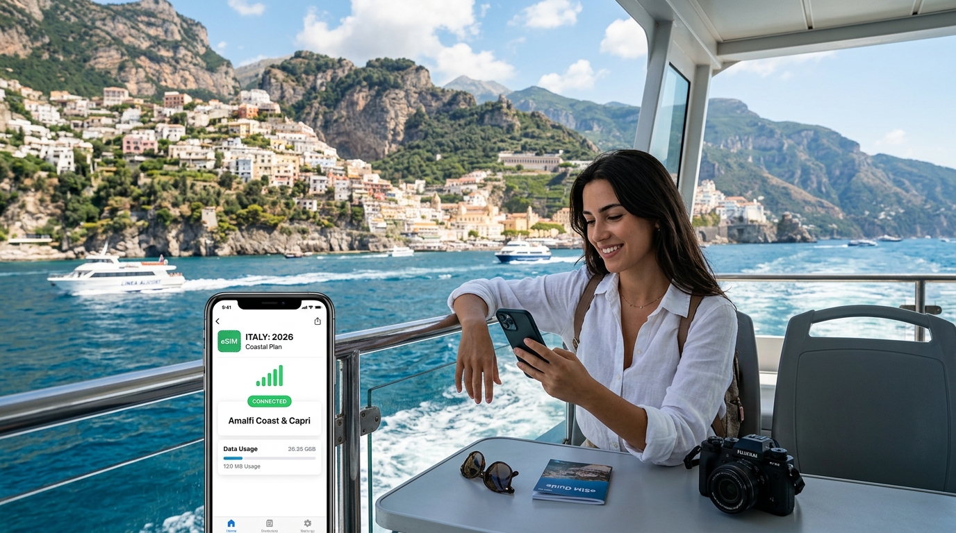
The Coastal Connectivity Dilemma: Sheer Cliffs, SS163 Topography, and Marine Blindspots
The Amalfi Coast presents one of the most hostile natural environments in Southern Europe for terrestrial cellular networks. Stretching roughly 50 kilometers between Positano and Vietri sul Mare, the Strada Statale 163 (SS163) clings to the jagged limestone faces of the Lattari Mountains. While this UNESCO-listed geography provides breathtaking vistas, the physics of Radio Frequency (RF) propagation in mountainous coastal terrain creates severe connectivity bottlenecks for international travelers relying on standard roaming profiles.
The Physics of Terrestrial Shadowing Along the SS163
Cellular signals operating across modern 4G LTE and 5G sub-6GHz bands (principally 700 MHz to 3.7 GHz in Italy) rely heavily on direct Line-of-Sight (LOS) or predictable signal reflection. Along the Amalfi Drive:
- Knife-Edge Diffraction and Shadow Zones: Towering, near-vertical dolomitic cliffs create dramatic RF shadows. When driving through deep incisions like the Fjord of Furore or around blind hairpin turns near Praiano, direct signals from inland Base Transceiver Stations (BTS) are physically blocked by thousands of tons of dense rock.
- Multipath Interference: High-frequency cellular waves reflect erratically off the sea surface and polished cliff faces, causing destructive wave interference that leads to sudden call drops, packet loss, and high latency even when your device shows "two bars" of reception.
- Tunnel Attenuation: The SS163 is punctuated by narrow, unamplified rock-hewn tunnels. The moment your SITA bus or rental car enters these subterranean passes, signal penetration drops close to zero (-120 dBm or worse), instantly terminating live navigation streams.
[ Inland Cell Tower (BTS) ]
           \
            \  (Blocked RF Path)
             X
      [ Mount San Michele ]
             |
             |   [ Fjord of Furore / SS163 ] -> (RF Dead Zone / Shadow Fading)
             |          \
             |           \-- [ Moving Vehicle ] -> Packet Loss / Disconnection
~~~~~~~~~~~~~~~~~~~~~~~~~~~~~~~~~~~~~~~~~~~~~~~~~~~~~~~~~~~~~~~~~~~~~~~~~~~~~~~
[ Tyrrhenian Sea / Gulf of Salerno ]
Marine Blindspots: Ferry Crossings to Capri
Transitioning from land to sea introduces a completely different set of wireless propagation challenges. High-speed hydrofoils (aliscafi) and passenger ferries operated by Caremar, NLG, and Positano Jet cross open expanses across the Gulf of Naples and Gulf of Salerno toward Capri's Marina Grande.
As ferries pull 3 to 7 nautical miles away from coastal hubs like Sorrento or Naples, signals suffer from earth curvature horizon drop-off and Fresnel zone obstruction over open water. Compounding the issue, modern high-speed ferries feature reinforced steel, composite fiberglass hulls, and tinted thermal-insulating glass, which can attenuate incoming RF signals by an additional 10 to 18 dB.
| Transit Route | Primary Connectivity Hazard | Network Behavior Observed |
|---|---|---|
| SS163 (Positano to Amalfi) | Cliff face shadowing & gorge diffraction | Frequent drops between 5G and Edge/No Service |
| Fjord of Furore Descent | Complete terrain blockage | Total LOS blackout for single-network profiles |
| Sorrento ⇄ Capri (Open Sea) | Vessel attenuation & base station range limits | Rapid battery drain due to continuous handoff hunting |
| Capri (Marina Grande Port) | High-density tourist congestion | Local cell tower saturation and severe bandwidth throttling |
Why Multi-Network Adaptability is Non-Negotiable
In regions with such fragmented topography, single-network roaming agreements routinely fail. Telecom Italia (TIM) may maintain the dominant micro-cell above Positano's cliffside hotels, while WindTre or Vodafone might hold the only functional sector antenna covering the ferry approaches into Capri.
When your ferry docks at Marina Grande and you need to pull up real-time transfer tickets, offline maps, or confirm an authentic taxi reservation, an adaptable data solution is vital. Utilizing an advanced travel eSIM like MollySIM ensures your device dynamically handshakes with the strongest underlying Italian carrier infrastructure (TIM, Vodafone, or WindTre) based on real-time signal-to-noise ratios (SNR). Furthermore, even if you exceed your prioritized data tier during heavy 4K video uploads of the Faraglioni rocks, MollySIM maintains a 384kbps Fair Use Policy (FUP) safety throttle—nearly 3x faster than the conventional 128kbps standard offered by legacy providers—ensuring Google Maps routing, WhatsApp messaging, and Apple Pay authentication never freeze mid-transit.
Italian Carrier Showdown: TIM vs. Vodafone Italia vs. WindTre along the Tyrrhenian Coast
🇺🇸 United States High-Speed Travel eSIM & SIM Plans
Instant QR code activation, hotspot enabled, with guaranteed 384kbps fallback speed to keep Maps & Digital Wallets active.
The rugged geography of the Sorrentine Peninsula and the Gulf of Naples creates one of the most demanding RF (radio frequency) propagation environments in Southern Europe. Limestone cliffs exceeding 300 meters, narrow coastal fjords, and sudden elevation changes between sea-level ports and cliff-perched villages shatter uniform wireless footprints.
Evaluating the performance of Italy’s four primary Mobile Network Operators (MNOs)—TIM (Telecom Italia), Vodafone Italia, WindTre, and newcomer Iliad—requires looking beyond generalized national coverage percentages and examining localized sub-6GHz spectrum deployments, coastal macro-site density, and maritime signal propagation.
       [Tyrrhenian Sea / Gulf of Naples]
                      |
     +----------------+----------------+
     | Ferry Lanes (Naples/Sorrento/Capri)
     v
[TIM / Vodafone] <--- Inter-Carrier Handover ---> [WindTre (Zefiro Net)]
     |                                                    |
     +--> Low-Band n28 (700MHz): Deep Fjord Reach        +--> High-Band n78 (3.5GHz): Port Capacity
     +--> Micro-Cells: Positano / Ravello Cliffs         +--> Iliad RAN Sharing: High Jitter Risk
MNO Technical Matrix: Coastal Campania & Gulf of Naples
| Carrier | Primary 5G Spectrum (Sub-6GHz) | Coastal Macro-Site Density | Ferry Lane Signal Persistence | Deep-Valley Penetration (Positano / Ravello) | Network Weak Point |
|---|---|---|---|---|---|
| TIM | n28 (700MHz), n78 (3.5GHz) | Very High (Extensive legacy hilltop infrastructure) | Excellent (Strong maritime LOS from Monte Faito & Capri) | Superior (Low-band n28 penetrates limestone gorges) | Occasional backhaul throttling during high-season port congestion |
| Vodafone | n78 (3.5GHz), n1 (2100MHz DSS) | High (Dense micro-cell grids in major hubs) | Very Good (Continuous along Sorrento–Capri axis) | Moderate-to-High (Excellent in towns, variable in rural ravines) | Reduced low-band propagation in unpopulated cliff paths |
| WindTre | n78 (3.5GHz), n38 (2600MHz) | Very High (Consolidated post-merger tower footprint) | Good (Subject to handoff latency over open water) | Moderate (Relies on DSS; struggles inside historical stone buildings) | Aggressive data deprioritization during peak tourist hours |
| Iliad | n78 (3.5GHz), n28 (700MHz) | Moderate (Growing standalone RAN, relies on Zefiro Net) | Fair (Frequent dropouts mid-crossing) | Poor (Significant latency spikes in shaded coastal pockets) | High packet loss during cross-network handover |
Spectrum Strategy & Field Performance
1. TIM (Telecom Italia): The Low-Band King of the Cliffs
TIM holds a decisive advantage across topographically isolated settlements such as Positano, Praiano, and Ravello. By leveraging its dedicated 700MHz (n28) frequency allocation, TIM achieves unmatched RF propagation through narrow limestone ravines and dense tuff-stone architecture. Hilltop macro-sites situated on Monte Faito and Anacapri project long-range Line-of-Sight (LOS) signals far out into the Tyrrhenian Sea, maintaining uninterrupted 5G/4G handshakes on high-speed hydrofoils navigating the Naples–Capri and Sorrento–Positano routes.
2. Vodafone Italia: High-Capacity Port Dominance
Vodafone prioritizes capacity over raw geographic reach. In dense passenger chokepoints—such as Sorrento’s Marina Piccola, Capri’s Marina Grande, and the Amalfi port pier—Vodafone deploys high-band 3.5GHz (n78) Massive MIMO antenna arrays. This infrastructure eliminates localized cell congestion when thousands of ferry passengers disembark simultaneously, ensuring reliable bandwidth for high-resolution mapping and cloud authentication.
3. WindTre & Iliad: Bandwidth vs. Latency Trade-offs
While WindTre operates the largest aggregate physical tower inventory in Italy following the Wind-3 network merger, its coastal performance is hindered by dynamic spectrum sharing (DSS) latency. During July and August, WindTre’s maritime cells suffer aggressive quality-of-service (QoS) throttling.
Iliad, while competitive in major metropolitan centers, operates non-standalone 5G in rural Campania through the Zefiro Net joint venture. When transitioning between proprietary Iliad antennas and shared towers along ferry paths, connections experience transient IP packet loss and latency spikes up to 450ms.
The Architecture Advantage: Multi-Network Roaming vs. Single-Carrier Local SIMs
Purchasing a physical tourist SIM from a single Italian operator creates a single point of RF failure. If you buy a local TIM prepaid card, your device remains pinned to TIM’s radio access network (RAN) even when descending into a Vodafone-dominated cove like Marina di Cantone or navigating behind Capri’s Faraglioni rocks where TIM's sector antenna is shadowed.
+---------------------------------------------------------------+
|                      Single-Carrier SIM                       |
|  Device Locked to Single Network (e.g., TIM)                  |
|  -> Enters Radio Shadow behind Cliff                         |
|  -> Connection Drops to 0 kbps (Total Blackout)               |
+---------------------------------------------------------------+
                                vs.
+---------------------------------------------------------------+
|                  Multi-Network Travel eSIM                    |
|  Device Dynamically Monitors Multiple Core Networks           |
|  -> TIM RSRP Drops Below Threshold                            |
|  -> Instant Handover to Vodafone / WindTre Infrastructure     |
|  -> Continuous Session Persistence (Maps, Navigation, Tickets)|
+---------------------------------------------------------------+
An international roaming eSIM profile dynamically scans available cellular towers and provisions an over-the-air handshake with whichever carrier exhibits the strongest Reference Signal Received Power (RSRP) and Signal-to-Interference-plus-Noise Ratio (SINR).
Deploying an adaptable solution like MollySIM allows your smartphone to switch dynamically between TIM and Vodafone backbones along the coast. If a ferry rounds the Punta Campanella headland and loses TIM's signal, a multi-network profile negotiates an immediate handover to Vodafone’s maritime sector. Furthermore, in the event of extreme data consumption during long sea crossings, MollySIM's 384kbps Fair Use Policy (FUP) safety throttle keeps critical protocols—such as Google Maps GPS routing, live maritime schedules, WhatsApp voice calls, and Apple Pay—fully operational, outperforming the 128kbps hard caps deployed by conventional travel SIM providers.
Navigating Ferry Routes & Dodging the Costly Maritime Satellite Roaming Trap
The waters between the Sorrentine Peninsula, the Gulf of Naples, and the Gulf of Salerno represent some of the busiest passenger maritime corridors in the Mediterranean. Fast catamarans, single-hull hydrofoils (aliscafi), and roll-on/roll-off vehicle ferries operate continuous loops between major ports, requiring travelers to transit varying degrees of terrestrial cellular signal shadow.
+---------------------------------------------------------------------------------------+
|                       Key Maritime Transit Corridors & Operators                      |
+----------------------+--------------------+---------------------+---------------------+
| Corridor             | Primary Operators  | Vessel Types        | Cell Shadow Risks   |
+----------------------+--------------------+---------------------+---------------------+
| Naples (Beverello)   | SNAV, NLG, Caremar | High-Speed Monohull,| Mid-Gulf crossing   |
| <-> Capri            |                    | Large Ro-Pax Ferry  | (Boccca Piccola)    |
+----------------------+--------------------+---------------------+---------------------+
| Sorrento             | Caremar, NLG,      | Hydrofoil,          | Cliff shadow under  |
| <-> Capri            | Alilauro           | Fast Catamaran      | Massa Lubrense      |
+----------------------+--------------------+---------------------+---------------------+
| Capri                | Positano Jet, NLG, | Medium Catamaran    | Faraglioni &        |
| <-> Positano/Amalfi  | Alicost            |                     | Punta Campanella    |
+----------------------+--------------------+---------------------+---------------------+
| Amalfi               | Travelmar, Alicost | Coastal Monohull    | High cliff base     |
| <-> Salerno          |                    | Ferry               | reflection zones    |
+----------------------+--------------------+---------------------+---------------------+
The Invisible Hazard: Onboard Maritime Satellite Networks
While crossing open stretches—particularly during the 45-to-80-minute transit between Naples Beverello and Capri, or when routing far off the Sorrentine headland—your smartphone can lose line-of-sight with mainland base transceiver stations (BTS).
When terrestrial signal disappears, smartphones set to default network configurations immediately search for any available broadcast tower. Large passenger ferries and commercial ships crossing these channels frequently host onboard satellite-linked cellular microcells operated by maritime providers such as Telenor Maritime (formerly Maritime Communications Partner - MCP), AT&T Cellular at Sea, or Telecom Italia Mobile Maritime.
These satellite networks do not fall under EU "Roam Like at Home" price caps or standard international roaming agreements. If your domestic carrier's SIM latches onto a maritime node:
- Data Charges: Often billed at $10.00 to $20.50 per megabyte (a single automated background cloud backup can generate a $400+ invoice in minutes).
- Incoming/Outgoing Voice: Billed at $3.00 to $9.99 per minute.
- SMS Messages: Billed at $0.50 to $2.00 per outbound text.
+--------------------------------------------------------------------------+
|                        THE SATELLITE ROAMING TRAP                        |
|                                                                          |
|   [ Smartphone ] ---> (Loses Land BTS) ---> [ Ferry Microcell (MCP) ]   |
|         |                                                |               |
|   Auto-Selection                                    Geostationary        |
|   Enabled                                             Satellite          |
|         |                                                v               |
|   SURPRISE BILL ($15/MB) <----------------------- Ground Earth Station   |
+--------------------------------------------------------------------------+
To eliminate bill shock completely, you must isolate your primary domestic SIM from maritime satellite handshakes while routing your data traffic through a dedicated terrestrial travel eSIM like MollySIM.
Step-by-Step OS Configuration: Securing Dual SIM Setup on the Water
Configure these OS settings before boarding any vessel at Molo Beverello, Calata Porta di Massa, Sorrento's Marina Piccola, or Amalfi's Molo Pennello.
For Apple iOS (iPhone 11 through iPhone 16 Series)
Settings > Cellular (or Mobile Data)
│
├── 1. Primary SIM (Home Carrier):
│    ├── Cellular Data: OFF
│    ├── Data Roaming: TOGGLE OFF
│    └── Network Selection: Switch from "Automatic" to YOUR HOME NETWORK NAME
│
├── 2. Secondary SIM (MollySIM Profile):
│    ├── Turn On This Line: TOGGLE ON
│    ├── Data Roaming: TOGGLE ON (Required for multi-network switching)
│    └── Network Selection: TOGGLE ON "Automatic" (or manual lock to "TIM" / "Vodafone IT")
│
└── 3. Global Setting:
└── Cellular Data Switching: NEVER ALLOW / TOGGLE OFF- Locking Network Selection on Primary SIM: Go to
Settings>Cellular> select your Primary SIM >Network Selection> toggle off Automatic > manually tap your home carrier (e.g., AT&T, Verizon, T-Mobile, O2). When the ferry loses mainland coverage, this prevents the device from hopping onto 901-12 (Telenor Maritime) or 901-26 (MCP). - Preventing Data Leaking: Ensure
Allow Cellular Data Switchingis strictly Off. Leaving this on allows iOS to fall back to your expensive home line if the eSIM data connection experiences momentary packet loss between Capri and Positano.
For Android (Samsung Galaxy, Google Pixel, Xiaomi)
Settings > Connections / Network & Internet > SIM Manager
│
├── 1. Primary SIM (Physical / Home eSIM):
│    ├── Mobile Data: OFF
│    ├── International Roaming: TOGGLE OFF
│    └── Mobile Network Operators: Disable "Auto Select" -> Select Home Network
│
├── 2. Travel eSIM (MollySIM):
│    ├── Preferred SIM for Mobile Data: SELECT MollySIM
│    ├── Roaming: TOGGLE ON
│    └── Network Operators: Set to "Auto" (allowing TIM / Vodafone / WindTre inter-carrier roaming)
│
└── 3. Data Switching / Backup Calling:
     └── Auto Data Switching: DISABLED
Why Ground-Locked Multi-Network eSIMs Excel on Ferries
Using MollySIM ensures your device communicates exclusively through ground-based Italian telecom infrastructure (TIM, Vodafone IT, and WindTre), entirely bypassing satellite networks. Even in deep transit zones where high-speed LTE-A or 5G bands drop out due to distance, MollySIM profiles prioritize land-based low-band spectrums (such as Band 20 / 800MHz and Band 28 / 700MHz) that reach well across the water.
Should high data usage deplete your high-speed pool during a sea crossing, MollySIM's 384kbps Fair Use Policy (FUP) ensures your ferry boarding QR codes (on NLG or SNAV apps), Apple Wallet passes, live GPS vessel tracking on MarineTraffic, and Google Maps routing remain fully operational—delivering triple the bandwidth of standard 128kbps throttles without ever exposing your wallet to satellite roaming surcharges.
Essential Digital Toolkit for Amalfi: SITA Sud, Ferryhopper, and Offline Navigation
Navigating the vertical topography of the Amalfi Coast and the bustling waterways of the Gulf of Naples requires a specialized suite of mobile applications. Between sudden schedule shifts caused by choppy seas, notoriously packed cliffside buses, and fast-moving port queues, having the right apps pre-configured with active cellular data is the difference between a seamless transfer and being stranded at the pier.
The Core App Matrix: Bandwidth & Connectivity Demands
To avoid network bottlenecks when thousands of passengers disembark simultaneously at Marina Grande in Capri or Molo Beverello in Naples, ensure the following applications are installed, logged in, and permitted to use background data.
| Application | Primary Use Case | Connectivity Requirement | Bandwidth Impact |
|---|---|---|---|
| Ferryhopper / Direct Ferries | Live hydrofoil tracking, schedule changes, mobile QR boarding passes | Real-Time Data Essential (Live push notifications for delays/cancellations) | Low (~2–5 MB per search/booking) |
| UnicoCampania / MooneyGo | Digital bus ticketing for SITA Sud along the SS163 coastal road | Real-Time Data Essential (Dynamic QR code generation and server timestamping) | Minimal (<1 MB per ticket validation) |
| Trenitalia / Italo Treno | High-speed train bookings and live platform updates at Napoli Centrale & Salerno | Real-Time Data Essential (Live train status and carriage assignments) | Low (~3–8 MB) |
| MarineTraffic | AIS vessel tracking to verify inbound ferry positions during delays | Moderate Data Required (Interactive live sea maps) | Moderate (~10–20 MB per session) |
| Google Maps / Apple Maps | Walking routes through pedestrian-only cliffside stairs in Positano & Capri town | Hybrid (Offline maps functional; live crowd/transit data needs connectivity) | Low if cached (150–300 MB pre-download) |
| Real-time coordination and live location sharing with private gozzo skippers | Real-Time Data Essential (VoIP, photo sharing, live pin drops) | Variable (1–15 MB depending on media) |
Critical Real-Time Use Cases Along the Coast
1. Rapid Ferry Rebooking During Weather Disruptions
The Tyrrhenian Sea is prone to rapid afternoon swell changes. When Libeccio (southwest) winds pick up, fast hydrofoils (aliscafi) operated by Positano Jet, NLG, or Alicost are the first vessels suspended. Slower, heavy-displacement catamarans and Ro-Pax ferries (such as Caremar) often continue running.
Having instant connectivity via MollySIM allows you to receive cancellation push alerts from Ferryhopper immediately—often 20 minutes before port authorities make verbal announcements over distorted pier loudspeakers. This window allows you to rebook alternative passage to Sorrento or Salerno via your phone before ticket windows are swamped by hundreds of displaced travelers.
2. Frictionless SITA Sud Digital Ticketing
Traditional paper bus tickets (biglietti a terra) must be purchased at local tobacconists (tabacchi), which frequently close for afternoon riposo or run out of stock during peak summer months. Physical ticket purchase on board SITA Sud buses is strictly prohibited.
The UnicoCampania and MooneyGo apps allow you to buy coastal bus tickets on demand. However, these platforms generate dynamic, cryptographically signed QR codes that require active cellular ping to validate against regional transport servers upon boarding.
3. Navigating Marina Transfers & Private Skippers
Private boat charters and shared gozzo tours departing from Positano's Spiaggia Grande or Sorrento's Marina Piccola rely almost exclusively on WhatsApp for boarding coordination. Skippers use live location pins to direct passengers to moving tender boats or specific floating docks.
Overcoming High-Density Port Congestion
During peak hours (09:00–11:00 and 16:30–18:30), cell towers surrounding micro-ports like Amalfi's Marina Coppola face immense data contention. A standard single-carrier tourist SIM locked to one congested tower will stall, failing to load digital wallets or train departure boards.
Because MollySIM establishes a multi-network bridge across TIM, Vodafone IT, and WindTre, your phone dynamically routes data through whichever local antenna has available spectrum. Furthermore, if you hit your daily high-speed allowance while streaming video on the ferry sundeck, MollySIM's 384kbps Fair Use Policy (FUP) speed limit—which is 3x faster than the industry-standard 128kbps throttle—ensures that mission-critical apps like Google Maps navigation, Apple Pay, WhatsApp text dispatch, and dynamic QR boarding passes continue to function without interruption.
Why MollySIM's 5G Speeds and 384kbps Unlimited Fallback Are Tailor-Made for Coastal Italy
The rugged geography of the Sorrentine Peninsula and the Amalfi Coast—defined by sheer limestone palisades, cavernous sea inlets, and isolated clifftop hamlets—places extreme demands on cellular infrastructure. Between traversing open water on the Beverello–Capri line and weaving through the deep valleys of the Costiera, travelers encounter sudden swings between high-capacity 5G coverage and low-signal shadow zones.
MollySIM is engineered specifically to eliminate both ends of this travel connectivity vulnerability, pairing high-throughput 5G performance with an industry-leading 384kbps unlimited Fair Usage Policy (FUP) safety net.
1. High-Throughput 5G: Real-Time Content Creation and Cloud Redundancy
Coastal Campania is one of the most photographed regions on earth. High-bandwidth 5G connectivity is essential for travelers who need to upload media on the move rather than waiting for unstable hotel Wi-Fi networks:
- Instant 4K Cloud Backups & Social Uploads: Whether you are capturing high-bitrate 4K 60fps video panning across the Faraglioni rocks from an open-deck ferry or shooting raw panoramas from the Terrazza dell'Infinito at Villa Cimbrone in Ravello, MollySIM’s unthrottled 5G delivers the upstream bandwidth needed to sync gigabytes of footage to iCloud or Google Photos in seconds.
- Jitter-Free Maritime VoIP Calls: While passing the Punta Campanella marine reserve on an aliscafi hydrofoil, low-latency 5G ensures uninterrupted, high-definition WhatsApp or FaceTime video calls without the audio clipping or packet drops common on fragmented 4G networks.
- Instant Digital Timetable Synchronization: 5G connectivity allows instant, split-second re-routing queries on marine aggregators (like Traghetto.it) when sudden afternoon scirocco winds force ferry operators to cancel docking at Positano and divert to Amalfi or Salerno.
2. The 384kbps Unlimited Lifeline: Why Standard Throttling Fails
When travelers exhaust their premium daily high-speed quota on standard tourist eSIMs, most providers throttle data speeds down to 64kbps or 128kbps, or sever the connection entirely. In a real-world travel scenario, 128kbps is practically a dead connection: modern web protocols, HTTPS handshake overheads, and bloated script libraries cause browsers to time out before loading essential verification pages.
MollySIM solves this failure point by establishing a 384kbps unlimited fallback speed—three times faster than the conventional industry baseline. This deliberate bandwidth threshold preserves the exact operational capacity needed to run mission-critical travel utilities.
| Travel Function / Application | Competitor Throttles (64kbps – 128kbps) | MollySIM Fallback (384kbps) |
|---|---|---|
| Google Maps / Apple Maps Navigation | Vector tiles fail to render; routing calculations drop | Full operational capacity: Smooth turn-by-turn routing & live traffic updates |
| Dynamic Ferry Boarding Passes (NLG, Caremar, SNAV) | SSL session times out; dynamic QR codes fail to fetch cryptographic keys | Instant pass rendering: Dynamic authentication tokens and tickets validate cleanly |
| WhatsApp / iMessage Dispatch | Text works with delay; voice notes and location pins fail to send | Complete functionality: Instant text delivery, rapid voice note transfer, and reliable VoIP voice calls |
| Apple Pay & Banking App Auth | SMS/In-app push authentications fail to handshake | Seamless verification: Biometric tokens and two-factor authorization pings clear instantly |
| Taxi & Transit Apps (FreeNow, MooneyGo) | Map interfaces freeze on loading screens | Operational: Vehicle tracking renders, route confirmations execute without timeout |
By guaranteeing a 384kbps floor, MollySIM ensures that even if you spend your morning streaming media across the Gulf of Naples, you will never be left stranded at Marina Grande in Capri unable to load a return boarding pass or hail an open-top taxi to Anacapri.
Step-by-Step 2026 Setup Guide: Installing, Activating, and Optimizing Your Italy eSIM
Navigating coastal Campania requires seamless mobile connectivity from the moment your flight touches down at Rome Fiumicino (FCO) or Naples Capodichino (NAP) to the instant you step off an hydrofoil at Marina Grande. Follow this precise, chronological checklist to install, configure, and troubleshoot your MollySIM profile to ensure zero data dropouts and avoid accidental domestic roaming charges.
Phase 1: Pre-Departure Installation (24–48 Hours Before Departure)
Install your eSIM profile while connected to your home Wi-Fi network before heading to the airport. This avoids dependency on congested public airport Wi-Fi networks in Europe.
- Retrieve Activation Details: Open your MollySIM confirmation email containing the digital QR code and the manual installation parameters (
SM-DP+ AddressandActivation Code). - Access eSIM Settings:
- iOS: Navigate to
Settings>Cellular(orMobile Data) >Add eSIM>Use QR Code. - Android (Samsung/Google Pixel): Navigate to
Settings>Connections(orNetwork & Internet) >SIMs(orSIM Manager) >Add eSIM/Download a SIM.
- Scan or Input Manually: Scan the QR code using your device’s viewfinder. If scanning off another screen is unavailable, select Enter Details Manually and paste the
SM-DP+ AddressandActivation Code. - Label Your Line: Designate the new eSIM label as "MollySIM Italy" or "Travel Data" to distinguish it cleanly from your domestic Primary SIM.
- Keep Line Inactive Until Takeoff: Leave the new profile installed but toggled off (or maintain your primary line for data) until you board your transatlantic or European feeder flight.
Phase 2: Touchdown Configuration at FCO or NAP
As soon as your flight taxis toward the gate at Naples or Rome, configure your cellular routing before switching off Airplane Mode:
- Select Primary Data Path: Go to
Settings>Cellular>Cellular Dataand select MollySIM Italy. - Disable "Allow Cellular Data Switching": On iOS, toggle Allow Cellular Data Switching to OFF. On Android, disable Auto data switching. Leaving this feature on allows your phone to silently route background data to your primary home carrier if coastal signal fluctuates, triggering unexpected domestic daily roaming pass fees ($10–$15/day).
- Enable Data Roaming on MollySIM: Navigate into the MollySIM Italy sub-menu and ensure Data Roaming is turned ON. Because MollySIM provisions through high-tier European routing hubs, roaming flags must be enabled to register on local partner masts (TIM, WindTre, Vodafone Italia).
- Verify Access Point Name (APN): In 99% of cases, MollySIM automatically populates the APN. If data does not immediately flow, go to
Cellular Data Network(iOS) orAccess Point Names(Android) and verify the APN field displaysglobaldata(or the specific APN string provided in your installation voucher). Leave username and password blank.
Phase 3: Port Optimization & Ferry Handover Troubleshooting
Ferries navigating the Gulf of Naples (such as the Sorrento–Capri or Naples–Amalfi runs) transit between high-power terrestrial masts and offshore coverage fringes. When disembarking at crowded terminals like Marina Grande (Capri) or Molo Pennello (Amalfi), thousands of arriving passengers simultaneously ping local cell towers, which can occasionally stall baseband chip handshakes.
| Port / Transit Scenario | Potential Cellular Symptom | Immediate Resolution Protocol |
|---|---|---|
| Mid-Channel Transit (Faraglioni / Punta Campanella) | Baseband hangs on distant Naples/Sorrento cell mast | Toggle Airplane Mode ON for 10 seconds, then OFF to force connection to the nearest coastal island mast. |
| Disembarking Marina Grande, Capri | 5G icon displays, but data traffic stalls due to port congestion | Go to Settings > Cellular > Network Selection, disable Automatic, and manually lock onto TIM or WindTre. |
| Approaching Amalfi / Positano Cliffs | Signal degrades inside deep limestone coves | Lock device radio to LTE/4G instead of 5G via Voice & Data settings to prioritize stable long-range low-band frequencies (Band 20 / 800MHz). |
| Exhausted High-Speed Allowance | Fear of stranded dynamic ferry passes or ride hailing | Zero action required: MollySIM automatically engages its 384kbps safety floor (3x faster than standard 128kbps limits), keeping live Google Maps vector navigation, Apple Pay authorizations, and transit apps running without timeout errors. |
By executing this setup before boarding your initial ferry, your device will maintain prioritized routing along the entire Sorrentine Peninsula, ensuring uninterrupted access to real-time marine radar schedules, ticketing apps, and navigation utilities.
🇺🇸 United States High-Speed Travel eSIM & SIM Plans
Instant QR code activation, hotspot enabled, with guaranteed 384kbps fallback speed to keep Maps & Digital Wallets active.